

>Ira Leviton m Fixed a typo found with Wikipedia:Typo_Team/moss. |
->Titodutta m project attribution remove from article, not standard attribution of project, typo(s) fixed: ’s → 's |
||
| Line 55: | Line 55: | ||
| footnotes = | | footnotes = | ||
}} | }} | ||
'''Kerur''' is a village in the [[Sabang (community development block)|Sabang]] [[Community development blocks in India|CD block]] in the [[Kharagpur subdivision]] of the [[Paschim Medinipur district]] in the state of [[West Bengal]], [[India]]. | '''Kerur''' is a village in the [[Sabang (community development block)|Sabang]] [[Community development blocks in India|CD block]] in the [[Kharagpur subdivision]] of the [[Paschim Medinipur district]] in the state of [[West Bengal]], [[India]]. | ||
==Geography== | ==Geography== | ||
| Line 77: | Line 77: | ||
|mark-coord15={{coord|22|13|23|N|87|40|48|E}}| label-pos15=right|label15= Bhemwa| numbered15=H| mark-title15= [[Bhemwa]] (H) |shape-color15=#AA6666 | |mark-coord15={{coord|22|13|23|N|87|40|48|E}}| label-pos15=right|label15= Bhemwa| numbered15=H| mark-title15= [[Bhemwa]] (H) |shape-color15=#AA6666 | ||
|mark-coord16={{coord|22|11|29|N|87|43|18|E}}| label-pos16=bottom|label16= Dubrajpur| numbered16=H| mark-title16= [[Dubrajpur, Paschim Medinipur]] (H) |shape-color16=#AA6666 | |mark-coord16={{coord|22|11|29|N|87|43|18|E}}| label-pos16=bottom|label16= Dubrajpur| numbered16=H| mark-title16= [[Dubrajpur, Paschim Medinipur]] (H) |shape-color16=#AA6666 | ||
|mark-coord17={{coord|22|11|10|N|87|40|27|E}}| label-pos17=left|label17= Kerur| numbered17=H| mark-title17= | |mark-coord17={{coord|22|11|10|N|87|40|27|E}}| label-pos17=left|label17= Kerur| numbered17=H| mark-title17= Kerur, Paschim Medinipur (H)|shape-color17=black| label-size17=13|label-color17=black <!-- make the subject of the article stand out with black colors --> | ||
|mark-coord18={{coord|22|5|40|N|87|31|32|E}}| label-pos18=right|label18= Kolanda| numbered18=H| mark-title18= [[Kolanda, Paschim Medinipur]] (H) |shape-color18=#AA6666 | |mark-coord18={{coord|22|5|40|N|87|31|32|E}}| label-pos18=right|label18= Kolanda| numbered18=H| mark-title18= [[Kolanda, Paschim Medinipur]] (H) |shape-color18=#AA6666 | ||
|mark-coord19={{coord|22|12|40|N|87|35|2|E}}| label-pos19=right|label19= Shrirampur| numbered19=H| mark-title19= [[Shrirampur, Paschim Medinipur]] (H) |shape-color19=#AA6666 | |mark-coord19={{coord|22|12|40|N|87|35|2|E}}| label-pos19=right|label19= Shrirampur| numbered19=H| mark-title19= [[Shrirampur, Paschim Medinipur]] (H) |shape-color19=#AA6666 | ||
| Line 88: | Line 88: | ||
===Area overview=== | ===Area overview=== | ||
Kharagpur subdivision, shown partly in the map alongside, mostly has [[Alluvium|alluvial]] soils, except in two CD blocks in the west – Kharagpur I and Keshiary, which mostly have [[Laterite|lateritic]] soils. Around 74% of the total cultivated area is cropped more than once.<ref>{{cite web | url = http://www.wbpspm.gov.in/publications/District%20Human%20Development%20Report| title = District Human Development Report Paschim Medinipur, 2011| work= page 27-28| publisher = Department of Planning and Statistics, Government of West Bengal |access-date = 10 September 2020}}</ref> With a density of population of 787 per km<sup>2</sup>nearly half of the | Kharagpur subdivision, shown partly in the map alongside, mostly has [[Alluvium|alluvial]] soils, except in two CD blocks in the west – Kharagpur I and Keshiary, which mostly have [[Laterite|lateritic]] soils. Around 74% of the total cultivated area is cropped more than once.<ref>{{cite web | url = http://www.wbpspm.gov.in/publications/District%20Human%20Development%20Report| title = District Human Development Report Paschim Medinipur, 2011| work= page 27-28| publisher = Department of Planning and Statistics, Government of West Bengal |access-date = 10 September 2020}}</ref> With a density of population of 787 per km<sup>2</sup>nearly half of the district's population resides in this subdivision. 14.33% of the population lives in urban areas and 86.67% lives in the rural areas.<ref>{{cite web | url = http://www.wbpspm.gov.in/publications/District%20Statistical%20Handbook | title = District Statistical Handbook Paschim Medinipur, 2013| work= Table 2.2, 2.4 (a)| publisher = Department of Planning and Statistics |access-date = 10 September 2020}}</ref> | ||
<small>Note: The map alongside presents some of the notable locations in the subdivision. All places marked in the map are linked in the larger full screen map.</small> | <small>Note: The map alongside presents some of the notable locations in the subdivision. All places marked in the map are linked in the larger full screen map.</small> | ||
| Line 96: | Line 96: | ||
.*For language details see [[Sabang (community development block)#Language and religion]] | .*For language details see [[Sabang (community development block)#Language and religion]] | ||
==Education== | ==Education== | ||
Kerur High School is a Bengali-medium co-educational institution established in 1970. It has facilities for teaching from class V to class X. It has a library with 594 books, 10 computers and a playground.<ref>{{cite web | url = https://schools.org.in/paschim-medinipur/19201014003/kerur-high-school-u-pry.html| title = Kerur High School U Pry | publisher = Schools.org |access-date = 19 August 2020}}</ref> | Kerur High School is a Bengali-medium co-educational institution established in 1970. It has facilities for teaching from class V to class X. It has a library with 594 books, 10 computers and a playground.<ref>{{cite web | url = https://schools.org.in/paschim-medinipur/19201014003/kerur-high-school-u-pry.html| title = Kerur High School U Pry | publisher = Schools.org |access-date = 19 August 2020}}</ref> | ||
| Line 104: | Line 105: | ||
File:Baikuntha Nath Deul temple at Kerur under Paschim Medinipur district in West Bengal 07.jpg|Baikunthanath deul | File:Baikuntha Nath Deul temple at Kerur under Paschim Medinipur district in West Bengal 07.jpg|Baikunthanath deul | ||
</gallery> | </gallery> | ||
==References== | ==References== | ||
| Line 115: | Line 115: | ||
[[Category:Villages in Paschim Medinipur district]] | [[Category:Villages in Paschim Medinipur district]] | ||
{{PaschimMedinipur-geo-stub}} | {{PaschimMedinipur-geo-stub}} | ||
Latest revision as of 08:50, 27 September 2021
Kerur | |
|---|---|
Village | |
Location in West Bengal, India   Kerur Kerur (India) | |
| Coordinates: 22°11′10″N 87°40′08″E / 22.1862°N 87.6688°E | |
| Country |  India |
| State | West Bengal |
| District | Paschim Medinipur |
| Population (2011) | |
| • Total | 1,652 |
| Languages | |
| • Official | Bengali, Santali, English |
| Time zone | UTC+5:30 (IST) |
| PIN | 721155 |
| Telephone/STD code | 03228 |
| Lok Sabha constituency | Ghatal |
| Vidhan Sabha constituency | Sabang |
| Website | paschimmedinipur |
Kerur is a village in the Sabang CD block in the Kharagpur subdivision of the Paschim Medinipur district in the state of West Bengal, India.
Geography[edit | edit source]
Lua error in Module:OSM_Location_map at line 1984: attempt to index field 'wikibase' (a nil value).
Location[edit | edit source]
Kerur is located at 22°11′10″N 87°40′08″E / 22.1862°N 87.6688°E.
Area overview[edit | edit source]
Kharagpur subdivision, shown partly in the map alongside, mostly has alluvial soils, except in two CD blocks in the west – Kharagpur I and Keshiary, which mostly have lateritic soils. Around 74% of the total cultivated area is cropped more than once.[1] With a density of population of 787 per km2nearly half of the district's population resides in this subdivision. 14.33% of the population lives in urban areas and 86.67% lives in the rural areas.[2]
Note: The map alongside presents some of the notable locations in the subdivision. All places marked in the map are linked in the larger full screen map.
Demographics[edit | edit source]
According to the 2011 Census of India, Kerur had a total population of 1,652, of which 847 (51%) were males and 805 (51%) were females. There were 200 persons in the age range of 0–6 years. The total number of literate persons in Kerur was 1,258 (86.64% of the population over 6 years).[3]
.*For language details see Sabang (community development block)#Language and religion
Education[edit | edit source]
Kerur High School is a Bengali-medium co-educational institution established in 1970. It has facilities for teaching from class V to class X. It has a library with 594 books, 10 computers and a playground.[4]
Kerur picture gallery[edit | edit source]
-
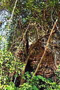 Baikunthanath deul
-
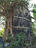 Baikunthanath deul


References[edit | edit source]
- ↑ "District Human Development Report Paschim Medinipur, 2011". page 27-28. Department of Planning and Statistics, Government of West Bengal. Retrieved 10 September 2020.
- ↑ "District Statistical Handbook Paschim Medinipur, 2013". Table 2.2, 2.4 (a). Department of Planning and Statistics. Retrieved 10 September 2020.
- ↑ "CD block Wise Primary Census Abstract Data(PCA)". West Bengal – District-wise CD blocks. Registrar General and Census, India. Retrieved 19 August 2020.
- ↑ "Kerur High School U Pry". Schools.org. Retrieved 19 August 2020.
External links[edit | edit source]


 | This article about a location in the Paschim Medinipur district of West Bengal is a stub. You can help Bharatpedia by expanding it. |