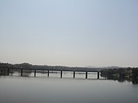
Uppinangady
This article does not cite any sources. (December 2016) |
Uppinangady or Ubar is a town in the Dakshina Kannada district in the state of Karnataka. It is surrounded by the Kumaradhara River on one side and Nethravathi River on the other. When the town's two surrounding rivers rise during the rainy season and meet, this is called the "Sangam" which is a Sanskrit word for confluence. The Sangam is a major event as people from the surrounding villages crowd the river banks to witness the merge. The population of Uppinangady is 7,172.
Uppinangady
Ubar | |
|---|---|
Town | |
 Uppinangady Bridge | |
| Coordinates: 12°50′24″N 75°14′56″E / 12.839972°N 75.248982°ECoordinates: 12°50′24″N 75°14′56″E / 12.839972°N 75.248982°E | |
| Country | |
| State | Karnataka |
| District | Dakshina Kannada |
| Government | |
| • Body | Grama Panchayath, Nadakacheri |
| Languages | |
| • Official | Tulu, Kannada, Beary |
| Time zone | UTC+5:30 (IST) |
| PIN | 574 241 |
| Telephone code | 08251 |
In 1923 the town of Uppinangady was washed out due to excessive flooding, and its courts were moved to Puttur. Severe flooding also occurred in 1974.
The town of Uppinangady is situated at an altitude of 53 meters. Uppinangady is also known as "Dakshina Kashi". It is believed that there is also a sangam of a third river along with the other two rivers which is known as Guptagamini. It is famous for the Sahasralingeshwara Temple
LegendEdit
Its legend dates back to the time of Mahabharata. The Skanda Purana states that when King Yudhisthira decided to perform the Rajasuya Yagna (to proclaim his sovereignty), he sent Bhima to present day Uppinangady. There, he was attacked by the huge giant animal named Purusha Mruga. To avoid attack, he dropped one of his hairs, which instantly turned into a Shivalinga. Seeing this, Purusha Mruga stopped to worship the Linga & then proceeded to attack. Bhima again dropped a hair, which turned into another Shivalinga. This happened for quite sometime. Finally, he dropped a handful of his hair, which instantly turned into a thousand Shivalingas. Purusha Mruga stopped to worship all the Lingas, giving time to escape. The Sangama (confluence) of Kumaradhara & Netravati rivers happen near the temple. However, during the monsoon, this confluence takes place directly in front of the sanctum sanctorum. It is considered an auspicious moment to bathe in the rivers' waters. It is also said that the 1000 Shivalingas, hidden deep in the sand, are revealed when the sand recedes.
TransportEdit
Uppinangady is at the foothills of the Western Ghats in Dakhshina Kannada district, surrounded by forests. Uppinangady lies on National Highway 75 which connects Mangaluru to Bengaluru. There are frequent bus and taxi service from this place to Mangaluru and its taluk headquarters Puttur and also to Kukke Subramanya. The nearest railway station is Puttur Railway station located at a distance of 12 km. The nearest airport is Mangalore International airport 55 km away.
ReferencesEdit
This section is empty. You can help by adding to it. (August 2019) |
External linksEdit
- http://www.fallingrain.com/world/IN/19/Uppinangadi.html
- Herald A. Stewart, A Handbook to South Kanara, 1895
- http://www.sunmediaonline.com/indiachroniclenovember/travel.html
- South Canara Gazetteers 1894,1938,1973


