Niwar
This article has multiple issues. Please help improve it or discuss these issues on the talk page. (Learn how and when to remove these template messages)
|
Niwar
Pahadi Niwar | |
|---|---|
Town | |
| Coordinates: 24°00′N 80°24′E / 24°N 80.40°ECoordinates: 24°00′N 80°24′E / 24°N 80.40°E | |
| Country | |
| State | Madhya Pradesh |
| District | Katni |
| Government | |
| • Type | Elected |
| • Body | Gram Panchayat |
| Elevation | 387 m (1,270 ft) |
| Population (2011)[1] | |
| • Total | 12,456 |
| Languages | |
| • Official | Hindi |
| Time zone | UTC+5:30 (IST) |
| PIN | 483442 |
| Telephone code | 07622 |
| Vehicle registration | MP-21 |
| Website | katni |
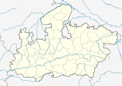
Niwar, also known as Pahadi, is a town on the banks of the Niwar River in Katni District in Madhya Pradesh, India. It is the administrative headquarters of Katni District. It is located in the Mahakoshal Region of Central India.
References[edit]
- ↑ "Provisional Population Totals, Census of India 2011; Cities having population 1 lakh and above" (pdf). Office of the Registrar General & Census Commissioner, India. Retrieved 27 March 2012.
