


This article needs additional citations for verification. (April 2022) |
Nagalapuram | |
|---|---|
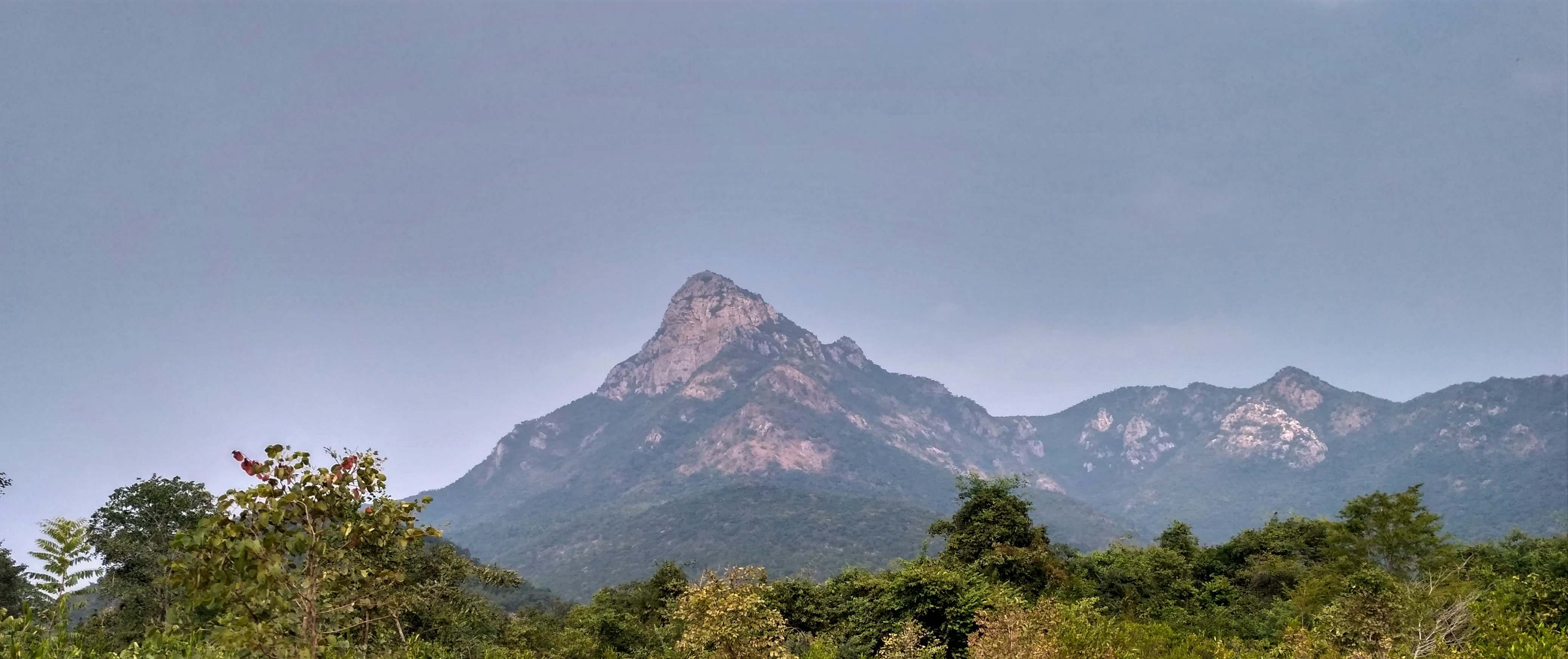
 Nagalapuram Hill Streams | |
 Nagalapuram Location in Andhra Pradesh, India  Nagalapuram Nagalapuram (India) | |
| Coordinates: 13°23′20″N 79°47′48″E / 13.3889°N 79.7967°E | |
| Country | India |
| State | Andhra Pradesh |
| District | Tirupati |
| Subdistrict | Nagalapuram mandal |
| Founded by | Shri Krishna Devaraya |
| Area | |
| • Total | 14.32 km2 (5.53 sq mi) |
| Population (2011)[2] | |
| • Total | 11,166 |
| • Density | 780/km2 (2,000/sq mi) |
| Language | |
| • Official | Telugu and Tamil |
| Time zone | UTC+5:30 (IST) |
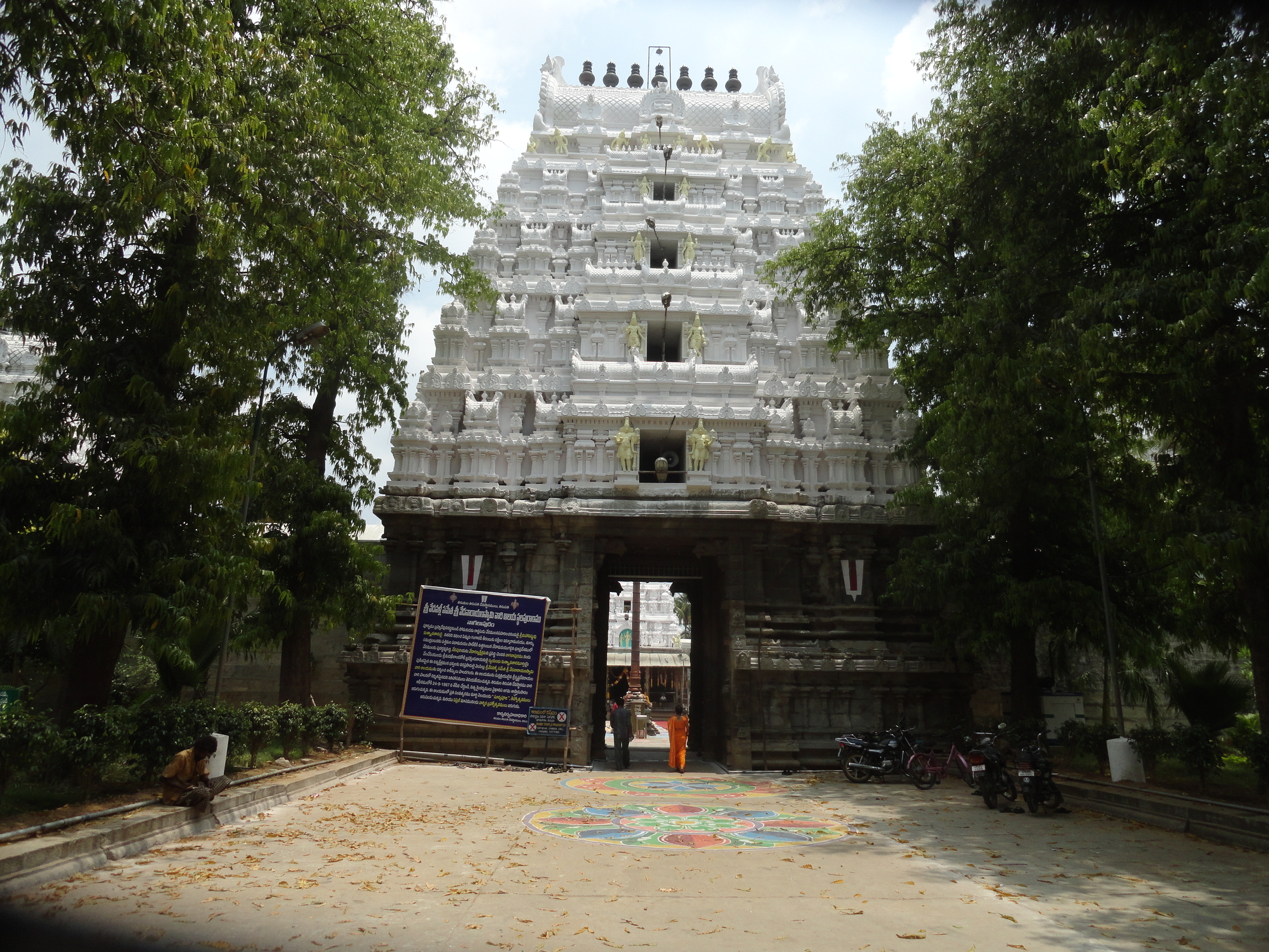
Nagalapuram is a Mandal Headquarter in Tirupati district of the Indian state of Andhra Pradesh. It is the mandal headquarters of Nagalapuram mandal in Srikalahasti revenue division.[3][4] This town is home to Vedanarayana Temple, where the presiding deity Vishnu is in the form of Matsya, the first incarnation of Dasavatara.[5]
History[edit | edit source]
Nagalapuram the temple town is built at the time of Krishnadevaraya of Vijayanagara Empire regime in memory of his mother Nagamamba Devi. Hence, it became Sri Nagalapuram. Before the change of its name to Nagalapuram, this village was known as Harigandapuram.
Tirupati district was formed on 4 April 2022 with parts of Chittoor and Nellore districts.[6]
Geography[edit | edit source]

Nagalapuram is located at 13°24′00″N 79°47′00″E / 13.4000°N 79.7833°E.[7] It has an average elevation of 64 meters (213 feet).
Culture[edit | edit source]

Temple reflects the Vijayanagara architectural style Vedanarayana swamy idol facing west. The sanctum sanctorum has Vedanarayana swamy with his consorts Sridevi and Bhoodevi on either side. This is a Matsya Avatar of Lord Vishnu first Avatar, who saved the four vedas from Somakudu and returned to Brahma. Temple Brahmostavam comes on Shukla Dwadasi, Trayodasi and Chaturdasi of Phalguni masam (Agama calendar). Temple architecture is done in such a way that during these three days, the sun rays fall on the main deity feet, navel and forehead, called as "Suriya Pooja". This remarks the start of Summer season as per the holy inscriptions available in the temple.[8]
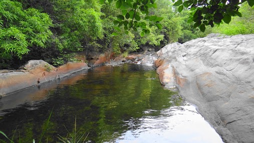
Nagalapuram Falls[edit | edit source]
Nagalapuram Falls is a waterfall which attracts many tourists. It offers a great trekking opportunity as you go into the forest in the Eastern Ghats. The trek is very scenic and one can see streams along the trek route. There are 3 waterfalls you come across and each of them has a pool next to it. The water is very clean and refreshing.[9]

Trekkers can visit the trekking route which is about 4 km in length and has views of three waterfalls. Paid parking facilities are available at the beginning of the trek.[citation needed] Due to its proximity to Chennai, large number of people visit the waterfalls each year and this has started taking a toll on the environment around the trek which is now heavily littered with waste left by trekkers.[citation needed]
The third waterfall, which is last in the series, has a deep pool which should not be explored without adequate safety equipment such as life jackets and due to negligence this has resulted in several drownings at this pool.[10]

Demographics[edit | edit source]
Total Number of House Hold : 2830
Population Persons Males Females Total 11,166 5,468 5,698 In the age group 0–6 years 1,072 588 484 Scheduled Castes (SC) 4,296 2,164 2,132 Scheduled Tribes (ST) 228 118 110 Literates 7,216 3,917 3,299
Gallery[edit | edit source]
-
 temple
 -
 temple


References[edit | edit source]
- ↑ "District Census Handbook – Chittoor" (PDF). Census of India. p. 19,394. Retrieved 29 January 2016.
- ↑ "Census 2011". The Registrar General & Census Commissioner, India. Retrieved 11 November 2014.
- ↑ "District Level Mandal wise List of Villages in Andhra Pradesh" (PDF). Chief Commissioner of Land Administration. National Informatics Centre. p. 7. Archived from the original (PDF) on 14 December 2014. Retrieved 19 September 2015.
- ↑ "Chittoor District Mandals" (PDF). Census of India. pp. 479, 515. Retrieved 19 June 2015.
- ↑ "Sun rays enter temple a day before Surya Puja festival". The Hindu. 25 March 2015. Retrieved 17 February 2019.
- ↑ "Tirupati District". About District > History. Government of Andhra Pradesh. Retrieved 9 October 2023.
- ↑ Falling Rain Genomics.Nagalapuram
- ↑ [1] Sri Veda Narayana Swamy Brahmotsavams in Nagalapuram From 4 to 12 May
- ↑ [2] Nagalapuram Hills: Scenic beauty by the ghats – Article in Deccan Chronicle
- ↑ "After accident, Nagalapuram police step up watch". The Hindu. Special Correspondent. 15 February 2018. ISSN 0971-751X. Retrieved 11 December 2018.
{{cite news}}: CS1 maint: others (link)