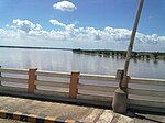
Kothapeta, Konaseema
Kothapeta | |
|---|---|
| Coordinates: 16°43′00″N 81°54′00″E / 16.7167°N 81.9000°ECoordinates: 16°43′00″N 81°54′00″E / 16.7167°N 81.9000°E | |
| Country | |
| State | Andhra Pradesh |
| District | Dr. B.R. Ambedkar Konaseema district |
| Talukas | Kothapeta |
| Government | |
| • MLA | Chirla Jaggireddy |
| Area | |
| • Total | 13.99 km2 (5.40 sq mi) |
| Population (2011)[1] | |
| • Total | 24,539 |
| • Density | 1,800/km2 (4,500/sq mi) |
| Language | |
| • Official | Telugu |
| Time zone | UTC+5:30 (IST) |
| PIN | 533 223 |
| Vehicle Registration | AP05 (Former) AP39 (from 30 January 2019)[2] |
Kothapeta is a village in the Kothapeta mandal in the Dr. B.R. Ambedkar Konaseema district of the Indian state of Andhra Pradesh.[1]
History[edit]
Konaseema district was one of the thirteen new districts formed on 4 April 2022.[3][4][5]According to the Gazette Notification No. 1156 dated 2 August 2022, Konaseema District was renamed as Dr. B.R.Ambedkar Konaseema District.[6]
Geography[edit]
Kothapeta is located at 16°43′00″N 81°54′00″E / 16.7167°N 81.9000°E.[7] It has an average elevation of 1 metres (6 ft).
Governance[edit]
The civic body of Kothapeta is going to be upgraded as municipal council.
Transport[edit]
Kothapeta is located on SH 40(Rajamahendravaram-Amalapuram road). The nearest major railway stations to Kothapeta are Rajahmundry railway station and Tanuku railway station. The nearest airport to Kothapeta is Rajahmundry Airport which is 50 km away.
See also[edit]
References[edit]
- ↑ 1.0 1.1 1.2 "District Census Handbook – Konaseema" (PDF). Census of India. pp. 16, 462. Retrieved 4 April 2017.
- ↑ "New 'AP 39' code to register vehicles in Andhra Pradesh launched". The New Indian Express. Vijayawada. 31 January 2019. Retrieved 9 June 2019.
- ↑ "Dr. B.R.Ambedkar Konaseema District". About District > History. Government of Andhra Pradesh. Retrieved 15 January 2024.
- ↑ "Andhra Pradesh Cabinet clears the formation of 13 new districts". Ravi Sharma. Frontline 26 January 2022. Retrieved 16 January 2024.
- ↑ "Jagan govt carves out 13 new districts in Andhra, names one after TDP founder". Srinivasa Rao Apparasu. Hindustan Times, 27 January 2022. Retrieved 16 January 2024.
- ↑ "Notifications by Government". Revenue Department (Lands IV). Andhra Pradesh Gazette, 2 August 2022. Retrieved 16January 2024.
{{cite web}}: Check date values in:|access-date=(help) - ↑ Kottapeta at Fallingrain.com

