

This article needs additional citations for verification. (November 2021) |
Kamothe
Mansarovar / Khandeshwar | |
|---|---|
Nodal city of Navi Mumbai | |
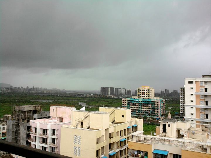
 Kamothe-Sector36 at night | |
 Kamothe | |
| Coordinates: 19°01′00″N 73°05′47″E / 19.016804°N 73.096461°E | |
| Country | India |
| State | Maharashtra |
| City | Navi Mumbai |
| District | Raigad |
| Founded by | CIDCO |
| Government | |
| • Body | Panvel Municipal Corporation |
| Elevation | 10 m (30 ft) |
| Population (2016) | |
| • Total | 250,000 |
| Official Language - Marathi | |
| Time zone | UTC+5:30 (IST) |
| PIN | 410206/410209 |
| Telephone code | 022 -------- |
| Vehicle registration | MH 46 (Navi Mumbai's Raigad district), MH 43 (Navi Mumbai's Thane district) and MH 06 (Alibaug) |
Kamothe is a node of Navi Mumbai in the Raigad District, developed and maintained by CIDCO. It is located on the Sion Panvel Highway and is the third node towards Mumbai after Panvel and Kalamboli. It is divided into 48 sectors though much of it is developed only till sector 38.
Location[edit | edit source]
The site of Kamothe adjoins the Central Business District of Belapur (CBD Belapur) of Navi Mumbai and is surrounded by Kharghar in its north, Taloja in north-east, Kalamboli in its east and Panvel in its south. The western region of Kamothe is a wet land area with enormous mangroves and towards the western side, this bed of mangroves will end thus giving way to the upcoming Navi Mumbai International Airport, which has become operational since December 26, 2025. Which can be viewed from the edges of the town due to its elevated position. Kamothe is nestled between the NH548 (connecting to JNPT road) and the Mumbai-Satara Highway. The site is also connected to the small village- Jui Gaav.
Characteristics[edit | edit source]
Kamothe is a spacious node, as it is evenly divided into 48 sectors and has some great infrastructure facilities. It is experiencing rapid growth, with a substantial rise in the population in the past five years.
Transportation[edit | edit source]
Kamothe falls in Raigad district and is maintained by the Panvel Municipal Corporation and CIDCO.
Kamothe has two railway stations Mansarovar and Khandeshwar that lie on the harbour line, a part of Mumbai suburban railways.

Auto rickshaws are the primary means of local transportation.
BEST, NMMT and MSRTC/ST buses serve as another means of transportation over a long distance to various nodes through Navi Mumbai. Kamothe postal index number is 410209. [1]


Schools and colleges[edit | edit source]
- MNR school of excellence
- Loknete Ramsheth Thakur English Medium School and Jr. College
- St. Agrasen High School & Jr. College
- Shankarrao Chavan Vidyalay School and Junior College
- Sushma Patil Vidyalaya and Junior College
- S.S.H. Jr. College
- H.B.P SHRI. DAMAJI GANPAT GOWARI VIDYALAYA & JUNIOR COLLEGE
- S.S.V Shree Suvidya Vidyalaya School
- Z.P.School
- Dattushet Patil School
- Loknete Ramsheth Thakur Public School - CBSE[2]
- MGM School of Biomedical Sciences[3]
- MGM Medical College and Hospital [4]
- M.U.M ENGLISH SCHOOL
- S S Bhagat New English School
- Indo Scots Global School[5]
- Maji Amdar Dattusheth Patil Vidyalay
- New English School
References[edit | edit source]
- ↑ "410209 Pin Code , post offices list". indiamapia.com. Retrieved 25 October 2021.
- ↑ "Loknete Ramsheth Thakur Public School, Kamothe – Sector 6A, Plot No. 40, Kamothe, Navi Mumbai – 410 209". Retrieved 24 October 2021.
- ↑ "MGM School of Biomedical Sciences Navi Mumbai | Home". mgmsbsnm.edu.in. Retrieved 24 October 2021.
- ↑ "MGM Medical College Navi Mumbai | Home". www.mgmmcnm.edu.in. Retrieved 24 October 2021.
- ↑ "School in Navi Mumbai | Best CBSE Schools | Top International School". School in Navi Mumbai | Best CBSE Schools | Top International School. Retrieved 24 October 2021.