.svg)
Durgi
Durgi | |
|---|---|
Village | |
 Primary Health Centre, Durgi | |
 Durgi Location in Andhra Pradesh, India | |
| Coordinates: 16°25′43″N 79°32′26″E / 16.42861°N 79.54056°ECoordinates: 16°25′43″N 79°32′26″E / 16.42861°N 79.54056°E | |
| Country | India |
| State | Andhra Pradesh |
| District | Palnadu |
| Mandal | Durgi |
| Government | |
| • Type | Panchayati raj |
| • Body | Durgi gram panchayat |
| Area | |
| • Total | 5,762 ha (14,238 acres) |
| Population (2011)[3] | |
| • Total | 9,480 |
| • Density | 160/km2 (430/sq mi) |
| Languages | |
| • Official | Telugu |
| Time zone | UTC+5:30 (IST) |
| PIN | 522612 |
| Telephone code | +91–863 |
| Vehicle registration | AP |
Durgi is a village in Palnadu district of the [[India]n state]] of Andhra Pradesh. It is the mandal headquarters of Durgi mandal in Gurazala revenue division.[4][5] In 15th century, Durgi stone craft was originated in the village.[6]
History[edit]
As per Gazettee No. 939 of 26 January 2022, the old Guntur District, formed in 1904, was split into three districts – Guntur, Palnadu and Bapatla.[7]
Geography[edit]
Durgi is situated at 16°26′25″N 79°37′25″E / 16.4401661°N 79.6235407°E. It is spread over an area of 5,762 ha (14,240 acres).[2]
Education[edit]

As per the school information report for the academic year 2018–19, the village has 6 MPP, one KGBV, one model and 7 private schools.[8]
Governance[edit]
Durgi gram panchayat is the local self-government of the village.[1] It is divided into wards and each ward is represented by a ward member.[9]
Temples[edit]

Radhakrushna Mandir

Maa Gram Devi Temple
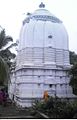
Lord Shiva Temple


See also[edit]
References[edit]
- ↑ 1.0 1.1 "Gram Panchayat Identification Codes" (PDF). Saakshar Bharat Mission. National Informatics Centre. p. 100. Archived from the original (PDF) on 18 August 2017. Retrieved 7 May 2019.
- ↑ 2.0 2.1 "District Census Hand Book : Guntur (Part B)" (PDF). Census of India. Directorate of Census Operations, Andhra Pradesh. 2011. pp. 14, 192. Retrieved 2 June 2019.
- ↑ "Population". Census of India. Registrar General and Census Commissioner of India. Retrieved 9 May 2019.
- ↑ "District Census Handbook : Guntur (Part A)" (PDF). Census of India. Directorate of Census Operations, Andhra Pradesh. 2011. pp. 5, 208–209. Retrieved 4 June 2019.
- ↑ "New Gurazala revenue division created". The Hindu. Gurazala (Guntur District). 1 July 2013. Retrieved 17 January 2015.
- ↑ "Durgi Stone Craft". National Informatics Centre. Archived from the original on 4 December 2013. Retrieved 18 December 2013.
- ↑ "Palnadu District". Government of Andhra Pradesh. Retrieved 26 August 2023.
- ↑ "School Information". Commissionerate of School Education. Government of Andhra Pradesh. Retrieved 7 May 2019.
- ↑ Seetharam, Mukkavilli (1 January 1990). Citizen Participation in Rural Development. Mittal Publications. p. 34. ISBN 9788170992271.
This article about a location in the Palnadu district of Andhra Pradesh is a stub. You can help Wikipedia by expanding it. |