


->Lagelander wrong iwkis removed |
m small refined formatting to improve readability |
||
| Line 3: | Line 3: | ||
{{Use Indian English|date=April 2017}} | {{Use Indian English|date=April 2017}} | ||
{{Infobox settlement | {{Infobox settlement | ||
| name | | name = Kullu district | ||
| settlement_type | | settlement_type = [[List of districts of Himachal Pradesh|District of Himachal Pradesh]] | ||
| total_type | | total_type = Total | ||
| native_name | | native_name = | ||
| | | image_skyline = {{Photomontage | ||
| map_caption | |size = 250 | ||
| coordinates | |photo1a = Hadimba Devi Temple, Hidimba Devi Temple Dhungari Temple Manali and around vrtmrgmpksk (41).jpg | ||
| coor_pinpoint | |photo1b = Solang Valley 2.jpg | ||
| subdivision_type | |photo2a = Rakhundi Top.jpg | ||
| subdivision_name | |photo2b = Parbati Snow Range South Himachal Nov21 D72 21117.jpg | ||
| subdivision_type1 | |photo3a = A cool place.jpg | ||
| subdivision_name1 | }} | ||
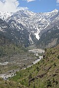
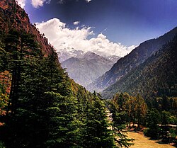
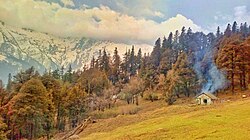
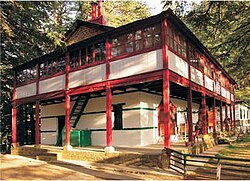
| subdivision_type2 | | image_caption = Clockwise from top-left: [[Hidimba Devi Temple]], View from [[Solang Valley]], mountains in the [[Parvati River (Himachal Pradesh)|Parvati]] Valley, mountains near [[Manali, Himachal Pradesh|Manali]], Rakhundi Top in [[Great Himalayan National Park]] | ||
| subdivision_name2 | | mapframe = yes | ||
| established_title | | mapframe-point = none | ||
| established_date | | map_alt = | ||
| seat_type | | map_caption = Location in Himachal Pradesh | ||
| seat | | coordinates = {{coord|31.99|77.40|display=title,inline}} | ||
| parts_type | | coor_pinpoint = Kullu | ||
| parts_style | | subdivision_type = Country | ||
| p1 | | subdivision_name = {{flag|India}} | ||
| area_total_km2 | | subdivision_type1 = [[States and union territories of India|State]] | ||
| area_footnotes | | subdivision_name1 = {{flagicon image|}} [[Himachal Pradesh]] | ||
| population_as_of | | subdivision_type2 = | ||
| population_total | | subdivision_name2 = | ||
| population_footnotes | | established_title = Established | ||
| population_urban | | established_date = | ||
| seat_type = Headquarters | |||
| seat = [[Kullu]] | |||
| parts_type = Sub-divisions | |||
| parts_style = para | |||
| p1 = Kullu, Banjar, Manali, Anni and Nirmand | |||
| area_total_km2 = 5503 | |||
| area_footnotes = | |||
| population_as_of = 2011 | |||
| population_total = 437,903 | |||
| population_footnotes = | |||
| population_urban = 7.92% | |||
| population_density_km2 = auto | | population_density_km2 = auto | ||
| demographics_type1 | | demographics_type1 = Demographics | ||
| demographics1_title1 | | demographics1_title1 = [[Literacy in India|Literacy]] | ||
| demographics1_info1 | | demographics_type2 = Languages | ||
| demographics1_title2 | | demographics1_info1 = 63.45% | ||
| demographics1_info2 | | demographics1_title2 = Sex ratio | ||
| leader_title | | demographics1_info2 = 105% | ||
| leader_name | | demographics2_title2 = Regional | ||
| leader_title1 | | demographics2_info2 = [[Kullui]]<ref>{{cite web| website=Literary Herald |title=Language and dialect of Himachal Pradesh |url=https://tlhjournal.com/uploads/products/35.shradha-shandil-article.pdf?utm_}}</ref> | ||
| leader_name1 | | leader_title = Constituencies | ||
| leader_title2 | | leader_name = Kullu, Banjar, Manali and Anni | ||
| leader_name2 | | leader_title1 = | ||
| timezone1 | | leader_name1 = | ||
| utc_offset1 | | leader_title2 = | ||
| registration_plate | | leader_name2 = | ||
| blank_name_sec1 | | demographics2_title1 = Official | ||
| blank_info_sec1 | | demographics2_info1 = [[Hindi]] | ||
| blank_name_sec2 | | timezone1 = [[Indian Standard Time|IST]] | ||
| blank_info_sec2 | | utc_offset1 = +05:30 | ||
| website | | registration_plate = | ||
| blank_name_sec1 = | |||
| blank_info_sec1 = | |||
| blank_name_sec2 = | |||
| blank_info_sec2 = | |||
| website = http://hpkullu.nic.in/ | |||
}} | }} | ||
'''Kullu''' is a [[district]] in [[Himachal Pradesh]], [[India]]. | '''Kullu district''' ({{indic Transl|hi|kullū|kʊlːuː}}) is a [[List of districts in India|district]] in [[Himachal Pradesh]], [[India]]. It borders [[Shimla district]] to the south, [[Mandi district|Mandi]] and [[Kangra district|Kangra]] districts to the west, [[Kinnaur district|Kinnaur]] to the east and the [[Lahaul and Spiti district|Lahaul and Spiti]] district to the north and east. The largest valley in this mountainous district is the [[Kullu Valley]], which follows the course of the [[Beas River]], and ranges in elevation from {{convert|833|m|ft}} at Aut to {{convert|3330|m|ft}} at the [[Atal Tunnel]] South Portal, below [[Rohtang Pass]]. The town of [[Kullu]], located on the right side of the Beas River, serves as the administrative headquarters of the Kullu district. The Kullu district also incorporates several riverine tributary valleys of the Beas, including those of the [[Parvati River (Himachal Pradesh)|Parvati]], Sainj, and Tirthan rivers, and thus some regions somewhat distant from the Kullu valley. The economy of the district relies mainly on horticulture, agriculture, tourism, and traditional handicrafts. Kullu district is part of the geographical, historical and cultural [[Mahasu (region)|Mahasu region]].<ref>{{Cite web |date=2022-02-01 |title=With scripts on brink of extinction, HP history buffs look to restore vanishing culture |url=https://www.hindustantimes.com/cities/chandigarh-news/with-scripts-on-brink-of-extinction-hp-history-buffs-look-to-restore-vanishing-culture-101643659534966.html |access-date=2025-12-27 |website=Hindustan Times |language=en}}</ref> | ||
[[ | |||
The | == History == | ||
The ancient seat of the kings of the kingdom of Kullu was the [[Naggar Castle]], about 12 km north of the present-day town of Kullu, and was thought to have been built in the late 15th century. [[Raja Jagat Singh]] (who ruled Kullu between 1637–72) moved the capital in the middle of the 17th century from Naggar to Sultanpur, within today's Kullu town.<ref>{{Cite web |title=History {{!}} District Kullu {{!}} India |url=https://hpkullu.nic.in/history/ |access-date=2022-10-06 |language=en-US}}</ref> | |||
Kullu ended being an independent kingdom upon the invasion by [[Ranjit Singh|Maharaja Ranjit Singh]] in 1839. Following, in turn, the takeover of the [[Sikh Empire]] by the [[British Empire]], Kullu was ceded by the Sikhs to the British in 1846, whereupon it became a tehsil of the British-administered [[Kangra district|Kangra]] district (in turn a part of the [[Punjab Province (British India)|Punjab Province]], [[Presidencies and provinces of British India|British India]]).<ref name=":0">{{Cite web |last=Rathore |first=Abhinay |title=Kullu (Jagir) |url=https://www.indianrajputs.com/view/kullu |access-date=2022-10-05 |website=Rajput Provinces of India |date=2 February 1949 |language=en}}</ref> The head of Kullu's royal family had been granted the Waziri Rupi by the Sikh emperor along with the title 'Rai', and this continued throughout the British period.<ref name=":0"/> Naggar Castle was exchanged by Raja Gyan Singh of Kullu for a rifle with Major Hay, the first Assistant Commissioner of the then-newly acquired British territory of Kullu.<ref>{{Cite web |last=Service |first=Tribune News |title=When castle was exchanged for a rifle |url=https://www.tribuneindia.com/news/himachaltribune/when-castle-was-exchanged-for-a-rifle-52369 |access-date=2022-10-06 |website=Tribuneindia News Service |language=en}}</ref> The Rupi Palace in Sultanpur is still used as home by the descendants of Kullu's royal family.<ref name=":0" /> | |||
Upon the [[Independence of India]], until 1960, Lahaul and Spiti continued being parts of the Kullu tehsil, as had also been the case during the British rule. In 1960, [[Lahaul and Spiti district|Lahaul and Spiti]] became a separate district.<ref>{{Cite web |title=History {{!}} District Lahaul and Spiti, Government of Himachal Pradesh {{!}} India |url=https://hplahaulspiti.nic.in/history/ |access-date=2022-10-06 |language=en-US}}</ref> Kullu became a district of [[Punjab, India|Punjab]] in 1963, and on November 1, 1966, it became a district of Himachal Pradesh, through the [[Punjab Reorganisation Act, 1966|Punjab Reorganisation Act of 1966]].<ref name=":1" /> | |||
Since the British times, the various government offices and other government institutions built around the Dhalpur grounds, in the heart of the Kullu town, have formed the nerve centre of the district administration in Kullu district.<ref name=":1">{{Cite web |title=History {{!}} District Kullu {{!}} India |url=https://hpkullu.nic.in/history/ |access-date=2022-10-05 |language=en-US}}</ref> | |||
== Demographics == | |||
===Population=== | |||
According to the [[2011 census of India|2011 census]] Kullu district has a [[Demographics of India|population]] of 437,903,<ref name="districtcensus">{{cite web |year=2011 |title=District Census Handbook: Kullu |url=https://censusindia.gov.in/nada/index.php/catalog/476/download/1552/DH_2011_0204_PART_A_DCHB_KULLU.pdf |access-date= |website=censusindia.gov.in |publisher=[[Registrar General and Census Commissioner of India]]}}</ref> roughly equal to the nation of [[Malta]].<ref name="cia">{{cite web | author = US Directorate of Intelligence | title = Country Comparison:Population | url = https://www.cia.gov/library/publications/the-world-factbook/rankorder/2119rank.html | accessdate = 2011-10-01 | quote = | archive-date = 27 September 2011 | archive-url = https://web.archive.org/web/20110927165947/https://www.cia.gov/library/publications/the-world-factbook/rankorder/2119rank.html | url-status = dead }}</ref> This gives it a ranking of 553rd in India (out of a total of [[Districts of India|640]]).<ref name="districtcensus" /> The district has a population density of {{convert|79|PD/sqkm|PD/sqmi}}.<ref name="districtcensus" /> Its [[Family planning in India|population growth rate]] over the decade 2001-2011 was 14.65%.<ref name="districtcensus" /> Kullu has a [[sex ratio]] of 942 [[Women in India|females]] for every 1000 males,<ref name="districtcensus" /> and a [[Literacy in India|literacy rate]] of 80.14%. 9.45% of the population lives in urban areas. Scheduled Castes and Scheduled Tribes make up 28.01% and 3.84% of the population respectively.<ref name="districtcensus" /> | |||
{{historical populations|11=1901|12=1,19,585|13=1911|14=1,24,803|15=1921|16=1,22,027|17=1931|18=1,31,425|19=1941|20=1,37,202|21=1951|22=1,45,688|23=1961|24=1,52,925|25=1971|26=1,92,371|27=1981|28=2,38,734|29=1991|30=3,02,432|31=2001|32=3,81,571|33=2011|34=4,37,903|percentages=pagr|footnote=source:<ref>[http://www.censusindia.gov.in/2011census/PCA/A2_Data_Table.html Decadal Variation In Population Since 1901]</ref>|align=middle}} | |||
===Language=== | |||
At the time of the 2011 census, census, 44% of the population in the district declared [[Kullui language|Kullui]] as their first language, 23% opted for [[Pahari languages|Pahari]], 10% chose Seraji,{{Efn|Seraji is a dialect of Kullui, different from [[Sarazi language|Sirazi]] in Jammu}} 7.8% – [[Hindi]], 3.2% – [[Mandeali language|Mandeali]], 2.5% – [[Nepali language|Nepali]], 2.3% – [[Lahuli–Spiti languages|Lahauli]], 0.92% – [[Punjabi language|Punjabi]], 0.87% – [[Kangri language|Kangri]], 0.84% – [[Kinnauri language|Kinnauri]], and 0.41% – [[Tibetan languages|Tibetan]].<ref name="languages">{{Cite web |title=Table C-16 Population by Mother Tongue: Himachal Pradesh |url=https://censusindia.gov.in/nada/index.php/catalog/10205/download/13317/DDW-C16-STMT-MDDS-0200.XLSX|website=www.censusindia.gov.in |publisher=[[Registrar General and Census Commissioner of India]]}}</ref> | |||
===Religion=== | |||
{{bar box | |||
|title=Religions in Kullu district (2011)<ref name="religion">{{Cite web|date=2011|title=Table C-01 Population by Religion: Himachal Pradesh|url=https://censusindia.gov.in/nada/index.php/catalog/11375/download/14488/DDW02C-01%20MDDS.XLS|website=censusindia.gov.in|publisher=[[Registrar General and Census Commissioner of India]]}}</ref> | |||
|titlebar=#Fcd116 | |||
|left1=Religion | |||
|right1=Percent | |||
|float=left | |||
|bars= | |||
{{bar percent|[[Hinduism]]|darkorange|94.92}} | |||
{{bar percent|[[Buddhism in Himachal Pradesh|Buddhism]]|yellow|3.51}} | |||
{{bar percent|[[Islam]]|green|0.68}} | |||
{{bar percent|Other or not stated|black|0.89}} | |||
|caption=Distribution of religions | |||
}} | |||
== Administrative == | |||
The administrative headquarters of the Kullu district lies at [[Kullu]]. The Kullu district has the following administrative divisions:<ref>{{Cite web |title=Administrative Setup {{!}} District Kullu {{!}} India |url=https://hpkullu.nic.in/administrative-setup/ |access-date=2022-10-05 |language=en-US}}</ref> | |||
*'''Development Blocks:''' Kullu, Naggar, Banjar, Anni, Nirmand and Bhuntar | |||
*'''Tehsils in Kullu:''' Kullu, Banjar, Manali, Anni, Nirmand, Bhuntar(Kullu) and Sainj(Banjar) | |||
*'''Sub-Tehsils in Kullu:''' Jari(Kullu) and Nithar(Nirmand) | |||
*'''Panchayat Samities:''' Kullu, Naggar, Banjar, Anni & Nirmand | |||
*'''Gram Panchayats''': 70 in Kullu tehsil, 40 in Naggar tehsil, 36 in Banjar tehsil, 32 in Anni tehsil, 26 in Nirmand tehsil.<ref>{{Cite web |title=Gram Panchayats {{!}} District Kullu {{!}} India |url=https://hpkullu.nic.in/panchayats/ |access-date=2022-10-05 |language=en-US}}</ref> | |||
*'''Zila Parishad:''' 1 (Kullu) | |||
*'''Nagar Parishad:''' 2 (Kullu and Manali) | |||
*'''Nagar Panchayats''': 2 (Bhuntar and Banjar) | |||
{{commons category|Kullu district}} | {{commons category|Kullu district}} | ||
== | == Politics == | ||
{{ | Electorally, at the State level, Kullu contains four of the 68 assembly constituencies of the [[Himachal Pradesh Legislative Assembly]], namely [[Manali Assembly constituency|Manali]], [[Kullu Assembly constituency|Kullu]], [[Banjar Assembly constituency|Banjar]], and [[Anni Assembly constituency|Anni]]. | ||
At the Central level, Kullu is a part of the [[Mandi Lok Sabha constituency|Mandi Lok Sabha Constituency]], one of the four such constituencies that represent the state of Himachal Pradesh in the [[Lok Sabha]]. | |||
| | |||
| | == Transport == | ||
| | |||
| | === By road === | ||
| | The main highway running through the Kullu district is the [[National Highway 3 (India)|National Highway 3]], formerly known as National Highway 21. The segment of this highway through the Kullu district begins at Aut and ends at the Atal Tunnel. This highway runs in a roughly south-north direction. To evade the usually heavy traffic between [[Kullu]] and [[Manali, Himachal Pradesh|Manali]], one can take the road along the left bank of the Beas River at Kullu, so as to arrive in Manali via Naggar. | ||
| | |||
| | === By air === | ||
| | The Kullu district has an [[Kullu–Manali Airport|airport at Bhuntar]], capable of accommodating small aircraft. There are helipads at Manali, Palchan, Kullu (Dhalpur ground), and Naggar.<ref>{{Cite web |title=List of Helipads in Kullu district |url=https://hpsdma.nic.in/Index1.aspx?lid=104&lsid=110&pid=89&lev=3&langid=1 |access-date=October 5, 2022}}</ref> | ||
| | |||
| | === By railway === | ||
| | The Kullu district is not connected through railways. | ||
| | |||
| | == Economy == | ||
| | Agriculture and horticulture are the predominant sources of livelihood in the Kullu district. Wheat, maize, vegetables, and garlic are the main crops grown. Most agriculture in this mountainous district is done in the form of [[Terrace (earthworks)|terrace farming]]. Most of this agricultural activity is subsistence level. Horticulture, particularly apple farming, has been more profitable in Kullu district.<ref>{{Cite web |title=Agriculture and horticulture in Kullu District of Himachal Pradesh, India: Practice, problems, and progress {{!}} HimalDoc |url=https://lib.icimod.org/record/12683 |access-date=2022-10-07 |website=lib.icimod.org |language=en}}</ref><ref name="Raghuvanshy">{{Cite web |last=Raghuvanshy |first=Garima |date=2021-08-11 |title=For Himachal Pradesh, Apples And Cannabis Are Double-Edged Swords |url=https://www.thequint.com/voices/opinion/for-himachal-pradesh-apples-and-cannabis-are-double-edged-swords |access-date=2022-10-10 |website=TheQuint |language=en}}</ref> But both these activities are being negatively influenced by [[climate change]].<ref>{{Cite journal |date=2015 |title=Impact of climate variability on apple production and diversity in Kullu valley, Himachal Pradesh |url=https://www.indianjournals.com/ijor.aspx?target=ijor:ijh&volume=72&issue=1&article=003 |journal=Indian Journal of Horticulture |volume=72 |issue=1 |issn=0972-8538}}</ref><ref>{{Cite book |title=Global Climate Change and Indian Agriculture: Case Studies from the ICAR Network Project |publisher=Indian Council of Agricultural Research |year=2009 |location=New Delhi |pages=vii}}</ref> [[Cannabis]] farming has also been a lucrative though illegal source of income in the district, particularly since the 1980s.<ref name="Raghuvanshy"/> Forests play an important role in securing local livelihoods in the Kullu district, in the form of timber and various non-timber forest products.<ref name=":3" /> The district is also rich in [[medicinal herbs]].<ref>{{Cite journal |date=2010 |title=Wild Medicinal Plants Used by Local Communities of Manali, Himachal Pradesh, India |url=https://core.ac.uk/download/pdf/60543151.pdf |journal=Ethnobotanical Leaflets |volume=3 |issue=4}}</ref><ref>{{Cite web |last=Chauhan |first=Kuldeep |title=Kullu-Manali Farmers Get Tips on How to Cultivate Medicinal Plants in Their Fields |url=https://himbumail.com/himachal-news/forests-rivers/kullu-manali-famers-get-tips-on-how-to-cultivate-medicinal-plants-in-their-fields |access-date=2022-10-10 |website=himbumail.com |date=10 July 2022 |language=en-gb}}</ref> No major minerals are found in the district.<ref name=":3" /> However, the district is rich in hydroelectric potential, and has several major hydroelectric projects, including the [[Parbati Hydroelectric Project|Parbati hydroelectric project]].<ref>{{Cite web |last=Singh |first=M.P. |date=2017 |title=Hydro Power Scenario in Himachal Pradesh {{!}} Electrical India Magazine |url=https://www.electricalindia.in/hydro-power-scenario-in-himachal-pradesh/ |access-date=2022-10-10 |language=en-US}}</ref><ref>{{Cite web |title=NHPC Limited : Projects : Under Construction : Parbati - II |url=http://www.nhpcindia.com/Default.aspx?id=186&lg=eng&CatId=2&ProjectId=13 |access-date=2022-10-10 |website=www.nhpcindia.com}}</ref><ref>{{Cite web |title=NHPC Limited : Projects : Power Stations : Parbati - III |url=http://www.nhpcindia.com/Default.aspx?id=186&lg=eng&CatId=1&ProjectId=38 |access-date=2022-10-10 |website=www.nhpcindia.com}}</ref> Some valleys in the district contain historic seasonal migration routes of the [[Gaddis|Gaddi]] and [[Gurjar|Gujjar]] [[Transhumance|transhumant communities]].<ref>{{Cite web |last=Service |first=Tribune News |title=Gaddis, adventurous trekkers use Pin Parbat pass |url=https://www.tribuneindia.com/news/archive/himachaltribune/gaddis-adventurous-trekkers-use-pin-parbat-pass-624024 |access-date=2022-10-10 |website=Tribuneindia News Service |language=en}}</ref> Tourism is a major source livelihood at many places in the Kullu district, in the form of hotels, homestays, restaurants, travel agencies, shops, [[dhaba]]s, guiding services, cooks, porters, and taxi services.<ref>{{Cite journal |last1=Gardner |first1=James |last2=Sinclair |first2=John |last3=Berkes |first3=Fikret |last4=Singh |first4=R. B. |date=2002-01-01 |title=Accelerated Tourism Development And Its Impacts In Kullu-Manali, H.P., India |url=https://doi.org/10.1080/02508281.2002.11081370 |journal=Tourism Recreation Research |volume=27 |issue=3 |pages=9–20 |doi=10.1080/02508281.2002.11081370 |s2cid=128607111 |issn=0250-8281|url-access=subscription }}</ref> Tourism has had a major [[ecological footprint]] in the district.<ref>{{Cite journal |last=Webster |first=Jane |date=1998 |title=Desktop Videoconferencing: Experiences of Complete Users, Wary Users, and Non-Users |url=http://dx.doi.org/10.2307/249666 |journal=MIS Quarterly |volume=22 |issue=3 |pages=257–286 |doi=10.2307/249666 |jstor=249666 |issn=0276-7783|url-access=subscription }}</ref> The [[handloom]]-based production and sale of [[Kullu shawl]]s is also important in some parts of the Kullu district.<ref>{{Cite web |date=2017 |title=A Comparative Study of Cooperative Society, Private Sector, and Clusters of Kullu Handicrafts in Kullu |url=https://d1wqtxts1xzle7.cloudfront.net/55974546/Final_Draft_A_Treatise_on_Recent_Trends_and_Sustainability_in_Crafts___Design_2017_e-Proceedings-with-cover-page-v2.pdf?Expires=1665139265&Signature=XnH1ORBYoTZsh1rMpuj3Jm87hFsTXssou6amMoQ5tuNoXhGbvVpfjjoKibXEggcu7oRobjILXu3P3Feg8A-HzJdmGsDcxSTkuXuVb34weFhjfl-dQ3Lkb6NmqBFz-v73N4B4aANJP-X9CHp4n9lN9rKPr6rdXikklAzLUwWK5uqWk8YvXJUpKbheR6PLMyfCsLm79SPUsCDDk8ivWtkK6sb3~GMroZzwYe~8so3FqmvaQ8rDiXkeMdR5lVFnawh6T~PzPgcCEOAMtT8FCZar9o2i0uZDsBTJt4R98juzUgepiIBchuNb~xp0C63sDudp86Hi7ESWMjEW6Ndw5DSnSg__&Key-Pair-Id=APKAJLOHF5GGSLRBV4ZA#page=9 |access-date=October 7, 2022}}</ref> Service sector industries, in field such as tourism, education, floriculture, and livestock and poultry farming have a good scope of growth in the district. There is no large-scale industry in the Kullu district. Geographic constraints and difficulty of access inhibit the growth of industries in the Kullu district.<ref name=":3">{{Cite web |last=MSME Development Institute, Govt. of India |date=2012 |title=Brief Industrial Profile of the Kullu District |url=http://dcmsme.gov.in/old/dips/DIP%20Kullu.pdf |access-date=October 7, 2022}}</ref> | ||
| | |||
| | == Institutions for Himalayan knowledge == | ||
| | ''[This section does not cover the schools, colleges, and universities of Kullu district.]'' | ||
| | |||
| | The Kullu district is rich in both ecological wealth and cultural and historical heritage. At the same time, Kullu is not far from regions such as the [[Transhimalaya|Trans-Himalayas]] and [[Tibet]], and lies on an important historic trade route from Punjab to [[Ladakh]] and [[Central Asia]].<ref>{{Cite web |title=The Worst Trade Route in the World |url=https://travelthehimalayas.com/kiki/2018/4/1/the-worst-trade-route-in-the-world |access-date=2022-10-06 |website=Travel The Himalayas |date=April 2018 |language=en-US}}</ref> In modern times, these features of the Kullu valley have drawn many researchers, scientists, artists, and seekers of other kinds to it. | ||
| | |||
| | The '''[[George de Roerich#Himalayan Research Institute|Urusvati Himalayan Research Institute]]''' was the first institution in the Kullu region, dedicated to research on various sciences and mysticism in the Himalayas. The [[Roerichism|Roerich]] family established this centre in 1928 at [[Naggar]] upon their return from their [[George de Roerich#Central Asian expedition|Central-Asian Expedition]]. By [[World War II]], the institute had become defunct. Nonetheless, the site of the former institute, a part of the Roerich estate in Naggar, continues to operate a library and some exhibitions.<ref>{{Cite web |title="Urusvati" Himalayan Research Institute |url=http://irmtkullu.com/objects-of-the-trust/urusvati-institute/urusvati-himalayan-research-institute/ |access-date=2022-10-06 |website=irmtkullu.com}}</ref> | ||
| | |||
| | '''The Himalayan Institute of Cultural and Heritage Studies''' ('''HICHS'''), founded by [[Sonali Gupta|Dr. Sonali Gupta]], was based in Katrain village, 30 km north of Kullu, until early 2023. This institution used to offer curated heritage walks in the Kullu valley; conducted on-site and online courses related to Himalayan cultures, religions, iconography, and architecture, and hosted weekly online talks by scholars and artists from India and around the world whose work featured the Himalayas. In 2023, the institute relocated to Bigri village near Dhami, [[Shimla district]].<ref>{{Cite web |title=HICHS – Archaeology, Anthropology and Cultural Study |url=https://hichs.org/ |access-date=2022-10-05 |language=en-US}}</ref> | ||
| | |||
}} | At present, there are two institutions in Kullu that are active in generating and preserving Himalaya-specific knowledge: | ||
* '''Himalayan Regional Centre of the GB Pant Institute of Himalayan Environment and Development''' - This institution is based in Mohal, about 6 km south of Kullu. It was established in Kullu in 1992, and shifted to Mohal in 1993. This government institution conducts research and informs policy on various issues related to climate change, mountain ecology, traditional ecological knowledge, and rural livelihoods.<ref>{{Cite web |title=Govind Ballabh Pant National Institute of Himalayan Environment |url=https://gbpihed.gov.in/Himanchal_Unit_details.php |access-date=2022-10-06 |website=gbpihed.gov.in}}</ref> | |||
* '''Himachal Pradesh Craftsmanship and Design Innovation Institute NORTH''' - This institute is based in Naggar, 22 km north of Kullu. It was established in 2017. This institution works to preserve Kullu's traditional [[Kath kuni architecture|kathkuni]] architectural style.<ref>{{Cite web |last=Karelia |first=Gopi |date=2021-03-03 |title=This CEPT Alumnus Is Reviving A 1200-YO Architecture Form That Can Last Upto 5 Centuries |url=https://www.thebetterindia.com/250285/rahul-bhushan-himachal-firm-north-preserving-reviving-kath-kuni-ancient-architecture-earthquake-resistant-eco-friendly-gop94/ |access-date=2022-10-06 |website=The Better India |language=en-US}}</ref> | |||
==Attractions== | |||
[[File:Beas_Valley_-_Kothi_-_Kullu_2014-05-10_2295.JPG|thumb|330x330px|View of Himalayas in the upper parts of the Kullu valley.]] | |||
[[File:Parvati_Valley.jpg|thumb|Parvati Valley]] | |||
[[File:Hidimba_Devi_Temple_with_Worshippers_-_Manali_2014-05-11_2680-2681.TIF|thumb|The Hidimba Devi Temple also known as the Hadimba Temple]] | |||
[[File:Nada_thach.jpg|thumb|Nada Thach, Tirthan Valley]] | |||
Particularly since the onset of the unrest in [[Kashmir]] in the 1980s, the Kullu region has gained in significance as a tourist destination.<ref>{{Cite web |title=Land use/cover change and its implications for Kullu district of Himachal Pradesh, India |url=https://www.indianjournals.com/ijor.aspx?target=ijor:ijggs&volume=3&issue=3&article=013 |access-date=2022-10-07 |website=www.indianjournals.com}}</ref> The Kullu valley is known as the "Valley of the Gods" or "Dev Bhumi" because almost every village in the valley has a local deity and annual festivities around them.<ref>{{cite web |title=Valley of the Gods |url=http://ignca.nic.in/ex_0058.htm |url-status=dead |archive-url=https://web.archive.org/web/20160303181515/http://ignca.nic.in/ex_0058.htm |archive-date=3 March 2016 |access-date=2007-03-26 |publisher=[[IGNCA]]}}</ref> The following is a non-exhaustive list of historical, cultural, religious, scenic, and ecological places of interest in the Kullu district. | |||
{{ | === Places of interest === | ||
* '''Basheshwar Mahadev Temple''' - This Shiva temple at Bajaura is made completely out of stone in the [[Shikhara]] style, and is renowned for its intricate sculpture art. Archeologically, the temple is dated to around the early 9th century A.D.<ref>{{Cite journal |last=Meister |first=Michael W. |date=2006 |title=Mountain Temples and Temple-Mountains: Masrur |url=https://www.jstor.org/stable/25068237 |journal=Journal of the Society of Architectural Historians |volume=65 |issue=1 |pages=26–49 |doi=10.2307/25068237 |jstor=25068237 |issn=0037-9808|url-access=subscription }}</ref> In local belief, this temple is believed to have been built by the [[Pandava]]s.<ref>{{Cite web |title=Basheswar Mahadev Temple Kullu, How to Reach Mahadev Temple Kullu |url=https://www.kulluonline.in/city-guide/basheswar-mahadev-temple-kullu |access-date=2022-10-06 |website=www.kulluonline.in}}</ref> | |||
* '''Bhuti Weavers Co-operative Society''' - This society is involved in the [[Kullu shawl]] industry. It was set up in 1944. Its main office and showroom are located at the Bhutti Colony in [[Shamshi, Himachal Pradesh|Shamshi]], about 8 km south of Kullu.<ref>{{Cite web |title=About Society |url=https://bhutticoshawls.com/pages/about-bhuttico |access-date=2025-11-06 |website=bhutticoshawls.com}}</ref><ref>{{Cite web |title=Our Showrooms |url=https://bhutticoshawls.com/pages/visit-a-bhuttico-store-near-you |url-status=live |access-date=2025-11-06 |website=bhutticoshawls.com}}</ref> | |||
* [[Bijli Mahadev|'''Bijli Mahadev Temple''']] '''-''' It is located at 2,435 meters from sea level and is about {{cvt|10|km}} from Kullu. The staff of the temple is 60 feet high and can be seen from the Kullu valley too. It is the highest point around Kullu from where there are views of the whole town. | |||
* '''Chaini Kothi''' - A 35 meters-high tower built in the [[Kath kuni architecture|Kathkuni]] style, built originally as a defensive structure and from later on used as a temple for a Jogini. It dates to the 17th century. It is located in the Tirthan valley near Banjar.<ref>{{Cite web |last=Bhole |first=Shabbir Khambaty and Swapnil S. |date=2018-08-24 |title=Chaini Kothi: Himachal's Towering Edifice |url=https://www.livehistoryindia.com/story/religious-places/chaini-kothi-himachals-towering-edifice |access-date=2022-10-06 |website=www.livehistoryindia.com |language=en}}</ref><ref>{{Cite web |last=Jain |first=Anshika |date=2019-05-15 |title=Chaini Kothi: Saving A Himalayan Wonder |url=https://www.livehistoryindia.com/story/heritage-matters/chaini-kothi-saving-a-himalayan-wonder |access-date=2022-10-06 |website=www.livehistoryindia.com |language=en}}</ref> | |||
* '''Dagpo Shedrup Ling monastery''' - This Tibetan Buddhist monastery of the [[Gelug]] school is located in village Kais, 8 km north from Kullu. It was inaugurated in 2005 by the [[14th Dalai Lama|Fourteenth Dalai Lama]]. This monastery is a continuation of the Dagpo Dratsang monastery in southeastern Tibet, which was destroyed during the [[Cultural Revolution]].<ref>{{Cite web |title=History |url=https://thedagpofund.org/en/history/ |access-date=2022-10-06 |website=The Dagpo Fund |language=en-US}}</ref> | |||
* '''Dechen Choekhor monastery''' - This Tibetan Buddhist monastery of the [[Drukpa Kagyu]] school is located in village Sarabhai, 13 km south from Kullu. Its construction was started in 2000 and completed in 2017. It is a continuation of a monastery of the same name in Tibet, which was destroyed during the Cultural Revolution.<ref>{{Cite web |title=Dechen Choekhor |url=https://drukpachoegon.org/about-dechen-choekhor |access-date=2022-10-06 |website=Dechen Choekhor Mahavihara |language=en-GB}}</ref> | |||
* '''[[Great Himalayan National Park]]''' '''(GHNP)''' -This national park is spread over {{cvt|700|km}} in [[Banjar, India|Banjar sub-division]] of Kullu District. The park is drained by the Sainj, Tirthan, Jiwa Nala, and Parvati rivers. It is home to many different and often rare kinds of birds, mammals, insects, and vegetation. The park was created in 1984 and became a [[UNESCO World heritage site|UNESCO World Heritage Site]] in 2014. Entering the Park requires permits.<ref>{{Cite web |title=The official website of Great Himalayan National Park {{!}} A UNESCO World Heritage |url=https://www.greathimalayannationalpark.org/ |access-date=2022-10-06 |language=en-US}}</ref> | |||
* '''[[Khirganga National Park]]''' Established in 2010,<ref>{{Cite news |title=Lesser-known national parks of the Himalayan region |work=The Times of India |url=https://timesofindia.indiatimes.com/travel/things-to-do/lesser-known-national-parks-of-the-himalayan-region/photostory/92364526.cms?picid=92364647 |access-date=2023-09-18 |issn=0971-8257}}</ref> Khirganga (also written as Keerganga) National Park is in Kullu district. It is spread in an area of 710{{nbsp}}km<sup>2</sup>.<ref>{{Cite web |date=2014-06-30 |title=Lessons from the success story of Great Himalayan National Park |url=https://www.firstpost.com/living/lessons-success-story-great-himalayan-national-park-1595833.html |access-date=2023-09-18 |website=Firstpost |language=en}}</ref> at a height of 550{{nbsp}}m. This national park is home to a wide variety of flora and fauna. | |||
* '''[[Inderkilla National Park]]''' Established in 2010, Inderkilla National Park is situated in Kullu district. It covers an area of around 104{{nbsp}}km<sup>2</sup>, and its fauna includes over 250 bird species and animals such as leopards, brown bear, black bear and mountain goats. | |||
*'''[[Hidimba Devi Temple|Hadimba Temple]] -''' This pagoda-style temple is located in the Dungri forest above Manali. It houses the footsteps of Hadimba Devi on a rock inside. It was built by Raja Bahadur Singh in 1553 A.D.<ref>{{Cite news |last=Gautam |first=Shikha |title=The strange story of Manali's Hadimba Devi Temple |url=https://timesofindia.indiatimes.com/travel/destinations/the-strange-story-of-manalis-hadimba-devi-temple/articleshow/65196789.cms |access-date=2022-10-05 |newspaper=The Times of India |language=en}}</ref> | |||
* '''Kais Dhar''' - A place with grass meadows and densely forested mountains. It is a part of trekking route and is not connected through road, hence the natural environment is preserved.<ref>{{cite web |title=Incredible India {{!}} Things To Do |url=https://www.incredibleindia.org/content/incredibleindia/en/destinations/kullu/things-to-do.html |access-date=2021-11-30 |website=www.incredibleindia.org}}</ref> This place has a British-era forest rest house.<ref>{{Cite web |last=WaysFare |date=2020-09-26 |title=Kaisdhar – The best Trek from Kullu to Lugvalley |url=https://www.waysfare.com/kaisdhar |access-date=2022-10-05 |language=en-GB}}</ref> | |||
* '''[[Kasol]]''' - A village in the [[Parvati Valley|Parvati valley]] that is popular among backpackers; also known as 'Little Israel' for being very popular among young Israeli tourists.<ref>{{Cite web |title=Kasol: Little Israel of the Himalayas |url=http://www.atlasobscura.com/places/kasol-little-israel-in-the-himalayas |access-date=2022-10-06 |website=Atlas Obscura |language=en}}</ref> | |||
* '''Tirthan Valley -''' The valley is drained by the Tirthan River and its various tributaries, along with several streams, waterfalls, and other water bodies. It is very rich in biodiversity, and supports a rich variety of flora, fauna and birdlife attracting birdwatchers and nature enthusiasts. | |||
* '''Khanag''' - This village in Anni tehsil has an old rest house with a memorial to the English travel writer [[Penelope Chetwode]], who died in a remote part of the Kullu district in April 1986. Chetwode loved the Kullu valley, and is known for her book ''Kulu: the End of the Habitable World''.<ref>{{Cite web |last=Service |first=Tribune News |title=She obsessively loved Kullu valley and died there |url=https://www.tribuneindia.com/news/archive/himachal/she-obsessively-loved-kullu-valley-and-died-there-433268 |access-date=2022-10-05 |website=Tribuneindia News Service |language=en}}</ref> | |||
* '''[[Khokhan]]''' - A pagoda-style temple of Adi Brahma, dating to the 14th century A.D., is located in village Khokhan, about 10 km south of Kullu town. The village also boasts open views of the confluence of the Parvati and Beas rivers, and of the [[Kullu–Manali Airport|Kullu airport]]. | |||
* '''[[Lug Valley|Lug valley]]''' - Another important valley in the district is the Lug valley, where forest contractors have been extracting timber from the forests for the last 150 years and continue to do so today.<ref name="mountaintech">{{cite web |title=History of Ropeways in Kullu |url=http://mountaintechnology.tripod.com/ropeway/history.html |url-status=dead |archive-url=https://web.archive.org/web/20030523144002/http://mountaintechnology.tripod.com/ropeway/history.html |archive-date=23 May 2003 |access-date=2006-12-24}}</ref> | |||
* '''Maha Devi Tirth Temple''' - Shri Mahadevi Tirth, locally known more commonly as Vaishno Devi Mandir, is a temple situated about two kilometers North from Kullu on the Kullu-Manali highway. It was built in 1966.<ref>{{Cite web |title=Mata Vaishno Mahadevi Tirth Temple, Kullu - Timings, History, Pooja & Aarti schedule |url=https://www.trawell.in/himachal/kullu/mata-vaishno-mahadevi-tirth-temple |access-date=2022-10-06 |website=Trawell.in}}</ref> | |||
* '''[[Malana, Himachal Pradesh|Malana]]''' - Malana is a relatively secluded village in the Kullu valley, known for its several unique cultural features. These include a language different from the rest of the Kullu region; worship of Jamlu devta, a god considered somewhat hostile by the Kullu Pantheon; a complex system of local-self governance; a weaker prevalence of caste distinctions, and a strong belief of contact with people outside the village being highly polluting.<ref name=":2">{{Cite journal |last=Rosser |first=Colin |date=1952 |title=A 'Hermit' village in Kulu |url=https://www.epw.in/system/files/pdf/1952_4/19-20/a_hermit_village_in_kulu.pdf |journal=The Economic Weekly |volume=IV |issue=19 & 20 |pages=477–482}}</ref> The village is much more connected to the outside world than it was in the 1950s, when Colin Rosser conducted perhaps the earliest detailed research on this village.<ref name=":2" /><ref>{{Cite journal |last=Axelby |first=Richard |date=2015 |title=Hermit Village or Zomian republic? An update on the political socio-economy of a remote Himalayan community |url=https://eprints.soas.ac.uk/25289/1/axelby-hermit-village-or-zomian-republic-EBHR.pdf |journal=European Bulletin of Himalayan Research |volume=46 |pages=35–61}}</ref><ref>{{Cite web |last=Mansingka |first=Shubham |date=2016-04-04 |title=The Legend Of The Mysterious Village Of Malana |url=https://theculturetrip.com/asia/india/articles/the-legend-of-the-mysterious-village-of-malana/ |access-date=2022-10-06 |website=Culture Trip}}</ref> | |||
* '''[[Manali, Himachal Pradesh|Manali]]''' - Perhaps the most famous tourist destination of the Kullu valley.{{citation needed|date=August 2024}} This town includes a Mall Road, the Hadimba Temple, a Tibetan market, and Old Manali, besides hundreds of hotels, resorts, and restaurants. Near Manali are sites like the [[Solang Valley|Solang valley]] (common site for adventure and winter sports), the hot springs at [[Vashisht, Himachal Pradesh|Vashisht]], the [[Atal Bihari Vajpayee Institute of Mountaineering and Allied Sports]], and the [[Snow and Avalanche Study Establishment]]. | |||
* '''[[Manikaran]]''' - A pilgrimage centre for Hindus and Sikhs in the [[Parvati Valley|Parvati valley]], known for its hot springs.<ref>{{Cite web |title=Manikaran Sahib - SikhiWiki, free Sikh encyclopedia. |url=https://www.sikhiwiki.org/index.php/Manikaran_Sahib |access-date=2022-10-07 |website=www.sikhiwiki.org}}</ref> | |||
* '''Mathasaur''' - Mathasaur is a scenic meadow located at the top of the Lug valley. It has a small temple dedicated to the female deity Fungni Mata, which has certain taboos around entry, as do most other temples in the Kullu region. One has to hike to reach the meadow and the temple.<ref>{{Cite web |title=Fungni Mata(Beasar) – ValleyOfGods.in |date=9 August 2019 |url=https://www.valleyofgods.in/fungni-mata-2/ |access-date=2022-10-06 |language=en-US}}</ref><ref>{{Cite web |last=shubhammansingka |date=2022-07-01 |title=Day Hike to Mathasaur – Jai Maa Fungni Temple |url=https://travelshoebum.com/2022/07/01/day-hike-to-mathasaur-jai-maa-fungni-temple/ |access-date=2022-10-06 |website=The Bum who Travels |language=en-US}}</ref> | |||
[[File:Urusvati base.jpg|thumb|<div class="center">Himalayan Research Institute named ''Urusvati'' in Naggar</div>]] | |||
* '''[[Naggar]]''' - Naggar was the old capital of Kullu. Its 15th century castle, built in the [[Kath kuni architecture|Kathkuni]] style, is now a hotel run by Himachal Tourism.<ref>{{Cite web |title=The Castle, Naggar – Himachal Pradesh Tourism Development Corporation (HPTDC) |url=http://hptdc.in/index.php/the-naggar-castle/ |access-date=2022-10-05 |website=hptdc.in}}</ref> Naggar also has the Roerich's Memorial House, and the Nicholas Roerich and Svetsolav Roerich Art Gallery.<ref>{{Cite web |title=The Roerichs' Memorial House |url=http://irmtkullu.com/objects-of-the-trust/the-roerichs-memorial-house/ |access-date=2022-10-05 |website=irmtkullu.com}}</ref><ref>{{Cite web |title=N. Roerich and S. Roerich Art Gallery |url=http://irmtkullu.com/objects-of-the-trust/n-roerich-and-s-roerich-art-gallery/ |access-date=2022-10-05 |website=irmtkullu.com}}</ref> The Russian scholar, artist, and mystic [[Nicholas Roerich]] lived at this site from the late 1920s till his death here in 1947. Naggar also has several old temples, built in the shikhara and pagoda styles. | |||
* '''[[Nirmand]]''' - One of the largest villages of Himachal Pradesh. Recorded in the Nirmand Copper Plate (7th century A.D.), and known for its ancient temples, including one dedicated to Parshurama.<ref>{{Cite web |last=Service |first=Tribune News |title=Nirmand and the legend of Parshurama |url=https://www.tribuneindia.com/news/archive/himachaltribune/nirmand-and-the-legend-of-parshurama-804996 |access-date=2022-10-05 |website=Tribuneindia News Service |language=en}}</ref><ref>{{Cite journal |last=Chauhan |first=Gian |date=1996 |title=TRACES OF FEUDALISM AS SEEN IN THE NIRMAND COPPER-PLATE INSCRIPTION OF C. a. 612-13 A. D. |url=https://www.jstor.org/stable/41702174 |journal=Annals of the Bhandarkar Oriental Research Institute |volume=77 |issue=1/4 |pages=241–246 |jstor=41702174 |issn=0378-1143}}</ref> | |||
* '''Raghunath Temple''' - In the 17th century, Raja Jagat Singh of Kullu committed a great mistake. To atone for the sin, he sent a senior courtier to Ayodhya for a statue of Lord Raghunath - Lord [[Rama|Ram]]. This temple was built in 1651 A.D. by Raja Jagat Singh to house the image, which continues to be greatly revered. Every year, the international fair [[Vijayadashami|Dussehra]] is celebrated with local deities in honour of Lord Raghunath.<ref>{{Cite web |title=Raghunath Temple in Kullu, About Lord Raghunathji Temple Kullu |url=https://www.kulluonline.in/city-guide/raghunathji-temple-kullu |access-date=2022-10-05 |website=www.kulluonline.in}}</ref> | |||
* '''[[Rohtang Pass]]''' - The Kullu valley connects with the Lahul and Spiti district via [[Rohtang Pass]], situated at {{convert|3978|m|ft|abbr=on}} {{convert|51|km|abbr=on}} from [[Manali, Himachal Pradesh|Manali]] city. In 2020, the [[Atal Tunnel]] was inaugurated, which bypasses the Pass and dramatically reduces the distance and effort required in getting from the Kullu valley to the Lahaul and Spiti valleys. But the pass continues to be a tourist attraction. Permits are required to visit the pass.<ref>{{Cite web |title=Tourism Development Council Manali (H.P.)-Home |url=https://rohtangpermits.nic.in/ |access-date=2022-10-10 |website=rohtangpermits.nic.in}}</ref> | |||
* '''Rupi Palace''' - Located in Sultanpur, Kullu, this palace was originally built in 1660 A.D. by Raja Jagat Singh. It was badly damaged in the [[1905 Kangra earthquake|Kangra earthquake of 1905]], and was subsequently rebuilt. It is the residence of the descendants of Kullu's royal family.<ref>{{Cite web |title=Sultanpur Palace Kullu, How to Reach Sultanpur Palace Kullu |url=https://www.kulluonline.in/city-guide/sultanpur-palace-kullu |access-date=2022-10-06 |website=www.kulluonline.in}}</ref> | |||
* '''Shoja''' - At 2368m, Shoja presents a vantage point for panoramic views of Himalayan ranges. Places of interest near Shoja include the Jalori Pass (3,140m), Jibhi, Serolsar Lake, Raghupur fort, and the Tirthan valley.<ref>{{Cite web |title=One Day Trip from Kullu, Famous Places to Visit near Kullu |url=https://www.kulluonline.in/city-guide/one-day-trip-from-kullu |access-date=2022-10-06 |website=www.kulluonline.in}}</ref><ref>{{Cite web |last=Marchal |first=Stephan |title=Jalori pass - treks, hikes and camping |url=https://www.himalayanecotourism.com/jalori-pass.html |access-date=2022-10-06 |website=Himalayan Ecotourism |language=en}}</ref> | |||
* '''Shringi Rishi Temple''' - Shringi Rishi Temple is located in the [[Banjar, India|Banjar]] valley, about 60 km from Kullu. [[Rishyasringa|Shringi Rishi]] is the ruling deity of Banjar valley. Shringi rishi is one among the "Atthara kardoo" (eighteen chief deities) of the Kullu valley.<ref>{{Cite web |title=Shringa Rishi Temple - Banjar, Kullu - Timings, History, Pooja & Aarti schedule |url=https://www.trawell.in/himachal/kullu/shringa-rishi-temple-banjar |access-date=2022-10-06 |website=Trawell.in}}</ref> | |||
*'''[[Shandilya Rishi Mandir]]''' - The temple is attributed to the Vedic sage Maharshi [[Shandilya (Rishi)|Shandilya]]. It is located at Shalin village in the Uji valley | |||
* '''[[Shrikhand Mahadev]] -''' One of Five Kailash Peaks, considered to be an abode of [[Shiva|Lord Shiva]] and his wife [[Parvati|Goddess Parvati]] | |||
* '''[[Tirthan Wildlife Sanctuary|Tirthan WLS]]''' - A Wildlife Sanctuary located in Banjar subdivision offering numerous flora and fauna species. In 2021, it was ranked the Best Managed Protected Area of India as per the Management Effectiveness Evaluation<ref>{{Cite web |last=Watcher |first=Himachal |date=2021-01-15 |title=The GHNP and Tirthan Wildlife Sanctuary Ranked as Best Managed Protected Areas of India {{!}} Himachal Watcher |url=https://himachalwatcher.com/2021/01/15/management-effectiveness-evaluation-2018-19/ |access-date=2025-12-27 |language=en-US}}</ref> | |||
== | === Festivals === | ||
[[File:Kullu_Dussehra_-_main_procession.jpg|thumb|[[Kullu Dussehra]]]] | |||
* '''[[Kullu Dussehra]]''' - The Kullu region is known for its unique celebration of the [[Dussehra]] festival in the Dhalpur grounds. The origins of Kullu's version of Dussehra lie in the mid-seventeenth century.<ref>{{Cite web |title=Official website for Kullu Dussehra |url=http://kulludussehra.hp.gov.in/history-of-kullu-dussehra/ |access-date=2022-10-06 |language=en-US}}</ref> It typically takes place in the month of October, which overlaps with the traditional period of the white lunar half of the month of [[Ashvin (month)|Ashvin]]. It includes a rath yatra, a week-long congregation of deities from all parts of the Kullu region (including distant parts such as [[Banjar, India|Banjar]] and [[Nirmand]]), a series of cultural performances, and a large fair that lasts several weeks.<ref>{{Cite web |title=Official website for Kullu Dussehra |url=http://kulludussehra.hp.gov.in/ |access-date=2022-10-05 |language=en-US}}</ref> | |||
*''' | * '''Pipal Jatar''' - This is a spring festival celebrated towards the end of April every year, with a large fair held in Kullu's Dhalpur ground.<ref>{{Cite web |title=Spring Festival Kullu, Pipal Jatra Fair Kullu, Vasantotsava Kullu |url=https://www.kulluonline.in/city-guide/spring-festival-in-kullu |access-date=2022-10-06 |website=www.kulluonline.in}}</ref> | ||
*''' | |||
=== Outdoor sports === | |||
* '''Angling/Fishing''' - The Kullu valley has numerous places for [[trout fishing]]. These include Katrain, Raison, Kasol and Naggar, then along the river Tirthan near Larji, in the Sainj Valley and in the Hurla khud.<ref>{{Cite web |last=Himalayan |first=The |date=2013-04-17 |title=Trout fishing proves boon for tourism in Kullu valley |url=https://discoverkullumanali.in/trout-fishing-proves-boon-for-touris/ |access-date=2022-10-06 |website=Discover Kullu Manali |language=en-US}}</ref><ref>{{Cite web |title=Angling - Fisheries Department, Government of Himachal Pradesh |url=https://himachal.nic.in/index1.php?lang=1&dpt_id=4&level=1&sublinkid=146&lid=168 |access-date=2022-10-06 |website=himachal.nic.in}}</ref> | |||
* '''Mountaineering''' - People interested in [[mountaineering]] can take basic to instructor-level training at the [[Atal Bihari Vajpayee Institute of Mountaineering and Allied Sports]]. The district has several peaks popular with mountaineers, such as [[Hanuman Tibba]], Papsura, and [[Indrasan]].<ref>{{Cite web |title=Kullu Mountains |url=https://peakvisor.com/adm/kullu.html |access-date=2022-10-05 |website=PeakVisor |language=en}}</ref> | |||
* '''Paragliding''' - [[Paragliding]] is offered at certain sites in the Kullu valley, such as Dobhi and Solang valley. However, there have been several fatal accidents in this sport in Kullu valley.<ref>{{Cite news |title=20 deaths in 10 years: The sport that's taking lives in India {{!}} India News - Times of India |url=https://timesofindia.indiatimes.com/india/20-deaths-in-10-years-the-sport-thats-taking-lives-in-india/articleshow/92382927.cms |access-date=2022-10-06 |website=The Times of India |language=en}}</ref><ref>{{Cite web |title=24-yr-old tourist dies in paragliding accident in Himachal |url=https://inshorts.com/en/news/24yrold-tourist-dies-in-paragliding-accident-in-himachal-1558244194969 |access-date=2022-10-06 |website=Inshorts - Stay Informed |language=en}}</ref><ref>{{Cite web |last=Service |first=Statesman News |date=2019-04-08 |title=Himachal: Kerala tourist, pilot killed in Kullu paragliding accident |url=https://www.thestatesman.com/india/kerala-tourist-pilot-killed-kullu-paragliding-accident-1502743748.html |access-date=2022-10-06 |website=The Statesman |language=en-US}}</ref> | |||
* '''Rafting''' - [[White Water Rafting|White water rafting]] is popular as a tourist activity on the Beas river. The [[Atal Bihari Vajpayee Institute of Mountaineering and Allied Sports]] also offers courses in rafting and [[kayaking]].<ref>{{Cite web |title=Sports & Adventure - Government of Himachal Pradesh, India |url=https://himachal.nic.in/contprintcont.php?lid=8486&cont=79&lang=1&dpt_id=200&level=1&sublinkid=8249 |access-date=2022-10-05 |website=himachal.nic.in}}</ref><ref>{{Cite web |title=Rapid Riders |url=http://www.rapidriders.in/rafting.html |archive-url=https://web.archive.org/web/20191221062715/http://www.rapidriders.in/rafting.html |archive-date=21 December 2019}}</ref> | |||
* '''Rock climbing and bouldering''' - In recent years, several places near Manali, such as Sethan and Aleo, have emerged as popular [[rock climbing]] and [[bouldering]] sites.<ref>{{Cite web |title=Sethan |url=https://boulderbox.in/blog/sethan |access-date=2022-10-05 |website=boulderbox.in |language=en}}</ref><ref>{{Cite web |title=Rock Climbing and Bouldering in Manali & beyond 1 to 21 days |url=https://www.potala-himalaya.com/trekking/rock-climbing-and-bouldering-in-manali-beyond-1-to-21-days |access-date=2022-10-05 |website=www.potala-himalaya.com}}</ref> | |||
* '''Skiing, heli-skiing, and snowboarding''' - These winter sports are possible in areas near Manali, such as the slopes of Solang valley and Hamta.<ref>{{Cite web |title=Sports & Adventure - Government of Himachal Pradesh, India |url=https://himachal.nic.in/contprintcont.php?lid=8486&cont=80&lang=1&dpt_id=200&level=1&sublinkid=8249 |access-date=2022-10-08 |website=himachal.nic.in}}</ref><ref>{{Cite web |last=Himalayan |first=The |date=2021-01-30 |title=Skiing and snowboarding championships at Hamta from Jan 31 |url=https://discoverkullumanali.in/skiing-and-snowboarding/ |access-date=2022-10-08 |website=Discover Kullu Manali |language=en-US}}</ref> | |||
* '''Trekking''' - The district possesses numerous trekking routes, with possibilities ranging from single-day hikes to multi-day treks. Some popular multi-day treks are the [[Bhrigu Lake]] trek; the [[Chanderkhani|Chandrakhani Pass]] to [[Malana, Himachal Pradesh|Malana]] trek, and the [[Pin Parbati Pass|Pin-Parvati Pass]] trek.<ref>{{Cite web |title=Bhrigu Lake Trek 2024 - Treks In Himachal Pradesh - Himalayan Frontiers |url=https://www.himalayanfrontiers.com/activities/bhrigu-lake-trek |access-date=2022-10-07 |website=himalayanfrontiers.com}}</ref><ref>{{Cite web |title=Malana Chanderkhani Pass - Potala Adventurers |url=https://www.potala-himalaya.com/trekking/chanderkhani-pass-trek-malana |access-date=2022-10-07 |website=www.potala-himalaya.com}}</ref><ref>{{Cite web |title=Pin Parvati Pass |url=https://indiahikes.com/pin-parvati-pass |access-date=2022-10-07 |website=indiahikes.com}}</ref> The Great Himalayan National Park also has several moderate to strenuous trekking routes.<ref>{{Cite web |last=Marchal |first=Stephan |title=Treks in the Great Himalayan National Park |url=https://himalayanecotourism.com/great-himalayan-national-park-trek.html |access-date=2022-10-07 |website=Himalayan Ecotourism |language=en}}</ref><ref>{{Cite journal |last=Pandey |first=Abhimanyu |date=July–September 2007 |title=Khandedhar - Origin of the Jiwa Nal |url=http://greathimalayannationalpark.com/wp-content/uploads/2015/01/JiwaNal-Khandedhar-trek-by-Abhimanyu-Pandey.pdf |journal=Monal |issue=54 |pages=3–5}}</ref> | |||
==Gallery== | ==Gallery== | ||
<gallery> | <gallery> | ||
File:Manikaran.jpg|The Gurdwara and a temple at Manikaran, in 2004. | |||
File:Raja Rupi Kulu Palace.jpg|Raja Rupi Kulu Palace, 2004 | |||
File:Himalayas from Kullu Valley, Himachal Pradesh.jpg|A view from the Kullu valley. | |||
File:Family Roerich.JPG|The Roerich family in Kullu valley | |||
File:Kais Dhar Medows.jpg|Kais Dhar | |||
File:Tourists in traditional Kullu attire.jpg|Tourists posing in traditional Kullu attire, at Solang valley | |||
File: | File:Hot Springs near Manali. 2020.jpg|Hot Springs at Vashisht, near [[Manali, Himachal Pradesh|Manali]]. 2020. | ||
File:Kullu Dussehra - main procession.jpg|Crowds of deities and devotees at the Dhalpur ground, on the opening day of Kullu Dussehra, 2011. | |||
File:Tosh in Monsoon, July 2017.jpg|View from Tosh village, Parvati valley, Kullu district. 2017. | |||
File:Hidimba Devi Temple - North-east View - Manali 2014-05-11 2650 (cropped).JPG|Hadimba Devi Temple, Manali. | |||
File:WesternTragopan.jpg|Western Tragopan, an extremely rare bird found in the Kullu district. | |||
File:4 Beas River Kullu south of Manali Himachal Pradesh India.jpg|The Beas River, near Manali. | |||
File:Apple tree, Dobhi, Kullu district.jpg|An apple tree at Dobi in Kullu valley. | |||
File:Rohtang La-17-Gebetsfahnen-gje.jpg|The Rohtang Pass. | |||
</gallery> | </gallery> | ||
== | == Further reading == | ||
*[[ | |||
*[[ | * Diack, A.H. 1897 ''[[iarchive:in.ernet.dli.2015.35271/page/n1/mode/2up|Gazetteers Of Kangra District, Parts II To IV - Kulu, Lahul And Spiti.]]'' | ||
*[[ | * Hutchison, John, and Jean Philippe Vogel.1933. ''[[iarchive:in.ernet.dli.2015.38533|History of the Panjab Hill States (Volume 1)]].'' | ||
* Khosla, Gopal Das.1956. [[iarchive:himalayancircuit001942mbp/page/n7/mode/2up|''Himalayan Circuit: The Story of a Journey in the Inner Himalayas''. Macmillan.]] | |||
* Prarthi, Lal Chand. 1971. ''[[iarchive:20210615 20210615 0747/page/n1/mode/2up|Kulut Desh ki Kahani]]''. | |||
* Chetwode, Penelope. 1972. ''Kulu: The End of the Inhabitable World.'' | |||
* Shabab, Dilaram. 1996. ''Kullu: Himalayan Abode of the Divine''. Indus Publishing. | |||
* Singh, Sanjay Kumar, and Gopal Singh Rawat. 2000. ''Flora of Great Himalayan National Park: Himachal Pradesh''. | |||
* Hingorani, Alka. 2012. ''Making Faces: Self and image creation in a Himalayan valley''. University of Hawaii Press. [https://himalaya.socanth.cam.ac.uk/collections/journals/ebhr/pdf/EBHR_44_full.pdf#page=104 (see a book review here.)] | |||
* Moran, Arik. 2013. [https://journals.sagepub.com/doi/pdf/10.1177/0019464612474165 "Toward a history of devotional Vaishnavism in the West Himalayas: Kullu and the Ramanandis, c. 1500–1800."] ''The Indian Economic & Social History Review'' 50.1: 1-25. | |||
* Halperin, Ehud. 2019. ''The Many Faces of a Himalayan Goddess: Hadimba, Her Devotees, and Religion in Rapid Change''. Oxford University Press, USA. [https://preo.u-bourgogne.fr/ebhr/index.php?id=109&lang=fr (see a book review here)] | |||
== | ==Notes== | ||
{{Reflist|group=lower-alpha}} | |||
== | ==References== | ||
{{Reflist}} | |||
==External links== | ==External links== | ||
| Line 163: | Line 270: | ||
[[Category:Kullu district| ]] | [[Category:Kullu district| ]] | ||
[[Category:Districts of Himachal Pradesh]] | [[Category:Districts of Himachal Pradesh]] | ||
[[Category:Former kingdoms]] | |||
Latest revision as of 05:48, 28 March 2026
Kullu district | |
|---|---|
.jpg)     Clockwise from top-left: Hidimba Devi Temple, View from Solang Valley, mountains in the Parvati Valley, mountains near Manali, Rakhundi Top in Great Himalayan National Park | |
| Coordinates (Kullu): 31°59′N 77°24′E / 31.99°N 77.40°E | |
| Country |  India India |
| State |  Himachal Pradesh Himachal Pradesh |
| Headquarters | Kullu |
| Sub-divisions | Kullu, Banjar, Manali, Anni and Nirmand |
| Government | |
| • Constituencies | Kullu, Banjar, Manali and Anni |
| Area | |
| • Total | 5,503 km2 (2,125 sq mi) |
| Population (2011) | |
| • Total | 437,903 |
| • Density | 80/km2 (210/sq mi) |
| • Urban | 7.92% |
| Demographics | |
| • Literacy | 63.45% |
| • Sex ratio | 105% |
| Languages | |
| • Official | Hindi |
| • Regional | Kullui[1] |
| Time zone | UTC+05:30 (IST) |
| Website | http://hpkullu.nic.in/ |
Kullu district (Template:Indic Transl) is a district in Himachal Pradesh, India. It borders Shimla district to the south, Mandi and Kangra districts to the west, Kinnaur to the east and the Lahaul and Spiti district to the north and east. The largest valley in this mountainous district is the Kullu Valley, which follows the course of the Beas River, and ranges in elevation from 833 metres (2,733 ft) at Aut to 3,330 metres (10,930 ft) at the Atal Tunnel South Portal, below Rohtang Pass. The town of Kullu, located on the right side of the Beas River, serves as the administrative headquarters of the Kullu district. The Kullu district also incorporates several riverine tributary valleys of the Beas, including those of the Parvati, Sainj, and Tirthan rivers, and thus some regions somewhat distant from the Kullu valley. The economy of the district relies mainly on horticulture, agriculture, tourism, and traditional handicrafts. Kullu district is part of the geographical, historical and cultural Mahasu region.[2]
History[edit | edit source]
The ancient seat of the kings of the kingdom of Kullu was the Naggar Castle, about 12 km north of the present-day town of Kullu, and was thought to have been built in the late 15th century. Raja Jagat Singh (who ruled Kullu between 1637–72) moved the capital in the middle of the 17th century from Naggar to Sultanpur, within today's Kullu town.[3]
Kullu ended being an independent kingdom upon the invasion by Maharaja Ranjit Singh in 1839. Following, in turn, the takeover of the Sikh Empire by the British Empire, Kullu was ceded by the Sikhs to the British in 1846, whereupon it became a tehsil of the British-administered Kangra district (in turn a part of the Punjab Province, British India).[4] The head of Kullu's royal family had been granted the Waziri Rupi by the Sikh emperor along with the title 'Rai', and this continued throughout the British period.[4] Naggar Castle was exchanged by Raja Gyan Singh of Kullu for a rifle with Major Hay, the first Assistant Commissioner of the then-newly acquired British territory of Kullu.[5] The Rupi Palace in Sultanpur is still used as home by the descendants of Kullu's royal family.[4]
Upon the Independence of India, until 1960, Lahaul and Spiti continued being parts of the Kullu tehsil, as had also been the case during the British rule. In 1960, Lahaul and Spiti became a separate district.[6] Kullu became a district of Punjab in 1963, and on November 1, 1966, it became a district of Himachal Pradesh, through the Punjab Reorganisation Act of 1966.[7]
Since the British times, the various government offices and other government institutions built around the Dhalpur grounds, in the heart of the Kullu town, have formed the nerve centre of the district administration in Kullu district.[7]
Demographics[edit | edit source]
Population[edit | edit source]
According to the 2011 census Kullu district has a population of 437,903,[8] roughly equal to the nation of Malta.[9] This gives it a ranking of 553rd in India (out of a total of 640).[8] The district has a population density of 79 inhabitants per square kilometre (200/sq mi).[8] Its population growth rate over the decade 2001-2011 was 14.65%.[8] Kullu has a sex ratio of 942 females for every 1000 males,[8] and a literacy rate of 80.14%. 9.45% of the population lives in urban areas. Scheduled Castes and Scheduled Tribes make up 28.01% and 3.84% of the population respectively.[8]
| Year | Pop. | ±% p.a. |
|---|---|---|
| 1901 | 119,585 | — |
| 1911 | 124,803 | +0.43% |
| 1921 | 122,027 | −0.22% |
| 1931 | 131,425 | +0.74% |
| 1941 | 137,202 | +0.43% |
| 1951 | 145,688 | +0.60% |
| 1961 | 152,925 | +0.49% |
| 1971 | 192,371 | +2.32% |
| 1981 | 238,734 | +2.18% |
| 1991 | 302,432 | +2.39% |
| 2001 | 381,571 | +2.35% |
| 2011 | 437,903 | +1.39% |
| source:[10] | ||
Language[edit | edit source]
At the time of the 2011 census, census, 44% of the population in the district declared Kullui as their first language, 23% opted for Pahari, 10% chose Seraji,[lower-alpha 1] 7.8% – Hindi, 3.2% – Mandeali, 2.5% – Nepali, 2.3% – Lahauli, 0.92% – Punjabi, 0.87% – Kangri, 0.84% – Kinnauri, and 0.41% – Tibetan.[11]
Religion[edit | edit source]
Administrative[edit | edit source]
The administrative headquarters of the Kullu district lies at Kullu. The Kullu district has the following administrative divisions:[13]
- Development Blocks: Kullu, Naggar, Banjar, Anni, Nirmand and Bhuntar
- Tehsils in Kullu: Kullu, Banjar, Manali, Anni, Nirmand, Bhuntar(Kullu) and Sainj(Banjar)
- Sub-Tehsils in Kullu: Jari(Kullu) and Nithar(Nirmand)
- Panchayat Samities: Kullu, Naggar, Banjar, Anni & Nirmand
- Gram Panchayats: 70 in Kullu tehsil, 40 in Naggar tehsil, 36 in Banjar tehsil, 32 in Anni tehsil, 26 in Nirmand tehsil.[14]
- Zila Parishad: 1 (Kullu)
- Nagar Parishad: 2 (Kullu and Manali)
- Nagar Panchayats: 2 (Bhuntar and Banjar)
Politics[edit | edit source]
Electorally, at the State level, Kullu contains four of the 68 assembly constituencies of the Himachal Pradesh Legislative Assembly, namely Manali, Kullu, Banjar, and Anni.
At the Central level, Kullu is a part of the Mandi Lok Sabha Constituency, one of the four such constituencies that represent the state of Himachal Pradesh in the Lok Sabha.
Transport[edit | edit source]
By road[edit | edit source]
The main highway running through the Kullu district is the National Highway 3, formerly known as National Highway 21. The segment of this highway through the Kullu district begins at Aut and ends at the Atal Tunnel. This highway runs in a roughly south-north direction. To evade the usually heavy traffic between Kullu and Manali, one can take the road along the left bank of the Beas River at Kullu, so as to arrive in Manali via Naggar.
By air[edit | edit source]
The Kullu district has an airport at Bhuntar, capable of accommodating small aircraft. There are helipads at Manali, Palchan, Kullu (Dhalpur ground), and Naggar.[15]
By railway[edit | edit source]
The Kullu district is not connected through railways.
Economy[edit | edit source]
Agriculture and horticulture are the predominant sources of livelihood in the Kullu district. Wheat, maize, vegetables, and garlic are the main crops grown. Most agriculture in this mountainous district is done in the form of terrace farming. Most of this agricultural activity is subsistence level. Horticulture, particularly apple farming, has been more profitable in Kullu district.[16][17] But both these activities are being negatively influenced by climate change.[18][19] Cannabis farming has also been a lucrative though illegal source of income in the district, particularly since the 1980s.[17] Forests play an important role in securing local livelihoods in the Kullu district, in the form of timber and various non-timber forest products.[20] The district is also rich in medicinal herbs.[21][22] No major minerals are found in the district.[20] However, the district is rich in hydroelectric potential, and has several major hydroelectric projects, including the Parbati hydroelectric project.[23][24][25] Some valleys in the district contain historic seasonal migration routes of the Gaddi and Gujjar transhumant communities.[26] Tourism is a major source livelihood at many places in the Kullu district, in the form of hotels, homestays, restaurants, travel agencies, shops, dhabas, guiding services, cooks, porters, and taxi services.[27] Tourism has had a major ecological footprint in the district.[28] The handloom-based production and sale of Kullu shawls is also important in some parts of the Kullu district.[29] Service sector industries, in field such as tourism, education, floriculture, and livestock and poultry farming have a good scope of growth in the district. There is no large-scale industry in the Kullu district. Geographic constraints and difficulty of access inhibit the growth of industries in the Kullu district.[20]
Institutions for Himalayan knowledge[edit | edit source]
[This section does not cover the schools, colleges, and universities of Kullu district.]
The Kullu district is rich in both ecological wealth and cultural and historical heritage. At the same time, Kullu is not far from regions such as the Trans-Himalayas and Tibet, and lies on an important historic trade route from Punjab to Ladakh and Central Asia.[30] In modern times, these features of the Kullu valley have drawn many researchers, scientists, artists, and seekers of other kinds to it.
The Urusvati Himalayan Research Institute was the first institution in the Kullu region, dedicated to research on various sciences and mysticism in the Himalayas. The Roerich family established this centre in 1928 at Naggar upon their return from their Central-Asian Expedition. By World War II, the institute had become defunct. Nonetheless, the site of the former institute, a part of the Roerich estate in Naggar, continues to operate a library and some exhibitions.[31]
The Himalayan Institute of Cultural and Heritage Studies (HICHS), founded by Dr. Sonali Gupta, was based in Katrain village, 30 km north of Kullu, until early 2023. This institution used to offer curated heritage walks in the Kullu valley; conducted on-site and online courses related to Himalayan cultures, religions, iconography, and architecture, and hosted weekly online talks by scholars and artists from India and around the world whose work featured the Himalayas. In 2023, the institute relocated to Bigri village near Dhami, Shimla district.[32]
At present, there are two institutions in Kullu that are active in generating and preserving Himalaya-specific knowledge:
- Himalayan Regional Centre of the GB Pant Institute of Himalayan Environment and Development - This institution is based in Mohal, about 6 km south of Kullu. It was established in Kullu in 1992, and shifted to Mohal in 1993. This government institution conducts research and informs policy on various issues related to climate change, mountain ecology, traditional ecological knowledge, and rural livelihoods.[33]
- Himachal Pradesh Craftsmanship and Design Innovation Institute NORTH - This institute is based in Naggar, 22 km north of Kullu. It was established in 2017. This institution works to preserve Kullu's traditional kathkuni architectural style.[34]
Attractions[edit | edit source]


Particularly since the onset of the unrest in Kashmir in the 1980s, the Kullu region has gained in significance as a tourist destination.[35] The Kullu valley is known as the "Valley of the Gods" or "Dev Bhumi" because almost every village in the valley has a local deity and annual festivities around them.[36] The following is a non-exhaustive list of historical, cultural, religious, scenic, and ecological places of interest in the Kullu district.
Places of interest[edit | edit source]
- Basheshwar Mahadev Temple - This Shiva temple at Bajaura is made completely out of stone in the Shikhara style, and is renowned for its intricate sculpture art. Archeologically, the temple is dated to around the early 9th century A.D.[37] In local belief, this temple is believed to have been built by the Pandavas.[38]
- Bhuti Weavers Co-operative Society - This society is involved in the Kullu shawl industry. It was set up in 1944. Its main office and showroom are located at the Bhutti Colony in Shamshi, about 8 km south of Kullu.[39][40]
- Bijli Mahadev Temple - It is located at 2,435 meters from sea level and is about 10 km (6.2 mi) from Kullu. The staff of the temple is 60 feet high and can be seen from the Kullu valley too. It is the highest point around Kullu from where there are views of the whole town.
- Chaini Kothi - A 35 meters-high tower built in the Kathkuni style, built originally as a defensive structure and from later on used as a temple for a Jogini. It dates to the 17th century. It is located in the Tirthan valley near Banjar.[41][42]
- Dagpo Shedrup Ling monastery - This Tibetan Buddhist monastery of the Gelug school is located in village Kais, 8 km north from Kullu. It was inaugurated in 2005 by the Fourteenth Dalai Lama. This monastery is a continuation of the Dagpo Dratsang monastery in southeastern Tibet, which was destroyed during the Cultural Revolution.[43]
- Dechen Choekhor monastery - This Tibetan Buddhist monastery of the Drukpa Kagyu school is located in village Sarabhai, 13 km south from Kullu. Its construction was started in 2000 and completed in 2017. It is a continuation of a monastery of the same name in Tibet, which was destroyed during the Cultural Revolution.[44]
- Great Himalayan National Park (GHNP) -This national park is spread over 700 km (430 mi) in Banjar sub-division of Kullu District. The park is drained by the Sainj, Tirthan, Jiwa Nala, and Parvati rivers. It is home to many different and often rare kinds of birds, mammals, insects, and vegetation. The park was created in 1984 and became a UNESCO World Heritage Site in 2014. Entering the Park requires permits.[45]
- Khirganga National Park Established in 2010,[46] Khirganga (also written as Keerganga) National Park is in Kullu district. It is spread in an area of 710 km2.[47] at a height of 550 m. This national park is home to a wide variety of flora and fauna.
- Inderkilla National Park Established in 2010, Inderkilla National Park is situated in Kullu district. It covers an area of around 104 km2, and its fauna includes over 250 bird species and animals such as leopards, brown bear, black bear and mountain goats.
- Hadimba Temple - This pagoda-style temple is located in the Dungri forest above Manali. It houses the footsteps of Hadimba Devi on a rock inside. It was built by Raja Bahadur Singh in 1553 A.D.[48]
- Kais Dhar - A place with grass meadows and densely forested mountains. It is a part of trekking route and is not connected through road, hence the natural environment is preserved.[49] This place has a British-era forest rest house.[50]
- Kasol - A village in the Parvati valley that is popular among backpackers; also known as 'Little Israel' for being very popular among young Israeli tourists.[51]
- Tirthan Valley - The valley is drained by the Tirthan River and its various tributaries, along with several streams, waterfalls, and other water bodies. It is very rich in biodiversity, and supports a rich variety of flora, fauna and birdlife attracting birdwatchers and nature enthusiasts.
- Khanag - This village in Anni tehsil has an old rest house with a memorial to the English travel writer Penelope Chetwode, who died in a remote part of the Kullu district in April 1986. Chetwode loved the Kullu valley, and is known for her book Kulu: the End of the Habitable World.[52]
- Khokhan - A pagoda-style temple of Adi Brahma, dating to the 14th century A.D., is located in village Khokhan, about 10 km south of Kullu town. The village also boasts open views of the confluence of the Parvati and Beas rivers, and of the Kullu airport.
- Lug valley - Another important valley in the district is the Lug valley, where forest contractors have been extracting timber from the forests for the last 150 years and continue to do so today.[53]
- Maha Devi Tirth Temple - Shri Mahadevi Tirth, locally known more commonly as Vaishno Devi Mandir, is a temple situated about two kilometers North from Kullu on the Kullu-Manali highway. It was built in 1966.[54]
- Malana - Malana is a relatively secluded village in the Kullu valley, known for its several unique cultural features. These include a language different from the rest of the Kullu region; worship of Jamlu devta, a god considered somewhat hostile by the Kullu Pantheon; a complex system of local-self governance; a weaker prevalence of caste distinctions, and a strong belief of contact with people outside the village being highly polluting.[55] The village is much more connected to the outside world than it was in the 1950s, when Colin Rosser conducted perhaps the earliest detailed research on this village.[55][56][57]
- Manali - Perhaps the most famous tourist destination of the Kullu valley.[citation needed] This town includes a Mall Road, the Hadimba Temple, a Tibetan market, and Old Manali, besides hundreds of hotels, resorts, and restaurants. Near Manali are sites like the Solang valley (common site for adventure and winter sports), the hot springs at Vashisht, the Atal Bihari Vajpayee Institute of Mountaineering and Allied Sports, and the Snow and Avalanche Study Establishment.
- Manikaran - A pilgrimage centre for Hindus and Sikhs in the Parvati valley, known for its hot springs.[58]
- Mathasaur - Mathasaur is a scenic meadow located at the top of the Lug valley. It has a small temple dedicated to the female deity Fungni Mata, which has certain taboos around entry, as do most other temples in the Kullu region. One has to hike to reach the meadow and the temple.[59][60]

- Naggar - Naggar was the old capital of Kullu. Its 15th century castle, built in the Kathkuni style, is now a hotel run by Himachal Tourism.[61] Naggar also has the Roerich's Memorial House, and the Nicholas Roerich and Svetsolav Roerich Art Gallery.[62][63] The Russian scholar, artist, and mystic Nicholas Roerich lived at this site from the late 1920s till his death here in 1947. Naggar also has several old temples, built in the shikhara and pagoda styles.
- Nirmand - One of the largest villages of Himachal Pradesh. Recorded in the Nirmand Copper Plate (7th century A.D.), and known for its ancient temples, including one dedicated to Parshurama.[64][65]
- Raghunath Temple - In the 17th century, Raja Jagat Singh of Kullu committed a great mistake. To atone for the sin, he sent a senior courtier to Ayodhya for a statue of Lord Raghunath - Lord Ram. This temple was built in 1651 A.D. by Raja Jagat Singh to house the image, which continues to be greatly revered. Every year, the international fair Dussehra is celebrated with local deities in honour of Lord Raghunath.[66]
- Rohtang Pass - The Kullu valley connects with the Lahul and Spiti district via Rohtang Pass, situated at 3,978 m (13,051 ft) 51 km (32 mi) from Manali city. In 2020, the Atal Tunnel was inaugurated, which bypasses the Pass and dramatically reduces the distance and effort required in getting from the Kullu valley to the Lahaul and Spiti valleys. But the pass continues to be a tourist attraction. Permits are required to visit the pass.[67]
- Rupi Palace - Located in Sultanpur, Kullu, this palace was originally built in 1660 A.D. by Raja Jagat Singh. It was badly damaged in the Kangra earthquake of 1905, and was subsequently rebuilt. It is the residence of the descendants of Kullu's royal family.[68]
- Shoja - At 2368m, Shoja presents a vantage point for panoramic views of Himalayan ranges. Places of interest near Shoja include the Jalori Pass (3,140m), Jibhi, Serolsar Lake, Raghupur fort, and the Tirthan valley.[69][70]
- Shringi Rishi Temple - Shringi Rishi Temple is located in the Banjar valley, about 60 km from Kullu. Shringi Rishi is the ruling deity of Banjar valley. Shringi rishi is one among the "Atthara kardoo" (eighteen chief deities) of the Kullu valley.[71]
- Shandilya Rishi Mandir - The temple is attributed to the Vedic sage Maharshi Shandilya. It is located at Shalin village in the Uji valley
- Shrikhand Mahadev - One of Five Kailash Peaks, considered to be an abode of Lord Shiva and his wife Goddess Parvati
- Tirthan WLS - A Wildlife Sanctuary located in Banjar subdivision offering numerous flora and fauna species. In 2021, it was ranked the Best Managed Protected Area of India as per the Management Effectiveness Evaluation[72]
Festivals[edit | edit source]

- Kullu Dussehra - The Kullu region is known for its unique celebration of the Dussehra festival in the Dhalpur grounds. The origins of Kullu's version of Dussehra lie in the mid-seventeenth century.[73] It typically takes place in the month of October, which overlaps with the traditional period of the white lunar half of the month of Ashvin. It includes a rath yatra, a week-long congregation of deities from all parts of the Kullu region (including distant parts such as Banjar and Nirmand), a series of cultural performances, and a large fair that lasts several weeks.[74]
- Pipal Jatar - This is a spring festival celebrated towards the end of April every year, with a large fair held in Kullu's Dhalpur ground.[75]
Outdoor sports[edit | edit source]
- Angling/Fishing - The Kullu valley has numerous places for trout fishing. These include Katrain, Raison, Kasol and Naggar, then along the river Tirthan near Larji, in the Sainj Valley and in the Hurla khud.[76][77]
- Mountaineering - People interested in mountaineering can take basic to instructor-level training at the Atal Bihari Vajpayee Institute of Mountaineering and Allied Sports. The district has several peaks popular with mountaineers, such as Hanuman Tibba, Papsura, and Indrasan.[78]
- Paragliding - Paragliding is offered at certain sites in the Kullu valley, such as Dobhi and Solang valley. However, there have been several fatal accidents in this sport in Kullu valley.[79][80][81]
- Rafting - White water rafting is popular as a tourist activity on the Beas river. The Atal Bihari Vajpayee Institute of Mountaineering and Allied Sports also offers courses in rafting and kayaking.[82][83]
- Rock climbing and bouldering - In recent years, several places near Manali, such as Sethan and Aleo, have emerged as popular rock climbing and bouldering sites.[84][85]
- Skiing, heli-skiing, and snowboarding - These winter sports are possible in areas near Manali, such as the slopes of Solang valley and Hamta.[86][87]
- Trekking - The district possesses numerous trekking routes, with possibilities ranging from single-day hikes to multi-day treks. Some popular multi-day treks are the Bhrigu Lake trek; the Chandrakhani Pass to Malana trek, and the Pin-Parvati Pass trek.[88][89][90] The Great Himalayan National Park also has several moderate to strenuous trekking routes.[91][92]
Gallery[edit | edit source]
-
 The Gurdwara and a temple at Manikaran, in 2004.
 -
 Raja Rupi Kulu Palace, 2004
 -
 A view from the Kullu valley.
 -
 The Roerich family in Kullu valley
 -
 Kais Dhar
 -
 Tourists posing in traditional Kullu attire, at Solang valley
 -
 Hot Springs at Vashisht, near Manali. 2020.
 -
Crowds of deities and devotees at the Dhalpur ground, on the opening day of Kullu Dussehra, 2011.
-
 View from Tosh village, Parvati valley, Kullu district. 2017.
 -
 Hadimba Devi Temple, Manali.
 -
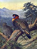 Western Tragopan, an extremely rare bird found in the Kullu district.
 -
 The Beas River, near Manali.
 -
 An apple tree at Dobi in Kullu valley.
 -
 The Rohtang Pass.


.JPG)


Further reading[edit | edit source]
- Diack, A.H. 1897 Gazetteers Of Kangra District, Parts II To IV - Kulu, Lahul And Spiti.
- Hutchison, John, and Jean Philippe Vogel.1933. History of the Panjab Hill States (Volume 1).
- Khosla, Gopal Das.1956. Himalayan Circuit: The Story of a Journey in the Inner Himalayas. Macmillan.
- Prarthi, Lal Chand. 1971. Kulut Desh ki Kahani.
- Chetwode, Penelope. 1972. Kulu: The End of the Inhabitable World.
- Shabab, Dilaram. 1996. Kullu: Himalayan Abode of the Divine. Indus Publishing.
- Singh, Sanjay Kumar, and Gopal Singh Rawat. 2000. Flora of Great Himalayan National Park: Himachal Pradesh.
- Hingorani, Alka. 2012. Making Faces: Self and image creation in a Himalayan valley. University of Hawaii Press. (see a book review here.)
- Moran, Arik. 2013. "Toward a history of devotional Vaishnavism in the West Himalayas: Kullu and the Ramanandis, c. 1500–1800." The Indian Economic & Social History Review 50.1: 1-25.
- Halperin, Ehud. 2019. The Many Faces of a Himalayan Goddess: Hadimba, Her Devotees, and Religion in Rapid Change. Oxford University Press, USA. (see a book review here)
Notes[edit | edit source]
References[edit | edit source]
- ↑ "Language and dialect of Himachal Pradesh" (PDF). Literary Herald.
- ↑ "With scripts on brink of extinction, HP history buffs look to restore vanishing culture". Hindustan Times. 1 February 2022. Retrieved 27 December 2025.
- ↑ "History | District Kullu | India". Retrieved 6 October 2022.
- ↑ 4.0 4.1 4.2 Rathore, Abhinay (2 February 1949). "Kullu (Jagir)". Rajput Provinces of India. Retrieved 5 October 2022.
- ↑ Service, Tribune News. "When castle was exchanged for a rifle". Tribuneindia News Service. Retrieved 6 October 2022.
- ↑ "History | District Lahaul and Spiti, Government of Himachal Pradesh | India". Retrieved 6 October 2022.
- ↑ 7.0 7.1 "History | District Kullu | India". Retrieved 5 October 2022.
- ↑ 8.0 8.1 8.2 8.3 8.4 8.5 "District Census Handbook: Kullu" (PDF). censusindia.gov.in. Registrar General and Census Commissioner of India. 2011.
- ↑ US Directorate of Intelligence. "Country Comparison:Population". Archived from the original on 27 September 2011. Retrieved 1 October 2011.
- ↑ Decadal Variation In Population Since 1901
- ↑ "Table C-16 Population by Mother Tongue: Himachal Pradesh". www.censusindia.gov.in. Registrar General and Census Commissioner of India.
- ↑ "Table C-01 Population by Religion: Himachal Pradesh". censusindia.gov.in. Registrar General and Census Commissioner of India. 2011.
- ↑ "Administrative Setup | District Kullu | India". Retrieved 5 October 2022.
- ↑ "Gram Panchayats | District Kullu | India". Retrieved 5 October 2022.
- ↑ "List of Helipads in Kullu district". Retrieved 5 October 2022.
- ↑ "Agriculture and horticulture in Kullu District of Himachal Pradesh, India: Practice, problems, and progress | HimalDoc". lib.icimod.org. Retrieved 7 October 2022.
- ↑ 17.0 17.1 Raghuvanshy, Garima (11 August 2021). "For Himachal Pradesh, Apples And Cannabis Are Double-Edged Swords". TheQuint. Retrieved 10 October 2022.
- ↑ "Impact of climate variability on apple production and diversity in Kullu valley, Himachal Pradesh". Indian Journal of Horticulture. 72 (1). 2015. ISSN 0972-8538.
- ↑ Global Climate Change and Indian Agriculture: Case Studies from the ICAR Network Project. New Delhi: Indian Council of Agricultural Research. 2009. pp. vii.
- ↑ 20.0 20.1 20.2 MSME Development Institute, Govt. of India (2012). "Brief Industrial Profile of the Kullu District" (PDF). Retrieved 7 October 2022.
- ↑ "Wild Medicinal Plants Used by Local Communities of Manali, Himachal Pradesh, India" (PDF). Ethnobotanical Leaflets. 3 (4). 2010.
- ↑ Chauhan, Kuldeep (10 July 2022). "Kullu-Manali Farmers Get Tips on How to Cultivate Medicinal Plants in Their Fields". himbumail.com. Retrieved 10 October 2022.
- ↑ Singh, M.P. (2017). "Hydro Power Scenario in Himachal Pradesh | Electrical India Magazine". Retrieved 10 October 2022.
- ↑ "NHPC Limited : Projects : Under Construction : Parbati - II". www.nhpcindia.com. Retrieved 10 October 2022.
- ↑ "NHPC Limited : Projects : Power Stations : Parbati - III". www.nhpcindia.com. Retrieved 10 October 2022.
- ↑ Service, Tribune News. "Gaddis, adventurous trekkers use Pin Parbat pass". Tribuneindia News Service. Retrieved 10 October 2022.
- ↑ Gardner, James; Sinclair, John; Berkes, Fikret; Singh, R. B. (1 January 2002). "Accelerated Tourism Development And Its Impacts In Kullu-Manali, H.P., India". Tourism Recreation Research. 27 (3): 9–20. doi:10.1080/02508281.2002.11081370. ISSN 0250-8281. S2CID 128607111.
- ↑ Webster, Jane (1998). "Desktop Videoconferencing: Experiences of Complete Users, Wary Users, and Non-Users". MIS Quarterly. 22 (3): 257–286. doi:10.2307/249666. ISSN 0276-7783. JSTOR 249666.
- ↑ "A Comparative Study of Cooperative Society, Private Sector, and Clusters of Kullu Handicrafts in Kullu" (PDF). 2017. Retrieved 7 October 2022.
- ↑ "The Worst Trade Route in the World". Travel The Himalayas. April 2018. Retrieved 6 October 2022.
- ↑ ""Urusvati" Himalayan Research Institute". irmtkullu.com. Retrieved 6 October 2022.
- ↑ "HICHS – Archaeology, Anthropology and Cultural Study". Retrieved 5 October 2022.
- ↑ "Govind Ballabh Pant National Institute of Himalayan Environment". gbpihed.gov.in. Retrieved 6 October 2022.
- ↑ Karelia, Gopi (3 March 2021). "This CEPT Alumnus Is Reviving A 1200-YO Architecture Form That Can Last Upto 5 Centuries". The Better India. Retrieved 6 October 2022.
- ↑ "Land use/cover change and its implications for Kullu district of Himachal Pradesh, India". www.indianjournals.com. Retrieved 7 October 2022.
- ↑ "Valley of the Gods". IGNCA. Archived from the original on 3 March 2016. Retrieved 26 March 2007.
- ↑ Meister, Michael W. (2006). "Mountain Temples and Temple-Mountains: Masrur". Journal of the Society of Architectural Historians. 65 (1): 26–49. doi:10.2307/25068237. ISSN 0037-9808. JSTOR 25068237.
- ↑ "Basheswar Mahadev Temple Kullu, How to Reach Mahadev Temple Kullu". www.kulluonline.in. Retrieved 6 October 2022.
- ↑ "About Society". bhutticoshawls.com. Retrieved 6 November 2025.
- ↑ "Our Showrooms". bhutticoshawls.com. Retrieved 6 November 2025.
{{cite web}}: CS1 maint: url-status (link) - ↑ Bhole, Shabbir Khambaty and Swapnil S. (24 August 2018). "Chaini Kothi: Himachal's Towering Edifice". www.livehistoryindia.com. Retrieved 6 October 2022.
- ↑ Jain, Anshika (15 May 2019). "Chaini Kothi: Saving A Himalayan Wonder". www.livehistoryindia.com. Retrieved 6 October 2022.
- ↑ "History". The Dagpo Fund. Retrieved 6 October 2022.
- ↑ "Dechen Choekhor". Dechen Choekhor Mahavihara. Retrieved 6 October 2022.
- ↑ "The official website of Great Himalayan National Park | A UNESCO World Heritage". Retrieved 6 October 2022.
- ↑ "Lesser-known national parks of the Himalayan region". The Times of India. ISSN 0971-8257. Retrieved 18 September 2023.
- ↑ "Lessons from the success story of Great Himalayan National Park". Firstpost. 30 June 2014. Retrieved 18 September 2023.
- ↑ Gautam, Shikha. "The strange story of Manali's Hadimba Devi Temple". The Times of India. Retrieved 5 October 2022.
- ↑ "Incredible India | Things To Do". www.incredibleindia.org. Retrieved 30 November 2021.
- ↑ WaysFare (26 September 2020). "Kaisdhar – The best Trek from Kullu to Lugvalley". Retrieved 5 October 2022.
- ↑ "Kasol: Little Israel of the Himalayas". Atlas Obscura. Retrieved 6 October 2022.
- ↑ Service, Tribune News. "She obsessively loved Kullu valley and died there". Tribuneindia News Service. Retrieved 5 October 2022.
- ↑ "History of Ropeways in Kullu". Archived from the original on 23 May 2003. Retrieved 24 December 2006.
- ↑ "Mata Vaishno Mahadevi Tirth Temple, Kullu - Timings, History, Pooja & Aarti schedule". Trawell.in. Retrieved 6 October 2022.
- ↑ 55.0 55.1 Rosser, Colin (1952). "A 'Hermit' village in Kulu" (PDF). The Economic Weekly. IV (19 & 20): 477–482.
- ↑ Axelby, Richard (2015). "Hermit Village or Zomian republic? An update on the political socio-economy of a remote Himalayan community" (PDF). European Bulletin of Himalayan Research. 46: 35–61.
- ↑ Mansingka, Shubham (4 April 2016). "The Legend Of The Mysterious Village Of Malana". Culture Trip. Retrieved 6 October 2022.
- ↑ "Manikaran Sahib - SikhiWiki, free Sikh encyclopedia". www.sikhiwiki.org. Retrieved 7 October 2022.
- ↑ "Fungni Mata(Beasar) – ValleyOfGods.in". 9 August 2019. Retrieved 6 October 2022.
- ↑ shubhammansingka (1 July 2022). "Day Hike to Mathasaur – Jai Maa Fungni Temple". The Bum who Travels. Retrieved 6 October 2022.
- ↑ "The Castle, Naggar – Himachal Pradesh Tourism Development Corporation (HPTDC)". hptdc.in. Retrieved 5 October 2022.
- ↑ "The Roerichs' Memorial House". irmtkullu.com. Retrieved 5 October 2022.
- ↑ "N. Roerich and S. Roerich Art Gallery". irmtkullu.com. Retrieved 5 October 2022.
- ↑ Service, Tribune News. "Nirmand and the legend of Parshurama". Tribuneindia News Service. Retrieved 5 October 2022.
- ↑ Chauhan, Gian (1996). "TRACES OF FEUDALISM AS SEEN IN THE NIRMAND COPPER-PLATE INSCRIPTION OF C. a. 612-13 A. D." Annals of the Bhandarkar Oriental Research Institute. 77 (1/4): 241–246. ISSN 0378-1143. JSTOR 41702174.
- ↑ "Raghunath Temple in Kullu, About Lord Raghunathji Temple Kullu". www.kulluonline.in. Retrieved 5 October 2022.
- ↑ "Tourism Development Council Manali (H.P.)-Home". rohtangpermits.nic.in. Retrieved 10 October 2022.
- ↑ "Sultanpur Palace Kullu, How to Reach Sultanpur Palace Kullu". www.kulluonline.in. Retrieved 6 October 2022.
- ↑ "One Day Trip from Kullu, Famous Places to Visit near Kullu". www.kulluonline.in. Retrieved 6 October 2022.
- ↑ Marchal, Stephan. "Jalori pass - treks, hikes and camping". Himalayan Ecotourism. Retrieved 6 October 2022.
- ↑ "Shringa Rishi Temple - Banjar, Kullu - Timings, History, Pooja & Aarti schedule". Trawell.in. Retrieved 6 October 2022.
- ↑ Watcher, Himachal (15 January 2021). "The GHNP and Tirthan Wildlife Sanctuary Ranked as Best Managed Protected Areas of India | Himachal Watcher". Retrieved 27 December 2025.
- ↑ "Official website for Kullu Dussehra". Retrieved 6 October 2022.
- ↑ "Official website for Kullu Dussehra". Retrieved 5 October 2022.
- ↑ "Spring Festival Kullu, Pipal Jatra Fair Kullu, Vasantotsava Kullu". www.kulluonline.in. Retrieved 6 October 2022.
- ↑ Himalayan, The (17 April 2013). "Trout fishing proves boon for tourism in Kullu valley". Discover Kullu Manali. Retrieved 6 October 2022.
- ↑ "Angling - Fisheries Department, Government of Himachal Pradesh". himachal.nic.in. Retrieved 6 October 2022.
- ↑ "Kullu Mountains". PeakVisor. Retrieved 5 October 2022.
- ↑ "20 deaths in 10 years: The sport that's taking lives in India | India News - Times of India". The Times of India. Retrieved 6 October 2022.
- ↑ "24-yr-old tourist dies in paragliding accident in Himachal". Inshorts - Stay Informed. Retrieved 6 October 2022.
- ↑ Service, Statesman News (8 April 2019). "Himachal: Kerala tourist, pilot killed in Kullu paragliding accident". The Statesman. Retrieved 6 October 2022.
- ↑ "Sports & Adventure - Government of Himachal Pradesh, India". himachal.nic.in. Retrieved 5 October 2022.
- ↑ "Rapid Riders". Archived from the original on 21 December 2019.
- ↑ "Sethan". boulderbox.in. Retrieved 5 October 2022.
- ↑ "Rock Climbing and Bouldering in Manali & beyond 1 to 21 days". www.potala-himalaya.com. Retrieved 5 October 2022.
- ↑ "Sports & Adventure - Government of Himachal Pradesh, India". himachal.nic.in. Retrieved 8 October 2022.
- ↑ Himalayan, The (30 January 2021). "Skiing and snowboarding championships at Hamta from Jan 31". Discover Kullu Manali. Retrieved 8 October 2022.
- ↑ "Bhrigu Lake Trek 2024 - Treks In Himachal Pradesh - Himalayan Frontiers". himalayanfrontiers.com. Retrieved 7 October 2022.
- ↑ "Malana Chanderkhani Pass - Potala Adventurers". www.potala-himalaya.com. Retrieved 7 October 2022.
- ↑ "Pin Parvati Pass". indiahikes.com. Retrieved 7 October 2022.
- ↑ Marchal, Stephan. "Treks in the Great Himalayan National Park". Himalayan Ecotourism. Retrieved 7 October 2022.
- ↑ Pandey, Abhimanyu (July–September 2007). "Khandedhar - Origin of the Jiwa Nal" (PDF). Monal (54): 3–5.
External links[edit | edit source]
- DISTRICT PROFILE
- CULTURAL & TOURISM HERITAGE OF THE DISTRICT
- Birds of Kullu District
- Butterflies of Kullu District
- Landscapes of Kullu District
Places adjacent to Kullu district | |
|---|---|


.png)