
->Waacstats stub sort |
improved information also |
||
| Line 1: | Line 1: | ||
{{Short description|Old numbering of road in India}} | |||
{{Use dmy dates|date=February 2017}} | {{Use dmy dates|date=February 2017}} | ||
{{Use Indian English|date=February 2017}} | {{Use Indian English|date=February 2017}} | ||
| Line 22: | Line 23: | ||
|next_route=8C | |next_route=8C | ||
}} | }} | ||
'''National Highway 8B''' ('''NH 8B''') | '''National Highway 8B''' ('''NH 8B''') was an [[India|Indian]] [[National Highway (India)|National Highway]] entirely within the state of [[Gujarat]]. NH 8B linked [[Bamanbore]] (junction of [[NH 8A]]) to [[Porbandar]] and is {{convert|206|km|mi|abbr=on}} long.<ref>{{cite web |url=http://morth.nic.in/writereaddata/sublink2images/NH_StartEnding_Station8634854396.htm |title=Archived copy |accessdate=2011-07-20 |url-status=dead |archiveurl=http://webarchive.loc.gov/all/20090410062034/http%3A//morth%2Enic%2Ein/writereaddata/sublink2images/NH_StartEnding_Station8634854396%2Ehtm |archivedate=10 April 2009 |df=dmy-all }} Start and end points of National Highways</ref> It is now part of [[National Highway 27 (India)|NH 27]] in new numbering. | ||
<ref>{{cite web |url=http://morth.nic.in/writereaddata/sublink2images/NH_StartEnding_Station8634854396.htm |title=Archived copy |accessdate=2011-07-20 |url-status=dead |archiveurl=http://webarchive.loc.gov/all/20090410062034/http%3A//morth%2Enic%2Ein/writereaddata/sublink2images/NH_StartEnding_Station8634854396%2Ehtm |archivedate=10 April 2009 |df=dmy-all }} Start and end points of National Highways</ref> | |||
NH 8B, for its entire length, | NH 8B, for its entire length, was a part of the [[North-South and East-West Corridor]]. | ||
==Route== | ==Route== | ||
* [[Rajkot]] | * [[Rajkot]] | ||
| Line 50: | Line 50: | ||
{{Indian Highways Network}} | {{Indian Highways Network}} | ||
{{DEFAULTSORT:National Highway 8B}} | {{DEFAULTSORT:National Highway 8B}} | ||
[[Category:National highways in Gujarat]] | |||
[[Category:National | |||
[[Category:North–South and East–West Corridor]] | [[Category:North–South and East–West Corridor]] | ||
[[Category:National highways in India (old numbering)]] | [[Category:National highways in India (old numbering)]] | ||
{{India-NH-stub}} | {{India-NH-stub}} | ||
Latest revision as of 00:14, 1 August 2025
 | ||||
|---|---|---|---|---|
| Route information | ||||
| Length | 206 km (128 mi) E-W: 206 km (128 mi) (Porbandar - Bamanbore) | |||
| Major junctions | ||||
| From | Bamanbore, Gujarat | |||
| To | Porbandar, Gujarat | |||
| Location | ||||
| States | Gujarat | |||
| Primary destinations | Rajkot - Gondal - Jetpur - Upleta - Ranavav | |||
| Highway system | ||||
| ||||


National Highway 8B (NH 8B) was an Indian National Highway entirely within the state of Gujarat. NH 8B linked Bamanbore (junction of NH 8A) to Porbandar and is 206 km (128 mi) long.[1] It is now part of NH 27 in new numbering.
NH 8B, for its entire length, was a part of the North-South and East-West Corridor.
Route[edit | edit source]
Gallery[edit | edit source]
-
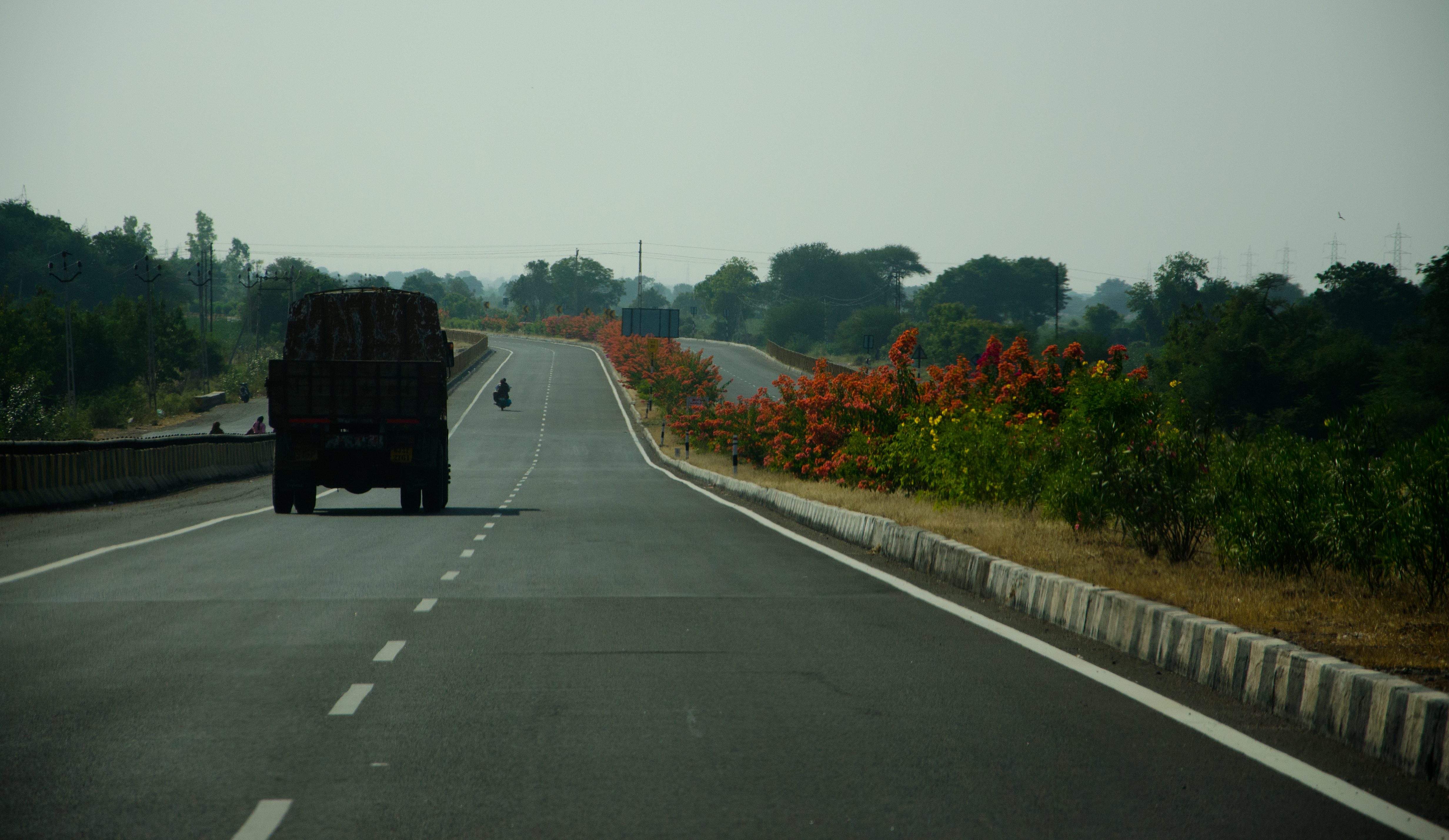 NH8B in Gujarat

See also[edit | edit source]
References[edit | edit source]
- ↑ "Archived copy". Archived from the original on 10 April 2009. Retrieved 20 July 2011.
{{cite web}}: CS1 maint: archived copy as title (link) Start and end points of National Highways
External links[edit | edit source]
- Route map of NH 8B at openstreetmap.org


 | This article about a National Highway in India is a stub. You can help Bharatpedia by expanding it. |