


>MB cleanup, typo(s) fixed: 1963-64 → 1963–64 |
corrected article to improve readability further and cleaned formatting as per guidelines |
||
| Line 1: | Line 1: | ||
{{more citations needed|date=December 2014}} | |||
{{Use dmy dates|date=December 2018}} | {{Use dmy dates|date=December 2018}} | ||
{{Use Indian English|date=December 2018}} | {{Use Indian English|date=December 2018}} | ||
<!-- See [[Wikipedia:WikiProject Indian cities]] for details -->{{Infobox settlement | <!-- See [[Wikipedia:WikiProject Indian cities]] for details -->{{Infobox settlement | ||
| name = Beypore | | name = Beypore | ||
| Line 14: | Line 14: | ||
| pushpin_map_alt = | | pushpin_map_alt = | ||
| pushpin_map_caption = Location in Kerala, India | | pushpin_map_caption = Location in Kerala, India | ||
| coordinates = {{coord|11.18|N|75. | | coordinates = {{coord|11.18|N|75.81|E|display=inline,title}} | ||
| subdivision_type = Country | | subdivision_type = Country | ||
| subdivision_name = {{flag|India}} | | subdivision_name = {{flag|India}} | ||
| Line 28: | Line 28: | ||
| governing_body = | | governing_body = | ||
| unit_pref = Metric | | unit_pref = Metric | ||
| area_footnotes = <ref name="population1">{{Cite web|url=https://kozhikodecorporation.lsgkerala.gov.in/en/master-plan}}</ref> | | area_footnotes = <ref name="population1">{{Cite web|url=https://kozhikodecorporation.lsgkerala.gov.in/en/master-plan|title=Master Plan | Kozhikode Municipal Corporation}}</ref> | ||
| area_rank = | | area_rank = | ||
| area_total_km2 = 10 | | area_total_km2 = 10 | ||
| Line 38: | Line 38: | ||
| population_density_km2 = auto | | population_density_km2 = auto | ||
| population_demonym = | | population_demonym = | ||
| population_footnotes = <ref name="population1">{{Cite web|url=https://kozhikodecorporation.lsgkerala.gov.in/en/master-plan}}</ref> | | population_footnotes = <ref name="population1">{{Cite web|url=https://kozhikodecorporation.lsgkerala.gov.in/en/master-plan|title=Master Plan | Kozhikode Municipal Corporation}}</ref> | ||
| demographics_type1 = Languages | | demographics_type1 = Languages | ||
| demographics1_title1 = Official | | demographics1_title1 = Official | ||
| Line 50: | Line 50: | ||
| footnotes = | | footnotes = | ||
}} | }} | ||
'''Beypore''' or ''Beypur'' is | '''Beypore''' or '''Beypur''' ({{IPA|ml|beːpːuːr|lang}}, formerly '''Beypoor''') is a port town in [[Kozhikode district]] in the state of [[Kerala]], India. It is located opposite to [[Chaliyam]], the estuary where the river [[Chaliyar]] empties into the [[Arabian Sea]]. Beypore is part of [[Kozhikode Municipal Corporation]]. The town was formerly known as Vaypura or Vadaparappanad and also as Beydary. [[Tippu Sultan|Tipu Sultan]], ruler of [[Kingdom of Mysore|Mysore]], named the town ''Sultan Pattanam''. There is a marina and a beach, while Beypore port is one of the oldest ports in Kerala, which historically traded with the [[Middle East]]. Beypore is noted for building wooden ships, known as ''[[dhow]]s'' or ''urus'' in the [[Malayalam]] language. These ships were usually bought by [[Arab]] merchants for trading and fishing but are now used as tourist ships. According to Captain Iwata, founder member of the Association of Sumerian Ships in Japan, Sumerian ships might have been built in Beypore. There is evidence to prove that Beypore had direct trade links with Mesopotamia and was a prominent link on the maritime silk route. The first railway line of Kerala was laid in 1861 from [[Tirur]] to Beypore ([[Chaliyam]]), passing through [[Tanur, Malappuram|Tanur]], [[Parappanangadi]], [[Vallikkunnu]], and [[Kadalundi]]. | ||
Beypore is located {{cvt|10|km}} away from [[Kozhikode]] city. | |||
==Etymology== | |||
{{Empty section|date=August 2023}} | |||
==History== | ==History== | ||
| Line 58: | Line 61: | ||
The ancient trading port of Tyndis is often identified with [[Kadalundi]]-[[Chaliyam]]-Beypore region. [[Tyndis]] was a major center of trade, next only to [[Muziris]], between the Cheras and the [[Roman Empire]].<ref>Coastal Histories: Society and Ecology in Pre-modern India, Yogesh Sharma, Primus Books 2010</ref> [[Pliny the Elder]] (1st century CE) states that the port of ''[[Tyndis]]'' was located at the northwestern border of ''Keprobotos'' ([[Chera dynasty]]).<ref name=":2">Gurukkal, R., & Whittaker, D. (2001). In search of Muziris. ''Journal of Roman Archaeology,'' ''14'', 334-350.</ref> The [[North Malabar]] region, which lies north of the port at ''[[Tyndis]]'', was ruled by the kingdom of [[Ezhimala]] during [[Sangam period]].<ref name="Malabar">A. Shreedhara Menon, A Survey of Kerala History</ref> According to the ''[[Periplus of the Erythraean Sea]]'', a region known as ''[[Limyrike]]'' began at ''[[Kannur|Naura]]'' and ''[[Tyndis]]''. However the [[Ptolemy]] mentions only ''[[Tyndis]]'' as the ''[[Limyrike]]'''s starting point. The region probably ended at [[Kanyakumari]]; it thus roughly corresponds to the present-day [[Malabar Coast]]. The value of Rome's annual trade with the region was estimated at around 50,000,000 [[sesterces]].<ref>According to [[Pliny the Elder]], goods from India were sold in the Empire at 100 times their original purchase price. See [https://web.archive.org/web/20131106031753/http://www.cartage.org.lb/en/themes/BookLibrary/books/bibliographie/P/Plinyelder/elder/pliny-india.html]</ref> [[Pliny the Elder]] mentioned that ''[[Limyrike]]'' was prone by pirates.<ref>Bostock, John (1855). "26 (Voyages to India)". Pliny the Elder, The Natural History. London: Taylor and Francis.</ref> The [[Cosmas Indicopleustes]] mentioned that the ''[[Limyrike]]'' was a source of peppers.<ref>Indicopleustes, Cosmas (1897). Christian Topography. 11. United Kingdom: The Tertullian Project. pp. 358–373.</ref><ref>Das, Santosh Kumar (2006). The Economic History of Ancient India. Genesis Publishing Pvt Ltd. p. 301.</ref> | The ancient trading port of Tyndis is often identified with [[Kadalundi]]-[[Chaliyam]]-Beypore region. [[Tyndis]] was a major center of trade, next only to [[Muziris]], between the Cheras and the [[Roman Empire]].<ref>Coastal Histories: Society and Ecology in Pre-modern India, Yogesh Sharma, Primus Books 2010</ref> [[Pliny the Elder]] (1st century CE) states that the port of ''[[Tyndis]]'' was located at the northwestern border of ''Keprobotos'' ([[Chera dynasty]]).<ref name=":2">Gurukkal, R., & Whittaker, D. (2001). In search of Muziris. ''Journal of Roman Archaeology,'' ''14'', 334-350.</ref> The [[North Malabar]] region, which lies north of the port at ''[[Tyndis]]'', was ruled by the kingdom of [[Ezhimala]] during [[Sangam period]].<ref name="Malabar">A. Shreedhara Menon, A Survey of Kerala History</ref> According to the ''[[Periplus of the Erythraean Sea]]'', a region known as ''[[Limyrike]]'' began at ''[[Kannur|Naura]]'' and ''[[Tyndis]]''. However the [[Ptolemy]] mentions only ''[[Tyndis]]'' as the ''[[Limyrike]]'''s starting point. The region probably ended at [[Kanyakumari]]; it thus roughly corresponds to the present-day [[Malabar Coast]]. The value of Rome's annual trade with the region was estimated at around 50,000,000 [[sesterces]].<ref>According to [[Pliny the Elder]], goods from India were sold in the Empire at 100 times their original purchase price. See [https://web.archive.org/web/20131106031753/http://www.cartage.org.lb/en/themes/BookLibrary/books/bibliographie/P/Plinyelder/elder/pliny-india.html]</ref> [[Pliny the Elder]] mentioned that ''[[Limyrike]]'' was prone by pirates.<ref>Bostock, John (1855). "26 (Voyages to India)". Pliny the Elder, The Natural History. London: Taylor and Francis.</ref> The [[Cosmas Indicopleustes]] mentioned that the ''[[Limyrike]]'' was a source of peppers.<ref>Indicopleustes, Cosmas (1897). Christian Topography. 11. United Kingdom: The Tertullian Project. pp. 358–373.</ref><ref>Das, Santosh Kumar (2006). The Economic History of Ancient India. Genesis Publishing Pvt Ltd. p. 301.</ref> | ||
According to the [[Legend of Cheraman Perumals]], the first Indian mosque was built in 624 AD at [[Kodungallur]] with the mandate of the last the ruler (the Cheraman Perumal) of [[Chera dynasty]], who converted to Islam during the lifetime of [[ | According to the [[Legend of Cheraman Perumals]], the first Indian mosque was built in 624 AD at [[Kodungallur]] with the mandate of the last the ruler (the Cheraman Perumal) of [[Chera dynasty]], who converted to Islam during the lifetime of [[Muhammad]] (c. 570–632).<ref>{{cite book |author=Jonathan Goldstein |title=The Jews of China |publisher=M. E. Sharpe |year=1999|isbn=9780765601049 |url=https://books.google.com/books?id=8Z6DlzyT2vwC |page=123}}</ref><ref name="SimpsonKresse2008">{{cite book |author1=Edward Simpson|author2=Kai Kresse|title=Struggling with History: Islam and Cosmopolitanism in the Western Indian Ocean|url=https://books.google.com/books?id=w0qHKA7zEaEC&pg=PA333|access-date=24 July 2012 |year=2008|publisher=Columbia University Press|isbn=978-0-231-70024-5|pages=333}}</ref><ref name="Kupferschmidt1987">{{cite book|author=Uri M. Kupferschmidt|title=The Supreme Muslim Council: Islam Under the British Mandate for Palestine|url=https://books.google.com/books?id=ChEVAAAAIAAJ&pg=PA458|access-date=25 July 2012|year=1987|publisher=Brill|isbn=978-90-04-07929-8|pages=458–459}}</ref><ref name="Raṇṭattāṇi2007">{{cite book|author=Husain Raṇṭattāṇi|title=Mappila Muslims: A Study on Society and Anti Colonial Struggles |url=https://books.google.com/books?id=xlb5BrabQd8C&pg=PA179|access-date=25 July 2012|year=2007|publisher=Other Books|isbn=978-81-903887-8-8|pages=179–}}</ref> According to ''[[Qissat Shakarwati Farmad]]'', the [[Mosque|''Masjids'']] at [[Kodungallur]], [[Kollam]], Madayi, [[Barkur]], [[Mangalore]], [[Kasaragod]], [[Kannur]], [[Dharmadam]], [[Koyilandy|Panthalayini]], and [[Chaliyam]] (just opposite to Beypore), were built during the era of [[Malik Dinar]], and they are among the oldest ''Masjid''s in the [[Indian subcontinent]].<ref>Prange, Sebastian R. ''Monsoon Islam: Trade and Faith on the Medieval Malabar Coast.'' Cambridge University Press, 2018. 98.</ref> It is believed that [[Malik Dinar]] died at [[Thalangara]] in [[Kasaragod]] town.<ref name="ch">Pg 58, Cultural heritage of [[Kerala]]: an introduction, A. Sreedhara Menon, East-West Publications, 1978</ref> | ||
In medieval period, Beypore was ruled by four Kovilakams - Karippa Puthiyakovilakam, Manayat Kovilakam, Nediyaal Kovilakam and Panagad Kovilakam | In the medieval period, Beypore was ruled by four Kovilakams - Karippa Puthiyakovilakam, Manayat Kovilakam, Nediyaal Kovilakam and Panagad Kovilakam - all belonging to the Beypore branch of the [[Parappanad]] family. The Parappanad royal family is related to the more famous [[Travancore royal family]]. [[Marthanda Varma]], the founder of [[Travancore]], belongs to [[Parappanad]] royal family. They also had branches at [[Parappanangadi]], [[Vallikkunnu]] and Beypore.<ref>{{Citation | ||
branch of the [[Parappanad]] family. Parappanad royal family is | |||
| author = K. V. Krishna Iyer | | author = K. V. Krishna Iyer | ||
| title = Zamorins of Calicut: From the earliest times to AD 1806 | | title = Zamorins of Calicut: From the earliest times to AD 1806 | ||
| publisher = Norman Printing Bureau, Kozhikode | | publisher = Norman Printing Bureau, Kozhikode | ||
| url = https://archive.org/details/in.gov.ignca.3379 | | url = https://archive.org/details/in.gov.ignca.3379 | ||
| year = 1938}}</ref> | | year = 1938}}</ref> | ||
Beypore was visited first by Romans and afterwards by Chinese, Syrians, Arabs and in recent centuries by Europeans for trade. Beypore has a long history of being a centre for shipbuilding since the first century AD, and it was further expanded under the East India Company during the early nineteenth century. The Indian Ocean trade started from ancient times and strengthened during the medieval times. While in the old days Malabar directly traded with the Greeks and Romans, it concentrated on exchanges with the Middle Eastern ports in the medieval times. This exchange of goods resulted also in transfer of people from their abodes. While it is mentioned that Malabaris were found along African ports and even Egypt's, it was mostly Arabs who migrated to the Malabar coasts, mainly to administer, control and conduct the trade with their brethren in Yemen, Basra and Egyptian ports. Beypore was virtually a free port with only an export import duty imposed by the ruling Zamorins. The intermediaries between the Arabs and the Nairs were the Moplahs (themselves a community started by the intermingling Arab men and local women from ancient times). Also the south east Malay ports sent ships to Malabar for the cloth from Kerala, until British cloth took its place later in the 19th century. It was also a stop over for Hajj pilgrims from south east Asia. The Arab settlers in Malabar even had African slaves during that period. | |||
==Beypore | ==Beypore port== | ||
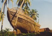
[[File:Uru.jpg|thumbnail|Beypore is world-famous for the ancient design boats called ''Uru''s]] | [[File:Uru.jpg|thumbnail|Beypore is world-famous for the ancient design boats called ''Uru''s]] | ||
Beypore port is a sub-port of [[Kozhikode]] port | Beypore port is a sub-port of [[Kozhikode]] port, located approximately {{cvt|10|km}} south of Kozhikode. The land for the port was acquired from Beypore Karippa Puthiyakovilakam in 1963 and 1964. It is an estuarine port, where Beypore river discharges into the Arabian Sea. Beypore is {{cvt|180|km}} North of Cochin and {{cvt|391|km}} away from Trivandrum. Beypore port is the second biggest port in Kerala after Cochin and currently handles about 100,000 tonnes of cargo and 7500 passengers per annum. The nearest ports are Kochi and Mangalore. The port has a depth of about {{convert|5|m}} alongside wharf and approach channel. Beypore port is one of the oldest ports in Kerala from where trading was done to the [[Middle East]]. | ||
== Uru | == Uru construction == | ||
[[File:Sd11-boom.JPG|thumbnail|Beypore has a reputation for boat building]] | [[File:Sd11-boom.JPG|thumbnail|Beypore has a reputation for boat building]] | ||
The [[Uru (boat)]], or "Fat Boat", is a generic name for large | The [[Uru (boat)|uru]], or "Fat Boat", is a generic name for large [[dhow]]-type wooden ships made in Beypore.{{citation needed|date=October 2021}} This type of boat has been used by the Arabs since ancient times as trading vessels, and to this day, urus are being manufactured and exported to Arab nations from Beypore.<ref>{{Cite web |url=https://visitbeypore.co.in/ |title=Archived copy |access-date=15 October 2019 |archive-url=https://web.archive.org/web/20180203084635/http://visitbeypore.co.in/ |archive-date=3 February 2018 |url-status=dead }}</ref> These boats used to be built of several types of wood, the main one being teak. The teak was taken from [[Nilambur]] forests in earlier times, but now imported Malaysian teak is used.<ref>https://www.facebook.com/238044912896496/videos/1454648004569508 {{User-generated source|certain=yes|date=March 2022}}</ref> | ||
==Geography== | ==Geography== | ||
Beypore is located at {{coord|11.18|N|75. | Beypore is located at {{coord|11.18|N|75.81|E|}}.<ref>[http://www.fallingrain.com/world/IN/13/Beypore.html Falling Rain Genomics, Inc - Beypore]</ref> It has an average elevation of {{convert|1|m|spell=in}}. | ||
==Travel information== | ==Travel information== | ||
By road : Beypore is well connected by road and is just {{cvt|11|km}} from [[Kozhikode]]. | By road: Beypore is well connected by road and is just {{cvt|11|km}} from [[Kozhikode]]. | ||
By air : | By air: [[Kozhikode International Airport]] is located in [[Karipur]] and is {{cvt|23|km}} from Kozhikode city centre. | ||
By rail : Kozhikode station {{cvt|10|km}} | By rail: Kozhikode station is {{cvt|10|km}} away and Ferokem is {{cvt|4|km}} away. | ||
==Demographics== | ==Demographics== | ||
{{as of|2001}} India [[census]],{{cite web|url=http://www.censusindia.net/results/town.php?stad=A&state5=999|archive-url=https://web.archive.org/web/20040616075334/http://www.censusindia.net/results/town.php?stad=A&state5=999|archive-date=2004-06-16|title= Census of India 2001: Data from the 2001 Census, including cities, villages and towns | {{as of|2001}} India [[census]],<ref>{{cite web|url=http://www.censusindia.net/results/town.php?stad=A&state5=999|archive-url=https://web.archive.org/web/20040616075334/http://www.censusindia.net/results/town.php?stad=A&state5=999|archive-date=2004-06-16|title= Census of India 2001: Data from the 2001 Census, including cities, villages and towns (Provisional)|access-date=2008-11-01|publisher= Census Commission of India}}</ref> Beypore had a population of 66,883. Males constitute 49% of the population and females 51%. Beypore has an average literacy rate of 81%, higher than the national average of 59.5%; with 50% of the males and 50% of females literate. 13% of the population is under 6 years of age. | ||
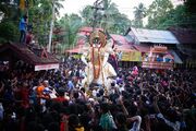
[[File:Cheruvannur 06146.JPG|thumb|Cheruvannur festival]] | [[File:Cheruvannur 06146.JPG|thumb|Cheruvannur festival]] | ||
==Notable residents== | ==Notable residents== | ||
* [[Vaikom Muhammad Basheer]] ( | * [[Vaikom Muhammad Basheer]] (1908 – 1994),<ref>{{Cite web |url=http://cs.nyu.edu/kandathi/basheer.html#date |title=Basheer's Janmadhinam |access-date=27 December 2011 |archive-url=https://web.archive.org/web/20111218204532/http://cs.nyu.edu/kandathi/basheer.html#date |archive-date=18 December 2011 |url-status=dead |df=dmy-all }}</ref> writer | ||
* [[Mamukkoya]], Malayalam film actor | * [[Mamukkoya]], Malayalam film actor | ||
== | ==Notable sites== | ||
* Pulimuttu- Pulimuttu is the local name of the {{convert|1|km|mi|adj=mid|-long}} bridge made of stone stretching in to sea. It is made by piling stones like a pathway to sea. [[File:StonePier Beypore.jpg|thumb|100px|right|StonePier Beypore]] | * Pulimuttu- Pulimuttu is the local name of the {{convert|1|km|mi|adj=mid|-long}} bridge made of stone stretching in to sea. It is made by piling stones like a pathway to sea. [[File:StonePier Beypore.jpg|thumb|100px|right|StonePier Beypore]] | ||
* Beypore Beach | * Beypore Beach | ||
* Beypore light house is situated at the south bank of chaliyar. | * Beypore light house is situated at the south bank of chaliyar. | ||
== | ==Government offices== | ||
Indian Coast Guard has established its | Indian Coast Guard has established its third station in Kerala at Beypore, Coast Guard Station Beypore. It was commissioned on 25 May 2006. | ||
== See also == | == See also == | ||
| Line 150: | Line 122: | ||
==Image gallery== | ==Image gallery== | ||
<gallery> | <gallery> | ||
File:Beypore Fishing1.jpg| | File:Beypore Fishing1.jpg|Fishing in Beypore | ||
File:Beypore Beach, Kozhikode, Kerala.jpg|The Sea Walk | File:Beypore Beach, Kozhikode, Kerala.jpg|The Sea Walk | ||
File:Beypore1.jpg|Making boats | File:Beypore1.jpg|Making boats | ||
File:Beypore.jpg|The promenade | File:Beypore.jpg|The promenade | ||
</gallery> | </gallery> | ||
| Line 163: | Line 133: | ||
==External links== | ==External links== | ||
*{{commons category-inline|Beypore}} | *{{commons category-inline|Beypore}} | ||
*{{wikivoyage | *{{wikivoyage inline|Beypore Beach}} | ||
* https://web.archive.org/web/20180203084635/http://visitbeypore.co.in/ | * https://web.archive.org/web/20180203084635/http://visitbeypore.co.in/ | ||
| Line 173: | Line 143: | ||
[[Category:Beaches of Kozhikode district]] | [[Category:Beaches of Kozhikode district]] | ||
[[Category:Kozhikode beach]] | [[Category:Kozhikode beach]] | ||
[[Category:Kozhikode | [[Category:Suburbs of Kozhikode]] | ||
[[Category:Villages in Kozhikode district]] | [[Category:Villages in Kozhikode district]] | ||
Latest revision as of 13:25, 12 January 2026
 | This article needs additional citations for verification. (December 2014) |
Beypore | |
|---|---|
city | |
  Beypore Location in Kerala, India  Beypore Beypore (India) | |
| Coordinates: 11°11′N 75°49′E / 11.18°N 75.81°E | |
| Country |  India India |
| State | Kerala |
| District | Kozhikode |
| Area | |
| • Total | 10 km2 (4 sq mi) |
| Elevation | 1 m (3 ft) |
| Population (2011)[1] | |
| • Total | 69,752 |
| • Density | 7,000/km2 (18,000/sq mi) |
| Languages | |
| • Official | Malayalam, English |
| Time zone | UTC+5:30 (IST) |
| Vehicle registration | KL-85 |
Beypore or Beypur (ml, formerly Beypoor) is a port town in Kozhikode district in the state of Kerala, India. It is located opposite to Chaliyam, the estuary where the river Chaliyar empties into the Arabian Sea. Beypore is part of Kozhikode Municipal Corporation. The town was formerly known as Vaypura or Vadaparappanad and also as Beydary. Tipu Sultan, ruler of Mysore, named the town Sultan Pattanam. There is a marina and a beach, while Beypore port is one of the oldest ports in Kerala, which historically traded with the Middle East. Beypore is noted for building wooden ships, known as dhows or urus in the Malayalam language. These ships were usually bought by Arab merchants for trading and fishing but are now used as tourist ships. According to Captain Iwata, founder member of the Association of Sumerian Ships in Japan, Sumerian ships might have been built in Beypore. There is evidence to prove that Beypore had direct trade links with Mesopotamia and was a prominent link on the maritime silk route. The first railway line of Kerala was laid in 1861 from Tirur to Beypore (Chaliyam), passing through Tanur, Parappanangadi, Vallikkunnu, and Kadalundi.
Beypore is located 10 km (6.2 mi) away from Kozhikode city.
Etymology[edit | edit source]
![[icon]](/wiki/File:Wiki_letter_w_cropped.svg) | This section is empty. You can help by adding to it. (August 2023) |
History[edit | edit source]

The ancient trading port of Tyndis is often identified with Kadalundi-Chaliyam-Beypore region. Tyndis was a major center of trade, next only to Muziris, between the Cheras and the Roman Empire.[2] Pliny the Elder (1st century CE) states that the port of Tyndis was located at the northwestern border of Keprobotos (Chera dynasty).[3] The North Malabar region, which lies north of the port at Tyndis, was ruled by the kingdom of Ezhimala during Sangam period.[4] According to the Periplus of the Erythraean Sea, a region known as Limyrike began at Naura and Tyndis. However the Ptolemy mentions only Tyndis as the Limyrike's starting point. The region probably ended at Kanyakumari; it thus roughly corresponds to the present-day Malabar Coast. The value of Rome's annual trade with the region was estimated at around 50,000,000 sesterces.[5] Pliny the Elder mentioned that Limyrike was prone by pirates.[6] The Cosmas Indicopleustes mentioned that the Limyrike was a source of peppers.[7][8]
According to the Legend of Cheraman Perumals, the first Indian mosque was built in 624 AD at Kodungallur with the mandate of the last the ruler (the Cheraman Perumal) of Chera dynasty, who converted to Islam during the lifetime of Muhammad (c. 570–632).[9][10][11][12] According to Qissat Shakarwati Farmad, the Masjids at Kodungallur, Kollam, Madayi, Barkur, Mangalore, Kasaragod, Kannur, Dharmadam, Panthalayini, and Chaliyam (just opposite to Beypore), were built during the era of Malik Dinar, and they are among the oldest Masjids in the Indian subcontinent.[13] It is believed that Malik Dinar died at Thalangara in Kasaragod town.[14]
In the medieval period, Beypore was ruled by four Kovilakams - Karippa Puthiyakovilakam, Manayat Kovilakam, Nediyaal Kovilakam and Panagad Kovilakam - all belonging to the Beypore branch of the Parappanad family. The Parappanad royal family is related to the more famous Travancore royal family. Marthanda Varma, the founder of Travancore, belongs to Parappanad royal family. They also had branches at Parappanangadi, Vallikkunnu and Beypore.[15]
Beypore was visited first by Romans and afterwards by Chinese, Syrians, Arabs and in recent centuries by Europeans for trade. Beypore has a long history of being a centre for shipbuilding since the first century AD, and it was further expanded under the East India Company during the early nineteenth century. The Indian Ocean trade started from ancient times and strengthened during the medieval times. While in the old days Malabar directly traded with the Greeks and Romans, it concentrated on exchanges with the Middle Eastern ports in the medieval times. This exchange of goods resulted also in transfer of people from their abodes. While it is mentioned that Malabaris were found along African ports and even Egypt's, it was mostly Arabs who migrated to the Malabar coasts, mainly to administer, control and conduct the trade with their brethren in Yemen, Basra and Egyptian ports. Beypore was virtually a free port with only an export import duty imposed by the ruling Zamorins. The intermediaries between the Arabs and the Nairs were the Moplahs (themselves a community started by the intermingling Arab men and local women from ancient times). Also the south east Malay ports sent ships to Malabar for the cloth from Kerala, until British cloth took its place later in the 19th century. It was also a stop over for Hajj pilgrims from south east Asia. The Arab settlers in Malabar even had African slaves during that period.
Beypore port[edit | edit source]

Beypore port is a sub-port of Kozhikode port, located approximately 10 km (6.2 mi) south of Kozhikode. The land for the port was acquired from Beypore Karippa Puthiyakovilakam in 1963 and 1964. It is an estuarine port, where Beypore river discharges into the Arabian Sea. Beypore is 180 km (110 mi) North of Cochin and 391 km (243 mi) away from Trivandrum. Beypore port is the second biggest port in Kerala after Cochin and currently handles about 100,000 tonnes of cargo and 7500 passengers per annum. The nearest ports are Kochi and Mangalore. The port has a depth of about 5 metres (16 ft) alongside wharf and approach channel. Beypore port is one of the oldest ports in Kerala from where trading was done to the Middle East.
Uru construction[edit | edit source]

The uru, or "Fat Boat", is a generic name for large dhow-type wooden ships made in Beypore.[citation needed] This type of boat has been used by the Arabs since ancient times as trading vessels, and to this day, urus are being manufactured and exported to Arab nations from Beypore.[16] These boats used to be built of several types of wood, the main one being teak. The teak was taken from Nilambur forests in earlier times, but now imported Malaysian teak is used.[17]
Geography[edit | edit source]
Beypore is located at 11°11′N 75°49′E / 11.18°N 75.81°E.[18] It has an average elevation of 1 metre (3 ft 3 in)*.
Travel information[edit | edit source]
By road: Beypore is well connected by road and is just 11 km (6.8 mi) from Kozhikode.
By air: Kozhikode International Airport is located in Karipur and is 23 km (14 mi) from Kozhikode city centre.
By rail: Kozhikode station is 10 km (6.2 mi) away and Ferokem is 4 km (2.5 mi) away.
Demographics[edit | edit source]
As of 2001[update] India census,[19] Beypore had a population of 66,883. Males constitute 49% of the population and females 51%. Beypore has an average literacy rate of 81%, higher than the national average of 59.5%; with 50% of the males and 50% of females literate. 13% of the population is under 6 years of age.

Notable residents[edit | edit source]
- Vaikom Muhammad Basheer (1908 – 1994),[20] writer
- Mamukkoya, Malayalam film actor
Notable sites[edit | edit source]
- Pulimuttu- Pulimuttu is the local name of the 1-kilometre-long (0.62 mi) bridge made of stone stretching in to sea. It is made by piling stones like a pathway to sea.
StonePier Beypore - Beypore Beach
- Beypore light house is situated at the south bank of chaliyar.

Government offices[edit | edit source]
Indian Coast Guard has established its third station in Kerala at Beypore, Coast Guard Station Beypore. It was commissioned on 25 May 2006.
See also[edit | edit source]
- Feroke
- Kadalundi
- Kadalundi Bird Sanctuary
- Karuvanthuruthy
- Chaliyar river
- Cheruvannur
- Marad
- Chaliyam
- panniyankara
Image gallery[edit | edit source]
-
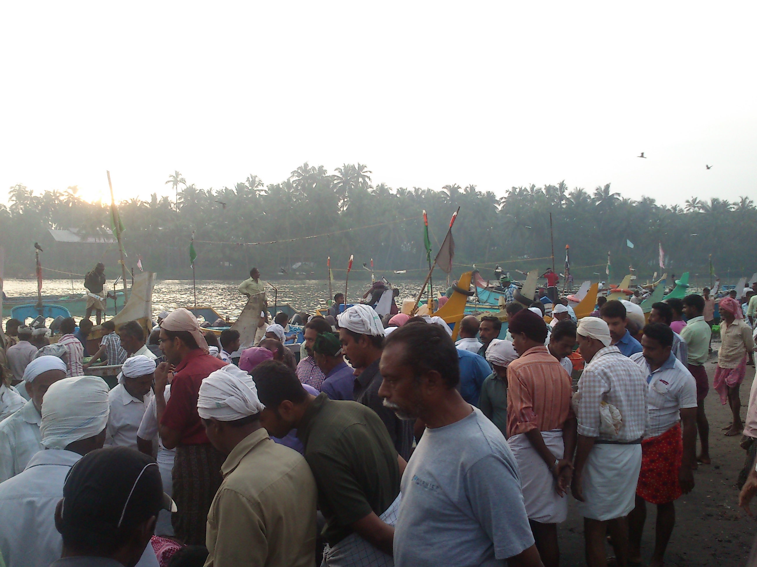 Fishing in Beypore
 -
 The Sea Walk
 -
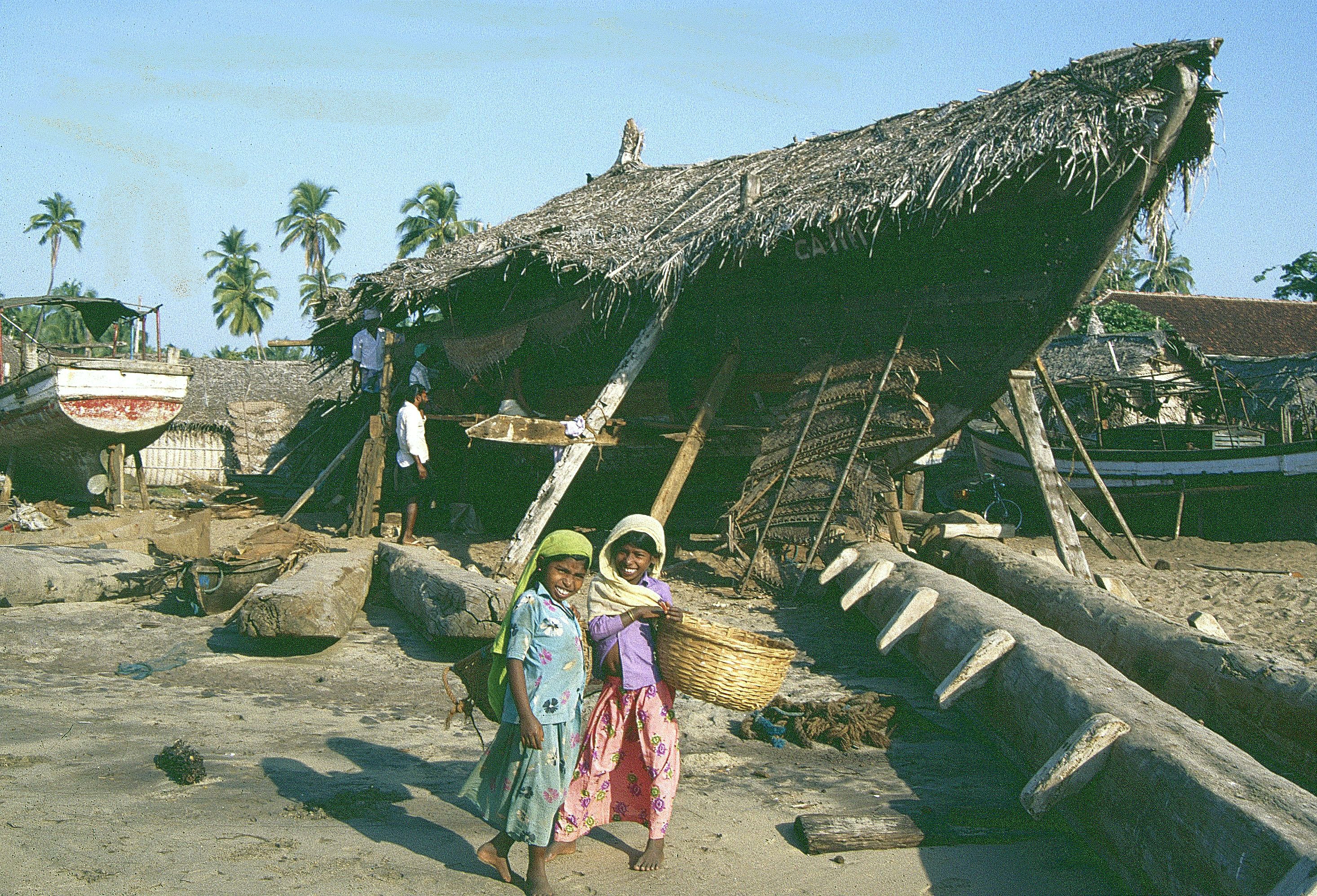 Making boats
 -
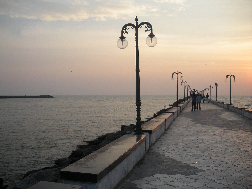 The promenade


References[edit | edit source]
- ↑ 1.0 1.1 "Master Plan | Kozhikode Municipal Corporation".
- ↑ Coastal Histories: Society and Ecology in Pre-modern India, Yogesh Sharma, Primus Books 2010
- ↑ Gurukkal, R., & Whittaker, D. (2001). In search of Muziris. Journal of Roman Archaeology, 14, 334-350.
- ↑ A. Shreedhara Menon, A Survey of Kerala History
- ↑ According to Pliny the Elder, goods from India were sold in the Empire at 100 times their original purchase price. See [1]
- ↑ Bostock, John (1855). "26 (Voyages to India)". Pliny the Elder, The Natural History. London: Taylor and Francis.
- ↑ Indicopleustes, Cosmas (1897). Christian Topography. 11. United Kingdom: The Tertullian Project. pp. 358–373.
- ↑ Das, Santosh Kumar (2006). The Economic History of Ancient India. Genesis Publishing Pvt Ltd. p. 301.
- ↑ Jonathan Goldstein (1999). The Jews of China. M. E. Sharpe. p. 123. ISBN 9780765601049.
- ↑ Edward Simpson; Kai Kresse (2008). Struggling with History: Islam and Cosmopolitanism in the Western Indian Ocean. Columbia University Press. p. 333. ISBN 978-0-231-70024-5. Retrieved 24 July 2012.
- ↑ Uri M. Kupferschmidt (1987). The Supreme Muslim Council: Islam Under the British Mandate for Palestine. Brill. pp. 458–459. ISBN 978-90-04-07929-8. Retrieved 25 July 2012.
- ↑ Husain Raṇṭattāṇi (2007). Mappila Muslims: A Study on Society and Anti Colonial Struggles. Other Books. pp. 179–. ISBN 978-81-903887-8-8. Retrieved 25 July 2012.
- ↑ Prange, Sebastian R. Monsoon Islam: Trade and Faith on the Medieval Malabar Coast. Cambridge University Press, 2018. 98.
- ↑ Pg 58, Cultural heritage of Kerala: an introduction, A. Sreedhara Menon, East-West Publications, 1978
- ↑ K. V. Krishna Iyer (1938), Zamorins of Calicut: From the earliest times to AD 1806, Norman Printing Bureau, Kozhikode
- ↑ "Archived copy". Archived from the original on 3 February 2018. Retrieved 15 October 2019.
{{cite web}}: CS1 maint: archived copy as title (link) - ↑ https://www.facebook.com/238044912896496/videos/1454648004569508 Template:User-generated source
- ↑ Falling Rain Genomics, Inc - Beypore
- ↑ "Census of India 2001: Data from the 2001 Census, including cities, villages and towns (Provisional)". Census Commission of India. Archived from the original on 16 June 2004. Retrieved 1 November 2008.
- ↑ "Basheer's Janmadhinam". Archived from the original on 18 December 2011. Retrieved 27 December 2011.