

m robot: Update article (please report if you notice any mistake or error in this edit) |
brief expand article based on references further and improved wording per sources |
||
| Line 1: | Line 1: | ||
{{Short description|Road in Maharashtra, India}} | |||
{{More citations needed|date=October 2012}} | |||
{{Use dmy dates|date=June 2018}} | {{Use dmy dates|date=June 2018}} | ||
{{Use Indian English|date=June 2018}} | {{Use Indian English|date=June 2018}} | ||
{{Infobox road | {{Infobox road | ||
|country=IND | |country=IND | ||
| Line 7: | Line 8: | ||
|type=SH | |type=SH | ||
|route=42 | |route=42 | ||
|alternate_name = | |alternate_name = ghodbunder road thane | ||
|map={{Maplink|frame=yes|plain=yes|frame-width=290|frame-height=200|zoom=11|frame-align=center|type=line|id=Q7603301| stroke-width=3|title=Thane-Ghodbunder Road}} | |map={{Maplink|frame=yes|plain=yes|frame-width=290|frame-height=200|zoom=11|frame-align=center|type=line|id=Q7603301| stroke-width=3|title=Thane-Ghodbunder Road}} | ||
|map_custom=yes | |map_custom=yes | ||
|map_notes= Thane | |map_notes= Thane ghodbunder road marked in Red on Thane area map | ||
|image = Ghodbunder Road (SH 42) (2319282008).jpg | |image = Ghodbunder Road (SH 42) (2319282008).jpg | ||
|image_notes=Aerial view of Ghodbunder Road near Gaimukh | |image_notes=Aerial view of Ghodbunder Road near Gaimukh | ||
| Line 23: | Line 24: | ||
}} | }} | ||
''' | '''Maharashtra State Highway 42''', commonly referred to as '''Ghodbunder Road''' or '''G.B. Road''', runs entirely through the district of [[Thane district|Thane]]. It is one of the major roads leading out of [[Thane]] city and connects to the [[Eastern Express Highway]] coming from south at Kapurbawdi, which joins [[National Highway 3 (India)|National Highway 3]] at this junction from North-East. It also connects to the [[Western Express Highway]] coming from south at Ghodbunder village, which later joins [[National Highway 8 (India)|National Highway 8]] at this junction traveling Northwards towards [[Gujarat]]. | ||
==General information== | ==General information== | ||
''' | '''Maharashtra State Highway 42''' is 14 km long<ref name=":0">{{Cite web |date=2025-10-28 |title=Ghodbunder Road repairs to slow traffic, again |url=https://www.hindustantimes.com/cities/mumbai-news/ghodbunder-road-repairs-to-slow-traffic-again-101761591604822.html |access-date=2025-10-28 |website=Hindustan Times |language=en}}</ref> and links the two main arterial roads of [[Mumbai]], the [[Eastern Express Highway]] and the [[Western Express Highway]]. It connects to Eastern Express Highway at Kapurbawdi village and Western Express Highway at Ghodbunder village. The Kapurbawdi bridge has been constructed to ease the traffic congestion.<ref>{{Cite web|url=https://www.dnaindia.com/mumbai/report-dna-exclusive-767-metre-long-kapurbawdi-flyover-opening-on-nov-15-in-mumbai-1908885|title=dna exclusive: 767-metre-long Kapurbawdi flyover opening on Nov 15 in Mumbai|date=2013-10-26|website=dna|language=en|access-date=2019-01-21}}</ref> The road falls within the municipal limits of two different municipal corporations. The stretch from Majiwada to Gaimukh village falls within the limits of [[Thane Municipal Corporation]] & from Gaimukh Village until the Mumbai-Ahmedabad Highway the road falls within the [[Mira-Bhayandar Municipal Corporation]] limits.<ref name=":0" /> This highway was tolled by the [[Maharashtra State Road Development Corporation|MSRDC]] through a concessionaire agreement awarded to Thane Ghodbunder Toll Road Limited which was a subsidiary of [[IRB Infrastructure]]. The highway is not subject to any toll as on date with the highway being handed back to the [[Maharashtra State Road Development Corporation]] effective 23.02.2021<ref name="tollchocolate">{{cite news|title=Ghodbunder Road toll naka gives chocolates, not change |url=http://archive.mid-day.com/news/2008/nov/101108-News-Mumbai-Ghodbunder-Road-toll-naka-chocolate-5-Star.htm |first=Vedika |last=Tripathi |date=2008-11-10|work=[[Mid-Day]] |location=Mumbai |accessdate=24 May 2015}}</ref><ref>{{Cite news |last=Business |first=Standard |date=February 25, 2021 |title=IRB Infra Unit completes concession period of Thane Ghodbunder BOT project |url=https://www.business-standard.com/article/news-cm/irb-infra-unit-completes-concession-period-of-thane-ghodbunder-bot-project-121022500459_1.html}}</ref> This road skirts the northern boundary of Salsette Island providing scenic views of the Yeoor hills and the Thane creek. | ||
[[File:Ghodbunder Fort.jpg|thumb|left|[[Ghodbunder fort]] ruins]] | [[File:Ghodbunder Fort.jpg|thumb|left|[[Ghodbunder fort]] ruins]] | ||
Ghodbunder Road cuts across dense forests which form part of the [[Sanjay Gandhi National Park]]. It also skirts the [[Vasai Creek]] for most of its route and overlooks the forest from across the creek. In spite of development encroaching on the forest, much of flora and fauna continue to survive and prosper. Ghodbunder Road is lined with numerous historical monuments like the [[Ghodbunder Fort]]. Naglakot, Gaimukh Gadi and Firangkot, which although damaged now, | Ghodbunder Road cuts across dense forests which form part of the [[Sanjay Gandhi National Park]]. It also skirts the [[Vasai Creek]] for most of its route and overlooks the forest from across the creek. In spite of development encroaching on the forest, much of flora and fauna continue to survive and prosper. Ghodbunder Road is lined with numerous historical monuments like the [[Ghodbunder Fort]]. Naglakot, Gaimukh Gadi and Firangkot, which although damaged now, unfolds stories of the 1500 century era reign of the [[Portuguese India|Portuguese]].<ref>{{cite news|url=https://www.hiranandani.com/ghodbunder-road.aspx|date=2017-01-01|website=hiranandani.com|title=Ghodbunder Road Development Plan.}}</ref> | ||
This road once played a crucial role in Indo-Arab trade and later the Portuguese used it to monopolise sea routes in the Arabian Sea, at one point acted as a bridge between distant cultures. Several empires fought wars to control it. The Persian horses | This road once played a crucial role in Indo-Arab trade and later the Portuguese used it to monopolise sea routes in the [[Arabian Sea]], at one point acted as a bridge between distant cultures. Several empires fought wars to control it. The [[Nisean horse|Persian horses]] came from the Arab countries used to land here in the port in Marathi Ghode means horse and bunder means port. Hence, it initially came to be known as [[Ghodegaon]] (horse village). Around the time of [[Shivaji|Chhatrapati Shivaji]], the road was renamed as '''Ghodbunder Road''' after the port.<ref name="indianexpress-gbroad">{{cite news|title=Ever busy Ghodbunder Road in Thane was once a route for Arabian horses|url=https://indianexpress.com/article/cities/mumbai/ever-busy-ghodbunder-road-in-thane-was-once-a-route-for-arabian-horses-5019747/|date=2018-01-11|website=indianexpress.com}}</ref> | ||
Locals say that till 1950, it was only a dirt road with residents of centuries old villages like [[Waghbil]], Majhiwada, [[Patlipada]], Ghodbunder, [[Kolshet]] and [[Kasarwadavli]] using bullock carts for transport. The surrounding forests had considerable plants like cashew, mangoes that were brought in by the Portuguese. The area was very rich in flora and fauna.<ref name="indianexpress-gbroad"/> | Locals say that till 1950, it was only a dirt road with residents of centuries old villages like [[Waghbil]], Majhiwada, [[Patlipada]], Ghodbunder, [[Kolshet]] and [[Kasarwadavli]] using bullock carts for transport. The surrounding forests had considerable plants like cashew, mangoes that were brought in by the Portuguese. The area was very rich in flora and fauna.<ref name="indianexpress-gbroad"/> | ||
| Line 38: | Line 39: | ||
{{Main|Line 4 (Mumbai Metro)}} | {{Main|Line 4 (Mumbai Metro)}} | ||
'''Green Line 4''' of the Mumbai Metro, currently under construction, is part of the [[Mumbai Metro|metro]] system for the city of [[Mumbai]], India and is being developed by MMRDA and a consortium of international companies.<ref name="off">{{cite web |title=Mumbai Metro line 4 - current status |url=https://mmrda.maharashtra.gov.in/metro-line-4 |website=www.mmrda.maharashtra.gov.in/ |publisher=MMRDA official website |access-date=15 November 2018}}</ref> | '''Green Line 4''' of the Mumbai Metro, currently under construction, is part of the [[Mumbai Metro|metro]] system for the city of [[Mumbai]], India and is being developed by [[Mumbai Metropolitan Region Development Authority|MMRDA]] and a consortium of international companies.<ref name="off">{{cite web |title=Mumbai Metro line 4 - current status |url=https://mmrda.maharashtra.gov.in/metro-line-4 |website=www.mmrda.maharashtra.gov.in/ |publisher=MMRDA official website |access-date=15 November 2018}}</ref> | ||
The {{convert|32.32|km|mi|abbr=on}} line is planned to be fully elevated, and is expected to consist of 32 stations from [[Wadala]], [[Mumbai]] to [[Kasarvadavali]] via [[Ghatkopar]], [[Mulund]]. It is estimated to cost {{INRConvert|14549|c|lk=on}} ({{₹|145.49 billion}}).<ref name = "FPJ1">{{cite web|title=Everything you need to know about Metro 2B and Metro 4 {{!}} Free Press Journal|url=http://www.freepressjournal.in/mumbai/everything-you-need-to-know-about-metro-2b-and-metro-4/980470|website=Free Press Journal|access-date=12 February 2017}}</ref> Its construction was expected to begin by June 2018. | The {{convert|32.32|km|mi|abbr=on}} line is planned to be fully elevated, and is expected to consist of 32 stations from [[Wadala]], [[Mumbai]] to [[Kasarvadavali]] via [[Ghatkopar]], [[Mulund]]. It is estimated to cost {{INRConvert|14549|c|lk=on}} ({{₹|145.49 billion}}).<ref name = "FPJ1">{{cite web|title=Everything you need to know about Metro 2B and Metro 4 {{!}} Free Press Journal|url=http://www.freepressjournal.in/mumbai/everything-you-need-to-know-about-metro-2b-and-metro-4/980470|website=Free Press Journal|access-date=12 February 2017}}</ref> Its construction was expected to begin by June 2018. | ||
It is expected to be completed in 2022 and is expected to provide interconnectivity among the existing [[Eastern Express Highway]], [[Central line (Mumbai Suburban Railway)|Central Railway]], [[Mumbai Monorail|Mono Rail]], the ongoing [[Line 2 (Mumbai Metro)|Metro Line 2B]] (D N Nagar to Mandale), and the proposed [[Line 5 (Mumbai Metro)|Metro Line 5]] (Thane to Kalyan), [[Line 6 (Mumbai Metro)|Metro Line 6]] (Swami Samarth Nagar to Vikhroli) and [[Line 11 (Mumbai Metro)|Metro Line 11]] (Wadala to CSMT). It will provide rail based access to the commercial, government bodies and geographical landmarks in Mumbai. It will reduce the current travel time by between 50% and 75% depending on road conditions. | It is expected to be completed in 2022 and is expected to provide interconnectivity among the existing [[Eastern Express Highway]], [[Central line (Mumbai Suburban Railway)|Central Railway]], [[Mumbai Monorail|Mono Rail]], the ongoing [[Line 2 (Mumbai Metro)|Metro Line 2B]] (D N Nagar to Mandale), and the proposed [[Line 5 (Mumbai Metro)|Metro Line 5]] (Thane to Kalyan), [[Line 6 (Mumbai Metro)|Metro Line 6]] (Swami Samarth Nagar to Vikhroli) and [[Line 11 (Mumbai Metro)|Metro Line 11]] (Wadala to CSMT). It will provide rail based access to the commercial, government bodies and geographical landmarks in Mumbai. It will reduce the current travel time by between 50% and 75% depending on road conditions. | ||
== Widening Project == | |||
In September 2025 the MMRDA announced that it would be commencing the widening of the highway into a 14-lane carriageway with 7 lanes on either side. The widening is being done to ease traffic congestion on this arterial highway as well as to complement the various other infrastructure developments such as the Metro lines.<ref>{{Cite web |date=2025-09-30 |title=Thane's Ghodbunder Road to be widened into 14-lane corridor - CNBC TV18 |url=https://www.cnbctv18.com/india/thanes-ghodbunder-road-to-be-widened-into-14-lane-corridor-19697306.htm |access-date=2025-10-30 |website=CNBCTV18 |language=en}}</ref> However, certain politicians and locals are opposing the widening as it would involve the removal of service roads that are used by residential buildings & commercial establishments that line the highway. These individuals fear that removal of service roads would result in increase in risk of accidents, time of commute for such residents along with increased usage of fuel.<ref>{{Cite news |date=2025-09-02 |title=600cr Ghodbunder highway widening project in Thane faces strong local opposition |url=https://timesofindia.indiatimes.com/city/mumbai/600cr-ghodbunder-highway-widening-project-in-thane-faces-strong-local-opposition/articleshow/123638934.cms |access-date=2025-10-30 |work=The Times of India |issn=0971-8257}}</ref> | |||
The widening project slated to be completed by January 2026 will be unable to meet the deadline due to an oversight in the planning process that failed to account for the shifting of utility lines to either side of the highway. The additional project cost for the shifting is expected to be Rs. 90 Crore.<ref>{{Cite news |date=2025-11-21 |title=Ghodbunder Highway widening project in Thane hits power line hurdle, may miss January deadline |url=https://timesofindia.indiatimes.com/city/mumbai/ghodbunder-highway-widening-project-in-thane-hits-power-line-hurdle-may-miss-january-deadline/articleshow/125470257.cms |access-date=2025-11-21 |work=The Times of India |issn=0971-8257}}</ref> | |||
==Major junctions== | ==Major junctions== | ||
{{ | {{Cleanup road junction list|date=November 2021}} | ||
The following roads either emanate from it or are crossed by it. This list has been separated by district and talukas for easy reading. | The following roads either emanate from it or are crossed by it. This list has been separated by district and talukas for easy reading. | ||
{| class=wikitable width="100%" | {| class=wikitable width="100%" | ||
| Line 76: | Line 82: | ||
==See also== | ==See also== | ||
*[[List of | *[[List of state highways in Maharashtra]] | ||
==References== | ==References== | ||
| Line 85: | Line 91: | ||
{{DEFAULTSORT:State Highway 42}} | {{DEFAULTSORT:State Highway 42}} | ||
[[Category:Transport in Thane]] | [[Category:Transport in Thane]] | ||
[[Category:State | [[Category:State highways in Maharashtra]] | ||
Latest revision as of 10:30, 21 November 2025
 | This article needs more citations. (October 2012) |
.svg) | |
|---|---|
| ghodbunder road thane | |
_(2319282008).jpg) Aerial view of Ghodbunder Road near Gaimukh | |
| Route information | |
| Maintained by MSRDC | |
| Major junctions | |
| From | Kapurbawdi, Thane |
| National Highway 3 National Highway 8 | |
| To | Ghodbunder, Thane |
| Location | |
| Country | India |
| State | Maharashtra |
| Districts | Thane |
| Highway system | |
| State Highways in Maharashtra | |
Maharashtra State Highway 42, commonly referred to as Ghodbunder Road or G.B. Road, runs entirely through the district of Thane. It is one of the major roads leading out of Thane city and connects to the Eastern Express Highway coming from south at Kapurbawdi, which joins National Highway 3 at this junction from North-East. It also connects to the Western Express Highway coming from south at Ghodbunder village, which later joins National Highway 8 at this junction traveling Northwards towards Gujarat.
General information[edit | edit source]
Maharashtra State Highway 42 is 14 km long[1] and links the two main arterial roads of Mumbai, the Eastern Express Highway and the Western Express Highway. It connects to Eastern Express Highway at Kapurbawdi village and Western Express Highway at Ghodbunder village. The Kapurbawdi bridge has been constructed to ease the traffic congestion.[2] The road falls within the municipal limits of two different municipal corporations. The stretch from Majiwada to Gaimukh village falls within the limits of Thane Municipal Corporation & from Gaimukh Village until the Mumbai-Ahmedabad Highway the road falls within the Mira-Bhayandar Municipal Corporation limits.[1] This highway was tolled by the MSRDC through a concessionaire agreement awarded to Thane Ghodbunder Toll Road Limited which was a subsidiary of IRB Infrastructure. The highway is not subject to any toll as on date with the highway being handed back to the Maharashtra State Road Development Corporation effective 23.02.2021[3][4] This road skirts the northern boundary of Salsette Island providing scenic views of the Yeoor hills and the Thane creek.

Ghodbunder Road cuts across dense forests which form part of the Sanjay Gandhi National Park. It also skirts the Vasai Creek for most of its route and overlooks the forest from across the creek. In spite of development encroaching on the forest, much of flora and fauna continue to survive and prosper. Ghodbunder Road is lined with numerous historical monuments like the Ghodbunder Fort. Naglakot, Gaimukh Gadi and Firangkot, which although damaged now, unfolds stories of the 1500 century era reign of the Portuguese.[5]
This road once played a crucial role in Indo-Arab trade and later the Portuguese used it to monopolise sea routes in the Arabian Sea, at one point acted as a bridge between distant cultures. Several empires fought wars to control it. The Persian horses came from the Arab countries used to land here in the port in Marathi Ghode means horse and bunder means port. Hence, it initially came to be known as Ghodegaon (horse village). Around the time of Chhatrapati Shivaji, the road was renamed as Ghodbunder Road after the port.[6]
Locals say that till 1950, it was only a dirt road with residents of centuries old villages like Waghbil, Majhiwada, Patlipada, Ghodbunder, Kolshet and Kasarwadavli using bullock carts for transport. The surrounding forests had considerable plants like cashew, mangoes that were brought in by the Portuguese. The area was very rich in flora and fauna.[6]
Mumbai Metro Line 4 (Upcoming)[edit | edit source]
Green Line 4 of the Mumbai Metro, currently under construction, is part of the metro system for the city of Mumbai, India and is being developed by MMRDA and a consortium of international companies.[7]
The 32.32 km (20.08 mi) line is planned to be fully elevated, and is expected to consist of 32 stations from Wadala, Mumbai to Kasarvadavali via Ghatkopar, Mulund. It is estimated to cost ₹14,549 crore (US$2.0 billion) (₹145.49 billion).[8] Its construction was expected to begin by June 2018.
It is expected to be completed in 2022 and is expected to provide interconnectivity among the existing Eastern Express Highway, Central Railway, Mono Rail, the ongoing Metro Line 2B (D N Nagar to Mandale), and the proposed Metro Line 5 (Thane to Kalyan), Metro Line 6 (Swami Samarth Nagar to Vikhroli) and Metro Line 11 (Wadala to CSMT). It will provide rail based access to the commercial, government bodies and geographical landmarks in Mumbai. It will reduce the current travel time by between 50% and 75% depending on road conditions.
Widening Project[edit | edit source]
In September 2025 the MMRDA announced that it would be commencing the widening of the highway into a 14-lane carriageway with 7 lanes on either side. The widening is being done to ease traffic congestion on this arterial highway as well as to complement the various other infrastructure developments such as the Metro lines.[9] However, certain politicians and locals are opposing the widening as it would involve the removal of service roads that are used by residential buildings & commercial establishments that line the highway. These individuals fear that removal of service roads would result in increase in risk of accidents, time of commute for such residents along with increased usage of fuel.[10]
The widening project slated to be completed by January 2026 will be unable to meet the deadline due to an oversight in the planning process that failed to account for the shifting of utility lines to either side of the highway. The additional project cost for the shifting is expected to be Rs. 90 Crore.[11]
Major junctions[edit | edit source]
 | This article contains a bulleted list or table of intersections which should be presented in a properly formatted junction table. (November 2021) |
The following roads either emanate from it or are crossed by it. This list has been separated by district and talukas for easy reading.
| Taluka | Distance | Location of Junction | Junction |
|---|---|---|---|
| Thane District | |||
| Thane | 0 km (0 mi) | Majiwada[12] |  National Highway 3 National Highway 3
|
| 104 km (65 mi) | Ghodbunder[12] |  National Highway 8 National Highway 8
| |
Gallery[edit | edit source]
-
 Ghodbunder Road
 -
 Another View along Ghodbunder Road
 -
 Hiranandani Estate along Ghodbunder Road
 -
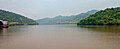 Scenic View along Ghodbunder Road
 -
 State Highway 42 Shield Marker near Ovale village


See also[edit | edit source]
References[edit | edit source]
- ↑ 1.0 1.1 "Ghodbunder Road repairs to slow traffic, again". Hindustan Times. 28 October 2025. Retrieved 28 October 2025.
- ↑ "dna exclusive: 767-metre-long Kapurbawdi flyover opening on Nov 15 in Mumbai". dna. 26 October 2013. Retrieved 21 January 2019.
- ↑ Tripathi, Vedika (10 November 2008). "Ghodbunder Road toll naka gives chocolates, not change". Mid-Day. Mumbai. Retrieved 24 May 2015.
- ↑ Business, Standard (25 February 2021). "IRB Infra Unit completes concession period of Thane Ghodbunder BOT project".
{{cite news}}:|last=has generic name (help) - ↑ "Ghodbunder Road Development Plan". hiranandani.com. 1 January 2017.
- ↑ 6.0 6.1 "Ever busy Ghodbunder Road in Thane was once a route for Arabian horses". indianexpress.com. 11 January 2018.
- ↑ "Mumbai Metro line 4 - current status". www.mmrda.maharashtra.gov.in/. MMRDA official website. Retrieved 15 November 2018.
- ↑ "Everything you need to know about Metro 2B and Metro 4 | Free Press Journal". Free Press Journal. Retrieved 12 February 2017.
- ↑ "Thane's Ghodbunder Road to be widened into 14-lane corridor - CNBC TV18". CNBCTV18. 30 September 2025. Retrieved 30 October 2025.
- ↑ "600cr Ghodbunder highway widening project in Thane faces strong local opposition". The Times of India. 2 September 2025. ISSN 0971-8257. Retrieved 30 October 2025.
- ↑ "Ghodbunder Highway widening project in Thane hits power line hurdle, may miss January deadline". The Times of India. 21 November 2025. ISSN 0971-8257. Retrieved 21 November 2025.
- ↑ 12.0 12.1 "National Highway 3 intersection with State Highway 10 at Malegaon Taluka". Mahapwd.com. Retrieved 22 October 2012. [dead link]
