






>Dhruv edits Undid revision 1066060396 by 2409:4050:E14:2763:0:0:8589:1806 (talk) |
DebbieLemke (talk | contribs) No edit summary |
||
| Line 1: | Line 1: | ||
{{Use dmy dates|date=October 2019}} | {{Use dmy dates|date=October 2019}} | ||
{{ | {{Use British English|date=July 2019}} | ||
<!-- See [[ | <!-- See [[Bharatpedia:WikiProject Indian cities]] for details -->{{Infobox settlement | ||
| name | | name = Haldwani | ||
| native_name | | native_name = <!-- Please do not add any Indic script in this infobox, per WP:INDICSCRIPT policy. --> | ||
| native_name_lang | | native_name_lang = hi | ||
| other_name | | other_name = | ||
| | | nicknames = '''Gateway of Kumaon''' | ||
| settlement_type | | settlement_type = City | ||
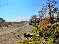
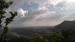
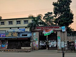
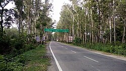
| image_skyline | | image_skyline = {{Photomontage |size = 240|border =2|spacing =1|photo1a = Tikonia Haldwani 02.jpg |photo2a = Haldwani-Kathgodam.jpg |photo2b = Haldwani_(1).jpg |photo3a = Haldwani railway station 02.jpg }} | ||
| image_alt | | image_alt = | ||
| image_size | | image_size = 275px | ||
| image_caption | | image_caption = | ||
| pushpin_map | | pushpin_map = India Uttarakhand | ||
| pushpin_map_alt | | pushpin_map_alt = | ||
| pushpin_map_caption | | pushpin_map_caption = Location in Uttarakhand, India | ||
| coordinates | | pushpin_relief = yes | ||
| subdivision_type | | coordinates = {{coord|29.22|N|79.52|E|display=inline,title}} | ||
| subdivision_name | | subdivision_type = Country | ||
| subdivision_type1 | | subdivision_name = {{flag|India}} | ||
| subdivision_name1 | | subdivision_type1 = State | ||
| subdivision_type2 | | subdivision_name1 = [[Uttarakhand]] | ||
| subdivision_name2 | | subdivision_type2 = Division | ||
| subdivision_type3 | | subdivision_name2 = [[Kumaon division|Kumaon]] | ||
| subdivision_name3 | | subdivision_type3 = [[List of districts of Uttarakhand|District]] | ||
| established_title1 | | subdivision_name3 = [[Nainital district|Nainital]] | ||
| established_date1 | | established_title1 = Founded | ||
| established_title2 | | established_date1 = 1834 | ||
| established_date2 | | established_title2 = Municipality | ||
| founder | | established_date2 = 1942 | ||
| named_for | | founder = [[George Traill|George William Traill]] | ||
| government_type | | named_for = [[Haldina|Haldu]] | ||
| governing_body | | government_type = [[Municipal Corporations in India|Municipal Corporation]] | ||
| | | governing_body = [[Haldwani Municipal Corporation]] | ||
| | | leader_title = [[Mayor]] | ||
| unit_pref | | leader_name = Gajraj Singh Bisht | ||
| area_footnotes | | leader_party = [[Bharatiya Janata Party|BJP]] | ||
| area_rank | | leader_title2 = [[Member of Parliament, Lok Sabha|Lok Sabha MP]] | ||
| area_total_km2 | | leader_name2 = [[Ajay Bhatt (politician)|Ajay Bhatt]] ([[Bharatiya Janata Party|BJP]]) | ||
| elevation_footnotes | | unit_pref = Metric | ||
| elevation_m | | area_footnotes = <br /><small>(Including [[Kathgodam]])</small><ref name="dchba" /> | ||
| population_total | | area_rank = | ||
| population_as_of | | area_total_km2 = 40 | ||
| population_est | | elevation_footnotes = | ||
| pop_est_as_of | | elevation_m = 424 | ||
| population_rank | | population_total = 201,461<ref>https://www.census2011.co.in/census/city/24-haldwani-and-kathgodam.html</ref> | ||
| population_density_km2 | | population_as_of = 2011 | ||
| population_demonym | | population_est = | ||
| population_footnotes | | pop_est_as_of = | ||
| demographics_type1 | | population_metro = 232,095<ref>https://www.census2011.co.in/census/city/24-haldwani-and-kathgodam.html</ref> | ||
| demographics1_title1 | | population_rank = | ||
| demographics1_info1 | | population_density_km2 = auto | ||
| demographics1_title2 | | population_demonym = | ||
| demographics1_info2 | | population_footnotes = <br /><small>(Including [[Kathgodam]])</small><ref name="census2011">{{cite web|title=Haldwani and Kathgodam Town Population Census 2011 {{!}} Uttarakhand|url=http://www.census2011.co.in/census/city/24-haldwani-and-kathgodam.html|website=www.census2011.co.in|access-date=4 July 2017}}</ref> | ||
| timezone1 | | demographics_type1 = Languages | ||
| utc_offset1 | | demographics1_title1 = Official | ||
| postal_code_type | | demographics1_info1 = [[Hindi]] | ||
| postal_code | | demographics1_title2 = Native | ||
| area_code_type | | demographics1_info2 = {{hlist|[[Kumaoni language|Kumaoni]] |[[Kauravi|Khariboli]]}} | ||
| area_code | | timezone1 = [[Indian Standard Time|IST]] | ||
| registration_plate | | utc_offset1 = +5:30 | ||
| website | | postal_code_type = [[Postal Index Number|PIN]] | ||
| footnotes | | postal_code = 263139,263141 | ||
| | | area_code_type = Telephone code | ||
| | | area_code = +91-5946 | ||
| registration_plate = UK-04 | |||
| website = {{URL|nagarnigamhaldwani.com/}} | |||
| footnotes = | |||
| leader_title4 = [[Municipal Commissioner (India)|Municipal Commissioner]] | |||
| leader_name4 = Paritosh Verma, [[Indian Administrative Service|IAS]] | |||
}} | }} | ||
'''Haldwani''' ([[Kumaoni language|Kumaoni]]: ''Haldvānī'') is the largest city of [[Kumaon division|Kumaon]], and the third most [[List of cities in Uttarakhand by population|populous city in the Indian state of Uttarakhand]]. Haldwani is said to be the financial capital of Uttarakhand, having the most commercial, economic and industrial activities of the state. Haldwani is located in the [[Nainital District]], and is one of its [[List of tehsils of Uttarakhand|thirteen subdivisions]]. Being situated in the immediate foothills of Kumaon Himalayas, the [[Kathgodam]] neighbourhood of Haldwani is known as the Gateway to Kumaon. | |||
Located in the [[Bhabar|Bhabhar region]] in the Himalayan foothills on the banks of the [[Gaula River (India)|Gaula River]], the [[c:File:Chhota_Kailash_through_morning_mists_from_Haldwani,_Nainital_region._Haldwani.jpg|town of Haldwani]] was established in 1834, as a mart for [[hill people]] who visited Bhabar during the cold season. The establishment of the [[Nainital Road|Bareilly–Nainital provincial road]] in 1882 and the [[Bhojipura (Assembly constituency)|Bhojeepura]]–[[Kathgodam]] railway line by [[Rohilkund and Kumaon Railway]] in 1884 helped develop the town into a major trading post and then a hub between the hilly regions of Kumaon and the [[Indo-Gangetic Plain]]s. | |||
Haldwani hosted National Games 2025 (Gaulapar). | |||
==Etymology== | ==Etymology== | ||
| Line 77: | Line 82: | ||
The Bhabhar region, where the city is located, has historically been a part of the [[Kumaon Kingdom|Kingdom of Kumaon]]. The region came under the dominion of Kumaon, when King ''Gyan Chand'' of [[Chand Dynasty]] visited [[Delhi Sultanate]] in the 14th century. Later, the [[Mughal Empire|Mughals]] tried to take over the hills, but their attempts received a setback due to the difficult terrain.<ref name=Ramsay /> | The Bhabhar region, where the city is located, has historically been a part of the [[Kumaon Kingdom|Kingdom of Kumaon]]. The region came under the dominion of Kumaon, when King ''Gyan Chand'' of [[Chand Dynasty]] visited [[Delhi Sultanate]] in the 14th century. Later, the [[Mughal Empire|Mughals]] tried to take over the hills, but their attempts received a setback due to the difficult terrain.<ref name=Ramsay /> | ||
In the early 1600s, the Haldwani region was sparsely populated. It was inhabited by people of a Native tribe known as the [[Bhoksa people|Buksa]].<ref>{{cite book|last = Singh|first = R|title = Social Transformation of Indian Tribes|year = 2004|publisher = Anmol Publications PVT. LTD.|location = New Delhi, India|isbn = 81-261-0452-X|pages = 25–26|chapter = Composition and Social Order}}</ref> | In the early 1600s, the Haldwani region was sparsely populated. It was inhabited by people of a Native tribe known as the [[Bhoksa people|Buksa]].<ref>{{cite book|last = Singh|first = R|title = Social Transformation of Indian Tribes|year = 2004|publisher = Anmol Publications PVT. LTD.|location = New Delhi, India|isbn = 81-261-0452-X|pages = 25–26|chapter = Composition and Social Order}}</ref> | ||
===Founding and 19th century=== | ===Founding and 19th century=== | ||
| Line 83: | Line 88: | ||
In 1816, after the British defeated [[Gorkhas]], and gained control of [[Kumaon Kingdom|Kumaon]] by the [[Treaty of Sugauli]], Gardner was appointed the Commissioner of Kumaon. Later George William Traill took over as Commissioner and renamed ''Halduvani'' as Haldwani in 1834.<ref name="History"/> Though British records suggest that the place was established in 1834, as a mart for hill people who visited the ''Bhabhar'' (Himalayan foothills) region, during the cold season.<ref name=Gaze /> The township, formerly located in [[Motahaldu|Mota Haldu]], had only thatched houses. Brick-houses began to be built only after 1850. The first English middle school was established in 1831. | In 1816, after the British defeated [[Gorkhas]], and gained control of [[Kumaon Kingdom|Kumaon]] by the [[Treaty of Sugauli]], Gardner was appointed the Commissioner of Kumaon. Later George William Traill took over as Commissioner and renamed ''Halduvani'' as Haldwani in 1834.<ref name="History"/> Though British records suggest that the place was established in 1834, as a mart for hill people who visited the ''Bhabhar'' (Himalayan foothills) region, during the cold season.<ref name=Gaze /> The township, formerly located in [[Motahaldu|Mota Haldu]], had only thatched houses. Brick-houses began to be built only after 1850. The first English middle school was established in 1831. | ||
During the [[Indian Rebellion of 1857]], Haldwani was briefly seized by the rebels of [[Rohilkhand]],<ref name="Mittal">{{cite book|last1=Mittal|first1=Arun K.|title=British Administration in Kumaon Himalayas: A Historical Study, 1815–1947|date=1986|publisher=Mittal Publications|url=https://books.google.com/books?id=4kAOImX9PfwC}}</ref>{{rp|19}} soon martial law was declared in the region by Sir [[Henry Ramsay (Indian Army officer)|Henry Ramsay]] (the Commissioner of Kumaon), and by 1858, the region was cleared of the rebels.<ref name=Ramsay>[https://dsal.uchicago.edu/reference/gazetteer/pager.html?objectid=DS405.1.I34_V18_330.gif History of Nainital District] ''[[The Imperial Gazetteer of India]]'' 1909, v. 18, p. 324-325.</ref><ref>{{cite book|last1=Husain|first1=Syed Mahdi|title=Bahadur Shah Zafar and the War of 1857 in Delhi|date=2006|publisher=Aakar Books|location=Delhi|isbn=9788187879916|page=1x|url=https://books.google.com/books?id=nUNprZiD3GsC&pg=PR60}}</ref> The Rohillas, who were accused of attacking Haldwani, were hanged by the British at Phansi Gadhera in [[Nainital]].<ref>{{cite news|last1=Pant|first1=Neha|title=Nainital MLA for change in 'strange' names of tourist points|url=http://www.hindustantimes.com/jaipur/nainital-mla-for-change-in-strange-names-of-tourist-points/story-Z5RzYyQD34rF0NYwJcXFQL.html|access-date=21 July 2017|work=Hindustan Times|date=17 July 2017|location=Jaipur}}</ref> Later, Ramsay connected Nainital with Kathgodam by road in 1882. In 1883–84, the railway track was laid between [[Bareilly]] and Kathgodam. The first train arrived at Haldwani from [[Lucknow]] on 24 April 1884.<ref name="pande" />{{rp|38}}<ref name="Haldwani">[http://www.uttaranchalonline.info/Kumaon/Nainital/Haldwani.html Haldwani] {{webarchive|url=https://web.archive.org/web/20080408122428/http://www.uttaranchalonline.info/Kumaon/Nainital/Haldwani.html |date=8 April 2008 }} http://www.uttaranchalonline.info.</ref> | During the [[Indian Rebellion of 1857]], Haldwani was briefly seized by the rebels of [[Rohilkhand]],<ref name="Mittal">{{cite book|last1=Mittal|first1=Arun K.|title=British Administration in Kumaon Himalayas: A Historical Study, 1815–1947|date=1986|publisher=Mittal Publications|url=https://books.google.com/books?id=4kAOImX9PfwC}}</ref>{{rp|19}} soon martial law was declared in the region by Sir [[Henry Ramsay (Indian Army officer)|Henry Ramsay]] (the Commissioner of Kumaon), and by 1858, the region was cleared of the rebels.<ref name=Ramsay>[https://dsal.uchicago.edu/reference/gazetteer/pager.html?objectid=DS405.1.I34_V18_330.gif History of Nainital District] ''[[The Imperial Gazetteer of India]]'' 1909, v. 18, p. 324-325.</ref><ref>{{cite book|last1=Husain|first1=Syed Mahdi|title=Bahadur Shah Zafar and the War of 1857 in Delhi|date=2006|publisher=Aakar Books|location=Delhi|isbn=9788187879916|page=1x|url=https://books.google.com/books?id=nUNprZiD3GsC&pg=PR60}}</ref> The Rohillas, who were accused of attacking Haldwani, were hanged by the British at Phansi Gadhera in [[Nainital]].<ref>{{cite news|last1=Pant|first1=Neha|title=Nainital MLA for change in 'strange' names of tourist points|url=http://www.hindustantimes.com/jaipur/nainital-mla-for-change-in-strange-names-of-tourist-points/story-Z5RzYyQD34rF0NYwJcXFQL.html|access-date=21 July 2017|work=Hindustan Times|date=17 July 2017|location=Jaipur}}</ref> Later, Ramsay connected Nainital with Kathgodam by road in 1882. In 1883–84, the railway track was laid between [[Bareilly]] and Kathgodam. The first train arrived at Haldwani from [[Lucknow]] on 24 April 1884.<ref name="pande" />{{rp|38}}<ref name="Haldwani">[http://www.uttaranchalonline.info/Kumaon/Nainital/Haldwani.html Haldwani] {{webarchive|url=https://web.archive.org/web/20080408122428/http://www.uttaranchalonline.info/Kumaon/Nainital/Haldwani.html |date=8 April 2008 }} http://www.uttaranchalonline.info {{Webarchive|url=https://web.archive.org/web/20100317120156/http://www.uttaranchalonline.info/ |date=17 March 2010 }}.</ref> | ||
Before the formation of Nainital district in 1891, it was part of the Kumaon district, which was later renamed [[Almora district]].<ref>[https://dsal.uchicago.edu/reference/gazetteer/pager.html?objectid=DS405.1.I34_V18_336.gif 1891] [[The Imperial Gazetteer of India]] 1909, v. 18, p. 330.</ref> The Town Act was implemented here in 1885 and Haldwani was declared a municipality on 1 February 1897. The Tehsil office was opened here in 1899, when it became the tehsil headquarters of the ''Bhabhar'', one of four divisions of the Nainital district,<ref name=Ramsay /> and included 4 towns and 511 villages; and had a combined population of 93,445 (1901), spread over 1,279 sq. miles.<ref>[https://dsal.uchicago.edu/reference/gazetteer/pager.html?objectid=DS405.1.I34_V18_332.gif Nainital District] [[The Imperial Gazetteer of India]] 1909, v. 18, p. 326.</ref> | Before the formation of [[Nainital district]] in 1891, it was part of the Kumaon district, which was later renamed [[Almora district]].<ref>[https://dsal.uchicago.edu/reference/gazetteer/pager.html?objectid=DS405.1.I34_V18_336.gif 1891] [[The Imperial Gazetteer of India]] 1909, v. 18, p. 330.</ref> The Town Act was implemented here in 1885 and Haldwani was declared a municipality on 1 February 1897. The Tehsil office was opened here in 1899, when it became the tehsil headquarters of the ''Bhabhar'', one of four divisions of the Nainital district,<ref name=Ramsay /> and included 4 towns and 511 villages; and had a combined population of 93,445 (1901), spread over 1,279 sq. miles.<ref>[https://dsal.uchicago.edu/reference/gazetteer/pager.html?objectid=DS405.1.I34_V18_332.gif Nainital District] [[The Imperial Gazetteer of India]] 1909, v. 18, p. 326.</ref> | ||
===20th and 21st centuries=== | ===20th and 21st centuries=== | ||
[[File:Map of the United Provinces from The Imperial Gazetteer of India (1907-1909).jpg|thumb|300px|Haldwani as a part of the [[United Provinces of Agra and Oudh|United Province]], 1907–1909]] | [[File:Map of the United Provinces from The Imperial Gazetteer of India (1907-1909).jpg|thumb|300px|Haldwani as a part of the [[United Provinces of Agra and Oudh|United Province]], 1907–1909]] | ||
In 1901, with a [[population]] of 6,624, Haldwani was the headquarters of the Bhabhar region of [[Nainital District]], in the [[United Provinces of Agra and Oudh]], and it also used to become the winter headquarters of the officers of the [[Kumaon Division]] and the [[Nainital District]].<ref name=Gaze>[https://dsal.uchicago.edu/reference/gazetteer/pager.html?objectid=DS405.1.I34_V13_016.gif Halwani] [[The Imperial Gazetteer of India]] 1909, v. 13, p. 10.</ref> The [[Arya Samaj]] Bhavan was built in 1901 and Sanatan Dharm Sabha in 1902.<ref name="pande">{{cite book|last1=Pande|first1=Badri Datt|title=History of Kumaun : English version of "Kumaun ka itihas"|date=1993|publisher=Shyam Prakashan|location=Almora, U.P., India|isbn=81-85865-01-9}}</ref>{{rp|38}} The Municipality of Haldwani was disestablished in 1904, and Haldwani was constituted as a [[Notified area]].<ref name="pande" />{{rp|38}} The first Hospital of the city was opened in 1912.<ref name="garhwal">{{cite book|last1=Rawat|first1=Ajay S.|title=Garhwal Himalayas: A Study in Historical Perspective|date=2002|publisher=Indus Publishing|location=New Delhi|isbn=9788173871368|url=https://books.google.com/books?id=olP_A60L-CMC}}</ref>{{rp|183}} | |||
Haldwani hosted the second session of the Kumaon Parishad in 1918.<ref name="Mittal" />{{rp|23}}<ref name="garhwal" />{{rp|252}} Protests against the [[Rowlatt Act]] and for [[Coolie-Begar Movement|Coolie-Begar Abolition]] were held all over the city in 1920 under the leadership of Pt. Tara Datt Gairola Raibahadur.<ref name="Mittal" />{{rp|23}}<ref name="negi">{{cite book|last1=Negi|first1=Sharad Singh|title=Kumaun: The Land and the People|date=1993|publisher=Indus Publishing|location=New Delhi|isbn=9788185182896|page=136|url=https://books.google.com/books?id=4OR16BYbWDwC}}</ref> Many processions were carried out in the city between 1930 and 1934 during the [[Civil disobedience movement]].<ref name="negi" /> In 1940, at the Haldwani conference, [[Badri Datt Pandey]] voiced for granting special status to the mountainous regions of Kumaon in the [[United Provinces (1937–50)|United Provinces]], thus, giving a way to the future [[Uttarakhand movement]].{{citation needed|date=April 2025}} | |||
Haldwani hosted the second session of the Kumaon Parishad in 1918.<ref name="Mittal" />{{rp|23}}<ref name="garhwal" />{{rp|252}} Protests against the [[Rowlatt Act]] and for [[Coolie-Begar Movement|Coolie-Begar Abolition]] were held all over the city in 1920 under the leadership of Pt. Tara Datt Gairola Raibahadur.<ref name="Mittal" />{{rp|23}}<ref name="negi">{{cite book|last1=Negi|first1=Sharad Singh|title=Kumaun: The Land and the People|date=1993|publisher=Indus Publishing|location=New Delhi|isbn=9788185182896|page=136|url=https://books.google.com/books?id=4OR16BYbWDwC}}</ref> Many processions were carried out in the city between 1930 and 1934 during the [[Civil disobedience movement]].<ref name="negi" /> In 1940, at the Haldwani conference, [[Badri Datt Pandey]] voiced for granting special status to the mountainous regions of Kumaon in the [[United Provinces (1937–50)|United Provinces]], thus, giving a way to the future [[Uttarakhand movement]]. | |||
Haldwani was a mid-sized town, with a population of about 25,000, in 1947, when India [[Independence of India|became Independent]] from the [[British Rule in India|British Rule]]. Haldwani became a part of the [[Indian state]] of [[Uttar Pradesh]]. The city was electrified in 1950.<ref>{{cite news|last1=Upadhyay|first1=Vineet|title=Thandi sadak in Haldwani is famous for its cluster of ten parks, a favourite haunt of cupid-struck couples|url=http://timesofindia.indiatimes.com/city/dehradun/Thandi-sadak-in-Haldwani-is-famous-for-its-cluster-of-ten-parks-a-favourite-haunt-of-cupid-struck-couples/articleshow/45243261.cms|access-date=21 July 2017|work=The Times of India|date=22 November 2014|location=Haldwani}}</ref> The 2nd battalion of the [[Naga Regiment]], affectionately known as Head Hunters, was raised at Haldwani on 11 February 1985.<ref>{{cite web|last1=Pike|first1=John|title=Naga Regiment|url=http://www.globalsecurity.org/military/world/india/rgt-naga.htm|website=www.globalsecurity.org|access-date=25 July 2017}}</ref> Haldwani played a major role in the [[Uttarakhand movement]]. The town was spearheading the agitation, which often ended up in violence and also in police firing and brutality.<ref>{{cite book|last1=Kaniyarasseril|first1=Jacob|title=Between Lines|date=2001|publisher=Media House|location=Delhi|isbn=9788174950062|page=40|url=https://books.google.com/books?id=sCKsFLRjTqwC}}</ref> | Haldwani was a mid-sized town, with a population of about 25,000, in 1947, when India [[Independence of India|became Independent]] from the [[British Rule in India|British Rule]]. Haldwani became a part of the [[Indian state]] of [[Uttar Pradesh]]. The city was electrified in 1950.<ref>{{cite news|last1=Upadhyay|first1=Vineet|title=Thandi sadak in Haldwani is famous for its cluster of ten parks, a favourite haunt of cupid-struck couples|url=http://timesofindia.indiatimes.com/city/dehradun/Thandi-sadak-in-Haldwani-is-famous-for-its-cluster-of-ten-parks-a-favourite-haunt-of-cupid-struck-couples/articleshow/45243261.cms|access-date=21 July 2017|work=The Times of India|date=22 November 2014|location=Haldwani}}</ref> The 2nd battalion of the [[Naga Regiment]], affectionately known as Head Hunters, was raised at Haldwani on 11 February 1985.<ref>{{cite web|last1=Pike|first1=John|title=Naga Regiment|url=http://www.globalsecurity.org/military/world/india/rgt-naga.htm|website=www.globalsecurity.org|access-date=25 July 2017}}</ref> Haldwani played a major role in the [[Uttarakhand movement]]. The town was spearheading the agitation, which often ended up in violence and also in police firing and brutality.<ref>{{cite book|last1=Kaniyarasseril|first1=Jacob|title=Between Lines|date=2001|publisher=Media House|location=Delhi|isbn=9788174950062|page=40|url=https://books.google.com/books?id=sCKsFLRjTqwC}}</ref> | ||
Forty human skeletons and 300 | Forty human skeletons and 300 "grave-like structures" were discovered in Haldwani's Golapar area on 9 May 2017 during the construction of the Haldwani ISBT.<ref>{{cite news|title=40 human skeletons, 300 'grave-like structures' found during construction work at Haldwani|url=http://timesofindia.indiatimes.com/city/dehradun/40-human-skeletons-300-grave-like-structures-found-during-construction-work-at-haldwani/articleshow/58614976.cms|access-date=25 July 2017|work=The Times of India|date=11 May 2017|location=Nainital}}</ref> The skeletons were speculated to be the remains of the [[Rohilla]] chieftains from Bareilly who fought against the [[British East India Company|British]] in 1857 and were killed by the British army or of those who died of [[epidemics]], [[malaria]] or [[famine]].<ref>{{cite news|last1=Madhwal|first1=Abhinav|title=ISBT site throws up 'British era' skeletons, CM for carbon dating|url=http://www.hindustantimes.com/dehradun/isbt-site-throws-up-british-era-skeletons-cm-for-carbon-dating/story-htiX4dNqTrukn4gGdHoSXM.html|access-date=25 July 2017|work=Hindustan Times|date=10 May 2017}}</ref> However, forensic tests later revealed the skeletons to be only two years old.<ref>{{cite news|last1=Upadhyay|first1=Vineet|title=Forensic tests says Haldwani skeleton 2-year-old|url=http://timesofindia.indiatimes.com/city/dehradun/forensic-tests-says-haldwani-skeleton-2-yr-old/articleshow/58862315.cms|access-date=25 July 2017|work=The Times of India|date=27 May 2017|location=Nainital}}</ref> | ||
==Geography== | ==Geography== | ||
===Topography=== | ===Topography=== | ||
[[File:Gaula kathgodam.jpg|thumb|left|Dry bed of [[Gaula River (India)|Gaula]] near [[Kathgodam]]; a characteristic of the [[Bhabar]] region in which Haldwani is situated.]] | [[File:Gaula kathgodam.jpg|thumb|left|Dry bed of [[Gaula River (India)|Gaula]] near [[Kathgodam]]; a characteristic of the [[Bhabar]] region in which Haldwani is situated.]] | ||
Haldwani is located at {{Coord|29.22|N|79.52|E|}},<ref>[http://www.fallingrain.com/world/IN/39/Haldwani.html Falling Rain Genomics, Inc – Haldwani]</ref> in the [[Nainital district]] on the right bank of the [[Gaula River (India)|Gaula River]]. Geologically, Haldwani is settled on a piedmont grade (called Bhabhar) where the mountain rivers go underground to re-emerge in the [[Indo-Gangetic | Haldwani is located at {{Coord|29.22|N|79.52|E|}},<ref>[http://www.fallingrain.com/world/IN/39/Haldwani.html Falling Rain Genomics, Inc – Haldwani]</ref> in the [[Nainital district]] on the right bank of the [[Gaula River (India)|Gaula River]]. Geologically, Haldwani is settled on a piedmont grade (called Bhabhar) where the mountain rivers go underground to re-emerge in the [[Indo-Gangetic Plain]]. The Haldwani Bhabhar stretches horizontally, surrounded by the regions of [[Ramnagar, Nainital|Ramnagar]] and [[Tanakpur]] and lies between the [[Shivalik hills]] to the north and the Terai region of [[Rudrapur, Uttarakhand|Rudrapur]] to the south. The average land elevation is {{convert|424|m|ft|abbr=on}} [[Above mean sea level|above sea level]].<ref>{{cite web|title=Elevation of Haldwani Uttarakhand 263139 with altitude and height|url=http://elevationmap.net/haldwani-uttarakhand-263139-india?latlngs=(29.2182644,79.51297669999997)|access-date=27 July 2017}}</ref> According to the [[Bureau of Indian Standards]], Haldwani falls under [[Earthquake hazard zoning of India|seismic zone 4]], in a scale of 2 to 5 (in order of increasing vulnerability to earthquakes).<ref>{{cite book|title=Hazard profiles of Indian districts|publisher=National Capacity Building Project in Disaster Management, UNDP|url=http://www.undp.org.in/dmweb/hazardprofile.pdf|access-date=17 October 2016|url-status=dead|archive-url=https://web.archive.org/web/20060519100611/http://www.undp.org.in/dmweb/hazardprofile.pdf|archive-date=19 May 2006}}</ref><ref name="sdmap">{{cite web|title=Complete sdmap, Uttarakhand|url=http://dmmc.uk.gov.in/files/pdf/complete_sdmap.pdf|access-date=26 October 2016}}</ref>{{rp|27}} | ||
The | The Haldwani tehsil has an area of 958.6 square k.m, including both flat and hilly ground, and is in the [[Indian Standard Time|Indian Standard Time Zone]] (UTC−5:30).<ref name="dchba" /> When Haldwani was founded in 1837, most of the early buildings were around [[Motahaldu|Mota Haldu]]. The city gradually developed northwards towards the present Bazaar and [[Haldwani railway station|Railway Station]]. The city had in the past seen haphazard development due to the absence of a development authority.<ref name="madhwal">{{cite news|last1=Madhwal|first1=Abhinav|title=Haldwani: High on development, but basic infrastructure problems remain a worry|url=http://www.hindustantimes.com/dehradun/haldwani-high-on-development-but-basic-infrastructure-problems-remain-a-worry/story-lecAOIiy6NgqGcjFE4aVoN.html|access-date=15 September 2017|work=Hindustan Times|date=10 September 2017|location=Haldwani}}</ref> Dozens of colonies were set up in the early 2000s without any regulation with narrow roads, making commuting a nightmare.<ref name="madhwal" /> The city ranked 395 in the [[Swachh Survekshan 2017]], out of 434 cities, with a total score of 557.<ref>{{cite news|title=Swachh Survekshan-2017: Find out where your city stands|url=http://timesofindia.indiatimes.com/india/swachh-survekshan-2017-find-out-where-your-city-stands/articleshow/58512197.cms|access-date=5 July 2017|work=The Times of India|date=4 May 2017}}</ref><ref>{{cite web|title=Swachh Survekshan 2017 Rankings (Press Information Bureau) |url=http://pib.nic.in/newsite/PrintRelease.aspx?relid=161535 |publisher=Press Information Bureau (Government of India) |access-date=4 May 2017}}</ref> | ||
===Metropolitan area=== | ===Metropolitan area=== | ||
| Line 109: | Line 113: | ||
Haldwani is the principal city in the Haldwani Urban Agglomeration Area, situated in the southeastern part of Uttarakhand, in the Kumaon region. Apart from the towns of Haldwani and Kathgodam, the Urban Agglomeration of Haldwani also includes eleven outgrowths (judge farm, Damua Dhunga Bandobasti, Byura, Bamori Talli Bandobasti, Amrawati Colony, Shakti Vihar, Bhatt Colony, Manpur Uttar, Haripur Sukha, Gaujajali Uttar, Kusumkhera, Bithoria No. 1, Korta, Bamori Malli and Bamori Talli Kham) and two census towns (Mukhani and Haldwani Talli).<ref>{{cite web| url = http://censusindia.gov.in/2011-prov-results/paper2/data_files/India2/Table_4_PR_UAs_1Lakh_and_Above_Appendix.pdf | title = Constituents of urban Agglomerations Having Population 1 Lakh & above |work= Provisional Population Totals, Census of India 2011|access-date = 7 July 2012 }}</ref> | Haldwani is the principal city in the Haldwani Urban Agglomeration Area, situated in the southeastern part of Uttarakhand, in the Kumaon region. Apart from the towns of Haldwani and Kathgodam, the Urban Agglomeration of Haldwani also includes eleven outgrowths (judge farm, Damua Dhunga Bandobasti, Byura, Bamori Talli Bandobasti, Amrawati Colony, Shakti Vihar, Bhatt Colony, Manpur Uttar, Haripur Sukha, Gaujajali Uttar, Kusumkhera, Bithoria No. 1, Korta, Bamori Malli and Bamori Talli Kham) and two census towns (Mukhani and Haldwani Talli).<ref>{{cite web| url = http://censusindia.gov.in/2011-prov-results/paper2/data_files/India2/Table_4_PR_UAs_1Lakh_and_Above_Appendix.pdf | title = Constituents of urban Agglomerations Having Population 1 Lakh & above |work= Provisional Population Totals, Census of India 2011|access-date = 7 July 2012 }}</ref> | ||
Haldwani is also a [[tehsil]], one of the [[Tehsils of Uttarakhand| | Haldwani is also a [[tehsil]], one of the [[Tehsils of Uttarakhand|thirteen subdivisions]] of the Nainital district.<ref>{{cite web|title=Tehsils in Nainital District, Uttarakhand|url=http://www.census2011.co.in/data/district/584-nainital-uttarakhand.html|website=www.census2011.co.in|access-date=26 July 2017}}</ref> The tehsil of Haldwani is situated in the southern part of the Nainital district and shares its borders with the tehsils of [[Nainital]], [[Kaladhungi]], [[Lalkuan]] and Dhari tehsils in Nainital district; [[Gadarpur]], [[Kiccha]] and [[Sitarganj]] in [[Udham Singh Nagar district]] and the tehsil of Poornagiri in [[Champawat district]]. The tehsil comprises four towns and 202 villages.<ref>{{cite web|title=Villages & Towns in Haldwani Tehsil of Nainital, Uttarakhand|url=http://www.census2011.co.in/data/subdistrict/342-haldwani-nainital-uttarakhand.html|website=census2011.co.in|access-date=27 July 2017}}</ref> | ||
===Climate=== | ===Climate=== | ||
| Line 468: | Line 472: | ||
==Demographics== | ==Demographics== | ||
{{ | {{Historical population | ||
| source = ''District Census Handbook: Nainital''<ref name="dchba">{{cite book|title=District Census Handbook Nainital Part-A|publisher=Directorate of Census Operations, Uttarakhand|location=Dehradun|url=http://www.censusindia.gov.in/2011census/dchb/0511_PART_A_DCHB_NAINITAL.pdf}}</ref>{{rp|509–510}} | |||
| footnote = † Includes population figures of Haldwani and its Outgrowths | |||
| 1901 | 7498 | |||
| 1911 | 7605 | |||
| 1921 | 8536 | |||
| 1931 | 11288 | |||
| 1941 | 17976 | |||
| 1951 | 25065 | |||
| 1961 | 38035 | |||
| 1971 | 52205 | |||
| 1981 | 77300 | |||
| 1991 | 104195 | |||
| 2001 | 158896 | |||
| 2011 | 201461 | |||
| | |align=center}} | ||
}} | |||
The | The Current population of Haldwani is about 650,000 people including urban and Rural areas.The region is dominated by the [[Kumaoni people|Kumaonis]] and migrants of various states including [[Uttar Pradesh]], [[Bihar]], [[Punjab]], [[Bengal]], hence a major population belonging to various religions and regions are present in Haldwani as per provisional data released by the [[2011 Census of India|2011 census]].<ref name="census2011" /><ref name="madhwal" /> The 2017 estimate, on the other hand, predicted a population of 291,338.<ref>{{cite web|title=Haldwani · Population|url=http://population.city/india/haldwani/|website=population.city|access-date=4 July 2017}}</ref> The population of the municipality area, combined with outgrowths was 201,461, and the urban agglomeration of Haldwani-cum-Kathgodam had a population of 232,060, out of which males were 121,409 and females were 110,686.<ref>{{cite web| url = http://www.censusindia.gov.in/2011-prov-results/paper2/data_files/India2/Table_3_PR_UA_Citiees_1Lakh_and_Above.pdf | title = Urban Agglomerations/Cities having population 100,000 and above |work= Provisional Population Totals, Census of India 2011 |access-date = 7 July 2012 }}</ref><ref>{{cite web|title=Haldwani and Kathgodam Metropolitan Urban Region Population 2011 Census|url=http://www.census2011.co.in/census/metropolitan/27-haldwani-and-kathgodam.html|website=www.census2011.co.in|access-date=4 July 2017}}</ref> | ||
{{bar box | {{bar box | ||
|title=Religion in Haldwani (2011) | |title=Religion in Haldwani-Kathgodam (2011)<ref name="religion" /> | ||
|titlebar=#fcd666 | |titlebar=#fcd666 | ||
|float=left | |float=left | ||
|bars= | |bars= | ||
{{bar percent|Hinduism| | {{bar percent|[[Hinduism]]|darkorange|64.84}} | ||
{{bar percent|Islam|green|31. | {{bar percent|[[Islam]]|green|31.90}} | ||
{{bar percent|Sikhism| | {{bar percent|[[Sikhism]]|darkkhaki|2.19}} | ||
{{bar percent|Christianity| | {{bar percent|[[Christianity]]|dodgerblue|0.90}} | ||
{{bar percent|Others (incl.unclassified and<br /> religion not stated)| | {{bar percent|Others (incl.unclassified and<br /> religion not stated)|black|0.19}} | ||
}} | }} | ||
== | Hinduism is the largest religion in Haldwani town, around 65% of the population. Islam is the second-largest religion which is practiced by 32% of the population. Sikhism and Christianity are small minorities.<ref name="religion">{{Cite web|date=2011|title=Table C-01 Population by Religion: Uttarakhand|url=https://censusindia.gov.in/nada/index.php/catalog/11395/download/14508/DDW05C-01%20MDDS.XLS|website=censusindia.gov.in|publisher=[[Registrar General and Census Commissioner of India]]}}</ref> | ||
{{Pie chart | |||
|caption = Languages of Haldwani-Kathgodam (2011)<ref name="census2011-C16"/> | |||
|label1 = [[Hindi]] |value1 = 56.45 |color1 = orange | |||
|label2 = [[Kumaoni language|Kumaoni]] |value2 = 19.86 |color2 = lightcoral | |||
|label3 = [[Urdu]] |value3 = 18.92 |color3 = green | |||
|label4 = [[Punjabi language|Punjabi]] |value4 = 2.60 |color4 = pink | |||
|other = y |other-label = Others |other-color = grey | |||
}} | |||
The | The predominant first language of the city is Hindi, spoken by nearly 57% of the population. Kumaoni is the second-largest language (20%) while Urdu is spoken by 19%. There is a small Punjabi population as well.<ref name="census2011-C16">{{Cite web |title=Table C-16 Population by Mother Tongue: Uttarakhand (Town)|url=https://censusindia.gov.in/nada/index.php/catalog/10231/download/13343/DDW-C16-TOWN-STMT-MDDS-0500.XLSX |website=www.censusindia.gov.in|publisher=[[Registrar General and Census Commissioner of India]]}}</ref> | ||
==Education== | |||
{{more citations needed section|date=September 2024}} | |||
[[File:Gmchld.jpg|thumb|left|Government Medical College(GMC), Haldwani was established in 1996.]] | |||
As of 2011, Haldwani has a total of 198 Government financed educational institutions, including 73 Primary Schools, 25 middle schools, 25 secondary schools and 25 senior secondary schools. Best being the DAV Centenary Public School among all. Besides, there are several other institutions of higher education, including 2-degree colleges affiliated with the [[Kumaun University]], [[Nainital]] and a medical college affiliated with the [[Hemwati Nandan Bahuguna Uttarakhand Medical Education University]], [[Dehradun]]. The [[Government Medical College, Haldwani]] was established in 1997 as Uttarakhand Forest Hospital Trust Medical College, and is a residential & co-educational college recognised by the [[Medical Council of India]] and [[Government of India]].<ref>{{cite web|url=http://dooneducation.com/blog/ufht|title=Government Medical College, Haldwani, Uttarakhand|publisher=dooneducation.com|access-date=16 July 2012|date=13 November 2008|archive-date=31 March 2022|archive-url=https://web.archive.org/web/20220331025858/http://dooneducation.com/blog/ufht|url-status=dead}}</ref> | |||
The [[Defence Institute of Bio-Energy Research]] (DIBER), an Indian defence laboratory of the [[Defence Research and Development Organisation]] (DRDO), is also located in Haldwani. It conducts research and development of bioenergy as well as the sustainable and eco-friendly high altitude agro-technologies in the Indian Himalayan Region for the use of [[Indian Military]]. | |||
[[File:MBPG Haldwani.jpg|thumb|MBPG college, affiliated to [[Kumaun University]], [[Nainital]]]] | [[File:MBPG Haldwani.jpg|thumb|MBPG college, affiliated to [[Kumaun University]], [[Nainital]]]] | ||
Haldwani is home to the [[Uttarakhand Open University]], which was established by an act of [[Uttarakhand Legislative Assembly]] on 31 October 2005.<ref>Act 23 of 2005 of the Uttarakhand Legislative Assembly</ref> The university, located in Teenpani neighbourhood of the city, is the only open university in the state. More than 140 courses are available at the university; prominent ones being journalism and mass communication, hotel management, tourism management, business management, education, {{ | Haldwani is home to the [[Uttarakhand Open University]], which was established by an act of [[Uttarakhand Legislative Assembly]] on 31 October 2005.<ref>Act 23 of 2005 of the Uttarakhand Legislative Assembly</ref> The university, located in Teenpani neighbourhood of the city, is the only open university in the state. More than 140 courses are available at the university; prominent ones being journalism and mass communication, hotel management, tourism management, business management, education, {{transliteration|hi|[[jyotish]]}}, {{transliteration|hi|[[karmkand]]}} and other traditional courses. | ||
==Economy== | ==Economy== | ||
Well connected with the Indo-Gangetic plain by road (to New Delhi, Dehradun and Lucknow) and rail ([[New Delhi]], [[ | {{unreferenced section|date=April 2025}} | ||
Well connected with the [[Indo-Gangetic Plain|Indo-Gangetic plain]] by road (to New Delhi, Dehradun and Lucknow) and rail ([[New Delhi]], [[Dehradun]], [[Lucknow]] and [[Kolkata]]), Haldwani is an important commercial hub. It is home to one of the largest vegetable, fruit and foodgrain markets in north India. Being the gateway to most of [[Kumaon division|Kumaon]], it is an important revenue center of Uttarakhand based on its advantageous location as a base depot for goods in transit to the hills. The Gaula river is exploited for a large quantity of boulders, sand and gravels every year, and forms an important revenue source for both the government and local business. | |||
==Government and politics== | ==Government and politics== | ||
| Line 529: | Line 533: | ||
Haldwani is a [[Nagar nigam|municipal corporation]] governed by a mayor–council system. The municipal area is divided into 60 territorial constituencies known as [[ward (electoral subdivision)|ward]]s. The Municipal Corporation is made up of a Wards Committee, where each ward has one seat. Members, known as Councillors, are elected to the Wards Committee on the basis of adult franchise for a term of five years, as provisioned by the 74th Amendment of the [[Indian Constitution]] relating to [[Municipal Corporations in India|urban local governments]].<ref>{{cite web|title=THE CONSTITUTION (AMENDMENT)|url=http://indiacode.nic.in/coiweb/amend/amend74.htm|website=indiacode.nic.in|access-date=3 December 2016}}{{PD-notice}}</ref> The 'Nagar Nigam Haldwani' is a unicameral legislative body, comprising sixty Councillors, and the Mayor. In addition to the elected Councillors, the committee also includes fifteen councillors nominated by the state government and four additional members; the three [[Member of Legislative Assembly (India)|MLA]]s and [[Member of Parliament (India)|MP]] from the city. | Haldwani is a [[Nagar nigam|municipal corporation]] governed by a mayor–council system. The municipal area is divided into 60 territorial constituencies known as [[ward (electoral subdivision)|ward]]s. The Municipal Corporation is made up of a Wards Committee, where each ward has one seat. Members, known as Councillors, are elected to the Wards Committee on the basis of adult franchise for a term of five years, as provisioned by the 74th Amendment of the [[Indian Constitution]] relating to [[Municipal Corporations in India|urban local governments]].<ref>{{cite web|title=THE CONSTITUTION (AMENDMENT)|url=http://indiacode.nic.in/coiweb/amend/amend74.htm|website=indiacode.nic.in|access-date=3 December 2016}}{{PD-notice}}</ref> The 'Nagar Nigam Haldwani' is a unicameral legislative body, comprising sixty Councillors, and the Mayor. In addition to the elected Councillors, the committee also includes fifteen councillors nominated by the state government and four additional members; the three [[Member of Legislative Assembly (India)|MLA]]s and [[Member of Parliament (India)|MP]] from the city. | ||
The Town Act was implemented in Haldwani in 1885 after which, it was declared a municipality on 1 February 1897. The Municipality of Haldwani was soon disestablished and Haldwani was constituted as a 'notified area' in 1904.<ref name=Gaze /> In 1907, it got the status of town area.<ref>[http://210.212.78.56/haldwani/en/?subid=101&id=50 History] {{webarchive|url=https://web.archive.org/web/20071224045155/http://210.212.78.56/haldwani/en/?subid=101&id=50 |date=24 December 2007 }}</ref> The Haldwani-Kathgodam Municipal Council was established on 21 September 1942, and was upgraded to a [[Municipal corporation]] on 21 May 2011.<ref>{{cite news|title=Haridwar, Haldwani municipal councils upgraded to corporations|url=http://www.dnaindia.com/india/report-haridwar-haldwani-municipal-councils-upgraded-to-corporations-1545970|access-date=4 July 2017|work=[[Daily News & Analysis]]|date=21 May 2011|location=Dehradun}}</ref> Currently it is the third largest Municipal Corporation in the state of Uttarakhand after [[Dehradun Municipal Corporation|Dehradun]] and [[Haridwar Municipal Corporation|Haridwar]] | The Town Act was implemented in Haldwani in 1885 after which, it was declared a municipality on 1 February 1897. The Municipality of Haldwani was soon disestablished and Haldwani was constituted as a 'notified area' in 1904.<ref name=Gaze /> In 1907, it got the status of town area.<ref>[http://210.212.78.56/haldwani/en/?subid=101&id=50 History] {{webarchive|url=https://web.archive.org/web/20071224045155/http://210.212.78.56/haldwani/en/?subid=101&id=50 |date=24 December 2007 }}</ref> The Haldwani-Kathgodam Municipal Council was established on 21 September 1942, and was upgraded to a [[Municipal corporation]] on 21 May 2011.<ref>{{cite news|title=Haridwar, Haldwani municipal councils upgraded to corporations|url=http://www.dnaindia.com/india/report-haridwar-haldwani-municipal-councils-upgraded-to-corporations-1545970|access-date=4 July 2017|work=[[Daily News & Analysis]]|date=21 May 2011|location=Dehradun}}</ref> Currently it is the third largest Municipal Corporation in the state of Uttarakhand after [[Dehradun Municipal Corporation|Dehradun]] and [[Haridwar Municipal Corporation|Haridwar]]. | ||
===Politics=== | ===Politics=== | ||
The city is represented in the [[Lok Sabha]] by a [[Member of Parliament, Lok Sabha|representative]] elected from the [[Nainital-Udhamsingh Nagar (Lok Sabha constituency)|Nainital-Udhamsingh Nagar Constituency]]. [[Ajay Bhatt]], from [[BJP]], is the current [[Member of Parliament, Lok Sabha|Member of Parliament]] from [[Nainital-Udhamsingh Nagar (Lok Sabha constituency)|Nainital-Udhamsingh Nagar]].<ref name="hindu" /> He won the [[ | The city is represented in the [[Lok Sabha]] by a [[Member of Parliament, Lok Sabha|representative]] elected from the [[Nainital-Udhamsingh Nagar (Lok Sabha constituency)|Nainital-Udhamsingh Nagar Constituency]]. [[Ajay Bhatt]], from [[BJP]], is the current [[Member of Parliament, Lok Sabha|Member of Parliament]] from [[Nainital-Udhamsingh Nagar (Lok Sabha constituency)|Nainital-Udhamsingh Nagar]].<ref name="hindu" /> He won the [[2024 Lok Sabha election]]s by 3,34,458 votes against Prakash Joshi from the [[Indian National Congress|Congress]].<ref name="hindu">{{cite news|last1=Upadhyay|first1=Kavita|title=BJP wins all five seats in Uttarakhand|url=http://www.thehindu.com/elections/loksabha2014/north/bjp-wins-all-five-seats-in-uttarakhand/article6017154.ece|access-date=4 July 2017|work=The Hindu|date=16 May 2014|location=Dehradun}}</ref> The city's first 33 wards are part of [[Haldwani Assembly constituency]] whose current MLA is [[Sumit Hridayesh]]. A lot of area is a part of the [[Kaladhungi (Uttarakhand Assembly constituency)|Kaladhungi]]<ref>{{Cite news|title=KALADHUNGI Election Result 2017, Uttarakhand|work=NDTV|url=https://www.ndtv.com/elections/uttarakhand/kaladhungi-mla-results}}</ref> (ward no. 34 to 55) and [[Lalkuan (Uttarakhand Assembly constituency)|Lalkuan]] (ward no. 56 to 60) constituencies which are represented by [[Banshidhar Bhagat]] and Mohan Singh Bisht, both from the [[Bharatiya Janata Party]],respectively.<ref>{{Cite web|title=Member of Legislative Assembly {{!}} District Nainital, Government of Uttarakhand {{!}} India|url=https://nainital.nic.in/m-l-a/|access-date=2021-05-01|language=en-US}}</ref><ref>{{Cite web|title=Constituencies {{!}} District Nainital, Government of Uttarakhand {{!}} India|url=https://nainital.nic.in/constituencies/|access-date=2021-05-01|language=en-US}}</ref> | ||
==Transport== | ==Transport== | ||
[[File:Rampur Road.jpg|thumb|Rampur Road connects Haldwani to [[Rampur, Uttar Pradesh|Rampur]] via [[Rudrapur, Uttarakhand|Rudrapur]] and [[Bilaspur, Uttar Pradesh|Bilaspur]]]] | [[File:Rampur Road.jpg|thumb|Rampur Road connects Haldwani to [[Rampur, Uttar Pradesh|Rampur]] via [[Rudrapur, Uttarakhand|Rudrapur]] and [[Bilaspur, Uttar Pradesh|Bilaspur]]]] | ||
[[File:Haldwani bus station - panoramio (1).jpg|thumb|[[Uttarakhand Transport Corporation|UTC]] buses bound for [[Swami Vivekanand Inter State Bus Terminus|ISBT Anand Vihar]] at the Haldwani Bus Station.]] | [[File:Haldwani bus station - panoramio (1).jpg|thumb|[[Uttarakhand Transport Corporation|UTC]] buses bound for [[Swami Vivekanand Inter State Bus Terminus|ISBT Anand Vihar]] at the Haldwani Bus Station.]] | ||
Haldwani is known as the Gateway to Kumaon.<ref>{{cite news|title=Sushila Tiwari hospital worst-hit by UPNL strike in Kumaon|url=http://timesofindia.indiatimes.com/city/dehradun/Sushila-Tiwari-hospital-worst-hit-by-UPNL-strike-in-Kumaon/articleshow/52994318.cms|access-date=2 November 2016|agency=TNN|work=The Times of India|date=30 June 2016|location=Nainital}}</ref> The most commonly used forms of transport in Haldwani include government owned services such as railways and buses. Complementing these government services are bus routes operated by KMOU (Kumaon Motor Owner's Union), as well as privately operated taxis and auto rickshaws. | Haldwani is known as the Gateway to Kumaon.<ref>{{cite news|title=Sushila Tiwari hospital worst-hit by UPNL strike in Kumaon|url=http://timesofindia.indiatimes.com/city/dehradun/Sushila-Tiwari-hospital-worst-hit-by-UPNL-strike-in-Kumaon/articleshow/52994318.cms|access-date=2 November 2016|agency=TNN|work=The Times of India|date=30 June 2016|location=Nainital}}</ref> The most commonly used forms of transport in Haldwani include government owned services such as railways and buses. Complementing these government services are bus routes operated by KMOU (Kumaon Motor Owner's Union),<ref>{{Cite web |title=Kumaon Motor Owners Union Limited, KMOU, Travel Service Uttarakhand |url=http://kmoultd.com/history.htm |access-date=2022-07-22 |website=kmoultd.com}}</ref> as well as privately operated taxis and auto rickshaws. | ||
===Road=== | ===Road=== | ||
[[National Highway 109 (India)|NH 109]] cuts through Haldwani; other major roads are the Bareilly-[[Bageshwar]] highway,<ref>{{cite news|last1=Tiwari|first1=Mrigank|title=CM opens much-awaited gateway to U'khand, enjoys ride too|url=http://timesofindia.indiatimes.com/city/bareilly/CM-opens-much-awaited-gateway-to-Ukhand-enjoys-ride-too/articleshow/49444370.cms|access-date=11 April 2017|agency=TNN|work=The Times of India|date=18 October 2015|location=Bareilly}}</ref><ref>{{cite news|last1=Tiwari|first1=Mrigank|title=Roadways hikes fare on Bareilly–Haldwani route|url=http://timesofindia.indiatimes.com/city/bareilly/Roadways-hikes-fare-on-Bareilly-Haldwani-route/articleshow/49496855.cms|access-date=2 November 2016|agency=TNN|work=The Times of India|date=22 October 2015|location=Bareilly}}</ref> Rampur Road, Haldwani-[[Kaladhungi]]–[[Ramnagar, Nainital|Ramnagar]] Road and the Kathgodam-[[Sitarganj]] Road. Haldwani is well connected to the country's capital [[Delhi]] via buses run by [[Uttarakhand Transport Corporation]]. All the buses leave from the | [[National Highway 109 (India)|NH 109]] cuts through Haldwani; other major roads are the Bareilly-[[Bageshwar]] highway,<ref>{{cite news|last1=Tiwari|first1=Mrigank|title=CM opens much-awaited gateway to U'khand, enjoys ride too|url=http://timesofindia.indiatimes.com/city/bareilly/CM-opens-much-awaited-gateway-to-Ukhand-enjoys-ride-too/articleshow/49444370.cms|access-date=11 April 2017|agency=TNN|work=The Times of India|date=18 October 2015|location=Bareilly}}</ref><ref>{{cite news|last1=Tiwari|first1=Mrigank|title=Roadways hikes fare on Bareilly–Haldwani route|url=http://timesofindia.indiatimes.com/city/bareilly/Roadways-hikes-fare-on-Bareilly-Haldwani-route/articleshow/49496855.cms|access-date=2 November 2016|agency=TNN|work=The Times of India|date=22 October 2015|location=Bareilly}}</ref> Rampur Road, Haldwani-[[Kaladhungi]]–[[Ramnagar, Nainital|Ramnagar]] Road and the Kathgodam-[[Sitarganj]] Road. Haldwani is well connected to the country's capital [[Delhi]] via buses run by [[Uttarakhand Transport Corporation]]. All the buses leave from the Haldwani Bus Station for Delhi's [[Swami Vivekanand Inter State Bus Terminus|Anand Vihar ISBT]]. The connectivity to state capital Dehradun is also good. There are a number of buses for Dehradun-Haldwani route. Apart from Delhi and Dehradun, regular buses are available for several hill cities like Nainital, [[Almora]], [[Ranikhet]], [[Bageshwar]] and [[Pithoragarh]]. | ||
A new ISBT is under construction in the Gaulapar region. The ISBT would be spread over 8 Acres,<ref>{{cite news|title=Haldwani set to get its own ISBT|url=http://www.dailypioneer.com/state-editions/dehradun/haldwani-set-to-get-its-own-isbt.html|access-date=18 July 2017|publisher=The Pioneer|date=10 February 2015|location=Haldwani}}</ref> and has been termed the 'Largest ISBT in north India' by [[The Times of India]].<ref name="Vineet">{{cite news|last1=Upadhyay|first1=Vineet|title='Largest' ISBT in north India gets fiscal push – Times of India|url=http://timesofindia.indiatimes.com/city/dehradun/Largest-ISBT-in-north-India-gets-fiscal-push/articleshow/45588449.cms|access-date=18 July 2017|work=The Times of India|date=20 December 2014|location=Haldwani}}</ref> The foundation stone was laid in 2016.<ref>{{cite news|last1=NU|first1=Team|title=76 crore ISBT Haldwani foundation stone laid {{!}} Nav Uttarakhand|url=http://www.navuttarakhand.com/foundation-stones-laid-isbt-haldwani/|access-date=19 July 2017|work=Nav Uttarakhand|date=15 October 2016|language=hi}}</ref> The construction work started in 2014, but was halted in May 2017, when a large number of human skeletons were discovered at the construction site by workers.<ref>{{cite news|title=Work on new ISBT complex stopped after skeletons found at site|url=http://www.hindustantimes.com/dehradun/work-on-new-isbt-complex-stopped-after-skeletons-found-at-site/story-xucXDXcE3ht71j7FZ1s5zJ.html|access-date=19 July 2017|work=hindustantimes.com/|date=12 May 2017}}</ref><ref>{{cite news|title=Uttarakhand Government Stops Construction Work Of ISBT Complex After Skeletons Found At Haldwani Site|url=https://www.outlookindia.com/newswire/story/uttarakhand-government-stops-construction-work-of-isbt-complex-after-skeletons-found-at-haldwani-site/969223|work=outlookindia.com/}}</ref><ref>{{cite news|title=Work on new ISBT in Uttarakhand halted after skeletons found at site|url=http://www.business-standard.com/article/current-affairs/work-on-new-isbt-in-uttarakhand-halted-after-skeletons-found-at-site-117051200618_1.html|access-date=4 July 2017|work=[[Press Trust of India]]|publisher=[[Business Standard|Business Standard India]]|date=12 May 2017|location=[[Dehradun]]}}</ref><ref>{{cite news|title=Hridayesh demands quick decision on ISBT Haldwani|url=http://www.india.com/news/agencies/hridayesh-demands-quick-decision-on-isbt-haldwani-2220081/|access-date=19 July 2017|work=India.com|date=9 June 2017}}</ref><ref>{{cite news|title=हल्द्वानी आईएसबीटी का कार्य जल्द शुरू कराया जाए: हृदयेश|url=http://www.livehindustan.com/news/haldwani/article1-Work-of-Haldwani-ISBT-to-be-started-soon:-Hridayesh-828387.html|access-date=19 July 2017|work=livehindustan.com|language=hi}}</ref><ref>{{cite news|title=Hridayesh demands quick decision on ISBT Haldwani|url= | A new ISBT is under construction in the Gaulapar region. The ISBT would be spread over 8 Acres,<ref>{{cite news|title=Haldwani set to get its own ISBT|url=http://www.dailypioneer.com/state-editions/dehradun/haldwani-set-to-get-its-own-isbt.html|access-date=18 July 2017|publisher=The Pioneer|date=10 February 2015|location=Haldwani}}</ref> and has been termed the 'Largest ISBT in north India' by [[The Times of India]].<ref name="Vineet">{{cite news|last1=Upadhyay|first1=Vineet|title='Largest' ISBT in north India gets fiscal push – Times of India|url=http://timesofindia.indiatimes.com/city/dehradun/Largest-ISBT-in-north-India-gets-fiscal-push/articleshow/45588449.cms|access-date=18 July 2017|work=The Times of India|date=20 December 2014|location=Haldwani}}</ref> The foundation stone was laid in 2016.<ref>{{cite news|last1=NU|first1=Team|title=76 crore ISBT Haldwani foundation stone laid {{!}} Nav Uttarakhand|url=http://www.navuttarakhand.com/foundation-stones-laid-isbt-haldwani/|access-date=19 July 2017|work=Nav Uttarakhand|date=15 October 2016|language=hi}}</ref> The construction work started in 2014, but was halted in May 2017, when a large number of human skeletons were discovered at the construction site by workers.<ref>{{cite news|title=Work on new ISBT complex stopped after skeletons found at site|url=http://www.hindustantimes.com/dehradun/work-on-new-isbt-complex-stopped-after-skeletons-found-at-site/story-xucXDXcE3ht71j7FZ1s5zJ.html|access-date=19 July 2017|work=hindustantimes.com/|date=12 May 2017}}</ref><ref>{{cite news|title=Uttarakhand Government Stops Construction Work Of ISBT Complex After Skeletons Found At Haldwani Site|url=https://www.outlookindia.com/newswire/story/uttarakhand-government-stops-construction-work-of-isbt-complex-after-skeletons-found-at-haldwani-site/969223|work=outlookindia.com/}}</ref><ref>{{cite news|title=Work on new ISBT in Uttarakhand halted after skeletons found at site|url=http://www.business-standard.com/article/current-affairs/work-on-new-isbt-in-uttarakhand-halted-after-skeletons-found-at-site-117051200618_1.html|access-date=4 July 2017|work=[[Press Trust of India]]|publisher=[[Business Standard|Business Standard India]]|date=12 May 2017|location=[[Dehradun]]}}</ref><ref>{{cite news|title=Hridayesh demands quick decision on ISBT Haldwani|url=http://www.india.com/news/agencies/hridayesh-demands-quick-decision-on-isbt-haldwani-2220081/|access-date=19 July 2017|work=India.com|date=9 June 2017}}</ref><ref>{{cite news|title=हल्द्वानी आईएसबीटी का कार्य जल्द शुरू कराया जाए: हृदयेश|url=http://www.livehindustan.com/news/haldwani/article1-Work-of-Haldwani-ISBT-to-be-started-soon:-Hridayesh-828387.html|access-date=19 July 2017|work=livehindustan.com|language=hi}}</ref><ref>{{cite news|title=Hridayesh demands quick decision on ISBT Haldwani|url=https://www.indiatoday.in/pti-feed/story/hridayesh-demands-quick-decision-on-isbt-haldwani-941351-2017-06-09|access-date=19 July 2017}}</ref><ref>{{cite news|title=Congress, BJP slug it out over stalled work at Haldwani ISBT|url=http://www.hindustantimes.com/dehradun/congress-bjp-slug-it-out-over-stalled-work-at-haldwani-isbt/story-eut8G27hwbOabbu3q8pyYI.html|access-date=19 July 2017|work=hindustantimes.com/|date=19 May 2017}}</ref> | ||
===Rail=== | ===Rail=== | ||
| Line 565: | Line 569: | ||
[[File:KGM - DDN Exp. (36636768836).jpg|thumb|[[Kathgodam Express]] near [[Kathgodam Railway Station]]]] | [[File:KGM - DDN Exp. (36636768836).jpg|thumb|[[Kathgodam Express]] near [[Kathgodam Railway Station]]]] | ||
[[File:Walkway Haldwani 02.jpg|thumb|Walkway Haldwani]] | [[File:Walkway Haldwani 02.jpg|thumb|Walkway Haldwani]] | ||
In Khari Boli, [[Kathgodam]] stands for timber depot. Kathgodam may be a railway station for most tourists traveling on to other destinations, but it has an interesting history.{{original research inline|date=October 2021}} Direct trains from cities such as Delhi, Kolkata, Jammu Tawi, Kanpur and Jaisalmer to Kathgodam provide access to travelers to the Kumaon Himalayas.<ref name="traveltriangle.com">{{Cite web|url=https://traveltriangle.com/blog/places-to-visit-in-haldwani/|title=Visit These Places in Haldwani for an Amazing Vacation in Uttarakhand|date=28 October 2021}}</ref> | |||
== | ==Notable people== | ||
* [[George Traill|George William Traill]] | |||
* [[Saurabh Sachdeva]] | |||
* [[Akbar Ahmad]] | |||
* [[Indira Hridayesh]] | |||
* [[Banshidhar Bhagat]] | |||
* [[Sumit Hridayesh]] | |||
* [[Saurav Joshi]] | |||
* [[Piyush Joshi]] | |||
* [[Sahil Joshi]] | |||
* [[Nakul joshi]] | |||
==References== | ==References== | ||
| Line 587: | Line 589: | ||
==External links== | ==External links== | ||
*[http://www.haldwanicity.com/ Haldwani city guide] | *[http://www.haldwanicity.com/ Haldwani city guide] | ||
*[http://www.haldwani.co.in/ Haldwani city guide] | *[http://www.haldwani.co.in/ Haldwani city guide] {{Webarchive|url=https://web.archive.org/web/20100516170145/http://www.haldwani.co.in/ |date=16 May 2010 }} | ||
{{Nainital district}} | {{Nainital district}} | ||
| Line 594: | Line 596: | ||
{{Uttarakhand}} | {{Uttarakhand}} | ||
{{Authority control}} | |||
[[Category:Haldwani| ]] | [[Category:Haldwani| ]] | ||
Latest revision as of 14:11, 24 March 2026
Haldwani | |
|---|---|
City | |
  .jpg)  | |
| Nicknames: Gateway of Kumaon | |
  Haldwani Location in Uttarakhand, India | |
| Coordinates: 29°13′N 79°31′E / 29.22°N 79.52°E | |
| Country |  India India |
| State | Uttarakhand |
| Division | Kumaon |
| District | Nainital |
| Founded | 1834 |
| Municipality | 1942 |
| Founded by | George William Traill |
| Named for | Haldu |
| Government | |
| • Type | Municipal Corporation |
| • Body | Haldwani Municipal Corporation |
| • Mayor | Gajraj Singh Bisht (BJP) |
| • Lok Sabha MP | Ajay Bhatt (BJP) |
| • Municipal Commissioner | Paritosh Verma, IAS |
| Area | |
| • City | 40 km2 (20 sq mi) |
| Elevation | 424 m (1,391 ft) |
| Population | |
| • City | 201,461[1] |
| • Metro | 232,095[3] |
| Languages | |
| • Official | Hindi |
| • Native | |
| Time zone | UTC+5:30 (IST) |
| PIN | 263139,263141 |
| Telephone code | +91-5946 |
| Vehicle registration | UK-04 |
| Website | nagarnigamhaldwani |
Haldwani (Kumaoni: Haldvānī) is the largest city of Kumaon, and the third most populous city in the Indian state of Uttarakhand. Haldwani is said to be the financial capital of Uttarakhand, having the most commercial, economic and industrial activities of the state. Haldwani is located in the Nainital District, and is one of its thirteen subdivisions. Being situated in the immediate foothills of Kumaon Himalayas, the Kathgodam neighbourhood of Haldwani is known as the Gateway to Kumaon.
Located in the Bhabhar region in the Himalayan foothills on the banks of the Gaula River, the town of Haldwani was established in 1834, as a mart for hill people who visited Bhabar during the cold season. The establishment of the Bareilly–Nainital provincial road in 1882 and the Bhojeepura–Kathgodam railway line by Rohilkund and Kumaon Railway in 1884 helped develop the town into a major trading post and then a hub between the hilly regions of Kumaon and the Indo-Gangetic Plains.

Haldwani hosted National Games 2025 (Gaulapar).
Etymology[edit | edit source]
The name "Haldwani" is an anglicised version of the Kumaoni word "Haldu-vani" (literally "forest of Haldu"), named after the tree of "Haldu" (Kadamb),[5] known to botanists as Haldina cordifolia. The Haldu trees were found in abundance around the city prior to deforestation of the region for agriculture and settlement. The place was regionally known as Halduvani until George William Traill took over as Commissioner of Kumaon and renamed it to Haldwani in 1834.[6]
History[edit | edit source]
The Bhabhar region, where the city is located, has historically been a part of the Kingdom of Kumaon. The region came under the dominion of Kumaon, when King Gyan Chand of Chand Dynasty visited Delhi Sultanate in the 14th century. Later, the Mughals tried to take over the hills, but their attempts received a setback due to the difficult terrain.[7]
In the early 1600s, the Haldwani region was sparsely populated. It was inhabited by people of a Native tribe known as the Buksa.[8]
Founding and 19th century[edit | edit source]

In 1816, after the British defeated Gorkhas, and gained control of Kumaon by the Treaty of Sugauli, Gardner was appointed the Commissioner of Kumaon. Later George William Traill took over as Commissioner and renamed Halduvani as Haldwani in 1834.[6] Though British records suggest that the place was established in 1834, as a mart for hill people who visited the Bhabhar (Himalayan foothills) region, during the cold season.[9] The township, formerly located in Mota Haldu, had only thatched houses. Brick-houses began to be built only after 1850. The first English middle school was established in 1831.
During the Indian Rebellion of 1857, Haldwani was briefly seized by the rebels of Rohilkhand,[10]:19 soon martial law was declared in the region by Sir Henry Ramsay (the Commissioner of Kumaon), and by 1858, the region was cleared of the rebels.[7][11] The Rohillas, who were accused of attacking Haldwani, were hanged by the British at Phansi Gadhera in Nainital.[12] Later, Ramsay connected Nainital with Kathgodam by road in 1882. In 1883–84, the railway track was laid between Bareilly and Kathgodam. The first train arrived at Haldwani from Lucknow on 24 April 1884.[13]:38[14]
Before the formation of Nainital district in 1891, it was part of the Kumaon district, which was later renamed Almora district.[15] The Town Act was implemented here in 1885 and Haldwani was declared a municipality on 1 February 1897. The Tehsil office was opened here in 1899, when it became the tehsil headquarters of the Bhabhar, one of four divisions of the Nainital district,[7] and included 4 towns and 511 villages; and had a combined population of 93,445 (1901), spread over 1,279 sq. miles.[16]
20th and 21st centuries[edit | edit source]
.jpg)
In 1901, with a population of 6,624, Haldwani was the headquarters of the Bhabhar region of Nainital District, in the United Provinces of Agra and Oudh, and it also used to become the winter headquarters of the officers of the Kumaon Division and the Nainital District.[9] The Arya Samaj Bhavan was built in 1901 and Sanatan Dharm Sabha in 1902.[13]:38 The Municipality of Haldwani was disestablished in 1904, and Haldwani was constituted as a Notified area.[13]:38 The first Hospital of the city was opened in 1912.[17]:183
Haldwani hosted the second session of the Kumaon Parishad in 1918.[10]:23[17]:252 Protests against the Rowlatt Act and for Coolie-Begar Abolition were held all over the city in 1920 under the leadership of Pt. Tara Datt Gairola Raibahadur.[10]:23[18] Many processions were carried out in the city between 1930 and 1934 during the Civil disobedience movement.[18] In 1940, at the Haldwani conference, Badri Datt Pandey voiced for granting special status to the mountainous regions of Kumaon in the United Provinces, thus, giving a way to the future Uttarakhand movement.[citation needed]
Haldwani was a mid-sized town, with a population of about 25,000, in 1947, when India became Independent from the British Rule. Haldwani became a part of the Indian state of Uttar Pradesh. The city was electrified in 1950.[19] The 2nd battalion of the Naga Regiment, affectionately known as Head Hunters, was raised at Haldwani on 11 February 1985.[20] Haldwani played a major role in the Uttarakhand movement. The town was spearheading the agitation, which often ended up in violence and also in police firing and brutality.[21]
Forty human skeletons and 300 "grave-like structures" were discovered in Haldwani's Golapar area on 9 May 2017 during the construction of the Haldwani ISBT.[22] The skeletons were speculated to be the remains of the Rohilla chieftains from Bareilly who fought against the British in 1857 and were killed by the British army or of those who died of epidemics, malaria or famine.[23] However, forensic tests later revealed the skeletons to be only two years old.[24]
Geography[edit | edit source]
Topography[edit | edit source]

Haldwani is located at 29°13′N 79°31′E / 29.22°N 79.52°E,[25] in the Nainital district on the right bank of the Gaula River. Geologically, Haldwani is settled on a piedmont grade (called Bhabhar) where the mountain rivers go underground to re-emerge in the Indo-Gangetic Plain. The Haldwani Bhabhar stretches horizontally, surrounded by the regions of Ramnagar and Tanakpur and lies between the Shivalik hills to the north and the Terai region of Rudrapur to the south. The average land elevation is 424 m (1,391 ft) above sea level.[26] According to the Bureau of Indian Standards, Haldwani falls under seismic zone 4, in a scale of 2 to 5 (in order of increasing vulnerability to earthquakes).[27][28]:27
The Haldwani tehsil has an area of 958.6 square k.m, including both flat and hilly ground, and is in the Indian Standard Time Zone (UTC−5:30).[2] When Haldwani was founded in 1837, most of the early buildings were around Mota Haldu. The city gradually developed northwards towards the present Bazaar and Railway Station. The city had in the past seen haphazard development due to the absence of a development authority.[29] Dozens of colonies were set up in the early 2000s without any regulation with narrow roads, making commuting a nightmare.[29] The city ranked 395 in the Swachh Survekshan 2017, out of 434 cities, with a total score of 557.[30][31]
Metropolitan area[edit | edit source]

Haldwani is the principal city in the Haldwani Urban Agglomeration Area, situated in the southeastern part of Uttarakhand, in the Kumaon region. Apart from the towns of Haldwani and Kathgodam, the Urban Agglomeration of Haldwani also includes eleven outgrowths (judge farm, Damua Dhunga Bandobasti, Byura, Bamori Talli Bandobasti, Amrawati Colony, Shakti Vihar, Bhatt Colony, Manpur Uttar, Haripur Sukha, Gaujajali Uttar, Kusumkhera, Bithoria No. 1, Korta, Bamori Malli and Bamori Talli Kham) and two census towns (Mukhani and Haldwani Talli).[32]
Haldwani is also a tehsil, one of the thirteen subdivisions of the Nainital district.[33] The tehsil of Haldwani is situated in the southern part of the Nainital district and shares its borders with the tehsils of Nainital, Kaladhungi, Lalkuan and Dhari tehsils in Nainital district; Gadarpur, Kiccha and Sitarganj in Udham Singh Nagar district and the tehsil of Poornagiri in Champawat district. The tehsil comprises four towns and 202 villages.[34]
Climate[edit | edit source]
| Climate data for Haldwani | |||||||||||||
|---|---|---|---|---|---|---|---|---|---|---|---|---|---|
| Month | Jan | Feb | Mar | Apr | May | Jun | Jul | Aug | Sep | Oct | Nov | Dec | Year |
| Average high °C (°F) | 20 (68) |
22.9 (73.2) |
28.4 (83.1) |
34.3 (93.7) |
37 (99) |
35.5 (95.9) |
31.2 (88.2) |
30.4 (86.7) |
30.5 (86.9) |
29.5 (85.1) |
25.2 (77.4) |
21.1 (70.0) |
28.8 (83.9) |
| Daily mean °C (°F) | 13.9 (57.0) |
16 (61) |
21.1 (70.0) |
26.2 (79.2) |
29.5 (85.1) |
29.6 (85.3) |
27.3 (81.1) |
26.7 (80.1) |
26.4 (79.5) |
23.6 (74.5) |
18.5 (65.3) |
14.7 (58.5) |
22.8 (73.1) |
| Average low °C (°F) | 7.8 (46.0) |
9.2 (48.6) |
13.9 (57.0) |
18.2 (64.8) |
22 (72) |
23.7 (74.7) |
23.4 (74.1) |
23.1 (73.6) |
22.4 (72.3) |
17.7 (63.9) |
11.8 (53.2) |
8.3 (46.9) |
16.8 (62.3) |
| Average rainfall mm (inches) | 57 (2.2) |
33 (1.3) |
35 (1.4) |
8 (0.3) |
40 (1.6) |
256 (10.1) |
649 (25.6) |
587 (23.1) |
301 (11.9) |
110 (4.3) |
5 (0.2) |
14 (0.6) |
2,095 (82.6) |
| Source: [35] | |||||||||||||
Demographics[edit | edit source]
| Year | Pop. | ±% |
|---|---|---|
| 1901 | 7,498 | — |
| 1911 | 7,605 | +1.4% |
| 1921 | 8,536 | +12.2% |
| 1931 | 11,288 | +32.2% |
| 1941 | 17,976 | +59.2% |
| 1951 | 25,065 | +39.4% |
| 1961 | 38,035 | +51.7% |
| 1971 | 52,205 | +37.3% |
| 1981 | 77,300 | +48.1% |
| 1991 | 104,195 | +34.8% |
| 2001 | 158,896 | +52.5% |
| 2011 | 201,461 | +26.8% |
| † Includes population figures of Haldwani and its Outgrowths Source: District Census Handbook: Nainital[2]:509–510 | ||
The Current population of Haldwani is about 650,000 people including urban and Rural areas.The region is dominated by the Kumaonis and migrants of various states including Uttar Pradesh, Bihar, Punjab, Bengal, hence a major population belonging to various religions and regions are present in Haldwani as per provisional data released by the 2011 census.[4][29] The 2017 estimate, on the other hand, predicted a population of 291,338.[36] The population of the municipality area, combined with outgrowths was 201,461, and the urban agglomeration of Haldwani-cum-Kathgodam had a population of 232,060, out of which males were 121,409 and females were 110,686.[37][38]
Hinduism is the largest religion in Haldwani town, around 65% of the population. Islam is the second-largest religion which is practiced by 32% of the population. Sikhism and Christianity are small minorities.[39]
The predominant first language of the city is Hindi, spoken by nearly 57% of the population. Kumaoni is the second-largest language (20%) while Urdu is spoken by 19%. There is a small Punjabi population as well.[40]
Education[edit | edit source]
 | This section needs more citations. (September 2024) |

As of 2011, Haldwani has a total of 198 Government financed educational institutions, including 73 Primary Schools, 25 middle schools, 25 secondary schools and 25 senior secondary schools. Best being the DAV Centenary Public School among all. Besides, there are several other institutions of higher education, including 2-degree colleges affiliated with the Kumaun University, Nainital and a medical college affiliated with the Hemwati Nandan Bahuguna Uttarakhand Medical Education University, Dehradun. The Government Medical College, Haldwani was established in 1997 as Uttarakhand Forest Hospital Trust Medical College, and is a residential & co-educational college recognised by the Medical Council of India and Government of India.[41]
The Defence Institute of Bio-Energy Research (DIBER), an Indian defence laboratory of the Defence Research and Development Organisation (DRDO), is also located in Haldwani. It conducts research and development of bioenergy as well as the sustainable and eco-friendly high altitude agro-technologies in the Indian Himalayan Region for the use of Indian Military.

Haldwani is home to the Uttarakhand Open University, which was established by an act of Uttarakhand Legislative Assembly on 31 October 2005.[42] The university, located in Teenpani neighbourhood of the city, is the only open university in the state. More than 140 courses are available at the university; prominent ones being journalism and mass communication, hotel management, tourism management, business management, education, jyotish, karmkand and other traditional courses.
Economy[edit | edit source]
|
Well connected with the Indo-Gangetic plain by road (to New Delhi, Dehradun and Lucknow) and rail (New Delhi, Dehradun, Lucknow and Kolkata), Haldwani is an important commercial hub. It is home to one of the largest vegetable, fruit and foodgrain markets in north India. Being the gateway to most of Kumaon, it is an important revenue center of Uttarakhand based on its advantageous location as a base depot for goods in transit to the hills. The Gaula river is exploited for a large quantity of boulders, sand and gravels every year, and forms an important revenue source for both the government and local business.
Government and politics[edit | edit source]
Civic Administration[edit | edit source]
Haldwani is a municipal corporation governed by a mayor–council system. The municipal area is divided into 60 territorial constituencies known as wards. The Municipal Corporation is made up of a Wards Committee, where each ward has one seat. Members, known as Councillors, are elected to the Wards Committee on the basis of adult franchise for a term of five years, as provisioned by the 74th Amendment of the Indian Constitution relating to urban local governments.[43] The 'Nagar Nigam Haldwani' is a unicameral legislative body, comprising sixty Councillors, and the Mayor. In addition to the elected Councillors, the committee also includes fifteen councillors nominated by the state government and four additional members; the three MLAs and MP from the city.
The Town Act was implemented in Haldwani in 1885 after which, it was declared a municipality on 1 February 1897. The Municipality of Haldwani was soon disestablished and Haldwani was constituted as a 'notified area' in 1904.[9] In 1907, it got the status of town area.[44] The Haldwani-Kathgodam Municipal Council was established on 21 September 1942, and was upgraded to a Municipal corporation on 21 May 2011.[45] Currently it is the third largest Municipal Corporation in the state of Uttarakhand after Dehradun and Haridwar.
Politics[edit | edit source]
The city is represented in the Lok Sabha by a representative elected from the Nainital-Udhamsingh Nagar Constituency. Ajay Bhatt, from BJP, is the current Member of Parliament from Nainital-Udhamsingh Nagar.[46] He won the 2024 Lok Sabha elections by 3,34,458 votes against Prakash Joshi from the Congress.[46] The city's first 33 wards are part of Haldwani Assembly constituency whose current MLA is Sumit Hridayesh. A lot of area is a part of the Kaladhungi[47] (ward no. 34 to 55) and Lalkuan (ward no. 56 to 60) constituencies which are represented by Banshidhar Bhagat and Mohan Singh Bisht, both from the Bharatiya Janata Party,respectively.[48][49]
Transport[edit | edit source]

.jpg)
Haldwani is known as the Gateway to Kumaon.[50] The most commonly used forms of transport in Haldwani include government owned services such as railways and buses. Complementing these government services are bus routes operated by KMOU (Kumaon Motor Owner's Union),[51] as well as privately operated taxis and auto rickshaws.
Road[edit | edit source]
NH 109 cuts through Haldwani; other major roads are the Bareilly-Bageshwar highway,[52][53] Rampur Road, Haldwani-Kaladhungi–Ramnagar Road and the Kathgodam-Sitarganj Road. Haldwani is well connected to the country's capital Delhi via buses run by Uttarakhand Transport Corporation. All the buses leave from the Haldwani Bus Station for Delhi's Anand Vihar ISBT. The connectivity to state capital Dehradun is also good. There are a number of buses for Dehradun-Haldwani route. Apart from Delhi and Dehradun, regular buses are available for several hill cities like Nainital, Almora, Ranikhet, Bageshwar and Pithoragarh.
A new ISBT is under construction in the Gaulapar region. The ISBT would be spread over 8 Acres,[54] and has been termed the 'Largest ISBT in north India' by The Times of India.[55] The foundation stone was laid in 2016.[56] The construction work started in 2014, but was halted in May 2017, when a large number of human skeletons were discovered at the construction site by workers.[57][58][59][60][61][62][63]
Rail[edit | edit source]

There are direct rail links to many parts both in and outside the state to all major junctions. All trains start from Kathgodam which is a terminal of North Eastern Railway's Izzatnagar Division and then reach Haldwani and proceed towards Lalkuan Junction. In 1883–84, the railway track was laid between Bareilly and Kathgodam. The first train arrived at Haldwani from Lucknow on 24 April 1884.[14] Later, the railway line was extended to Kathgodam. Indian Railways is planning shorter rail track via Ramnagar–Kotdwar–Haridwar instead of the present track via Rampur–Moradabad.
Air[edit | edit source]
The air gateway to Haldwani is the Pantnagar Airport located at Pantnagar, which is about 28 km (17 mi) south of Haldwani city, and handles the domestic flights. The Pantnagar Airport provides direct connectivity to New Delhi, the Capital of India.[64] Government has approved Hindon Airport to operate as civil Terminal. From October 2019 people of Uttarakhand can fly to Pithoragarh from Hindon Airport located in Ghaziabad. Hindon Airport is only 4 km away from East Delhi. The new civil terminal is proposed to operate flights to eight routes, including Nasik, Pithoragarh, Kannur, Hubli, Faizabad, Shimla, Jamnagar and Kalaburgi.
Sports[edit | edit source]

Indira Gandhi International Sports Stadium is located in Haldwani. The stadium, having a capacity of 25000 people, was inaugurated on 18 December 2016 by Harish Rawat, the then Chief Minister of Uttarakhand.[65] It is spread over an area of 70 acres and has cricket and football grounds, a track for 800-metre race, a hockey field, badminton courts, a lawn tennis court, a boxing ring, and a swimming pool.
Haldwani hosted a state-level football championship,[66] and the first edition of CWE (Continental Wrestling Entertainment) pro-wrestling series,[67] in 2016. Haldwani will be the second city after Delhi in northern India to have more than one international stadium. The Uttarakhand State Football Association has its headquarters in Haldwani.
Media and communications[edit | edit source]
Haldwani, along with other areas of the Kumaon division, is served by the Almora station of the All India Radio.[68] The first relay centre of Akashwani FM will be set up in Haldwani city on 1,560 sqm of land.[69] The relay centre will broadcast FM radio programmes of the All India Radio round the clock within a range of 70 km.[70] Internet Services are provided by BSNL, Vodafone, Bharti Airtel,[71] Idea Cellular and Reliance jio. Hello Haldwani community radio broadcasts programmes on education, agriculture, health and local traditions from the campus of Uttarakhand Open University, Haldwani.[72]
Local attractions[edit | edit source]
.jpg)

In Khari Boli, Kathgodam stands for timber depot. Kathgodam may be a railway station for most tourists traveling on to other destinations, but it has an interesting history.[original research?] Direct trains from cities such as Delhi, Kolkata, Jammu Tawi, Kanpur and Jaisalmer to Kathgodam provide access to travelers to the Kumaon Himalayas.[73]
Notable people[edit | edit source]
- George William Traill
- Saurabh Sachdeva
- Akbar Ahmad
- Indira Hridayesh
- Banshidhar Bhagat
- Sumit Hridayesh
- Saurav Joshi
- Piyush Joshi
- Sahil Joshi
- Nakul joshi
References[edit | edit source]
- ↑ https://www.census2011.co.in/census/city/24-haldwani-and-kathgodam.html
- ↑ 2.0 2.1 2.2 District Census Handbook Nainital Part-A (PDF). Dehradun: Directorate of Census Operations, Uttarakhand.
- ↑ https://www.census2011.co.in/census/city/24-haldwani-and-kathgodam.html
- ↑ 4.0 4.1 "Haldwani and Kathgodam Town Population Census 2011 | Uttarakhand". www.census2011.co.in. Retrieved 4 July 2017.
- ↑ "Imperial Gazetteer2 of India, Volume 13, page 10 -- Imperial Gazetteer of India -- Digital South Asia Library".
- ↑ 6.0 6.1 History Archived 24 December 2007 at the Wayback Machine Official website.
- ↑ 7.0 7.1 7.2 History of Nainital District The Imperial Gazetteer of India 1909, v. 18, p. 324-325.
- ↑ Singh, R (2004). "Composition and Social Order". Social Transformation of Indian Tribes. New Delhi, India: Anmol Publications PVT. LTD. pp. 25–26. ISBN 81-261-0452-X.
- ↑ 9.0 9.1 9.2 Halwani The Imperial Gazetteer of India 1909, v. 13, p. 10.
- ↑ 10.0 10.1 10.2 Mittal, Arun K. (1986). British Administration in Kumaon Himalayas: A Historical Study, 1815–1947. Mittal Publications.
- ↑ Husain, Syed Mahdi (2006). Bahadur Shah Zafar and the War of 1857 in Delhi. Delhi: Aakar Books. p. 1x. ISBN 9788187879916.
- ↑ Pant, Neha (17 July 2017). "Nainital MLA for change in 'strange' names of tourist points". Hindustan Times. Jaipur. Retrieved 21 July 2017.
- ↑ 13.0 13.1 13.2 Pande, Badri Datt (1993). History of Kumaun : English version of "Kumaun ka itihas". Almora, U.P., India: Shyam Prakashan. ISBN 81-85865-01-9.
- ↑ 14.0 14.1 Haldwani Archived 8 April 2008 at the Wayback Machine http://www.uttaranchalonline.info Archived 17 March 2010 at the Wayback Machine.
- ↑ 1891 The Imperial Gazetteer of India 1909, v. 18, p. 330.
- ↑ Nainital District The Imperial Gazetteer of India 1909, v. 18, p. 326.
- ↑ 17.0 17.1 Rawat, Ajay S. (2002). Garhwal Himalayas: A Study in Historical Perspective. New Delhi: Indus Publishing. ISBN 9788173871368.
- ↑ 18.0 18.1 Negi, Sharad Singh (1993). Kumaun: The Land and the People. New Delhi: Indus Publishing. p. 136. ISBN 9788185182896.
- ↑ Upadhyay, Vineet (22 November 2014). "Thandi sadak in Haldwani is famous for its cluster of ten parks, a favourite haunt of cupid-struck couples". The Times of India. Haldwani. Retrieved 21 July 2017.
- ↑ Pike, John. "Naga Regiment". www.globalsecurity.org. Retrieved 25 July 2017.
- ↑ Kaniyarasseril, Jacob (2001). Between Lines. Delhi: Media House. p. 40. ISBN 9788174950062.
- ↑ "40 human skeletons, 300 'grave-like structures' found during construction work at Haldwani". The Times of India. Nainital. 11 May 2017. Retrieved 25 July 2017.
- ↑ Madhwal, Abhinav (10 May 2017). "ISBT site throws up 'British era' skeletons, CM for carbon dating". Hindustan Times. Retrieved 25 July 2017.
- ↑ Upadhyay, Vineet (27 May 2017). "Forensic tests says Haldwani skeleton 2-year-old". The Times of India. Nainital. Retrieved 25 July 2017.
- ↑ Falling Rain Genomics, Inc – Haldwani
- ↑ "Elevation of Haldwani Uttarakhand 263139 with altitude and height". Retrieved 27 July 2017.
- ↑ Hazard profiles of Indian districts (PDF). National Capacity Building Project in Disaster Management, UNDP. Archived from the original (PDF) on 19 May 2006. Retrieved 17 October 2016.
- ↑ "Complete sdmap, Uttarakhand" (PDF). Retrieved 26 October 2016.
- ↑ 29.0 29.1 29.2 Madhwal, Abhinav (10 September 2017). "Haldwani: High on development, but basic infrastructure problems remain a worry". Hindustan Times. Haldwani. Retrieved 15 September 2017.
- ↑ "Swachh Survekshan-2017: Find out where your city stands". The Times of India. 4 May 2017. Retrieved 5 July 2017.
- ↑ "Swachh Survekshan 2017 Rankings (Press Information Bureau)". Press Information Bureau (Government of India). Retrieved 4 May 2017.
- ↑ "Constituents of urban Agglomerations Having Population 1 Lakh & above" (PDF). Provisional Population Totals, Census of India 2011. Retrieved 7 July 2012.
- ↑ "Tehsils in Nainital District, Uttarakhand". www.census2011.co.in. Retrieved 26 July 2017.
- ↑ "Villages & Towns in Haldwani Tehsil of Nainital, Uttarakhand". census2011.co.in. Retrieved 27 July 2017.
- ↑ "Climate: Haldwani". climate-data.org. Retrieved 4 July 2017.
- ↑ "Haldwani · Population". population.city. Retrieved 4 July 2017.
- ↑ "Urban Agglomerations/Cities having population 100,000 and above" (PDF). Provisional Population Totals, Census of India 2011. Retrieved 7 July 2012.
- ↑ "Haldwani and Kathgodam Metropolitan Urban Region Population 2011 Census". www.census2011.co.in. Retrieved 4 July 2017.
- ↑ 39.0 39.1 "Table C-01 Population by Religion: Uttarakhand". censusindia.gov.in. Registrar General and Census Commissioner of India. 2011.
- ↑ 40.0 40.1 "Table C-16 Population by Mother Tongue: Uttarakhand (Town)". www.censusindia.gov.in. Registrar General and Census Commissioner of India.
- ↑ "Government Medical College, Haldwani, Uttarakhand". dooneducation.com. 13 November 2008. Archived from the original on 31 March 2022. Retrieved 16 July 2012.
- ↑ Act 23 of 2005 of the Uttarakhand Legislative Assembly
- ↑ "THE CONSTITUTION (AMENDMENT)". indiacode.nic.in. Retrieved 3 December 2016.
 This article incorporates text from this source, which is in the public domain.
- ↑ History Archived 24 December 2007 at the Wayback Machine
- ↑ "Haridwar, Haldwani municipal councils upgraded to corporations". Daily News & Analysis. Dehradun. 21 May 2011. Retrieved 4 July 2017.
- ↑ 46.0 46.1 Upadhyay, Kavita (16 May 2014). "BJP wins all five seats in Uttarakhand". The Hindu. Dehradun. Retrieved 4 July 2017.
- ↑ "KALADHUNGI Election Result 2017, Uttarakhand". NDTV.
- ↑ "Member of Legislative Assembly | District Nainital, Government of Uttarakhand | India". Retrieved 1 May 2021.
- ↑ "Constituencies | District Nainital, Government of Uttarakhand | India". Retrieved 1 May 2021.
- ↑ "Sushila Tiwari hospital worst-hit by UPNL strike in Kumaon". The Times of India. Nainital. TNN. 30 June 2016. Retrieved 2 November 2016.
- ↑ "Kumaon Motor Owners Union Limited, KMOU, Travel Service Uttarakhand". kmoultd.com. Retrieved 22 July 2022.
- ↑ Tiwari, Mrigank (18 October 2015). "CM opens much-awaited gateway to U'khand, enjoys ride too". The Times of India. Bareilly. TNN. Retrieved 11 April 2017.
- ↑ Tiwari, Mrigank (22 October 2015). "Roadways hikes fare on Bareilly–Haldwani route". The Times of India. Bareilly. TNN. Retrieved 2 November 2016.
- ↑ "Haldwani set to get its own ISBT". Haldwani: The Pioneer. 10 February 2015. Retrieved 18 July 2017.
- ↑ Upadhyay, Vineet (20 December 2014). "'Largest' ISBT in north India gets fiscal push – Times of India". The Times of India. Haldwani. Retrieved 18 July 2017.
- ↑ NU, Team (15 October 2016). "76 crore ISBT Haldwani foundation stone laid | Nav Uttarakhand". Nav Uttarakhand (in हिन्दी). Retrieved 19 July 2017.
- ↑ "Work on new ISBT complex stopped after skeletons found at site". hindustantimes.com/. 12 May 2017. Retrieved 19 July 2017.
- ↑ "Uttarakhand Government Stops Construction Work Of ISBT Complex After Skeletons Found At Haldwani Site". outlookindia.com/.
- ↑ "Work on new ISBT in Uttarakhand halted after skeletons found at site". Press Trust of India. Dehradun: Business Standard India. 12 May 2017. Retrieved 4 July 2017.
- ↑ "Hridayesh demands quick decision on ISBT Haldwani". India.com. 9 June 2017. Retrieved 19 July 2017.
- ↑ "हल्द्वानी आईएसबीटी का कार्य जल्द शुरू कराया जाए: हृदयेश". livehindustan.com (in हिन्दी). Retrieved 19 July 2017.
- ↑ "Hridayesh demands quick decision on ISBT Haldwani". Retrieved 19 July 2017.
- ↑ "Congress, BJP slug it out over stalled work at Haldwani ISBT". hindustantimes.com/. 19 May 2017. Retrieved 19 July 2017.
- ↑ Markuna, Rajendra S. (11 September 2014). "Pantnagar airport to see regular flights again". dailypioneer.com. Haldwani: The Pioneer. Retrieved 2 November 2016.
- ↑ "Harish Rawat inaugurates international stadium in Haldwani". The Times of India. Nainital. TNN. 19 December 2016. Retrieved 22 March 2017.
- ↑ Talwar, Gaurav (27 December 2015). "State-level football championship in Haldwani from Jan 5". The Times of India. Dehradun. Retrieved 21 July 2017.
- ↑ "Uttarakhand to host WWF-like Indian pro-wrestling matches". Hindustan Times. 7 January 2016. Retrieved 22 July 2017.
- ↑ Upadhyay, Vineet (29 December 2015). "New Year gift: AIR to broadcast Vividh Bharati in Bageshwar". The Times of India. Dehradun. TNN. Retrieved 15 October 2016.
- ↑ "Haldwani to get Kumaon's first regional radio channel". The Times of India. Nainital. 15 November 2017.
- ↑ Madhwal, Abhinav (15 November 2017). "First FM relay centre of Akashwani to come up in Haldwani". Hindustan Times. Dehradun. Retrieved 22 November 2017.
- ↑ "Airtel Launches 4G Services in Dehradun, Haridwar, Roorkee, Rishikesh, Rudrapur and Haldwani". News18. Retrieved 21 July 2017.
- ↑ Hello Haldwani community radio Community radio.
- ↑ "Visit These Places in Haldwani for an Amazing Vacation in Uttarakhand". 28 October 2021.


External links[edit | edit source]
- Haldwani city guide
- Haldwani city guide Archived 16 May 2010 at the Wayback Machine
State of Uttarakhand | |||||||||||||||||
|---|---|---|---|---|---|---|---|---|---|---|---|---|---|---|---|---|---|
| Government |  | ||||||||||||||||
| History |
| ||||||||||||||||
| Geography and Ecology |
| ||||||||||||||||
| Demographics |
| ||||||||||||||||
| Administrative divisions |
| ||||||||||||||||
| Politics | |||||||||||||||||
| Tourism |
| ||||||||||||||||
| Sports | |||||||||||||||||
| Other topics | |||||||||||||||||
| Districts |
| ||||||||||||||||
| Major cities | |||||||||||||||||