

Location was weong |
adjusted content for clarity and cleaned formatting |
||
| Line 3: | Line 3: | ||
{{Infobox waterfall | {{Infobox waterfall | ||
| name = Shivanasamudra Falls | | name = Shivanasamudra Falls | ||
| alt_name = | | alt_name = Bharachukki and Gaganachukki Falls | ||
| photo = | | photo = [[File:Bharachukki Falls (1).jpg|200px]]Bharachukki Falls<br />[[File:Beautiful Shivanasamudra Falls.jpg|200px]]Gaganachukki Falls | ||
| photo_caption = | | photo_caption = | ||
| location = [[ | | location = [[Malavalli|Malavalli taluk]], [[Mandya district]], [[Karnataka]], [[India]] and [[Kollegal|Kollegala taluk]], [[Chamrajnagar district|Chamarajanagara district]], [[Karnataka]], [[India]] | ||
| coords = {{ | | coords = {{Coord|12|17|30|N|77|10|30|E|region:IN|display=inline,title}} | ||
| watercourse = Kaveri River | | watercourse = Kaveri River | ||
| type = Segmented | | type = Segmented | ||
| height = {{convert|90|m|ft}} | | height = {{convert|90|m|ft}} | ||
| height_longest = | | height_longest = | ||
| number_drops = Gaganachukki, | | number_drops = Gaganachukki, Bharachukki | ||
| average_flow = 934 cubic metres/s (33,000 cubic ft/s) | | average_flow = 934 cubic metres/s (33,000 cubic ft/s) | ||
| world_rank = | | world_rank = | ||
|map=Karnataka}} | |map=Karnataka | ||
'''Shivanasamudra Falls''' is a | }} | ||
'''Shivanasamudra Falls''' is a cluster of waterfalls on the borders of [[Malavalli|Malavalli, Mandya]] and [[Kollegal|Kollegala, Chamarajanagara]], in [[Karnataka]], [[India]], situated along the river [[Kaveri]]. The falls form the contour between the districts of Chamarajanagara and Mandya. The Bharachukki Falls in Kollegala, with a height of 69 metres, and the Gaganachukki Falls in Malavalli, with a height of 90 metres, collectively form the Shivanasamudra Falls. | |||
Shivanasamudra Falls is home to one of the first [[Hydroelectricity|hydro-electric]] [[power station]]s in Asia, which was set up in 1902. The idea of tapping power from the falls to supply power for the machinery at the Kolar Gold Fields was suggested in 1898 by [[Alain Chartier Joly de Lotbiniere]].<ref>{{Cite journal |last=Hincks |first=H T |date=1903 |title=The Cauvery power transmission scheme |url=https://www.icevirtuallibrary.com/doi/10.1680/imotp.1903.18113 |journal=Minutes of the Proceedings of the Institution of Civil Engineers |language=en |volume=152 |issue=1903 |pages=269–284 |doi=10.1680/imotp.1903.18113 |issn=1753-7843|url-access=subscription }}</ref> The project was designed by Dewan [[K. Seshadri Iyer|Sir. Sheshadri Iyer]] and Chief Engineer [[M. Visvesvaraya|Sir M. Visvesvaraya]]. | |||
Sivanadamudra Falls was a filming location for the 1972 film [[Pakeezah]]. The song "Chalo Dildar Chalo Chand Ke Par Chalo," which features [[Meena Kumari]] and [[Raaj Kumar|Raj Kumar]] was filmed here. | |||
==Waterfalls== | ==Waterfalls== | ||
The Shivanasamudra Falls is on the [[Kaveri River]] after the river has found its way through the rocks and [[ravine]]s of the [[Deccan Plateau]] and drops off to form waterfalls.<ref>{{cite web |url= http://www.bengaloorutourism.com/shivanasamudra-falls.php|title=Shivanasamudra Falls }}</ref> The island town of | The Shivanasamudra Falls is on the [[Kaveri River]] after the river has found its way through the rocks and [[ravine]]s of the [[Deccan Plateau]] and drops off to form waterfalls.<ref>{{cite web |url= http://www.bengaloorutourism.com/shivanasamudra-falls.php|title=Shivanasamudra Falls }}</ref> The island town of Shivanasamudra divides the river into twin waterfalls. This creates the fourth largest island in the course of the river.{{citation needed|date=October 2020}} A group of ancient temples is located here and there likely was a village. | ||
This is a segmented waterfall. Segmented waterfalls occur where the water flow is broken into two or more channels before dropping over a cliff, resulting in multiple sides by side waterfalls. It has an average width of {{convert|305| | This is a segmented waterfall. Segmented waterfalls occur where the water flow is broken into two or more channels before dropping over a cliff, resulting in multiple sides by side waterfalls. It has an average width of {{convert|305|metres}}, a height of {{convert|98|m|abbr=on}}, and an average volume of {{convert|934|m3/s}}. The maximum recorded volume is {{convert|18,887|m3/s}}. | ||
It is a perennial waterfall. The time of best flow are the [[monsoon]] season of July to October.<ref name="waterfall">{{cite web | It is a perennial waterfall. The time of best flow are the [[monsoon]] season of July to October.<ref name="waterfall">{{cite web | ||
| Line 29: | Line 35: | ||
}}</ref> | }}</ref> | ||
A common misconception about these waterfalls is that the left segment is called Gaganachukki and the right segment is called Bharachukki. In reality the Bharachukki falls<ref> | A common misconception about these waterfalls is that the left segment is called Gaganachukki and the right segment is called Bharachukki. In reality the Bharachukki falls<ref>{{cite web|url=http://wikimapia.org/192518/Barachukki-waterfalls-Shivanasamudra-Sivasamudram|title = ಬರಚುಕ್ಕಿ - Barachukki Falls}}</ref> are a few kilometers to the south-west of the Gaganachukki falls.<ref>http://wikimapia.org/1284526/Gagganchucki-waterfalls {{User-generated source|date=May 2022}}</ref> This is due to the Kaveri river itself splitting a few kilometers to the south into western and eastern branches.<ref>{{cite web|url=http://wikimapia.org/5483146/Bridge-on-Kaveri-Branch-on-way-to-Bharachukki-There-is-also-a-low-lining-bridge|title = Sri Rama Sethuve( Kaveri Bridge )}}</ref> The western branch results in the twin waterfalls of Gaganachukki, whereas the eastern branch results in the Bharachukki falls. The Gaganachukki waterfalls are best viewed from the Shivanasamudra watch tower.<ref>{{cite web|url=http://wikimapia.org/433206/Sivasamudram-watch-tower|title=Sivasamudram Watch Tower}}</ref> Most of the pictures showing the twin waterfalls are taken from that location. There is another approach to the Gaganachukki falls from the Darga Hazrath Mardane Gaib (Imam Ali).<ref>http://wikimapia.org/330695/Darga-Hazrath-Mardane-Gaib-R {{User-generated source|date=May 2022}}</ref> Despite warnings being posted, people climb down the rocks and attempt to view the waterfalls from behind/top, resulting in many fatal accidents. It is {{convert|139|km|abbr=on}} from the city of [[Bangalore]]. | ||
==Temples== | ==Temples== | ||
[[Ranganathaswamy Temple, Shivanasamudra|Sri Ranganathaswamy Temple]] located here is built in the | [[Ranganathaswamy Temple, Shivanasamudra|Sri Ranganathaswamy Temple]] located here is built in the Hindu style of architecture. Sri Ranganathaswamy here is also referred to as "Madhya Ranga", who is highly revered by Sri Vaishnava devotees among others. Among all the three Rangas, the deity here is believed to represent the youth form of God and hence is also fondly referred to as 'Mohana Ranga' and 'Jaganmohana Ranga'. Madhya Ranga is an ancient temple housing a beautiful idol, yet being located remotely sees few visitors. The Shivanasamudra temple is one of the three temples of the God [[Ranganatha]] (Madhya Ranga) that are situated in the natural islands formed in the Kaveri river. They are: | ||
*Adi Ranga: the [[Sri Ranganathaswamy Temple, Srirangapatna|Sri Ranganathaswamy Temple]] at [[Srirangapatna]], [[Srirangapatna|Srirangapatna taluk]], [[Mandya district]], [[Karnataka]], [[India]] | |||
*Madhya Ranga: the [[Sri Ranganathaswamy Temple (Shivanasamudra)|Sri Ranganathaswamy Temple]] at [[Shivanasamudra]], [[Kollegal|Kollegala taluk]], [[Chamrajnagar district|Chamarajanagara district]], [[Karnataka]], [[India]] | |||
*Antya Ranga: the [[Ranganathaswamy Temple, Srirangam|Sri Ranganathaswamy Temple]] at [[Srirangam]], [[Srirangam taluk]], [[Tiruchirappalli district]], [[Tamil Nadu]], [[India]] | |||
There are three more temples on three other sides of the island.{{citation needed|date=December 2019}} | |||
The ancient | The ancient Sri Someshwara Temple, is another famous temple at Shivanasamudra. Adi guru Sri Shankaracharya is said to have visited this place and established a "Sri Chakra". It is unusually believed that the Someshwara Linga here has existed much before the Ranganantha idol and that the Saptarshis was performing pooja and worshipping this Linga.{{citation needed|date=December 2019}} | ||
The Shakthi Devathe temple of Vanadurga Devi is {{convert|1|km}} away from the Someshwara temple.{{citation needed|date=December 2019}} | The Shakthi Devathe temple of Vanadurga Devi is {{convert|1|km}} away from the Someshwara temple.{{citation needed|date=December 2019}} | ||
| Line 41: | Line 53: | ||
==Power-generation== | ==Power-generation== | ||
It was the first ever hydro electric project in Asia and is still functional. This station was commissioned by the [[List of Diwans of Mysore|Diwan]] of [[Mysore kingdom|Mysore]], Sir [[K. Seshadri Iyer]]. The power generated here was initially used for the [[Kolar Gold Fields]], starting from 1902. Three years later Bangalore was also electrified.<ref name="pow">{{cite news|url=http://www.hindu.com/2004/07/05/stories/2004070506280400.htm|archive-url=https://web.archive.org/web/20040804021543/http://www.hindu.com/2004/07/05/stories/2004070506280400.htm|url-status=dead|archive-date=2004-08-04|title= 100 years of hydel power in State|access-date=2007-08-26|location=Chennai, India|work=[[The Hindu]]|date=2004-07-05}}</ref> | |||
One can visit the power station by obtaining special permission through [[Karnataka Power Corporation]]. Travelling in British built winch lift is an experience. | One can visit the power station by obtaining special permission through [[Karnataka Power Corporation]]. Travelling in British built winch lift is an experience. | ||
== | == Gallery == | ||
=== Bharachukki Falls === | |||
Coordinates: {{Coord|12|17|14|N|77|11|0|E|region:IN|display=inline}} | |||
{{wide image|Shivanawsamudra.jpg|630px|This image shows most of the Bharachukki Falls. This waterfall is formed by two large streams.||none|dir=rtl}} | |||
<gallery> | |||
File:Barachukki - a revelation.jpg|[[Monsoon]] season of the south stream | |||
Bharachukkiwaterfall.jpg|North stream | |||
Shivanasamudra falls, Karnataka.jpg|View near waterfall basin | |||
File:Shivasamudram.jpg|Bharachukki Falls is where tourists can access the waterfall basin. The circular thing in the foreground is a boat. | |||
</gallery> | |||
== | === Gaganachukki Falls === | ||
Coordinates: {{Coord|12|17|40|N|77|10|7|E|region:IN|display=inline}} | |||
{{wide image|Gagana-Chukki-Water-Falls-02.jpg|630px|This image shows most of the Gaganachukki Falls. This waterfall is formed by two large streams.||none|dir=rtl}} | |||
<gallery> | <gallery> | ||
File: | File:Sivanasamudram Falls.jpg|Dry season | ||
File:Gaganachukki water falls.jpg|12 August 2007 | |||
File: | File:Gaganachukki Falls (1).jpg|East stream seen from the minor direction. Most tourists view the falls from the viewpoint at the top right of the photo. | ||
File: | File:Shivanasamudram.JPG|East stream seen from the minor direction | ||
</gallery> | |||
File: | |||
==See also== | ==See also== | ||
*[[List of waterfalls]] | |||
*[[List of waterfalls in India]] | |||
*[[List of waterfalls by flow rate]] | *[[List of waterfalls by flow rate]] | ||
Latest revision as of 19:54, 24 March 2026
| Shivanasamudra Falls | |
|---|---|
| Bharachukki and Gaganachukki Falls | |
.jpg) Bharachukki Falls Bharachukki Falls Gaganachukki Falls Gaganachukki Falls | |
| Location | Malavalli taluk, Mandya district, Karnataka, India and Kollegala taluk, Chamarajanagara district, Karnataka, India |
| Coordinates | 12°17′30″N 77°10′30″E / 12.29167°N 77.17500°E |
| Type | Segmented |
| Total height | 90 metres (300 ft) |
| Number of drops | Gaganachukki, Bharachukki |
| Watercourse | Kaveri River |
| Average flow rate | 934 cubic metres/s (33,000 cubic ft/s) |

Shivanasamudra Falls is a cluster of waterfalls on the borders of Malavalli, Mandya and Kollegala, Chamarajanagara, in Karnataka, India, situated along the river Kaveri. The falls form the contour between the districts of Chamarajanagara and Mandya. The Bharachukki Falls in Kollegala, with a height of 69 metres, and the Gaganachukki Falls in Malavalli, with a height of 90 metres, collectively form the Shivanasamudra Falls.
Shivanasamudra Falls is home to one of the first hydro-electric power stations in Asia, which was set up in 1902. The idea of tapping power from the falls to supply power for the machinery at the Kolar Gold Fields was suggested in 1898 by Alain Chartier Joly de Lotbiniere.[1] The project was designed by Dewan Sir. Sheshadri Iyer and Chief Engineer Sir M. Visvesvaraya.
Sivanadamudra Falls was a filming location for the 1972 film Pakeezah. The song "Chalo Dildar Chalo Chand Ke Par Chalo," which features Meena Kumari and Raj Kumar was filmed here.
Waterfalls[edit | edit source]
The Shivanasamudra Falls is on the Kaveri River after the river has found its way through the rocks and ravines of the Deccan Plateau and drops off to form waterfalls.[2] The island town of Shivanasamudra divides the river into twin waterfalls. This creates the fourth largest island in the course of the river.[citation needed] A group of ancient temples is located here and there likely was a village.
This is a segmented waterfall. Segmented waterfalls occur where the water flow is broken into two or more channels before dropping over a cliff, resulting in multiple sides by side waterfalls. It has an average width of 305 metres (1,001 ft), a height of 98 m (322 ft), and an average volume of 934 cubic metres per second (33,000 cu ft/s). The maximum recorded volume is 18,887 cubic metres per second (667,000 cu ft/s).
It is a perennial waterfall. The time of best flow are the monsoon season of July to October.[3]
A common misconception about these waterfalls is that the left segment is called Gaganachukki and the right segment is called Bharachukki. In reality the Bharachukki falls[4] are a few kilometers to the south-west of the Gaganachukki falls.[5] This is due to the Kaveri river itself splitting a few kilometers to the south into western and eastern branches.[6] The western branch results in the twin waterfalls of Gaganachukki, whereas the eastern branch results in the Bharachukki falls. The Gaganachukki waterfalls are best viewed from the Shivanasamudra watch tower.[7] Most of the pictures showing the twin waterfalls are taken from that location. There is another approach to the Gaganachukki falls from the Darga Hazrath Mardane Gaib (Imam Ali).[8] Despite warnings being posted, people climb down the rocks and attempt to view the waterfalls from behind/top, resulting in many fatal accidents. It is 139 km (86 mi) from the city of Bangalore.
Temples[edit | edit source]
Sri Ranganathaswamy Temple located here is built in the Hindu style of architecture. Sri Ranganathaswamy here is also referred to as "Madhya Ranga", who is highly revered by Sri Vaishnava devotees among others. Among all the three Rangas, the deity here is believed to represent the youth form of God and hence is also fondly referred to as 'Mohana Ranga' and 'Jaganmohana Ranga'. Madhya Ranga is an ancient temple housing a beautiful idol, yet being located remotely sees few visitors. The Shivanasamudra temple is one of the three temples of the God Ranganatha (Madhya Ranga) that are situated in the natural islands formed in the Kaveri river. They are:
- Adi Ranga: the Sri Ranganathaswamy Temple at Srirangapatna, Srirangapatna taluk, Mandya district, Karnataka, India
- Madhya Ranga: the Sri Ranganathaswamy Temple at Shivanasamudra, Kollegala taluk, Chamarajanagara district, Karnataka, India
- Antya Ranga: the Sri Ranganathaswamy Temple at Srirangam, Srirangam taluk, Tiruchirappalli district, Tamil Nadu, India
There are three more temples on three other sides of the island.[citation needed]
The ancient Sri Someshwara Temple, is another famous temple at Shivanasamudra. Adi guru Sri Shankaracharya is said to have visited this place and established a "Sri Chakra". It is unusually believed that the Someshwara Linga here has existed much before the Ranganantha idol and that the Saptarshis was performing pooja and worshipping this Linga.[citation needed]
The Shakthi Devathe temple of Vanadurga Devi is 1 kilometre (0.62 mi) away from the Someshwara temple.[citation needed]
Template:Mysore Kingdom series
Power-generation[edit | edit source]
It was the first ever hydro electric project in Asia and is still functional. This station was commissioned by the Diwan of Mysore, Sir K. Seshadri Iyer. The power generated here was initially used for the Kolar Gold Fields, starting from 1902. Three years later Bangalore was also electrified.[9]
One can visit the power station by obtaining special permission through Karnataka Power Corporation. Travelling in British built winch lift is an experience.
Gallery[edit | edit source]
Bharachukki Falls[edit | edit source]
Coordinates: 12°17′14″N 77°11′0″E / 12.28722°N 77.18333°E

-
 Monsoon season of the south stream
 -
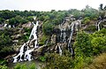 North stream
 -
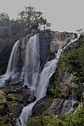 View near waterfall basin
 -
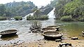 Bharachukki Falls is where tourists can access the waterfall basin. The circular thing in the foreground is a boat.


Gaganachukki Falls[edit | edit source]
Coordinates: 12°17′40″N 77°10′7″E / 12.29444°N 77.16861°E

-
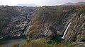 Dry season
 -
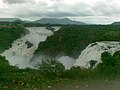 12 August 2007
 -
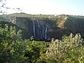 East stream seen from the minor direction. Most tourists view the falls from the viewpoint at the top right of the photo.
 -
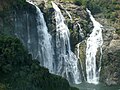 East stream seen from the minor direction


.jpg)


See also[edit | edit source]
Notes[edit | edit source]
- ↑ Hincks, H T (1903). "The Cauvery power transmission scheme". Minutes of the Proceedings of the Institution of Civil Engineers. 152 (1903): 269–284. doi:10.1680/imotp.1903.18113. ISSN 1753-7843.
- ↑ "Shivanasamudra Falls".
- ↑ "World Waterfall Database". Retrieved 7 July 2012.
- ↑ "ಬರಚುಕ್ಕಿ - Barachukki Falls".
- ↑ http://wikimapia.org/1284526/Gagganchucki-waterfalls [user-generated source]
- ↑ "Sri Rama Sethuve( Kaveri Bridge )".
- ↑ "Sivasamudram Watch Tower".
- ↑ http://wikimapia.org/330695/Darga-Hazrath-Mardane-Gaib-R [user-generated source]
- ↑ "100 years of hydel power in State". The Hindu. Chennai, India. 5 July 2004. Archived from the original on 4 August 2004. Retrieved 26 August 2007.
- "Tourist Places/Attractions in mandya District". All Places India. Retrieved 13 August 2014.
- "Shortage of water hits power generation at Shivanasamudra plant". The Hindu. 12 July 2014. Retrieved 13 August 2014.
- "Shivanasamudra soon to host solar power plant". Deccan Herald. 17 March 2012. Retrieved 13 August 2014.