


WikiDwarfBOT (talk | contribs) Cleanup: Source modification. |
updated structure for consistency and updated info for accuracy |
||
| Line 1: | Line 1: | ||
{{pp|small=yes}} | |||
{{Short description|Town in India}} | {{Short description|Town in India}} | ||
{{Use Indian English|date= | {{Use Indian English|date=November 2025}} | ||
{{Use dmy dates|date= | {{Use dmy dates|date=November 2025}} | ||
{{Infobox settlement | {{Infobox settlement | ||
| name | | name = Manali | ||
| settlement_type | | settlement_type = [[Town]] | ||
| image_skyline | | image_skyline = {{multiple image | ||
| border = infobox | | border = infobox | ||
| total_width = 290 | | total_width = 290 | ||
| Line 17: | Line 18: | ||
|image6= Manali in winters.png | |image6= Manali in winters.png | ||
}} | }} | ||
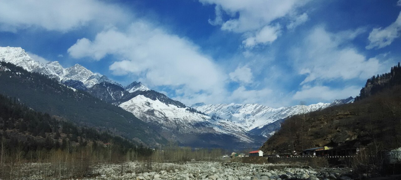
| image_caption | | image_caption = '''''Clockwise from top:''''' Manali aerial view, Dhauladhar view, Mountains in Manali, Manali after snowfall, River in Manali, [[Mall Road, Manali|Mall road]] | ||
| subdivision_name2 | | subdivision_name2 = [[Kullu district|Kullu]] | ||
| established_title | | established_title = <!-- Established --> | ||
| established_date | | established_date = | ||
| founder | | founder = | ||
| named_for | | named_for = ''[[Manu (Hinduism)|Manu]]'' | ||
| government_type | | government_type = | ||
| governing_body | | governing_body = | ||
| unit_pref | | unit_pref = Metric | ||
| area_footnotes | | area_footnotes = | ||
| area_rank | | area_rank = | ||
| area_total_km2 | | area_total_km2 = | ||
| elevation_footnotes | | elevation_footnotes = | ||
| elevation_m | | elevation_m = 2050 | ||
| population_total | | population_total = 8096<ref name="pop">{{Cite web|url=http://www.citypopulation.de/php/india-himachalpradesh.php?cityid=0240401000|title= Manali (Kullu, Himachal Pradesh, India) - population statistics, map, and location|access-date=1 August 2014}}</ref> | ||
| population_as_of | | population_as_of = [[2011 Census of India|2011]] | ||
| population_rank | | population_rank = [[List of cities in Himachal Pradesh by population|22 (state)]] | ||
| population_density_km2 | | population_density_km2 = auto | ||
| population_footnotes | | population_footnotes = | ||
| demographics_type1 | | demographics_type1 = Languages | ||
| demographics1_title1 | | demographics1_title1 = Official | ||
| demographics1_info1 | | demographics1_info1 = [[Hindi]] | ||
| timezone1 | | demographics1_title2 = Regional | ||
| utc_offset1 | | demographics1_info2 = [[Kullui]]<ref>{{cite web| website=Literary Herald |title=Language and dialect of Himachal Pradesh |url=https://tlhjournal.com/uploads/products/35.shradha-shandil-article.pdf?utm_}}</ref> | ||
| postal_code_type | | timezone1 = [[Indian Standard Time|IST]] | ||
| postal_code | | utc_offset1 = +5:30 | ||
| area_code_type | | postal_code_type = [[Postal Index Number|PIN]] | ||
| area_code | | postal_code = 175131 | ||
| registration_plate | | area_code_type = Telephone code | ||
| website | | area_code = +911902 | ||
| footnotes | | registration_plate = HP-58 | ||
| subdivision_name | | website = | ||
| native_name | | footnotes = | ||
| subdivision_type2 | | subdivision_name = {{flag|India}} | ||
| subdivision_name1 | | native_name = <!-- DO NOT FILL FIELD AS PER WP:INDICSCRIPTS POLICY --> | ||
| subdivision_type1 | | subdivision_type2 = [[List of districts of Himachal Pradesh|District]] | ||
| pushpin_label | | subdivision_name1 = [[Himachal Pradesh]] | ||
| subdivision_type | | subdivision_type1 = [[States and union territories of India|State]] | ||
| pushpin_map_alt | | pushpin_label = Manali | ||
| pushpin_label_position | | subdivision_type = [[Country]] | ||
| coordinates | | pushpin_map_alt = Map showing the location of Manali within Himachal Pradesh and India | ||
| pushpin_map | | pushpin_label_position = right | ||
| native_name_lang | | coordinates = {{coord|32.243177|N|77.189246|E|display=inline, title}} | ||
| pushpin_map = India Himachal Pradesh#India | |||
| native_name_lang = <!-- DO NOT FILL FIELD AS PER WP:INDICSCRIPTS POLICY --> | |||
}} | }} | ||
'''Manali''' is a [[town]], near [[Kullu|Kullu town]] in [[Kullu district]] in the Indian state of [[Himachal Pradesh]].<ref>{{Cite news|url=https://indianexpress.com/photos/lifestyle-gallery/express-wanderlust-the-mountains-are-calling-head-over-to-manali-6141029/|title=Wanderlust the mountains are calling head over to Manali, Himachal Pradesh|website=theindianexpress.com}}</ref> It is situated | '''Manali''' ({{indic Transl|hi|manālī|mənaːliː}}) is a [[resort town]], near [[Kullu|Kullu town]] in the [[Kullu district]] in the Indian state of [[Himachal Pradesh]].<ref>{{Cite news|url=https://indianexpress.com/photos/lifestyle-gallery/express-wanderlust-the-mountains-are-calling-head-over-to-manali-6141029/|title=Wanderlust the mountains are calling head over to Manali, Himachal Pradesh|website=theindianexpress.com}}</ref> It is situated at the northern end of the [[Kullu Valley]], formed by the [[Beas River]]. The town is located in the [[Kullu district]], approximately {{convert|270|km|mi|abbr=}} north of the state capital of [[Shimla]] and {{Convert|544|km|mi}} northeast of the national capital of [[New Delhi]]. Manali is a popular [[Tourism in India|tourist destination in India]] and serves as the gateway to the [[Lahaul and Spiti district]] as well as the city of [[Leh]] in [[Ladakh]].<ref name="Gardner1995">''Paper also Presented at the International Seminar on Disasters, Environment and Development, 9–12 December 1994, New Delhi, India'' –by {{cite book|author=James S. Gardner|title=Tourism and Risk from Natural Hazards: Manali, Himachal Pradesh, India |url=https://books.google.com/books?id=NtgsAQAAMAAJ|year=1995|publisher=Natural Resources Institute, University of Manitoba}}</ref> | ||
Manali is the beginning of an ancient trade route through [[Lahaul|Lahaul (H.P.)]] and [[Ladakh]], over the [[Karakoram Pass]] and onto [[Yarkant County|Yarkand]] and [[Hotan]] in the [[Tarim Basin]] of [[China]]. As per the [[2011 census of India|2011 Census of India]], the Manali Municipal Council had a population of 8,096, comprising 4,717 males and 3,379 females. Updated estimates suggest the town’s population is approximately 11,700 as of 2025.<ref>{{Cite web |title=Manali Municipal Council City Population Census 2011-2025 {{!}} Himachal Pradesh |url=https://www.census2011.co.in/data/town/800100-manali-himachal-pradesh.html |access-date=26 July 2025 |website=www.census2011.co.in}}</ref> | |||
== Mythology == | |||
Manali is named after [[Manu (Hinduism)|Manu]], the [[Protoplast (religion)|progenitor of humanity]] in [[Hinduism]]. The name ''Manali'' is regarded as the derivative of ''Manu-Alaya'' ({{Translation|'the abode of Manu'}}).<ref>{{Cite web |title=History {{!}} District Kullu {{!}} India |url=https://hpkullu.nic.in/history/ |access-date=23 November 2022 |language=en-US}}</ref> In [[Hindu cosmology]], Manu is believed to have stepped off his ark in Manali to recreate human life after a great flood had deluged the world at the [[Manvantara|end of an cyclic age]]. The [[Kullu Valley]] in which Manali is situated is often referred to as the "Valley of the Gods". An old village in the town has an ancient temple dedicated to the sage Manu.<ref>{{Cite web |title=Manali Tourism, Himachal Pradesh |url=https://indiathrills.com/manali/ |access-date=26 November 2022 |website=India Thrills |language=en-US}}</ref> | |||
== History == | == History == | ||
Manali’s history blends ancient mythological traditions with trade, medieval temple heritage, and modern tourism development. The town’s name derives from [[Sanskrit]] ''Manu-Alaya'' (“abode of Manu”), reflecting a local legend that Sage Manu resettled humanity here after a great flood. In medieval times, the region was part of the broader [[Kullu district|Kullu]] principality and saw the construction of enduring temples such as the 16th-century [[Hidimba Devi Temple]]. Under British rule in the 19th and early 20th centuries, Manali began to emerge as a hill retreat, with infrastructure and orchard cultivation introduced by colonial visitors. After Indian independence, Manali’s growth accelerated as a tourist destination, facilitated by improved road links and leisure amenities.<ref>{{Cite web |title=Himachal Online |url=https://www.himachalonline.com/manali/history-of-manali?}}</ref> | |||
Captain A. Banon and J.S. Mackay were the early apple orchardists in Manali.<ref>{{Cite book |last=Diack |first=Alexander Henderson |url=http://archive.org/details/dli.pahar.1425 |title=Gazetteer of the Kangra District / 2/4 Kulu, Lahul and Spiti : 1897 |date=1897 |publisher=New Delhi : Indus Publ. Co. |isbn=978-81-7387-016-3 |pages=87}}</ref> | |||
== Governance == | |||
Manali’s urban local governance evolved from a Notified Area in the early 1960s to formal municipal administration under state law. After implementation of the '''Himachal Pradesh Municipal Act, 1994'''<ref>{{Cite web |title=THE HIMACHAL PRADESH MUNICIPAL ACT, 1994 |url=https://ud.hp.gov.in/sites/default/files/Acts/Municipal%20Act%2C%201994%20updated%20as%20on%20Feb%2C2023.pdf}}</ref>, Manali was constituted as a '''Nagar Panchayat in 1994''' as the town’s population and built-up area expanded. With further socio-economic growth and expansion of urban infrastructure, it was '''upgraded to a Municipal Council in 2009'''<ref>{{Cite news |title=Manali News: हिमाचल प्रदेश के मनाली में 50 साल में 80 गुना बढ़ गया कंक्रीट का जंगल |url=https://www.jagran.com/himachal-pradesh/kullu-manali-news-concrete-jungle-increased-80-times-in-50-years-23293907.html?}}</ref>, and is officially listed among the Municipal Councils of Himachal Pradesh. The '''Municipal Council, Manali'''<ref>{{Cite web |title=List of Municipalities in HP as on dated September,2023 |url=https://ud.hp.gov.in/sites/default/files/LIST%20OF%20ULBS/list%20of%20committee%20september%202023.pdf?}}</ref> functions under the [https://ud.hp.gov.in/ Directorate of Urban Development, Govt. of Himachal Pradesh], and is responsible for urban planning, land regulation, roads, sanitation and waste management, water supply, public amenities, and local development. The administrative headquarters of the council is located near Nehru Park in Manali.<ref>{{Cite web |title=Municipal Council Manali |url=https://mcmanali.in/?}}</ref> | |||
==Geography== | ==Geography== | ||
| Line 71: | Line 84: | ||
Manali is located at 32.2396 N, 77.1887 E, about {{convert|547|km|abbr=on}} north of New Delhi. | Manali is located at 32.2396 N, 77.1887 E, about {{convert|547|km|abbr=on}} north of New Delhi. | ||
== | ===Climate=== | ||
Manali | {{Climate chart|Manali|-1.1|10.5|90|0.3|12.0|113.7|3.3|17.1|154.9|6.4|21.4|87.7|9.3|24.9|66.4|13.0|26.4|89.9|16.0|25.7|201.5|16.1|25.3|217.0|12.2|24.2|123.4|6.3|21.6|24.8|2.6|17.3|31.3|0.3|13.5|38.7|float=left|clear=none}} | ||
[[File:Jagtsukh Manali.jpg|left|thumb|Manali in 2025]] | |||
Manali features NO [[subtropical highland climate]] (''[[Köppen climate classification|Cfb]]'') with warm summers, relatively cold winters, and a high [[diurnal temperature variation]]. The temperatures range from {{convert|-7|C||abbr=on}} to {{convert|30|C|abbr=on}} over the year with the hottest day crossing {{convert|30|C|abbr=on}} and the coldest day going below {{convert|-7|C||abbr=on}}. The average temperature during summer is between {{convert|10|C|abbr=on}} to , and between {{convert|-7|C|abbr=on}} to {{convert|15|C|abbr=on}} in the winter. | |||
Monthly precipitation varies between {{convert|31|mm|abbr=on}} in November and {{convert|217|mm|abbr=on}} in August. On average, some {{convert|45|mm|abbr=on}} of precipitation is received during winter and spring months, increasing to some {{convert|115|mm|abbr=on}} in summer as the monsoon approaches. The average total annual precipitation is {{convert|1363|mm|abbr=on}}. Manali experiences snowfall predominantly between December and the beginning of March. | |||
[[File:Manali 2022.jpg|thumb|260x260px|Manali in May 2022]] | [[File:Manali 2022.jpg|thumb|260x260px|Manali in May 2022]] | ||
[[File:Mountains, Manali, Himachal Pradesh.jpg|thumb|Snowfall in Manali|260x260px]] | [[File:Mountains, Manali, Himachal Pradesh.jpg|thumb|Snowfall in Manali|260x260px]] | ||
[[File:1 Mountain Vista scenic view from Drifter's Inn Manali Himachal Pradesh India 2016.jpg|thumb|View of Himalayas from Manali|260x260px]] | [[File:1 Mountain Vista scenic view from Drifter's Inn Manali Himachal Pradesh India 2016.jpg|thumb|View of Himalayas from Manali|260x260px]] | ||
{{Weather box | |||
| location = Manali, Himachal Pradesh ( | | location = Manali, Himachal Pradesh (1991–2020, extremes 1968–2020) | ||
| metric first = Yes | | metric first = Yes | ||
| single line = Yes | | single line = Yes | ||
| Line 95: | Line 109: | ||
| Nov record high C = 25.6 | | Nov record high C = 25.6 | ||
| Dec record high C = 21.5 | | Dec record high C = 21.5 | ||
| year record high C = | | year record high C = | ||
| Jan high C = 10. | | Jan high C = 10.5 | ||
| Feb high C = 12. | | Feb high C = 12.0 | ||
| Mar high C = | | Mar high C = 17.1 | ||
| Apr high C = 21. | | Apr high C = 21.4 | ||
| May high C = 24.9 | | May high C = 24.9 | ||
| Jun high C = | | Jun high C = 26.4 | ||
| Jul high C = | | Jul high C = 25.7 | ||
| Aug high C = 25. | | Aug high C = 25.3 | ||
| Sep high C = 24. | | Sep high C = 24.2 | ||
| Oct high C = | | Oct high C = 21.6 | ||
| Nov high C = 17. | | Nov high C = 17.3 | ||
| Dec high C = 13.5 | | Dec high C = 13.5 | ||
| year high C = 20.2 | | year high C = 20.2 | ||
| Jan low C = -1.1 | | Jan low C = -1.1 | ||
| Feb low C = 0. | | Feb low C = 0.3 | ||
| Mar low C = 3. | | Mar low C = 3.3 | ||
| Apr low C = 6.4 | | Apr low C = 6.4 | ||
| May low C = 9. | | May low C = 9.3 | ||
| Jun low C = | | Jun low C = 13.0 | ||
| Jul low C = | | Jul low C = 16.0 | ||
| Aug low C = 16. | | Aug low C = 16.1 | ||
| Sep low C = 12.2 | | Sep low C = 12.2 | ||
| Oct low C = 6. | | Oct low C = 6.3 | ||
| Nov low C = 2. | | Nov low C = 2.6 | ||
| Dec low C = 0. | | Dec low C = 0.3 | ||
| year low C = | | year low C = 7.2 | ||
| Jan record low C = -11.6 | | Jan record low C = -11.6 | ||
| Feb record low C = -11.0 | | Feb record low C = -11.0 | ||
| Line 134: | Line 148: | ||
| Nov record low C = -5.0 | | Nov record low C = -5.0 | ||
| Dec record low C = -10.0 | | Dec record low C = -10.0 | ||
| year record low C = | | year record low C = | ||
| rain colour = green | | rain colour = green | ||
| Jan rain mm = | | Jan rain mm = 90.0 | ||
| Feb rain mm = | | Feb rain mm = 113.7 | ||
| Mar rain mm = | | Mar rain mm = 154.9 | ||
| Apr rain mm = | | Apr rain mm = 87.7 | ||
| May rain mm = | | May rain mm = 66.4 | ||
| Jun rain mm = | | Jun rain mm = 89.9 | ||
| Jul rain mm = | | Jul rain mm = 201.5 | ||
| Aug rain mm = | | Aug rain mm = 217.0 | ||
| Sep rain mm = | | Sep rain mm = 123.4 | ||
| Oct rain mm = | | Oct rain mm = 24.8 | ||
| Nov rain mm = | | Nov rain mm = 31.3 | ||
| Dec rain mm = | | Dec rain mm = 38.7 | ||
| year rain mm = | | year rain mm = 1239.3 | ||
| Jan rain days = 5. | | Jan rain days = 5.6 | ||
| Feb rain days = 7 | | Feb rain days = 6.7 | ||
| Mar rain days = 8. | | Mar rain days = 8.4 | ||
| Apr rain days = | | Apr rain days = 6.0 | ||
| May rain days = | | May rain days = 6.2 | ||
| Jun rain days = | | Jun rain days = 7.9 | ||
| Jul rain days = 12. | | Jul rain days = 12.9 | ||
| Aug rain days = | | Aug rain days = 14.9 | ||
| Sep rain days = | | Sep rain days = 8.1 | ||
| Oct rain days = | | Oct rain days = 1.9 | ||
| Nov rain days = 1. | | Nov rain days = 1.8 | ||
| Dec rain days = 2. | | Dec rain days = 2.2 | ||
| year rain days = | | year rain days = 82.6 | ||
|time day = 17:30 [[Indian Standard Time|IST]] | |time day = 17:30 [[Indian Standard Time|IST]] | ||
| Jan humidity = | | Jan humidity = 62 | ||
| Feb humidity = | | Feb humidity = 60 | ||
| Mar humidity = | | Mar humidity = 52 | ||
| Apr humidity = | | Apr humidity = 58 | ||
| May humidity = | | May humidity = 63 | ||
| Jun humidity = | | Jun humidity = 66 | ||
| Jul humidity = | | Jul humidity = 75 | ||
| Aug humidity = 76 | | Aug humidity = 76 | ||
| Sep humidity = | | Sep humidity = 76 | ||
| Oct humidity = 69 | | Oct humidity = 69 | ||
| Nov humidity = | | Nov humidity = 63 | ||
| Dec humidity = 62 | | Dec humidity = 62 | ||
|year humidity = | |year humidity = 65 | ||
|source 1 = [[India Meteorological Department]]<ref name=IMDnormals> | |source 1 = [[India Meteorological Department]]<ref>{{cite web | ||
| url = https://imdpune.gov.in/library/public/Climatological%20Tables%201991-2020.pdf | |||
| title = Climatological Tables of Observatories in India 1991-2020 | |||
| publisher = [[India Meteorological Department]] | |||
| access-date = 8 April 2024 | |||
}}</ref><ref name=IMDnormals> | |||
{{cite web | {{cite web | ||
| archive-url = https://web.archive.org/web/20200205040301/http://imdpune.gov.in/library/public/1981-2010%20CLIM%20NORMALS%20%28STATWISE%29.pdf | | archive-url = https://web.archive.org/web/20200205040301/http://imdpune.gov.in/library/public/1981-2010%20CLIM%20NORMALS%20%28STATWISE%29.pdf | ||
| Line 197: | Line 216: | ||
| access-date = 15 February 2020}}</ref> | | access-date = 15 February 2020}}</ref> | ||
}} | }} | ||
==Demographics== | |||
Manali has grown from a trading village to a small town. As of the 2011 census of India, its population was 8,096. In 2001, Manali had an official population of 6,265. Males constituted 64% of the population and females 36%. Manali had an average literacy rate of 74%, male literacy was 80%, and female literacy was 63.9%. 9.5% of the population was under six years of age.<ref>{{Cite web|title=Census of India 2001: Data from the 2001 Census, including cities, villages, and towns (Provisional)|url=http://www.censusindia.net/results/town.php?stad=A&state5=999|archive-url=https://web.archive.org/web/20040616075334/http://www.censusindia.net/results/town.php?stad=A&state5=999|archive-date=16 June 2004|access-date=1 November 2008|publisher=Census Commission of India}}</ref> | |||
==Transport== | ==Transport== | ||
=== Road === | |||
[[File:Solang Valley, Road, India.jpg|thumb|Road near Manali in Himachal Pradesh|260x260px]] | |||
Manali can be reached from Delhi by [[National Highway 1 (India)|national highway NH 1]] up to [[Ambala]] and from there [[NH 22]] to [[Chandigarh]] and from there by [[National Highway 21 (India)|national highway NH21]] that passes through [[Bilaspur, Himachal Pradesh|Bilaspur]], [[Sundernagar]], [[Mandi, Himachal Pradesh, India|Mandi]] and [[Kullu]] towns. The road distance from Chandigarh to Manali is {{convert|282|km|abbr=on}}, and the total distance from Delhi to Manali is {{convert|550|km|abbr=on}}. Bus services are available from HRTC ([[Himachal Road Transport Corporation]]), HPTDC (Himachal Tourism Development Corporation), and private operators. | |||
[[File:Beas river at Manali.jpg|thumb|Beas river in Manali]] | |||
=== Air === | === Air === | ||
The nearest airport [[Kullu–Manali Airport]] (IATA code KUU) is at [[Bhuntar|Bhuntar town]] in [[Kullu]]. The airport is also known as Kullu-Manali airport and has more than a | The nearest airport [[Kullu–Manali Airport]] (IATA code KUU) is at [[Bhuntar|Bhuntar town]] in [[Kullu]]. The airport is also known as Kullu-Manali airport and has more than a kilometre-long runway. [[Air India]] has regular flights to the airport from [[New Delhi]]. | ||
==== Helicopter Service ==== | |||
[[Pawan Hans]], the Government charter agency, provides helicopter-taxi service connecting [[Shimla]] to [[Chandigarh]], [[Kullu district|Kullu]], [[Kangra, Himachal Pradesh|Kangra]] and [[Dharamshala]].<ref>{{Cite web|date=19 March 2019|title=Shimla-Chandigarh helicopter service now operating six days a week|url=https://himachaltourism.gov.in/shimla-chandigarh-helicopter-service-now-operating-six-days-a-week/|access-date=21 November 2019|website=Himachal Tourism Official Website}}</ref> | |||
=== Rail === | |||
Bilaspur will be a station on the under-construction [[Bhanupli–Leh line]] (also see [[Jammu railway division#Future|Planned rail lines between Himachal and Ladakh]]).<ref name=featup1>[https://www.theweek.in/theweek/current/2025/04/05/bilaspur-manali-leh-rail-project-details.html India’s costliest rail line will change how we view travel], theweek.in, 13 April 2025.</ref> There is no close railhead available close to Manali. The nearest [[broad gauge]] railheads are at [[Una, Himachal Pradesh|Una]] {{convert|250|km|0|abbr=on}} away, [[Kiratpur Sahib]] {{convert|268|km|0|abbr=on}}, [[Kalka]] ({{convert|275|km|0|abbr=on}}), [[Chandigarh]] ({{convert|310|km|0|abbr=on}}), and [[Pathankot]] ({{convert|325|km|0|abbr=on}}). The nearest [[Narrow gauge railway|narrow gauge]] railhead is at [[Joginder Nagar]] ({{convert|147|km}}). The [[Kalka–Shimla Railway]] is a nostalgic narrow-gauge route culminating at the state capital to travel by road to Manali. | |||
==== | == Attractions == | ||
=== | * [[Mall Road, Manali|Mall Road]] - Main shopping street of Manali. | ||
[[ | * [[Hidimba Devi Temple|Hadimba Temple]] – A unique wooden shrine dedicated to Hidimbi, wife of Bhima, noted for its pagoda-style architecture.<ref>{{Cite web |title=Hidimba Temple Manali - Ancient sanctuary in the mountains |url=https://www.incredibleindia.gov.in/en/himachal-pradesh/manali/hidimba-temple |access-date=26 July 2025 |website=Incredible India |language=en}}</ref> | ||
Manali | * Ghatotkacha Temple<ref>{{Cite news |last=Rangarajan |first=Malathi |date=13 July 2017 |title=Temples dedicated to demoness Hidimbi Devi and her son Ghatothkach in Manali, Himachal Pradesh |url=https://www.thehindu.com/society/history-and-culture/temples-dedicated-to-demoness-hidimbi-devi-and-her-son-ghatothkach-in-manali-himachal-pradesh/article19270468.ece |access-date=26 July 2025 |work=The Hindu |language=en-IN |issn=0971-751X}}</ref> – Located close to Hadimba, dedicated to Ghatotkacha, son of Bhima and Hadimba Devi. | ||
* [[Vashisht, Himachal Pradesh|Vashisht Temple]] – Situated in Vashisht village, known for its sulphurous hot springs and temples dedicated to Lord Vashisht, Shiva, and Rama.<ref>{{Cite news |date=19 February 2025 |title=Why Vashisht Temple is a must-visit spiritual gem in Manali, Himachal Pradesh |url=https://timesofindia.indiatimes.com/life-style/travel/destinations/why-vashisht-temple-is-a-must-visit-spiritual-gem-in-manali-himachal-pradesh/articleshow/118389434.cms |access-date=26 July 2025 |work=The Times of India |issn=0971-8257}}</ref> | |||
* Manu Temple<ref>{{Cite web |title=Manu Temple, Manali - Tripadvisor |url=https://www.tripadvisor.in/Attraction_Review-g297618-d3912843-Reviews-Manu_Temple-Manali_Kullu_District_Himachal_Pradesh.html |archive-url=https://web.archive.org/web/20241107222323/https://www.tripadvisor.in/Attraction_Review-g297618-d3912843-Reviews-Manu_Temple-Manali_Kullu_District_Himachal_Pradesh.html |archive-date=7 November 2024 |access-date=26 July 2025 |website=Tripadvisor |language=en-IN |url-status=live }}</ref> – An ancient shrine dedicated to [[Maharishi]] Manu, believed to be the creator of mankind in Hindu tradition.<ref>{{Cite web |title=Manu Temple Old Manali (Timings, History, Entry Fee, Images, Aarti, Location & Phone) - Manali Tourism |url=https://manalitourism.co.in/manu-temple-old-manali |access-date=26 July 2025 |website=manalitourism.co.in}}</ref> | |||
* [[Rohtang Pass]] – Approximately 51 km from Manali, at an altitude of 3979 m (13,050 ft) above sea level; connects Kullu Valley with Lahaul and Spiti, and is a popular scenic destination. | |||
* [[Bara-lacha la|Bara Lacha Pass]] – Another high mountain pass in the region, providing access to Zanskar and Ladakh, often included in trekking circuits. | |||
* [[Atal Tunnel]] - Runs under [[Rohtang Pass]] constructed on the Manali - Leh Highway. Longest Highway Tunnel at 10,000 feet.<ref>{{Cite web |title=Longest Tunnel at 10,000 Feet |url=https://www.pib.gov.in/PressReleaseIframePage.aspx?PRID=1796961}}</ref> | |||
* [[Solang Valley]] - Vast green slopes and a ski resort 14 Km north of Manali. Popularly known as Snow Point. | |||
* [[Hamta Pass]] - Scenic pass between Manali and Chandra Valley. | |||
== | == Environmental concerns == | ||
Manali has witnessed a flurry of activity related to hydroelectric power and tourism. Unplanned and rampant construction has led to severe depletion of forests and pollution of river bodies, along with garbage being disposed of on the side of the mountains. There has been a loss of habitat to various species of fauna, not limited to the [[Himalayan monal]] only.<ref>{{cite news |last1=Azad |first1=Shivani |date=18 November 2019 |title=Uttarakhand's state bird monal to be conserved with help from Himachal |url=https://timesofindia.indiatimes.com/city/dehradun/ukhands-state-bird-monal-to-be-conserved-with-help-from-himachal/articleshow/72099088.cms |access-date=1 March 2021 |work=The Times of India |language=en}}</ref> | |||
=== | During the summer 2025 monsoon season, heavy rainfall triggered multiple landslides in [[Mandi district]], disrupting the Chandigarh–Manali highway near 4 Mile, Pandoh, and the Thalot Tunnel. The route was blocked for up to 24 hours, stranding hundreds of vehicles and causing significant travel delays.<ref>{{Cite web |title=Massive landslide in Mandi halts traffic on Chandigarh-Manali highway |url=https://www.tribuneindia.com/news/himachal/massive-landslide-in-mandi-halts-traffic-on-chd-manali-highway/ |access-date=26 July 2025 |website=The Tribune |language=en}}</ref> Statewide, over 400 roads were blocked; Mandi alone reported 232 blocked roads and 71 in the Kullu district, including Manali-bound routes.<ref>{{Cite AV media |url=https://www.youtube.com/watch?v=HiD0NuIhYmw |title=Heavy Rainfall Triggers Landslides On Kullu-Manali-Chandigarh Highway, Disruptaing Traffic |date=1 July 2025 |last=India Today |access-date=26 July 2025 |via=YouTube}}</ref> The disasters resulted in 137 deaths, with severe damage to roads, water and power infrastructure.<ref>{{Cite news |date=23 July 2025 |title=Himachal hit hard: Over 400 roads blocked, power down, and water crisis as rains wreak havoc |url=https://economictimes.indiatimes.com/news/india/himachal-hit-hard-over-400-roads-blocked-power-down-and-water-crisis-as-rains-wreak-havoc/articleshow/122853462.cms |access-date=26 July 2025 |work=The Economic Times |issn=0013-0389}}</ref> Due to the narrow Himalayan terrain and recent landslides, traffic congestion along the Chandigarh–Manali National Highway (NH‑21) has worsened significantly. Even outside disaster periods, gridlock is common during peak tourist season, leading to long delays and often only one-way traffic management on affected stretches.<ref>{{Cite news |date=1 July 2025 |title=Rain throws normal life out of gear in Himachal Pradesh, Chandigarh-Manali highway disrupted |url=https://timesofindia.indiatimes.com/city/chandigarh/rain-throws-normal-life-out-of-gear-in-himachal-pradesh-chandigarh-manali-highway-disrupted/articleshow/122167969.cms |access-date=26 July 2025 |work=The Times of India |issn=0971-8257}}</ref> | ||
Manali | |||
==See also== | == See also == | ||
* [[Tourism in Himachal Pradesh]] | * [[Tourism in Himachal Pradesh]] | ||
* [[List of hill stations in India]] | * [[List of hill stations in India]] | ||
* [[Mall Road, Manali]] | * [[Mall Road, Manali]] | ||
* [[Rohtang Pass]], Manali | * [[Rohtang Pass]], Manali | ||
==Further reading== | ==Further reading== | ||
| Line 233: | Line 270: | ||
== External links == | == External links == | ||
{{commons category|Manali}} | |||
* [https://himachaltourism.gov.in/destination/manali/ Himachal Tourism Official Govt Website] | * [https://himachaltourism.gov.in/destination/manali/ Himachal Tourism Official Govt Website] | ||
* https://hpkullu.nic.in/ | * https://hpkullu.nic.in/ | ||
{{Wikivoyage|Manali}} | |||
{{Leh-Manali Highway}} | {{Leh-Manali Highway}} | ||
{{Kullu Manali Circuit}} | {{Kullu Manali Circuit}} | ||
Latest revision as of 22:12, 16 February 2026
Manali | |
|---|---|
Clockwise from top: Manali aerial view, Dhauladhar view, Mountains in Manali, Manali after snowfall, River in Manali, Mall road | |
  Manali  Manali | |
| Coordinates: 32°14′35″N 77°11′21″E / 32.243177°N 77.189246°E | |
| Country |  India India |
| State | Himachal Pradesh |
| District | Kullu |
| Named for | Manu |
| Elevation | 2,050 m (6,730 ft) |
| Population (2011) | |
| • Total | 8,096[1] |
| • Rank | 22 (state) |
| Languages | |
| • Official | Hindi |
| • Regional | Kullui[2] |
| Time zone | UTC+5:30 (IST) |
| PIN | 175131 |
| Telephone code | +911902 |
| Vehicle registration | HP-58 |


Manali (Template:Indic Transl) is a resort town, near Kullu town in the Kullu district in the Indian state of Himachal Pradesh.[3] It is situated at the northern end of the Kullu Valley, formed by the Beas River. The town is located in the Kullu district, approximately 270 kilometres (170 mi) north of the state capital of Shimla and 544 kilometres (338 mi) northeast of the national capital of New Delhi. Manali is a popular tourist destination in India and serves as the gateway to the Lahaul and Spiti district as well as the city of Leh in Ladakh.[4]
Manali is the beginning of an ancient trade route through Lahaul (H.P.) and Ladakh, over the Karakoram Pass and onto Yarkand and Hotan in the Tarim Basin of China. As per the 2011 Census of India, the Manali Municipal Council had a population of 8,096, comprising 4,717 males and 3,379 females. Updated estimates suggest the town’s population is approximately 11,700 as of 2025.[5]
Mythology[edit | edit source]
Manali is named after Manu, the progenitor of humanity in Hinduism. The name Manali is regarded as the derivative of Manu-Alaya (transl. 'the abode of Manu').[6] In Hindu cosmology, Manu is believed to have stepped off his ark in Manali to recreate human life after a great flood had deluged the world at the end of an cyclic age. The Kullu Valley in which Manali is situated is often referred to as the "Valley of the Gods". An old village in the town has an ancient temple dedicated to the sage Manu.[7]
History[edit | edit source]
Manali’s history blends ancient mythological traditions with trade, medieval temple heritage, and modern tourism development. The town’s name derives from Sanskrit Manu-Alaya (“abode of Manu”), reflecting a local legend that Sage Manu resettled humanity here after a great flood. In medieval times, the region was part of the broader Kullu principality and saw the construction of enduring temples such as the 16th-century Hidimba Devi Temple. Under British rule in the 19th and early 20th centuries, Manali began to emerge as a hill retreat, with infrastructure and orchard cultivation introduced by colonial visitors. After Indian independence, Manali’s growth accelerated as a tourist destination, facilitated by improved road links and leisure amenities.[8]
Captain A. Banon and J.S. Mackay were the early apple orchardists in Manali.[9]
Governance[edit | edit source]
Manali’s urban local governance evolved from a Notified Area in the early 1960s to formal municipal administration under state law. After implementation of the Himachal Pradesh Municipal Act, 1994[10], Manali was constituted as a Nagar Panchayat in 1994 as the town’s population and built-up area expanded. With further socio-economic growth and expansion of urban infrastructure, it was upgraded to a Municipal Council in 2009[11], and is officially listed among the Municipal Councils of Himachal Pradesh. The Municipal Council, Manali[12] functions under the Directorate of Urban Development, Govt. of Himachal Pradesh, and is responsible for urban planning, land regulation, roads, sanitation and waste management, water supply, public amenities, and local development. The administrative headquarters of the council is located near Nehru Park in Manali.[13]
Geography[edit | edit source]

Manali is located at 32.2396 N, 77.1887 E, about 547 km (340 mi) north of New Delhi.
Climate[edit | edit source]
| Manali | ||||||||||||||||||||||||||||||||||||||||||||||||||||||||||||
|---|---|---|---|---|---|---|---|---|---|---|---|---|---|---|---|---|---|---|---|---|---|---|---|---|---|---|---|---|---|---|---|---|---|---|---|---|---|---|---|---|---|---|---|---|---|---|---|---|---|---|---|---|---|---|---|---|---|---|---|---|
| Climate chart (explanation) | ||||||||||||||||||||||||||||||||||||||||||||||||||||||||||||
| ||||||||||||||||||||||||||||||||||||||||||||||||||||||||||||
| ||||||||||||||||||||||||||||||||||||||||||||||||||||||||||||

Manali features NO subtropical highland climate (Cfb) with warm summers, relatively cold winters, and a high diurnal temperature variation. The temperatures range from −7 °C (19 °F) to 30 °C (86 °F) over the year with the hottest day crossing 30 °C (86 °F) and the coldest day going below −7 °C (19 °F). The average temperature during summer is between 10 °C (50 °F) to , and between −7 °C (19 °F) to 15 °C (59 °F) in the winter.
Monthly precipitation varies between 31 mm (1.2 in) in November and 217 mm (8.5 in) in August. On average, some 45 mm (1.8 in) of precipitation is received during winter and spring months, increasing to some 115 mm (4.5 in) in summer as the monsoon approaches. The average total annual precipitation is 1,363 mm (53.7 in). Manali experiences snowfall predominantly between December and the beginning of March.


| Climate data for Manali, Himachal Pradesh (1991–2020, extremes 1968–2020) | |||||||||||||
|---|---|---|---|---|---|---|---|---|---|---|---|---|---|
| Month | Jan | Feb | Mar | Apr | May | Jun | Jul | Aug | Sep | Oct | Nov | Dec | Year |
| Record high °C (°F) | 19.5 (67.1) |
23.5 (74.3) |
27.0 (80.6) |
30.0 (86.0) |
35.0 (95.0) |
33.2 (91.8) |
32.6 (90.7) |
30.6 (87.1) |
29.2 (84.6) |
30.0 (86.0) |
25.6 (78.1) |
21.5 (70.7) |
35.0 (95.0) |
| Average high °C (°F) | 10.5 (50.9) |
12.0 (53.6) |
17.1 (62.8) |
21.4 (70.5) |
24.9 (76.8) |
26.4 (79.5) |
25.7 (78.3) |
25.3 (77.5) |
24.2 (75.6) |
21.6 (70.9) |
17.3 (63.1) |
13.5 (56.3) |
20.2 (68.4) |
| Average low °C (°F) | −1.1 (30.0) |
0.3 (32.5) |
3.3 (37.9) |
6.4 (43.5) |
9.3 (48.7) |
13.0 (55.4) |
16.0 (60.8) |
16.1 (61.0) |
12.2 (54.0) |
6.3 (43.3) |
2.6 (36.7) |
0.3 (32.5) |
7.2 (45.0) |
| Record low °C (°F) | −11.6 (11.1) |
−11.0 (12.2) |
−6.0 (21.2) |
−1.0 (30.2) |
1.0 (33.8) |
4.4 (39.9) |
7.4 (45.3) |
7.0 (44.6) |
3.0 (37.4) |
−1.5 (29.3) |
−5.0 (23.0) |
−10.0 (14.0) |
−11.6 (11.1) |
| Average rainfall mm (inches) | 90.0 (3.54) |
113.7 (4.48) |
154.9 (6.10) |
87.7 (3.45) |
66.4 (2.61) |
89.9 (3.54) |
201.5 (7.93) |
217.0 (8.54) |
123.4 (4.86) |
24.8 (0.98) |
31.3 (1.23) |
38.7 (1.52) |
1,239.3 (48.79) |
| Average rainy days | 5.6 | 6.7 | 8.4 | 6.0 | 6.2 | 7.9 | 12.9 | 14.9 | 8.1 | 1.9 | 1.8 | 2.2 | 82.6 |
| Average relative humidity (%) (at 17:30 IST) | 62 | 60 | 52 | 58 | 63 | 66 | 75 | 76 | 76 | 69 | 63 | 62 | 65 |
| Source: India Meteorological Department[14][15][16] | |||||||||||||
Demographics[edit | edit source]
Manali has grown from a trading village to a small town. As of the 2011 census of India, its population was 8,096. In 2001, Manali had an official population of 6,265. Males constituted 64% of the population and females 36%. Manali had an average literacy rate of 74%, male literacy was 80%, and female literacy was 63.9%. 9.5% of the population was under six years of age.[17]
Transport[edit | edit source]
Road[edit | edit source]

Manali can be reached from Delhi by national highway NH 1 up to Ambala and from there NH 22 to Chandigarh and from there by national highway NH21 that passes through Bilaspur, Sundernagar, Mandi and Kullu towns. The road distance from Chandigarh to Manali is 282 km (175 mi), and the total distance from Delhi to Manali is 550 km (340 mi). Bus services are available from HRTC (Himachal Road Transport Corporation), HPTDC (Himachal Tourism Development Corporation), and private operators.

Air[edit | edit source]
The nearest airport Kullu–Manali Airport (IATA code KUU) is at Bhuntar town in Kullu. The airport is also known as Kullu-Manali airport and has more than a kilometre-long runway. Air India has regular flights to the airport from New Delhi.
Helicopter Service[edit | edit source]
Pawan Hans, the Government charter agency, provides helicopter-taxi service connecting Shimla to Chandigarh, Kullu, Kangra and Dharamshala.[18]
Rail[edit | edit source]
Bilaspur will be a station on the under-construction Bhanupli–Leh line (also see Planned rail lines between Himachal and Ladakh).[19] There is no close railhead available close to Manali. The nearest broad gauge railheads are at Una 250 km (155 mi) away, Kiratpur Sahib 268 km (167 mi), Kalka (275 km (171 mi)), Chandigarh (310 km (193 mi)), and Pathankot (325 km (202 mi)). The nearest narrow gauge railhead is at Joginder Nagar (147 kilometres (91 mi)). The Kalka–Shimla Railway is a nostalgic narrow-gauge route culminating at the state capital to travel by road to Manali.
Attractions[edit | edit source]
- Mall Road - Main shopping street of Manali.
- Hadimba Temple – A unique wooden shrine dedicated to Hidimbi, wife of Bhima, noted for its pagoda-style architecture.[20]
- Ghatotkacha Temple[21] – Located close to Hadimba, dedicated to Ghatotkacha, son of Bhima and Hadimba Devi.
- Vashisht Temple – Situated in Vashisht village, known for its sulphurous hot springs and temples dedicated to Lord Vashisht, Shiva, and Rama.[22]
- Manu Temple[23] – An ancient shrine dedicated to Maharishi Manu, believed to be the creator of mankind in Hindu tradition.[24]
- Rohtang Pass – Approximately 51 km from Manali, at an altitude of 3979 m (13,050 ft) above sea level; connects Kullu Valley with Lahaul and Spiti, and is a popular scenic destination.
- Bara Lacha Pass – Another high mountain pass in the region, providing access to Zanskar and Ladakh, often included in trekking circuits.
- Atal Tunnel - Runs under Rohtang Pass constructed on the Manali - Leh Highway. Longest Highway Tunnel at 10,000 feet.[25]
- Solang Valley - Vast green slopes and a ski resort 14 Km north of Manali. Popularly known as Snow Point.
- Hamta Pass - Scenic pass between Manali and Chandra Valley.
Environmental concerns[edit | edit source]
Manali has witnessed a flurry of activity related to hydroelectric power and tourism. Unplanned and rampant construction has led to severe depletion of forests and pollution of river bodies, along with garbage being disposed of on the side of the mountains. There has been a loss of habitat to various species of fauna, not limited to the Himalayan monal only.[26]
During the summer 2025 monsoon season, heavy rainfall triggered multiple landslides in Mandi district, disrupting the Chandigarh–Manali highway near 4 Mile, Pandoh, and the Thalot Tunnel. The route was blocked for up to 24 hours, stranding hundreds of vehicles and causing significant travel delays.[27] Statewide, over 400 roads were blocked; Mandi alone reported 232 blocked roads and 71 in the Kullu district, including Manali-bound routes.[28] The disasters resulted in 137 deaths, with severe damage to roads, water and power infrastructure.[29] Due to the narrow Himalayan terrain and recent landslides, traffic congestion along the Chandigarh–Manali National Highway (NH‑21) has worsened significantly. Even outside disaster periods, gridlock is common during peak tourist season, leading to long delays and often only one-way traffic management on affected stretches.[30]
See also[edit | edit source]
Further reading[edit | edit source]
- Verma, V. 1996. Gadd of Dhauladhar: A Transhumant Tribe of the Himalayas. Indus Publishing Co., New Delhi.
- Handa, O. C. 1996. Buddhist Monasteries in Himachal Pradesh. ISBN 978-8185182032.
- Penelope Chetwode 1972, 1989 "Kulu: The End of the Habitable World" (ISBN 9788185113203) Time Books International
References[edit | edit source]
- ↑ "Manali (Kullu, Himachal Pradesh, India) - population statistics, map, and location". Retrieved 1 August 2014.
- ↑ "Language and dialect of Himachal Pradesh" (PDF). Literary Herald.
- ↑ "Wanderlust the mountains are calling head over to Manali, Himachal Pradesh". theindianexpress.com.
- ↑ Paper also Presented at the International Seminar on Disasters, Environment and Development, 9–12 December 1994, New Delhi, India –by James S. Gardner (1995). Tourism and Risk from Natural Hazards: Manali, Himachal Pradesh, India. Natural Resources Institute, University of Manitoba.
- ↑ "Manali Municipal Council City Population Census 2011-2025 | Himachal Pradesh". www.census2011.co.in. Retrieved 26 July 2025.
- ↑ "History | District Kullu | India". Retrieved 23 November 2022.
- ↑ "Manali Tourism, Himachal Pradesh". India Thrills. Retrieved 26 November 2022.
- ↑ "Himachal Online".
- ↑ Diack, Alexander Henderson (1897). Gazetteer of the Kangra District / 2/4 Kulu, Lahul and Spiti : 1897. New Delhi : Indus Publ. Co. p. 87. ISBN 978-81-7387-016-3.
- ↑ "THE HIMACHAL PRADESH MUNICIPAL ACT, 1994" (PDF).
- ↑ "Manali News: हिमाचल प्रदेश के मनाली में 50 साल में 80 गुना बढ़ गया कंक्रीट का जंगल".
- ↑ "List of Municipalities in HP as on dated September,2023" (PDF).
- ↑ "Municipal Council Manali".
- ↑ "Climatological Tables of Observatories in India 1991-2020" (PDF). India Meteorological Department. Retrieved 8 April 2024.
- ↑ "Station: Manali Climatological Table 1981–2010" (PDF). Climatological Normals 1981–2010. India Meteorological Department. January 2015. pp. 469–470. Archived from the original (PDF) on 5 February 2020. Retrieved 15 February 2020.
- ↑ "Extremes of Temperature & Rainfall for Indian Stations (Up to 2012)" (PDF). India Meteorological Department. December 2016. p. M69. Archived from the original (PDF) on 5 February 2020. Retrieved 15 February 2020.
- ↑ "Census of India 2001: Data from the 2001 Census, including cities, villages, and towns (Provisional)". Census Commission of India. Archived from the original on 16 June 2004. Retrieved 1 November 2008.
- ↑ "Shimla-Chandigarh helicopter service now operating six days a week". Himachal Tourism Official Website. 19 March 2019. Retrieved 21 November 2019.
- ↑ India’s costliest rail line will change how we view travel, theweek.in, 13 April 2025.
- ↑ "Hidimba Temple Manali - Ancient sanctuary in the mountains". Incredible India. Retrieved 26 July 2025.
- ↑ Rangarajan, Malathi (13 July 2017). "Temples dedicated to demoness Hidimbi Devi and her son Ghatothkach in Manali, Himachal Pradesh". The Hindu. ISSN 0971-751X. Retrieved 26 July 2025.
- ↑ "Why Vashisht Temple is a must-visit spiritual gem in Manali, Himachal Pradesh". The Times of India. 19 February 2025. ISSN 0971-8257. Retrieved 26 July 2025.
- ↑ "Manu Temple, Manali - Tripadvisor". Tripadvisor. Archived from the original on 7 November 2024. Retrieved 26 July 2025.
- ↑ "Manu Temple Old Manali (Timings, History, Entry Fee, Images, Aarti, Location & Phone) - Manali Tourism". manalitourism.co.in. Retrieved 26 July 2025.
- ↑ "Longest Tunnel at 10,000 Feet".
- ↑ Azad, Shivani (18 November 2019). "Uttarakhand's state bird monal to be conserved with help from Himachal". The Times of India. Retrieved 1 March 2021.
- ↑ "Massive landslide in Mandi halts traffic on Chandigarh-Manali highway". The Tribune. Retrieved 26 July 2025.
- ↑ India Today (1 July 2025). Heavy Rainfall Triggers Landslides On Kullu-Manali-Chandigarh Highway, Disruptaing Traffic. Retrieved 26 July 2025 – via YouTube.
- ↑ "Himachal hit hard: Over 400 roads blocked, power down, and water crisis as rains wreak havoc". The Economic Times. 23 July 2025. ISSN 0013-0389. Retrieved 26 July 2025.
- ↑ "Rain throws normal life out of gear in Himachal Pradesh, Chandigarh-Manali highway disrupted". The Times of India. 1 July 2025. ISSN 0971-8257. Retrieved 26 July 2025.