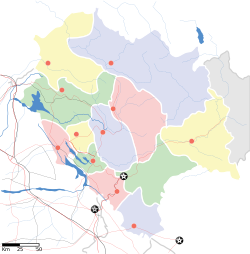
Una, Himachal Pradesh
Una | |
|---|---|
City | |
| Coordinates: 31°28′05″N 76°16′16″E / 31.468°N 76.271°ECoordinates: 31°28′05″N 76°16′16″E / 31.468°N 76.271°E | |
| Country | |
| State | File:Himachal Pradesh Flag, India.png Himachal Pradesh |
| District | Una |
| Elevation | 369 m (1,211 ft) |
| Population (2011) | |
| • Total | 18,722 |
| • Rank | 10 in HP |
| Languages | |
| • Official | Hindi |
| • Other spoken | Punjabi |
| Time zone | UTC+5:30 (IST) |
| Website | hpuna |
Una is a Municipal Council City in Una district in the Indian state of Himachal Pradesh. It serves as the headquarters of Una district. There are 11 wards under Municipal Council. Una City is home to the Kila, which is a historical fort and an ancestral home of the descendants of the first guru of the Sikhs, Guru Nanak.[1]
Geography and climate[edit | edit source]
Una is located at 31°29′N 76°17′E / 31.48°N 76.28°E.[2] It has an average elevation of 369 metres (1,210 feet). The elevation keeps temperatures cooler than surrounding lowlands, however, the area still experiences temperatures up to 45 °C (113 °F).[3]
| Climate data for Una (1985–2010, extremes 1985–2011) | |||||||||||||
|---|---|---|---|---|---|---|---|---|---|---|---|---|---|
| Month | Jan | Feb | Mar | Apr | May | Jun | Jul | Aug | Sep | Oct | Nov | Dec | Year |
| Record high °C (°F) | 31.0 (87.8) |
34.2 (93.6) |
39.4 (102.9) |
43.2 (109.8) |
45.2 (113.4) |
45.2 (113.4) |
42.2 (108.0) |
38.4 (101.1) |
38.6 (101.5) |
35.6 (96.1) |
33.4 (92.1) |
28.2 (82.8) |
45.2 (113.4) |
| Average high °C (°F) | 19.9 (67.8) |
23.1 (73.6) |
28.1 (82.6) |
34.3 (93.7) |
37.8 (100.0) |
37.9 (100.2) |
33.8 (92.8) |
32.8 (91.0) |
32.8 (91.0) |
31.1 (88.0) |
27.4 (81.3) |
22.3 (72.1) |
30.1 (86.2) |
| Average low °C (°F) | 3.2 (37.8) |
5.7 (42.3) |
9.4 (48.9) |
13.5 (56.3) |
18.2 (64.8) |
21.2 (70.2) |
22.1 (71.8) |
21.9 (71.4) |
20.1 (68.2) |
13.8 (56.8) |
8.2 (46.8) |
4.0 (39.2) |
13.5 (56.3) |
| Record low °C (°F) | −5.8 (21.6) |
−1.6 (29.1) |
3.0 (37.4) |
6.7 (44.1) |
8.6 (47.5) |
14.7 (58.5) |
17.0 (62.6) |
16.3 (61.3) |
13.2 (55.8) |
5.1 (41.2) |
1.8 (35.2) |
−2.4 (27.7) |
−5.8 (21.6) |
| Average rainfall mm (inches) | 37.0 (1.46) |
42.4 (1.67) |
42.3 (1.67) |
24.9 (0.98) |
37.1 (1.46) |
89.6 (3.53) |
323.2 (12.72) |
320.3 (12.61) |
162.2 (6.39) |
21.1 (0.83) |
10.7 (0.42) |
20.4 (0.80) |
1,131.2 (44.54) |
| Average rainy days | 2.4 | 3.4 | 3.3 | 1.6 | 2.7 | 5.5 | 11.6 | 11.6 | 5.8 | 1.2 | 0.9 | 1.2 | 51.2 |
| Average relative humidity (%) (at 17:30 IST) | 65 | 63 | 57 | 42 | 41 | 49 | 68 | 72 | 67 | 61 | 58 | 61 | 59 |
| Source: India Meteorological Department[4][5] | |||||||||||||
Demographics[edit | edit source]
According to the 2011 Census of India, Una town had a population of 18,722 with 9,851 males and 8,871 females.[6] The literacy rate was 86.21%, higher than the state average of 82.80%.[6] The male literacy and female literacy rates were 88.84 and 83.29% respectively. There were 1,954 children below the age of six years. The sex ratio and child sex ratio of the town stood at 901 and 918 respectively.[6] Hindi and Punjabi are the main spoken languages.
Transport[edit | edit source]
Roadways
Una serves as one of the main entry points to the rest of Himachal Pradesh through the borders of Punjab at Nangal-Mehetpur checkpoint. Una is well connected with the rest of the state, Himachal Pradesh and rest of India through National Highway 503 and National Highway 503A.[7]
Railways
Una Himachal Railway Station is well Connected with Chandigarh Junction and Capital Of India "New Delhi" through Express and Mails Trains and some other trains connected it with Ambala Cantt.Junction
Nearest Airport's and Distance
• Gaggal ( Kangra ) Domestic Airport (114Km)
• Chandigarh International Airport ( 127 Km )
References[edit | edit source]
- ↑ "Kila Baba Sahib Singh Ji Bedi Una Sahib". HP Tours. Retrieved 16 May 2018.
- ↑ Falling Rain Genomics, Inc - Una
- ↑ "India heatwave temperatures pass 50 Celsius". Phys.org. 2 June 2019. Retrieved 2 June 2019.
- ↑ "Station: Una Climatological Table 1981–2010" (PDF). Climatological Normals 1981–2010. India Meteorological Department. January 2015. pp. 775–776. Archived from the original (PDF) on 5 February 2020. Retrieved 15 February 2020.
- ↑ "Extremes of Temperature & Rainfall for Indian Stations (Up to 2012)" (PDF). India Meteorological Department. December 2016. p. M73. Archived from the original (PDF) on 5 February 2020. Retrieved 15 February 2020.
- ↑ 6.0 6.1 6.2 "Una Population Census 2011". Census 2011 India. Retrieved 28 April 2018.
- ↑ "National Highways in Himachal Pradesh" (PDF). Himachal Pradesh Public Works Department. Retrieved 23 May 2018.
