








m Removed empty portal template using script |
refine references per sources for accuracy |
||
| Line 1: | Line 1: | ||
{{short description|Capital and largest city in Nepal}} | {{short description|Capital and largest city in Nepal}} | ||
{{ | {{About|the capital city of Nepal|the district in which it is located|Kathmandu District|the geographical area|Kathmandu Valley|other uses}} | ||
{{Use British English|date=July 2019}}{{Use dmy dates|date=September 2021}} | |||
{{Use British English}}{{Use dmy dates}} | |||
{{Infobox settlement | {{Infobox settlement | ||
| name = Kathmandu | | name = Kathmandu | ||
| | | native_name = काठमाडौँ | ||
| | | settlement_type = [[Capital city|Capital City <br> (राजधानी)]] | ||
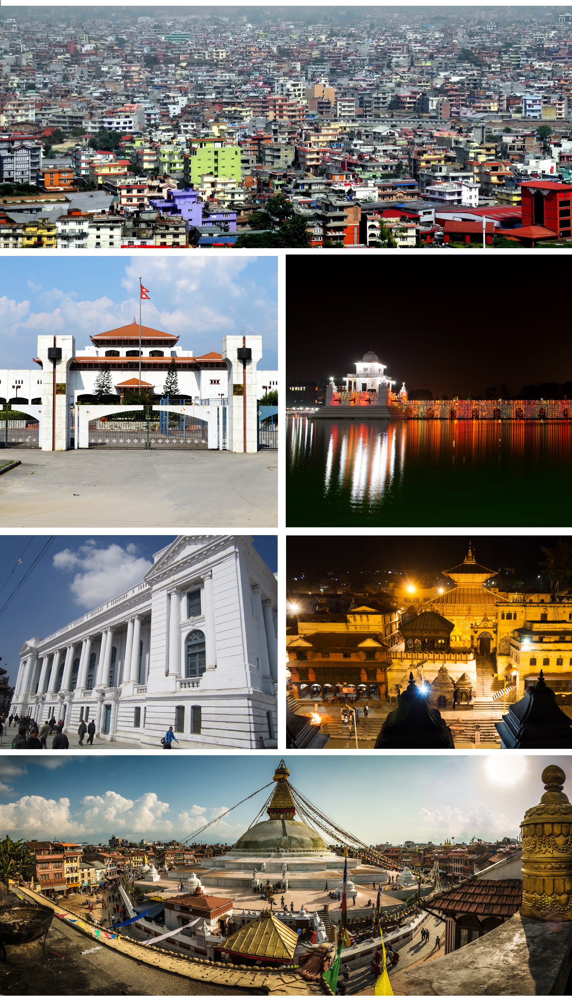
{{ | | image_skyline = {{Multiple image | ||
| | | border = infobox | ||
| | | total_width = 300 | ||
| | | image_style = | ||
| | | caption_align = center | ||
| | | perrow = 1/1/2/2/1 | ||
| | | image1 = Kathmandu-Durbar Square-06-Mahavishnu-Kuh-Vishnu-Pratapamalla-Jagannath-2007-gje.jpg | ||
| | | caption1 = [[Kathmandu Durbar Square]] | ||
| | | image2 = Boudhanath Panorama 2016.jpg | ||
| caption2 = [[Boudha Stupa]] at Boudhanath | |||
| | | image3 = Ghantaghar Kathmandu.jpg | ||
| | | caption3 = [[Ghanta Ghar (Kathmandu)|Ghanta Ghar]] | ||
| | | image4 = DHARAHARA TOWER.jpg | ||
}} | | caption4 = [[Dharahara]] | ||
| image5 = Pashupatinath Temple-2020.jpg | |||
| caption5 = [[Pashupatinath Temple]] | |||
| image6 = Narayanhiti Palace Museum, crop.jpg | |||
| caption6 = [[Narayanhiti Palace]] | |||
| image7 = Kathmandu - panoramio (2).jpg | |||
| caption7 = Kathmandu's skyline with [[Gaurishankar]] visible}} | |||
| imagesize = 300 | | imagesize = 300 | ||
| image_flag = Flag of Kathmandu, Nepal.svg | | image_flag = Flag of Kathmandu, Nepal.svg | ||
| image_seal = Kathmandu city logo.jpg | | image_seal = Kathmandu city logo.jpg | ||
| motto = {{ | | motto = {{langx|ne|सांस्कृतिक सहर, काठमाडौं महानगर|lit=Cultural City, Kathmandu Metropolitan City}} | ||
| pushpin_map = Nepal Bagmati Province#Nepal | | pushpin_map = Nepal Bagmati Province#Nepal | ||
| coordinates = {{ | | pushpin_relief = yes | ||
| pushpin_mapsize = 300 | |||
| pushpin_label_position = | |||
| coordinates = {{Coord|27|42|36|N|85|19|12|E|type:city_region:NP|display=inline,title}} | |||
| subdivision_type = Country | | subdivision_type = Country | ||
| subdivision_name = {{flag|Nepal}} | | subdivision_name = {{flag|Nepal}} | ||
| subdivision_type1 = [[Provinces of Nepal|Province]] | | subdivision_type1 = [[Provinces of Nepal|Province]] | ||
| subdivision_name1 = [[Bagmati Province]] | | subdivision_name1 = [[Bagmati Province|Bagmati]] | ||
| subdivision_type2 = [[List of districts of Nepal|District]] | | subdivision_type2 = [[List of districts of Nepal|District]] | ||
| subdivision_name2 = [[Kathmandu District|Kathmandu]] | | subdivision_name2 = [[Kathmandu District|Kathmandu]] | ||
| Line 37: | Line 45: | ||
| parts_type = No. of [[Ward (electoral subdivision)|Ward]]s | | parts_type = No. of [[Ward (electoral subdivision)|Ward]]s | ||
| parts = 32 | | parts = 32 | ||
| named_for = [[Kasthamandap]]<ref>{{cite web | title=Kasthamandap: The Wooden Pavilion That Gave Kathmandu Its Name | website=Travellingcamera | date=May 20, 2025 | url=https://www.travellingcamera.com/2025/05/kasthamandap-wooden-pavilion-that-gave.html?m=1 | access-date=August 11, 2025}}</ref> | |||
| seat_type = | | seat_type = | ||
| seat = | | seat = | ||
| Line 43: | Line 52: | ||
| governing_body = Kathmandu Metropolitan Government| | | governing_body = Kathmandu Metropolitan Government| | ||
| leader_title = [[Mayor of Kathmandu|Mayor]] | | leader_title = [[Mayor of Kathmandu|Mayor]] | ||
| leader_name = [[ | | leader_name = [[Sunita Dangol]] (acting) | ||
| leader_title1 = Deputy mayor | | leader_title1 = [[Deputy mayor]] | ||
| leader_name1 = | | leader_name1 = Sunita Dangol | ||
| leader_title2 = [[Executive Officer]] | | leader_title2 = [[Executive Officer]] | ||
| leader_name2 = | | leader_name2 = Saroj Guragain<ref>{{cite web |url=https://kathmandu.gov.np/official-type/employee-en/?lang=en |title=Chief Administrative Officer of Kathmandu Metropolitan City |access-date=21 November 2024 |archive-date=21 October 2022 |archive-url=https://web.archive.org/web/20221021045834/https://kathmandu.gov.np/official-type/employee-en/?lang=en |url-status=live }}</ref> | ||
| unit_pref = Metric | | unit_pref = Metric | ||
| area_total_km2 = 49.45 | |||
| area_metro_km2 = 899<!--- "Kathmandu Valley" is considered as a singular Metropolitan area by World Bank 2010. Source: https://www.worldbank.org/en/news/feature/2013/04/01/managing-nepals-urban-transition---> | | area_metro_km2 = 899<!--- "Kathmandu Valley" is considered as a singular Metropolitan area by World Bank 2010. Source: https://www.worldbank.org/en/news/feature/2013/04/01/managing-nepals-urban-transition---> | ||
| elevation_m = 1400 | |||
| population_footnotes = <ref name="auto">{{cite web |url=https://cbs.gov.np/wp-content/upLoads/2022/01/Final%20Preliminary%20Report%20of%20Census%202021%20Newfinal.pdf |title=Archived copy |website=cbs.gov.np |access-date=22 February 2022 |archive-url=https://web.archive.org/web/20220206104652/https://cbs.gov.np/wp-content/upLoads/2022/01/Final%20Preliminary%20Report%20of%20Census%202021%20Newfinal.pdf |archive-date=6 February 2022 |url-status=dead}}</ref> | | population_footnotes = <ref name="auto">{{cite web |url=https://cbs.gov.np/wp-content/upLoads/2022/01/Final%20Preliminary%20Report%20of%20Census%202021%20Newfinal.pdf |title=Archived copy |website=cbs.gov.np |access-date=22 February 2022 |archive-url=https://web.archive.org/web/20220206104652/https://cbs.gov.np/wp-content/upLoads/2022/01/Final%20Preliminary%20Report%20of%20Census%202021%20Newfinal.pdf |archive-date=6 February 2022 |url-status=dead}}</ref> | ||
| population_as_of = [[2021 Nepal census|2021]] | | population_as_of = [[2021 Nepal census|2021]] | ||
| Line 57: | Line 66: | ||
| population_density_km2 = {{density|845,767|49.45}} | | population_density_km2 = {{density|845,767|49.45}} | ||
| population_rank = [[List of cities in Nepal|1st]] | | population_rank = [[List of cities in Nepal|1st]] | ||
| population_metro = | | population_metro = Approximately 4 million<!--- "Kathmandu Valley" is considered as a singular Metropolitan area by World Bank 2010. Source: https://www.worldbank.org/en/news/feature/2013/04/01/managing-nepals-urban-transition. See Kathmandu agglomeration below.---> | ||
| population_blank1_title = Metro rank | | population_blank1_title = Metro rank | ||
| population_blank1 = [[List of cities in Nepal#List of Metropolitan Areas in Nepal by population|1st]] | | population_blank1 = [[List of cities in Nepal#List of Metropolitan Areas in Nepal by population|1st]] | ||
| timezone1 = [[Nepal Standard Time]] | | blank1_name_sec1 = [[International Airport]] | ||
| blank1_info_sec1 = [[Tribhuwan International Airport]] | |||
| timezone1 = [[Nepal Standard Time|NPT]] | |||
| utc_offset1 = +05:45 | | utc_offset1 = +05:45 | ||
| postal_code_type = Postal Code | | postal_code_type = Postal Code | ||
| postal_code = | | postal_code = 44600 | ||
| area_code = 01 | | area_code = 01 | ||
| iso_code = | | iso_code = | ||
| website = {{URL|www.kathmandu.gov.np}} | | website = {{URL|www.kathmandu.gov.np}} | ||
| | | mapframe = yes | ||
| mapframe-zoom = 11 | |||
| | | mapframe-wikidata = yes | ||
| | |||
}} | }} | ||
'''Kathmandu''' | '''Kathmandu'''{{efn|{{IPAc-en|ˌ|k|æ|t|m|æ|n|ˈ|d|uː|audio=LL-Q1860 (eng)-Vealhurl-Kathmandu.wav}},<ref>{{cite web |url=http://www.oxforddictionaries.com/definition/english/Kathmandu |archive-url=https://web.archive.org/web/20141115054504/http://www.oxforddictionaries.com/definition/english/Kathmandu |url-status=dead |archive-date=15 November 2014 |title=Definition of Kathmandu in English |website=Oxford Dictionaries |access-date=13 June 2022}}</ref> {{Langx|ne|काठमाडौँ}}, [[Newar language|Newar]]: {{Script|Newa|𑐫𑐾𑑃 𑐡𑐾𑐫𑑂}} / येँ देय्; officially the '''Kathmandu Metropolitan City''' ({{Langx|ne|काठमाडौँ महानगरपालिका}}, Newar: {{Script|Newa|𑐫𑐾𑑃 𑐩𑐴𑐵𑐣𑐐𑐬𑐥𑐵𑐮𑐶𑐎𑐵}} / येँ महानगरपालिका). The city is named after the [[Kasthamandap]] temple, a 16th-century structure built entirely of wood from a single tree, located in the historic [[Durbar Square]], which itself derives from the Sanskrit words ''kāṣṭha'' ("wood") and ''maṇḍapa'' ("pavilion").}} ({{IPA|ne|ˈkaʈʰmaɳɖu|lang}}) is the capital and largest city of [[Nepal]], situated in the central part of the country within the [[Kathmandu Valley]]. As per the [[2021 Nepal census]],<ref name="auto" /> it has a population of 845,767 residing in 105,649 households, with approximately 4 million people in the surrounding metropolitan area. The city stands at an elevation of {{conv|1324|m|ft}} above sea level.<ref>{{Cite web |date=2024-10-17 |title=Kathmandu {{!}} Rivers, History, Population, Elevation, & Map {{!}} Britannica |url=https://www.britannica.com/place/Kathmandu |access-date=2024-10-29 |website=www.britannica.com |language=en}}</ref> | ||
Recognized as one of the [[oldest continuously inhabited places in the world]], Kathmandu's history dates back to the 2nd century AD.<ref>{{Cite web |last=Author |title=Kathmandu - The Explorers |url=https://theexplorers.com/photo/kathmandu/en |access-date=2024-10-03 |website=theexplorers.com |language=en}}</ref> Historically known as the ''[[Nepal Mandala]]'', the valley has been the cultural and political hub for the [[Newar people]], a significant [[Urbanization|urban civilization]] in the [[Himalayas |Himalayan]] region. Kathmandu served as the royal capital of the [[Kingdom of Nepal]] and is home to numerous palaces, temples, and gardens reflecting its rich heritage. Since 1985, it has hosted the headquarters of the [[South Asian Association for Regional Cooperation]] (SAARC).<ref>{{Cite web |title=Nepal and SAARC - Ministry of Foreign Affairs Nepal MOFA |url=https://mofa.gov.np/nepal-and-saarc/ |access-date=2024-10-03 |language=en-US}}</ref> | |||
Today, Kathmandu remains the epicenter of Nepal's [[History of Nepal|history]], [[Newa art|art]], [[Culture of Nepal|culture]], and [[Economy of Nepal|economy]]. It has a multi-ethnic population with a [[Hinduism|Hindu]] majority and a significant [[Tibetan Buddhism|Vajrayana Buddhist]] presence.<ref>{{Cite web |url=https://whc.unesco.org/en/list/121/ |access-date=2024-10-03 |website=whc.unesco.org|title=Kathmandu Valley - UNESCO World Heritage Centre}}</ref> Religious and cultural festivals are integral to life in the city. Tourism plays a vital role in the economy, with the city serving as a gateway to the [[List of mountains in Nepal|Nepal Himalayas]]. Kathmandu is home to several [[World Heritage Site]]s, including the [[Kathmandu Durbar Square|Durbar Square]], [[Swayambhunath|Swayambhu Mahachaitya]], [[Boudhanath|Bouddha]], and [[Pashupatinath Temple|Pashupatinath]].<ref>{{Cite web |url=https://whc.unesco.org/en/list/121/ |access-date=2024-10-03 |title= Kathmandu Valley|website=whc.unesco.org}}</ref> | |||
Kathmandu | The Kathmandu Valley has been experiencing rapid urbanization, with a growth rate of 4% per year as of 2010, making it one of the fastest-growing metropolitan areas in South Asia.<ref>{{Cite web |title=Managing Nepal's Urban Transition |url=https://www.worldbank.org/en/news/feature/2013/04/01/managing-nepals-urban-transition |access-date=2024-10-03 |website=World Bank |language=en}}</ref><ref name="Ktmvalleymetro">{{Cite web |title=Managing Nepal's Urban Transition |url=https://www.worldbank.org/en/news/feature/2013/04/01/managing-nepals-urban-transition |publisher=World Bank |language=en |access-date=1 December 2019 |archive-date=2 November 2019 |archive-url=https://web.archive.org/web/20191102160957/https://www.worldbank.org/en/news/feature/2013/04/01/managing-nepals-urban-transition |url-status=live}}</ref> | ||
== Etymology == | == Etymology == | ||
The [[Nepali language|Nepali]] name ''Kathmandu'' comes from [[Kasthamandap]], a building that stood in [[Kathmandu Durbar Square]] and was completely destroyed by the [[April 2015 Nepal earthquake]] (it has since been reconstructed). In [[Sanskrit]], ''Kāṣṭha'' (काष्ठ) is "wood" and ''Maṇḍapa'' (मण्डप) is "pavilion". | |||
This public pavilion, also known as ''Maru Satta'' in Newari, was rebuilt in 1596 by Biseth in the period of King Laxmi Narsingh Malla. The three-storey structure was made entirely of wood and used neither iron nails nor supports. According to legends, all the timber used to build the [[pagoda]] was obtained from a single tree.<ref name="introd">{{cite web |url=http://www.kathmandu.gov.np/index.php?cid=1&pr_id=1 |title=Introduction |access-date=12 December 2009 |publisher=Kathmandu Metropolitan City, Government of Nepal |archive-date=24 July 2011 |archive-url=https://web.archive.org/web/20110724190236/http://www.kathmandu.gov.np/index.php?cid=1&pr_id=1 |url-status=live}}</ref> | |||
The [[colophon (publishing)|colophons]] of ancient manuscripts, dated as late as the 20th century, refer to Kathmandu as {{Transliteration|ne|Kāṣṭhamaṇḍap Mahānagar}} in [[Nepal Mandala]]. Mahānagar means "great city". The city is called {{Transliteration|ne|Kāṣṭhamaṇḍap}} in a vow that Buddhist priests still recite to this day. Thus, Kathmandu is also known as {{Transliteration|ne|Kāṣṭhamaṇḍap}}. During medieval times, the city was sometimes called [[Kantipur|Kāntipur]] ({{langx|sa|कान्तिपुर}}). This name is derived from two Sanskrit words – {{Transliteration|sa|Kānti}} and {{Transliteration|sa|Pur}}. {{Transliteration|sa|Kānti}} is a word that stands for "beauty" and is mostly associated with light and {{Transliteration|sa|Pur}} means place, thus giving it the meaning, "City of light". | |||
Among the indigenous Newar people, Kathmandu is known as ''Yeṃ Dey'' ({{Langx|new|येँ देय्}}), and Patan and Bhaktapur are known as ''Yala Dey'' ({{Langx|new|यल देय्}}) and ''Khwopa Dey'' ({{Langx|new|ख्वप देय्}}) respectively.<ref>{{cite book |last=Kirkpatrick |first=Colonel |url=https://archive.org/details/bub_gb_ijxAAAAAYAAJ |title=An Account of the Kingdom of Nepaul |publisher=London: William Miller |year=1811 |access-date=9 March 2012 |page=[https://archive.org/details/bub_gb_ijxAAAAAYAAJ/page/n191 159]}} pp. 162–63</ref> "Yen" is the shorter form of ''Yambu'' ({{Langx|new|यम्बु}}), which originally referred to the northern half of Kathmandu. The older northern settlements were referred to as Yambi while the southern settlement was known as Yangala.<ref>{{cite book |url=http://documents.worldbank.org/curated/en/422791468124158019/pdf/481440CDS0v20R00Box338889B00PUBLIC0.pdf |title=City Diagnostic Report for City Development Strategy: Kathmandu |date=2001 |page=5 |editor-last=Tenzin |editor-first=Sunam G. |place=Kathmandu |access-date=17 July 2019 |archive-date=17 July 2019 |archive-url=https://web.archive.org/web/20190717090110/http://documents.worldbank.org/curated/en/422791468124158019/pdf/481440CDS0v20R00Box338889B00PUBLIC0.pdf |url-status=live}}</ref><ref>{{cite journal |url=http://himalaya.socanth.cam.ac.uk/collections/journals/contributions/pdf/CNAS_11_01_reviews.pdf |title=The Limits of Surface Archaeology |journal=CNAS Journal |publisher=Tribhuvan University |access-date=28 July 2012 |date=December 1983 |volume=11 |number=1 |last=Malla |first=Kamal P. |archive-date=27 March 2014 |archive-url=https://web.archive.org/web/20140327210240/http://himalaya.socanth.cam.ac.uk/collections/journals/contributions/pdf/CNAS_11_01_reviews.pdf |url-status=live}}</ref> | |||
== History == | == History == | ||
{{Main|History of Kathmandu|Timeline of Kathmandu}} | {{Main|History of Kathmandu|Timeline of Kathmandu}} | ||
[[File:Medbud BuddhaManjushri.jpg|thumb| | [[File:Medbud BuddhaManjushri.jpg|thumb|[[Manjushri]], with his indestructible sword [[Chandrahasa (Hinduism)|Chandrahasa]], the Buddhist deity said to have created the valley|319x319px]] | ||
[[Archaeological excavation]]s in parts of Kathmandu have found evidence of ancient civilizations. The oldest of these findings is a statue, found in Maligaon, that was dated at 185 AD.<ref name="Kantipur">{{cite web|url=http://www.ekantipur.com/nepal/article/?id=1485 |archive-url=https://web.archive.org/web/20100911000320/http://www.ekantipur.com/nepal/article/?id=1485 |url-status=dead |archive-date=11 September 2010 |title=सुस्त उत्खनन " पुरातत्व " सम्पदा :: नेपाल | [[Archaeological excavation]]s in parts of Kathmandu have found evidence of ancient civilizations. The oldest of these findings is a statue, found in Maligaon, that was dated at 185 AD.<ref name="Kantipur">{{cite web |url=http://www.ekantipur.com/nepal/article/?id=1485 |archive-url=https://web.archive.org/web/20100911000320/http://www.ekantipur.com/nepal/article/?id=1485 |url-status=dead |archive-date=11 September 2010 |title=सुस्त उत्खनन " पुरातत्व " सम्पदा :: नेपाल |publisher=Ekantipur.com |date=9 June 2010 |access-date=15 January 2012}}</ref> The excavation of Dhando Chaitya uncovered a brick with an inscription in [[Brahmi script]]. Archaeologists believe that it is two thousand years old.<ref name="Kantipur"/> [[Stone inscriptions in the Kathmandu Valley|Stone inscriptions]] are ubiquitous elements at the heritage sites and are key sources for the history of [[Nepal]]. | ||
The earliest Western reference to Kathmandu appears in an account of Portuguese Jesuit [[ | The earliest Western reference to Kathmandu appears in an account of Portuguese Jesuit [[João Cabral|Father Joao Cabral]] who passed through the Kathmandu Valley in the spring of 1628 and was received graciously by the king of that time, probably King Lakshminarasimha Malla of Kathmandu on their way from [[Tibet]] to [[India]].<ref>{{Cite web |url=https://www.apostolicnunciatureindia.com/history_nepal_church.aspx |title=History of the Catholic Church in Nepal |website=apostolicnunciatureindia.com |access-date=29 August 2020 |archive-date=29 December 2020 |archive-url=https://web.archive.org/web/20201229131443/https://www.apostolicnunciatureindia.com/history_nepal_church.aspx |url-status=live}}</ref> Father Cabral reported that they reached "Cadmendu", the capital of Nepal kingdom.<ref>{{cite book |last=Levi |first=Sylvain |url=https://docs.google.com/viewer?a=v&q=cache:C8hQgCDo-QUJ:himalaya.socanth.cam.ac.uk/collections/journals/ancientnepal/pdf/ancient_nepal_25_05.pdf+kuti+necbal&hl=en&pid=bl&srcid=ADGEESi1sCufbZ0miDrM87qYQinPM-tdnLbKdy_9dVkkHEDDtBrFP0WMe5YCb8ugsjinxRuW5wg8jKoxs34VWa0NrMQE-EIVTF4XkqE_fBaCIaehWaSTSd667Yba6th7UQufXvovZL_H&sig=AHIEtbSJJa1YFxA2dpP--Pxsz3HtiKVAQA |title=Nepal |page=50 |access-date=1 December 2013 |archive-date=11 December 2013 |archive-url=https://web.archive.org/web/20131211002435/https://docs.google.com/viewer?a=v&q=cache%3AC8hQgCDo-QUJ%3Ahimalaya.socanth.cam.ac.uk%2Fcollections%2Fjournals%2Fancientnepal%2Fpdf%2Fancient_nepal_25_05.pdf+kuti+necbal&hl=en&pid=bl&srcid=ADGEESi1sCufbZ0miDrM87qYQinPM-tdnLbKdy_9dVkkHEDDtBrFP0WMe5YCb8ugsjinxRuW5wg8jKoxs34VWa0NrMQE-EIVTF4XkqE_fBaCIaehWaSTSd667Yba6th7UQufXvovZL_H&sig=AHIEtbSJJa1YFxA2dpP--Pxsz3HtiKVAQA |url-status=live}}</ref> | ||
=== Ancient history === | === Ancient history === | ||
The ancient history of Kathmandu is described in its traditional [[myths]] and [[legend]]s. According to [[Swayambhu Purana]], present-day Kathmandu was once a huge and deep lake | The ancient history of Kathmandu is described in its traditional [[myths]] and [[legend]]s. According to the scripture of [[Swayambhu Purana]], present-day Kathmandu was once a huge and deep lake where dwelt mythical serpents ([[Nāgas]]) like [[Karkotaka]], [[Takshaka]] and Kulika and the [[Buddhahood|Buddhas]], [[Bodhisattva|bodhisattvas]], hermits, [[Yogi|yogis]], gods and goddesses as well as other celestial beings used to come for ablution in its water. [[Vipassī Buddha]], who lived ninety-one [[Kalpa (aeon)|kalpas (aeon)]] ago, came on a pilgrimage and sowed the seed of a [[Nelumbo nucifera|lotus]] in the lake which grew into a lotus flower with thousand petals. The flower emitted eternal radiant form of light with the [[Five Tathāgatas|Five Great Buddhas]], [[Vairocana]], [[Akshobhya]], [[Ratnasambhava]], [[Amitābha]] and [[Amoghasiddhi]] appearing on each side of the differently coloured rays of the light. Following on the footsteps of [[Vipassī Buddha]], [[Sikhī Buddha|Sikhī Buddha and]] [[Vessabhū Buddha]] came to pay homage to the lotus flower thirty-one [[Kalpa (aeon)|kalpas]] ago. Later on, [[Manjusri|Bodhisattva Manjushri]] came to the lake and pondered how to drain the lake so that people can traverse and pay homage to the radiant light. Out of his compassion, he drained the lake out of the valley by cutting the mountain with his indestructible sword; and created other lakes nearby to give shelter to the mythical serpents. The self-arisen ray of light in a thousand - petaled lotus came to be worshipped as [[Swayambhunath|Swayambhu]].<ref>Swoyambhu (Book), Josephson, S. 1985. Modern Printing Press, Kantipath. Available at: https://pahar.in/pahar/Books%20and%20Articles/Nepal/1985%20Swoyambu%20by%20Josephson%20s.pdf</ref> Manjushri then established a city called Manjupattan, and made Dharmakar the ruler of the valley land. After some time, a demon named [[Banasura]] closed the outlet, and the valley again turned into a lake. [[Krishna]] came to Nepal, killed Banasura, and again drained out the water by cutting the edge of Chobhar hill with this [[Sudarshana Chakra]]. He brought some cowherds along with him, and made Bhuktaman the king of Nepal.<ref name=prehistory>{{cite web |url=http://www.kathmandu.gov.np/index.php?cid=4&pr_id=4 |title=History |access-date=12 December 2009 |publisher=Government of Nepal |archive-date=7 January 2019 |archive-url=https://web.archive.org/web/20190107015826/http://www.kathmandu.gov.np/index.php?cid=4&pr_id=4 |url-status=live}}</ref><ref name="travel">{{cite web |url=http://www.newatravels.com/nepal/index.html |title=History:Ancient Nepal |website=Newa Travels and Tours |publisher=New Travels and Tours Ltd |archive-url=https://web.archive.org/web/20090721111831/http://www.newatravels.com/nepal/index.html |archive-date=21 July 2009 |access-date=18 December 2009}}</ref><ref name="nepalmandal.com">{{cite web |last=Apr |url=http://www.nepalmandal.com/content/7752.html |title=Article:झीसं पत्याः यानाच्वनागु अन्धविश्वास – Author:विपेन्द्र महर्जन Nepalmandal |publisher=Nepalmandal.com |date=21 April 2010 |access-date=15 January 2012 |archive-date=3 February 2012 |archive-url=https://web.archive.org/web/20120203210240/http://www.nepalmandal.com/content/7752.html |url-status=live}}</ref> | ||
Kotirudra Samhita of [[Shiva Purana]], Chapter 11, ''Shloka'' 18 refers to the place as Nayapala city, which was famous for its [[Pashupati]] Shivalinga. The name Nepal probably originates from this city Nayapala. | Kotirudra Samhita of [[Shiva Purana]], Chapter 11, ''Shloka'' 18 refers to the place as Nayapala city, which was famous for its [[Pashupati]] Shivalinga. The name Nepal probably originates from this city Nayapala. Very few historical records exists of the period before medieval [[Licchavi (kingdom)|Licchavi rulers]]. According to [[Gopalraj Vansawali]], a genealogy of Nepali monarchy, the rulers of Kathmandu Valley before the Licchavis were [[Pala empire|Gopalas]], Mahispalas, Aabhirs, [[Kirati people |Kirat]], and Somavanshi.<ref name="nepalmandal.com" /><ref>Article:गोपालराज वंशावली Language: Nepalbhasa, Journal:नेपालभाषा केन्द्रीय विभागया जर्नल, Edition:1, Date: 1998, pp. 18–25, 44</ref> The Kirata dynasty was established by [[Yalambar|Yalamber]]. During the Kirata era, a settlement called Yambu existed in the northern half of old Kathmandu. In some of the [[Sino-Tibetan languages]], Kathmandu is still called Yambu. Another smaller settlement called Yengal was present in the southern half of old Kathmandu, near Manjupattan. During the reign of the seventh Kirata ruler, Jitedasti, Buddhist monks entered Kathmandu valley and established a forest monastery at [[Sankhu]].[[File:Kathmandu durbar square.jpg|thumb|Kathmandu Durbar Square, 1852|246x246px]] | ||
[[File:Boudha Stupa IMG 7804 2018 36.jpg|thumb|The eyes of [[Boudhanath]], a [[World Heritage Site|UNESCO World Heritage]], associated with the relics of [[Kassapa Buddha]] and [[Shakyamuni Buddha]]|247x247px]] | |||
[[File:Gautam buddha statue.jpg|thumb|Seated [[The Buddha|Buddha]] statues in [[Swayambhu (architecture)|Swayambhunath]], one of the ancient pilgrimage sites of Kathmandu and a [[World Heritage Site|UNESCO World Heritage]] site]] | |||
[[File:Kaal Bhairav at Hanumandhoka.jpg|thumb|Temple of [[Bhairava|Kala Bhairava]], a fearsome form of [[Shiva]], worshipped by both Hindus and Buddhists as the 'lord of time and death' at [[Hanumandhoka Palace Complex|Hanumandhoka palace]] of [[Malla (Nepal)|Malla era]]]] | |||
[[File:Nepaul valley map 1802.jpg|thumb|Scan of map of Nepaul, present-day Kathmandu Valley and surrounding areas in Nepal, reduced from original map by [[Francis Buchanan-Hamilton]] and Charles Crawford from surveys in 1802.<ref>{{cite web |url=https://kathmandupost.com/miscellaneous/2017/12/30/the-first-map-of-nepal |author=Sanyukta Shrestha |date=2017-12-30 |archive-url=https://archive.today/20230203064042/https://kathmandupost.com/miscellaneous/2017/12/30/the-first-map-of-nepal |url-status=live |publisher=The Kathmandu Post |archive-date=2023-02-03 |title=The First Map of Nepal}}</ref> | |||
]] | |||
==== Licchavi era ==== | |||
[[ | The Licchavis from [[Vaishali (ancient city)|Vaisali]] in modern-day [[Bihar]] migrated north and defeated the [[Kirat people|Kirats]], establishing the [[Licchavis of Nepal|Licchavi dynasty]] circa 400 AD. During this era, following the genocide of [[Shakya]]s in [[Lumbini]] by [[Virudhaka (raja)|Virudhaka]], the survivors migrated north and entered the forest monastery, masquerading as Koliyas. From Sankhu, they migrated to Yambu and Yengal (Lanjagwal and Manjupattan) and established the first permanent Buddhist monasteries of Kathmandu. This created the basis of [[Newar Buddhism]], which is the only surviving Sanskrit-based [[Buddhism|Buddhist]] tradition in the world.<ref>{{cite web |url=http://www.dsbcproject.org/manuscripts/short-history |archive-url=https://archive.today/20130414141212/http://www.dsbcproject.org/manuscripts/short-history |url-status=dead |archive-date=14 April 2013 |title=A Short History of Sanskrit Buddhist Manuscripts |publisher=Dsbcproject.org |access-date=24 November 2013}}</ref> With their migration, Yambu was called Koligram and Yengal was called Dakshin Koligram<ref>{{cite web |url=http://www.kathmandu.gov.np/Page_Ward+No.+23_38 |archive-url=https://web.archive.org/web/20120622181813/http://www.kathmandu.gov.np/Page_Ward%2BNo.%2B23_38 |url-status=dead |archive-date=22 June 2012 |title=Kathmandu Metropolitan City |publisher=Kathmandu.gov.np |access-date=24 November 2013}}</ref> during most of the Licchavi era.<ref name="काष्ठमण्डप कि होममण्डप">{{cite web |url=http://www.gorkhapatra.org.np/gopa.detail.php?article_id=37878&cat_id=22 |archive-url=https://web.archive.org/web/20120706165415/http://www.gorkhapatra.org.np/gopa.detail.php?article_id=37878&cat_id=22 |url-status=dead |archive-date=6 July 2012 |title=काष्ठमण्डप कि होममण्डप |publisher=Gorkhapatra.org.np |access-date=24 November 2013}}</ref> | ||
==== | |||
Eventually, the Licchavi ruler [[Gunakamadeva]] merged Koligram and Dakshin Koligram, founding the city of Kathmandu.<ref name="काष्ठमण्डप कि होममण्डप" /> The city was designed in the shape of ''Chandrahrasa'', the sword of Manjushri. The city was surrounded by eight barracks guarded by [[Ajima]]s. One of these barracks is still in use at [[Bhadrakali Temple (Kathmandu)|Bhadrakali]] (in front of [[Singha Durbar]]). The city served as an important transit point in the trade between India and Tibet, leading to tremendous growth in architecture. Descriptions of buildings such as Managriha, Kailaskut Bhawan, and Bhadradiwas Bhawan have been found in the surviving journals of travellers and monks who lived during this era. For example, the famous 7th-century Chinese traveller [[Xuanzang]] described Kailaskut Bhawan, the palace of the Licchavi king [[Amshuverma]].<ref>{{cite web |url=http://www.ekantipur.com/kantipur/news/news-detail.php?news_id=224549 |archive-url=https://web.archive.org/web/20120120203517/http://www.ekantipur.com/kantipur/news/news-detail.php?news_id=224549 |url-status=dead |archive-date=20 January 2012 |title=राष्ट्रपति अचानक ग्यालरीमा | कला र शैली | :: कान्तिपुर |publisher=Ekantipur.com |access-date=15 January 2012}}</ref> | |||
The trade route also led to cultural exchange as well. The artistry of the Newar people—the indigenous inhabitants of the Kathmandu Valley—became highly sought after during this era, both within the Valley and throughout the greater Himalayas. Newar artists travelled extensively throughout Asia, creating religious art for their neighbours. For example, [[Araniko]] led a group of his compatriot artists through [[Tibet]] and China. [[Bhrikuti]], the princess of Nepal who married Tibetan monarch [[Songtsen Gampo|Songtsän Gampo]], was instrumental in introducing Buddhism to Tibet. | |||
==== Malla era ==== | ==== Malla era ==== | ||
[[File:Kathmandu 1811 high (cropped).jpg|thumb|left|Skyline of Kathmandu, | [[File:Kathmandu 1811 high (cropped).jpg|thumb|left|Skyline of Kathmandu, {{c.|1811}}|205x205px]] | ||
The Licchavi era was followed by the [[Malla (Kathmandu Valley)|Malla era]]. Rulers from [[Tirhut]], upon being attacked by the [[Delhi Sultanate]], fled north to the Kathmandu valley. They intermarried with Nepali royalty, and this led to the Malla era. The early years of the Malla era were turbulent, with raids and attacks from [[Khasas|Khas]] and [[Turkic peoples|Turk Muslims]]. There was also a devastating earthquake which claimed the lives of a third of Kathmandu's population, including the king [[Abhaya Malla]]. These disasters led to the destruction of most of the architecture of the Licchavi era (such as Mangriha and [[Kailashkut Bhawan]]), and the loss of literature collected in various monasteries within the city. Despite the initial hardships, Kathmandu rose to prominence again and, during most of the Malla era, dominated the trade between India and Tibet. Nepali currency became the standard currency in trans-Himalayan trade. | The Licchavi era was followed by the [[Malla (Kathmandu Valley)|Malla era]]. Rulers from [[Tirhut]], upon being attacked by the [[Delhi Sultanate]], fled north to the Kathmandu valley. They intermarried with Nepali royalty, and this led to the Malla era. The early years of the Malla era were turbulent, with raids and attacks from [[Khasas|Khas]] and [[Turkic peoples|Turk Muslims]]. There was also a devastating earthquake which claimed the lives of a third of Kathmandu's population, including the king [[Abhaya Malla]]. These disasters led to the destruction of most of the architecture of the Licchavi era (such as Mangriha and [[Kailashkut Bhawan]]), and the loss of literature collected in various monasteries within the city. Despite the initial hardships, Kathmandu rose to prominence again and, during most of the Malla era, dominated the trade between India and Tibet. Nepali currency became the standard currency in trans-Himalayan trade. | ||
During the later part of the Malla era, Kathmandu Valley comprised four fortified cities: Kantipur, Lalitpur, Bhaktapur, and Kirtipur. These served as the capitals of the Malla confederation of Nepal. These states competed with each other in the arts, architecture, esthetics, and trade, resulting in tremendous development. The kings of this period directly influenced or involved themselves in the construction of public buildings, squares, and temples, as well as the development of waterspouts, the institutionalisation of trusts (called [[guthi]]s), the codification of laws, the writing of dramas, and the performance of plays in city squares. Evidence of an influx of ideas from India, Tibet, China, Persia, and Europe among other places can be found in a stone inscription from the time of king [[Pratap Malla]]. Books have been found from this era that describe their [[Tantra|tantric]] tradition (e.g. Tantrakhyan), medicine (e.g. Haramekhala), religion (e.g. Mooldevshashidev), law, morals, and history. Amarkosh, a Sanskrit-Nepal Bhasa dictionary from 1381 | During the later part of the Malla era, Kathmandu Valley comprised four fortified cities: Kantipur, Lalitpur, Bhaktapur, and Kirtipur. These served as the capitals of the Malla confederation of Nepal. These states competed with each other in the arts, architecture, esthetics, and trade, resulting in tremendous development. The kings of this period directly influenced or involved themselves in the construction of public buildings, squares, and temples, as well as the development of waterspouts, the institutionalisation of trusts (called [[guthi]]s), the codification of laws, the writing of dramas, and the performance of plays in city squares. Evidence of an influx of ideas from India, Tibet, China, Persia, and Europe among other places can be found in a stone inscription from the time of king [[Pratap Malla]]. Books have been found from this era that describe their [[Tantra|tantric]] tradition (e.g. Tantrakhyan), medicine (e.g. Haramekhala), religion (e.g. Mooldevshashidev), law, morals, and history. Amarkosh, a Sanskrit-Nepal Bhasa dictionary from 1381, was also found. Architecturally notable buildings from this era include [[Kathmandu Durbar Square]], [[Patan Durbar Square]], [[Bhaktapur Durbar Square]], the former durbar of [[Kirtipur]], [[Nyatapola Temple|Nyatapola]], [[Kumbheshwar Temple|Kumbheshwar]], the Krishna temple, and others. | ||
=== Medieval era === | === Medieval era === | ||
==== Early Shah rule ==== | |||
[[ | The [[Gorkha Kingdom]] ended the Malla confederation after the [[Battle of Kathmandu]] in 1768. This marked the beginning of the modern era in Kathmandu. The [[Battle of Kirtipur]] was the start of the [[Unification of Nepal|Gorkha conquest]] of the Kathmandu Valley. Kathmandu was adopted as the capital of the [[Gorkha Kingdom|Gorkha]] empire, and the empire itself was dubbed Nepal. During the early part of this era, Kathmandu maintained its distinctive culture. Buildings with characteristic Nepali architecture, such as the nine-story tower of Basantapur, were built during this era. However, trade declined because of continual war with neighbouring nations. [[Bhimsen Thapa]] supported France against [[Great Britain]]; this led to the development of modern military structures, such as modern barracks in Kathmandu. The nine-storey tower [[Dharahara]] was originally built during this era. | ||
==== | ==== Rana rule ==== | ||
Rana rule over Nepal started with the [[Kot massacre]] of 1846, which occurred near Hanuman Dhoka Durbar. During this massacre, most of Nepal's high-ranking officials were massacred by [[Jung Bahadur Rana]] and his supporters. Another massacre, the [[List of massacres in Nepal|Bhandarkhal Massacre]], was also conducted by Kunwar and his supporters in Kathmandu. During the Rana regime, Kathmandu's alliance shifted from anti-British to pro-British; this led to the construction of the first buildings in the style of Western European architecture. The most well-known of these buildings include Singha Durbar, [[Garden of Dreams]], Shital Niwas, and the old Narayanhiti palace. The first modern commercial road in the Kathmandu Valley, the [[New Road of Kathmandu|New Road]], was also built during this era. [[Tri-Chandra College|Trichandra College]] (the first college of Nepal), [[Durbar High School]] (the first modern school of Nepal), and [[Bir Hospital]] (the first hospital of Nepal) were built in Kathmandu during this era. Education was only accessible to the privileged class. Rana rule was marked by despotism, economic exploitation and religious persecution.<ref>{{cite news |last=Dietrich |first=Angela |title=Buddhist Monks and Rana Rulers: A History of Persecution |url=http://ccbs.ntu.edu.tw/FULLTEXT/JR-BH/bh117536.htm |access-date=24 September 2013 |newspaper=Buddhist Himalaya: A Journal of Nagarjuna Institute of Exact Methods |year=1996 |url-status=dead |archive-url=https://web.archive.org/web/20131001124156/http://ccbs.ntu.edu.tw/FULLTEXT/JR-BH/bh117536.htm |archive-date=1 October 2013}}</ref><ref>{{cite news |last=Lal |first=C. K. |title=The Rana resonance |url=http://nepalitimes.com/news.php?id=8741 |access-date=24 September 2013 |newspaper=Nepali Times |date=16 February 2001 |archive-date=28 September 2013 |archive-url=https://web.archive.org/web/20130928013152/http://nepalitimes.com/news.php?id=8741 |url-status=live}}</ref> | |||
=== Modern History (2000-Present) === | |||
{{Expand section|date=March 2025}} | |||
The turn of the 21st century brought major political and social upheavals to Kathmandu. In June 2001, the [[Nepalese royal massacre]] at [[Narayanhiti Palace Museum|Narayanhiti Palace]] claimed the lives of [[Birendra of Nepal|King Birendra]], Queen Aishwarya, Crown Prince Dipendra, and several others, and following Dipendra’s brief, comatose reign, [[Gyanendra of Nepal|Gyanendra]] was appointed king. After the [[2006 Nepalese revolution|2006 Revolution]], it was turned into a museum. | |||
Kathmandu later became the center of the 2006 People’s Movement (''[[2006 Nepalese revolution|Jana Andolan II]]''), when widespread protests forced King Gyanendra to restore parliament on 24 April 2006 and set Nepal on the path toward becoming a federal democratic republic.<ref>{{Cite web |date=2006-05-10 |title=Nepal: From People Power to Peace? {{!}} International Crisis Group |url=https://www.crisisgroup.org/asia-pacific/nepal/115-nepal-people-power-peace |access-date=2025-09-19 |website=www.crisisgroup.org |language=en}}</ref> | |||
==== | On 28 February 2025, a magnitude 6.1 earthquake struck north of Kathmandu, Nepal, according to the National Earthquake Monitoring and Research Centre. The quake, centered in [[Sindhupalchowk District|Sindhupalchok District]] near the Himalayan border with [[Tibet]], was measured at magnitudes ranging from 5.5 to 6.1 by different agencies. Despite strong tremors that startled residents, no significant damage or casualties were reported, except for a minor landslide and a prison inmate who sustained a broken hand while fleeing. Local officials confirmed structural cracks in a police post but no major destruction.<ref>{{Cite web |last1=Sharma |first1=Gopal |last2=Shah |first2=Chandni |last3=Singh |first3=Kritika |date=28 February 2025 |editor-last=Berkrot |editor-first=Bill |editor2-last=Maler |editor2-first=Sandra |title=Nepal's Kathmandu rattled by strong quake, no casualties reported |url=https://www.reuters.com/world/asia-pacific/earthquake-magnitude-55-strikes-nepal-gfz-says-2025-02-27/ |access-date=4 March 2025 |website=Reuters}}</ref> | ||
In September 2025, widespread [[2025 Nepalese Gen Z protests|Gen Z protests]] erupted in Kathmandu after the government imposed a ban on multiple social media platforms. The protests quickly grew to include complaints about corruption, nepotism, and lack of opportunity.<ref>{{Cite web |last1=Saaliq |first1=Sheikh |last2=Shrestha |first2=Niranjan |date=2025-09-09 |title=Anger over corruption and nepotism fuel Nepal's deadly protests over social media ban |url=https://apnews.com/article/nepal-genz-protest-social-media-ban-9dc6ecd2c089141cc8c36af5949cfc09 |access-date=2025-09-19 |website=AP News |language=en}}</ref> The army was deployed on the streets of Kathmandu, and many government buildings and residences of important government officials were burnt.<ref>{{Cite web |last1=Scarr |first1=Charlotte |last2=Dahal |first2=Phanindra |last3=Butler |first3=Gavin |date=2025-09-10 |title=Nepal: Army patrols Kathmandu as Gen Z claims protests were 'hijacked' |url=https://www.bbc.com/news/articles/cjd1ndmrej0o |access-date=2025-09-10 |website=www.bbc.com |language=en-GB}}</ref> Security forces responded with lethal force, resulting in dozens of casualties and major damage to government property, and the prime minister eventually resigned. Following the unrest, President Ram Chandra Poudel appointed former Supreme Court Chief Justice Sushila Karki as Nepal’s first female prime minister, and parliament was dissolved with fresh elections scheduled for March 2026.<ref>{{Cite web |date=2025-09-12 |title=Nepal gets first female PM after deadly unrest |url=https://www.bbc.com/news/articles/c179qne0zw0o |access-date=2025-09-19 |website=www.bbc.com |language=en-GB}}</ref> | |||
== Geography == | == Geography == | ||
Kathmandu is in the northwestern part of the [[Kathmandu Valley]] to the north of the [[Bagmati River]] and covers an area of {{ | Kathmandu is in the northwestern part of the [[Kathmandu Valley]] to the north of the [[Bagmati River]] and covers an area of {{cvt|50.7|km2|1}}. The average elevation is {{convert|1400|m|ft|sigfig=2}} [[Above mean sea level|above sea level]].<ref name="KTM intro">{{cite web |url=http://www.kathmandu.gov.np/Page_Introduction_1 |archive-url=https://web.archive.org/web/20120623003237/http://www.kathmandu.gov.np/Page_Introduction_1 |url-status=dead |archive-date=23 June 2012 |title=Kathmandu Metropolitan City Office – Introduction |access-date=14 August 2014 |publisher=Kathmandu Metropolitan City Office}}</ref> The city is bounded by several other municipalities of the Kathmandu valley: south of the Bagmati by [[Lalitpur, Nepal|Lalitpur Metropolitan City]] (Patan), with which it forms one urban area surrounded by a [[Ring Road (Kathmandu)|ring road]], to the southwest by [[Kirtipur]] and to the east by [[Madhyapur Thimi|Madyapur Thimi]]. To the north the urban area extends into several municipalities; [[Nagarjun Municipality|Nagarjun]], [[Tarakeshwar|Tarakeshwor]], [[Tokha]], [[Budhanilkantha]], [[Gokarneshwar|Gokarneshwor]] and [[Kageshwari-Manohara|Kageshwori Manohara]]. However, the urban agglomeration extends well beyond the neighbouring municipalities, e.g. to [[Bhaktapur]], and nearly covers the entire [[Kathmandu Valley]]. | ||
Kathmandu is dissected by eight rivers, the main river of the valley, the [[Bagmati River|Bagmati]] and its tributaries, of which the [[Bisnumati River|Bishnumati]], Dhobi Khola, Manohara Khola, Hanumante Khola, and Tukucha Khola are predominant. The mountains from where these rivers originate are in the elevation range of {{convert|1500|-|3000|m|ft}}, and have passes which provide access to and from Kathmandu and its valley.<ref name=facts>{{cite web |url=http://www.kathmandu.gov.np/index.php?cid=2&pr_id=2 |title=Kathmandu Facts |access-date=12 December 2009 |publisher=Kathmandu Metropolitan City Council, Government of Nepal |archive-date=31 March 2017 |archive-url=https://web.archive.org/web/20170331101811/http://www.kathmandu.gov.np/index.php?cid=2&pr_id=2 |url-status=live}}</ref><ref name=Geography>{{cite web |url=http://www.kathmandu.gov.np/index.php?cid=3&pr_id=3 |title=Geography |access-date=12 December 2009 |publisher=Kathmandu Metropolitan City |archive-date=4 April 2009 |archive-url=https://web.archive.org/web/20090404081746/http://www.kathmandu.gov.np/index.php?cid=3&pr_id=3 |url-status=live}}</ref><ref name="Shreshta S.H.">{{Cite book |last=Shreshta |title=Nepal in Maps |pages=102–14 |publisher=Educational Publishing House |location=Kathmandu |year=2005 |first=S.H}}</ref> An ancient canal once flowed from Nagarjuna Hill through Balaju to Kathmandu; this canal is now extinct. | |||
The city of Kathmandu and the surrounding valley are in the ''Deciduous Monsoon Forest Zone'' (altitude range of {{convert|1200|-|2100|m|ft}}), one of five vegetation zones defined for Nepal. The dominant tree species in this zone are [[oak]], [[elm]], [[beech]], [[maple]] and others, with [[coniferous]] trees at higher altitude.<ref>Shrestha S.H. p. 35</ref> | |||
<gallery mode="packed"> | |||
File:2015-03-08 Swayambhunath, Katmandu, Nepal.jpg| Haphazard settlement seen near Swoyambhu, 2015. | |||
File:Kathmandu, Nepal.JPG|The green, vegetated slopes that surround the Kathmandu metro area (light grey, image centre) include both forest reserves and national parks | |||
File:Kathmandu City during monsoon.jpg|[[Araniko Highway]] connects Kathmandu to Bhaktapur and onwards to the [[Kodari|Chinese border]]. | |||
File:Evening view of the mountain range from Patan, Lalitpur.jpg|Northeastern Kathmandu with [[Gaurishankar]] in background. | |||
</gallery> | |||
{{wide image|Panoramic view of Kathmandu Valley from Swoyambhu hill.jpg|800px|align-cap=center|Panoramic view of the Kathmandu valley from [[Swayambhunath|Swayambhu]]}} | {{wide image|Panoramic view of Kathmandu Valley from Swoyambhu hill.jpg|800px|align-cap=center|Panoramic view of the Kathmandu valley from [[Swayambhunath|Swayambhu]]}} | ||
| Line 148: | Line 175: | ||
|East = [[Kageshwari Manohara]] | |East = [[Kageshwari Manohara]] | ||
|Southeast = [[Madhyapur Thimi]] | |Southeast = [[Madhyapur Thimi]] | ||
|South = ''[[Bagmati river]]''<br />[[Lalitpur, Nepal|Lalitpur]] | |South = ''[[Bagmati river]]''<br />[[Lalitpur, Nepal|Lalitpur]] | ||
|Southwest = [[Kirtipur]] | |Southwest = [[Kirtipur]] | ||
|West = [[Nagarjun, Nepal|Nagarjun]] | |West = [[Nagarjun, Nepal|Nagarjun]] | ||
|Northwest = [[Tarakeshwor]] | |Northwest = [[Tarakeshwor]] | ||
}} | }} | ||
=== Kathmandu administration === | === Kathmandu administration === | ||
Kathmandu and adjacent cities are composed of [[List of neighborhoods of Kathmandu|neighbourhoods]], which are utilized quite extensively and more familiar among locals. However, administratively the city is divided into 32 wards, numbered from 1 to 32. Earlier, there were 35 wards which made it the metropolitan city with the largest number of the wards. | Kathmandu and adjacent cities are composed of [[List of neighborhoods of Kathmandu|neighbourhoods]], which are utilized quite extensively and more familiar among locals. However, administratively the city is divided into 32 wards, numbered from 1 to 32. Earlier, there were 35 wards which made it the metropolitan city with the largest number of the wards. | ||
=== Climate === | === Climate === | ||
{{climate chart | {{climate chart | ||
| Kathmandu | | Kathmandu | ||
| Line 188: | Line 203: | ||
|clear=none | |clear=none | ||
|units=metric}} | |units=metric}} | ||
Under [[Köppen climate classification|Köppen's climate classification]], portions of the city with lower elevations (1300-1400m) which | Under [[Köppen climate classification|Köppen's climate classification]], portions of the city with at lower elevations (1300-1400m), which make up 88% of the total area, have a [[humid subtropical climate]] (Cwa), while portions of the city with higher elevations generally have a [[subtropical highland climate]] (Cwb). In the Kathmandu Valley, which is representative of its valley's climate, the average summer temperature varies from {{convert|22|to|25|C|F}}. The average winter temperature is {{convert|10.1|C|1}}. | ||
Five major climatic regions are found in Nepal. Of these, High hills of Kathmandu Valley including Chandragiri hill is in the ''Warm [[Temperate climate|Temperate Zone]]'' (elevation ranging from {{convert|1200|to|2300|m|ft}}), where the climate is fairly temperate, atypical for the region. This zone is followed by the ''Cool Temperate Zone'' with elevation varying between {{convert|2100|and|3300|m|ft}}. | Five major climatic regions are found in Nepal. Of these, High hills of Kathmandu Valley including Chandragiri hill is in the ''Warm [[Temperate climate|Temperate Zone]]'' (elevation ranging from {{convert|1200|to|2300|m|ft}}), where the climate is fairly temperate, atypical for the region. This zone is followed by the ''Cool Temperate Zone'' with elevation varying between {{convert|2100|and|3300|m|ft}}. | ||
The city generally has a climate with warm days followed by cool nights and mornings. Unpredictable weather is expected, given that temperatures can drop to {{convert| | The city generally has a climate with warm days followed by cool nights and mornings. Unpredictable weather is expected, given that temperatures can drop to {{convert|0|C|F}} or less during the winter.<ref name=onk>{{cite news|title=Kathmandu temperature plummets to freezing point, lowest ever in eight years|url=https://english.onlinekhabar.com/katmandu-temperature-plummets-to-freezing-point-lowest-ever-in-eight-years.html|date=7 January 2018|website=Onlinekhabar|access-date=31 December 2023|archive-date=4 February 2024|archive-url=https://web.archive.org/web/20240204172103/https://english.onlinekhabar.com/katmandu-temperature-plummets-to-freezing-point-lowest-ever-in-eight-years.html|url-status=live}}</ref> The lowest ever temperature of −3.5 °C was recorded in 1978.<ref name=onk/> While snowfall is generally confined to the hills surrounding the city,<ref>{{cite news|url=https://kathmandupost.com/visual-stories/2021/12/29/mountain-districts-hills-around-kathmandu-witness-snowfall|title=Mountain districts, hills around Kathmandu witness snowfall|date=31 December 2023|newspaper=The Kathmandu Post|access-date=31 December 2023|archive-date=31 December 2023|archive-url=https://web.archive.org/web/20231231083512/https://kathmandupost.com/visual-stories/2021/12/29/mountain-districts-hills-around-kathmandu-witness-snowfall|url-status=live}}</ref> there have been a few instances of snowfall in city, most notably in 1945 and 2007.<ref>{{cite news|title=Kathmandu gets first snowfall in 63 years|url=https://www.reuters.com/article/idUSB531712/|date=10 August 2007|work=Reuters|access-date=31 December 2023|archive-date=17 May 2021|archive-url=https://web.archive.org/web/20210517080545/https://www.reuters.com/article/idUSB531712|url-status=live}}</ref> | ||
Rainfall is mostly monsoon-based (about 65% of the total concentrated during the [[monsoon]] months of June to September), and decreases substantially ({{cvt|100|to|200|cm|0}}) from eastern Nepal to western Nepal. The average annual rainfall for the city is around 1400 mm (55 in).<ref>{{cite web |title=Nepal |website=Britannica |url=https://www.britannica.com/place/Nepal/Climate |access-date=31 December 2023 |archive-date=31 December 2023 |archive-url=https://web.archive.org/web/20231231091634/https://www.britannica.com/place/Nepal/Climate |url-status=live }}</ref> On average [[humidity]] is 75%.<ref name=facts/><ref name=Shrestha>{{Cite book |last=Shreshta |first=Vinod Prasad |title=A Concise Geography of Nepal |pages=24–28 |publisher=Mandal Publications |year=2007 |location=Kathmandu |isbn=978-99946-55-04-5}}</ref><ref name=vista>{{cite web |url=http://www.nepalvista.com/travel/kathmandu-temperature.php |title=Average Temperature and Rainfall of Kathmandu City |work=Nepal Vista |publisher=Nepal Bureau of Standards, Weather Meteorology |access-date=6 November 2009 |archive-date=30 January 2013 |archive-url=https://archive.today/20130130200137/http://www.nepalvista.com/travel/kathmandu-temperature.php |url-status=live}}</ref> The chart below is based on data from the Nepal Bureau of Standards & Meteorology, Weather Meteorology for 2005. The chart provides minimum and maximum temperatures during each month. The annual amount of precipitation was {{convert|1124|mm|in}} for 2005, as per monthly data included in the table above.<ref name=vista/> The decade of 2000–2010 saw highly variable and unprecedented precipitation anomalies in Kathmandu. This was mostly due to the annual variation of the southwest monsoon.{{citation needed|date=March 2013}} For example, 2001 recorded only {{cvt|356|mm|0}} of precipitation due to an extraordinarily weak monsoon season. In contrast, 2003 was the wettest year ever in Kathmandu, totaling over {{cvt|2900|mm|0}} of precipitation due to an exceptionally strong monsoon season. | |||
{{Weather box | {{Weather box | ||
| location = Kathmandu ( | | location = Kathmandu ([[Tribhuvan International Airport]]), elevation {{convert|1337|m|ft|abbr=on}} (1991–2020 normals, extremes 1968–present) | ||
| metric first = Y | | metric first = Y | ||
| single line = Y | | single line = Y | ||
| Jan record high C = | | Jan record high C = 27.4 | ||
| Feb record high C = | | Feb record high C = 29.2 | ||
| Mar record high C = | | Mar record high C = 31.6 | ||
| Apr record high C = 35. | | Apr record high C = 35.6 | ||
| May record high C = 36. | | May record high C = 36.6 | ||
| Jun record high C = | | Jun record high C = 35.2 | ||
| Jul record high C = | | Jul record high C = 34.6 | ||
| Aug record high C = | | Aug record high C = 32.6 | ||
| Sep record high C = 33. | | Sep record high C = 33.2 | ||
| Oct record high C = | | Oct record high C = 31.9 | ||
| Nov record high C = | | Nov record high C = 30.0 | ||
| Dec record high C = | | Dec record high C = 25.2 | ||
|year record high C = | |year record high C = | ||
| Jan | | Jan record low C = -3.5 | ||
| Feb | | Feb record low C = -2.4 | ||
| Mar | | Mar record low C = 0.5 | ||
| Apr | | Apr record low C = 3.5 | ||
| May | | May record low C = 8.7 | ||
| Jun | | Jun record low C = 11.1 | ||
| Jul | | Jul record low C = 13.1 | ||
| Aug | | Aug record low C = 13.0 | ||
| Sep | | Sep record low C = 11.8 | ||
| Oct | | Oct record low C = 5.8 | ||
| Nov | | Nov record low C = 1.3 | ||
| Dec | | Dec record low C = -1.9 | ||
|year | |year record low C = | ||
| Jan | |Jan high C = 19.2 | ||
| Feb | |Feb high C = 22.1 | ||
| Mar | |Mar high C = 26.0 | ||
| Apr | |Apr high C = 28.6 | ||
| May | |May high C = 29.2 | ||
| Jun | |Jun high C = 29.5 | ||
| Jul | |Jul high C = 28.7 | ||
| Aug | |Aug high C = 29.0 | ||
| Sep | |Sep high C = 28.6 | ||
| Oct | |Oct high C = 27.2 | ||
| Nov | |Nov high C = 23.6 | ||
| Dec | |Dec high C = 20.2 | ||
|year | | year high C = 26.0 | ||
| Jan | |Jan mean C = 11.0 | ||
| Feb | |Feb mean C = 13.7 | ||
| Mar | |Mar mean C = 17.4 | ||
| Apr | |Apr mean C = 20.5 | ||
| May | |May mean C = 22.7 | ||
| Jun | |Jun mean C = 24.4 | ||
| Jul | |Jul mean C = 24.5 | ||
| Aug | |Aug mean C = 24.6 | ||
| Sep | |Sep mean C = 23.7 | ||
| Oct | |Oct mean C = 20.6 | ||
| Nov | |Nov mean C = 16.0 | ||
| Dec | |Dec mean C = 12.2 | ||
|year | | year mean C = 19.3 | ||
| Jan | |Jan low C = 2.8 | ||
| Feb | |Feb low C = 5.3 | ||
| Mar | |Mar low C = 8.8 | ||
| Apr | |Apr low C = 12.3 | ||
| May | |May low C = 16.1 | ||
| Jun | |Jun low C = 19.3 | ||
| Jul | |Jul low C = 20.3 | ||
| Aug | |Aug low C = 20.2 | ||
| Sep | |Sep low C = 18.8 | ||
| Oct | |Oct low C = 13.9 | ||
| Nov | |Nov low C = 8.4 | ||
| Dec | |Dec low C = 4.2 | ||
|year | | year low C = 12.5 | ||
|precipitation colour = green | |precipitation colour = green | ||
| Jan precipitation mm = | |Jan precipitation mm = 15.2 | ||
| Feb precipitation mm = | |Feb precipitation mm = 23.6 | ||
| Mar precipitation mm = | |Mar precipitation mm = 38.0 | ||
| Apr precipitation mm = | |Apr precipitation mm = 62.9 | ||
| May precipitation mm = | |May precipitation mm = 128.8 | ||
| Jun precipitation mm = | |Jun precipitation mm = 241.4 | ||
| Jul precipitation mm = | |Jul precipitation mm = 384.1 | ||
| Aug precipitation mm = | |Aug precipitation mm = 342.7 | ||
| Sep precipitation mm = | |Sep precipitation mm = 207.8 | ||
| Oct precipitation mm = | |Oct precipitation mm = 43.3 | ||
| Nov precipitation mm = | |Nov precipitation mm = 6.4 | ||
| Dec precipitation mm = | |Dec precipitation mm = 7.8 | ||
|year precipitation mm = | | year precipitation mm = | ||
| Jan precipitation days = | | unit precipitation days = 1.0 mm | ||
| Feb precipitation days = | |Jan precipitation days = 1.9 | ||
| Mar precipitation days = | |Feb precipitation days = 2.6 | ||
| Apr precipitation days = 6 | |Mar precipitation days = 3.9 | ||
| May precipitation days = | |Apr precipitation days = 6.6 | ||
| Jun precipitation days = | |May precipitation days = 11.9 | ||
| Jul precipitation days = 23 | |Jun precipitation days = 16.9 | ||
| Aug precipitation days = 22 | |Jul precipitation days = 23.1 | ||
| Sep precipitation days = | |Aug precipitation days = 22.7 | ||
| Oct precipitation days = | |Sep precipitation days = 14.6 | ||
| Nov precipitation days = | |Oct precipitation days = 3.8 | ||
| Dec precipitation days = | |Nov precipitation days = 0.5 | ||
|year precipitation days = | |Dec precipitation days = 0.7 | ||
|year precipitation days = 109.4 | |||
| Jan humidity = 79 | | Jan humidity = 79 | ||
| Feb humidity = 71 | | Feb humidity = 71 | ||
| Line 301: | Line 319: | ||
| Dec humidity = 80 | | Dec humidity = 80 | ||
|year humidity = 74 | |year humidity = 74 | ||
| Jan sun = | | Jan sun = 210 | ||
| Feb sun = | | Feb sun = 209 | ||
| Mar sun = | | Mar sun = 236 | ||
| Apr sun = | | Apr sun = 230 | ||
| May sun = | | May sun = 244 | ||
| Jun sun = | | Jun sun = 175 | ||
| Jul sun = | | Jul sun = 130 | ||
| Aug sun = | | Aug sun = 160 | ||
| Sep sun = | | Sep sun = 156 | ||
| Oct sun = | | Oct sun = 233 | ||
| Nov sun = | | Nov sun = 228 | ||
| Dec sun = | | Dec sun = 211 | ||
|year sun = | |year sun = | ||
| source 1 = | |Jand sun = 6.6 | ||
|Febd sun = 7.6 | |||
|Mard sun = 7.9 | |||
|Aprd sun = 7.1 | |||
|Mayd sun = 7.7 | |||
|Jund sun = 5.9 | |||
|Juld sun = 3.9 | |||
|Augd sun = 4.5 | |||
|Sepd sun = 5.4 | |||
|Octd sun = 6.3 | |||
|Novd sun = 7.9 | |||
|Decd sun = 6.2 | |||
|yeard sun = 6.4 | |||
| source 1 = [[World Meteorological Organization]]<ref name=WMO>{{cite web | |||
| archive-url = https://web.archive.org/web/20231014221403/https://www.nodc.noaa.gov/archive/arc0216/0253808/1.1/data/0-data/Region-2-WMO-Normals-9120/Nepal/CSV/Kathmandu_44454.csv | |||
| archive-date = 14 October 2023 | |||
| url = https://www.nodc.noaa.gov/archive/arc0216/0253808/1.1/data/0-data/Region-2-WMO-Normals-9120/Nepal/CSV/Kathmandu_44454.csv | |||
| title = World Meteorological Organization Climate Normals for 1991–2020 | |||
| work = World Meteorological Organization Climatological Standard Normals (1991–2020) | |||
| publisher = National Oceanic and Atmospheric Administration | |||
| access-date = 15 October 2023}}</ref> | |||
|source 2 = Department of Hydrology and Meteorology,<ref name = DHM>{{cite web | |||
| archive-url = https://web.archive.org/web/20231014213207/https://nepalindata.com/media/resources/items/13/bANNUAL_EXTREME_TEMPERATURES.pdf | |||
| archive-date = 14 October 2023 | |||
| url = https://nepalindata.com/media/resources/items/13/bANNUAL_EXTREME_TEMPERATURES.pdf | |||
| title = Annual Extreme Temperatures | |||
| publisher=Department of Hydrology and Meteorology | |||
| access-date = 15 October 2023}}</ref> [[Deutscher Wetterdienst]] (sun 1961–1990, daily sun 1979-1988)<ref name = DWDsun> | |||
{{cite web | |||
| url = ftp://ftp-cdc.dwd.de/pub/CDC/observations_global/CLIMAT/multi_annual/sunshine_duration/1961_1990.txt | |||
| title = Station 44454 Kathmandu | |||
| work = Global station data 1961–1990—Sunshine Duration | |||
| publisher = Deutscher Wetterdienst | |||
| archive-url = https://web.archive.org/web/20171017195327/ftp://ftp-cdc.dwd.de/pub/CDC/observations_global/CLIMAT/multi_annual/sunshine_duration/1961_1990.txt | |||
| archive-date = 2017-10-17 | |||
| url-status = dead | |||
| access-date = 6 November 2016}}</ref><ref> | |||
{{cite web | |||
| url = https://www.dwd.de/DWD/klima/beratung/ak/ak_444540_kt.pdf | |||
| title = Klimatafel von Kathmandu (Flugh.) / Nepal | |||
| publisher = Federal Ministry of Transport and Digital Infrastructure | |||
| access-date = September 17, 2016}} | |||
</ref> | |||
| collapsed = y | |||
}} | |||
===Parks=== | |||
{{main|List of parks in Kathmandu}} | |||
===Environment=== | |||
{{main|Environmental issues in Kathmandu}} | |||
===Air quality=== | ===Air quality=== | ||
Air pollution is a major issue in the Kathmandu Valley.<ref>{{Cite news|url=https://www.theguardian.com/cities/2014/mar/21/air-pollution-kathmandu-nepal-liveable-smog-paris|title=Has air pollution made Kathmandu unliveable?|last=Lodge|first=Andrew|work=The Guardian|access-date=4 April 2017|language=en-GB|issn=0261-3077|archive-date=12 December 2017|archive-url=https://web.archive.org/web/20171212014126/https://www.theguardian.com/cities/2014/mar/21/air-pollution-kathmandu-nepal-liveable-smog-paris|url-status=live}}</ref><ref>{{Cite news|url=https://www.iied.org/clearing-air-kathmandu|title=Clearing the air in Kathmandu|work=International Institute for Environment and Development|access-date=4 April 2017|archive-date=6 April 2017|archive-url=https://web.archive.org/web/20170406020422/https://www.iied.org/clearing-air-kathmandu|url-status=live}}</ref><ref>{{Cite web|url=https://thehimalayantimes.com/kathmandu/topography-blame-worsening-air-pollution/|title= | [[File:IMG-cbda959226963b8c6bbdaf27da44fabd-V.jpg|thumb|View of pollution in the Kathmandu Valley and mountain range as seen from Champa Devi]] | ||
Air pollution is a major issue in the Kathmandu Valley.<ref>{{Cite news |url=https://www.theguardian.com/cities/2014/mar/21/air-pollution-kathmandu-nepal-liveable-smog-paris |title=Has air pollution made Kathmandu unliveable?|last=Lodge |first=Andrew |date=21 March 2014 |work=The Guardian |access-date=4 April 2017 |language=en-GB |issn=0261-3077 |archive-date=12 December 2017 |archive-url=https://web.archive.org/web/20171212014126/https://www.theguardian.com/cities/2014/mar/21/air-pollution-kathmandu-nepal-liveable-smog-paris |url-status=live}}</ref><ref>{{Cite news |url=https://www.iied.org/clearing-air-kathmandu |title=Clearing the air in Kathmandu |date=7 June 2016 |work=International Institute for Environment and Development |access-date=4 April 2017 |archive-date=6 April 2017 |archive-url=https://web.archive.org/web/20170406020422/https://www.iied.org/clearing-air-kathmandu |url-status=live}}</ref><ref>{{Cite web |url=https://thehimalayantimes.com/kathmandu/topography-blame-worsening-air-pollution/ |title=Topography to blame for worsening air pollution |website=thehimalayantimes.com |access-date=4 April 2017 |date=24 March 2017}}</ref> According to the 2016 World Health Organization's Ambient Air Pollution Database,<ref>{{Cite web |url=https://www.who.int/phe/health_topics/outdoorair/databases/cities/en/ |title=WHO Global Urban Ambient Air Pollution Database (update 2016) |website=World Health Organization |language=en-GB |access-date=4 April 2017 |archive-date=1 March 2017 |archive-url=https://web.archive.org/web/20170301221905/http://who.int/phe/health_topics/outdoorair/databases/cities/en/ |url-status=dead}}</ref> the annual average [[Particulates#Size, shape and solubility matter|PM2.5]] (particulate matter) concentration in 2013 was 49 μg/m<sup>3</sup>, which is 4.9 times higher than recommended by the [[World Health Organization]].<ref>{{cite web |url=https://www.who.int/mediacentre/factsheets/fs313/en/ |title=Ambient (outdoor) air quality and health |website=World Health Organization |access-date=5 October 2020 |archive-date=4 January 2016 |archive-url=https://web.archive.org/web/20160104165807/http://www.who.int/mediacentre/factsheets/fs313/en/ |url-status=live}}</ref><ref>{{Cite web |url=https://www.who.int/mediacentre/factsheets/fs313/en/ |title=Ambient (outdoor) air quality and health |website=World Health Organization |language=en-GB |access-date=4 April 2017 |archive-date=4 January 2016 |archive-url=https://web.archive.org/web/20160104165807/http://www.who.int/mediacentre/factsheets/fs313/en/ |url-status=live}}</ref> | |||
Starting in early 2017, the Government of Nepal and the Embassy of the United States in Kathmandu have monitored and publicly share real-time air quality data. In Nepal and Kathmandu, the annual premature deaths due to air pollution reached 37,399 and 9,943 respectively, according to a Republica news report published on 23 November 2019. This indicates, around a quarter of the total deaths due to air pollution in Nepal are in Kathmandu.<ref>{{Cite web |url=http://www.pollution.gov.np/networkOverview |title=Pollution |website=pollution.gov.np |language=en |access-date=4 April 2017 |url-status=dead |archive-url=https://web.archive.org/web/20170406020534/http://www.pollution.gov.np/networkOverview |archive-date=6 April 2017}}</ref><ref>{{Cite web |url=https://airnow.gov/index.cfm?action=airnow.global_summary |title=AirNow |website=airnow.gov |access-date=4 April 2017 |archive-date=5 April 2017 |archive-url=https://web.archive.org/web/20170405170532/https://airnow.gov/index.cfm?action=airnow.global_summary |url-status=live}}</ref> | |||
== Demographics == | == Demographics == | ||
[[File:Kathmandu Photo College 2017.jpg|thumb|Kathmandu Skyline]] | |||
Kathmandu's urban cosmopolitan character has made it the most populous city in Nepal. According to the National Population Census of 2011, the total population of Kathmandu city was 975,543 in 254,292 households with an annual growth rate of 6.12% with respect to the population figure of 2001.<ref name="Census2011">{{cite web |title=National Population and Housing Census 2011 (Village Development Committee/Municipality) |url=https://censusnepal.cbs.gov.np/Home/Details?tpid=5&dcid=bafe28cf-9f53-41de-9348-a1c49943f574&tfsid=1 |website=Central Bureau of | Kathmandu's urban cosmopolitan character has made it the most populous city in Nepal. According to the National Population Census of 2011, the total population of Kathmandu city was 975,543 in 254,292 households with an annual growth rate of 6.12% with respect to the population figure of 2001.<ref name="Census2011">{{cite web |title=National Population and Housing Census 2011 (Village Development Committee/Municipality) |url=https://censusnepal.cbs.gov.np/Home/Details?tpid=5&dcid=bafe28cf-9f53-41de-9348-a1c49943f574&tfsid=1 |website=Central Bureau of Statistics |publisher=Government of Nepal, National Planning Commission, Central Bureau of Statistics |access-date=12 November 2021 |archive-date=28 November 2021 |archive-url=https://web.archive.org/web/20211128162112/https://censusnepal.cbs.gov.np/Home/Details?tpid=5&dcid=bafe28cf-9f53-41de-9348-a1c49943f574&tfsid=1 |url-status=live }}</ref> 70% of the total population residing in Kathmandu are aged between 15 and 59. | ||
In one decade, the population increased from 427,045 in 1991 to 671,805 in 2001. The population was projected to reach 915,071 in 2011 and 1,319,597 by 2021. To keep up this population growth, the KMC-controlled area of {{convert|5076.6|ha|acre}} expanded to {{convert|8214|ha|acre|abbr=off}} in 2001. With this new area, the population density which was 85 in 1991 remained 85 in 2001; it is likely to jump to 111 in 2011 and 161 in 2021.<ref name="popu">{{cite web |url = http://www.kathmandu.gov.np/index.php?cid=6&pr_id=6 |title = Population |access-date = 12 December 2009 |publisher = Kathmandu Metropolitan City, Government of Nepal |archive-date = 4 April 2009 |archive-url = https://web.archive.org/web/20090404081824/http://www.kathmandu.gov.np/index.php?cid=6&pr_id=6 |url-status = live }}</ref> | In one decade, the population increased from 427,045 in 1991 to 671,805 in 2001. The population was projected to reach 915,071 in 2011 and 1,319,597 by 2021. To keep up this population growth, the KMC-controlled area of {{convert|5076.6|ha|acre}} expanded to {{convert|8214|ha|acre|abbr=off}} in 2001. With this new area, the population density which was 85 in 1991 remained 85 in 2001; it is likely to jump to 111 in 2011 and 161 in 2021.<ref name="popu">{{cite web |url=http://www.kathmandu.gov.np/index.php?cid=6&pr_id=6 |title=Population |access-date=12 December 2009 |publisher=Kathmandu Metropolitan City, Government of Nepal |archive-date=4 April 2009 |archive-url=https://web.archive.org/web/20090404081824/http://www.kathmandu.gov.np/index.php?cid=6&pr_id=6 |url-status=live}}</ref> | ||
=== Languages === | === Languages === | ||
{{Pie chart | {{Pie chart | ||
|label1=Nepali|value1=62|color1=orange | |label1=Nepali|value1=62|color1=orange | ||
|label2= | |label2=Newari|value2=19|color2=grey | ||
|label3=Tamang|value3=6|color3=red | |label3=Tamang|value3=6|color3=red | ||
|label4=Maithili|value4=3|color4=skyblue | |label4=Maithili|value4=3|color4=skyblue | ||
| Line 364: | Line 406: | ||
|label7=Others|value7=6|color7=yellow | |label7=Others|value7=6|color7=yellow | ||
}} | }} | ||
As of the 2011 census, [[Nepali language|Nepali]] is the most common mother tongue in Kathmandu, with 62% of the population speaking it as their mother tongue. [[Newar language| | As of the 2011 census, [[Nepali language|Nepali]] is the most common mother tongue in Kathmandu, with 62% of the population speaking it as their mother tongue. [[Newar language|Newari]] is spoken by 19%, and the other languages spoken in the city include [[Tamang language|Tamang]] (6%), [[Maithili language|Maithili]] (3%), [[Bhojpuri language|Bhojpuri]] (2%), [[Gurung language|Gurung]] (2%), [[Magar language|Magar]] (2%) and [[Sherpa language|Sherpa]] (1%) as their first language. English is also spoken by many.<ref>{{Cite web |title=Grid View: Table Language – NepalMap |url=https://nepalmap.org/data/table/?table=LANGUAGE&geo_ids=local-27006,country-NP&primary_geo_id=local-27006 |access-date=27 February 2021 |website=nepalmap.org |archive-date=9 March 2021 |archive-url=https://web.archive.org/web/20210309210317/https://nepalmap.org/data/table/?table=LANGUAGE&geo_ids=local-27006,country-NP&primary_geo_id=local-27006 |url-status=live}}</ref> | ||
=== Ethnic groups === | === Ethnic groups === | ||
{{Pie chart|thumb=left | {{Pie chart | ||
|caption=Ethnic groups in | | thumb = left | ||
|label1=[[Newar]]|value1=24. | | caption = Ethnic groups in Kathmandu | ||
|label2=[[Bahun|Hill | | label1 = [[Newar]] | ||
|label3=[[Chhetri]]|value3=18|color3=yellow | | value1 = 24.59 | ||
|label4=[[Tamang people|Tamang]]|value4=7. | | color1 = dodgerblue | ||
|label5=[[Magar people|Magar]]|value5= | | label2 = [[Bahun|Hill Brahmin]] | ||
|label6=Others|value6= | | value2 = 21.62 | ||
| color2 = orange | |||
| label3 = [[Chhetri]] | |||
| value3 = 18.66 | |||
| color3 = yellow | |||
| label4 = [[Tamang people|Tamang]] | |||
| value4 = 7.74 | |||
| color4 = red | |||
| label5 = [[Magar people|Magar]] | |||
| value5 = 4.16 | |||
| color5 = darkgreen | |||
| label6 = Others | |||
| value6 = 23.23 | |||
| color6 = black | |||
}} | }} | ||
{| class="wikitable sortable | The largest group is the native [[Newar people|Newars]], whose various sub-groups combine to make up 24.59% of the population. The [[Bahun]]s, also known as Hill-Brahmin or Khas Brahmin, representing 21.62% of the population. They are part of the broader Khas community, as are the [[Chhetri]], the third largest group, who account for 18.66% of the population. [[Tamang people|Tamang]] community composites of 7.74% making them 4th largest group in Kathmandu metropolitan. | ||
{{static row numbers}} | |||
{| class="wikitable sortable static-row-numbers static-row-header-text" | |||
|+ Broad Caste and Ethnicity category (2011 Census) | |+ Broad Caste and Ethnicity category (2011 Census) | ||
|- | |- | ||
! Broad Ethnic Category !!Sub Category<ref>{{cite web | url=https://nepalmap.org/profiles/local-27006-kathmandu/ | title=NepalMap profile: Kathmandu Metropolitan }}</ref> !!Linguistic Family !!Population Percentage | ! Broad Ethnic Category !!Sub Category<ref>{{cite web |url=https://nepalmap.org/profiles/local-27006-kathmandu/ |title=NepalMap profile: Kathmandu Metropolitan |access-date=27 August 2022 |archive-date=27 August 2022 |archive-url=https://web.archive.org/web/20220827165038/https://nepalmap.org/profiles/local-27006-kathmandu/ |url-status=dead}}</ref>!!Linguistic Family !!Population Percentage | ||
|- | |- | ||
|[[Khas people|Khas Aryan]] (Hill/Pahari Caste Groups) || [[Bahun|Khas Brahmin]], [[Chhetri]], [[Kami (caste)|Kami]], [[Thakuri]], [[Damai]] [[Sarki (ethnic group)|Sarki]], [[Daśanāmi Sampradaya|Sanyasi/Dasnami]] | |[[Khas people|Khas Aryan]] (Hill/Pahari Caste Groups) || [[Bahun|Khas Brahmin]], [[Chhetri]], [[Kami (caste)|Kami]], [[Thakuri]], [[Damai]] [[Sarki (ethnic group)|Sarki]], [[Daśanāmi Sampradaya|Sanyasi/Dasnami]] || [[Indo-Aryan languages|Indo-Aryan]] || 46.3% | ||
|- | |- | ||
| [[Newar]] (Kathmandu Valley Caste Groups)|| [[Rajopadhyaya|Newari Brahmin]], [[Shresthas#Sr.C4.93.E1.B9.A3.E1.B9.ADha sub-caste groups|Shrestha]], [[Tamrakar]], [[ | | [[Newar]] (Kathmandu Valley Caste Groups)|| [[Rajopadhyaya|Newari Brahmin]], [[Shresthas#Sr.C4.93.E1.B9.A3.E1.B9.ADha sub-caste groups|Shrestha]], [[Tamrakar]], [[Dangol]], [[Maharjan]], [[Rajkarnikar]], etc. || [[Sino-Tibetan]] || 24.7% | ||
|- | |- | ||
| [[Janajati]] | | [[Janajati]] (Hill Tribal Groups)|| [[Magar people|Magar]], [[Tamang people|Tamang]], [[Gurung people|Gurung]], [[Sherpa people|Sherpa]], [[Rai people|Rai]], [[Limbu people|Limbu]], etc. || [[Sino-Tibetan]] || 19.2% | ||
|- | |- | ||
| [[ | | [[Maithil people|Maithil]] (Terai Caste Groups) || [[Maithil Yadav]], [[Maithil Brahmins]], [[Chamar]], [[Kushwaha]], [[Musahar]], [[Kurmi]], [[Dhanuk]], etc.|| [[Indo-Aryan languages|Indo-Aryan]] || 4.1% | ||
|- | |- | ||
| Muslim || - || [[Indo-Aryan languages|Indo-Aryan]] || 1.8% | | Muslim{{Efn|Census of Nepal treat Muslims as an ethnic group<ref name="census 2019">{{cite web |title=National Population Census 2021 |url=https://cbs.gov.np/population-of-nepal-2021/ |access-date=20 June 2025 |website=Central Bureau of Statistics, Nepal |publisher=Government of Nepal |pages=114}}</ref>}}|| – || [[Indo-Aryan languages|Indo-Aryan]] || 1.8% | ||
|- | |- | ||
| [[Marwari people|Marwadi]], [[ | | [[Marwari people|Marwadi]], [[Rajbongshi people|Rajbanshi]] ||- || [[Indo-Aryan languages|Indo-Aryan]] || 1.6% | ||
|- | |- | ||
| Adibasi | | Adibasi (Terai Indigenous Groups) || [[Tharu people|Tharu]], [[Rajbanshi people|Rajbanshi]], Tajpuriya, [[Santal people|Santhal]] etc. ||[[Indo-Aryan languages|Indo-Aryan]] And [[Sino-Tibetan]] || 1.5% | ||
|- | |- | ||
| Others || | | Others || – || [[Indo-Aryan languages|Indo-Aryan]] and [[Sino-Tibetan]] || 1.5% | ||
|} | |} | ||
== | ===Religions=== | ||
{{ | {{main|Religion in Kathmandu}} | ||
=== Hinduism === | |||
[[File:Dipawali 2013 of Kathmandu.jpg|thumb|Kathmandu valley as seen from Halchowk during [[Tihar (festival)|Deepawali]], 2013|231x231px]][[Hinduism]] is one of the indigenous beliefs of the city. Assumedly, together with the kingdom of Licchhavi (c. 400 to 750), Hinduism and the [[endogamy|endogam]] [[social stratification]] of the [[Caste system in Nepal|caste]] was established in Kathmandu Valley. {{Citation needed|date=September 2025}} The [[Pashupatinath Temple]], [[Changu Narayan Temple]], and the [[Kasthamandap]] are of particular importance to Hindus. Other notable Hindu temples in Kathmandu and the surrounding valley include [[Bajrayogini Temple]], [[Dakshinkali Temple]], [[Guhyeshwari Temple]], and the [[Shobha Bhagawati]] shrine. | |||
The | The [[Bagmati River]] which flows through Kathmandu is considered a [[holy river]] both by Hindus and Buddhists, and many Hindu temples are on the banks of this river. The importance of the Bagmati also lies in the fact that Hindus are cremated on its banks, and Kirants are buried in the hills by its side. According to the Nepali Hindu tradition, the dead body must be dipped three times into the Bagmati before cremation. The chief mourner (usually the first son) who lights the funeral pyre must take a holy riverwater bath immediately after cremation. Many relatives who join the funeral procession also take bath in the Bagmati or sprinkle the holy water on their bodies at the end of cremation as the Bagmati is believed to purify people spiritually. | ||
[[File:The Licchavi Princess Bhrikuti Devi in Golden Temple, Patan.jpg|thumb|7th century [[Bhrikuti|Princess Bhrikuti]] from Kathmandu is credited with spreading [[Buddhism]] in Tibet and China, and is worshipped as the Buddhist Goddess [[Tara (Buddhism)|Green Tara]]|304x304px]] | |||
=== | === Buddhism === | ||
{{ | Buddhism was brought into Kathmandu with the arrival of Buddhist monks during the time of Buddha (c. 563 – 483 BCE<ref name="Cousins">L. S. Cousins (1996), "[http://indology.info/papers/cousins The dating of the historical Buddha] {{Webarchive|url=https://web.archive.org/web/20110226184207/http://indology.info/papers/cousins/ |date=26 February 2011 }}: a review article", ''[[Journal of the Royal Asiatic Society]]'' '''(3)6(1)''': 57–63.</ref>). They established a forest monastery in [[Sankhu]]. This monastery was renovated by [[Shakya]]s after they fled genocide from [[Virudhaka]] (r. 491–461 BCE). | ||
During the Hindu Lichchavi era (c. 400 to 750), various monasteries and orders were created which successively led to the formation of [[Newar Buddhism]], which is still practiced in the primary [[liturgical language]] of Hinduism, [[Sanskrit]]. | |||
Legendary Princess [[Bhrikuti]] (7th-century) and artist [[Araniko]] (1245–1306 CE) from that tradition of Kathmandu valley played a significant role in spreading Buddhism in Tibet and China. There are over 108 traditional monasteries (Bahals and Baháʼís) in Kathmandu based on Newar Buddhism. Since the 1960s, the permanent Tibetan Buddhist population of Kathmandu has risen significantly so that there are now over fifty Tibetan Buddhist monasteries in the area. Also, with the modernization of Newar Buddhism, various Theravada Bihars have been established. | |||
=== Kirat Mundhum === | |||
[[File:इन्द्र.jpg|thumb|334x334px|A woman worshipping in a statue of [[Swet Bhairav|Sweta Bhairava]], a fierce [[avatar]] of Hindu deity [[Shiva]]]] | |||
Kirant Mundhum is one of the indigenous [[animism|animistic]] practices of Nepal. It is practiced by the [[Kirati people|Kirat people]]. Some animistic aspects of Kirant beliefs, such as ancestor worship (worship of Ajima) are also found in Newars of Kirant origin. Ancient religious sites believed to be worshipped by ancient Kirats, such as Pashupatinath, Wanga Akash Bhairabh (Yalambar) and Ajima are now worshipped by people of all Dharmic religions in Kathmandu. Kirats who have migrated from other parts of Nepal to Kathmandu practice [[Mundhum]] in the city.<ref name="Broadening">{{Cite web |work=Kathmandu post |publisher=Ekantipur |date=2 February 2017 |url=http://kathmandupost.ekantipur.com/news/2017-02-02/broadening-the-nepali-mind.html |title=Broadening the Nepali mind |access-date=21 July 2017 |archive-date=3 August 2017 |archive-url=https://web.archive.org/web/20170803012308/http://kathmandupost.ekantipur.com/news/2017-02-02/broadening-the-nepali-mind.html |url-status=live}}</ref> | |||
[[ | === Other religions === | ||
[[Sikhism]] is practiced primarily in Gurudwara at Kupundole. An earlier temple of Sikhism is also present in Kathmandu which is now defunct.{{cn|date=July 2025}} | |||
[[Jainism in Nepal|Jainism]] is practiced by a small community. A Jain temple is present in Gyaneshwar, where Jains practice their faith.{{cn|date=July 2025}} | |||
{{ | |||
[[ | According to the records of the [[Spiritual Assembly]] of the Baháʼís of Nepal, there are approximately 300 followers of the [[Baháʼí Faith]] in Kathmandu valley. They have a national office in Shantinagar, Baneshwor. The Baháʼís also have classes for children at the National Centre and other localities in Kathmandu.{{cn|date=July 2025}} | ||
In Kathmandu alone there are about 170 Christian churches.<ref>{{Cite web |last=Basnet |first=Lakshman |date=2021-02-08 |title=All About Christianity in Nepal with Church List |url=https://lakshmanbasnet.com/nepal/churches-list-christianity-nepal/ |access-date=2023-04-06 |website=lakshmanbasnet.com |language=en-AU |archive-date=6 April 2023 |archive-url=https://web.archive.org/web/20230406115246/https://lakshmanbasnet.com/nepal/churches-list-christianity-nepal/ |url-status=live }}</ref> Christian missionary hospitals, welfare organizations, and schools are also operating. Nepali citizens who served as soldiers in Indian and British armies, who had converted to Christianity while in service, on return to Nepal continue to practice their religion. They have contributed to the spread of Christianity and the building of churches in Nepal and in Kathmandu, in particular.<ref>{{cite web |url=http://across.co.nz/NepalChurches.html |title=Churches in Nepal |publisher=Across |access-date=20 December 2009 |archive-date=23 May 2010 |archive-url=https://web.archive.org/web/20100523112534/http://across.co.nz/NepalChurches.html |url-status=live}}</ref><ref name= "Christ">{{cite web |url=https://2001-2009.state.gov/g/drl/rls/irf/2004/35518.htm |title=Diplomacy in Action |access-date=20 December 2009 |publisher=[[US Department of State]] |archive-date=2 August 2020 |archive-url=https://web.archive.org/web/20200802193417/https://2001-2009.state.gov/g/drl/rls/irf/2004/35518.htm |url-status=live}}</ref> | |||
== Economy == | |||
{{main|Economy of Kathmandu}} | |||
[[File:Rastrabank.JPG|thumb|[[Nepal Rastra Bank|Central Bank of Nepal]]|alt=|left]] | |||
The | The location and terrain of Kathmandu have played a significant role in the development of a stable economy which spans millennia. The city is in an ancient lake basin, with fertile soil and flat terrain. This geography helped form a society based on agriculture. This, combined with its location between India and China, helped establish Kathmandu as an important trading centre over the centuries. Kathmandu's trade is an ancient profession that flourished along an offshoot of the [[Silk Road]] which linked India and Tibet. From centuries past, [[Lhasa Newar]] merchants of Kathmandu have conducted trade across the Himalaya and contributed to spreading art styles and Buddhism across Central Asia.<ref>{{cite news |last=Lewis |first=Todd T |title=Buddhism, Himalayan Trade, and Newar Merchants |url=http://buddhim.20m.com/8-4.htm/ |access-date=28 July 2012 |archive-date=7 July 2011 |archive-url=https://web.archive.org/web/20110707061349/http://buddhim.20m.com/8-4.htm/ |url-status=live}}</ref> Other traditional occupations are farming, metal casting, woodcarving, painting, weaving, and pottery.<ref name="economy">{{cite web |title=Economy |url=http://www.kathmandu.gov.np/index.php?cid=5&pr_id=5 |publisher=Kathmandu Metropolitan City, Government of Nepal |access-date=20 December 2009 |archive-date=29 July 2017 |archive-url=https://web.archive.org/web/20170729234251/http://www.kathmandu.gov.np/index.php?cid=5&pr_id=5 |url-status=live}}</ref> | ||
= | Kathmandu is the most important industrial and commercial centre in Nepal. The [[Nepal Stock Exchange]], the head office of the [[Nepal Rastra Bank|national bank]], the [[Federation of Nepalese Chambers of Commerce and Industry|chamber of commerce]], as well as head offices of national and international banks, telecommunication companies, the electricity authority, and various other national and international organizations are in Kathmandu. The major economic hubs are the [[New Road of Kathmandu|New Road]], [[Durbar Marg]], [[Asan, Kathmandu|Ason]] and Putalisadak.<ref name="economy" /> | ||
[[ | The economic output of the metropolitan area of around [[Nepalese rupee|Rs.]] 550 billion approximately per year alone is worth more than one third of national GDP (nominal), while the per capita income of $2200 is approximately three times the national average.<ref name="kmco">{{cite web |title=Economy |url=http://www.kathmandu.gov.np/index.php?cid=5&pr_id=5 |publisher=Kathmandu Metropolitan City Office |access-date=18 December 2009 |archive-date=29 July 2017 |archive-url=https://web.archive.org/web/20170729234251/http://www.kathmandu.gov.np/index.php?cid=5&pr_id=5 |url-status=live}}</ref> Kathmandu exports handicrafts, artworks, garments, carpets, pashmina, paper; trade accounts for 21% of its revenues.<ref name="economy" /><ref name="kmco" /> Manufacturing is also important and accounts for 19% of the revenue that Kathmandu generates. Garments and woolen carpets are the most notable manufactured products.<ref name="kmco" /> Other economic sectors in Kathmandu include agriculture (9%), education (6%), transport (6%), and hotels and restaurants (5%).<ref name="kmco" /> Kathmandu is famous for [[lokta paper]] and [[pashmina]] shawls. | ||
[[File: | ===Real estate=== | ||
=== Tourism === | |||
{{main|Tourism in Kathmandu}} | |||
[[File:Shanker.jpg|thumb|[[Hotel Shanker]] is one of the city's popular heritage hotels]] | |||
[[Tourism in Nepal]] is considered an important industry. In 1956, air transportation was established and the construction of [[Tribhuvan Highway]], between Kathmandu and [[Raxaul]], was started. Separate organizations were created in Kathmandu to promote the tourism industry, including the [[Nepal Tourism Board|Tourism Development Board]], the Department of Tourism, and the [[Civil Aviation Authority of Nepal|Civil Aviation Department]]. Furthermore, Nepal became a member of several international tourist associations. Establishing diplomatic relations with other nations further accentuated this activity. The hotel industry, travel agencies, the training of tourist guides, and targeted publicity campaigns are the chief reasons for the significant growth of this industry in Nepal and in Kathmandu in particular.<ref name="Shrestha p.86-89">Shrestha pp. 86–89</ref> | |||
[[File:Hyatt Regency Kathmandu Hotel.jpg|thumb|left|[[Hyatt Regency Kathmandu]]]] | |||
Tourism is a major source of income for most of the people in the city, with several hundred thousand visitors annually. Hindu and Buddhist pilgrims from all over the world visit Kathmandu's religious sites such as [[Pashupatinath Temple]], [[Swayambhunath]], [[Boudhanath]], [[Changu Narayan Temple]], and [[Budhanilkantha Temple]]. From a mere 6,179 tourists in 1961/62, the number increased to 491,504 in 1999/2000. In economic terms, the foreign exchange registered 3.8 percent of the GDP in 1995/96 but then started declining. Following the end of [[Nepalese Civil War]], there was a significant rise in the number of tourist arrivals, with 509,956 tourists recorded in 2009. Since then, tourism has improved as the country transitioned into a republic. The high level of tourism is attributed to the natural grandeur of the Himalayas and the cultural heritage of the country which is continuously preserved and restored at great cost.<ref name="Shrestha p.86-89" /> | |||
[[File:Agni Bhawan (Hotel Shanker, Kathmandu after 1964).jpg|thumb|right|Official photo of Agni Bhawan from the 1920s, now part of Hotel Shanker Kathmandu]] | |||
=== | The neighbourhood of [[Thamel]] is Kathmandu's primary go-to place for tourists and is widely regarded as the center of Kathmandu's nightlife, packed with guest houses, restaurants, shops, and bookstores, catering to tourists. Another neighbourhood of growing popularity is Jhamel, a name for Jhamsikhel that was coined to rhyme with Thamel.<ref>{{cite news |title=Thamel |newspaper=Nepali Times |url=https://www.nepalitimes.com/issue/2010/01/22/LifeTimes/16741 |access-date=12 March 2012 |archive-date=10 November 2021 |archive-url=https://web.archive.org/web/20211110135408/http://archive.nepalitimes.com/news.php?id=16741 |url-status=live}}</ref> [[Old Freak Street|Jhochhen Tol]], also known as ''Freak Street'' remains a traveler haunt. This original meeting place for international guests in Kathmandu became known in the 1960s and 1970s through [[folklore]] told by [[hippie]]s in Europe and North America.<ref>{{cite news |title=Nepal |publisher=Institute for Global Studies |url=https://gointern.com/nepal/ |access-date=7 November 2024 }}</ref> | ||
{{ | |||
With the opening of the tourist industry after the change in the political scenario of Nepal in 1950, the hotel industry drastically improved.<ref name="Shrestha p.86-87">Shrestha pp. 86–87</ref> Now Kathmandu boasts several luxury hotels with some including casinos. [[Asan, Kathmandu|Ason]] is a bazaar and ceremonial square on the old trade route to Tibet.<ref>{{cite news |title=Nepal |publisher=Institute for Global Studies |url=https://gointern.com/nepal/ |access-date=7 November 2024 }}</ref> | |||
===Media and entertainment=== | |||
=== | == Government and public services == | ||
=== Civic administration === | |||
[[File:Primeminister's Office 01.jpg|thumb|Office of the [[Prime Minister of Nepal]] in [[Singha Durbar]], Kathmandu]] | |||
Kathmandu Municipal Corporation (KMC) is the chief nodal agency for the administration of Kathmandu. The Municipality of Kathmandu was upgraded to a metropolitan city in 1995. | |||
Metropolitan Kathmandu is divided into five sectors: the Central Sector, the East Sector, the North Sector, the City Core and the West Sector. For civic administration, the city is further divided into 32 administrative wards. The Council administers the Metropolitan area of Kathmandu city through its 177 elected representatives and 20 nominated members. It holds biannual meetings to review, process and approve the annual budget and make major policy decisions.<ref name="facts" /><ref name="council">{{cite web |url=http://www.kathmandu.gov.np/index.php?cid=9&pr_id=9 |title=Metropolis Council |access-date=14 December 2009 |publisher=Kathmandu Metropolitan City Council, Government of Nepal |archive-date=4 April 2009 |archive-url=https://web.archive.org/web/20090404082004/http://www.kathmandu.gov.np/index.php?cid=9&pr_id=9 |url-status=live}}</ref> The ward's profile documents for the 32 wards prepared by the Kathmandu Metropolitan Council is detailed and provides information for each ward on population, the structure and condition of houses, the type of roads, educational, health and financial institutions, entertainment facilities, parking space, security provisions, etc. It also includes lists of development projects completed, on-going and planned, along with informative data about the cultural heritage, festivals, historical sites and the local inhabitants. Ward 16 is the largest, with an area of 437.4 ha; ward 26 is the smallest, with an area of 4 ha.<ref name="ward">{{cite web |url=http://www.kathmandu.gov.np/index.php?cid=915&pr_id=15 |title=Ward Profile |access-date=14 December 2009 |publisher=Kathmandu Metropolitan City Council, Government of Nepal |archive-date=4 April 2009 |archive-url=https://web.archive.org/web/20090404082656/http://www.kathmandu.gov.np/index.php?cid=915&pr_id=15 |url-status=live}}</ref> | |||
Kathmandu is the headquarters of the surrounding [[Kathmandu District]]. | |||
=== | === Law and order === | ||
The Metropolitan Police is the main law enforcement agency in the city. It is headed by a [[police commissioner|commissioner of police]]. The Metropolitan Police is a division of the [[Nepal Police]], and the administrative control lies with the [[Ministry of Home Affairs (Nepal)|Ministry of Home Affairs]]. | |||
=== Fire service === | |||
[[File:US Embassy in Kathmandu glowing with Ukrainian colours to stand united with Ukraine.jpg|thumb|Embassy of the [[United States|United States of America.]] Kathmandu hosts [[List of diplomatic missions in Nepal|28 diplomatic missions]]]] | |||
The fire service, known as the ''Barun Yantra Karyalaya'' ({{Langx|ne|वारुण यन्त्र कार्यालय}}), opened its first station in Kathmandu in 1937 with a single vehicle.<ref name="FAN">{{cite web |url=http://www.fan.org.np/ |title=History and problem |publisher=Firefighters Volunteer Association of Nepal (FAN) |access-date=20 December 2009 |archive-date=14 September 2019 |archive-url=https://web.archive.org/web/20190914233123/http://www.fan.org.np/ |url-status=live}}</ref> An iron tower was erected to monitor the city and watch for a fire. As a precautionary measure, firemen were sent to the areas which were designated as accident-prone areas.<ref name="FAN" /> In 1944, the fire service was extended to the neighbouring cities of Lalitpur and Bhaktapur. In 1966, a fire service was established in [[Tribhuvan International Airport|Kathmandu central airport]].<ref name="FAN" /> In 1975, a West German government donation added seven fire engines to Kathmandu's fire service.<ref name="FAN" /> The fire service in the city is also overlooked by an international non-governmental organization, the Firefighters Volunteer Association of Nepal (FAN), which was established in 2000 with the purpose of raising public awareness about fire and improving safety.<ref name="FAN" /> | |||
=== Electricity and water supply === | |||
[[File:Public baths, Kathmandu. 1979.jpg|thumb|A 1979 photograph of public baths in Kathmandu]] | |||
Electricity in Kathmandu is regulated and distributed by the [[Nepal Electricity Authority]] (NEA). Water supply and sanitation facilities are provided by the Kathmandu Upatyaka Khanepani Limited (KUKL). There is a severe shortage of water for household purposes such as drinking, bathing, cooking and washing and irrigation. People have been using bottled mineral water, water from tank trucks and from the ancient [[dhunge dhara]]s ({{Langx|ne|ढुङ्गे धारा}}) for all the purposes related to water. The city water shortage should be solved by the completion of the much plagued [[Melamchi Water Supply Project]] by the end of 2019. Despite continued efforts by governmental bodies, Kathmandu is one of the most polluted cities in Nepal, largely due to overpopulation.<ref>[https://archive.nepalitimes.com/article/nation/Melamchi-water-not-enough-for-everyone,3899 Not enough for everyone] {{Webarchive|url=https://web.archive.org/web/20211110135454/https://archive.nepalitimes.com/article/nation/Melamchi-water-not-enough-for-everyone,3899 |date=10 November 2021 }} by Sonia Awale, Nepali Times, 25–31 August 2017. Retrieved 10 September 2019</ref><ref>[https://www.nepalitimes.com/from-the-nepali-press/melamchi-delayed-by-government-extortion/ Melamchi delayed by government extortion] {{Webarchive|url=https://web.archive.org/web/20210622102718/https://www.nepalitimes.com/from-the-nepali-press/melamchi-delayed-by-government-extortion/ |date=22 June 2021 }} by Bikash Thapa, Nepali Times, 28 December 2018. Retrieved 10 September 2019</ref> | |||
=== Waste management === | |||
Waste management may be through composting in municipal waste management units, and at houses with home composting units. Both systems are common and established in India and neighbouring countries.<ref>{{cite web |url=http://www.dandc.eu/en/article/waste-management-has-not-kept-kathmandus-fast-growth |title=Living amidst filth |date=13 May 2016 |access-date=7 July 2016 |publisher=D+C, development and cooperation |first=Roshan |last=Sharma |archive-date=20 September 2016 |archive-url=https://web.archive.org/web/20160920201839/http://www.dandc.eu/en/article/waste-management-has-not-kept-kathmandus-fast-growth |url-status=live}}</ref> | |||
== Architecture and cityscape == | |||
{{Main|Architecture of Kathmandu}} | |||
{{Kathmandu valley World Heritage Site (WHS) Monuments}} | |||
The ancient trade route between India and [[Tibet]] that passed through Kathmandu enabled a fusion of artistic and architectural traditions from other cultures to be amalgamated with local art and architecture.<ref name="festival">{{cite web |url=http://www.kathmandu.gov.np/index.php?cid=142&pr_id=172 |title=Festivals |access-date=12 December 2009 |publisher=Kathmandu Metropolitan City, Government of Nepal |archive-date=4 April 2009 |archive-url=https://web.archive.org/web/20090404081644/http://www.kathmandu.gov.np/index.php?cid=142&pr_id=172 |url-status=live}}</ref> The monuments of Kathmandu City have been influenced over the centuries by Hindu and Buddhist religious practices. The architectural treasure of the Kathmandu valley has been categorized under the well-known seven groups of heritage monuments and buildings. In 2006 UNESCO declared these seven groups of monuments as a [[List of World Heritage Sites in Nepal|World Heritage Site]] (WHS). The seven monuments zones cover an area of {{convert|189|ha|acre}}, with the buffer zone extending to {{convert|2394|ha|acre}}. The Seven Monument Zones inscribed originally in 1979 and with a minor modification in 2006 are the [[Durbar square]]s of [[Kathmandu Durbar Square|Hanuman Dhoka]], [[Patan Durbar Square|Patan]] and [[Bhaktapur Durbar Square|Bhaktapur]], the Hindu temples of [[Pashupatinath Temple|Pashupatinath]] and [[Changu Narayan Temple|Changunarayan]], the Buddhist stupas of [[Swayambhunath]] and [[Boudhanath]].<ref name="Heritage">{{cite web |url=https://whc.unesco.org/en/list/121 |title=Kathmandu Valley – Unesco World Heritage site |access-date=25 November 2009 |publisher=World Heritage – UNESCO.org |archive-date=31 October 2005 |archive-url=https://web.archive.org/web/20051031092004/https://whc.unesco.org/en/list/121 |url-status=live}}</ref><ref name="unesco">{{cite web |url=http://unesdoc.unesco.org/images/0015/001520/152020m.pdf |title=Kathmandu Valley World Heritage site: Nepal |work=Heritage Homeowner's Preservation Manual |access-date=25 November 2009 |publisher=Unesco, Kathmandu and Bangkok |year=2006 |archive-date=4 June 2012 |archive-url=https://web.archive.org/web/20120604225242/http://unesdoc.unesco.org/images/0015/001520/152020m.pdf |url-status=live}}</ref> | |||
[[File:Naxal Bhagwatibahal, Naxal Bhagwati of Kathmandu.jpg|thumb|left|Naxal Bhagwati|130x130px|alt=]] | |||
[[File:Mahankaal Temple, Kathmandu-6337.jpg|thumb|center|Mahakaal Temple|200x150px|alt=]] | |||
=== Durbar Squares === | |||
{{Main|Kathmandu Durbar Square|Hanuman Dhoka}} | |||
The | The literal meaning of [[Durbar Square]] is a "place of palaces". There are three preserved Durbar Squares in Kathmandu valley and one unpreserved in [[Kirtipur]]. The Durbar Square of Kathmandu is in the old city and has heritage buildings representing four kingdoms (Kantipur, Lalitpur, Bhaktapur, Kirtipur); the earliest being the Licchavi dynasty. The complex has 50 temples and is distributed in two quadrangles of the Durbar Square. The outer quadrangle has the [[Kasthamandap]], [[Kumari (goddess)|Kumari Ghar]], and Shiva-Parvati Temple; the inner quadrangle has the [[Hanuman Dhoka]] palace. The squares were severely damaged in the [[April 2015 Nepal earthquake|April 2015 earthquake]]. | ||
Hanuman Dhoka is a complex of structures with the royal palace of the Malla kings and of the [[Shah dynasty]]. It is spread over five acres. The eastern wing (with ten courtyards) is the oldest part, dating to the mid-16th century. It was expanded by King Pratap Malla in the 17th century with many temples. The royal family lived in this palace until 1886 when they moved to Narayanhiti Palace. The stone inscription outside is in fifteen languages. | |||
Kumari Ghar is a palace in the centre of the Kathmandu city, next to the Durbar square where a royal [[Kumari (goddess)|Kumari]] selected from several Kumaris resides. Kumari (or Kumari Devi), is the tradition of worshipping young pre-pubescent girls as manifestations of the divine female energy (or ''devi'') in South Asian countries. In Nepal, the selection process is very rigorous. Previously, during the time of the monarchy, the queen and the priests used to appoint the proposed Kumari with delicate process of astrological examination and physical examination of 32 'gunas'. The ''china'' ({{Langx|ne|चिना}}), an ancient Hindu astrological report of the Kumari and the reigning king, has been said to be similar. The Kumari is believed to be a bodily incarnation of the goddess Taleju (the Nepali name for Durga) until she menstruates, after which it is believed that the goddess vacates her body. Serious illness or a major loss of blood from an injury also causes her to revert to common status. The current Kumari, Trishna Shakya, age three at the time of appointment, was installed in September 2017 succeeding Matina Shakya who was the first Kumari of Kathmandu after the end of the monarchy.<ref>{{cite web |url=http://www.visitnepal.com/nepal_information/kumari.php |title=Kumari Devi – The Living Goddess |publisher=Visitnepal.com |access-date=19 December 2009 |archive-date=7 August 2011 |archive-url=https://web.archive.org/web/20110807200215/http://www.visitnepal.com/nepal_information/kumari.php |url-status=live}}</ref> | |||
[[Kasthamandap]] is a three-storeyed temple enshrining an image of [[Gorakhnath]]. It was built in the 16th century in the [[pagoda]] style. The name of Kathmandu is a derivative of the word ''Kasthamandap''. It was built under the reign of King Laxmi Narsingha Malla. Kasthamandap stands at the intersection of two ancient trade routes linking India and Tibet at [[Maru, Kathmandu|Maru]] square. It was originally built as a rest house for travellers. | |||
=== Pashupatinath temple === | |||
{{Main|Pashupatinath Temple}} | |||
==== | [[File:Pashupati dec 20 2009.jpg|thumb|centre|Panorama of the Pashupatinath Temple from the other bank of Bagmati river|633x633px|alt=]] | ||
[[File:Pashupatinath Temple-2020.jpg|thumb|229x229px|Pashupatinath temple dedicated to [[Shiva]] as the 'lord of all beings' is a [[World Heritage Site|UNESCO World Heritage site]]]] | |||
The Pashupatinath Temple ({{Langx|ne|पशुपतिनाथ मन्दिर}}) is a famous 5th century [[Hindu temple]] dedicated to [[Shiva]]. Located on the banks of the [[Bagmati River]], the Pashupatinath Temple is the oldest Hindu temple in Kathmandu.<ref name="SAARC Tourism">{{cite web |url=http://nepal.saarctourism.org/pashupatinath-temple.html |title=SAARC tourism |work=Nepal.saarctourism.org |access-date=4 July 2010 |archive-url=https://web.archive.org/web/20100722213803/http://nepal.saarctourism.org/pashupatinath-temple.html |archive-date=22 July 2010 |url-status=dead |df=dmy-all}}</ref> It served as the seat of national deity, [[Shree Pashupatinath|Pashupatinath]], until Nepal was secularized. However, a significant part of the temple was destroyed by [[Mughal Empire|Mughal]] invaders in the 14th century and little or nothing remains of the original 5th-century temple exterior. The temple as it stands today was built in the 19th century, although the image of the bull and the black four-headed image of Pashupati are at least 300 years old.<ref name="Lonely Planet (2006)">{{Cite book |url=https://archive.org/details/nepal00brad |url-access=registration |title=Nepal |publisher=[[Lonely Planet]] |year=2006 |page=[https://archive.org/details/nepal00brad/page/166 166] |isbn=978-1-74059-699-2 |first1=Bradley |last1=Mayhew |first2=Joe |last2=Bindloss |first3=Stan |last3=Armington}}</ref> The temple is a [[World Heritage Site|UNESCO World Heritage Site]].<ref name="Lonely Planet (2006)" /><ref name="autogenerated1">{{cite web |url=http://nepal.saarctourism.org/pashupatinath-temple.html |title=SAARC tourism |work=Nepal.saarctourism.org |access-date=25 November 2013 |archive-url=https://web.archive.org/web/20100722213803/http://nepal.saarctourism.org/pashupatinath-temple.html |archive-date=22 July 2010 |url-status=dead |df=dmy-all}}</ref> [[Maha Shivaratri|Shivaratri]], or the night of Shiva, is the most important festival that takes place here, attracting thousands of devotees and [[sadhu]]s.<ref>{{Cite web |last=PTI |title=About 10 lakh visitors expected to throng Pashupatinath temple on Maha Shivratri |url=https://www.deccanherald.com/india/about-10-lakh-visitors-expected-to-throng-pashupatinath-temple-on-maha-shivratri-2928017 |access-date=2024-09-16 |website=Deccan Herald |language=en}}</ref> | |||
[[ | Believers in Pashupatinath (mainly [[Hinduism|Hindus]]) are allowed to enter the temple premises, but non-Hindu visitors are allowed to view the temple only from the across the Bagmati River.<ref name="Lonely Planet (2006)" /> The priests who perform the services at this temple have been [[Brahmin]]s from [[Karnataka]] in [[South India|southern India]] since the time of Malla king [[Yaksha Malla]].<ref>{{cite web |url=http://www.vegetarian-restaurants.net/Nepal/Kathmandu-Valley/Pashupatinath-Temple.htm |title=Spiritual guides |website=Vegetarian-restaurants.net |date=1 January 2006 |access-date=4 July 2010 |url-status=dead |archive-url=https://web.archive.org/web/20100612020258/http://vegetarian-restaurants.net/Nepal/Kathmandu-Valley/Pashupatinath-Temple.htm |archive-date=12 June 2010 |df=dmy-all}}</ref> This tradition is believed to have been started at the request of [[Adi Shankara]] who sought to unify the states of [[Names for India|Bhāratam]], a region in south Asia believed to be ruled by a mythological king [[Bharata (Mahabharata)|Bharata]], by encouraging cultural exchange. This procedure is followed in other temples around India, which were sanctified by Adi Shankara. | ||
The temple is built in the [[pagoda]] style of architecture, with cubic constructions and carved wooden rafters (tundal) on which they rest, and two-level roofs made of copper and gold. | |||
Kathmandu | === Boudhanath === | ||
{{Main|Boudhanath}} | |||
[[File:Boudhanath stupa , Kathmandu, Nepal.jpg|thumb|226x226px|Boudhanath Stupa]] | |||
Boudhanath ({{Langx|ne|बौद्ध स्तुप}}; also written as ''Bouddhanath'', ''Bodhnath'', ''Baudhanath'' or the ''Khāsa'' ''Chaitya''), is one of the holiest Buddhist sites in Nepal, along with the [[Swayambhunath]]. It is a very popular tourist site. Boudhanath is known as Khāsti by [[Newars]] and as Bauddha or Bodhnāth by speakers of [[Nepali language|Nepali]].<ref>Snellgrove (1987), p. 365.</ref> About {{cvt|11|km|0}} from the centre and northeastern outskirts of Kathmandu, the stupa's massive [[mandala]] makes it one of the largest spherical [[stupa]]s in Nepal.<ref>{{cite web |url=http://www.nepalnews.com.np/contents/englishweekly/independent/11-09/tourism.htm |title=Fables of Boudhanath and Changunarayan |publisher=nepalnews.com |access-date=13 December 2009 |url-status=dead |archive-url=https://web.archive.org/web/20080705134905/http://www.nepalnews.com.np/contents/englishweekly/independent/11-09/tourism.htm |archive-date=5 July 2008}}</ref> Boudhanath became a UNESCO [[World Heritage Site]] in 1979. | |||
The | The base of the stupa has 108 small depictions of the Dhyani Buddha [[Amitabha]]. It is surrounded with a brick wall with 147 niches, each with four or five [[prayer wheel]]s engraved with the mantra, ''[[Om mani padme hum]]''.<ref name="LP (2006), p.170-1">{{cite book |url=https://archive.org/details/nepal00brad |url-access=registration |title=Nepal |publisher=[[Lonely Planet]] |year=2006 |pages=[https://archive.org/details/nepal00brad/page/170 170]–71 |isbn=978-1-74059-699-2 |first1=Bradley |last1=Mayhew |first2=Joe |last2=Bindloss |first3=Stan |last3=Armington}}</ref> At the northern entrance where visitors must pass is a shrine dedicated to [[Ajima]], the goddess of [[smallpox]].<ref name="LP (2006), p.170-1" /> Every year the stupa attracts many Tibetan Buddhist pilgrims who perform full body prostrations in the inner lower enclosure, walk around the stupa with prayer wheels, chant, and pray.<ref name="LP (2006), p.170-1" /> Thousands of prayer flags are hoisted up from the top of the stupa downwards and dot the perimeter of the complex. The influx of many Tibetan refugees from China has seen the construction of over 50 Tibetan [[gompa]]s ([[Monastery|monasteries]]) around Boudhanath. | ||
[[File:Swayambhunath 2018.jpg|thumb|225x225px|Stupa at Swayambhu]] | |||
=== | === Swayambhu === | ||
{{Main|Swayambhunath}} | |||
Swayambhunath ({{Langx|ne|स्वयम्भू स्तूप}}) is a Buddhist stupa atop a hillock at the northwestern part of the city. This is among the oldest religious sites in [[Nepal]]. Although the site is considered Buddhist, it is revered by both Buddhists and Hindus. The stupa consists of a dome at the base; above the dome, there is a cubic structure with the eyes of [[Gautama Buddha|Buddha]] looking in all four directions.{{clarify|date=March 2013}} There are pentagonal ''[[torana|toran]]'' above each of the four sides, with statues engraved on them. Behind and above the torana there are thirteen tiers. Above all the tiers, there is a small space above which lies a ''gajur''. | |||
[[File:Bal Gopaleshwor Temple Rani Pokhari Kathmandu Nepal Rajesh Dhungana (24).jpg|thumb|235x235px|Rani Pokhari or Queen's Pond, a 17th century moument in Kathmandu]] | |||
=== Rani Pokhari === | |||
==== | |||
{{Main|Ranipokhari}}Ranipokhari ({{Langx|ne|रानी पोखरी|lit=Queen's Pond}}) is a historic artificial pond nestled in the heart of Kathmandu. It was built by king Pratap Malla in 1670 for his beloved queen after she lost her son and could not recover from her loss.<ref>{{cite web |title=Ranipokhari, the Queen's pond |url=http://bossnepal.com/ranipokhari-the-queens-pond/ |url-status=live |archive-url=https://web.archive.org/web/20180314175128/http://bossnepal.com/ranipokhari-the-queens-pond/ |archive-date=14 March 2018 |access-date=14 March 2018 |website=bossnepal.com}}</ref> A large stone statue of an elephant in the south signifies the image of Pratap Malla and his two sons. Balgopaleshwor Temple stands still inside the temple above the pond. Rani Pokhari is opened once a year during the final day of Tihar i.e. Bhai Tika and Chhath festival. The world's largest Chhath takes place every year in Ranipokhari. The pond is one of Kathmandu's most famous landmarks and is known for its religious and aesthetic significance. After sustaining damages from the 2015 earthquake, Ranipokhari went under development, which began in 2019 and the reconstruction was completed in October 2020.<ref>{{Cite web |title=Nepal completes reconstruction of historical 'Rani Pokhari' |url=https://timesofindia.indiatimes.com/videos/international/nepal-completes-reconstruction-of-historical-rani-pokhari/videoshow/78814602.cms |access-date=2024-09-16 |website=The Times of India |language=en}}</ref> | |||
== Education == | == Education == | ||
The oldest modern school in Nepal, the [[Durbar High School]], and the oldest college, the [[Tri-Chandra College]], are both in Kathmandu. | |||
The oldest | The oldest engineering college in Nepal, [[Thapathali Campus]] also lies in Kathmandu. Not surprisingly the best schools and colleges of Nepal are located in Kathmandu and its adjoining cities. Every year thousands of students from all over Nepal arrive at Kathmandu to get admission in the various schools and colleges. | ||
== Healthcare == | == Healthcare == | ||
| Line 583: | Line 595: | ||
The city is supported by specialist hospitals/clinics such as Shahid Shukraraj Tropical Hospital, Shahid Gangalal Foundation, Kathmandu Veterinary Hospital, Nepal Eye Hospital, Kanti Children's Hospital, Nepal International Clinic (Travel and Mountain Medicine Center), Neuro Center, Spinal Rehabilitation center and [[Bhaktapur Cancer Hospital]]. Most of the general hospitals are in the city center, although several clinics are elsewhere in Kathmandu district. | The city is supported by specialist hospitals/clinics such as Shahid Shukraraj Tropical Hospital, Shahid Gangalal Foundation, Kathmandu Veterinary Hospital, Nepal Eye Hospital, Kanti Children's Hospital, Nepal International Clinic (Travel and Mountain Medicine Center), Neuro Center, Spinal Rehabilitation center and [[Bhaktapur Cancer Hospital]]. Most of the general hospitals are in the city center, although several clinics are elsewhere in Kathmandu district. | ||
[[Tilganga Institute of Ophthalmology]] is an | [[Tilganga Institute of Ophthalmology]] is an ophthalmology hospital in Kathmandu. It pioneered the production of low cost intraocular lenses (IOLs), which are used in cataract surgery.<ref>{{cite web |author=Ramon Magsaysay Award Foundation |title=Ramon Magsaysay Award Foundation |url=http://www.rmaf.org.ph/Awardees/Biography/pdfbio/RuitSan.pdf |url-status=dead |archive-url=https://web.archive.org/web/20131202030114/http://www.rmaf.org.ph/Awardees/Biography/pdfbio/RuitSan.pdf |archive-date=2 December 2013 |access-date=24 November 2013 |publisher=Rmaf.org.ph}}</ref> The team of Dr. [[Sanduk Ruit]] in Tilganga pioneered sutureless small-incision cataract surgery (SICS),<ref>{{cite web |date=May 2007 |title=healio |url=https://www.healio.com/news/print/ocular-surgery-news-europe-asia-edition/%7B9E0C8694-39FD-4FBB-A2A8-AC245C2AF69C%7D/Small-incision-manual-technique-fills-need-in-remote-parts-of-developing-countries |access-date=24 November 2013 |publisher=Healio |archive-date=2 December 2013 |archive-url=https://web.archive.org/web/20131202222447/http://www.healio.com/news/print/ocular-surgery-news-europe-asia-edition/%7B9e0c8694-39fd-4fbb-a2a8-ac245c2af69c%7D/small-incision-manual-technique-fills-need-in-remote-parts-of-developing-countries |url-status=live}}</ref><ref>{{cite web |date=5 May 2009 |title=Prince Mahidol Award |url=http://www.princemahidolaward.org/laureate-bio.en.php?type=ind&id=2009-05-18%2009:52:04 |url-status=dead |archive-url=https://web.archive.org/web/20141216000908/http://www.princemahidolaward.org/laureate-bio.en.php?type=ind&id=2009-05-18%2009:52:04 |archive-date=16 December 2014 |access-date=24 November 2013 |publisher=Prince Mahidol Award}}</ref> a technique which has been used to treat 4 million of the world's 20 million people with cataract blindness. | ||
=== Medical colleges === | === Medical colleges === | ||
[[Institute of Medicine, Nepal|Institute of Medicine]], the central college of Tribhuvan University is the first medical college of Nepal and is in Maharajgunj, Kathmandu. It was established in 1972 and started to impart medical education from 1978. Other major institutions include Patan Academy of Health Sciences, [[Kathmandu Medical College]], [[Nepal Medical College]], KIST Medical College, Nepal Army Institute of Health Sciences, National Academy of Medical Sciences (NAMS) and Kathmandu University School of Medical Sciences (KUSMS), are also in or around Kathmandu.<ref>{{cite web|title=List of medical colleges of Nepal|url=http://medchrome.com/medicalcolleges/nepal/list-of-medical-colleges-of-nepal/|access-date=15 January 2012|publisher=Medchrome.com|archive-date=10 January 2012|archive-url=https://web.archive.org/web/20120110133601/http://medchrome.com/medicalcolleges/nepal/list-of-medical-colleges-of-nepal | [[Institute of Medicine, Nepal|Institute of Medicine]], the central college of Tribhuvan University is the first medical college of Nepal and is in Maharajgunj, Kathmandu. It was established in 1972 and started to impart medical education from 1978. Other major institutions include Patan Academy of Health Sciences, [[Kathmandu Medical College]], [[Nepal Medical College]], KIST Medical College, Nepal Army Institute of Health Sciences, National Academy of Medical Sciences (NAMS) and Kathmandu University School of Medical Sciences (KUSMS), are also in or around Kathmandu.<ref>{{cite web |date=26 December 2009 |title=List of medical colleges of Nepal |url=http://medchrome.com/medicalcolleges/nepal/list-of-medical-colleges-of-nepal/ |access-date=15 January 2012 |publisher=Medchrome.com |archive-date=10 January 2012 |archive-url=https://web.archive.org/web/20120110133601/http://medchrome.com/medicalcolleges/nepal/list-of-medical-colleges-of-nepal/ |url-status=live}}</ref> | ||
== Transport == | == Transport == | ||
[[File: | [[File:Thaunkanhe first issue cover.jpg|thumb|upright|A Nepal Bhasa magazine cover in 1951 showing Kathmandu Durbar Square]] | ||
=== Road === | === Road === | ||
The total length of roads in Nepal is recorded to be {{ | The total length of roads in Nepal is recorded to be {{cvt|17182|km|mi}}, as of 2003–04. This fairly large network has helped the economic development of the country, particularly in the fields of agriculture, horticulture, vegetable farming, industry and also tourism.<ref name="Shrestha p.91-96">Shrestha pp. 91–96</ref> In view of the hilly terrain, transportation takes place in Kathmandu are mainly by road and air. Kathmandu is connected by the [[Tribhuvan Highway]] to the south connecting India, [[Prithvi Highway]] to the west and [[Araniko Highway]] to the north connecting China. The [[BP Highway]] connects Kathmandu to the eastern part of Nepal through [[Sindhuli District]]. The BP Highway was constructed as a short cut from Kathmandu to [[Terai]].<ref>[https://kathmandupost.com/national/2015/01/22/bp-highway-construction-complete-after-20-years 22 January 2015 BP Highway construction complete after 20 years ]</ref> | ||
[[Sajha Yatayat]] provides regular bus services throughout Kathmandu and the surrounding valley. Other bus companies including micro-bus companies operate several unscheduled routes. [[Trolleybuses in Kathmandu]] used to be operate on the route between [[Tripureshwor]] and [[Suryabinayak Municipality]]. | |||
=== | === Airport === | ||
[[File:Kathmandu City on lockdown.jpg|thumb|upright|[[Baneshwor, Kathmandu|Baneshwor]], the location of the [[International Convention Centre, Nepal|International Convention Centre]] in Kathmandu]] | |||
[[Tribhuvan International Airport]] is abbreviated as TIA and in 2024 nonstop international destinations included a wide range of airports. Domestic flights are offered by several Nepali airlines. Larger aircraft that can land and takeoff on the runways of Tribhuvan International Airport are Boeing 777, Airbus A330, and Boeing 787 Dreamliner. However, the overwhelming number of scheduled flights are landed and started with the [[ATR 72|ATR 72/42]] and the [[De Havilland Canada Dash 8|Bombardier Dash 8]].<ref>{{cite web |url=https://www.flightsfrom.com/KTM |title=All scheduled direct (non-stop) flights from Kathmandu (KTM)}}</ref><ref>{{Cite web |title=Nepal Airlines flights from Kathmandu (KTM) |url=https://airport-terminals.com/airlines/ra/ktm |access-date=2025-04-11 |website=Airport Terminals informations Worldwide |language=en}}</ref> | |||
[[Ropeways in Nepal | == Mountaineering == | ||
=== Ropeways and cable cars === | |||
[[Ropeways in Nepal]] are an important transportation means in hilly terrain.<ref>{{cite web |url=http://nepalitimes.com/article/business/ropeways-connecting-nepal,1749 |title=Connecting Nepal with ropes – Business – Nepali Times |first=Elvin L |last=Shrestha |publisher=nepalitimes.com |access-date=6 October 2017 |archive-date=7 October 2017 |archive-url=https://web.archive.org/web/20171007021743/http://nepalitimes.com/article/business/ropeways-connecting-nepal,1749 |url-status=live}}</ref> A ropeway operated between Kathmandu and [[Hetauda]] over a length of {{cvt|43|km|mi}} which carried 25 tonnes of goods per hour. Service was discontinued due to poor carrying capacity and maintenance issues. During the Rana period, a ropeway was constructed between [[Matatirtha]] in Kathmandu to Dhorsing in [[Makwanpur District]] of over {{cvt|22|km|0}} in length, which carried a cargo of 8 tonnes per hour. At present, cable cars are operated from Kathmandu to the [[Chandragiri Cable Car|Chandragiri Hills]].<ref>{{cite web |url=http://chandragirihills.com/#project |title=Chandragiri Hills |website=chandragirihills.com |access-date=6 October 2017 |archive-date=7 October 2017 |archive-url=https://web.archive.org/web/20171007021539/http://chandragirihills.com/#project |url-status=live}}</ref> | |||
== Media == | == Media == | ||
Kathmandu is the television hub of Nepal. [[Nepal Television]] | Kathmandu is the television hub of Nepal. [[Nepal Television]] (established in 1984) is the oldest and most-watched television channel in Nepal, as is government-owned [[NTV PLUS]] and also [[Kantipur Television]], [[Image Channel]], [[Sagarmatha Television (Nepal)|Sagarmatha Television]], [[Himalaya TV]], [[AP1 TV]], and other channels. | ||
The headquarters of many of the country's news outlets are also in the city including Kathmandu Tribune, the government-owned [[Gorkhapatra]] (the oldest national daily newspaper in Nepal), [[The Kathmandu Post]], [[Nepali Times]], [[Kantipur Publications]] and its paper [[Kantipur (daily)|Kantipur]], [[Naya Patrika]], [[The Himalayan Times]], [[Karobar Economic Daily]], Aarthik Abhiyan National Daily and [[Jana Aastha National Weekly]]. | The headquarters of many of the country's news outlets are also in the city including Kathmandu Tribune, the government-owned [[Gorkhapatra]] (the oldest national daily newspaper in Nepal), [[The Kathmandu Post]], [[Nepali Times]], [[Kantipur Publications]] and its paper [[Kantipur (daily)|Kantipur]], [[Naya Patrika]], [[The Himalayan Times]], [[Karobar Economic Daily]], Aarthik Abhiyan National Daily and [[Jana Aastha National Weekly]]. | ||
Nepal Republic Media, the publisher of [[Republica (newspaper)|myRepublica]], joined a publishing alliance with the [[International Herald Tribune]] (IHT) | Nepal Republic Media, the publisher of [[Republica (newspaper)|myRepublica]], joined a publishing alliance with the [[International Herald Tribune]] (IHT) to publish the Asia Pacific Edition of IHT from Kathmandu from 20 July 2011. There is also a state-run [[Rastriya Samachar Samiti|National News Agency (RSS)]]. | ||
[[Radio Nepal]] is a state-run organization that operates national and regional radio stations | [[Radio Nepal]] is a state-run organization that operates national and regional radio stations; these stations are: [[Hits FM (Nepal)|Hits FM]], [[Radio Kantipur]], HBC 94 FM, Radio Sagarmatha and Image FM. The [[BBC Radio|BBC]] also has an FM broadcasting station in Kathmandu. Some [[community radio]] stations such as Radio Pratibodh and Radio Upatyaka also broadcast within the valley. | ||
== Sports == | == Sports == | ||
[[File: | [[File:Dasarath_Stadium_during_2022_SAFF_Women's_Championship_Final_match.jpg|thumb|[[Dasharath Rangasala]]]] | ||
Kathmandu is also home of some of the oldest cricket clubs in Nepal, such as Yengal Sports Club. [[Kathmandu | [[Cricket]], [[association football|football]] and [[volleyball]] are the most popular sports among the younger generation in Nepal and there are several stadiums in the city.<ref>{{cite web |title=Goal Programme – All-Nepal Football Association – 2001 |url=https://www.fifa.com/associations/association=nep/goalprogramme/newsid=521692.html |archive-url=https://web.archive.org/web/20070921030626/http://www.fifa.com/associations/association=nep/goalprogramme/newsid=521692.html |url-status=dead |archive-date=21 September 2007 |publisher=[[FIFA]] |access-date=20 December 2009}}</ref> The sport is governed by the [[National Sports Council (Nepal)|National Sports Council]] from its headquarters in Kathmandu. The only international football stadium in the city is the [[Dasharath Rangasala]], a [[multi-purpose stadium]] used mostly for football matches and cultural events, in the neighbourhood of Tripureshwor. Built in 1956, it is the largest stadium in Nepal with a capacity of 25,000 spectators. The [[Martyr's Memorial A-Division League|Martyr's Memorial League]] is also held in this ground every year. The stadium was renovated with Chinese aid before the [[1999 South Asian Games|8th South Asian Games]] were held in Kathmandu in 1999 and [[floodlight]]s were installed. Kathmandu is home to the oldest football clubs of Nepal such as [[Ranipokhari Corner Team]] (RCT), [[Sankata Boys S.C.|Sankata Club]] and [[New Road Team]] (NRT). Other prominent clubs include [[Manang Marshyangdi Club|Manang Marsyangdi Club]], [[Machhindra F.C.|Machhindra FC]], [[Nepal Army Club|Tribhuvan Army Club]] (TAC) and [[Nepal Police Club]]. | ||
Kathmandu is also home of some of the oldest cricket clubs in Nepal, such as Yengal Sports Club. [[Kathmandu Gorkhas]] represents Kathmandu in the [[Nepal Premier League]].<ref>{{cite web |title=Kathmandu Kings XI |url=http://kathmandukingsxi.com/about-us-2/ |website=kathmandukingsxi.com |access-date=19 November 2018 |archive-date=19 November 2018 |archive-url=https://web.archive.org/web/20181119185037/http://kathmandukingsxi.com/about-us-2/ |url-status=live}}</ref> | |||
== International relations and organizations == | == International relations and organizations == | ||
[[File:SAARC Secretariat at Kathmandu.JPG|thumb|[[South Asian Association for Regional Cooperation]] Secretariat in Kathmandu]] | [[File:SAARC Secretariat at Kathmandu.JPG|thumb|[[South Asian Association for Regional Cooperation]] Secretariat in Kathmandu]] | ||
Kathmandu established an International Relations Secretariat in order to promote international relations. The city's first international relationship was established in 1975 with the city of [[Eugene, Oregon|Eugene]], Oregon, United States; this was further enhanced by establishing formal relationships with 15 other cities:<ref>{{Cite web |date=2024-01-16 |title=National/International Relations of Kathmandu Metropolitan City |url=https://kathmandu.gov.np/kmc-relation/?lang=en |access-date=2024-01-16 |website=Kathmandu Metropolitan City Official Site |archive-date=15 January 2024 |archive-url=https://web.archive.org/web/20240115184742/https://kathmandu.gov.np/kmc-relation/?lang=en |url-status=live }}</ref> [[Matsumoto, Nagano|Matsumoto]] (Japan), [[Rochester, New York|Rochester]] (United States), [[Fredericksburg, Virginia|Fredericksburg]] (United States), [[Boulder, Colorado|Boulder]] (United States), [[Yangon]] (formerly Rangoon, Myanmar), [[Xi'an]] (China), [[Shenzhen]] (China), [[Chengdu]] (China), [[Lhasa (city)|Lhasa]] (China), [[Nanjing]] (China), [[Lanzhou]] (China), [[Minsk]] (Belarus), [[Varanasi]] (India), [[Seoul]] (South Korea) and [[Pyongyang]] (North Korea). | |||
Kathmandu's constant endeavour is to enhance its interaction with other South Asian countries, other international agencies and many other major cities of the world to achieve better urban management and developmental programs for Kathmandu.<ref name="relations">{{cite web |url=http://www.kathmandu.gov.np/pdf/27IRelation.pdf |archive-url=https://web.archive.org/web/20110724190345/http://www.kathmandu.gov.np/pdf/27IRelation.pdf |url-status=dead |archive-date=24 July 2011 |title=Outline of International Relations of Kathmandu Metropolitan City |access-date=20 December 2009 |publisher=Katamandu Metropolitan City, Government of Nepal}}</ref> Kathmandu is home to several international and regional organizations, including the [[South Asian Association for Regional Cooperation]] (SAARC) and the [[International Centre for Integrated Mountain Development]] (ICIMOD). | |||
===Twin towns – sister cities=== | ===Twin towns – sister cities=== | ||
{{See also|List of twin towns and sister cities in Asia#Nepal|l1=List of twin towns and sister cities in Nepal}} | {{See also|List of twin towns and sister cities in Asia#Nepal|l1=List of twin towns and sister cities in Nepal}} | ||
Kathmandu is [[Sister city|twinned]] with:<ref name=twins>{{cite web|title=KMC International Relationship With Sister Cities|url=https://www.kathmandu.gov.np/en/content/kmc-international-relationship-sister-cities|website=kathmandu.gov.np|publisher=Kathmandu Metropolitan City|access-date=12 November 2020|archive-date=12 November 2020|archive-url=https://web.archive.org/web/20201112200020/https://www.kathmandu.gov.np/en/content/kmc-international-relationship-sister-cities|url-status=live}}</ref> | Kathmandu is [[Sister city|twinned]] with:<ref name=twins>{{cite web |title=KMC International Relationship With Sister Cities |url=https://www.kathmandu.gov.np/en/content/kmc-international-relationship-sister-cities |website=kathmandu.gov.np |publisher=Kathmandu Metropolitan City |access-date=12 November 2020 |archive-date=12 November 2020 |archive-url=https://web.archive.org/web/20201112200020/https://www.kathmandu.gov.np/en/content/kmc-international-relationship-sister-cities |url-status=live}}</ref> | ||
{{div col|colwidth=20em}} | {{div col|colwidth=20em}} | ||
*{{flagicon| | * {{flagicon|USA}} [[Eugene, Oregon|Eugene]], United States | ||
*{{flagicon|USA}} [[ | * {{flagicon|USA}} [[Fredericksburg, Virginia|Fredericksburg]], United States | ||
*{{flagicon| | * {{flagicon|USA}} [[Boulder, Colorado|Boulder]], United States | ||
*{{flagicon| | * {{flagicon|USA}} [[Rochester, New York|Rochester]], United States | ||
*{{flagicon| | * {{flagicon|CHN}} [[Lhasa (city)|Lhasa]], China | ||
*{{flagicon| | * {{flagicon|CHN}} [[Shenzhen]], China | ||
*{{flagicon|CHN}} [[ | * {{flagicon|CHN}} [[Chengdu]], China | ||
*{{flagicon| | * {{flagicon|CHN}} [[Lanzhou]], China | ||
*{{flagicon| | * {{flagicon|CHN}} [[Xi'an]], China | ||
*{{flagicon| | * {{flagicon|CHN}} [[Nanjing]], China | ||
*{{flagicon| | * {{flagicon|JPN}} [[Matsumoto, Nagano|Matsumoto]], Japan | ||
*{{flagicon| | * {{flagicon|ROK}} [[Seoul]], South Korea | ||
*{{flagicon| | * {{flagicon|PRK}} [[Pyongyang]], North Korea | ||
*{{flagicon|IND}} [[Varanasi]], India | * {{flagicon|IND}} [[Varanasi]], India | ||
*{{flagicon| | * {{flagicon|MMR}} [[Yangon]], Myanmar | ||
*{{flagicon| | * {{flagicon|BLR}} [[Minsk]], Belarus | ||
<!--rest - other form of cooperation and/or twinning ended--> | <!--rest - other form of cooperation and/or twinning ended--> | ||
| Line 661: | Line 664: | ||
====Proposed sister cities==== | ====Proposed sister cities==== | ||
*{{flagicon|THA}} [[Bangkok]], Thailand<ref name=twins/> | * {{flagicon|THA}} [[Bangkok]], Thailand<ref name=twins/> | ||
==Notable people== | ==Notable people== | ||
{{div col|colwidth=20em}} | {{div col|colwidth=20em}} | ||
*[[Tribhuvan of Nepal|King Tribhuvan]] | * [[Tribhuvan of Nepal|King Tribhuvan]] | ||
*[[Mahendra of Nepal|King Mahendra]] | * [[Mahendra of Nepal|King Mahendra]] | ||
*[[Birendra of Nepal|King Birendra]] | * [[Birendra of Nepal|King Birendra]] | ||
*[[Bhimsen Thapa]], Prime Minister of Nepal | * [[Bhimsen Thapa]], Prime Minister of Nepal | ||
*[[Jung Bahadur Rana]], Prime Minister of Nepal | * [[Jigme Khesar Namgyel Wangchuck]], King of Bhutan | ||
*[[Rana Jang Pande]], Prime Minister of Nepal | * [[Jung Bahadur Rana]], Prime Minister of Nepal | ||
*[[Gehendra Shumsher|Gehendra Sumsher Rana]], first scientist of Nepal | * [[Rana Jang Pande]], Prime Minister of Nepal | ||
*[[Laxmi Prasad Devkota]], writer | * [[Gehendra Shumsher|Gehendra Sumsher Rana]], first scientist of Nepal | ||
*[[Martyrs of Nepal]]: | * [[Laxmi Prasad Devkota]], writer | ||
**[[Dharma Bhakta Mathema]] | * [[Martyrs of Nepal]]: | ||
**[[Gangalal Shrestha]] | ** [[Dharma Bhakta Mathema]] | ||
*[[Madan Krishna Shrestha]], actor and comedian | ** [[Gangalal Shrestha]] | ||
*[[Hari Bansha Acharya]], actor and comedian | **[[Dashrath Chand]] | ||
*[[Manisha Koirala]], Bollywood actress | **[[Shukraraj Shastri]] | ||
*[[Rajesh Hamal]], actor | * [[Madan Krishna Shrestha]], actor and comedian | ||
*[[Amrita Acharia]], actress | * [[Hari Bansha Acharya]], actor and comedian | ||
*[[Curtis Waters]], recording artist | * [[Manisha Koirala]], Bollywood actress | ||
*[[Anuradha Koirala]], social activist | * [[Rohit Saraf]], Bollywood actor | ||
*[[Pushpa Basnet]], social activist | * [[Rajesh Hamal]], actor | ||
*[[Pardeep Bastola]], Nepali movie actor | * [[Amrita Acharia]], actress | ||
*[[Baikuntha Manandhar]], marathon runner | * [[Curtis Waters]], recording artist | ||
*[[Narendra Man Singh]], football player | * [[Anuradha Koirala]], social activist | ||
*[[Paras Khadka]], cricketer | * [[Pushpa Basnet]], social activist | ||
*[[Priti Rijal]], professional tennis player | * [[Pardeep Bastola]], Nepali movie actor | ||
*[[Sushma Shakya]], artist | * [[Baikuntha Manandhar]], marathon runner | ||
*[[Gagan Thapa]], politician | * [[Narendra Man Singh]], football player | ||
*[[Prakash Man Singh]], politician | * [[Paras Khadka]], cricketer | ||
*[[Balendra Shah]], rapper, civil engineer,<br/>mayor-elect in 2022 | * [[Shriya Shah-Klorfine]], Nepalese-Canadian who died on [[Mount Everest]] | ||
*[[Nirmal Purja]], Nims Dai, mountaineer | * [[Priti Rijal]], professional tennis player | ||
* [[Sushma Shakya]], artist | |||
* [[Gagan Thapa]], politician | |||
* [[Prakash Man Singh]], politician | |||
* [[Balendra Shah]], rapper, civil engineer,<br/>mayor-elect in 2022 | |||
* [[Nirmal Purja]], Nims Dai, mountaineer – 14 peaks | |||
* [[Asta Narayan Manandhar]], founder of the first bicycle shop in Kathmandu in 1925 | |||
* [[Prabal Gurung]], fashion designer | |||
* [[Binod Chaudhary]], businessman, politician and philanthropist | |||
{{div col end}} | {{div col end}} | ||
==Gallery== | ==Gallery== | ||
<gallery mode="packed"> | <gallery mode="packed"> | ||
File:City under a cloudy sky.jpg|Kathmandu valley as seen from the [[ | File:City under a cloudy sky.jpg|Kathmandu valley as seen from the [[Shivapuri Nagarjun National Park|Shivapuri hills]] | ||
File:Simha durbar.jpg|[[Singha Durbar]] | File:Simha durbar.jpg|[[Singha Durbar]] | ||
File:Kathmandu Durbar Square, Maju Dega 2, Nepal.jpg|[[Kathmandu Durbar Square|Basantapur Durbar Square]] | File:Kathmandu Durbar Square, Maju Dega 2, Nepal.jpg|[[Kathmandu Durbar Square|Basantapur Durbar Square]] | ||
| Line 764: | Line 720: | ||
== See also == | == See also == | ||
{{Portal|Geography|Nepal}} | |||
* [[Kathmandu District]] | * [[Kathmandu District]] | ||
* [[Kathmandu Valley]] | * [[Kathmandu Valley]] | ||
* [[Tourism in Kathmandu]] | |||
== Notes == | == Notes == | ||
| Line 775: | Line 732: | ||
==Further reading== | ==Further reading== | ||
{{refbegin|30em}} | Kathmandu days: The blight and the plight by Chandra k. Bhatt. Publisher: Niyogi Books, New Delhi. https://booksmandala.com/books/kathmandu-days-44588<nowiki/>{{refbegin|30em}} | ||
* Beal, Samuel (1884). ''Si-Yu-Ki: Buddhist Records of the Western World, by Hiuen Tsiang''. 2 vols. Translated by Samuel Beal. London. 1884. Reprint: Delhi. Oriental Books Reprint Corporation. 1969. | * Beal, Samuel (1884). ''Si-Yu-Ki: Buddhist Records of the Western World, by Hiuen Tsiang''. 2 vols. Translated by Samuel Beal. London. 1884. Reprint: Delhi. Oriental Books Reprint Corporation. 1969. | ||
* {{Cite book |title = Lonely Planet |page = 416 |url = https://books.google.com/books?id=dtSIz1vwg4YC&pg=PA38 |publisher = Lonely Planet |year = 2006 |isbn = 978-1-74059-699-2 |first1 = Bradley |last1 = Mayhew |first2 = Joe |last2 = Bindloss |first3 = Stan |last3 = Armington |access-date = 26 April 2021 |archive-date = 9 October 2021 |archive-url = https://web.archive.org/web/20211009091520/https://books.google.com/books?id=dtSIz1vwg4YC&pg=PA38 |url-status = live }} | * {{Cite book |title=Lonely Planet |page=416 |url=https://books.google.com/books?id=dtSIz1vwg4YC&pg=PA38 |publisher=Lonely Planet |year=2006 |isbn=978-1-74059-699-2 |first1=Bradley |last1=Mayhew |first2=Joe |last2=Bindloss |first3=Stan |last3=Armington |access-date=26 April 2021 |archive-date=9 October 2021 |archive-url=https://web.archive.org/web/20211009091520/https://books.google.com/books?id=dtSIz1vwg4YC&pg=PA38 |url-status=live}} | ||
* {{Cite book |url = https://archive.org/details/nepal00brad |url-access = registration |title = Nepal |publisher = [[Lonely Planet]] |year = 2006 |page = [https://archive.org/details/nepal00brad/page/166 166] |isbn = 978-1-74059-699-2 |first1 = Bradley |last1 = Mayhew |first2 = Joe |last2 = Bindloss |first3 = Stan |last3 = Armington }} | * {{Cite book |url=https://archive.org/details/nepal00brad |url-access=registration |title=Nepal |publisher=[[Lonely Planet]] |year=2006 |page=[https://archive.org/details/nepal00brad/page/166 166] |isbn=978-1-74059-699-2 |first1=Bradley |last1=Mayhew |first2=Joe |last2=Bindloss |first3=Stan |last3=Armington}} | ||
* {{Cite book |author1 = Mayhew, Bradley |author2 = Brown, Lindsay |author3 = Vivequin, Wanda |title = Lonely Planet Nepal |publisher = [[Lonely Planet]] |year = 2003 |isbn = 978-1-74059-422-6 }} | * {{Cite book |author1=Mayhew, Bradley |author2=Brown, Lindsay |author3=Vivequin, Wanda |title=Lonely Planet Nepal |publisher=[[Lonely Planet]] |year=2003 |isbn=978-1-74059-422-6}} | ||
* Nanjio, Bunyiu (1883). ''A Catalogue of the Chinese Translation of the Buddhist Pantheon''. Oxford at the Clarendon Press. | * Nanjio, Bunyiu (1883). ''A Catalogue of the Chinese Translation of the Buddhist Pantheon''. Oxford at the Clarendon Press. | ||
* Shaha, Rishikesh (1992). ''Ancient and Medieval Nepal''. Manohar Publications, New Delhi. {{ISBN|978-81-85425-69-6}}. | * Shaha, Rishikesh (1992). ''Ancient and Medieval Nepal''. Manohar Publications, New Delhi. {{ISBN|978-81-85425-69-6}}. | ||
* {{Cite book |last = Shreshta |title = Nepal in Maps |page = 129 |publisher = Educational Publishing House |location = Kathmandu |year = 2005 |first = S.H }} | * {{Cite book |last=Shreshta |title=Nepal in Maps |page=129 |publisher=Educational Publishing House |location=Kathmandu |year=2005 |first=S.H}} | ||
* {{Cite book |last = Shreshta |first = Vinod Prasad |title = A Concise Geography of Nepal |page = 126 |publisher = Mandal Publications |year = 2007 |location = Kathmandu |isbn = 978-99946-55-04-5 }} | * {{Cite book |last=Shreshta |first=Vinod Prasad |title=A Concise Geography of Nepal |page=126 |publisher=Mandal Publications |year=2007 |location=Kathmandu |isbn=978-99946-55-04-5}} | ||
* Snellgrove, David (1987). ''Indo-Tibetan Buddhism: Indian Buddhists & Their Tibetan Successors''. Two Volumes. Shambhala Publications, Boston. {{ISBN|978-0-87773-311-9}} (v. 1); {{ISBN|978-0-87773-379-9}} (v. 2). | * Snellgrove, David (1987). ''Indo-Tibetan Buddhism: Indian Buddhists & Their Tibetan Successors''. Two Volumes. Shambhala Publications, Boston. {{ISBN|978-0-87773-311-9}} (v. 1); {{ISBN|978-0-87773-379-9}} (v. 2). | ||
* Tamot, Kashinath, and Ian Alsop. (2001). "A Kushan-period Sculpture from the reign of Jaya Varma, CE 184/185, Kathmandu, Nepal." (2001). [ | * Tamot, Kashinath, and Ian Alsop. (2001). "A Kushan-period Sculpture from the reign of Jaya Varma, CE 184/185, Kathmandu, Nepal." (2001). [https://www.asianart.com/articles/jaya/index.html Asianart.com] {{Webarchive|url=https://web.archive.org/web/20100103112719/http://asianart.com/articles/jaya/index.html |date=3 January 2010 }} | ||
* Tamot, Kashinath, and Ian Alsop. (date unknown. Update of previous article). "A Kushan-period Sculpture from the reign of Jaya Varman, CE 185, Kathmandu, Nepal." [ | * Tamot, Kashinath, and Ian Alsop. (date unknown. Update of previous article). "A Kushan-period Sculpture from the reign of Jaya Varman, CE 185, Kathmandu, Nepal." [https://www.asianart.com/articles/jaya/index.html Asianart.com] {{Webarchive|url=https://web.archive.org/web/20100103112719/http://asianart.com/articles/jaya/index.html |date=3 January 2010 }} | ||
* {{cite journal|doi=10.1016/j.cities.2007.10.001|title=Kathmandu|journal=Cities|volume=25|pages=45–57|year=2008|last1=Thapa|first1=Rajesh Bahadur|last2=Murayama|first2=Yuji|last3=Ale|first3=Shailja|url=https://tsukuba.repo.nii.ac.jp/?action=repository_action_common_download&item_id=17585&item_no=1&attribute_id=17&file_no=1|hdl=2241/102252|hdl-access=free|access-date=4 May 2020|archive-date=2 August 2020|archive-url=https://web.archive.org/web/20200802205531/https://tsukuba.repo.nii.ac.jp/?action=repository_action_common_download&item_id=17585&item_no=1&attribute_id=17&file_no=1|url-status=live}} | * {{cite journal |doi=10.1016/j.cities.2007.10.001 |title=Kathmandu |journal=Cities |volume=25 |pages=45–57 |year=2008 |last1=Thapa |first1=Rajesh Bahadur |last2=Murayama |first2=Yuji |last3=Ale |first3=Shailja |url=https://tsukuba.repo.nii.ac.jp/?action=repository_action_common_download&item_id=17585&item_no=1&attribute_id=17&file_no=1 |hdl=2241/102252 |hdl-access=free |access-date=4 May 2020 |archive-date=2 August 2020 |archive-url=https://web.archive.org/web/20200802205531/https://tsukuba.repo.nii.ac.jp/?action=repository_action_common_download&item_id=17585&item_no=1&attribute_id=17&file_no=1 |url-status=live}} | ||
* {{cite journal|doi=10.3390/rs1030534|title=Examining Spatiotemporal Urbanization Patterns in Kathmandu Valley, Nepal: Remote Sensing and Spatial Metrics Approaches|journal=Remote Sensing|volume=1|issue=3|pages=534–556|year=2009|last1=Thapa|first1=Rajesh|last2=Murayama|first2=Yuji|bibcode=2009RemS....1..534T|doi-access=free}} | * {{cite journal |doi=10.3390/rs1030534 |title=Examining Spatiotemporal Urbanization Patterns in Kathmandu Valley, Nepal: Remote Sensing and Spatial Metrics Approaches |journal=Remote Sensing |volume=1 |issue=3 |pages=534–556 |year=2009 |last1=Thapa |first1=Rajesh |last2=Murayama |first2=Yuji |bibcode=2009RemS....1..534T |doi-access=free}} | ||
* {{cite journal|doi=10.1016/j.apgeog.2009.10.002|title=Drivers of urban growth in the Kathmandu valley, Nepal: Examining the efficacy of the analytic hierarchy process|journal=Applied Geography|volume=30|pages=70–83|year=2010|last1=Thapa|first1=Rajesh Bahadur|last2=Murayama|first2=Yuji}} | * {{cite journal |doi=10.1016/j.apgeog.2009.10.002 |title=Drivers of urban growth in the Kathmandu valley, Nepal: Examining the efficacy of the analytic hierarchy process |journal=Applied Geography |volume=30 |pages=70–83 |year=2010 |last1=Thapa |first1=Rajesh Bahadur |last2=Murayama |first2=Yuji|issue=1 |bibcode=2010AppGe..30...70T }} | ||
* {{cite journal|doi=10.1016/j.compenvurbsys.2010.07.005|title=Urban growth modeling of Kathmandu metropolitan region, Nepal|journal=Computers, Environment and Urban Systems|volume=35|pages=25–34|year=2011|last1=Thapa|first1=Rajesh Bahadur|last2=Murayama|first2=Yuji}} | * {{cite journal |doi=10.1016/j.compenvurbsys.2010.07.005 |title=Urban growth modeling of Kathmandu metropolitan region, Nepal |journal=Computers, Environment and Urban Systems |volume=35 |pages=25–34 |year=2011 |last1=Thapa |first1=Rajesh Bahadur |last2=Murayama |first2=Yuji|issue=1 |bibcode=2011CEUS...35...25T }} | ||
* {{Cite book |last = Vibhaga |first = Nepal Sūcanā |title = Narayanhity Royal Palace, home of the King of Nepal |page = 14 |url = https://books.google.com/books?id=N2kKAQAAIAAJ |publisher = His Majesty's Govt., Ministry of Communications, Dept. of Information |year = 1975 |access-date = 26 April 2021 |archive-date = 9 October 2021 |archive-url = https://web.archive.org/web/20211009082732/https://books.google.com/books?id=N2kKAQAAIAAJ |url-status = live }} | * {{Cite book |last=Vibhaga |first=Nepal Sūcanā |title=Narayanhity Royal Palace, home of the King of Nepal |page=14 |url=https://books.google.com/books?id=N2kKAQAAIAAJ |publisher=His Majesty's Govt., Ministry of Communications, Dept. of Information |year=1975 |access-date=26 April 2021 |archive-date=9 October 2021 |archive-url=https://web.archive.org/web/20211009082732/https://books.google.com/books?id=N2kKAQAAIAAJ |url-status=live}} | ||
* Watters, Thomas. (1904–05). ''On Yuan Chwang's Travels in India. (629–645 CE).'' Royal Asiatic Society. Second Indian Edition. Munshhiram Manoharlal Publishers, New Delhi. (1973). | * Watters, Thomas. (1904–05). ''On Yuan Chwang's Travels in India. (629–645 CE).'' Royal Asiatic Society. Second Indian Edition. Munshhiram Manoharlal Publishers, New Delhi. (1973). | ||
* {{Cite book |last = Woodhatch |first = Tom |title = Nepal handbook |page = [https://archive.org/details/nepalhandbook0000wood/page/194 194] | * {{Cite book |last=Woodhatch |first=Tom |title=Nepal handbook |page=[https://archive.org/details/nepalhandbook0000wood/page/194 194] |access-date=17 December 2009 |url=https://archive.org/details/nepalhandbook0000wood |url-access=registration |publisher=Footprint Travel Guides |year=1999 |isbn=978-1-900949-44-6}} | ||
* [https://web.archive.org/web/20140819083413/http://www.turkishairlines.com/en-int/corporate/news/news/turkish-airlines-launches-a-new-route-to-kathmandu Turkish Airlines - News - turkishairlines.com] | * [https://web.archive.org/web/20140819083413/http://www.turkishairlines.com/en-int/corporate/news/news/turkish-airlines-launches-a-new-route-to-kathmandu Turkish Airlines - News - turkishairlines.com] | ||
{{refend}} | {{refend}} | ||
==External links== | ==External links== | ||
{{Commons category}} | |||
{{Wikivoyage}} | |||
* {{Official website}} | * {{Official website}} | ||
* {{osmrelation-inline|4583125}} | * {{osmrelation-inline|4583125}} | ||
| Line 804: | Line 763: | ||
{{Kathmandu District}} | {{Kathmandu District}} | ||
{{Metropolitan Municipalities of Nepal}} | {{Metropolitan Municipalities of Nepal}} | ||
{{Authority control}} | |||
[[Category:Kathmandu District|.]] | [[Category:Kathmandu District|.]] | ||
[[Category:Kathmandu| ]] | [[Category:Kathmandu| ]] | ||
[[Category: | [[Category:Capital cities in Asia]] | ||
[[Category:Metropolitan cities in Nepal]] | [[Category:Metropolitan cities in Nepal]] | ||
[[Category:Nepal municipalities established in 1953]] | [[Category:Nepal municipalities established in 1953]] | ||
[[Category:Nepalese capital cities|K]] | [[Category:Nepalese capital cities|K]] | ||
[[Category:Populated places established in the 8th century BC]] | [[Category:Populated places established in the 8th century BC]] | ||
Latest revision as of 23:14, 13 March 2026
Kathmandu
काठमाडौँ | |
|---|---|
Boudha Stupa at Boudhanath Kathmandu's skyline with Gaurishankar visible | |
 Flag  Seal | |
| Motto: Script error: The function "langx" does not exist. | |
| Lua error in Module:Location_map at line 501: Unable to find the specified location map definition: "Module:Location map/data/Nepal Bagmati Province" does not exist. | |
| Coordinates: 27°42′36″N 85°19′12″E / 27.71000°N 85.32000°E | |
| Country |  Nepal Nepal |
| Province | Bagmati |
| District | Kathmandu |
| Founded by | Manjushri |
| Named for | Kasthamandap[1] |
| No. of Wards | 32 |
| Government | |
| • Type | Mayor–council government |
| • Body | Kathmandu Metropolitan Government |
| • Mayor | Sunita Dangol (acting) |
| • Deputy mayor | Sunita Dangol |
| • Executive Officer | Saroj Guragain[2] |
| Area | |
| • Capital City (राजधानी) | 49.45 km2 (19.09 sq mi) |
| • Metro | 899 km2 (347 sq mi) |
| Elevation | 1,400 m (4,600 ft) |
| Population | |
| • Capital City (राजधानी) | 856,767 |
| • Rank | 1st |
| • Metro | Approximately 4 million |
| • Metro rank | 1st |
| Time zone | UTC+05:45 (NPT) |
| Postal Code | 44600 |
| Area code | 01 |
| International Airport | Tribhuwan International Airport |
| Website | www |


.jpg)
Kathmandu[lower-alpha 1] (ne) is the capital and largest city of Nepal, situated in the central part of the country within the Kathmandu Valley. As per the 2021 Nepal census,[3] it has a population of 845,767 residing in 105,649 households, with approximately 4 million people in the surrounding metropolitan area. The city stands at an elevation of Template:Conv above sea level.[5]
Recognized as one of the oldest continuously inhabited places in the world, Kathmandu's history dates back to the 2nd century AD.[6] Historically known as the Nepal Mandala, the valley has been the cultural and political hub for the Newar people, a significant urban civilization in the Himalayan region. Kathmandu served as the royal capital of the Kingdom of Nepal and is home to numerous palaces, temples, and gardens reflecting its rich heritage. Since 1985, it has hosted the headquarters of the South Asian Association for Regional Cooperation (SAARC).[7]
Today, Kathmandu remains the epicenter of Nepal's history, art, culture, and economy. It has a multi-ethnic population with a Hindu majority and a significant Vajrayana Buddhist presence.[8] Religious and cultural festivals are integral to life in the city. Tourism plays a vital role in the economy, with the city serving as a gateway to the Nepal Himalayas. Kathmandu is home to several World Heritage Sites, including the Durbar Square, Swayambhu Mahachaitya, Bouddha, and Pashupatinath.[9]
The Kathmandu Valley has been experiencing rapid urbanization, with a growth rate of 4% per year as of 2010, making it one of the fastest-growing metropolitan areas in South Asia.[10][11]
Etymology[edit | edit source]
The Nepali name Kathmandu comes from Kasthamandap, a building that stood in Kathmandu Durbar Square and was completely destroyed by the April 2015 Nepal earthquake (it has since been reconstructed). In Sanskrit, Kāṣṭha (काष्ठ) is "wood" and Maṇḍapa (मण्डप) is "pavilion".
This public pavilion, also known as Maru Satta in Newari, was rebuilt in 1596 by Biseth in the period of King Laxmi Narsingh Malla. The three-storey structure was made entirely of wood and used neither iron nails nor supports. According to legends, all the timber used to build the pagoda was obtained from a single tree.[12]
The colophons of ancient manuscripts, dated as late as the 20th century, refer to Kathmandu as Kāṣṭhamaṇḍap Mahānagar in Nepal Mandala. Mahānagar means "great city". The city is called Kāṣṭhamaṇḍap in a vow that Buddhist priests still recite to this day. Thus, Kathmandu is also known as Kāṣṭhamaṇḍap. During medieval times, the city was sometimes called Kāntipur (Script error: The function "langx" does not exist.). This name is derived from two Sanskrit words – Kānti and Pur. Kānti is a word that stands for "beauty" and is mostly associated with light and Pur means place, thus giving it the meaning, "City of light".
Among the indigenous Newar people, Kathmandu is known as Yeṃ Dey (Script error: The function "langx" does not exist.), and Patan and Bhaktapur are known as Yala Dey (Script error: The function "langx" does not exist.) and Khwopa Dey (Script error: The function "langx" does not exist.) respectively.[13] "Yen" is the shorter form of Yambu (Script error: The function "langx" does not exist.), which originally referred to the northern half of Kathmandu. The older northern settlements were referred to as Yambi while the southern settlement was known as Yangala.[14][15]
History[edit | edit source]

Archaeological excavations in parts of Kathmandu have found evidence of ancient civilizations. The oldest of these findings is a statue, found in Maligaon, that was dated at 185 AD.[16] The excavation of Dhando Chaitya uncovered a brick with an inscription in Brahmi script. Archaeologists believe that it is two thousand years old.[16] Stone inscriptions are ubiquitous elements at the heritage sites and are key sources for the history of Nepal.
The earliest Western reference to Kathmandu appears in an account of Portuguese Jesuit Father Joao Cabral who passed through the Kathmandu Valley in the spring of 1628 and was received graciously by the king of that time, probably King Lakshminarasimha Malla of Kathmandu on their way from Tibet to India.[17] Father Cabral reported that they reached "Cadmendu", the capital of Nepal kingdom.[18]
Ancient history[edit | edit source]
The ancient history of Kathmandu is described in its traditional myths and legends. According to the scripture of Swayambhu Purana, present-day Kathmandu was once a huge and deep lake where dwelt mythical serpents (Nāgas) like Karkotaka, Takshaka and Kulika and the Buddhas, bodhisattvas, hermits, yogis, gods and goddesses as well as other celestial beings used to come for ablution in its water. Vipassī Buddha, who lived ninety-one kalpas (aeon) ago, came on a pilgrimage and sowed the seed of a lotus in the lake which grew into a lotus flower with thousand petals. The flower emitted eternal radiant form of light with the Five Great Buddhas, Vairocana, Akshobhya, Ratnasambhava, Amitābha and Amoghasiddhi appearing on each side of the differently coloured rays of the light. Following on the footsteps of Vipassī Buddha, Sikhī Buddha and Vessabhū Buddha came to pay homage to the lotus flower thirty-one kalpas ago. Later on, Bodhisattva Manjushri came to the lake and pondered how to drain the lake so that people can traverse and pay homage to the radiant light. Out of his compassion, he drained the lake out of the valley by cutting the mountain with his indestructible sword; and created other lakes nearby to give shelter to the mythical serpents. The self-arisen ray of light in a thousand - petaled lotus came to be worshipped as Swayambhu.[19] Manjushri then established a city called Manjupattan, and made Dharmakar the ruler of the valley land. After some time, a demon named Banasura closed the outlet, and the valley again turned into a lake. Krishna came to Nepal, killed Banasura, and again drained out the water by cutting the edge of Chobhar hill with this Sudarshana Chakra. He brought some cowherds along with him, and made Bhuktaman the king of Nepal.[20][21][22]
Kotirudra Samhita of Shiva Purana, Chapter 11, Shloka 18 refers to the place as Nayapala city, which was famous for its Pashupati Shivalinga. The name Nepal probably originates from this city Nayapala. Very few historical records exists of the period before medieval Licchavi rulers. According to Gopalraj Vansawali, a genealogy of Nepali monarchy, the rulers of Kathmandu Valley before the Licchavis were Gopalas, Mahispalas, Aabhirs, Kirat, and Somavanshi.[22][23] The Kirata dynasty was established by Yalamber. During the Kirata era, a settlement called Yambu existed in the northern half of old Kathmandu. In some of the Sino-Tibetan languages, Kathmandu is still called Yambu. Another smaller settlement called Yengal was present in the southern half of old Kathmandu, near Manjupattan. During the reign of the seventh Kirata ruler, Jitedasti, Buddhist monks entered Kathmandu valley and established a forest monastery at Sankhu.


Licchavi era[edit | edit source]
The Licchavis from Vaisali in modern-day Bihar migrated north and defeated the Kirats, establishing the Licchavi dynasty circa 400 AD. During this era, following the genocide of Shakyas in Lumbini by Virudhaka, the survivors migrated north and entered the forest monastery, masquerading as Koliyas. From Sankhu, they migrated to Yambu and Yengal (Lanjagwal and Manjupattan) and established the first permanent Buddhist monasteries of Kathmandu. This created the basis of Newar Buddhism, which is the only surviving Sanskrit-based Buddhist tradition in the world.[25] With their migration, Yambu was called Koligram and Yengal was called Dakshin Koligram[26] during most of the Licchavi era.[27]
Eventually, the Licchavi ruler Gunakamadeva merged Koligram and Dakshin Koligram, founding the city of Kathmandu.[27] The city was designed in the shape of Chandrahrasa, the sword of Manjushri. The city was surrounded by eight barracks guarded by Ajimas. One of these barracks is still in use at Bhadrakali (in front of Singha Durbar). The city served as an important transit point in the trade between India and Tibet, leading to tremendous growth in architecture. Descriptions of buildings such as Managriha, Kailaskut Bhawan, and Bhadradiwas Bhawan have been found in the surviving journals of travellers and monks who lived during this era. For example, the famous 7th-century Chinese traveller Xuanzang described Kailaskut Bhawan, the palace of the Licchavi king Amshuverma.[28]
The trade route also led to cultural exchange as well. The artistry of the Newar people—the indigenous inhabitants of the Kathmandu Valley—became highly sought after during this era, both within the Valley and throughout the greater Himalayas. Newar artists travelled extensively throughout Asia, creating religious art for their neighbours. For example, Araniko led a group of his compatriot artists through Tibet and China. Bhrikuti, the princess of Nepal who married Tibetan monarch Songtsän Gampo, was instrumental in introducing Buddhism to Tibet.
Malla era[edit | edit source]
.jpg)
The Licchavi era was followed by the Malla era. Rulers from Tirhut, upon being attacked by the Delhi Sultanate, fled north to the Kathmandu valley. They intermarried with Nepali royalty, and this led to the Malla era. The early years of the Malla era were turbulent, with raids and attacks from Khas and Turk Muslims. There was also a devastating earthquake which claimed the lives of a third of Kathmandu's population, including the king Abhaya Malla. These disasters led to the destruction of most of the architecture of the Licchavi era (such as Mangriha and Kailashkut Bhawan), and the loss of literature collected in various monasteries within the city. Despite the initial hardships, Kathmandu rose to prominence again and, during most of the Malla era, dominated the trade between India and Tibet. Nepali currency became the standard currency in trans-Himalayan trade.
During the later part of the Malla era, Kathmandu Valley comprised four fortified cities: Kantipur, Lalitpur, Bhaktapur, and Kirtipur. These served as the capitals of the Malla confederation of Nepal. These states competed with each other in the arts, architecture, esthetics, and trade, resulting in tremendous development. The kings of this period directly influenced or involved themselves in the construction of public buildings, squares, and temples, as well as the development of waterspouts, the institutionalisation of trusts (called guthis), the codification of laws, the writing of dramas, and the performance of plays in city squares. Evidence of an influx of ideas from India, Tibet, China, Persia, and Europe among other places can be found in a stone inscription from the time of king Pratap Malla. Books have been found from this era that describe their tantric tradition (e.g. Tantrakhyan), medicine (e.g. Haramekhala), religion (e.g. Mooldevshashidev), law, morals, and history. Amarkosh, a Sanskrit-Nepal Bhasa dictionary from 1381, was also found. Architecturally notable buildings from this era include Kathmandu Durbar Square, Patan Durbar Square, Bhaktapur Durbar Square, the former durbar of Kirtipur, Nyatapola, Kumbheshwar, the Krishna temple, and others.
Medieval era[edit | edit source]
Early Shah rule[edit | edit source]
The Gorkha Kingdom ended the Malla confederation after the Battle of Kathmandu in 1768. This marked the beginning of the modern era in Kathmandu. The Battle of Kirtipur was the start of the Gorkha conquest of the Kathmandu Valley. Kathmandu was adopted as the capital of the Gorkha empire, and the empire itself was dubbed Nepal. During the early part of this era, Kathmandu maintained its distinctive culture. Buildings with characteristic Nepali architecture, such as the nine-story tower of Basantapur, were built during this era. However, trade declined because of continual war with neighbouring nations. Bhimsen Thapa supported France against Great Britain; this led to the development of modern military structures, such as modern barracks in Kathmandu. The nine-storey tower Dharahara was originally built during this era.
Rana rule[edit | edit source]
Rana rule over Nepal started with the Kot massacre of 1846, which occurred near Hanuman Dhoka Durbar. During this massacre, most of Nepal's high-ranking officials were massacred by Jung Bahadur Rana and his supporters. Another massacre, the Bhandarkhal Massacre, was also conducted by Kunwar and his supporters in Kathmandu. During the Rana regime, Kathmandu's alliance shifted from anti-British to pro-British; this led to the construction of the first buildings in the style of Western European architecture. The most well-known of these buildings include Singha Durbar, Garden of Dreams, Shital Niwas, and the old Narayanhiti palace. The first modern commercial road in the Kathmandu Valley, the New Road, was also built during this era. Trichandra College (the first college of Nepal), Durbar High School (the first modern school of Nepal), and Bir Hospital (the first hospital of Nepal) were built in Kathmandu during this era. Education was only accessible to the privileged class. Rana rule was marked by despotism, economic exploitation and religious persecution.[29][30]
Modern History (2000-Present)[edit | edit source]
![[icon]](/wiki/File:Wiki_letter_w_cropped.svg) | This section needs expansion. You can help by adding to it. (March 2025) |
The turn of the 21st century brought major political and social upheavals to Kathmandu. In June 2001, the Nepalese royal massacre at Narayanhiti Palace claimed the lives of King Birendra, Queen Aishwarya, Crown Prince Dipendra, and several others, and following Dipendra’s brief, comatose reign, Gyanendra was appointed king. After the 2006 Revolution, it was turned into a museum.
Kathmandu later became the center of the 2006 People’s Movement (Jana Andolan II), when widespread protests forced King Gyanendra to restore parliament on 24 April 2006 and set Nepal on the path toward becoming a federal democratic republic.[31]
On 28 February 2025, a magnitude 6.1 earthquake struck north of Kathmandu, Nepal, according to the National Earthquake Monitoring and Research Centre. The quake, centered in Sindhupalchok District near the Himalayan border with Tibet, was measured at magnitudes ranging from 5.5 to 6.1 by different agencies. Despite strong tremors that startled residents, no significant damage or casualties were reported, except for a minor landslide and a prison inmate who sustained a broken hand while fleeing. Local officials confirmed structural cracks in a police post but no major destruction.[32]
In September 2025, widespread Gen Z protests erupted in Kathmandu after the government imposed a ban on multiple social media platforms. The protests quickly grew to include complaints about corruption, nepotism, and lack of opportunity.[33] The army was deployed on the streets of Kathmandu, and many government buildings and residences of important government officials were burnt.[34] Security forces responded with lethal force, resulting in dozens of casualties and major damage to government property, and the prime minister eventually resigned. Following the unrest, President Ram Chandra Poudel appointed former Supreme Court Chief Justice Sushila Karki as Nepal’s first female prime minister, and parliament was dissolved with fresh elections scheduled for March 2026.[35]
Geography[edit | edit source]
Kathmandu is in the northwestern part of the Kathmandu Valley to the north of the Bagmati River and covers an area of 50.7 km2 (19.6 sq mi). The average elevation is 1,400 metres (4,600 ft) above sea level.[36] The city is bounded by several other municipalities of the Kathmandu valley: south of the Bagmati by Lalitpur Metropolitan City (Patan), with which it forms one urban area surrounded by a ring road, to the southwest by Kirtipur and to the east by Madyapur Thimi. To the north the urban area extends into several municipalities; Nagarjun, Tarakeshwor, Tokha, Budhanilkantha, Gokarneshwor and Kageshwori Manohara. However, the urban agglomeration extends well beyond the neighbouring municipalities, e.g. to Bhaktapur, and nearly covers the entire Kathmandu Valley.
Kathmandu is dissected by eight rivers, the main river of the valley, the Bagmati and its tributaries, of which the Bishnumati, Dhobi Khola, Manohara Khola, Hanumante Khola, and Tukucha Khola are predominant. The mountains from where these rivers originate are in the elevation range of 1,500–3,000 metres (4,900–9,800 ft), and have passes which provide access to and from Kathmandu and its valley.[37][38][39] An ancient canal once flowed from Nagarjuna Hill through Balaju to Kathmandu; this canal is now extinct.
The city of Kathmandu and the surrounding valley are in the Deciduous Monsoon Forest Zone (altitude range of 1,200–2,100 metres (3,900–6,900 ft)), one of five vegetation zones defined for Nepal. The dominant tree species in this zone are oak, elm, beech, maple and others, with coniferous trees at higher altitude.[40]
-
 Haphazard settlement seen near Swoyambhu, 2015.
 -
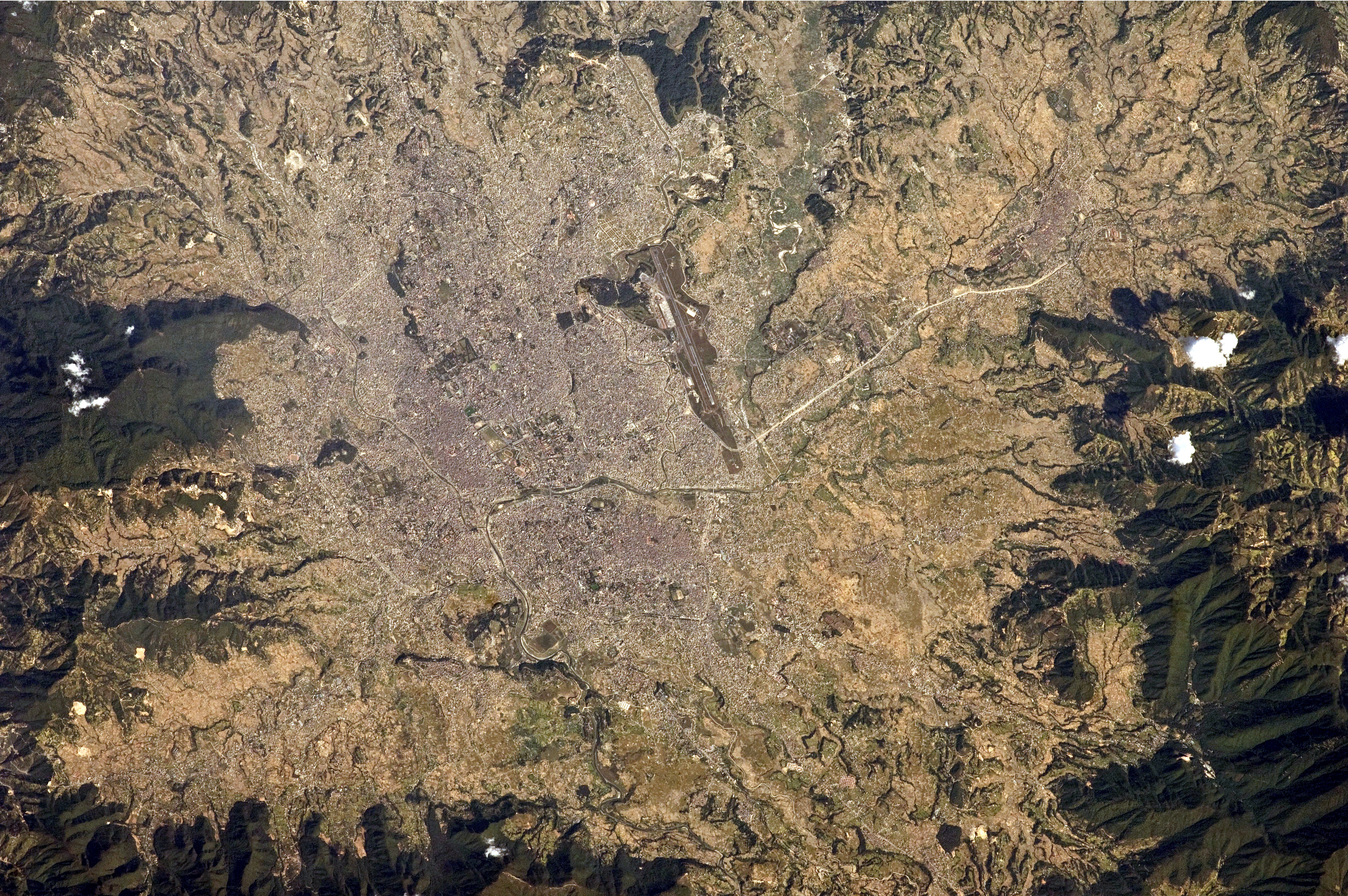 The green, vegetated slopes that surround the Kathmandu metro area (light grey, image centre) include both forest reserves and national parks
 -
 Araniko Highway connects Kathmandu to Bhaktapur and onwards to the Chinese border.
 -
 Northeastern Kathmandu with Gaurishankar in background.


Places adjacent to Kathmandu | ||||||||||
|---|---|---|---|---|---|---|---|---|---|---|
| ||||||||||




Kathmandu administration[edit | edit source]
Kathmandu and adjacent cities are composed of neighbourhoods, which are utilized quite extensively and more familiar among locals. However, administratively the city is divided into 32 wards, numbered from 1 to 32. Earlier, there were 35 wards which made it the metropolitan city with the largest number of the wards.
Climate[edit | edit source]
| Kathmandu | ||||||||||||||||||||||||||||||||||||||||||||||||||||||||||||
|---|---|---|---|---|---|---|---|---|---|---|---|---|---|---|---|---|---|---|---|---|---|---|---|---|---|---|---|---|---|---|---|---|---|---|---|---|---|---|---|---|---|---|---|---|---|---|---|---|---|---|---|---|---|---|---|---|---|---|---|---|
| Climate chart (explanation) | ||||||||||||||||||||||||||||||||||||||||||||||||||||||||||||
| ||||||||||||||||||||||||||||||||||||||||||||||||||||||||||||
| ||||||||||||||||||||||||||||||||||||||||||||||||||||||||||||
Under Köppen's climate classification, portions of the city with at lower elevations (1300-1400m), which make up 88% of the total area, have a humid subtropical climate (Cwa), while portions of the city with higher elevations generally have a subtropical highland climate (Cwb). In the Kathmandu Valley, which is representative of its valley's climate, the average summer temperature varies from 22 to 25 °C (72 to 77 °F). The average winter temperature is 10.1 °C (50.2 °F). Five major climatic regions are found in Nepal. Of these, High hills of Kathmandu Valley including Chandragiri hill is in the Warm Temperate Zone (elevation ranging from 1,200 to 2,300 metres (3,900 to 7,500 ft)), where the climate is fairly temperate, atypical for the region. This zone is followed by the Cool Temperate Zone with elevation varying between 2,100 and 3,300 metres (6,900 and 10,800 ft).
The city generally has a climate with warm days followed by cool nights and mornings. Unpredictable weather is expected, given that temperatures can drop to 0 °C (32 °F) or less during the winter.[41] The lowest ever temperature of −3.5 °C was recorded in 1978.[41] While snowfall is generally confined to the hills surrounding the city,[42] there have been a few instances of snowfall in city, most notably in 1945 and 2007.[43]
Rainfall is mostly monsoon-based (about 65% of the total concentrated during the monsoon months of June to September), and decreases substantially (100 to 200 cm (39 to 79 in)) from eastern Nepal to western Nepal. The average annual rainfall for the city is around 1400 mm (55 in).[44] On average humidity is 75%.[37][45][46] The chart below is based on data from the Nepal Bureau of Standards & Meteorology, Weather Meteorology for 2005. The chart provides minimum and maximum temperatures during each month. The annual amount of precipitation was 1,124 millimetres (44.3 in) for 2005, as per monthly data included in the table above.[46] The decade of 2000–2010 saw highly variable and unprecedented precipitation anomalies in Kathmandu. This was mostly due to the annual variation of the southwest monsoon.[citation needed] For example, 2001 recorded only 356 mm (14 in) of precipitation due to an extraordinarily weak monsoon season. In contrast, 2003 was the wettest year ever in Kathmandu, totaling over 2,900 mm (114 in) of precipitation due to an exceptionally strong monsoon season.
| Climate data for Kathmandu (Tribhuvan International Airport), elevation 1,337 m (4,386 ft) (1991–2020 normals, extremes 1968–present) | |||||||||||||
|---|---|---|---|---|---|---|---|---|---|---|---|---|---|
| Month | Jan | Feb | Mar | Apr | May | Jun | Jul | Aug | Sep | Oct | Nov | Dec | Year |
| Record high °C (°F) | 27.4 (81.3) |
29.2 (84.6) |
31.6 (88.9) |
35.6 (96.1) |
36.6 (97.9) |
35.2 (95.4) |
34.6 (94.3) |
32.6 (90.7) |
33.2 (91.8) |
31.9 (89.4) |
30.0 (86.0) |
25.2 (77.4) |
36.6 (97.9) |
| Average high °C (°F) | 19.2 (66.6) |
22.1 (71.8) |
26.0 (78.8) |
28.6 (83.5) |
29.2 (84.6) |
29.5 (85.1) |
28.7 (83.7) |
29.0 (84.2) |
28.6 (83.5) |
27.2 (81.0) |
23.6 (74.5) |
20.2 (68.4) |
26.0 (78.8) |
| Daily mean °C (°F) | 11.0 (51.8) |
13.7 (56.7) |
17.4 (63.3) |
20.5 (68.9) |
22.7 (72.9) |
24.4 (75.9) |
24.5 (76.1) |
24.6 (76.3) |
23.7 (74.7) |
20.6 (69.1) |
16.0 (60.8) |
12.2 (54.0) |
19.3 (66.7) |
| Average low °C (°F) | 2.8 (37.0) |
5.3 (41.5) |
8.8 (47.8) |
12.3 (54.1) |
16.1 (61.0) |
19.3 (66.7) |
20.3 (68.5) |
20.2 (68.4) |
18.8 (65.8) |
13.9 (57.0) |
8.4 (47.1) |
4.2 (39.6) |
12.5 (54.5) |
| Record low °C (°F) | −3.5 (25.7) |
−2.4 (27.7) |
0.5 (32.9) |
3.5 (38.3) |
8.7 (47.7) |
11.1 (52.0) |
13.1 (55.6) |
13.0 (55.4) |
11.8 (53.2) |
5.8 (42.4) |
1.3 (34.3) |
−1.9 (28.6) |
−3.5 (25.7) |
| Average precipitation mm (inches) | 15.2 (0.60) |
23.6 (0.93) |
38.0 (1.50) |
62.9 (2.48) |
128.8 (5.07) |
241.4 (9.50) |
384.1 (15.12) |
342.7 (13.49) |
207.8 (8.18) |
43.3 (1.70) |
6.4 (0.25) |
7.8 (0.31) |
1,502 (59.13) |
| Average precipitation days (≥ 1.0 mm) | 1.9 | 2.6 | 3.9 | 6.6 | 11.9 | 16.9 | 23.1 | 22.7 | 14.6 | 3.8 | 0.5 | 0.7 | 109.4 |
| Average relative humidity (%) | 79 | 71 | 61 | 53 | 57 | 73 | 81 | 83 | 82 | 79 | 85 | 80 | 74 |
| Mean monthly sunshine hours | 210 | 209 | 236 | 230 | 244 | 175 | 130 | 160 | 156 | 233 | 228 | 211 | 2,422 |
| Mean daily sunshine hours | 6.6 | 7.6 | 7.9 | 7.1 | 7.7 | 5.9 | 3.9 | 4.5 | 5.4 | 6.3 | 7.9 | 6.2 | 6.4 |
| Source 1: World Meteorological Organization[47] | |||||||||||||
| Source 2: Department of Hydrology and Meteorology,[48] Deutscher Wetterdienst (sun 1961–1990, daily sun 1979-1988)[49][50] | |||||||||||||
Parks[edit | edit source]
Environment[edit | edit source]
Air quality[edit | edit source]

Air pollution is a major issue in the Kathmandu Valley.[51][52][53] According to the 2016 World Health Organization's Ambient Air Pollution Database,[54] the annual average PM2.5 (particulate matter) concentration in 2013 was 49 μg/m3, which is 4.9 times higher than recommended by the World Health Organization.[55][56]
Starting in early 2017, the Government of Nepal and the Embassy of the United States in Kathmandu have monitored and publicly share real-time air quality data. In Nepal and Kathmandu, the annual premature deaths due to air pollution reached 37,399 and 9,943 respectively, according to a Republica news report published on 23 November 2019. This indicates, around a quarter of the total deaths due to air pollution in Nepal are in Kathmandu.[57][58]
Demographics[edit | edit source]

Kathmandu's urban cosmopolitan character has made it the most populous city in Nepal. According to the National Population Census of 2011, the total population of Kathmandu city was 975,543 in 254,292 households with an annual growth rate of 6.12% with respect to the population figure of 2001.[59] 70% of the total population residing in Kathmandu are aged between 15 and 59.
In one decade, the population increased from 427,045 in 1991 to 671,805 in 2001. The population was projected to reach 915,071 in 2011 and 1,319,597 by 2021. To keep up this population growth, the KMC-controlled area of 5,076.6 hectares (12,545 acres) expanded to 8,214 hectares (20,300 acres) in 2001. With this new area, the population density which was 85 in 1991 remained 85 in 2001; it is likely to jump to 111 in 2011 and 161 in 2021.[60]
Languages[edit | edit source]
As of the 2011 census, Nepali is the most common mother tongue in Kathmandu, with 62% of the population speaking it as their mother tongue. Newari is spoken by 19%, and the other languages spoken in the city include Tamang (6%), Maithili (3%), Bhojpuri (2%), Gurung (2%), Magar (2%) and Sherpa (1%) as their first language. English is also spoken by many.[61]
Ethnic groups[edit | edit source]
Ethnic groups in Kathmandu
The largest group is the native Newars, whose various sub-groups combine to make up 24.59% of the population. The Bahuns, also known as Hill-Brahmin or Khas Brahmin, representing 21.62% of the population. They are part of the broader Khas community, as are the Chhetri, the third largest group, who account for 18.66% of the population. Tamang community composites of 7.74% making them 4th largest group in Kathmandu metropolitan.
| Broad Ethnic Category | Sub Category[62] | Linguistic Family | Population Percentage |
|---|---|---|---|
| Khas Aryan (Hill/Pahari Caste Groups) | Khas Brahmin, Chhetri, Kami, Thakuri, Damai Sarki, Sanyasi/Dasnami | Indo-Aryan | 46.3% |
| Newar (Kathmandu Valley Caste Groups) | Newari Brahmin, Shrestha, Tamrakar, Dangol, Maharjan, Rajkarnikar, etc. | Sino-Tibetan | 24.7% |
| Janajati (Hill Tribal Groups) | Magar, Tamang, Gurung, Sherpa, Rai, Limbu, etc. | Sino-Tibetan | 19.2% |
| Maithil (Terai Caste Groups) | Maithil Yadav, Maithil Brahmins, Chamar, Kushwaha, Musahar, Kurmi, Dhanuk, etc. | Indo-Aryan | 4.1% |
| Muslim[lower-alpha 2] | – | Indo-Aryan | 1.8% |
| Marwadi, Rajbanshi | - | Indo-Aryan | 1.6% |
| Adibasi (Terai Indigenous Groups) | Tharu, Rajbanshi, Tajpuriya, Santhal etc. | Indo-Aryan And Sino-Tibetan | 1.5% |
| Others | – | Indo-Aryan and Sino-Tibetan | 1.5% |
Religions[edit | edit source]
Hinduism[edit | edit source]

Hinduism is one of the indigenous beliefs of the city. Assumedly, together with the kingdom of Licchhavi (c. 400 to 750), Hinduism and the endogam social stratification of the caste was established in Kathmandu Valley. [citation needed] The Pashupatinath Temple, Changu Narayan Temple, and the Kasthamandap are of particular importance to Hindus. Other notable Hindu temples in Kathmandu and the surrounding valley include Bajrayogini Temple, Dakshinkali Temple, Guhyeshwari Temple, and the Shobha Bhagawati shrine.
The Bagmati River which flows through Kathmandu is considered a holy river both by Hindus and Buddhists, and many Hindu temples are on the banks of this river. The importance of the Bagmati also lies in the fact that Hindus are cremated on its banks, and Kirants are buried in the hills by its side. According to the Nepali Hindu tradition, the dead body must be dipped three times into the Bagmati before cremation. The chief mourner (usually the first son) who lights the funeral pyre must take a holy riverwater bath immediately after cremation. Many relatives who join the funeral procession also take bath in the Bagmati or sprinkle the holy water on their bodies at the end of cremation as the Bagmati is believed to purify people spiritually.

Buddhism[edit | edit source]
Buddhism was brought into Kathmandu with the arrival of Buddhist monks during the time of Buddha (c. 563 – 483 BCE[64]). They established a forest monastery in Sankhu. This monastery was renovated by Shakyas after they fled genocide from Virudhaka (r. 491–461 BCE).
During the Hindu Lichchavi era (c. 400 to 750), various monasteries and orders were created which successively led to the formation of Newar Buddhism, which is still practiced in the primary liturgical language of Hinduism, Sanskrit.
Legendary Princess Bhrikuti (7th-century) and artist Araniko (1245–1306 CE) from that tradition of Kathmandu valley played a significant role in spreading Buddhism in Tibet and China. There are over 108 traditional monasteries (Bahals and Baháʼís) in Kathmandu based on Newar Buddhism. Since the 1960s, the permanent Tibetan Buddhist population of Kathmandu has risen significantly so that there are now over fifty Tibetan Buddhist monasteries in the area. Also, with the modernization of Newar Buddhism, various Theravada Bihars have been established.
Kirat Mundhum[edit | edit source]

Kirant Mundhum is one of the indigenous animistic practices of Nepal. It is practiced by the Kirat people. Some animistic aspects of Kirant beliefs, such as ancestor worship (worship of Ajima) are also found in Newars of Kirant origin. Ancient religious sites believed to be worshipped by ancient Kirats, such as Pashupatinath, Wanga Akash Bhairabh (Yalambar) and Ajima are now worshipped by people of all Dharmic religions in Kathmandu. Kirats who have migrated from other parts of Nepal to Kathmandu practice Mundhum in the city.[65]
Other religions[edit | edit source]
Sikhism is practiced primarily in Gurudwara at Kupundole. An earlier temple of Sikhism is also present in Kathmandu which is now defunct.[citation needed]
Jainism is practiced by a small community. A Jain temple is present in Gyaneshwar, where Jains practice their faith.[citation needed]
According to the records of the Spiritual Assembly of the Baháʼís of Nepal, there are approximately 300 followers of the Baháʼí Faith in Kathmandu valley. They have a national office in Shantinagar, Baneshwor. The Baháʼís also have classes for children at the National Centre and other localities in Kathmandu.[citation needed]
In Kathmandu alone there are about 170 Christian churches.[66] Christian missionary hospitals, welfare organizations, and schools are also operating. Nepali citizens who served as soldiers in Indian and British armies, who had converted to Christianity while in service, on return to Nepal continue to practice their religion. They have contributed to the spread of Christianity and the building of churches in Nepal and in Kathmandu, in particular.[67][68]
Economy[edit | edit source]

The location and terrain of Kathmandu have played a significant role in the development of a stable economy which spans millennia. The city is in an ancient lake basin, with fertile soil and flat terrain. This geography helped form a society based on agriculture. This, combined with its location between India and China, helped establish Kathmandu as an important trading centre over the centuries. Kathmandu's trade is an ancient profession that flourished along an offshoot of the Silk Road which linked India and Tibet. From centuries past, Lhasa Newar merchants of Kathmandu have conducted trade across the Himalaya and contributed to spreading art styles and Buddhism across Central Asia.[69] Other traditional occupations are farming, metal casting, woodcarving, painting, weaving, and pottery.[70]
Kathmandu is the most important industrial and commercial centre in Nepal. The Nepal Stock Exchange, the head office of the national bank, the chamber of commerce, as well as head offices of national and international banks, telecommunication companies, the electricity authority, and various other national and international organizations are in Kathmandu. The major economic hubs are the New Road, Durbar Marg, Ason and Putalisadak.[70]
The economic output of the metropolitan area of around Rs. 550 billion approximately per year alone is worth more than one third of national GDP (nominal), while the per capita income of $2200 is approximately three times the national average.[71] Kathmandu exports handicrafts, artworks, garments, carpets, pashmina, paper; trade accounts for 21% of its revenues.[70][71] Manufacturing is also important and accounts for 19% of the revenue that Kathmandu generates. Garments and woolen carpets are the most notable manufactured products.[71] Other economic sectors in Kathmandu include agriculture (9%), education (6%), transport (6%), and hotels and restaurants (5%).[71] Kathmandu is famous for lokta paper and pashmina shawls.
Real estate[edit | edit source]
Tourism[edit | edit source]

Tourism in Nepal is considered an important industry. In 1956, air transportation was established and the construction of Tribhuvan Highway, between Kathmandu and Raxaul, was started. Separate organizations were created in Kathmandu to promote the tourism industry, including the Tourism Development Board, the Department of Tourism, and the Civil Aviation Department. Furthermore, Nepal became a member of several international tourist associations. Establishing diplomatic relations with other nations further accentuated this activity. The hotel industry, travel agencies, the training of tourist guides, and targeted publicity campaigns are the chief reasons for the significant growth of this industry in Nepal and in Kathmandu in particular.[72]

Tourism is a major source of income for most of the people in the city, with several hundred thousand visitors annually. Hindu and Buddhist pilgrims from all over the world visit Kathmandu's religious sites such as Pashupatinath Temple, Swayambhunath, Boudhanath, Changu Narayan Temple, and Budhanilkantha Temple. From a mere 6,179 tourists in 1961/62, the number increased to 491,504 in 1999/2000. In economic terms, the foreign exchange registered 3.8 percent of the GDP in 1995/96 but then started declining. Following the end of Nepalese Civil War, there was a significant rise in the number of tourist arrivals, with 509,956 tourists recorded in 2009. Since then, tourism has improved as the country transitioned into a republic. The high level of tourism is attributed to the natural grandeur of the Himalayas and the cultural heritage of the country which is continuously preserved and restored at great cost.[72]
.jpg)
The neighbourhood of Thamel is Kathmandu's primary go-to place for tourists and is widely regarded as the center of Kathmandu's nightlife, packed with guest houses, restaurants, shops, and bookstores, catering to tourists. Another neighbourhood of growing popularity is Jhamel, a name for Jhamsikhel that was coined to rhyme with Thamel.[73] Jhochhen Tol, also known as Freak Street remains a traveler haunt. This original meeting place for international guests in Kathmandu became known in the 1960s and 1970s through folklore told by hippies in Europe and North America.[74]
With the opening of the tourist industry after the change in the political scenario of Nepal in 1950, the hotel industry drastically improved.[75] Now Kathmandu boasts several luxury hotels with some including casinos. Ason is a bazaar and ceremonial square on the old trade route to Tibet.[76]
Media and entertainment[edit | edit source]
Government and public services[edit | edit source]
Civic administration[edit | edit source]

Kathmandu Municipal Corporation (KMC) is the chief nodal agency for the administration of Kathmandu. The Municipality of Kathmandu was upgraded to a metropolitan city in 1995.
Metropolitan Kathmandu is divided into five sectors: the Central Sector, the East Sector, the North Sector, the City Core and the West Sector. For civic administration, the city is further divided into 32 administrative wards. The Council administers the Metropolitan area of Kathmandu city through its 177 elected representatives and 20 nominated members. It holds biannual meetings to review, process and approve the annual budget and make major policy decisions.[37][77] The ward's profile documents for the 32 wards prepared by the Kathmandu Metropolitan Council is detailed and provides information for each ward on population, the structure and condition of houses, the type of roads, educational, health and financial institutions, entertainment facilities, parking space, security provisions, etc. It also includes lists of development projects completed, on-going and planned, along with informative data about the cultural heritage, festivals, historical sites and the local inhabitants. Ward 16 is the largest, with an area of 437.4 ha; ward 26 is the smallest, with an area of 4 ha.[78]
Kathmandu is the headquarters of the surrounding Kathmandu District.
Law and order[edit | edit source]
The Metropolitan Police is the main law enforcement agency in the city. It is headed by a commissioner of police. The Metropolitan Police is a division of the Nepal Police, and the administrative control lies with the Ministry of Home Affairs.
Fire service[edit | edit source]

The fire service, known as the Barun Yantra Karyalaya (Script error: The function "langx" does not exist.), opened its first station in Kathmandu in 1937 with a single vehicle.[79] An iron tower was erected to monitor the city and watch for a fire. As a precautionary measure, firemen were sent to the areas which were designated as accident-prone areas.[79] In 1944, the fire service was extended to the neighbouring cities of Lalitpur and Bhaktapur. In 1966, a fire service was established in Kathmandu central airport.[79] In 1975, a West German government donation added seven fire engines to Kathmandu's fire service.[79] The fire service in the city is also overlooked by an international non-governmental organization, the Firefighters Volunteer Association of Nepal (FAN), which was established in 2000 with the purpose of raising public awareness about fire and improving safety.[79]
Electricity and water supply[edit | edit source]

Electricity in Kathmandu is regulated and distributed by the Nepal Electricity Authority (NEA). Water supply and sanitation facilities are provided by the Kathmandu Upatyaka Khanepani Limited (KUKL). There is a severe shortage of water for household purposes such as drinking, bathing, cooking and washing and irrigation. People have been using bottled mineral water, water from tank trucks and from the ancient dhunge dharas (Script error: The function "langx" does not exist.) for all the purposes related to water. The city water shortage should be solved by the completion of the much plagued Melamchi Water Supply Project by the end of 2019. Despite continued efforts by governmental bodies, Kathmandu is one of the most polluted cities in Nepal, largely due to overpopulation.[80][81]
Waste management[edit | edit source]
Waste management may be through composting in municipal waste management units, and at houses with home composting units. Both systems are common and established in India and neighbouring countries.[82]
Architecture and cityscape[edit | edit source]
Template:Kathmandu valley World Heritage Site (WHS) Monuments
The ancient trade route between India and Tibet that passed through Kathmandu enabled a fusion of artistic and architectural traditions from other cultures to be amalgamated with local art and architecture.[83] The monuments of Kathmandu City have been influenced over the centuries by Hindu and Buddhist religious practices. The architectural treasure of the Kathmandu valley has been categorized under the well-known seven groups of heritage monuments and buildings. In 2006 UNESCO declared these seven groups of monuments as a World Heritage Site (WHS). The seven monuments zones cover an area of 189 hectares (470 acres), with the buffer zone extending to 2,394 hectares (5,920 acres). The Seven Monument Zones inscribed originally in 1979 and with a minor modification in 2006 are the Durbar squares of Hanuman Dhoka, Patan and Bhaktapur, the Hindu temples of Pashupatinath and Changunarayan, the Buddhist stupas of Swayambhunath and Boudhanath.[84][85]


Durbar Squares[edit | edit source]
The literal meaning of Durbar Square is a "place of palaces". There are three preserved Durbar Squares in Kathmandu valley and one unpreserved in Kirtipur. The Durbar Square of Kathmandu is in the old city and has heritage buildings representing four kingdoms (Kantipur, Lalitpur, Bhaktapur, Kirtipur); the earliest being the Licchavi dynasty. The complex has 50 temples and is distributed in two quadrangles of the Durbar Square. The outer quadrangle has the Kasthamandap, Kumari Ghar, and Shiva-Parvati Temple; the inner quadrangle has the Hanuman Dhoka palace. The squares were severely damaged in the April 2015 earthquake.
Hanuman Dhoka is a complex of structures with the royal palace of the Malla kings and of the Shah dynasty. It is spread over five acres. The eastern wing (with ten courtyards) is the oldest part, dating to the mid-16th century. It was expanded by King Pratap Malla in the 17th century with many temples. The royal family lived in this palace until 1886 when they moved to Narayanhiti Palace. The stone inscription outside is in fifteen languages.
Kumari Ghar is a palace in the centre of the Kathmandu city, next to the Durbar square where a royal Kumari selected from several Kumaris resides. Kumari (or Kumari Devi), is the tradition of worshipping young pre-pubescent girls as manifestations of the divine female energy (or devi) in South Asian countries. In Nepal, the selection process is very rigorous. Previously, during the time of the monarchy, the queen and the priests used to appoint the proposed Kumari with delicate process of astrological examination and physical examination of 32 'gunas'. The china (Script error: The function "langx" does not exist.), an ancient Hindu astrological report of the Kumari and the reigning king, has been said to be similar. The Kumari is believed to be a bodily incarnation of the goddess Taleju (the Nepali name for Durga) until she menstruates, after which it is believed that the goddess vacates her body. Serious illness or a major loss of blood from an injury also causes her to revert to common status. The current Kumari, Trishna Shakya, age three at the time of appointment, was installed in September 2017 succeeding Matina Shakya who was the first Kumari of Kathmandu after the end of the monarchy.[86]
Kasthamandap is a three-storeyed temple enshrining an image of Gorakhnath. It was built in the 16th century in the pagoda style. The name of Kathmandu is a derivative of the word Kasthamandap. It was built under the reign of King Laxmi Narsingha Malla. Kasthamandap stands at the intersection of two ancient trade routes linking India and Tibet at Maru square. It was originally built as a rest house for travellers.
Pashupatinath temple[edit | edit source]


The Pashupatinath Temple (Script error: The function "langx" does not exist.) is a famous 5th century Hindu temple dedicated to Shiva. Located on the banks of the Bagmati River, the Pashupatinath Temple is the oldest Hindu temple in Kathmandu.[87] It served as the seat of national deity, Pashupatinath, until Nepal was secularized. However, a significant part of the temple was destroyed by Mughal invaders in the 14th century and little or nothing remains of the original 5th-century temple exterior. The temple as it stands today was built in the 19th century, although the image of the bull and the black four-headed image of Pashupati are at least 300 years old.[88] The temple is a UNESCO World Heritage Site.[88][89] Shivaratri, or the night of Shiva, is the most important festival that takes place here, attracting thousands of devotees and sadhus.[90]
Believers in Pashupatinath (mainly Hindus) are allowed to enter the temple premises, but non-Hindu visitors are allowed to view the temple only from the across the Bagmati River.[88] The priests who perform the services at this temple have been Brahmins from Karnataka in southern India since the time of Malla king Yaksha Malla.[91] This tradition is believed to have been started at the request of Adi Shankara who sought to unify the states of Bhāratam, a region in south Asia believed to be ruled by a mythological king Bharata, by encouraging cultural exchange. This procedure is followed in other temples around India, which were sanctified by Adi Shankara.
The temple is built in the pagoda style of architecture, with cubic constructions and carved wooden rafters (tundal) on which they rest, and two-level roofs made of copper and gold.
Boudhanath[edit | edit source]

Boudhanath (Script error: The function "langx" does not exist.; also written as Bouddhanath, Bodhnath, Baudhanath or the Khāsa Chaitya), is one of the holiest Buddhist sites in Nepal, along with the Swayambhunath. It is a very popular tourist site. Boudhanath is known as Khāsti by Newars and as Bauddha or Bodhnāth by speakers of Nepali.[92] About 11 km (7 mi) from the centre and northeastern outskirts of Kathmandu, the stupa's massive mandala makes it one of the largest spherical stupas in Nepal.[93] Boudhanath became a UNESCO World Heritage Site in 1979.
The base of the stupa has 108 small depictions of the Dhyani Buddha Amitabha. It is surrounded with a brick wall with 147 niches, each with four or five prayer wheels engraved with the mantra, Om mani padme hum.[94] At the northern entrance where visitors must pass is a shrine dedicated to Ajima, the goddess of smallpox.[94] Every year the stupa attracts many Tibetan Buddhist pilgrims who perform full body prostrations in the inner lower enclosure, walk around the stupa with prayer wheels, chant, and pray.[94] Thousands of prayer flags are hoisted up from the top of the stupa downwards and dot the perimeter of the complex. The influx of many Tibetan refugees from China has seen the construction of over 50 Tibetan gompas (monasteries) around Boudhanath.

Swayambhu[edit | edit source]
Swayambhunath (Script error: The function "langx" does not exist.) is a Buddhist stupa atop a hillock at the northwestern part of the city. This is among the oldest religious sites in Nepal. Although the site is considered Buddhist, it is revered by both Buddhists and Hindus. The stupa consists of a dome at the base; above the dome, there is a cubic structure with the eyes of Buddha looking in all four directions.[clarification needed] There are pentagonal toran above each of the four sides, with statues engraved on them. Behind and above the torana there are thirteen tiers. Above all the tiers, there is a small space above which lies a gajur.
.jpg)
Rani Pokhari[edit | edit source]
Ranipokhari (Script error: The function "langx" does not exist.) is a historic artificial pond nestled in the heart of Kathmandu. It was built by king Pratap Malla in 1670 for his beloved queen after she lost her son and could not recover from her loss.[95] A large stone statue of an elephant in the south signifies the image of Pratap Malla and his two sons. Balgopaleshwor Temple stands still inside the temple above the pond. Rani Pokhari is opened once a year during the final day of Tihar i.e. Bhai Tika and Chhath festival. The world's largest Chhath takes place every year in Ranipokhari. The pond is one of Kathmandu's most famous landmarks and is known for its religious and aesthetic significance. After sustaining damages from the 2015 earthquake, Ranipokhari went under development, which began in 2019 and the reconstruction was completed in October 2020.[96]
Education[edit | edit source]
The oldest modern school in Nepal, the Durbar High School, and the oldest college, the Tri-Chandra College, are both in Kathmandu.
The oldest engineering college in Nepal, Thapathali Campus also lies in Kathmandu. Not surprisingly the best schools and colleges of Nepal are located in Kathmandu and its adjoining cities. Every year thousands of students from all over Nepal arrive at Kathmandu to get admission in the various schools and colleges.
Healthcare[edit | edit source]
Healthcare in Kathmandu is the most developed in Nepal, and the city and surrounding valley is home to some of the best hospitals and clinics in the country. Bir Hospital is the oldest, established in July 1889 by Bir Shamsher Jang Bahadur Rana. Notable hospitals include Bir Hospital, Nepal Medical College (Jorpati) and Teaching Hospital, Tribhuvan University Institute of Medicine (Teaching Hospital), Patan Hospital, Kathmandu Model Hospital, Scheer Memorial Hospital, Om Hospital, Norvic Hospital, Grande International Hospital, Nobel Hospital and many more.
The city is supported by specialist hospitals/clinics such as Shahid Shukraraj Tropical Hospital, Shahid Gangalal Foundation, Kathmandu Veterinary Hospital, Nepal Eye Hospital, Kanti Children's Hospital, Nepal International Clinic (Travel and Mountain Medicine Center), Neuro Center, Spinal Rehabilitation center and Bhaktapur Cancer Hospital. Most of the general hospitals are in the city center, although several clinics are elsewhere in Kathmandu district.
Tilganga Institute of Ophthalmology is an ophthalmology hospital in Kathmandu. It pioneered the production of low cost intraocular lenses (IOLs), which are used in cataract surgery.[97] The team of Dr. Sanduk Ruit in Tilganga pioneered sutureless small-incision cataract surgery (SICS),[98][99] a technique which has been used to treat 4 million of the world's 20 million people with cataract blindness.
Medical colleges[edit | edit source]
Institute of Medicine, the central college of Tribhuvan University is the first medical college of Nepal and is in Maharajgunj, Kathmandu. It was established in 1972 and started to impart medical education from 1978. Other major institutions include Patan Academy of Health Sciences, Kathmandu Medical College, Nepal Medical College, KIST Medical College, Nepal Army Institute of Health Sciences, National Academy of Medical Sciences (NAMS) and Kathmandu University School of Medical Sciences (KUSMS), are also in or around Kathmandu.[100]
Transport[edit | edit source]

Road[edit | edit source]
The total length of roads in Nepal is recorded to be 17,182 km (10,676 mi), as of 2003–04. This fairly large network has helped the economic development of the country, particularly in the fields of agriculture, horticulture, vegetable farming, industry and also tourism.[101] In view of the hilly terrain, transportation takes place in Kathmandu are mainly by road and air. Kathmandu is connected by the Tribhuvan Highway to the south connecting India, Prithvi Highway to the west and Araniko Highway to the north connecting China. The BP Highway connects Kathmandu to the eastern part of Nepal through Sindhuli District. The BP Highway was constructed as a short cut from Kathmandu to Terai.[102]
Sajha Yatayat provides regular bus services throughout Kathmandu and the surrounding valley. Other bus companies including micro-bus companies operate several unscheduled routes. Trolleybuses in Kathmandu used to be operate on the route between Tripureshwor and Suryabinayak Municipality.
Airport[edit | edit source]

Tribhuvan International Airport is abbreviated as TIA and in 2024 nonstop international destinations included a wide range of airports. Domestic flights are offered by several Nepali airlines. Larger aircraft that can land and takeoff on the runways of Tribhuvan International Airport are Boeing 777, Airbus A330, and Boeing 787 Dreamliner. However, the overwhelming number of scheduled flights are landed and started with the ATR 72/42 and the Bombardier Dash 8.[103][104]
Mountaineering[edit | edit source]
Ropeways and cable cars[edit | edit source]
Ropeways in Nepal are an important transportation means in hilly terrain.[105] A ropeway operated between Kathmandu and Hetauda over a length of 43 km (27 mi) which carried 25 tonnes of goods per hour. Service was discontinued due to poor carrying capacity and maintenance issues. During the Rana period, a ropeway was constructed between Matatirtha in Kathmandu to Dhorsing in Makwanpur District of over 22 km (14 mi) in length, which carried a cargo of 8 tonnes per hour. At present, cable cars are operated from Kathmandu to the Chandragiri Hills.[106]
Media[edit | edit source]
Kathmandu is the television hub of Nepal. Nepal Television (established in 1984) is the oldest and most-watched television channel in Nepal, as is government-owned NTV PLUS and also Kantipur Television, Image Channel, Sagarmatha Television, Himalaya TV, AP1 TV, and other channels.
The headquarters of many of the country's news outlets are also in the city including Kathmandu Tribune, the government-owned Gorkhapatra (the oldest national daily newspaper in Nepal), The Kathmandu Post, Nepali Times, Kantipur Publications and its paper Kantipur, Naya Patrika, The Himalayan Times, Karobar Economic Daily, Aarthik Abhiyan National Daily and Jana Aastha National Weekly.
Nepal Republic Media, the publisher of myRepublica, joined a publishing alliance with the International Herald Tribune (IHT) to publish the Asia Pacific Edition of IHT from Kathmandu from 20 July 2011. There is also a state-run National News Agency (RSS).
Radio Nepal is a state-run organization that operates national and regional radio stations; these stations are: Hits FM, Radio Kantipur, HBC 94 FM, Radio Sagarmatha and Image FM. The BBC also has an FM broadcasting station in Kathmandu. Some community radio stations such as Radio Pratibodh and Radio Upatyaka also broadcast within the valley.
Sports[edit | edit source]

Cricket, football and volleyball are the most popular sports among the younger generation in Nepal and there are several stadiums in the city.[107] The sport is governed by the National Sports Council from its headquarters in Kathmandu. The only international football stadium in the city is the Dasharath Rangasala, a multi-purpose stadium used mostly for football matches and cultural events, in the neighbourhood of Tripureshwor. Built in 1956, it is the largest stadium in Nepal with a capacity of 25,000 spectators. The Martyr's Memorial League is also held in this ground every year. The stadium was renovated with Chinese aid before the 8th South Asian Games were held in Kathmandu in 1999 and floodlights were installed. Kathmandu is home to the oldest football clubs of Nepal such as Ranipokhari Corner Team (RCT), Sankata Club and New Road Team (NRT). Other prominent clubs include Manang Marsyangdi Club, Machhindra FC, Tribhuvan Army Club (TAC) and Nepal Police Club.
Kathmandu is also home of some of the oldest cricket clubs in Nepal, such as Yengal Sports Club. Kathmandu Gorkhas represents Kathmandu in the Nepal Premier League.[108]
International relations and organizations[edit | edit source]

Kathmandu established an International Relations Secretariat in order to promote international relations. The city's first international relationship was established in 1975 with the city of Eugene, Oregon, United States; this was further enhanced by establishing formal relationships with 15 other cities:[109] Matsumoto (Japan), Rochester (United States), Fredericksburg (United States), Boulder (United States), Yangon (formerly Rangoon, Myanmar), Xi'an (China), Shenzhen (China), Chengdu (China), Lhasa (China), Nanjing (China), Lanzhou (China), Minsk (Belarus), Varanasi (India), Seoul (South Korea) and Pyongyang (North Korea).
Kathmandu's constant endeavour is to enhance its interaction with other South Asian countries, other international agencies and many other major cities of the world to achieve better urban management and developmental programs for Kathmandu.[110] Kathmandu is home to several international and regional organizations, including the South Asian Association for Regional Cooperation (SAARC) and the International Centre for Integrated Mountain Development (ICIMOD).
Twin towns – sister cities[edit | edit source]
Kathmandu is twinned with:[111]
 Eugene, United States
- Fredericksburg, United States
- Boulder, United States
- Rochester, United States
 Lhasa, China
- Shenzhen, China
- Chengdu, China
- Lanzhou, China
- Xi'an, China
- Nanjing, China
 Matsumoto, Japan
- Template:Country data ROKTemplate:Preview warning Seoul, South Korea
 Pyongyang, North Korea
 Varanasi, India
- Template:Country data MMRTemplate:Preview warning Yangon, Myanmar
 Minsk, Belarus
Proposed sister cities[edit | edit source]
Notable people[edit | edit source]
- King Tribhuvan
- King Mahendra
- King Birendra
- Bhimsen Thapa, Prime Minister of Nepal
- Jigme Khesar Namgyel Wangchuck, King of Bhutan
- Jung Bahadur Rana, Prime Minister of Nepal
- Rana Jang Pande, Prime Minister of Nepal
- Gehendra Sumsher Rana, first scientist of Nepal
- Laxmi Prasad Devkota, writer
- Martyrs of Nepal:
- Madan Krishna Shrestha, actor and comedian
- Hari Bansha Acharya, actor and comedian
- Manisha Koirala, Bollywood actress
- Rohit Saraf, Bollywood actor
- Rajesh Hamal, actor
- Amrita Acharia, actress
- Curtis Waters, recording artist
- Anuradha Koirala, social activist
- Pushpa Basnet, social activist
- Pardeep Bastola, Nepali movie actor
- Baikuntha Manandhar, marathon runner
- Narendra Man Singh, football player
- Paras Khadka, cricketer
- Shriya Shah-Klorfine, Nepalese-Canadian who died on Mount Everest
- Priti Rijal, professional tennis player
- Sushma Shakya, artist
- Gagan Thapa, politician
- Prakash Man Singh, politician
- Balendra Shah, rapper, civil engineer,
mayor-elect in 2022 - Nirmal Purja, Nims Dai, mountaineer – 14 peaks
- Asta Narayan Manandhar, founder of the first bicycle shop in Kathmandu in 1925
- Prabal Gurung, fashion designer
- Binod Chaudhary, businessman, politician and philanthropist
Gallery[edit | edit source]
-
 Kathmandu valley as seen from the Shivapuri hills
 -

-

-
 Entrance to a building in the Durbar Square
 -
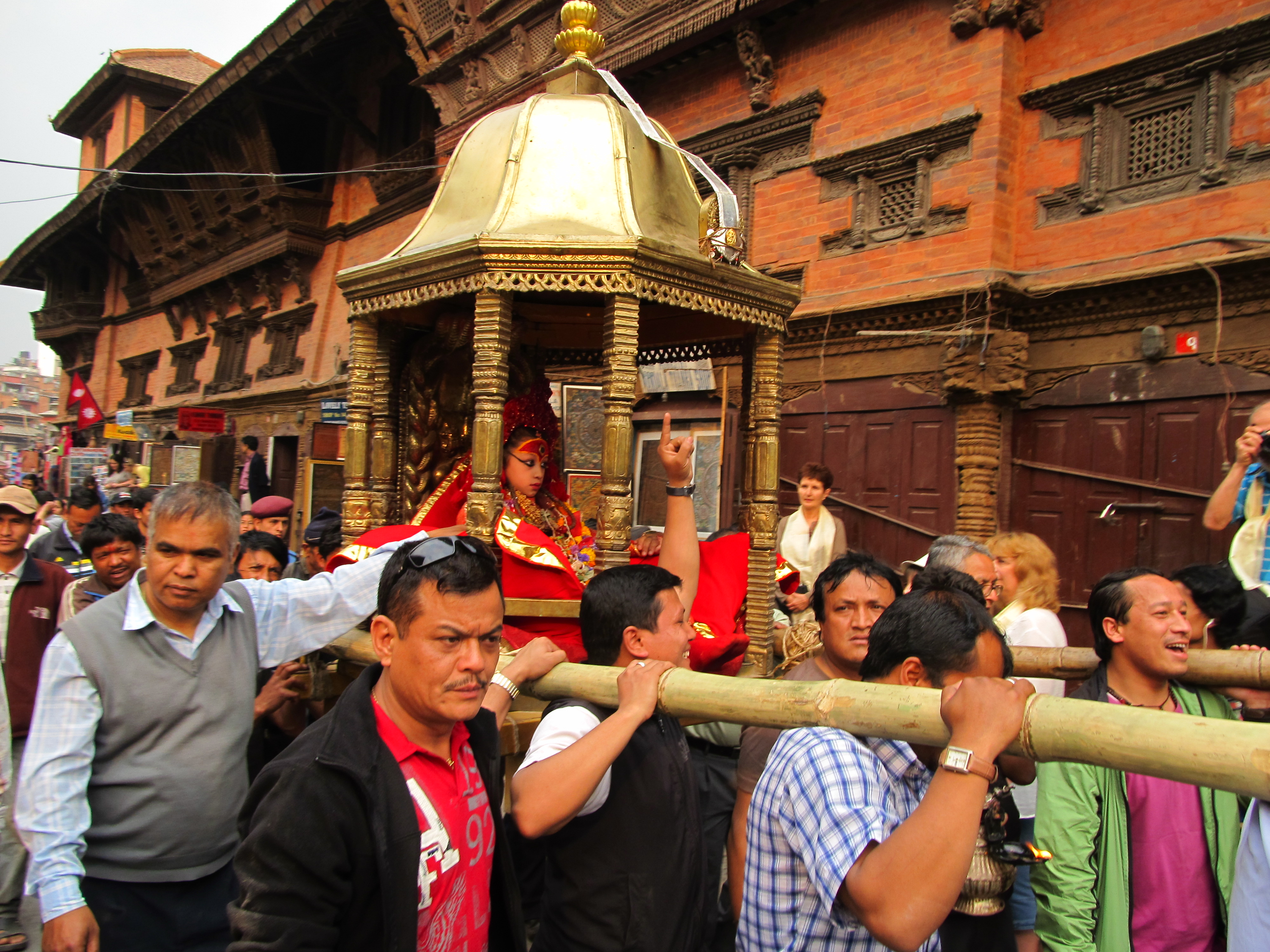 Goddess Kumari in a chariot procession
 -
 Ghanta Ghar and surrounding areas
 -
 Dharahara in 2014
 -
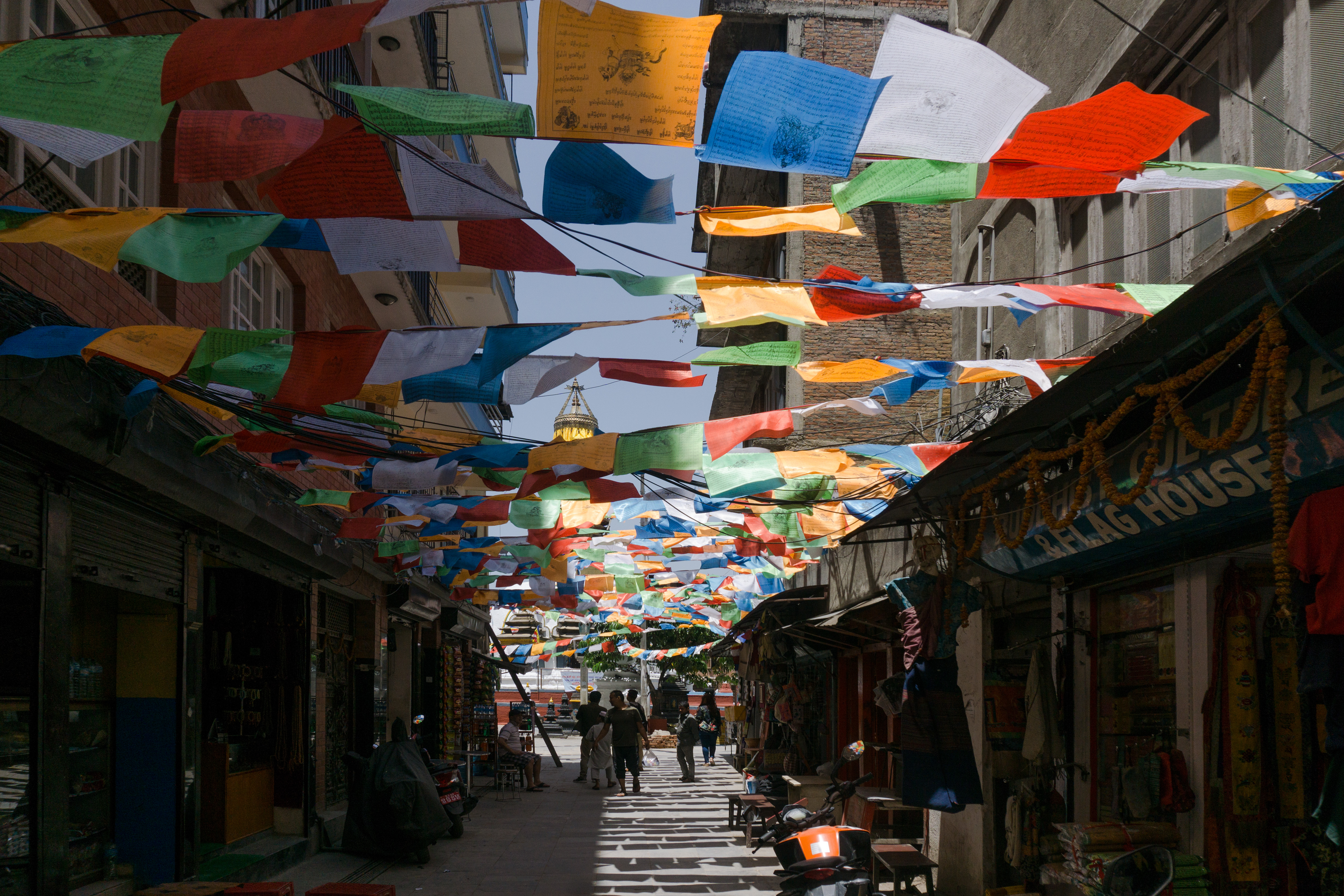 Alleyway in Boudhanath


See also[edit | edit source]
Notes[edit | edit source]
- ↑ /ˌkætmænˈduː/ (
 listen),[4] Script error: The function "langx" does not exist., Newar: 𑐫𑐾𑑃 𑐡𑐾𑐫𑑂 / येँ देय्; officially the Kathmandu Metropolitan City (Script error: The function "langx" does not exist., Newar: 𑐫𑐾𑑃 𑐩𑐴𑐵𑐣𑐐𑐬𑐥𑐵𑐮𑐶𑐎𑐵 / येँ महानगरपालिका). The city is named after the Kasthamandap temple, a 16th-century structure built entirely of wood from a single tree, located in the historic Durbar Square, which itself derives from the Sanskrit words kāṣṭha ("wood") and maṇḍapa ("pavilion").
- ↑ Census of Nepal treat Muslims as an ethnic group[63]
References[edit | edit source]
- ↑ "Kasthamandap: The Wooden Pavilion That Gave Kathmandu Its Name". Travellingcamera. 20 May 2025. Retrieved 11 August 2025.
- ↑ "Chief Administrative Officer of Kathmandu Metropolitan City". Archived from the original on 21 October 2022. Retrieved 21 November 2024.
- ↑ 3.0 3.1 "Archived copy" (PDF). cbs.gov.np. Archived from the original (PDF) on 6 February 2022. Retrieved 22 February 2022.
{{cite web}}: CS1 maint: archived copy as title (link) - ↑ "Definition of Kathmandu in English". Oxford Dictionaries. Archived from the original on 15 November 2014. Retrieved 13 June 2022.
- ↑ "Kathmandu | Rivers, History, Population, Elevation, & Map | Britannica". www.britannica.com. 17 October 2024. Retrieved 29 October 2024.
- ↑ Author. "Kathmandu - The Explorers". theexplorers.com. Retrieved 3 October 2024.
{{cite web}}:|last=has generic name (help) - ↑ "Nepal and SAARC - Ministry of Foreign Affairs Nepal MOFA". Retrieved 3 October 2024.
- ↑ "Kathmandu Valley - UNESCO World Heritage Centre". whc.unesco.org. Retrieved 3 October 2024.
- ↑ "Kathmandu Valley". whc.unesco.org. Retrieved 3 October 2024.
- ↑ "Managing Nepal's Urban Transition". World Bank. Retrieved 3 October 2024.
- ↑ "Managing Nepal's Urban Transition". World Bank. Archived from the original on 2 November 2019. Retrieved 1 December 2019.
- ↑ "Introduction". Kathmandu Metropolitan City, Government of Nepal. Archived from the original on 24 July 2011. Retrieved 12 December 2009.
- ↑ Kirkpatrick, Colonel (1811). An Account of the Kingdom of Nepaul. London: William Miller. p. 159. Retrieved 9 March 2012.
{{cite book}}: CS1 maint: publisher location (link) pp. 162–63 - ↑ Tenzin, Sunam G., ed. (2001). City Diagnostic Report for City Development Strategy: Kathmandu (PDF). Kathmandu. p. 5. Archived (PDF) from the original on 17 July 2019. Retrieved 17 July 2019.
{{cite book}}: CS1 maint: location missing publisher (link) - ↑ Malla, Kamal P. (December 1983). "The Limits of Surface Archaeology" (PDF). CNAS Journal. 11 (1). Tribhuvan University. Archived (PDF) from the original on 27 March 2014. Retrieved 28 July 2012.
- ↑ 16.0 16.1 "सुस्त उत्खनन " पुरातत्व " सम्पदा :: नेपाल". Ekantipur.com. 9 June 2010. Archived from the original on 11 September 2010. Retrieved 15 January 2012.
- ↑ "History of the Catholic Church in Nepal". apostolicnunciatureindia.com. Archived from the original on 29 December 2020. Retrieved 29 August 2020.
- ↑ Levi, Sylvain. Nepal. p. 50. Archived from the original on 11 December 2013. Retrieved 1 December 2013.
- ↑ Swoyambhu (Book), Josephson, S. 1985. Modern Printing Press, Kantipath. Available at: https://pahar.in/pahar/Books%20and%20Articles/Nepal/1985%20Swoyambu%20by%20Josephson%20s.pdf
- ↑ "History". Government of Nepal. Archived from the original on 7 January 2019. Retrieved 12 December 2009.
- ↑ "History:Ancient Nepal". Newa Travels and Tours. New Travels and Tours Ltd. Archived from the original on 21 July 2009. Retrieved 18 December 2009.
- ↑ 22.0 22.1 Apr (21 April 2010). "Article:झीसं पत्याः यानाच्वनागु अन्धविश्वास – Author:विपेन्द्र महर्जन Nepalmandal". Nepalmandal.com. Archived from the original on 3 February 2012. Retrieved 15 January 2012.
- ↑ Article:गोपालराज वंशावली Language: Nepalbhasa, Journal:नेपालभाषा केन्द्रीय विभागया जर्नल, Edition:1, Date: 1998, pp. 18–25, 44
- ↑ Sanyukta Shrestha (30 December 2017). "The First Map of Nepal". The Kathmandu Post.
{{cite web}}: CS1 maint: deprecated archival service (link) - ↑ "A Short History of Sanskrit Buddhist Manuscripts". Dsbcproject.org. Retrieved 24 November 2013.
{{cite web}}: CS1 maint: deprecated archival service (link) - ↑ "Kathmandu Metropolitan City". Kathmandu.gov.np. Archived from the original on 22 June 2012. Retrieved 24 November 2013.
- ↑ 27.0 27.1 "काष्ठमण्डप कि होममण्डप". Gorkhapatra.org.np. Archived from the original on 6 July 2012. Retrieved 24 November 2013.
- ↑ "राष्ट्रपति अचानक ग्यालरीमा | कला र शैली | :: कान्तिपुर". Ekantipur.com. Archived from the original on 20 January 2012. Retrieved 15 January 2012.
- ↑ Dietrich, Angela (1996). "Buddhist Monks and Rana Rulers: A History of Persecution". Buddhist Himalaya: A Journal of Nagarjuna Institute of Exact Methods. Archived from the original on 1 October 2013. Retrieved 24 September 2013.
- ↑ Lal, C. K. (16 February 2001). "The Rana resonance". Nepali Times. Archived from the original on 28 September 2013. Retrieved 24 September 2013.
- ↑ "Nepal: From People Power to Peace? | International Crisis Group". www.crisisgroup.org. 10 May 2006. Retrieved 19 September 2025.
- ↑ Sharma, Gopal; Shah, Chandni; Singh, Kritika (28 February 2025). Berkrot, Bill; Maler, Sandra (eds.). "Nepal's Kathmandu rattled by strong quake, no casualties reported". Reuters. Retrieved 4 March 2025.
- ↑ Saaliq, Sheikh; Shrestha, Niranjan (9 September 2025). "Anger over corruption and nepotism fuel Nepal's deadly protests over social media ban". AP News. Retrieved 19 September 2025.
- ↑ Scarr, Charlotte; Dahal, Phanindra; Butler, Gavin (10 September 2025). "Nepal: Army patrols Kathmandu as Gen Z claims protests were 'hijacked'". www.bbc.com. Retrieved 10 September 2025.
- ↑ "Nepal gets first female PM after deadly unrest". www.bbc.com. 12 September 2025. Retrieved 19 September 2025.
- ↑ "Kathmandu Metropolitan City Office – Introduction". Kathmandu Metropolitan City Office. Archived from the original on 23 June 2012. Retrieved 14 August 2014.
- ↑ 37.0 37.1 37.2 "Kathmandu Facts". Kathmandu Metropolitan City Council, Government of Nepal. Archived from the original on 31 March 2017. Retrieved 12 December 2009.
- ↑ "Geography". Kathmandu Metropolitan City. Archived from the original on 4 April 2009. Retrieved 12 December 2009.
- ↑ Shreshta, S.H (2005). Nepal in Maps. Kathmandu: Educational Publishing House. pp. 102–14.
- ↑ Shrestha S.H. p. 35
- ↑ 41.0 41.1 "Kathmandu temperature plummets to freezing point, lowest ever in eight years". Onlinekhabar. 7 January 2018. Archived from the original on 4 February 2024. Retrieved 31 December 2023.
- ↑ "Mountain districts, hills around Kathmandu witness snowfall". The Kathmandu Post. 31 December 2023. Archived from the original on 31 December 2023. Retrieved 31 December 2023.
- ↑ "Kathmandu gets first snowfall in 63 years". Reuters. 10 August 2007. Archived from the original on 17 May 2021. Retrieved 31 December 2023.
- ↑ "Nepal". Britannica. Archived from the original on 31 December 2023. Retrieved 31 December 2023.
- ↑ Shreshta, Vinod Prasad (2007). A Concise Geography of Nepal. Kathmandu: Mandal Publications. pp. 24–28. ISBN 978-99946-55-04-5.
- ↑ 46.0 46.1 "Average Temperature and Rainfall of Kathmandu City". Nepal Vista. Nepal Bureau of Standards, Weather Meteorology. Retrieved 6 November 2009.
{{cite web}}: CS1 maint: deprecated archival service (link) - ↑ "World Meteorological Organization Climate Normals for 1991–2020". World Meteorological Organization Climatological Standard Normals (1991–2020). National Oceanic and Atmospheric Administration. Archived from the original on 14 October 2023. Retrieved 15 October 2023.
- ↑ "Annual Extreme Temperatures" (PDF). Department of Hydrology and Meteorology. Archived from the original (PDF) on 14 October 2023. Retrieved 15 October 2023.
- ↑ "Station 44454 Kathmandu". Global station data 1961–1990—Sunshine Duration. Deutscher Wetterdienst. Archived from the original on 17 October 2017. Retrieved 6 November 2016.
- ↑ "Klimatafel von Kathmandu (Flugh.) / Nepal" (PDF). Federal Ministry of Transport and Digital Infrastructure. Retrieved 17 September 2016.
- ↑ Lodge, Andrew (21 March 2014). "Has air pollution made Kathmandu unliveable?". The Guardian. ISSN 0261-3077. Archived from the original on 12 December 2017. Retrieved 4 April 2017.
- ↑ "Clearing the air in Kathmandu". International Institute for Environment and Development. 7 June 2016. Archived from the original on 6 April 2017. Retrieved 4 April 2017.
- ↑ "Topography to blame for worsening air pollution". thehimalayantimes.com. 24 March 2017. Retrieved 4 April 2017.
- ↑ "WHO Global Urban Ambient Air Pollution Database (update 2016)". World Health Organization. Archived from the original on 1 March 2017. Retrieved 4 April 2017.
- ↑ "Ambient (outdoor) air quality and health". World Health Organization. Archived from the original on 4 January 2016. Retrieved 5 October 2020.
- ↑ "Ambient (outdoor) air quality and health". World Health Organization. Archived from the original on 4 January 2016. Retrieved 4 April 2017.
- ↑ "Pollution". pollution.gov.np. Archived from the original on 6 April 2017. Retrieved 4 April 2017.
- ↑ "AirNow". airnow.gov. Archived from the original on 5 April 2017. Retrieved 4 April 2017.
- ↑ "National Population and Housing Census 2011 (Village Development Committee/Municipality)". Central Bureau of Statistics. Government of Nepal, National Planning Commission, Central Bureau of Statistics. Archived from the original on 28 November 2021. Retrieved 12 November 2021.
- ↑ "Population". Kathmandu Metropolitan City, Government of Nepal. Archived from the original on 4 April 2009. Retrieved 12 December 2009.
- ↑ "Grid View: Table Language – NepalMap". nepalmap.org. Archived from the original on 9 March 2021. Retrieved 27 February 2021.
- ↑ "NepalMap profile: Kathmandu Metropolitan". Archived from the original on 27 August 2022. Retrieved 27 August 2022.
- ↑ "National Population Census 2021". Central Bureau of Statistics, Nepal. Government of Nepal. p. 114. Retrieved 20 June 2025.
- ↑ L. S. Cousins (1996), "The dating of the historical Buddha Archived 26 February 2011 at the Wayback Machine: a review article", Journal of the Royal Asiatic Society (3)6(1): 57–63.
- ↑ "Broadening the Nepali mind". Kathmandu post. Ekantipur. 2 February 2017. Archived from the original on 3 August 2017. Retrieved 21 July 2017.
- ↑ Basnet, Lakshman (8 February 2021). "All About Christianity in Nepal with Church List". lakshmanbasnet.com. Archived from the original on 6 April 2023. Retrieved 6 April 2023.
- ↑ "Churches in Nepal". Across. Archived from the original on 23 May 2010. Retrieved 20 December 2009.
- ↑ "Diplomacy in Action". US Department of State. Archived from the original on 2 August 2020. Retrieved 20 December 2009.
- ↑ Lewis, Todd T. "Buddhism, Himalayan Trade, and Newar Merchants". Archived from the original on 7 July 2011. Retrieved 28 July 2012.
- ↑ 70.0 70.1 70.2 "Economy". Kathmandu Metropolitan City, Government of Nepal. Archived from the original on 29 July 2017. Retrieved 20 December 2009.
- ↑ 71.0 71.1 71.2 71.3 "Economy". Kathmandu Metropolitan City Office. Archived from the original on 29 July 2017. Retrieved 18 December 2009.
- ↑ 72.0 72.1 Shrestha pp. 86–89
- ↑ "Thamel". Nepali Times. Archived from the original on 10 November 2021. Retrieved 12 March 2012.
- ↑ "Nepal". Institute for Global Studies. Retrieved 7 November 2024.
- ↑ Shrestha pp. 86–87
- ↑ "Nepal". Institute for Global Studies. Retrieved 7 November 2024.
- ↑ "Metropolis Council". Kathmandu Metropolitan City Council, Government of Nepal. Archived from the original on 4 April 2009. Retrieved 14 December 2009.
- ↑ "Ward Profile". Kathmandu Metropolitan City Council, Government of Nepal. Archived from the original on 4 April 2009. Retrieved 14 December 2009.
- ↑ 79.0 79.1 79.2 79.3 79.4 "History and problem". Firefighters Volunteer Association of Nepal (FAN). Archived from the original on 14 September 2019. Retrieved 20 December 2009.
- ↑ Not enough for everyone Archived 10 November 2021 at the Wayback Machine by Sonia Awale, Nepali Times, 25–31 August 2017. Retrieved 10 September 2019
- ↑ Melamchi delayed by government extortion Archived 22 June 2021 at the Wayback Machine by Bikash Thapa, Nepali Times, 28 December 2018. Retrieved 10 September 2019
- ↑ Sharma, Roshan (13 May 2016). "Living amidst filth". D+C, development and cooperation. Archived from the original on 20 September 2016. Retrieved 7 July 2016.
- ↑ "Festivals". Kathmandu Metropolitan City, Government of Nepal. Archived from the original on 4 April 2009. Retrieved 12 December 2009.
- ↑ "Kathmandu Valley – Unesco World Heritage site". World Heritage – UNESCO.org. Archived from the original on 31 October 2005. Retrieved 25 November 2009.
- ↑ "Kathmandu Valley World Heritage site: Nepal" (PDF). Heritage Homeowner's Preservation Manual. Unesco, Kathmandu and Bangkok. 2006. Archived (PDF) from the original on 4 June 2012. Retrieved 25 November 2009.
- ↑ "Kumari Devi – The Living Goddess". Visitnepal.com. Archived from the original on 7 August 2011. Retrieved 19 December 2009.
- ↑ "SAARC tourism". Nepal.saarctourism.org. Archived from the original on 22 July 2010. Retrieved 4 July 2010.
- ↑ 88.0 88.1 88.2 Mayhew, Bradley; Bindloss, Joe; Armington, Stan (2006). Nepal. Lonely Planet. p. 166. ISBN 978-1-74059-699-2.
- ↑ "SAARC tourism". Nepal.saarctourism.org. Archived from the original on 22 July 2010. Retrieved 25 November 2013.
- ↑ PTI. "About 10 lakh visitors expected to throng Pashupatinath temple on Maha Shivratri". Deccan Herald. Retrieved 16 September 2024.
- ↑ "Spiritual guides". Vegetarian-restaurants.net. 1 January 2006. Archived from the original on 12 June 2010. Retrieved 4 July 2010.
- ↑ Snellgrove (1987), p. 365.
- ↑ "Fables of Boudhanath and Changunarayan". nepalnews.com. Archived from the original on 5 July 2008. Retrieved 13 December 2009.
- ↑ 94.0 94.1 94.2 Mayhew, Bradley; Bindloss, Joe; Armington, Stan (2006). Nepal. Lonely Planet. pp. 170–71. ISBN 978-1-74059-699-2.
- ↑ "Ranipokhari, the Queen's pond". bossnepal.com. Archived from the original on 14 March 2018. Retrieved 14 March 2018.
- ↑ "Nepal completes reconstruction of historical 'Rani Pokhari'". The Times of India. Retrieved 16 September 2024.
- ↑ Ramon Magsaysay Award Foundation. "Ramon Magsaysay Award Foundation" (PDF). Rmaf.org.ph. Archived from the original (PDF) on 2 December 2013. Retrieved 24 November 2013.
- ↑ "healio". Healio. May 2007. Archived from the original on 2 December 2013. Retrieved 24 November 2013.
- ↑ "Prince Mahidol Award". Prince Mahidol Award. 5 May 2009. Archived from the original on 16 December 2014. Retrieved 24 November 2013.
- ↑ "List of medical colleges of Nepal". Medchrome.com. 26 December 2009. Archived from the original on 10 January 2012. Retrieved 15 January 2012.
- ↑ Shrestha pp. 91–96
- ↑ 22 January 2015 BP Highway construction complete after 20 years
- ↑ "All scheduled direct (non-stop) flights from Kathmandu (KTM)".
- ↑ "Nepal Airlines flights from Kathmandu (KTM)". Airport Terminals informations Worldwide. Retrieved 11 April 2025.
- ↑ Shrestha, Elvin L. "Connecting Nepal with ropes – Business – Nepali Times". nepalitimes.com. Archived from the original on 7 October 2017. Retrieved 6 October 2017.
- ↑ "Chandragiri Hills". chandragirihills.com. Archived from the original on 7 October 2017. Retrieved 6 October 2017.
- ↑ "Goal Programme – All-Nepal Football Association – 2001". FIFA. Archived from the original on 21 September 2007. Retrieved 20 December 2009.
- ↑ "Kathmandu Kings XI". kathmandukingsxi.com. Archived from the original on 19 November 2018. Retrieved 19 November 2018.
- ↑ "National/International Relations of Kathmandu Metropolitan City". Kathmandu Metropolitan City Official Site. 16 January 2024. Archived from the original on 15 January 2024. Retrieved 16 January 2024.
- ↑ "Outline of International Relations of Kathmandu Metropolitan City" (PDF). Katamandu Metropolitan City, Government of Nepal. Archived from the original (PDF) on 24 July 2011. Retrieved 20 December 2009.
- ↑ 111.0 111.1 "KMC International Relationship With Sister Cities". kathmandu.gov.np. Kathmandu Metropolitan City. Archived from the original on 12 November 2020. Retrieved 12 November 2020.
Further reading[edit | edit source]
Kathmandu days: The blight and the plight by Chandra k. Bhatt. Publisher: Niyogi Books, New Delhi. https://booksmandala.com/books/kathmandu-days-44588
- Beal, Samuel (1884). Si-Yu-Ki: Buddhist Records of the Western World, by Hiuen Tsiang. 2 vols. Translated by Samuel Beal. London. 1884. Reprint: Delhi. Oriental Books Reprint Corporation. 1969.
- Mayhew, Bradley; Bindloss, Joe; Armington, Stan (2006). Lonely Planet. Lonely Planet. p. 416. ISBN 978-1-74059-699-2. Archived from the original on 9 October 2021. Retrieved 26 April 2021.
- Mayhew, Bradley; Bindloss, Joe; Armington, Stan (2006). Nepal. Lonely Planet. p. 166. ISBN 978-1-74059-699-2.
- Mayhew, Bradley; Brown, Lindsay; Vivequin, Wanda (2003). Lonely Planet Nepal. Lonely Planet. ISBN 978-1-74059-422-6.
- Nanjio, Bunyiu (1883). A Catalogue of the Chinese Translation of the Buddhist Pantheon. Oxford at the Clarendon Press.
- Shaha, Rishikesh (1992). Ancient and Medieval Nepal. Manohar Publications, New Delhi. ISBN 978-81-85425-69-6.
- Shreshta, S.H (2005). Nepal in Maps. Kathmandu: Educational Publishing House. p. 129.
- Shreshta, Vinod Prasad (2007). A Concise Geography of Nepal. Kathmandu: Mandal Publications. p. 126. ISBN 978-99946-55-04-5.
- Snellgrove, David (1987). Indo-Tibetan Buddhism: Indian Buddhists & Their Tibetan Successors. Two Volumes. Shambhala Publications, Boston. ISBN 978-0-87773-311-9 (v. 1); ISBN 978-0-87773-379-9 (v. 2).
- Tamot, Kashinath, and Ian Alsop. (2001). "A Kushan-period Sculpture from the reign of Jaya Varma, CE 184/185, Kathmandu, Nepal." (2001). Asianart.com Archived 3 January 2010 at the Wayback Machine
- Tamot, Kashinath, and Ian Alsop. (date unknown. Update of previous article). "A Kushan-period Sculpture from the reign of Jaya Varman, CE 185, Kathmandu, Nepal." Asianart.com Archived 3 January 2010 at the Wayback Machine
- Thapa, Rajesh Bahadur; Murayama, Yuji; Ale, Shailja (2008). "Kathmandu". Cities. 25: 45–57. doi:10.1016/j.cities.2007.10.001. hdl:2241/102252. Archived from the original on 2 August 2020. Retrieved 4 May 2020.
- Thapa, Rajesh; Murayama, Yuji (2009). "Examining Spatiotemporal Urbanization Patterns in Kathmandu Valley, Nepal: Remote Sensing and Spatial Metrics Approaches". Remote Sensing. 1 (3): 534–556. Bibcode:2009RemS....1..534T. doi:10.3390/rs1030534.
- Thapa, Rajesh Bahadur; Murayama, Yuji (2010). "Drivers of urban growth in the Kathmandu valley, Nepal: Examining the efficacy of the analytic hierarchy process". Applied Geography. 30 (1): 70–83. Bibcode:2010AppGe..30...70T. doi:10.1016/j.apgeog.2009.10.002.
- Thapa, Rajesh Bahadur; Murayama, Yuji (2011). "Urban growth modeling of Kathmandu metropolitan region, Nepal". Computers, Environment and Urban Systems. 35 (1): 25–34. Bibcode:2011CEUS...35...25T. doi:10.1016/j.compenvurbsys.2010.07.005.
- Vibhaga, Nepal Sūcanā (1975). Narayanhity Royal Palace, home of the King of Nepal. His Majesty's Govt., Ministry of Communications, Dept. of Information. p. 14. Archived from the original on 9 October 2021. Retrieved 26 April 2021.
- Watters, Thomas. (1904–05). On Yuan Chwang's Travels in India. (629–645 CE). Royal Asiatic Society. Second Indian Edition. Munshhiram Manoharlal Publishers, New Delhi. (1973).
- Woodhatch, Tom (1999). Nepal handbook. Footprint Travel Guides. p. 194. ISBN 978-1-900949-44-6. Retrieved 17 December 2009.
- Turkish Airlines - News - turkishairlines.com
External links[edit | edit source]
{{URL|example.com|optional display text}} Geographic data related to Kathmandu at OpenStreetMap
Template:Kathmandu District Template:Metropolitan Municipalities of Nepal