

>Monkbot m Task 18 (cosmetic): eval 3 templates: hyphenate params (2×); |
No edit summary |
||
| Line 73: | Line 73: | ||
==Demographics== | ==Demographics== | ||
As per [[2011 Census of India]], Haripur had a | As per [[2011 Census of India]], Haripur had a population of 2,797 of which 1,455 (52%) were males and 1,342 (48%) females. Population below 6 years was 271. The number of literates in Haripur was 2,066 (81.79% of the population over 6 years).<ref name=census2011>{{cite web| url = http://censusindia.gov.in/pca/cdb_pca_census/Houselisting-housing-WB.html |title = C.D. Block Wise Primary Census Abstract Data(PCA) | work= 2011 census: West Bengal – District-wise CD Blocks|publisher= Registrar General and Census Commissioner, India | access-date = 7 October 2018}}</ref> | ||
==Transport== | ==Transport== | ||
| Line 84: | Line 84: | ||
{{Hooghly District}} | {{Hooghly District}} | ||
[[Category:Villages in Hooghly district]] | |||
[[Category:Villages in Chanditala I CD Block]] | [[Category:Villages in Chanditala I CD Block]] | ||
{{Hooghly-geo-stub}} | {{Hooghly-geo-stub}} | ||
Latest revision as of 16:56, 21 November 2024
Haripur | |
|---|---|
Village | |
Location in West Bengal, India   Haripur Haripur (India) | |
| Coordinates: 22°42′06″N 88°09′54″E / 22.7015782°N 88.1649503°E | |
| Country |  India India |
| State | West Bengal |
| District | Hooghly |
| Government | |
| • Body | Gram panchayat |
| Population (2011) | |
| • Total | 2,797 |
| Languages | |
| • Official | Bengali, English |
| Time zone | UTC+5:30 (IST) |
| PIN | 712701 |
| ISO 3166 code | IN-WB |
| Vehicle registration | WB |
| Lok Sabha constituency | Serampore |
| Vidhan Sabha constituency | Chanditala |
| Website | wb |
Haripur is a village and gram panchayat in Chanditala I community development block of Srirampore subdivision in Hooghly district in the Indian state of West Bengal.[1]
Geography[edit | edit source]
Haripur is located at 22°42′06″N 88°09′54″E / 22.7015782°N 88.1649503°E.
Gram panchayat[edit | edit source]
Villages in Haripur gram panchayat are: Anantarampur, Bade Sola, Baghati, Ban Panchbere, Chak Bangla, Chota Choughara, Dudhkomra, Haripur, Ichhapasar, Jagmohanpur, Mamudpur and Radhaballabhpur.[2]
-
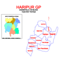 Map of Haripur GP
 -
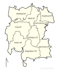 Map of Chanditala-I CD block sowing GP
 -
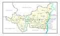 Map of Hooghly district showing CD blocks and municipal areas


Demographics[edit | edit source]
As per 2011 Census of India, Haripur had a population of 2,797 of which 1,455 (52%) were males and 1,342 (48%) females. Population below 6 years was 271. The number of literates in Haripur was 2,066 (81.79% of the population over 6 years).[3]
Transport[edit | edit source]
Bargachia railway station is the nearest railway station.
References[edit | edit source]
- ↑ "banglarbhumi.gov.in". WEST BENGAL ->HUGLI(হুগলী) ->CHANDITALA-I (চণ্ডীতলা-১) Mouza Information. Government of West Bengal. Archived from the original on 22 December 2016. Retrieved 6 October 2018.
- ↑ "Haripur". Indian Village Directory. Retrieved 12 October 2018.
- ↑ "C.D. Block Wise Primary Census Abstract Data(PCA)". 2011 census: West Bengal – District-wise CD Blocks. Registrar General and Census Commissioner, India. Retrieved 7 October 2018.

Cities, towns and locations in Hooghly district | |||||||||
|---|---|---|---|---|---|---|---|---|---|
| Cities, municipalities and census towns |
| ||||||||
| Locations other than cities and towns |
| ||||||||
| Neighbourhoods | |||||||||
| Related topics | |||||||||


 | This article about a location in the Hooghly district of West Bengal is a stub. You can help Bharatpedia by expanding it. |