

>Rasnaboy c/e |
revised |
||
| Line 1: | Line 1: | ||
{{short description|Mountain range in western India}} | {{short description|Mountain range in western India}} | ||
{{about|the mountain range| An Rajasthan heritage | Marwar}} | |||
{{Use Indian English|date=October 2019}} | {{Use Indian English|date=October 2019}} | ||
{{Use dmy dates|date= | {{Use dmy dates|date=July 2024}} | ||
{{Infobox mountain | {{Infobox mountain | ||
| name | | name = Aravalli Range | ||
| other_name | | other_name = | ||
| photo | | photo = Aravalli.jpg | ||
| native_name | | native_name = | ||
| native_name_lang | | native_name_lang = | ||
| etymology | | etymology = | ||
| photo_size | | photo_size = 300 | ||
| photo_alt | | photo_alt = | ||
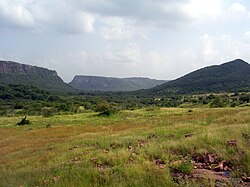
| photo_caption | | photo_caption = The Aravali Range in Rajasthan | ||
| map_image | | map_image = India Geographic Map.jpg | ||
| map_alt | | map_alt = | ||
| map_caption | | map_caption = Topographic map of India showing the range | ||
| map_relief | | map_relief = | ||
| map_size | | map_size = | ||
| location | | location = | ||
| label | | label = | ||
| label_position | | label_position = | ||
| elevation | | elevation = | ||
| elevation_m | | elevation_m = 1722 | ||
| elevation_ft | | elevation_ft = | ||
| elevation_ref | | elevation_ref = | ||
| prominence | | prominence = | ||
| prominence_m | | prominence_m = | ||
| prominence_ft | | prominence_ft = | ||
| prominence_ref | | prominence_ref = | ||
| isolation | | isolation = | ||
| isolation_km | | isolation_km = | ||
| isolation_mi | | isolation_mi = | ||
| isolation_ref | | isolation_ref = | ||
| highest | | highest = [[Guru Shikhar]], [[Mount Abu]] | ||
| parent_peak | | parent_peak = | ||
| listing | | listing = | ||
| translation | | translation = | ||
| language = | | language = | ||
| pronunciation | | pronunciation = {{IPA|hi| əɾaːʋ(ə)li}} | ||
| coordinates | | coordinates = {{coord|24|35|33|N|74|42|30|E|type:mountain_region:IN|format=dms|display=inline}} | ||
| range_coordinates = {{coord|25|N|73.5|E|type:mountain_region:IN|format=dms|display=inline,title}} | | range_coordinates = {{coord|25|N|73.5|E|type:mountain_region:IN|format=dms|display=inline,title}} | ||
| coordinates_ref | | coordinates_ref = | ||
| length_km | | length_km = 670 | ||
| length_orientation = | |||
| length_orientation= | | width_km = | ||
| width_km | | width_orientation = | ||
| width_orientation = | | area_km2 = | ||
| area_km2 | | topo_map = | ||
| topo_map | | mountain_type = | ||
| mountain_type | | age = [[Precambrian]] <!-- age of rocks --> | ||
| age | | last_eruption = | ||
| last_eruption | | first_ascent = | ||
| first_ascent | | easiest_route = | ||
| easiest_route | | normal_route = | ||
| normal_route | | access = | ||
| access | | child = | ||
| child | | embedded = | ||
| embedded | | country = India | ||
| country | |||
| subdivision1_type = States | | subdivision1_type = States | ||
| subdivision1 | | subdivision1 = {{hlist|[[Rajasthan]]|[[Haryana]]|[[Delhi]]|[[Gujarat]]}} | ||
| subdivision2_type = | | subdivision2_type = Regions | ||
| subdivision2 | | subdivision2 = {{hlist|[[North India]]|[[Western India]]}} | ||
| settlement_type | | settlement_type = Settlements | ||
| settlement | | settlement = {{hlist|Delhi|[[Gurgaon]]|[[Mount Abu]]}} | ||
| subdivision4_type = Rivers | | subdivision4_type = Rivers | ||
| subdivision4 | | subdivision4 = {{hlist|[[Banas River|Banas]]|[[Luni River|Luni]]|Sakhi|[[Sabarmati River|Sabarmati]]}} | ||
| geology | | geology = [[Fold mountains]] from [[plate tectonics]] | ||
| orogeny | * [[Igneous rock]] [[granite]] and [[gneiss]] | ||
<!-- type of rocks -->| orogeny = [[Aravalli-Delhi Orogen]] <!-- orogeny --> | |||
}} | }} | ||
The '''Aravalli Range''' (also spelled ''Aravali'') is a mountain range in [[ | The '''Aravalli Range''' (also spelled ''Aravali'') is a mountain range in [[Northwest India|north-western]] [[India]]. running approximately {{convert|670|km|abbr=on}} in a south-west direction, starting near [[Delhi]], passing through southern [[Haryana]]<ref name=ara8>{{cite web|url=http://aravalibiodiversitypark.in/?q=node/1 |title=Aravalli Biodiversity Park, Gurgaon |url-status=dead |archive-url=https://web.archive.org/web/20120528194722/http://aravalibiodiversitypark.in/?q=node%2F1 |archive-date=28 May 2012}}</ref> and [[Rajasthan]], and ending in Ahmedabad, [[Gujarat]].<ref name=ara3>{{citation|last=Kohli|first=M.S.|title=Mountains of India: Tourism, Adventure, Pilgrimage|url=https://books.google.com/books?id=GIs4zv17HHwC&pg=PA29|year=2004|publisher=Indus Publishing|isbn=978-81-7387-135-1|pages=29–}}</ref><ref name=ara4>{{cite book|chapter-url=https://books.google.com/books?id=Kpd9lLY_0-IC&q=Aravali&pg=PA92 |chapter=Aravali Range |title=Students' Britannica India |author1=Dale Hoiberg |author2=Indu Ramchandani |publisher=Popular Prakashan |year=2000 |isbn=978-0-85229-760-5 |pages=92–93}}</ref> The highest peak is [[Guru Shikhar]] in [[Mount Abu]], Rajasthan at {{convert|1722|m|abbr=on}}. The Aravalli Range is the oldest [[Fold mountains|fold-mountain]] belt in India, dating back to the [[Paleoproterozoic]] era.<ref>{{Cite journal |last1=Verma |first1=P. K. |last2=Greiling |first2=R. O. |date=1995-12-01 |title=Tectonic evolution of the Aravalli orogen (NW India): an inverted Proterozoic rift basin? |url=https://doi.org/10.1007/BF00240560 |journal=Geologische Rundschau |language=en |volume=84 |issue=4 |pages=683–696 |bibcode=1995GeoRu..84..683V |doi=10.1007/BF00240560 |issn=1432-1149 |s2cid=129382615 |url-access=subscription}}</ref><ref>{{Cite journal |last1=Roy |first1=A.B. |date=1990-01-01 |title=Evolution of the Precambrian Crust of the Aravalli Mountain Range |url=https://www.sciencedirect.com/science/article/pii/S0166263508701737 |url-status=live |journal=Developments in Precambrian Geology |language=en |volume=8 |pages=327–347 |doi=10.1016/S0166-2635(08)70173-7 |isbn=9780444883100 |issn=0166-2635 |url-access=subscription |archive-url=https://web.archive.org/web/20210628223223/https://www.sciencedirect.com/science/article/pii/S0166263508701737 |archive-date=28 June 2021 |access-date=28 June 2021}}</ref> | ||
== Etymology == | == Etymology == | ||
Aravalli, a composite [[Sanskrit]] word from ''"ara"'' and ''"vali"'', literally means the ''"line of peaks"''.<ref name=ara2>{{cite book |title=The Geography of British India, Political & Physical |url=https://archive.org/details/geographybritis01smitgoog |author=George Smith |publisher=J. Murray |year=1882 |page=[https://archive.org/details/geographybritis01smitgoog/page/n58 23]}}</ref><ref name=ara5>{{cite web|url= | Aravalli, a composite [[Sanskrit]] word from the roots ''"ara"'' and ''"vali"'', literally means the ''"line of peaks"''.<ref name=ara2>{{cite book |title=The Geography of British India, Political & Physical |url=https://archive.org/details/geographybritis01smitgoog |author=George Smith |publisher=J. Murray |year=1882 |page=[https://archive.org/details/geographybritis01smitgoog/page/n58 23]}}</ref><ref name=ara5>{{cite web|url=https://www.britannica.com/EBchecked/topic/32222/Aravali-Range |title=Aravali Range |date=13 August 2024 |publisher=Britannica.com}}</ref> | ||
== Natural history == | == Natural history == | ||
| Line 91: | Line 91: | ||
{{main|Tectonic evolution of the Aravalli Mountains}} {{see also | Geology of India}} | {{main|Tectonic evolution of the Aravalli Mountains}} {{see also | Geology of India}} | ||
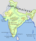
[[File:Indiahills.png|thumb|upright=1.36|Map of prominent mountain ranges in India, showing Aravalli in north-west India]] | [[File:Indiahills.png|thumb|upright=1.36|Map of prominent mountain ranges in India, showing Aravalli in north-west India]] | ||
The Aravalli Range, an eroded stub of ancient mountains, is the oldest range of [[fold mountains]] in India.<ref name=ara6>Roy, A. B. (1990). Evolution of the Precambrian crust of the Aravalli Range. Developments in Precambrian Geology, 8, 327–347.</ref> The [[natural history]] of the Aravalli Range dates back to times when the [[Indian Plate]] was separated from the [[Eurasian Plate]] by an ocean. The Proterozoic Aravalli-Delhi orogenic belt in northwest India is similar to the younger Himalayan-type orogenic belts of the [[Mesozoic]]-[[Cenozoic]] era (of the [[Phanerozoic]]) in terms of component parts and appears to have passed through a near-orderly [[Supercontinent cycle#Description|Wilson supercontinental cycle of events]]. The range rose in a [[Precambrian]] event called the [[Tectonic evolution of the Aravalli Mountains#Aravalli Orogeny|Aravalli]]-[[Tectonic evolution of the Aravalli Mountains#Delhi Orogeny|Delhi Orogen]]. The Aravalli Range is a northeast–southwest trending | The Aravalli Range, an eroded stub of ancient mountains, is believed to be the oldest range of [[fold mountains]] in India.<ref name=ara6>Roy, A. B. (1990). Evolution of the Precambrian crust of the Aravalli Range. Developments in Precambrian Geology, 8, 327–347.</ref> The [[natural history]] of the Aravalli Range dates back to times when the [[Indian Plate]] was separated from the [[Eurasian Plate]] by an ocean. The Proterozoic Aravalli-Delhi [[orogenic belt]] in northwest India is similar to the younger Himalayan-type orogenic belts of the [[Mesozoic]]-[[Cenozoic]] era (of the [[Phanerozoic]]) in terms of component parts and appears to have passed through a near-orderly [[Supercontinent cycle#Description|Wilson supercontinental cycle of events]]. The range rose in a [[Precambrian]] event called the [[Tectonic evolution of the Aravalli Mountains#Aravalli Orogeny|Aravalli]]-[[Tectonic evolution of the Aravalli Mountains#Delhi Orogeny|Delhi Orogen]]. The Aravalli Range is a northeast–southwest trending orogenic belt located in the northwestern part of Indian Peninsula. It is part of the [[Indian Shield]] that formed from a series of [[craton]]ic collisions.<ref name=":0">Mishra, D.C.; Kumar, M. Ravi. Proterozoic orogenic belts and rifting of Indian cratons: Geophysical constraints. Geoscience Frontiers. 2013 March. 5: 25–41.</ref> In ancient times, Aravalli were extremely high but since have worn down almost completely from millions of years of [[weathering]], whereas the [[Himalayas]], young fold mountains, are still continuously rising. Aravalli have stopped growing higher due to the cessation of upward thrust caused by the [[tectonic plates]] in the [[Earth's crust]] below them. The Aravalli Range joins two of the ancient Earth's crust segments that make up the greater Indian [[craton]], the [[Aravalli Craton]] which is the [[Marwar]] segment of Earth's crust to the northwest of the Aravalli Range, and the [[Bundelkand Craton]] segment of the Earth's crust to the southeast of the Aravalli Range. Cratons, generally found in the interiors of tectonic plates, are old and stable parts of the continental [[lithosphere]] that have remained relatively undeformed during the cycles of merging and rifting of continents. | ||
[[File:Subduction-en.svg|thumb|upright=1.5|Volcanic arc and geological process of undersea subduction during | [[File:Subduction-en.svg|thumb|upright=1.5|Volcanic arc and geological process of undersea subduction during tectonic collusion]] | ||
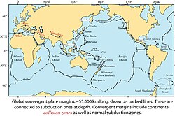
[[File:ConMarRJS.jpg|thumb|upright=1.5|Global [[convergent boundary]] of [[Plate tectonics#Types of plate boundaries|plate margins]]]] | [[File:ConMarRJS.jpg|thumb|upright=1.5|Global [[convergent boundary]] of [[Plate tectonics#Types of plate boundaries|plate margins]]]] | ||
It consists of two main [[Sequence (geology)|sequences]] formed in [[Proterozoic]] [[Eon (geology)|eon]], [[metasedimentary rock]] (sedimentary rocks [[metamorphism| | It consists of two main [[Sequence (geology)|sequences]] formed in the [[Proterozoic]] [[Eon (geology)|eon]], [[metasedimentary rock]] (sedimentary rocks [[metamorphism|metamorphosed]] under pressure and heat without melting) and [[metavolcanic rock]] (metamorphosed volcanic rocks) sequences of the [[Tectonic evolution of the Aravalli Mountains#Aravalli Supergroup|Aravalli Supergroup]] and [[Tectonic evolution of the Aravalli Mountains#Delhi Supergroup|Delhi Supergroup]]. These two [[Belt Supergroup|supergroups]] rest over the [[Tectonic evolution of the Aravalli Mountains#Archean Bhilwara Gneissic Complex basement|Archean Bhilwara Gneissic Complex basement]], which is a [[gneiss]]ic (high-grade metamorphism of sedimentary or igneous rocks) [[Basement (geology)|basement]] formed during the [[archean]] [[eon (geology)|eon]] 4 [[Billion years|Ga]] ago. It started as an [[Inversion (geology)|inverted basin]], that [[rift|rifted and pulled]] apart into [[granite|granitoid]] [[Basement (geology)|basement]], initially during Aravalli [[Volcanic passive margin#Passive rifting|passive rifting]] around 2.5 to 2.0 Ga years ago and then during Delhi [[Volcanic passive margin#Active rifting|active rifting]] around 1.9 to 1.6 Ga years ago. It started with rifting of a rigid Archaean continent [[Peninsular Gneiss|banded gneissic complex]] around 2.2 Ga with the coexisting formation of the Bhilwara [[aulacogen]] in its eastern part and eventual rupturing and separation of the continent along a line parallel to the Rakhabdev (Rishabhdev) lineament to the west, simultaneous development of a [[Passive margin|passive continental margin]] with the undersea shelf rise sediments of the Aravalli-Jharol belts depositing on the attenuated crust on the eastern flank of the separated continent, subsequent destruction of the continental margin by [[Accretion (geology)|accretion]] of the Delhi [[island arc]] (a type of archipelago composed of an arc-shaped chain of volcanoes closely situated parallel to a [[convergent boundary]] between two converging tectonic plates) from the west around 1.5 Ga. This tectonic plates collision event involved early thrusting with partial [[obduction]] (overthrusting of oceanic lithosphere onto continental lithosphere at a convergent plate boundary) of the [[oceanic crust]] along the Rakhabdev lineament, flattening and eventual [[Fault (geology)#Strike-slip faults|wrenching]] (also called strike-slip plate fault, sideways horizontal movement of colliding plates with no vertical motion) parallel to the collision zone. Associated [[Mafic|mafic igneous rocks]] show both continental and oceanic [[Tholeiitic magma series#Geochemical characterization|tholeiitic geochemistry]] (magnesium and iron-rich igneous rocks) from the [[Phanerozoic]] eon (541–0 million) with rift-related [[magma]]tic rock formations.<ref name=linkz>{{citation|doi=10.1007/BF00240560|title=Tectonic evolution of the Aravalli orogen (NW India): An inverted Proterozoic rift basin?|journal=Geologische Rundschau|volume=84|issue=4|pages=683|year=1995|last1=Verma|first1=P.K.|last2=Greiling|first2=R.O.|bibcode=1995GeoRu..84..683V|s2cid=129382615}}</ref> | ||
The Aravalli-Delhi Orogen is an [[orogen]] event that led to a large structural deformation of the Earth's lithosphere (crust and uppermost mantle, such as Aravalli and Himalayas fold mountains) due to the interaction between tectonic plates when a continental plate is crumpled and is pushed upwards to form mountain ranges, and involve a great range of geological processes collectively called [[orogenesis]].<ref name=Waltham>{{cite book |title=Foundations of Engineering Geology |author=Tony Waltham |page=20 |url=https://books.google.com/books?id=JGtIHJTXaI4C&pg=PA20 |isbn=978-0-415-46959-3 |publisher=Taylor & Francis |date=2009 |edition=3rd}}</ref><ref name=Vine>{{cite book |title=Global Tectonics |author=Philip Kearey |author2=Keith A. Klepeis |author3=Frederick J. Vine |chapter-url=https://books.google.com/books?id=HYqZntfg25UC&pg=PA287 |page=287 |chapter=Chapter 10: Orogenic belts |isbn=978-1-4051-0777-8 |date=2009 |publisher=Wiley-Blackwell |edition=3rd}}</ref> | The Aravalli-Delhi Orogen is an [[orogen]] event that led to a large structural deformation of the Earth's lithosphere (crust and uppermost mantle, such as Aravalli and Himalayas fold mountains) due to the interaction between tectonic plates when a continental plate is crumpled and is pushed upwards to form mountain ranges, and involve a great range of geological processes collectively called [[orogenesis]].<ref name=Waltham>{{cite book |title=Foundations of Engineering Geology |author=Tony Waltham |page=20 |url=https://books.google.com/books?id=JGtIHJTXaI4C&pg=PA20 |isbn=978-0-415-46959-3 |publisher=Taylor & Francis |date=2009 |edition=3rd}}</ref><ref name=Vine>{{cite book |title=Global Tectonics |author=Philip Kearey |author2=Keith A. Klepeis |author3=Frederick J. Vine |chapter-url=https://books.google.com/books?id=HYqZntfg25UC&pg=PA287 |page=287 |chapter=Chapter 10: Orogenic belts |isbn=978-1-4051-0777-8 |date=2009 |publisher=Wiley-Blackwell |edition=3rd}}</ref> | ||
=== Minerals === | === Minerals === | ||
The [[Tectonic evolution of the Aravalli Mountains#Evolution of the Archean Basement|archean basement]] had served as a [[Indenter tectonics|rigid indentor]] which controlled the overall [[Mantle wedge|wedge shaped geometry]] of the orogen. [[Lithology]] of area shows that the base rocks of Aravalli are of Mewar Gneiss formed by high-grade regional [[Metamorphism|metamorphic]] processes from preexisting formations that were originally [[sedimentary rock]] with earliest life form that were formed during the [[archean]] eon, these contain fossils of [[unicellular organism]] such as [[green algae]] and [[cyanobacteria]] in [[stromatolite|stromatolitic]] carbonate ocean reefs formed during the [[paleoproterozoic]] [[Era (geology)|era]]. [[Sedimentary exhalative deposits]] of [[base metal]] [[sulfide]] ores formed extensively along several, long, linear zones in the Bhilwara aulacogen or produced local concentration in the rifted Aravalli continental margin, where rich stromatolitic [[phosphorite]]s also formed. [[Tectonic evolution of the Aravalli Mountains]] shows Mewar | The [[Tectonic evolution of the Aravalli Mountains#Evolution of the Archean Basement|archean basement]] had served as a [[Indenter tectonics|rigid indentor]] which controlled the overall [[Mantle wedge|wedge shaped geometry]] of the orogen. [[Lithology]] of area shows that the base rocks of Aravalli are of Mewar Gneiss formed by high-grade regional [[Metamorphism|metamorphic]] processes from preexisting formations that were originally [[sedimentary rock]] with earliest life form that were formed during the [[archean]] eon, these contain fossils of [[unicellular organism]] such as [[green algae]] and [[cyanobacteria]] in [[stromatolite|stromatolitic]] carbonate ocean reefs formed during the [[paleoproterozoic]] [[Era (geology)|era]]. [[Sedimentary exhalative deposits]] of [[base metal]] [[sulfide]] ores formed extensively along several, long, linear zones in the Bhilwara aulacogen or produced local concentration in the rifted Aravalli continental margin, where rich stromatolitic [[phosphorite]]s also formed. [[Tectonic evolution of the Aravalli Mountains]] shows Mewar Gneiss rocks are overlain by Delhi Supergroup type of rocks that also have post-Aravalli intrusions. Metal sulfide ores were formed in two different epochs, lead and zinc sulfide ores were formed in the sedimentary rocks around 1.8 Ga years ago during [[Paleoproterozoic]] phase. The [[tectonic setting]] of zinc-lead-copper sulfides mineralisation in the Delhi supergroup rocks in Haryana-Delhi were formed by [[mantle plume]] volcanic action around one billion years ago covering Haryana and Rajasthan during the [[mesoproterozoic]]. In the southern part of the Aravalli supergroup arc base metal sulfides were generated near the subduction zone on the western fringe and in zones of back-arc extension to the south-east. Continued subduction produced [[tungsten]]-[[tin]] mineralisation in S-type (sedimentary unmetamorphosed rock), [[felsic]] (volcanic rock), and [[pluton]]s (crystallised solidified magma). This includes commercially viable quantities of minerals, such as [[Phosphorite|rock phosphate]], [[lead]]-[[zinc]]-[[silver]] mineral deposits at [[Zawar]], Rikahbdev [[serpentinite]], [[talc]], [[pyrophyllite]], [[asbestos]], [[apatite]], [[kyanite]] and [[beryl]].<ref name=deb1>M. Deb and Wayne David Goodfellow, 2004, [https://books.google.com/books?id=H64sxguvlpMC&dq=stromatolites+tosham+aravalli&pg=PA260 "Sediment Hosted Lead-Zinc Sulphide Deposits"], [http://www.narosa.com Narosa Publishing] {{Webarchive|url=https://web.archive.org/web/20170729032529/http://www.narosa.com/? |date=29 July 2017 }}, pp 260.</ref><ref name=irs1>Naveed Qamar, [http://www.naveedqamar.ga/2017/01/indian-shield-rocks.html "Indian shield rocks"] {{Webarchive|url=https://web.archive.org/web/20170720205058/http://www.naveedqamar.ga/2017/01/indian-shield-rocks.html |date=20 July 2017 }}.</ref> | ||
=== Mining === | === Mining === | ||
Mining of copper and other metals in the Aravalli | Mining of copper and other metals in the Aravalli Range dates back to at least the 5th century BCE, based on [[carbon dating]].<ref name=ara9>SM Gandhi (2000) Chapter 2 – Ancient Mining and Metallurgy in Rajasthan, Crustal Evolution and Metallogeny in the Northwestern Indian Shield: A Festschrift for Asoke Mookherjee, {{ISBN|978-1842650011}}</ref><ref>Shrivastva, R. (1999). Mining of copper in ancient India. Indian Journal of History of Science, 34, 173–180</ref> Recent research indicates that copper was already mined here during the [[Sothi (archaeology)|Sothi]]-[[Siswal]] period going back to {{Circa|4000 BCE}}. Ancient [[Kalibangan]] and [[Kunal, Haryana]] settlements obtained copper here.<ref name=ara10>Jane McIntosh, [https://books.google.com/books?id=1AJO2A-CbccC&pg=PA77 ''The Ancient Indus Valley: New Perspectives.''] Understanding ancient civilizations. ABC-CLIO, 2008 {{ISBN|1576079074}} p77</ref> | ||
=== Geographical features === | === Geographical features === | ||
| Line 110: | Line 110: | ||
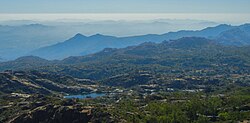
[[File:Arbuda Mountains.JPG|thumb|upright=1.2|The Aravalli Range, seen from the range's highest point at [[Guru Shikhar]], in Rajasthan.]] | [[File:Arbuda Mountains.JPG|thumb|upright=1.2|The Aravalli Range, seen from the range's highest point at [[Guru Shikhar]], in Rajasthan.]] | ||
The [[Geography of India#Cratons|Indian Craton]] includes [[List of shields and cratons#Indian Subcontinent|five major cratons]]. Cratons are part of [[continental crust]] made up of upper layer called [[Platform (geology)|platforms]] and older bottom layer called [[Basement (geology)|basement rocks]]. [[Shield (geology)|shield]]s are part of a craton where basement rock [[Outcrop|crops out]] at the surface and it is the relatively oldest and most stable part that are undeformed by the [[plate tectonics]]. The [[Aravalli Craton]] (Marwar-Mewar Craton or Western Indian Craton) covers [[Rajasthan]] as well as [[Tosham Hill range|western]] and [[South Haryana|southern]] [[Haryana]]. It includes the Mewar Craton in the east and Marwar Craton in the west. It is limited by the Great Boundary Fault in the east, the [[Thar | The [[Geography of India#Cratons|Indian Craton]] includes [[List of shields and cratons#Indian Subcontinent|five major cratons]]. Cratons are part of [[continental crust]] made up of upper layer called [[Platform (geology)|platforms]] and older bottom layer called [[Basement (geology)|basement rocks]]. [[Shield (geology)|shield]]s are part of a craton where basement rock [[Outcrop|crops out]] at the surface and it is the relatively oldest and most stable part that are undeformed by the [[plate tectonics]]. The [[Aravalli Craton]] (Marwar-Mewar Craton or Western Indian Craton) covers [[Rajasthan]] as well as [[Tosham Hill range|western]] and [[South Haryana|southern]] [[Haryana]]. It includes the Mewar Craton in the east and Marwar Craton in the west. It is limited by the Great Boundary Fault in the east, the [[Thar Desert]] in the west, Indo-gangetic alluvium in the north, and the [[Son River]]-[[Narmada River]]-[[Tapti River]] basins in the south. It mainly has [[quartzite]], [[marble]], [[pelite]], [[greywacke]] and extinct volcanos exposed in the [[Aravalli-Delhi Orogen]]. [[Jodhpur Group – Malani Igneous Suite Contact|Malani Igneous Suite]] is the largest in India and third largest [[Igneous rock|igneous]] suit in the world.<ref name=cratonm2>[https://www.slideshare.net/pramodgpramod/cratons-of-india Cratons of India] {{Webarchive|url=https://web.archive.org/web/20210912162139/https://www.slideshare.net/pramodgpramod/cratons-of-india |date=12 September 2021 }}.</ref><ref name=cratonm1>[http://mem.lyellcollection.org/content/43/1/151 Cratons of India] {{Webarchive|url=https://web.archive.org/web/20190116100217/http://mem.lyellcollection.org/content/43/1/151 |date=16 January 2019 }}, lyellcollection.org.</ref> The uniqueness of the geological feature of Malani Igneous Suite at Jodhpur prompted the [[Geological Survey of India]] to declare the site as a [[National Geological Monument]].<ref name= GSI>{{cite book|title=National Geological Monuments|access-date=23 March 2009|chapter=Jodhpur Group-Malani Igneous Suite Contact|pages=65–67|publisher=Geological Survey of India|location=27 Jawaharlal Nehru Road, Kolkata,700016|year=2001|url=http://www.vedamsbooks.com/no24484.htm|archive-date=30 March 2009|archive-url=https://web.archive.org/web/20090330120907/http://www.vedamsbooks.com/no24484.htm|url-status=dead}}</ref> | ||
==== Tectonic-stratigraphic evolution ==== | ==== Tectonic-stratigraphic evolution ==== | ||
| Line 131: | Line 131: | ||
The stratigraphic classification of the Aravalli Range can be divided into the following parts (north to south direction): | The stratigraphic classification of the Aravalli Range can be divided into the following parts (north to south direction): | ||
*The Archean basement is a banded gneissic complex with [[schists]] (medium grade metamorphic rock), [[gneiss]]es (high grade regional metamorphic rock), [[Peninsular Gneiss|composite gneiss]] and [[quartzite]]s. It forms the basement rock for both the Delhi Supergroup and the Aravalli Supergroup. | * The Archean basement is a banded gneissic complex with [[schists]] (medium grade metamorphic rock), [[gneiss]]es (high grade regional metamorphic rock), [[Peninsular Gneiss|composite gneiss]] and [[quartzite]]s. It forms the basement rock for both the Delhi Supergroup and the Aravalli Supergroup. | ||
* Aravalli Supergroup: The Aravalli supergroup passes through [[Rajasthan]] state, dividing it into two halves, with three-fifths of Rajasthan on the western side towards the [[Thar Desert]] and two-thirds on the eastern side consisting of the catchment area of [[Banas River|Banas]] and [[Chambal River|Chambal]] rivers bordering the state of [[Madhya Pradesh]].{{Clarify |date=September 2020 |reason=Three-fifths and two-thirds add up to more than one.}} [[Guru Shikhar]], the highest peak in the Aravalli Range at {{convert|5650|ft}} in [[Mount Abu]] of Rajasthan, lies near the south-western extremity of the Central Aravalli range, close to the border with [[Gujarat]] state. The southern ''Aravalli Supergroup'' enters the northeast of [[Gujarat]] near [[Modasa]] where it lends its name to the [[Aravalli district]], and ends at the centre of the state at [[Palanpur]] near [[Ahmedabad]]. | * Aravalli Supergroup: The Aravalli supergroup passes through [[Rajasthan]] state, dividing it into two halves, with three-fifths of Rajasthan on the western side towards the [[Thar Desert]] and two-thirds on the eastern side consisting of the catchment area of [[Banas River|Banas]] and [[Chambal River|Chambal]] rivers bordering the state of [[Madhya Pradesh]].{{Clarify |date=September 2020 |reason=Three-fifths and two-thirds add up to more than one.}} [[Guru Shikhar]], the highest peak in the Aravalli Range at {{convert|5650|ft}} in [[Mount Abu]] of Rajasthan, lies near the south-western extremity of the Central Aravalli range, close to the border with [[Gujarat]] state. The southern ''Aravalli Supergroup'' enters the northeast of [[Gujarat]] near [[Modasa]] where it lends its name to the [[Aravalli district]], and ends at the centre of the state at [[Palanpur]] near [[Ahmedabad]]. | ||
** Champaner Group is a rectangular outcrop composed of [[greywacke|subgreywacke]], [[Siliceous rocks|siliceous]] [[phyllite]], [[pelite|pelitic]] [[schist]], [[quartzite]] and pertomict [[Conglomerate (geology)|conglomerate]]. | ** Champaner Group is a rectangular outcrop composed of [[greywacke|subgreywacke]], [[Siliceous rocks|siliceous]] [[phyllite]], [[pelite|pelitic]] [[schist]], [[quartzite]] and pertomict [[Conglomerate (geology)|conglomerate]]. | ||
| Line 137: | Line 137: | ||
** Jharol Group is spread over 200 km<sup>2</sup> area with average width of 40 km carbonate-free phyllite and [[arenite]] with [[turbidite]] facies and argillaceous rocks. | ** Jharol Group is spread over 200 km<sup>2</sup> area with average width of 40 km carbonate-free phyllite and [[arenite]] with [[turbidite]] facies and argillaceous rocks. | ||
** Udaipur Group is a thick accumulation of greywacke-phyllite basement overlain by [[Dolomite (rock)|dolomite]]. | ** Udaipur Group is a thick accumulation of greywacke-phyllite basement overlain by [[Dolomite (rock)|dolomite]]. | ||
** Debari Group consists of | ** Debari Group consists of [[Carbonate]]s, [[Quartzite]], and [https://www.britannica.com/science/pelitic-rock Pelitic] rocks which are overlain by the Delwara group. | ||
** Delwara Group is spread over a 500 km<sup>2</sup> area with average thickness of 500 m and includes basement orthoquartzite overlain by volcanic | ** Delwara Group is spread over a 500 km<sup>2</sup> area with average thickness of 500 m and includes basement orthoquartzite overlain by volcanic conglomerate. | ||
** Unconformities | ** Unconformities | ||
*** Mangalwar/Sandmata Complex and Mewar Gneiss with enclaves of the Jagat group | *** Mangalwar/Sandmata Complex and Mewar Gneiss with enclaves of the Jagat group | ||
| Line 145: | Line 145: | ||
*** [[Delhi Ridge]], in the north | *** [[Delhi Ridge]], in the north | ||
*** Haryana Aravalli ranges, in the west | *** Haryana Aravalli ranges, in the west | ||
**** [[Tosham Hill range]] basement rocks include quartzite with [[chiastolite]], the upper layers of [[quartz porphyry]] [[Ring dike|ring dyke]], [[felsite]], [[welded tuff]] and [[muscovite]] [[biotite]] [[granite]] rocks which have commercially nonviable tin, tungsten and copper. The [[Tosham Hill range]], west of Bhiwani in Haryana, is the northernmost end of the Aravalli range. A northeastern extension of the Aravalli extends to the national capital of India also. Locally known as a ridge it diagonally traverses to the [[South Delhi]] (hills of [[Asola Bhatti Wildlife Sanctuary]]), where at the hills of Bandhwari, it meets the Haryana Aravalli range consisting of various isolated hills and rocky ridges passing along the southern border of [[Haryana]].<ref name=ara7>Bhuiyan | **** [[Tosham Hill range]] basement rocks include quartzite with [[chiastolite]], the upper layers of [[quartz porphyry]] [[Ring dike|ring dyke]], [[felsite]], [[welded tuff]] and [[muscovite]] [[biotite]] [[granite]] rocks which have commercially nonviable tin, tungsten and copper. The [[Tosham Hill range]], west of Bhiwani in Haryana, is the northernmost end of the Aravalli range. A northeastern extension of the Aravalli extends to the national capital of India also. Locally known as a ridge it diagonally traverses to the [[South Delhi]] (hills of [[Asola Bhatti Wildlife Sanctuary]]), where at the hills of Bandhwari, it meets the [[Haryana]]Aravalli range consisting of various isolated hills and rocky ridges passing along the southern border of [[Haryana]].<ref name=ara7>{{cite journal |last1=Bhuiyan |first1=C. |last2=Singh |first2=R. P. |last3=Kogan |first3=F. N. |year=2006 |title=Monitoring drought dynamics in the Aravalli region (India) using different indices based on ground and remote sensing data |journal=International Journal of Applied Earth Observation and Geoinformation |volume=8 |issue=4 |pages=289–302 |doi=10.1016/j.jag.2006.03.002 |bibcode=2006IJAEO...8..289B }}</ref> | ||
**** [[Madhogarh Fort, Haryana|Madhogarh hill]] | **** [[Madhogarh Fort, Haryana|Madhogarh hill]] | ||
**** Satnali hill | **** Satnali hill | ||
**** Nuh-Ferozepur Jhirka hill range, runs along Haryana-Rajasthan border from [[Nuh district|Nuh]] to the south of [[Ferozepur Jhirka]]. | **** Nuh-Ferozepur Jhirka hill range, runs along Haryana-Rajasthan border from [[Nuh district|Nuh]] to the south of [[Ferozepur Jhirka]]. | ||
*** Rajasthan Alwar range, in the east | *** Rajasthan Alwar range, in the east | ||
** Ajabgarh Group – Kumbhalgarh Group with carbonate, mafic volcanic and argillaceous rocks | ** Ajabgarh Group – Kumbhalgarh Group with [[carbonate]], mafic volcanic and [[Argillaceous rocks|argillaceous]] rocks | ||
** Raialo Group with mafic volcanic and calcareous rocks | ** Raialo Group with mafic volcanic and calcareous rocks | ||
| Line 159: | Line 159: | ||
(a) introductory summary para, | (a) introductory summary para, | ||
(b) summary of pre-history human activity e.g. rock painting, tools, etc | (b) summary of pre-history human activity e.g. rock painting, tools, etc | ||
(c) summary sub-section on Indus Valley | (c) summary sub-section on Indus Valley Civilisation sites in Haryana, Gujrat and Rajasthan, | ||
(d} summary of other ancient civilisations | (d} summary of other ancient civilisations | ||
(e) summary of medieval and modern history | (e) summary of medieval and modern history | ||
| Line 165: | Line 165: | ||
Note: remove the points that have been already addressed. | Note: remove the points that have been already addressed. | ||
--> | --> | ||
===Tosham Hills - Indus Civilisation mines=== | |||
The [[Tosham Hill range#Tosham Hill range Indus Valley Civilisation mines and smelters|Tosham hills]] have several [[Indus Valley Civilisation]] sites in and around the hill range as the area falls under copper-bearing zone of Southwest Haryana and Northeast Rajasthan of Aravalli hill range.<ref name=law3>{{cite journal |first1=N. |last1=Kochhar |first2=R. |last2=Kochhar |first3=D. K. |last3=Chakrabarti |year=1999 |title=A New Source of Primary Tin Ore in the Indus Civilisation |journal=South Asian Studies |volume=15 |issue=1 |pages=115–118 |doi=10.1080/02666030.1999.9628571 }}</ref><ref name=law4>{{cite book |first=D. K. |last=Chakrabarti |year=2014 |chapter=Distribution and Features of the Harappan Settlements |title=History of India II : Protohistoric Foundation |publisher=[[Vivekananda International Foundation]] |location=New Delhi |isbn=978-81-7305-481-5 |pages=97–143 }}</ref> | |||
=== Tosham | |||
The [[Tosham Hill range#Tosham Hill range Indus Valley | |||
Investigation of IVC network of mineral ore needs for | Investigation of IVC network of mineral ore needs for metallurgical work and trade, shows that the most common type of grinding stone at Harappa is of Delhi quartzite type found only in the westernmost outliers of the Aravalli Range in southern Haryana near Kaliana and Makanwas villages of Bhiwani district. The quartzite is red-pink to pinkish grey in colour and is crisscrossed with thin [[haematite]] and quartz filled fractures with sugary size grain texture.<ref name=law5>{{cite book |first=Randall |last=Law |year=2006 |chapter=Moving Mountains: The Trade and Transport of Rocks and Minerals within the Greater Indus Valley Region |title=Space and Spatial Analysis in Archaeology |editor-first=E. C. |editor-last=Robertson |editor2-first=R. D. |editor2-last=Seibert |editor3-first=D. C. |editor3-last=Fernandez |editor4-first=M. V. |editor4-last=Zender |display-editors=1 |publisher=University of Calgary Press |location=Alberta, Canada |isbn=0-8263-4022-9 }}</ref><ref name=law6>{{cite thesis |first=Randall |last=Law |year=2008 |type=PhD thesis |title=Inter-regional Interaction and Urbanism in the Ancient Indus Valley: A Geologic Provenance Study of Harappa's Rock and Mineral Assemblage |publisher=[[University of Wisconsin–Madison]] |pages=209–210 |oclc=302421826 }}</ref> | ||
Ravindra Nath Singh and his team of [[Banaras Hindu University]] carried out [[Archaeological Survey of India|ASI]]-financed excavations of [[Indus Valley | Ravindra Nath Singh and his team of [[Banaras Hindu University]] carried out [[Archaeological Survey of India|ASI]]-financed excavations of [[Indus Valley Civilisation]] site on the grounds of the Government School in Khanak, during 2014 and 2016. They found [[Periodisation of the Indus Valley Civilisation|early to mature Harappan phase IVC]] materials, pottery, semiprecious beads of [[lapis lazuli]], [[carnelian]] and others. They also found evidence of metallurgical activities, such as [[crucible]]s (used for pouring molten metal), furnace lining, burnt floor, ash and ore slugs. [[Ceramic petrography]], [[metallography]], [[scanning electron microscope]] (SEM, non-destructive, surface images of nanoscale resolution), [[energy-dispersive X-ray spectroscopy]] (EDXA and EDXMA non-destructive, qualitative and quantitative elemental composition) and [[transmission electron microscopy]] (TEM, destructive method) scientific studies of the material found prove that the Khanak site was inhabited by the IVC metal-workers who used the locally mined [[polymetal]]lic [[tin]], and they were also familiar with metallurgical work with [[copper]] and [[bronze]]. The lowest level of site dates back as far the pre-Harappan era to [[Sothi (archaeology)|Sothi-Siswal culture]] (6600 BP) tentatively.<ref name=sciexp1>{{citation|doi=10.1134/S1063774516060183|title=Electron microscopy methods in studies of cultural heritage sites|journal=Crystallography Reports|volume=61|issue=6|pages=873–885|year=2016|last1=Vasiliev|first1=A. L.|last2=Kovalchuk|first2=M. V.|last3=Yatsishina|first3=E. B.|bibcode=2016CryRp..61..873V|s2cid=99544227}}</ref> | ||
=== Ganeshwar | === Ganeshwar Sunari Cultural Complex === | ||
The Ganeshwar | The Ganeshwar Sunari Cultural Complex (GSCC) is a collection of third millennium BCE settlements in the area of the Aravalli Hill Range. Among them, there are similarities in material culture, and in the production of copper tools. They are located near the copper mines. | ||
<blockquote> | <blockquote> | ||
"The GSCC is east of the Harappan culture, to the north-east of [[ | "The GSCC is east of the Harappan culture, to the north-east of [[Ahar–Banas culture|Ahar–Banas Complex]], north/north west to the Kayatha Culture and at a later date, west of the OCP-Copper Hoard sites ([[Ochre Coloured Pottery culture]]–[[Copper Hoard culture]]). Located within the regions of the Aravalli Hill Range, primarily along the Kantli, Sabi, Sota, Dohan and Bondi rivers, the GJCC is the largest copper producing community in third millennium BCE South Asia, with 385 sites documented. Archaeological indicators of the GSCC were documented primarily in Jaipur, Jhunjhunu, and Sikar districts of Rajasthan, India ..."<ref name=ara11>Uzma Z. Rizvi (2010) [http://www.networkedheritage.org/wp-content/uploads/2011/07/Indices-of-interactions-Rizvi-2010.pdf Indices of Interaction: Comparisons between the Ahar–Banas and Ganeshwar Jodhpura Cultural Complex] {{webarchive |url=https://web.archive.org/web/20160509152542/http://www.networkedheritage.org/wp-content/uploads/2011/07/Indices-of-interactions-Rizvi-2010.pdf |date=9 May 2016 }}, in EASAA 2007: Special Session on Gilund Excavations, edited by T. Raczek and V. Shinde, pp. 51–61. British Archaeological Reports: ArchaeoPress</ref> | ||
</blockquote> | </blockquote> | ||
Pottery found in the area include incised ware, and reserved slipware. | Pottery found in the area include incised ware, and reserved slipware. | ||
There are two main [[type site]]s, [[Ganeshwar]], and [[Sunari]], in Tehsil Kot Putli, [[Jaipur | There are two main [[type site]]s, [[Ganeshwar]], and [[Sunari]], in Tehsil Kot Putli, [[Jaipur district]] (Geo coordinates: N 27° 35' 51", 76° 06' 85" E). | ||
=== 2025 Supreme Court orders === | |||
On 20th November 2025 [[Supreme Court of India|Supreme Court]] issued an order stating that landforms rising over 100 meters with respect to surrounding terrain would be considered as Aravalli Hills and 2 such hills within 500 meters of each other with land between them are considered an Aravalli range. Hills under 100 m can be used for mining, making buildings and for other works.<ref>{{Cite web |date=2025-12-22 |title=Aravalli: Why India's ancient hills are at the centre of growing protests |url=https://www.bbc.com/news/articles/cn5ln4wee7wo |access-date=2025-12-30 |website=www.bbc.com |language=en-GB}}</ref> However, on 29th December the Supreme Court stayed its order following protests by residents, farmers, environmentalists, lawyers and political parties.<ref>{{Cite web |date=2025-12-29 |title=Supreme Court stays own order limiting definition of Aravalli range amid row |url=https://www.hindustantimes.com/india-news/supreme-court-stays-order-limiting-definition-of-aravalli-range-amid-row-101766992154207.html |access-date=2025-12-30 |website=Hindustan Times |language=en}}</ref> | |||
== Environment == | == Environment == | ||
| Line 210: | Line 204: | ||
=== Climate === | === Climate === | ||
The Northern Aravalli | The Northern Aravalli Range in Delhi and Haryana has [[humid subtropical climate]] and [[semi-arid climate#Hot semi-arid climates|hot semi-arid]] [[continental climate]] with very hot summers and relatively cool winters.<ref name="ppu">{{cite web|url=http://www.ppu.edu.in/about-hisar.html |title=Climate of Hisar |publisher=PPU |access-date=27 May 2012 |url-status=dead |archive-url=https://web.archive.org/web/20120505132444/http://www.ppu.edu.in/about-hisar.html |archive-date=5 May 2012}}</ref> The main characteristics of climate in Hisar are dryness, temperature extremes, and low rainfall.<ref name="climate of hisar">{{cite web|url=http://hisar.nic.in/climate.aspx|title=Climate of Hisar|publisher=District Administration, Hisar|access-date=27 May 2012|archive-url=https://web.archive.org/web/20120327140623/http://hisar.nic.in/climate.aspx|archive-date=27 March 2012|url-status=dead}}</ref> The maximum daytime temperature during the summer varies between {{Convert|40|and|46|C|F}}. During winter, its ranges between 1.5 and 4 °C.<ref>{{cite news|url=http://www.thehindu.com/news/national/other-states/more-snowfall-in-himachal-pradesh/article5549454.ece|title=More snowfall in Himachal|newspaper=[[The Hindu]]|access-date=24 March 2016|archive-date=29 May 2014|archive-url=https://web.archive.org/web/20140529214422/http://www.thehindu.com/news/national/other-states/more-snowfall-in-himachal-pradesh/article5549454.ece|url-status=live}}</ref> | ||
The Central Aravalli | The Central Aravalli Range in [[Rajasthan]] has an arid and dry climate. | ||
<!--- | <!--- | ||
{{Main article|Climate of Rajasthan}} | {{Main article|Climate of Rajasthan}} | ||
{{unreferenced section|date=July 2013}} | {{unreferenced section|date=July 2013}} | ||
The geographic features of Rajasthan are the [[Thar Desert]] and the | The geographic features of Rajasthan are the [[Thar Desert]] and the Aravalli Range, which runs through the state from southwest to northeast, almost from one end to the other, for more than {{convert|850|km}}. [[Mount Abu]] lies at the southwestern end of the range, separated from the main ranges by the [[West Banas River]], although a series of broken ridges continues into [[Haryana]] in the direction of [[Delhi]] where it can be seen as outcrops in the form of the [[Raisina Hill]] and the ridges farther north. About three-fifths of Rajasthan lies northwest of the Aravallis, leaving two-fifths on the east and south direction. | ||
[[File:Thar Khuri.jpg|thumb|left|Camel ride in the [[Thar Desert]] near [[Jaisalmer]] | [[File:Thar Khuri.jpg|thumb|left|Camel ride in the [[Thar Desert]] near [[Jaisalmer]]]] | ||
The northwestern portion of Rajasthan is generally sandy and dry. Most of this region is covered by the | The northwestern portion of Rajasthan is generally sandy and dry. Most of this region is covered by the Thar Desert which extends into adjoining portions of Pakistan. The Aravalli Range does not intercept the moisture-giving southwest [[monsoon]] winds off the [[Arabian Sea]], as it lies in a direction parallel to that of the coming monsoon winds, leaving the northwestern region in a [[rain shadow]]. The Thar Desert is thinly populated; the town of [[Jodhpur]] is the largest city in the desert and known as the gateway of Thar Desert. The desert has some major districts like Jodhpur, Jaisalmer, Barmer, Bikaner and Nagour. This area is also an important defence point of view. Jodhpur airbase is Indias largest airbase and military, BSF bases are also situated here. A single civil airport is also situated in Jodhpur. The [[Northwestern thorn scrub forests]] lie in a band around the Thar Desert, between the desert and the Aravallis. This region receives less than 400 mm of rain in an average year. Temperatures can sometimes exceed 54 °C in the summer months or {{convert|129|°F|°C}} and drop below freezing in the winter. The [[Godwar]], [[Marwar]], and [[Shekhawati]] [[List of regions in India|regions]] lie in the thorn scrub forest zone, along with the city of [[Jodhpur]]. The [[Luni River]] and its tributaries are the major river system of Godwar and Marwar regions, draining the western slopes of the Aravallis and emptying southwest into the great [[Rann of Kutch]] wetland in neighbouring [[Gujarat]]. This river is saline in the lower reaches and remains potable only up to Balotara in Barmer district. The [[Ghaggar River]], which originates in [[Haryana]], is an intermittent stream that disappears into the sands of the Thar Desert in the northern corner of the state and is seen as a remnant of the primitive [[Saraswati]] River. | ||
The Aravalli Range and the lands to the east and southeast of the range are generally more fertile and better watered. This region is home to the | The Aravalli Range and the lands to the east and southeast of the range are generally more fertile and better watered. This region is home to the Kathiarbar–Gir dry deciduous forests ecoregion, with [[tropical and subtropical dry broadleaf forests|tropical dry broadleaf forests]] that include [[teak]], ''[[Acacia]]'', and other trees. The hilly [[Vagad]] region, home to the cities of [[Dungarpur]] and [[Banswara]] lies in southernmost Rajasthan, on the border with [[Gujarat]] and [[Madhya Pradesh]]. With the exception of Mount Abu, Vagad is the wettest region in Rajasthan, and the most heavily forested. North of Vagad lies the [[Mewar]] region, home to the cities of [[Udaipur]] and [[Chittaurgarh]]. The [[Hadoti]] region lies to the southeast, on the border with Madhya Pradesh. North of Hadoti and Mewar lies the [[Dhundhar]] region, home to the state capital of [[Jaipur]]. [[Mewat]], the easternmost region of Rajasthan, borders [[Haryana]] and [[Uttar Pradesh]]. Eastern and southeastern Rajasthan is drained by the [[Banas River|Banas]] and [[Chambal River|Chambal]] rivers, tributaries of the [[Ganges]]. | ||
[[File:View from Jaigarh Fort, Rajasthan, India – 20061001.jpg|thumb|left|Hills around [[Jaipur]], viewed from [[Jaigarh Fort]].]] | [[File:View from Jaigarh Fort, Rajasthan, India – 20061001.jpg|thumb|left|Hills around [[Jaipur]], viewed from [[Jaigarh Fort]].]] | ||
| Line 229: | Line 223: | ||
---> | ---> | ||
The Southern Aravalli | The Southern Aravalli Range in [[Gujarat]] has a [[tropical wet and dry climate]] | ||
=== Rivers === | === Rivers === | ||
Three major rivers and their tributaries flow from the Aravalli, namely Banas and Sahibi rivers which are tributaries of [[Yamuna]], as well as Luni River which flows into the [[Rann of Kutch]]. | Three major rivers and their tributaries flow from the Aravalli, namely Banas and Sahibi rivers which are tributaries of [[Yamuna]], as well as Luni River which flows into the [[Rann of Kutch]]. | ||
* North-to-south flowing rivers originate from the western slopes of the Aravalli | * North-to-south flowing rivers originate from the western slopes of the Aravalli Range in Rajasthan, pass through the southeastern portion of the [[Thar Desert]], and end into Gujarat. | ||
**[[Luni River]], originates in the [[Pushkar]] valley near Ajmer, ends in the marshy lands of [[Rann of Kutch]]. It used to be one of the channel of the [[Saraswati River]], as a result its banks have several [[Indus Valley Civilisation]] sites including [[Lothal]]. | ** [[Luni River]], originates in the [[Pushkar]] valley near Ajmer, ends in the marshy lands of [[Rann of Kutch]]. It used to be one of the channel of the [[Saraswati River]], as a result its banks have several [[Indus Valley Civilisation]] sites including [[Lothal]]. | ||
** [[Sakhi River]], ends in the marshy lands of Rann of Kutch. | ** [[Sakhi River]], ends in the marshy lands of Rann of Kutch. | ||
** [[Sabarmati River]], originates on the western slopes of Aravalli | ** [[Sabarmati River]], originates on the western slopes of Aravalli Range of the [[Udaipur district]], end into the [[Gulf of Khambhat]] of the [[Arabian Sea]]. | ||
* West to north-west flowing rivers originate from the western slopes of the Aravalli | * West to north-west flowing rivers originate from the western slopes of the Aravalli Range in Rajasthan, flow through semi-arid historical [[Shekhawati]] region and drain into southern Haryana. Several [[Ochre Coloured Pottery culture]] sites, also identified as late Harappan phase of [[Indus Valley Civilisation]] culture,<ref name=IVCOCP>{{Citation | editor-last = Gupta | editor-first = S.P. | title = The 'Lost' Sarasvati and the Indus Civilisation | place = Jodhpur | publisher = Kusumanjali Prakashan | year = 1995}}</ref> have been found along the banks of these rivers. | ||
** [[Sahibi River]], originates near [[Manoharpur]] in [[Sikar district]] flows through Haryana and meets its confluence with the Yamuna in Delhi where it is called [[Najafgarh drain]], along with its following tributaries:<ref name=culture1>[https://books.google.com/books?isbn=0391023586 Cultural Contours of India: Dr. Satya Prakash Felicitation Volume, Vijai Shankar Śrivastava, 1981]. {{ISBN|0391023586}}</ref><ref name="Sahibi1"> | ** [[Sahibi River]], originates near [[Manoharpur]] in [[Sikar district]] flows through Haryana and meets its confluence with the Yamuna in Delhi where it is called [[Najafgarh drain]], along with its following tributaries:<ref name=culture1>[https://books.google.com/books?isbn=0391023586 Cultural Contours of India: Dr. Satya Prakash Felicitation Volume, Vijai Shankar Śrivastava, 1981]. {{ISBN|0391023586}}</ref><ref name="Sahibi1">{{Cite web |url=http://www.indiamapped.in/revers-in-india/haryana/sahibi-river |title=Sahibi river |access-date=18 June 2017 |archive-date=12 October 2017 |archive-url=https://web.archive.org/web/20171012201926/http://www.indiamapped.in/revers-in-india/haryana/sahibi-river |url-status=dead }}</ref><ref name=AKjain>[https://books.google.com/books?id=1PjJD61h8Q0C&dq=sahibi+river&pg=PA41 Google Books: Page 41, 42, 43, 44, 47 (b) Sahibi Nadi (River), River Pollution, By A.k.jain]</ref><ref name=Dariba>[https://books.google.com/books?isbn=812460049X Minerals and Metals in Ancient India: Archaeological evidence], Arun Kumar Biswas, Sulekha Biswas, University of Michigan. 1996. {{ISBN|812460049X}}.</ref> [[Masani barrage]], is an important wildlife area. | ||
*** [[Dohan | *** [[Dohan River]], tributary of the Sahibi River, originates near [[Neem Ka Thana]] in Sikar district). | ||
*** [[Sota River, India|Sota River]], tributary of the Sahibi River with which it merges at [[Behror]] in Alwar district. | *** [[Sota River, India|Sota River]], tributary of the Sahibi River with which it merges at [[Behror]] in Alwar district. | ||
*** [[Krishnavati river]], former tributary of Sahibi river, originates near [[Dariba, Rajasthan|Dariba]] copper mines in [[Rajsamand district]] of Rajasthan, flows through [[Patan, Rajasthan|Patan]] in [[Dausa district]] and Mothooka in [[Alwar district]], then disappears in [[Mahendragarh district]] in [[Haryana]] much before reaching Sahibi River. It previously was a tributary to the Sahibi and part of its present canalised channel is called the ''Outfall Drain No. 8''. Many important wetlands lie in its paleochannel, including [[Matanhail]], [[Chhuchhakwas|Chhuchhakwas-Godhari]], [[Khaparwas Wildlife Sanctuary]], [[Bhindawas Wildlife Sanctuary]], [[Sarbashirpur]], [[Sultanpur National Park]], [[Basai]] and The Lost Lake (Gurugram). | *** [[Krishnavati river]], former tributary of Sahibi river, originates near [[Dariba, Rajasthan|Dariba]] copper mines in [[Rajsamand district]] of Rajasthan, flows through [[Patan, Rajasthan|Patan]] in [[Dausa district]] and Mothooka in [[Alwar district]], then disappears in [[Mahendragarh district]] in [[Haryana]] much before reaching Sahibi River. It previously was a tributary to the Sahibi and part of its present canalised channel is called the ''Outfall Drain No. 8''. Many important wetlands lie in its paleochannel, including [[Matanhail]], [[Chhuchhakwas|Chhuchhakwas-Godhari]], [[Khaparwas Wildlife Sanctuary]], [[Bhindawas Wildlife Sanctuary]], [[Sarbashirpur]], [[Sultanpur National Park]], [[Basai]] and The Lost Lake (Gurugram). | ||
* West to north-east flowing rivers, originating from the eastern slopes of Aravalli | * West to north-east flowing rivers, originating from the eastern slopes of Aravalli Range in Rajasthan, flow northwards to [[Yamuna]]. | ||
** [[Chambal River]], a southern-side tributary of Yamuna River. | ** [[Chambal River]], a southern-side tributary of Yamuna River. | ||
*** [[Banas River]], a northern-side tributary of Chambal River. | *** [[Banas River]], a northern-side tributary of Chambal River. | ||
**** [[Berach River]], a southern-side tributary of Banas River, originates in the hills of [[Udaipur | **** [[Berach River]], a southern-side tributary of Banas River, originates in the hills of [[Udaipur district]]. | ||
***** [[Ahar River]], a right-side (or eastern side) tributary of the Berach river, originates in the hills of Udaipur | ***** [[Ahar River]], a right-side (or eastern side) tributary of the Berach river, originates in the hills of Udaipur district, flows through [[Udaipur]] city and into [[Lake Pichola]]. | ||
***** [[Wagli River]], a right-side tributary of the Berach River. | ***** [[Wagli River]], a right-side tributary of the Berach River. | ||
***** [[Wagon River]], a right-side tributary of the Berach River. | ***** [[Wagon River]], a right-side tributary of the Berach River. | ||
| Line 265: | Line 259: | ||
Ecology section cover the following (do not place environment related content here): | Ecology section cover the following (do not place environment related content here): | ||
(a) Living organisms: flora and fauna | (a) Living organisms: flora and fauna | ||
(b) Relationship | (b) Relationship and interactions organisms with each other. e.g symbiotic relationship between rhizobium and legume plant roots, or Competition among herbivorous animals for food. | ||
(c) Relationship | (c) Relationship and interactions with surrounding environment. | ||
--> | --> | ||
===Wildlife corridors=== | ===Wildlife corridors=== | ||
====The Great Green Wall of India==== | |||
{{anchor| Green wall | Great wall of Aravalli | Great wall | Wall }} | |||
{{See also|Inland_Customs_Line#Great_Hedge|l1=The Great Hedge of India}} | |||
'''"The Great Green Wall of Aravalli"''' is a proposed 1,600 km long and 5 km wide green ecological corridor along Aravalli range from Gujarat to Delhi, it will be connected to [[Sivalik Hills|Shivalik]] hill range and 1.35 billion (135 crore) new native trees will be planted over 10 years to rehabilitate the forest cover in this area. To be implemented on a concept similar to the [[Great Green Wall (Africa)|Great Green Wall]] of [[Sahara]] in Africa, it will act as a buffer against pollution, 51% of which is caused by the industrial pollution, 27% by vehicles, 8% by [[Stubble burning#Stubble burning in India|crop burning]] and 5% by [[Diwali|diwali fireworks]].<ref name=wall1>[https://indianexpress.com/article/cities/ahmedabad/want-govt-to-build-1600-km-green-wall-along-aravalli-says-activist-vijaypal-baghel-6182069/ Want govt to build 1600 km green wall along Aravalli] {{Webarchive|url=https://web.archive.org/web/20191224165431/https://indianexpress.com/article/cities/ahmedabad/want-govt-to-build-1600-km-green-wall-along-aravalli-says-activist-vijaypal-baghel-6182069/ |date=24 December 2019 }}, Indian Express, 24 December 2019.</ref> It was proposed several times form the 1990s, but as of 2024 the project is still in the planning stage.<ref>{{Cite AV media |url=https://www.youtube.com/watch?v=g59CelQPX74 |title=Can India's Great Green Wall stop desertification? |date=2023-10-13 |last=DW Planet A |access-date=2024-08-17 |via=YouTube}}</ref> On the [[World Environment Day]] 5 June 2025, Prime Minister Modi kickstarted the phase-I of re-greening of this green wall as extension of the ''"Ek Ped Maa Ke Naam"'' (one tree [by each person], for the mother [nature]" campaign which will last till 2027, entailing setting up 1000 permanent nurseries of the native plants for the ongoing regreening of Aravalli by replacing the foreign species. The effort also entails development of the trails, eco parks, wildlife safaris, and people's involvement in 29 districts across 4 states and 700 km mountain range.<ref>[https://theprint.in/environment/modi-to-kickstart-aravalli-green-wall-campaign-to-reforest-worlds-oldest-mountain-range/2646181 Modi to kickstart ‘Aravalli Green Wall’ campaign to reforest world’s oldest mountain range], The Print, 3 June 2025.</ref> | |||
{{ | |||
The 10,000-acre [[Haryana_Forest_Department#Safari|Gurgram Safari Park]] is being developed under the Aravalli Green Wall Project to reforest and restore the mountain range.<ref>[https://indianexpress.com/article/cities/delhi/sc-pauses-aravalli-jungle-safari-eco-tourism-project-delhi-10297491/ SC pauses Aravalli jungle safari: What is the eco-tourism project at Delhi’s doorstep, and why are critics opposed to it?], Indian Express, 9 Oct 2025.</ref> | |||
==== Northern Aravalli leopard and wildlife corridor ==== | ==== Northern Aravalli leopard and wildlife corridor ==== | ||
{{see also | Forests Department, Haryana#Leopards | l1= Leopards of Haryana}} | {{see also|Forests Department, Haryana#Leopards|l1=Leopards of Haryana}} | ||
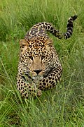
[[File:Charging Leopard-001.JPG|thumb|upright| | [[File:Charging Leopard-001.JPG|thumb|upright|Indian leopard.]] | ||
{{anchor | Northern Aravalli wildlife corridor | Sariska-Delhi wildlife corridor | Northern Aravalli leopard wildlife corridor | Sariska-Delhi leopard wildlife corridor }} | {{anchor|Northern Aravalli wildlife corridor|Sariska-Delhi wildlife corridor|Northern Aravalli leopard wildlife corridor|Sariska-Delhi leopard wildlife corridor}} | ||
The | The Sariska–Delhi leopard wildlife corridor or the Northern Aravalli leopard wildlife corridor is a 200 km long important [[biodiversity]] and [[wildlife corridor]] which runs from the [[Sariska Tiger Reserve]] in Rajasthan to Delhi Ridge.<ref name=protect1>[https://timesofindia.indiatimes.com/city/gurgaon/haryana-government-moots-buffer-zone-to-save-asola-sanctuary/articleshow/67752163.cms Haryana Government moots buffer zone to save Asola sanctuary], ''Times of India'', 30 January 2019.</ref> | ||
This corridor is an important habitat for the Indian [[leopard]]s and [[jackal]]s of Aravalli. In January 2019, the [[Wildlife Institute of India]] announced that they will undertake the survey of leopard and wildlife, using pugmarks and trap cameras, subsequently, leopards and jackals will be tracked via the [[Wildlife radio telemetry|radio collars]]. Urban development, especially the highways and railways bisecting the Aravalli | This corridor is an important habitat for the Indian [[leopard]]s and [[jackal]]s of Aravalli. In January 2019, the [[Wildlife Institute of India]] announced that they will undertake the survey of leopard and wildlife, using pugmarks and trap cameras, subsequently, leopards and jackals will be tracked via the [[Wildlife radio telemetry|radio collars]]. Urban development, especially the highways and railways bisecting the Aravalli Range and wildlife corridor in several places pose a great risk. Large parts of Aravalli are legally and physically unprotected, with no wildlife passages and little or no wildlife conservation work resulting in deaths of over 10 leopards in 4 years between January 2015 to January 2019.<ref name=hitunp1>[https://www.hindustantimes.com/india-news/death-proof-of-leopardlife-in-asola-sanctuary/story-XFkBEhQ05I2vew9M1KDSFI.html Death, proof of leopard life in Asola sanctuary], Hindustan Times, 31 January 2019.</ref><ref name=today1>[https://www.indiatoday.in/india/story/10-month-old-leopard-dead-haryana-gurugram-faridabad-expressway-1442898-2019-01-30 10-month-old leopard found dead on Gurugram-Faridabad Expressway], ''India Today'', 31 January 2019.</ref><ref>[https://timesofindia.indiatimes.com/city/gurgaon/leopard-killed-in-accident-on-gurugram-faridabad-road/articleshow/67755160.cms Leopard killed in accident on Gurugram-Faridabad road], ''Times of India'', 30 January 2019.</ref> | ||
The Haryana side of the Gurugram-Faridabad Aravalli hill forests lack availability of water due to which wild animals are seldom seen there. The Government of Haryana used drones for aerial surveys and dug 22 [[ephemeral]] pits in 2018 to store the rainwater which became dry during the summer months. In January 2019, the government announced the plan to make the pit [[Perennial stream|perennial]] by connecting those with pipelines from the nearby villages.<ref name=scar1>[https://timesofindia.indiatimes.com/city/chandigarh/leopards-keep-away-from-haryana-side-of-asola-due-to-scarcity-of-water/articleshow/67777130.cms Leopards keep away from Haryana side of Asola due to scarcity], Times of India, 1 February 2019.</ref> | The Haryana side of the Gurugram-Faridabad Aravalli hill forests lack availability of water due to which wild animals are seldom seen there. The Government of Haryana used drones for aerial surveys and dug 22 [[ephemeral]] pits in 2018 to store the rainwater which became dry during the summer months. In January 2019, the government announced the plan to make the pit [[Perennial stream|perennial]] by connecting those with pipelines from the nearby villages.<ref name=scar1>[https://timesofindia.indiatimes.com/city/chandigarh/leopards-keep-away-from-haryana-side-of-asola-due-to-scarcity-of-water/articleshow/67777130.cms Leopards keep away from Haryana side of Asola due to scarcity], ''Times of India'', 1 February 2019.</ref> | ||
Human activity, such as unplanned | Human activity, such as unplanned urbanization and polluting industrial plants, also pose a great threat. There is often reluctance and denial on part of the government officials of the presence of wildlife such as leopard so that the forest land can be exploited and opened up for the intrusive human development.<ref name=risk1>[https://timesofindia.indiatimes.com/city/gurgaon/only-30-from-5-villages-show-up-for-impact-study-on-bandhwari/articleshow/63405359.cms Only 30 villagers turn up for impact study], ''Times of India'', 2018.</ref><ref name=risk3>[https://www.indiatoday.in/pti-feed/story/ngt-asks-cpcb-to-test-groundwater-sample-near-bandhwari-plant-1008325-2017-08-01 NGT asks CPCB to test groundwater sample near Bandhwari plant] {{Webarchive|url=https://web.archive.org/web/20190116202653/https://www.indiatoday.in/pti-feed/story/ngt-asks-cpcb-to-test-groundwater-sample-near-bandhwari-plant-1008325-2017-08-01 |date=16 January 2019 }}, ''India Today'', 1 August 2017.</ref><ref name=scar1/> | ||
This habitat is under serious threat from the wrong actions of the [[Government of Haryana]] which in 2019 passed [[Forests Department, Haryana#Flora and forests of Haryana|the amendment]] to the [[Punjab Land Alienation Act, 1900]] (PLPA). Governor has given his | This habitat is under serious threat from the wrong actions of the [[Government of Haryana]] which in 2019 passed [[Forests Department, Haryana#Flora and forests of Haryana|the amendment]] to the [[Punjab Land Alienation Act, 1900]] (PLPA). Governor has given his assent for the act, but it has not yet been notified by the Haryana government, hence it is in limbo and has not officially become a law. This amendment will reduce the Haryana's Natural Conservation Zones (NCZs) by 47% or 60,000 acres from 122,113.30 hectares to only 64,384.66 hectares. This is in violation of multiple guidelines of the [[Supreme Court of India]] as well as "[[National Capital Region (India)|NCR Planning Board]]" (NCRPB) notification which states the original 122,113.30 hectares ecologically sensitive forest of [[South Haryana]] is a forest, ''"The major natural features, identified as environmentally sensitive areas, are the extension of Aravalli ridge in Rajasthan, Haryana and NCT-Delhi; forest areas; rivers and tributaries... major lakes and water bodies such as [[Badkhal Lake|Badkhal lake]], [[Surajkund|Suraj Kund]] and [[Damdama Lake|Damdama]] in Haryana sub-region"''.<ref name=pollute1>[https://www.hindustantimes.com/cities/law-changes-bring-aravalli-conservation-to-the-fore/story-0PKgcgblRjSoVkuJIZuu0O.html Law changes bring Aravalli conservation to the fore] {{Webarchive|url=https://web.archive.org/web/20191224152836/https://www.hindustantimes.com/cities/law-changes-bring-aravalli-conservation-to-the-fore/story-0PKgcgblRjSoVkuJIZuu0O.html |date=24 December 2019 }}, Hindustan Times, 22 December 2019.</ref> This area as part of [[#Northern Aravalli leopard and wildlife corridor|Northern Aravalli leopard and wildlife corridor]] is an important habitat for the [[Forests Department, Haryana#leopard|leopards in Haryana]]. | ||
==== Southern Aravalli leopard wildlife corridor ==== | ==== Southern Aravalli leopard wildlife corridor ==== | ||
| Line 296: | Line 291: | ||
===Nature reserves=== | ===Nature reserves=== | ||
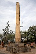
[[File:Asokan Pillar.JPG|thumb|upright|[[Ashoka pillar]] at Delhi Ridge, brought to Delhi from [[Topra Kalan]] by [[ | [[File:Asokan Pillar.JPG|thumb|upright|[[Ashoka pillar]] at Delhi Ridge, brought to Delhi from [[Topra Kalan]] by [[Firoz Shah Tughlaq]] in 1356]] | ||
The following national parks, wildlife reserves, and forests lie in the Aravalli Range. | The following national parks, wildlife reserves, and forests lie in the Aravalli Range. | ||
* [[Delhi Ridge]] | * [[Delhi Ridge]] | ||
** [[Northern | ** [[Northern Ridge biodiversity park]], 87 hectares approximately near [[Delhi University]] | ||
** [[Yamuna biodiversity park]] | ** [[Yamuna biodiversity park]] | ||
** [[Neela Hauz biodiversity park]], next to [[Sanjay Van]] | ** [[Neela Hauz biodiversity park]], next to [[Sanjay Van]] | ||
| Line 307: | Line 302: | ||
** [[Sanjay Lake]] | ** [[Sanjay Lake]] | ||
** [[Aravalli Biodiversity Park]] | ** [[Aravalli Biodiversity Park]] | ||
** [[Tilpath valley biodiversity park]], 70 hectares approximately near [[Sainik Farm]] | ** [[Tilpath Valley Biodiversity Park|Tilpath valley biodiversity park]], 70 hectares approximately near [[Sainik Farm]] | ||
** [[Asola Bhatti Wildlife Sanctuary]] | ** [[Asola Bhatti Wildlife Sanctuary]] | ||
* Haryana | * Haryana | ||
<!-- includes maor forests that have npot yet been declared as reserved forests. yet supreme court has ordered the guidelines that the dictionary meaning of the forests must be used. --> | <!-- includes maor forests that have npot yet been declared as reserved forests. yet supreme court has ordered the guidelines that the dictionary meaning of the forests must be used. --> | ||
** [[Aravali Biodiversity Park, Gurgaon]] | ** [[Aravali Biodiversity Park, Gurgaon]] | ||
** [[Madhogarh | ** [[Madhogarh Biodiversity Park]] forest | ||
** [[Nuh Aravalli | ** [[Nuh Aravalli Biodiversity Park]] forest | ||
** [[Satnali | ** [[Satnali Biodiversity Park]] forest | ||
** [[Tosham | ** [[Tosham Hill range]] biodiversity park | ||
** [[Masani barrage]] wildlife area. | ** [[Masani barrage]] wildlife area. | ||
** [[Matanhail]] wildlife area | ** [[Matanhail]] wildlife area | ||
| Line 325: | Line 320: | ||
** [[Basai]] | ** [[Basai]] | ||
** [[Bandhwari]] forest | ** [[Bandhwari]] forest | ||
** [[Mangar Bani]] | ** [[Mangar Bani forest]] | ||
** [[The Lost Lake]] (Gurugram) | ** [[The Lost Lake]] (Gurugram) | ||
* Rajasthan | * Rajasthan | ||
| Line 345: | Line 340: | ||
===Flora=== | ===Flora=== | ||
The Aravalli Range has several forests with a diversity of environment.<ref | The Aravalli Range has several forests with a diversity of environment. The Aravalli Range is characterized by dry [[deciduous forests]]. They are dominated by plant species such as dhok, acacia, and neem. These forests also support a variety of flowering plants, including roses, [[bougainvillea]], and hibiscus. The Great Green Wall of India, the Northern Aravalli Leopard and Wildlife Corridor, and the Southern Aravalli Leopard Wildlife Corridor are some of the Wildlife Corridors in this Range.<ref>{{cite web | ||
|title=Aravalli Range – Overview of Flora & Fauna |url=https://www.geeksforgeeks.org/social-science/aravalli-range-overview-flora-fauna/ | |||
|website=GeeksforGeeks | |||
|publisher=GeeksforGeeks | |||
|access-date=26 December 2025 | |||
|date=23 July 2025 | |||
}}</ref> | |||
===Fauna=== | ===Fauna=== | ||
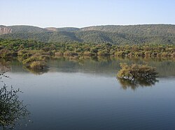
[[File:Ranthambore National Park.JPG|thumb|upright=1.09|Ranthambore National Park, in Rajasthan | [[File:Ranthambore National Park.JPG|thumb|upright=1.09|Ranthambore National Park, in Rajasthan]] | ||
The Aravalli Range is rich in wildlife. The first-ever 2017 wildlife survey of a 200 square kilometre area crossing five districts (Gurgaon, Faridabad, Mewat, Rewari and Mahendergarh) of [[Haryana]] by the [[Wildlife Institute of India]] (WII) found 14 species, including [[Indian leopard|leopards]], [[striped hyena]] (7 sightings), [[golden jackal]] (9 sightings, with 92% occupancy across the survey area), [[nilgai]] (55 sightings), [[palm civet]] (7 sightings), [[Pig|wild pig]] (14 sightings), [[rhesus macaque]] (55 sightings), [[peafowl]] (57 sightings) and [[Indian crested porcupine]] (12 sightings). Encouraged by the first survey, the wildlife department has prepared a plan for a comprehensive study and census of wildlife across the whole Aravalli Range, including radio collar tracking of the wild animals.<ref name=ara1/> Well known leopard and hyena habitat is along the Ferozpure Jhirka-Nuh Aravali range as well as [[Delhi Ridge|Delhi South Ridge]] (Faridabad-Gurugram) to [[Farrukhnagar]] area on the | The Aravalli Range is rich in wildlife. The first-ever 2017 wildlife survey of a 200 square kilometre area crossing five districts (Gurgaon, Faridabad, Mewat, Rewari and Mahendergarh) of [[Haryana]] by the [[Wildlife Institute of India]] (WII) found 14 species, including [[Indian leopard|leopards]], [[striped hyena]] (7 sightings), [[golden jackal]] (9 sightings, with 92% occupancy across the survey area), [[nilgai]] (55 sightings), [[palm civet]]{{which|date=January 2023}} (7 sightings), [[Pig|wild pig]] (14 sightings), [[rhesus macaque]] (55 sightings), [[peafowl]] (57 sightings) and [[Indian crested porcupine]] (12 sightings). Encouraged by the first survey, the wildlife department has prepared a plan for a comprehensive study and census of wildlife across the whole Aravalli Range, including radio collar tracking of the wild animals.<ref name="ara1">''{{Citation needed|date=October 2024}}''</ref> Well known leopard and hyena habitat is along the Ferozpure Jhirka-Nuh Aravali range as well as [[Delhi Ridge|Delhi South Ridge]] (Faridabad-Gurugram) to [[Farrukhnagar]] area on the Delhi–Haryana border, with reports of sightings in Saidpur, Lokri and Jhund Sarai Viran villages near the KMP expressway; Bhukarka 7 km from Pataudi; Pathkori, Bhond, Mandawar in Ferozepur Jirka region.<ref>[https://www.hindustantimes.com/gurugram/traps-set-up-in-four-villages-of-farrukhnagar-after-leopard-s-presence-confirmed-by-pug-marks/story-v3yBOHdCz1ywYsQNvRFGeL.html Traps set up in four villages of Farrukhnagar after leopard's presence confirmed by pug marks], Hindustan Times, 18 January 2019.</ref> | ||
== Concerns == | |||
In May 1992, some parts of the Aravalli hills in Rajasthan and Haryana were protected from mining through the Ecologically Sensitive Areas clauses of Indian laws. In 2003, the central government of India prohibited mining operations in these areas. In 2004, India's Supreme Court banned mining in the notified areas of Aravalli Range. In May 2009, the [[Supreme Court of India|Supreme Court]] extended the ban on mining in an area of 448 km<sup>2</sup> across the [[Faridabad]], [[Gurgaon]] and [[Mewat]] districts in [[Haryana]], covering the Aravalli Range.<ref name=ara12>[https://web.archive.org/web/20121023205119/http://articles.timesofindia.indiatimes.com/2009-05-09/india/28155585_1_aravali-hills-minor-minerals-reclamation-and-rehabilitation SC bans all mining activity in Aravali hills area of Haryana], 9 May 2009.</ref><ref name=ara13>[http://www.hindustantimes.com/StoryPage/StoryPage.aspx?sectionName=HomePage&id=88ca3745-4632-46ec-b790-a32bfae63f22&Headline=Mission+Green%3a+SC+bans+mining+in+Aravali+hills Mission Green: SC bans mining in Aravali hills] {{Webarchive|url=https://web.archive.org/web/20090608191757/http://www.hindustantimes.com/StoryPage/StoryPage.aspx?sectionName=HomePage&id=88ca3745-4632-46ec-b790-a32bfae63f22&Headline=Mission+Green%3A+SC+bans+mining+in+Aravali+hills |date=8 June 2009 }} [[Hindustan Times]], 9 May 2009.</ref> Between 2018-25, 40,175 instances of illegal mining, both major and minor have been reported in the Aravalli districts and 4,181 FIRs have been filed.<ref>{{Cite web |last=Khan |first=Hamza |date=2025-12-26 |title=Over 7,000 illegal mining FIRs in Rajasthan in 7 years; 4,000-plus in Aravalli districts alone |url=https://indianexpress.com/article/india/over-7000-illegal-mining-firs-in-rajasthan-7-years-aravalli-districts-10439539/ |access-date=2025-12-26 |website=The Indian Express |language=en}}</ref> Hills have been completely vanished due to mining like the Bakrija hill in Haryana which was completely flattened in 2024.<ref>{{Cite web |date=2025-12-24 |title=How was hill status taken away from 90% of Aravalli?: What does the landform cover now; will northern India see more desertification? |url=https://www.bhaskarenglish.in/originals/news/savearavalli-hills-aravalli-new-definition-supreme-court-verdict-bjp-governments-vs-congress-136760379.html |access-date=2025-12-27 |website=Bhaskar English |language=en}}</ref><ref>{{Cite web |last=Sharma |first=Bidisha SahaAakash |date=2025-12-23 |title=The Aravalli you’ve never seen: 3D maps reveal a vanishing mountain range |url=https://www.indiatoday.in/india/story/the-aravalli-hills-youve-never-seen-3d-maps-reveal-a-vanishing-mountain-range-2840616-2025-12-23 |access-date=2025-12-27 |website=India Today |language=en}}</ref> | |||
A 2013 report used high-resolution Cartosat-1 and LISS-IV satellite imaging to determine the existence and condition of mines in the Aravalli Range. In the Guru Gram district, the Aravalli hills occupy an area of 11,256 hectares, of which 491 (4.36%) hectares had mines, of which 16 hectares (0.14%) were abandoned flooded mines. In the Faridabad and Mewat districts, about 3610 hectares were part of mining industry, out of a total of 49,300 hectares. These mines were primarily granite and marble quarries for India's residential and real estate construction applications.<ref name=ara14>Rai and Kumar, Mapping of Mining Areas in Aravalli Hills in Gurgaon, Faridabad & Mewat Districts of Haryana Using Geo-Informatics Technology, International Journal of Remote Sensing & Geoscience, Volume 2, Issue 1, Jan. 2013</ref> In the Central Rajasthan region, Sharma states that the presence of some mining has had both positive and negative effects on neighboring agriculture and the ecosystem. The rain-induced erosion brings nutrients as well as potential contaminants.<ref name=ara15>Sharma, K. C. (2003). Perplexities and Ecoremediation of Central Aravallis of Rajasthan. Environmental Scenario for 21st Century, {{ISBN|978-8176484183}}, Chapter 20</ref> | |||
[[environmental damage|Damage to the environment]] and ecology from the unorganized [[urbanization]], [[overexploitation]] of the natural resources including water and minerals, [[environmental effects of mining|mining]], untreated human waste and disposal, pollution, loss of forest cover and [[habitat loss|wildlife habitat]], unprotected status of most of the Aravalli and the lack of an integrated Aravalli management agency are the major causes of concern.<ref>{{cite web|url=https://science.thewire.in/environment/why-illegal-mining-in-the-aravalli-hills-should-scare-delhi-and-its-neighbours/|title=Why Illegal Mining in the Aravalli Hills Should Scare Delhi and Its Neighbours|work=The Wire|author=Hridayesh Joshi|date=22 September 2020|access-date=4 January 2021|archive-date=4 March 2021|archive-url=https://web.archive.org/web/20210304032142/https://science.thewire.in/environment/why-illegal-mining-in-the-aravalli-hills-should-scare-delhi-and-its-neighbours/|url-status=live}}</ref><ref>{{cite web|url=https://www.dw.com/en/the-disappearance-of-indias-aravali-hills/a-49617993|title=The disappearance of India's Aravali Hills|work=[[DW News]]|date=25 July 2019}}</ref> | |||
[[environmental damage|Damage to the environment]] and ecology from the | |||
== Gallery == | == Gallery == | ||
<gallery mode="packed"> | <gallery mode="packed"> | ||
File:Aravali range inside Ranthambhore, Rajasthan.jpg|The Aravali Range inside [[ | File:Aravali range inside Ranthambhore, Rajasthan.jpg|The Aravali Range inside [[Ranthambore National Park]], in [[Rajasthan]]. | ||
File:Aravali hills Udaipur Rajasthan India 2014.jpg|Aravalli | File:Aravali hills Udaipur Rajasthan India 2014.jpg|Aravalli Range near [[Udaipur]] [[Rajasthan]] | ||
File:Mt. Abu.jpg|alt=Mount Abu is the tallest mountain in this range with GURU SHIKHAR as its peak.|Sunset from the sunset point of [[Mount Abu]] | File:Mt. Abu.jpg|alt=Mount Abu is the tallest mountain in this range with GURU SHIKHAR as its peak.|Sunset from the sunset point of [[Mount Abu]] | ||
</gallery> | </gallery> | ||
| Line 383: | Line 378: | ||
==References== | ==References== | ||
{{Reflist| | {{Reflist|30em}} | ||
==Further reading== | ==Further reading== | ||
Latest revision as of 02:45, 2 March 2026
| Aravalli Range | |
|---|---|
 The Aravali Range in Rajasthan | |
| Highest point | |
| Peak | Guru Shikhar, Mount Abu |
| Elevation | 1,722 m (5,650 ft) |
| Coordinates | 24°35′33″N 74°42′30″E / 24.59250°N 74.70833°E |
| Dimensions | |
| Length | 670 km (420 mi) |
| Naming | |
| Pronunciation | Hindi pronunciation: [əɾaːʋ(ə)li] |
| Geography | |
 Topographic map of India showing the range
| |
| Country | India |
| States | |
| Regions | |
| Rivers | |
| Settlements | |
| Range coordinates | 25°00′N 73°30′E / 25°N 73.5°E |
| Geology | |
| Orogeny | Aravalli-Delhi Orogen |
| Age of rock | Precambrian |
| Type of rock | Fold mountains from plate tectonics |
The Aravalli Range (also spelled Aravali) is a mountain range in north-western India. running approximately 670 km (420 mi) in a south-west direction, starting near Delhi, passing through southern Haryana[1] and Rajasthan, and ending in Ahmedabad, Gujarat.[2][3] The highest peak is Guru Shikhar in Mount Abu, Rajasthan at 1,722 m (5,650 ft). The Aravalli Range is the oldest fold-mountain belt in India, dating back to the Paleoproterozoic era.[4][5]
Etymology[edit | edit source]
Aravalli, a composite Sanskrit word from the roots "ara" and "vali", literally means the "line of peaks".[6][7]
Natural history[edit | edit source]
Geology[edit | edit source]

The Aravalli Range, an eroded stub of ancient mountains, is believed to be the oldest range of fold mountains in India.[8] The natural history of the Aravalli Range dates back to times when the Indian Plate was separated from the Eurasian Plate by an ocean. The Proterozoic Aravalli-Delhi orogenic belt in northwest India is similar to the younger Himalayan-type orogenic belts of the Mesozoic-Cenozoic era (of the Phanerozoic) in terms of component parts and appears to have passed through a near-orderly Wilson supercontinental cycle of events. The range rose in a Precambrian event called the Aravalli-Delhi Orogen. The Aravalli Range is a northeast–southwest trending orogenic belt located in the northwestern part of Indian Peninsula. It is part of the Indian Shield that formed from a series of cratonic collisions.[9] In ancient times, Aravalli were extremely high but since have worn down almost completely from millions of years of weathering, whereas the Himalayas, young fold mountains, are still continuously rising. Aravalli have stopped growing higher due to the cessation of upward thrust caused by the tectonic plates in the Earth's crust below them. The Aravalli Range joins two of the ancient Earth's crust segments that make up the greater Indian craton, the Aravalli Craton which is the Marwar segment of Earth's crust to the northwest of the Aravalli Range, and the Bundelkand Craton segment of the Earth's crust to the southeast of the Aravalli Range. Cratons, generally found in the interiors of tectonic plates, are old and stable parts of the continental lithosphere that have remained relatively undeformed during the cycles of merging and rifting of continents.


It consists of two main sequences formed in the Proterozoic eon, metasedimentary rock (sedimentary rocks metamorphosed under pressure and heat without melting) and metavolcanic rock (metamorphosed volcanic rocks) sequences of the Aravalli Supergroup and Delhi Supergroup. These two supergroups rest over the Archean Bhilwara Gneissic Complex basement, which is a gneissic (high-grade metamorphism of sedimentary or igneous rocks) basement formed during the archean eon 4 Ga ago. It started as an inverted basin, that rifted and pulled apart into granitoid basement, initially during Aravalli passive rifting around 2.5 to 2.0 Ga years ago and then during Delhi active rifting around 1.9 to 1.6 Ga years ago. It started with rifting of a rigid Archaean continent banded gneissic complex around 2.2 Ga with the coexisting formation of the Bhilwara aulacogen in its eastern part and eventual rupturing and separation of the continent along a line parallel to the Rakhabdev (Rishabhdev) lineament to the west, simultaneous development of a passive continental margin with the undersea shelf rise sediments of the Aravalli-Jharol belts depositing on the attenuated crust on the eastern flank of the separated continent, subsequent destruction of the continental margin by accretion of the Delhi island arc (a type of archipelago composed of an arc-shaped chain of volcanoes closely situated parallel to a convergent boundary between two converging tectonic plates) from the west around 1.5 Ga. This tectonic plates collision event involved early thrusting with partial obduction (overthrusting of oceanic lithosphere onto continental lithosphere at a convergent plate boundary) of the oceanic crust along the Rakhabdev lineament, flattening and eventual wrenching (also called strike-slip plate fault, sideways horizontal movement of colliding plates with no vertical motion) parallel to the collision zone. Associated mafic igneous rocks show both continental and oceanic tholeiitic geochemistry (magnesium and iron-rich igneous rocks) from the Phanerozoic eon (541–0 million) with rift-related magmatic rock formations.[10]
The Aravalli-Delhi Orogen is an orogen event that led to a large structural deformation of the Earth's lithosphere (crust and uppermost mantle, such as Aravalli and Himalayas fold mountains) due to the interaction between tectonic plates when a continental plate is crumpled and is pushed upwards to form mountain ranges, and involve a great range of geological processes collectively called orogenesis.[11][12]
Minerals[edit | edit source]
The archean basement had served as a rigid indentor which controlled the overall wedge shaped geometry of the orogen. Lithology of area shows that the base rocks of Aravalli are of Mewar Gneiss formed by high-grade regional metamorphic processes from preexisting formations that were originally sedimentary rock with earliest life form that were formed during the archean eon, these contain fossils of unicellular organism such as green algae and cyanobacteria in stromatolitic carbonate ocean reefs formed during the paleoproterozoic era. Sedimentary exhalative deposits of base metal sulfide ores formed extensively along several, long, linear zones in the Bhilwara aulacogen or produced local concentration in the rifted Aravalli continental margin, where rich stromatolitic phosphorites also formed. Tectonic evolution of the Aravalli Mountains shows Mewar Gneiss rocks are overlain by Delhi Supergroup type of rocks that also have post-Aravalli intrusions. Metal sulfide ores were formed in two different epochs, lead and zinc sulfide ores were formed in the sedimentary rocks around 1.8 Ga years ago during Paleoproterozoic phase. The tectonic setting of zinc-lead-copper sulfides mineralisation in the Delhi supergroup rocks in Haryana-Delhi were formed by mantle plume volcanic action around one billion years ago covering Haryana and Rajasthan during the mesoproterozoic. In the southern part of the Aravalli supergroup arc base metal sulfides were generated near the subduction zone on the western fringe and in zones of back-arc extension to the south-east. Continued subduction produced tungsten-tin mineralisation in S-type (sedimentary unmetamorphosed rock), felsic (volcanic rock), and plutons (crystallised solidified magma). This includes commercially viable quantities of minerals, such as rock phosphate, lead-zinc-silver mineral deposits at Zawar, Rikahbdev serpentinite, talc, pyrophyllite, asbestos, apatite, kyanite and beryl.[13][14]
Mining[edit | edit source]
Mining of copper and other metals in the Aravalli Range dates back to at least the 5th century BCE, based on carbon dating.[15][16] Recent research indicates that copper was already mined here during the Sothi-Siswal period going back to c. 4000 BCE. Ancient Kalibangan and Kunal, Haryana settlements obtained copper here.[17]
Geographical features[edit | edit source]

The Indian Craton includes five major cratons. Cratons are part of continental crust made up of upper layer called platforms and older bottom layer called basement rocks. shields are part of a craton where basement rock crops out at the surface and it is the relatively oldest and most stable part that are undeformed by the plate tectonics. The Aravalli Craton (Marwar-Mewar Craton or Western Indian Craton) covers Rajasthan as well as western and southern Haryana. It includes the Mewar Craton in the east and Marwar Craton in the west. It is limited by the Great Boundary Fault in the east, the Thar Desert in the west, Indo-gangetic alluvium in the north, and the Son River-Narmada River-Tapti River basins in the south. It mainly has quartzite, marble, pelite, greywacke and extinct volcanos exposed in the Aravalli-Delhi Orogen. Malani Igneous Suite is the largest in India and third largest igneous suit in the world.[18][19] The uniqueness of the geological feature of Malani Igneous Suite at Jodhpur prompted the Geological Survey of India to declare the site as a National Geological Monument.[20]
Tectonic-stratigraphic evolution[edit | edit source]
Tectonic-stratigraphic evolution of the Aravalli Range:[18]
- Neoproterozoic: Marwar Group
- 500–550 Ma: Malani Igneous Suite
- 720–750 Ma: Sindhrath/Punagarh Group
- 800–850 Ma: Sirohi Group
- 900 Ma: Erinpura granite
- Mesoproterozoic: Delhi Supergroup
- 1100–900 Ma: South Delhi fold belt
- 1600–1450 Ma: North Delhi fold belt
- Paleoproterozoic: Hindoli Group
- 1800–1700 Ma: Sandmata Complex
- 2200–1800 Ma: Aravalli Supergroup and mineralised basin at Rajpura-Dariba
- Neoarchean (2900–2600 Ma): Mangalwar Complex with Bhilwara Group
- Mesoarchean (3300–3000 Ma): Mewar gneiss with Jagat Supergroup
Stratigraphic classification[edit | edit source]
The stratigraphic classification of the Aravalli Range can be divided into the following parts (north to south direction):
- The Archean basement is a banded gneissic complex with schists (medium grade metamorphic rock), gneisses (high grade regional metamorphic rock), composite gneiss and quartzites. It forms the basement rock for both the Delhi Supergroup and the Aravalli Supergroup.
- Aravalli Supergroup: The Aravalli supergroup passes through Rajasthan state, dividing it into two halves, with three-fifths of Rajasthan on the western side towards the Thar Desert and two-thirds on the eastern side consisting of the catchment area of Banas and Chambal rivers bordering the state of Madhya Pradesh.[clarification needed] Guru Shikhar, the highest peak in the Aravalli Range at 5,650 feet (1,720 m) in Mount Abu of Rajasthan, lies near the south-western extremity of the Central Aravalli range, close to the border with Gujarat state. The southern Aravalli Supergroup enters the northeast of Gujarat near Modasa where it lends its name to the Aravalli district, and ends at the centre of the state at Palanpur near Ahmedabad.
- Champaner Group is a rectangular outcrop composed of subgreywacke, siliceous phyllite, pelitic schist, quartzite and pertomict conglomerate.
- Lunavada Group is a polygon area in the south of the Aravali Orogen composed of greywacke-phyllite
- Jharol Group is spread over 200 km2 area with average width of 40 km carbonate-free phyllite and arenite with turbidite facies and argillaceous rocks.
- Udaipur Group is a thick accumulation of greywacke-phyllite basement overlain by dolomite.
- Debari Group consists of Carbonates, Quartzite, and Pelitic rocks which are overlain by the Delwara group.
- Delwara Group is spread over a 500 km2 area with average thickness of 500 m and includes basement orthoquartzite overlain by volcanic conglomerate.
- Unconformities
- Mangalwar/Sandmata Complex and Mewar Gneiss with enclaves of the Jagat group
- Delhi Supergroup
- Alwar Group with arenaceous and mafic volcanic rocks
- Delhi Ridge, in the north
- Haryana Aravalli ranges, in the west
- Tosham Hill range basement rocks include quartzite with chiastolite, the upper layers of quartz porphyry ring dyke, felsite, welded tuff and muscovite biotite granite rocks which have commercially nonviable tin, tungsten and copper. The Tosham Hill range, west of Bhiwani in Haryana, is the northernmost end of the Aravalli range. A northeastern extension of the Aravalli extends to the national capital of India also. Locally known as a ridge it diagonally traverses to the South Delhi (hills of Asola Bhatti Wildlife Sanctuary), where at the hills of Bandhwari, it meets the HaryanaAravalli range consisting of various isolated hills and rocky ridges passing along the southern border of Haryana.[21]
- Madhogarh hill
- Satnali hill
- Nuh-Ferozepur Jhirka hill range, runs along Haryana-Rajasthan border from Nuh to the south of Ferozepur Jhirka.
- Rajasthan Alwar range, in the east
- Ajabgarh Group – Kumbhalgarh Group with carbonate, mafic volcanic and argillaceous rocks
- Raialo Group with mafic volcanic and calcareous rocks
- Alwar Group with arenaceous and mafic volcanic rocks
Human history[edit | edit source]
Tosham Hills - Indus Civilisation mines[edit | edit source]
The Tosham hills have several Indus Valley Civilisation sites in and around the hill range as the area falls under copper-bearing zone of Southwest Haryana and Northeast Rajasthan of Aravalli hill range.[22][23]
Investigation of IVC network of mineral ore needs for metallurgical work and trade, shows that the most common type of grinding stone at Harappa is of Delhi quartzite type found only in the westernmost outliers of the Aravalli Range in southern Haryana near Kaliana and Makanwas villages of Bhiwani district. The quartzite is red-pink to pinkish grey in colour and is crisscrossed with thin haematite and quartz filled fractures with sugary size grain texture.[24][25]
Ravindra Nath Singh and his team of Banaras Hindu University carried out ASI-financed excavations of Indus Valley Civilisation site on the grounds of the Government School in Khanak, during 2014 and 2016. They found early to mature Harappan phase IVC materials, pottery, semiprecious beads of lapis lazuli, carnelian and others. They also found evidence of metallurgical activities, such as crucibles (used for pouring molten metal), furnace lining, burnt floor, ash and ore slugs. Ceramic petrography, metallography, scanning electron microscope (SEM, non-destructive, surface images of nanoscale resolution), energy-dispersive X-ray spectroscopy (EDXA and EDXMA non-destructive, qualitative and quantitative elemental composition) and transmission electron microscopy (TEM, destructive method) scientific studies of the material found prove that the Khanak site was inhabited by the IVC metal-workers who used the locally mined polymetallic tin, and they were also familiar with metallurgical work with copper and bronze. The lowest level of site dates back as far the pre-Harappan era to Sothi-Siswal culture (6600 BP) tentatively.[26]
Ganeshwar Sunari Cultural Complex[edit | edit source]
The Ganeshwar Sunari Cultural Complex (GSCC) is a collection of third millennium BCE settlements in the area of the Aravalli Hill Range. Among them, there are similarities in material culture, and in the production of copper tools. They are located near the copper mines.
"The GSCC is east of the Harappan culture, to the north-east of Ahar–Banas Complex, north/north west to the Kayatha Culture and at a later date, west of the OCP-Copper Hoard sites (Ochre Coloured Pottery culture–Copper Hoard culture). Located within the regions of the Aravalli Hill Range, primarily along the Kantli, Sabi, Sota, Dohan and Bondi rivers, the GJCC is the largest copper producing community in third millennium BCE South Asia, with 385 sites documented. Archaeological indicators of the GSCC were documented primarily in Jaipur, Jhunjhunu, and Sikar districts of Rajasthan, India ..."[27]
Pottery found in the area include incised ware, and reserved slipware.
There are two main type sites, Ganeshwar, and Sunari, in Tehsil Kot Putli, Jaipur district (Geo coordinates: N 27° 35' 51", 76° 06' 85" E).
2025 Supreme Court orders[edit | edit source]
On 20th November 2025 Supreme Court issued an order stating that landforms rising over 100 meters with respect to surrounding terrain would be considered as Aravalli Hills and 2 such hills within 500 meters of each other with land between them are considered an Aravalli range. Hills under 100 m can be used for mining, making buildings and for other works.[28] However, on 29th December the Supreme Court stayed its order following protests by residents, farmers, environmentalists, lawyers and political parties.[29]
Environment[edit | edit source]


Climate[edit | edit source]
The Northern Aravalli Range in Delhi and Haryana has humid subtropical climate and hot semi-arid continental climate with very hot summers and relatively cool winters.[30] The main characteristics of climate in Hisar are dryness, temperature extremes, and low rainfall.[31] The maximum daytime temperature during the summer varies between 40 and 46 °C (104 and 115 °F). During winter, its ranges between 1.5 and 4 °C.[32]
The Central Aravalli Range in Rajasthan has an arid and dry climate.
The Southern Aravalli Range in Gujarat has a tropical wet and dry climate
Rivers[edit | edit source]
Three major rivers and their tributaries flow from the Aravalli, namely Banas and Sahibi rivers which are tributaries of Yamuna, as well as Luni River which flows into the Rann of Kutch.
- North-to-south flowing rivers originate from the western slopes of the Aravalli Range in Rajasthan, pass through the southeastern portion of the Thar Desert, and end into Gujarat.
- Luni River, originates in the Pushkar valley near Ajmer, ends in the marshy lands of Rann of Kutch. It used to be one of the channel of the Saraswati River, as a result its banks have several Indus Valley Civilisation sites including Lothal.
- Sakhi River, ends in the marshy lands of Rann of Kutch.
- Sabarmati River, originates on the western slopes of Aravalli Range of the Udaipur district, end into the Gulf of Khambhat of the Arabian Sea.
- West to north-west flowing rivers originate from the western slopes of the Aravalli Range in Rajasthan, flow through semi-arid historical Shekhawati region and drain into southern Haryana. Several Ochre Coloured Pottery culture sites, also identified as late Harappan phase of Indus Valley Civilisation culture,[33] have been found along the banks of these rivers.
- Sahibi River, originates near Manoharpur in Sikar district flows through Haryana and meets its confluence with the Yamuna in Delhi where it is called Najafgarh drain, along with its following tributaries:[34][35][36][37] Masani barrage, is an important wildlife area.
- Dohan River, tributary of the Sahibi River, originates near Neem Ka Thana in Sikar district).
- Sota River, tributary of the Sahibi River with which it merges at Behror in Alwar district.
- Krishnavati river, former tributary of Sahibi river, originates near Dariba copper mines in Rajsamand district of Rajasthan, flows through Patan in Dausa district and Mothooka in Alwar district, then disappears in Mahendragarh district in Haryana much before reaching Sahibi River. It previously was a tributary to the Sahibi and part of its present canalised channel is called the Outfall Drain No. 8. Many important wetlands lie in its paleochannel, including Matanhail, Chhuchhakwas-Godhari, Khaparwas Wildlife Sanctuary, Bhindawas Wildlife Sanctuary, Sarbashirpur, Sultanpur National Park, Basai and The Lost Lake (Gurugram).
- Sahibi River, originates near Manoharpur in Sikar district flows through Haryana and meets its confluence with the Yamuna in Delhi where it is called Najafgarh drain, along with its following tributaries:[34][35][36][37] Masani barrage, is an important wildlife area.
- West to north-east flowing rivers, originating from the eastern slopes of Aravalli Range in Rajasthan, flow northwards to Yamuna.
- Chambal River, a southern-side tributary of Yamuna River.
- Banas River, a northern-side tributary of Chambal River.
- Berach River, a southern-side tributary of Banas River, originates in the hills of Udaipur district.
- Ahar River, a right-side (or eastern side) tributary of the Berach river, originates in the hills of Udaipur district, flows through Udaipur city and into Lake Pichola.
- Wagli River, a right-side tributary of the Berach River.
- Wagon River, a right-side tributary of the Berach River.
- Gambhiri River, a right-side tributary of the Berach River.
- Orai River, a right-side tributary of the Berach River.
- Berach River, a southern-side tributary of Banas River, originates in the hills of Udaipur district.
- Banas River, a northern-side tributary of Chambal River.
- Chambal River, a southern-side tributary of Yamuna River.
Ecology[edit | edit source]
Wildlife corridors[edit | edit source]
The Great Green Wall of India[edit | edit source]
"The Great Green Wall of Aravalli" is a proposed 1,600 km long and 5 km wide green ecological corridor along Aravalli range from Gujarat to Delhi, it will be connected to Shivalik hill range and 1.35 billion (135 crore) new native trees will be planted over 10 years to rehabilitate the forest cover in this area. To be implemented on a concept similar to the Great Green Wall of Sahara in Africa, it will act as a buffer against pollution, 51% of which is caused by the industrial pollution, 27% by vehicles, 8% by crop burning and 5% by diwali fireworks.[38] It was proposed several times form the 1990s, but as of 2024 the project is still in the planning stage.[39] On the World Environment Day 5 June 2025, Prime Minister Modi kickstarted the phase-I of re-greening of this green wall as extension of the "Ek Ped Maa Ke Naam" (one tree [by each person], for the mother [nature]" campaign which will last till 2027, entailing setting up 1000 permanent nurseries of the native plants for the ongoing regreening of Aravalli by replacing the foreign species. The effort also entails development of the trails, eco parks, wildlife safaris, and people's involvement in 29 districts across 4 states and 700 km mountain range.[40]
The 10,000-acre Gurgram Safari Park is being developed under the Aravalli Green Wall Project to reforest and restore the mountain range.[41]
Northern Aravalli leopard and wildlife corridor[edit | edit source]

The Sariska–Delhi leopard wildlife corridor or the Northern Aravalli leopard wildlife corridor is a 200 km long important biodiversity and wildlife corridor which runs from the Sariska Tiger Reserve in Rajasthan to Delhi Ridge.[42]
This corridor is an important habitat for the Indian leopards and jackals of Aravalli. In January 2019, the Wildlife Institute of India announced that they will undertake the survey of leopard and wildlife, using pugmarks and trap cameras, subsequently, leopards and jackals will be tracked via the radio collars. Urban development, especially the highways and railways bisecting the Aravalli Range and wildlife corridor in several places pose a great risk. Large parts of Aravalli are legally and physically unprotected, with no wildlife passages and little or no wildlife conservation work resulting in deaths of over 10 leopards in 4 years between January 2015 to January 2019.[43][44][45]
The Haryana side of the Gurugram-Faridabad Aravalli hill forests lack availability of water due to which wild animals are seldom seen there. The Government of Haryana used drones for aerial surveys and dug 22 ephemeral pits in 2018 to store the rainwater which became dry during the summer months. In January 2019, the government announced the plan to make the pit perennial by connecting those with pipelines from the nearby villages.[46]
Human activity, such as unplanned urbanization and polluting industrial plants, also pose a great threat. There is often reluctance and denial on part of the government officials of the presence of wildlife such as leopard so that the forest land can be exploited and opened up for the intrusive human development.[47][48][46]
This habitat is under serious threat from the wrong actions of the Government of Haryana which in 2019 passed the amendment to the Punjab Land Alienation Act, 1900 (PLPA). Governor has given his assent for the act, but it has not yet been notified by the Haryana government, hence it is in limbo and has not officially become a law. This amendment will reduce the Haryana's Natural Conservation Zones (NCZs) by 47% or 60,000 acres from 122,113.30 hectares to only 64,384.66 hectares. This is in violation of multiple guidelines of the Supreme Court of India as well as "NCR Planning Board" (NCRPB) notification which states the original 122,113.30 hectares ecologically sensitive forest of South Haryana is a forest, "The major natural features, identified as environmentally sensitive areas, are the extension of Aravalli ridge in Rajasthan, Haryana and NCT-Delhi; forest areas; rivers and tributaries... major lakes and water bodies such as Badkhal lake, Suraj Kund and Damdama in Haryana sub-region".[49] This area as part of Northern Aravalli leopard and wildlife corridor is an important habitat for the leopards in Haryana.
Southern Aravalli leopard wildlife corridor[edit | edit source]
This corridor runs from Sariska and Ranthmbor to Rann of Kutch National Park and Gir National Park in Gujarat.
Nature reserves[edit | edit source]

The following national parks, wildlife reserves, and forests lie in the Aravalli Range.
- Delhi Ridge
- Northern Ridge biodiversity park, 87 hectares approximately near Delhi University
- Yamuna biodiversity park
- Neela Hauz biodiversity park, next to Sanjay Van
- Sanjay Van
- Sanjay Lake
- Aravalli Biodiversity Park
- Tilpath valley biodiversity park, 70 hectares approximately near Sainik Farm
- Asola Bhatti Wildlife Sanctuary
- Haryana
- Aravali Biodiversity Park, Gurgaon
- Madhogarh Biodiversity Park forest
- Nuh Aravalli Biodiversity Park forest
- Satnali Biodiversity Park forest
- Tosham Hill range biodiversity park
- Masani barrage wildlife area.
- Matanhail wildlife area
- Chhuchhakwas-Godhari wetland
- Khaparwas Wildlife Sanctuary
- Bhindawas Wildlife Sanctuary
- Sarbashirpur
- Sultanpur National Park
- Basai
- Bandhwari forest
- Mangar Bani forest
- The Lost Lake (Gurugram)
- Rajasthan
- Gujarat
Flora[edit | edit source]
The Aravalli Range has several forests with a diversity of environment. The Aravalli Range is characterized by dry deciduous forests. They are dominated by plant species such as dhok, acacia, and neem. These forests also support a variety of flowering plants, including roses, bougainvillea, and hibiscus. The Great Green Wall of India, the Northern Aravalli Leopard and Wildlife Corridor, and the Southern Aravalli Leopard Wildlife Corridor are some of the Wildlife Corridors in this Range.[50]
Fauna[edit | edit source]

The Aravalli Range is rich in wildlife. The first-ever 2017 wildlife survey of a 200 square kilometre area crossing five districts (Gurgaon, Faridabad, Mewat, Rewari and Mahendergarh) of Haryana by the Wildlife Institute of India (WII) found 14 species, including leopards, striped hyena (7 sightings), golden jackal (9 sightings, with 92% occupancy across the survey area), nilgai (55 sightings), palm civet[which?] (7 sightings), wild pig (14 sightings), rhesus macaque (55 sightings), peafowl (57 sightings) and Indian crested porcupine (12 sightings). Encouraged by the first survey, the wildlife department has prepared a plan for a comprehensive study and census of wildlife across the whole Aravalli Range, including radio collar tracking of the wild animals.[51] Well known leopard and hyena habitat is along the Ferozpure Jhirka-Nuh Aravali range as well as Delhi South Ridge (Faridabad-Gurugram) to Farrukhnagar area on the Delhi–Haryana border, with reports of sightings in Saidpur, Lokri and Jhund Sarai Viran villages near the KMP expressway; Bhukarka 7 km from Pataudi; Pathkori, Bhond, Mandawar in Ferozepur Jirka region.[52]
Concerns[edit | edit source]
In May 1992, some parts of the Aravalli hills in Rajasthan and Haryana were protected from mining through the Ecologically Sensitive Areas clauses of Indian laws. In 2003, the central government of India prohibited mining operations in these areas. In 2004, India's Supreme Court banned mining in the notified areas of Aravalli Range. In May 2009, the Supreme Court extended the ban on mining in an area of 448 km2 across the Faridabad, Gurgaon and Mewat districts in Haryana, covering the Aravalli Range.[53][54] Between 2018-25, 40,175 instances of illegal mining, both major and minor have been reported in the Aravalli districts and 4,181 FIRs have been filed.[55] Hills have been completely vanished due to mining like the Bakrija hill in Haryana which was completely flattened in 2024.[56][57]
A 2013 report used high-resolution Cartosat-1 and LISS-IV satellite imaging to determine the existence and condition of mines in the Aravalli Range. In the Guru Gram district, the Aravalli hills occupy an area of 11,256 hectares, of which 491 (4.36%) hectares had mines, of which 16 hectares (0.14%) were abandoned flooded mines. In the Faridabad and Mewat districts, about 3610 hectares were part of mining industry, out of a total of 49,300 hectares. These mines were primarily granite and marble quarries for India's residential and real estate construction applications.[58] In the Central Rajasthan region, Sharma states that the presence of some mining has had both positive and negative effects on neighboring agriculture and the ecosystem. The rain-induced erosion brings nutrients as well as potential contaminants.[59]
Damage to the environment and ecology from the unorganized urbanization, overexploitation of the natural resources including water and minerals, mining, untreated human waste and disposal, pollution, loss of forest cover and wildlife habitat, unprotected status of most of the Aravalli and the lack of an integrated Aravalli management agency are the major causes of concern.[60][61]
Gallery[edit | edit source]
-
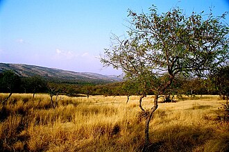 The Aravali Range inside Ranthambore National Park, in Rajasthan.
 -
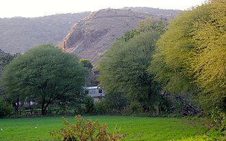
-
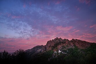 Sunset from the sunset point of Mount Abu


See also[edit | edit source]
- Asola Bhatti Wildlife Sanctuary, Delhi
- Aravali Biodiversity Park
- Arid Forest Research Institute – Indian forest research institute
- Hill Forts of Rajasthan – UNESCO World Heritage Site in northern India
- Pinangwan
References[edit | edit source]
- ↑ "Aravalli Biodiversity Park, Gurgaon". Archived from the original on 28 May 2012.
- ↑ Kohli, M.S. (2004), Mountains of India: Tourism, Adventure, Pilgrimage, Indus Publishing, pp. 29–, ISBN 978-81-7387-135-1
- ↑ Dale Hoiberg; Indu Ramchandani (2000). "Aravali Range". Students' Britannica India. Popular Prakashan. pp. 92–93. ISBN 978-0-85229-760-5.
- ↑ Verma, P. K.; Greiling, R. O. (1 December 1995). "Tectonic evolution of the Aravalli orogen (NW India): an inverted Proterozoic rift basin?". Geologische Rundschau. 84 (4): 683–696. Bibcode:1995GeoRu..84..683V. doi:10.1007/BF00240560. ISSN 1432-1149. S2CID 129382615.
- ↑ Roy, A.B. (1 January 1990). "Evolution of the Precambrian Crust of the Aravalli Mountain Range". Developments in Precambrian Geology. 8: 327–347. doi:10.1016/S0166-2635(08)70173-7. ISBN 9780444883100. ISSN 0166-2635. Archived from the original on 28 June 2021. Retrieved 28 June 2021.
- ↑ George Smith (1882). The Geography of British India, Political & Physical. J. Murray. p. 23.
- ↑ "Aravali Range". Britannica.com. 13 August 2024.
- ↑ Roy, A. B. (1990). Evolution of the Precambrian crust of the Aravalli Range. Developments in Precambrian Geology, 8, 327–347.
- ↑ Mishra, D.C.; Kumar, M. Ravi. Proterozoic orogenic belts and rifting of Indian cratons: Geophysical constraints. Geoscience Frontiers. 2013 March. 5: 25–41.
- ↑ Verma, P.K.; Greiling, R.O. (1995), "Tectonic evolution of the Aravalli orogen (NW India): An inverted Proterozoic rift basin?", Geologische Rundschau, 84 (4): 683, Bibcode:1995GeoRu..84..683V, doi:10.1007/BF00240560, S2CID 129382615
- ↑ Tony Waltham (2009). Foundations of Engineering Geology (3rd ed.). Taylor & Francis. p. 20. ISBN 978-0-415-46959-3.
- ↑ Philip Kearey; Keith A. Klepeis; Frederick J. Vine (2009). "Chapter 10: Orogenic belts". Global Tectonics (3rd ed.). Wiley-Blackwell. p. 287. ISBN 978-1-4051-0777-8.
- ↑ M. Deb and Wayne David Goodfellow, 2004, "Sediment Hosted Lead-Zinc Sulphide Deposits", Narosa Publishing Archived 29 July 2017 at the Wayback Machine, pp 260.
- ↑ Naveed Qamar, "Indian shield rocks" Archived 20 July 2017 at the Wayback Machine.
- ↑ SM Gandhi (2000) Chapter 2 – Ancient Mining and Metallurgy in Rajasthan, Crustal Evolution and Metallogeny in the Northwestern Indian Shield: A Festschrift for Asoke Mookherjee, ISBN 978-1842650011
- ↑ Shrivastva, R. (1999). Mining of copper in ancient India. Indian Journal of History of Science, 34, 173–180
- ↑ Jane McIntosh, The Ancient Indus Valley: New Perspectives. Understanding ancient civilizations. ABC-CLIO, 2008 ISBN 1576079074 p77
- ↑ 18.0 18.1 Cratons of India Archived 12 September 2021 at the Wayback Machine.
- ↑ Cratons of India Archived 16 January 2019 at the Wayback Machine, lyellcollection.org.
- ↑ "Jodhpur Group-Malani Igneous Suite Contact". National Geological Monuments. 27 Jawaharlal Nehru Road, Kolkata,700016: Geological Survey of India. 2001. pp. 65–67. Archived from the original on 30 March 2009. Retrieved 23 March 2009.
{{cite book}}: CS1 maint: location (link) - ↑ Bhuiyan, C.; Singh, R. P.; Kogan, F. N. (2006). "Monitoring drought dynamics in the Aravalli region (India) using different indices based on ground and remote sensing data". International Journal of Applied Earth Observation and Geoinformation. 8 (4): 289–302. Bibcode:2006IJAEO...8..289B. doi:10.1016/j.jag.2006.03.002.
- ↑ Kochhar, N.; Kochhar, R.; Chakrabarti, D. K. (1999). "A New Source of Primary Tin Ore in the Indus Civilisation". South Asian Studies. 15 (1): 115–118. doi:10.1080/02666030.1999.9628571.
- ↑ Chakrabarti, D. K. (2014). "Distribution and Features of the Harappan Settlements". History of India II : Protohistoric Foundation. New Delhi: Vivekananda International Foundation. pp. 97–143. ISBN 978-81-7305-481-5.
- ↑ Law, Randall (2006). "Moving Mountains: The Trade and Transport of Rocks and Minerals within the Greater Indus Valley Region". In Robertson, E. C.; et al. (eds.). Space and Spatial Analysis in Archaeology. Alberta, Canada: University of Calgary Press. ISBN 0-8263-4022-9.
- ↑ Law, Randall (2008). Inter-regional Interaction and Urbanism in the Ancient Indus Valley: A Geologic Provenance Study of Harappa's Rock and Mineral Assemblage (PhD thesis). University of Wisconsin–Madison. pp. 209–210. OCLC 302421826.
- ↑ Vasiliev, A. L.; Kovalchuk, M. V.; Yatsishina, E. B. (2016), "Electron microscopy methods in studies of cultural heritage sites", Crystallography Reports, 61 (6): 873–885, Bibcode:2016CryRp..61..873V, doi:10.1134/S1063774516060183, S2CID 99544227
- ↑ Uzma Z. Rizvi (2010) Indices of Interaction: Comparisons between the Ahar–Banas and Ganeshwar Jodhpura Cultural Complex Archived 9 May 2016 at the Wayback Machine, in EASAA 2007: Special Session on Gilund Excavations, edited by T. Raczek and V. Shinde, pp. 51–61. British Archaeological Reports: ArchaeoPress
- ↑ "Aravalli: Why India's ancient hills are at the centre of growing protests". www.bbc.com. 22 December 2025. Retrieved 30 December 2025.
- ↑ "Supreme Court stays own order limiting definition of Aravalli range amid row". Hindustan Times. 29 December 2025. Retrieved 30 December 2025.
- ↑ "Climate of Hisar". PPU. Archived from the original on 5 May 2012. Retrieved 27 May 2012.
- ↑ "Climate of Hisar". District Administration, Hisar. Archived from the original on 27 March 2012. Retrieved 27 May 2012.
- ↑ "More snowfall in Himachal". The Hindu. Archived from the original on 29 May 2014. Retrieved 24 March 2016.
- ↑ Gupta, S.P., ed. (1995), The 'Lost' Sarasvati and the Indus Civilisation, Jodhpur: Kusumanjali Prakashan
- ↑ Cultural Contours of India: Dr. Satya Prakash Felicitation Volume, Vijai Shankar Śrivastava, 1981. ISBN 0391023586
- ↑ "Sahibi river". Archived from the original on 12 October 2017. Retrieved 18 June 2017.
- ↑ Google Books: Page 41, 42, 43, 44, 47 (b) Sahibi Nadi (River), River Pollution, By A.k.jain
- ↑ Minerals and Metals in Ancient India: Archaeological evidence, Arun Kumar Biswas, Sulekha Biswas, University of Michigan. 1996. ISBN 812460049X.
- ↑ Want govt to build 1600 km green wall along Aravalli Archived 24 December 2019 at the Wayback Machine, Indian Express, 24 December 2019.
- ↑ DW Planet A (13 October 2023). Can India's Great Green Wall stop desertification?. Retrieved 17 August 2024 – via YouTube.
- ↑ Modi to kickstart ‘Aravalli Green Wall’ campaign to reforest world’s oldest mountain range, The Print, 3 June 2025.
- ↑ SC pauses Aravalli jungle safari: What is the eco-tourism project at Delhi’s doorstep, and why are critics opposed to it?, Indian Express, 9 Oct 2025.
- ↑ Haryana Government moots buffer zone to save Asola sanctuary, Times of India, 30 January 2019.
- ↑ Death, proof of leopard life in Asola sanctuary, Hindustan Times, 31 January 2019.
- ↑ 10-month-old leopard found dead on Gurugram-Faridabad Expressway, India Today, 31 January 2019.
- ↑ Leopard killed in accident on Gurugram-Faridabad road, Times of India, 30 January 2019.
- ↑ 46.0 46.1 Leopards keep away from Haryana side of Asola due to scarcity, Times of India, 1 February 2019.
- ↑ Only 30 villagers turn up for impact study, Times of India, 2018.
- ↑ NGT asks CPCB to test groundwater sample near Bandhwari plant Archived 16 January 2019 at the Wayback Machine, India Today, 1 August 2017.
- ↑ Law changes bring Aravalli conservation to the fore Archived 24 December 2019 at the Wayback Machine, Hindustan Times, 22 December 2019.
- ↑ "Aravalli Range – Overview of Flora & Fauna". GeeksforGeeks. GeeksforGeeks. 23 July 2025. Retrieved 26 December 2025.
- ↑ [citation needed]
- ↑ Traps set up in four villages of Farrukhnagar after leopard's presence confirmed by pug marks, Hindustan Times, 18 January 2019.
- ↑ SC bans all mining activity in Aravali hills area of Haryana, 9 May 2009.
- ↑ Mission Green: SC bans mining in Aravali hills Archived 8 June 2009 at the Wayback Machine Hindustan Times, 9 May 2009.
- ↑ Khan, Hamza (26 December 2025). "Over 7,000 illegal mining FIRs in Rajasthan in 7 years; 4,000-plus in Aravalli districts alone". The Indian Express. Retrieved 26 December 2025.
- ↑ "How was hill status taken away from 90% of Aravalli?: What does the landform cover now; will northern India see more desertification?". Bhaskar English. 24 December 2025. Retrieved 27 December 2025.
- ↑ Sharma, Bidisha SahaAakash (23 December 2025). "The Aravalli you've never seen: 3D maps reveal a vanishing mountain range". India Today. Retrieved 27 December 2025.
- ↑ Rai and Kumar, Mapping of Mining Areas in Aravalli Hills in Gurgaon, Faridabad & Mewat Districts of Haryana Using Geo-Informatics Technology, International Journal of Remote Sensing & Geoscience, Volume 2, Issue 1, Jan. 2013
- ↑ Sharma, K. C. (2003). Perplexities and Ecoremediation of Central Aravallis of Rajasthan. Environmental Scenario for 21st Century, ISBN 978-8176484183, Chapter 20
- ↑ Hridayesh Joshi (22 September 2020). "Why Illegal Mining in the Aravalli Hills Should Scare Delhi and Its Neighbours". The Wire. Archived from the original on 4 March 2021. Retrieved 4 January 2021.
- ↑ "The disappearance of India's Aravali Hills". DW News. 25 July 2019.
Further reading[edit | edit source]
- Watershed Management in Aravali Foothills, by Gurmel Singh, S. S. Grewal, R. C. Kaushal. Published by Central Soil & Water Conservation Research & Training Institute, 1990.
External links[edit | edit source]
- Aravali Range Homepage India Environment Portal
- Rainfall