



WikiDwarfBOT (talk | contribs) Cleanup: Source modification. |
m page updated |
||
| Line 1: | Line 1: | ||
{{About|the municipality in Uttar Pradesh, India|its namesake district|Muzaffarnagar district}} | {{About|the municipality in Uttar Pradesh, India|its namesake district|Muzaffarnagar district}} | ||
{{more citations needed|date=January 2013}} | {{more citations needed|date=January 2013}} | ||
{{Use Indian English|date= | {{Use Indian English|date=November 2023}} | ||
{{Use dmy dates|date= | {{Use dmy dates|date=November 2023}} | ||
{{Infobox settlement | {{Infobox settlement | ||
<!-- Please do not add any Indic script in this infobox, per WP:INDICSCRIPT policy. -->| name | <!-- Please do not add any Indic script in this infobox, per WP:INDICSCRIPT policy. -->| name = Muzaffarnagar | ||
| official_name | | official_name = | ||
| settlement_type | | settlement_type = City | ||
| nickname | | nickname = Sugar Bowl of Uttar Pradesh | ||
| pushpin_map | | pushpin_map = India Uttar Pradesh | ||
| coordinates | | coordinates = {{coord|29.482|77.700|format=dms|display=inline,title}} | ||
| subdivision_type | | subdivision_type = Country | ||
| subdivision_name | | subdivision_name = {{flag|India}} | ||
| subdivision_type1 | | subdivision_type1 = [[States and territories of India|State]] | ||
| subdivision_type2 | | subdivision_type2 = [[List of districts of Uttar Pradesh|District]] | ||
| subdivision_name1 | | subdivision_name1 = [[Uttar Pradesh]] | ||
| subdivision_name2 | | subdivision_name2 = [[Muzaffarnagar district|Muzaffarnagar]] | ||
| established_title | | established_title = First Settled | ||
| established_date | | established_date = 1399 | ||
| established_title1 | | established_title1 = Founded | ||
| established_date1 | | established_date1 = 1633 | ||
| established_title2 | | established_title2 = Incorporated as City | ||
| established_date2 | | established_date2 = 1826 | ||
| founder | | founder = Syed Muzaffar Ali Khan | ||
| named_for | | named_for = Syed Muzaffar Ali Khan | ||
| governing_body | | governing_body = Municipal Board of Muzaffarnagar | ||
| leader_party | | leader_party = | ||
| leader_title | | leader_title = [[District magistrate|District Magistrate]] | ||
| leader_name | | leader_name = Umesh Mishra | ||
[[Indian Administrative Service|IAS]]<ref name="dm-profile">{{Cite web|url=https://muzaffarnagar.nic.in/dm-profile/|title=Who's Who|website=muzaffarnagar.nic.in|access-date=15 May 2019}}</ref> | [[Indian Administrative Service|IAS]]<ref name="dm-profile">{{Cite web|url=https://muzaffarnagar.nic.in/dm-profile/|title=Who's Who|website=muzaffarnagar.nic.in|access-date=15 May 2019}}</ref> | ||
| leader_title1 | | leader_title1 = [[Member of Parliament, Lok Sabha]] | ||
| leader_name1 | | leader_name1 = [[Harendra Singh Malik]] ([[Samajwadi Party|SP]]) | ||
| unit_pref | | unit_pref = Metric | ||
| area_total_km2 | | area_total_km2 = 204.8 | ||
| length_km | | length_km = | ||
| width_km | | width_km = | ||
| elevation_footnotes | | elevation_footnotes = | ||
| elevation_m | | elevation_m = 267 | ||
| population_total | | population_total = 494,792 | ||
| population_as_of | | population_as_of = 2011 | ||
| population_footnotes | | population_footnotes = <ref name=2011Cities>{{cite web|url=http://www.censusindia.gov.in/2011-prov-results/paper2/data_files/India2/Table_2_PR_Cities_1Lakh_and_Above.pdf|title=Provisional Population Totals, Census of India 2011; Cities having population 1 lakh and above|publisher=Office of the Registrar General & Census Commissioner, India|archive-url=https://web.archive.org/web/20120507135928/http://www.censusindia.gov.in/2011-prov-results/paper2/data_files/India2/Table_2_PR_Cities_1Lakh_and_Above.pdf |access-date=31 October 2023|archive-date=7 May 2012}}</ref> | ||
| population_density_km2 | | population_density_km2 = auto | ||
| population_metro_footnotes = <ref name=2011UA>{{cite web|url= | | population_metro_footnotes = <ref name=2011UA>{{cite web|url=https://www.censusindia.gov.in/2011-prov-results/paper2/data_files/India2/Table_3_PR_UA_Citiees_1Lakh_and_Above.pdf|title=Provisional Population Totals, Census of India 2011; Urban Agglomerations/Cities having population 1 lakh and above|publisher=Office of the Registrar General & Census Commissioner, India|archive-url=https://web.archive.org/web/20201122151653/https://www.censusindia.gov.in/2011-prov-results/paper2/data_files/India2/Table_3_PR_UA_Citiees_1Lakh_and_Above.pdf |archive-date=22 November 2020 |access-date=31 October 2023}}</ref> | ||
| population_rank | | population_rank = [[List of cities in Uttar Pradesh by population|15]] (In [[Uttar Pradesh|U.P.]]) | ||
| population_blank1_title | | population_blank1_title = City | ||
| population_blank1 | | population_blank1 = 351,838 | ||
| population_demonym | | population_demonym = Muzaffarnagri | ||
| demographics_type1 | | demographics_type1 = Languages | ||
| demographics1_title1 | | demographics1_title1 = Official | ||
| timezone1 | | demographics1_info1 = [[Hindi]] | ||
| utc_offset1 | | demographics1_title2 = Additional official | ||
| postal_code_type | | demographics1_info2 = [[Urdu]] | ||
| postal_code | | demographics1_title3 = Native | ||
| postal2_code_type | | demographics1_info3 = [[Kauravi dialect|Khariboli]] | ||
| postal2_code | | demographics1_title4 = Literacy rate | ||
| area_code | | demographics1_info4 = 85.16 | ||
| area_code_type | | timezone1 = [[Indian Standard Time|IST]] | ||
| registration_plate | | utc_offset1 = +5:30 | ||
| blank_name_sec1 | | postal_code_type = [[Postal Index Number|PIN]] | ||
| blank_info_sec1 | | postal_code = 251001 | ||
| website | | postal2_code_type = [[Postal Index Number|PIN]] | ||
| leader_title2 | | postal2_code = 251002 | ||
| leader_name2 | | area_code = 0131 | ||
| area_code_type = Telephone code | |||
| registration_plate = UP-12 | |||
| blank_name_sec1 = First newspaper | |||
| blank_info_sec1 = ''Dainik Dehat'' (est. 1936) | |||
| website = {{URL|muzaffarnagar.nic.in}} | |||
| leader_title2 = [[Member of Legislative Assembly]] | |||
| leader_name2 = [[Kapil Dev Agarwal]] ([[BJP]]) | |||
}} | }} | ||
'''Muzaffarnagar''' is a city under [[Muzaffarnagar district]] in the Indian State of [[Uttar Pradesh]]. It is situated midway on the [[Delhi]] - [[Haridwar]]/[[Dehradun]] National Highway ([[NH 58]]) and is also well connected with the [[Indian Railways|national railway network]]. It is known as the sugarbowl of Uttar Pradesh. | '''Muzaffarnagar''' ({{IPA|hi|mʊzəfːəɾ.nəgəɾ}}, {{IPA|hi|mʊd͡ʒəp.pʰəɾ.nəgəɾ|also}}) is a city under [[Muzaffarnagar district]] in the Indian State of [[Uttar Pradesh]]. It is situated midway on the [[Delhi]] - [[Haridwar]]/[[Dehradun]] National Highway ([[NH 58]]) and is also well connected with the [[Indian Railways|national railway network]]. It is known as the sugarbowl of Uttar Pradesh. | ||
The city previously called Sarwat and is located in the middle of the highly fertile upper [[Ganga-Yamuna Doab]] region and is very near to New Delhi and Saharanpur, making it one of the most developed and prosperous cities of Uttar Pradesh. It comes under the Saharanpur division. This city is part of Delhi Mumbai Industrial Corridor (DMIC) and [[Amritsar Delhi Kolkata Industrial Corridor]] (ADKIC). It shares its border with the state of Uttarakhand and it is the principal commercial, industrial and educational hub of Western Uttar Pradesh. | The city previously called Sarwat and is located in the middle of the highly fertile upper [[Ganga-Yamuna Doab]] region and is very near to New Delhi and Saharanpur, making it one of the most developed and prosperous cities of Uttar Pradesh. It comes under the Saharanpur division. This city is part of Delhi Mumbai Industrial Corridor (DMIC) and [[Amritsar Delhi Kolkata Industrial Corridor]] (ADKIC). It shares its border with the state of Uttarakhand and it is the principal commercial, industrial and educational hub of Western Uttar Pradesh. | ||
| Line 73: | Line 77: | ||
==History== | ==History== | ||
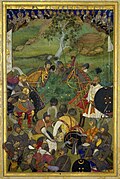
[[File:The Decapitation of Khan Jahan Lodi.jpg|thumb|Khan-i Jahan Muzaffar Barha (right) and Sayyid Mian Barha I (left)]] | [[File:The Decapitation of Khan Jahan Lodi.jpg|thumb|Khan-i Jahan Muzaffar Barha (right) and Sayyid Mian Barha I (left)]] | ||
The town was established in 1633 by the son of a [[Mughal Empire|Mughal]] Commander | The earliest settlers of Muzaffarnagar and the region around it were [[Brahmins]] and [[Rajputs]], followed by later migrations of [[Jat]] and [[Gurjar]] tribes.<ref name="Ross"/> The town was established in 1633 by the son of a [[Mughal Empire|Mughal]] Commander Sayyid Muzaffar Khan Barha, otherwise known as Khan-i-Jahan,<ref>{{cite book |author=Cadell |first=Alan |url=https://books.google.com/books?id=4HoIAAAAQAAJ&dq=sayyids+jansath&pg=RA4-PA31 |title=Settlement Report of the District of Muzaffarnagar: Including a Report on the Permanent Settlement of the Western Parganas of the District, and Also a Report on the Settlement of the Ganges Canal Tract |date=1873 |publisher=North-Western Provinces and Oudh Government Press |page=31 |author-link=Alan Cadell}}</ref> during the reign of [[Shah Jahan]]. At the time Muzaffarnagar was part of the ''Barah country'' as it was intimately connected with the Indian Muslim kinship group called the [[Sadaat-e-Bara|Barah Sayyids]],<ref name="Ross">{{cite book |url= https://books.google.com/books?id=snpCAAAAIAAJ&dq=muzaffarnagar+barha+country&pg=PA266 |page=266 |author= David Ross |title= The Land of the Five Rivers and Sindh |date= 1883 }}</ref> who controlled the upper Doab.<ref>{{Cite book|url= https://books.google.com/books?id=25MbAQAAIAAJ&dq=sayyid+barha+rural&pg=PA68 |title= The Imperial Gazetteer of India: Volume 10 |page=68 |author= William Wilson Hunter |date=1885 |publisher=the University of California |isbn= 978-81-7019-108-7 }}</ref><ref>{{Cite book|url= https://books.google.com/books?id=SW45AAAAIAAJ&q=muzaffarnagar+barha+country |title= Islamic Culture:Volume 7 |page=439 |author= Marmaduke William Pickthall, Muhammad Asad |date=1933 }}</ref> From Muzaffarnagar, the influential [[Sayyid Brothers|Sayyid brothers]] became de-facto rulers of the Mughal empire in the 1710s. The Indian Muslim inhabitants of [[Jansath|Barha]] especially from near the town of [[Jansath]] were heavily recruited in the Mughal army and in the personal cavalry of the [[Sayyid Brothers]].<ref>{{cite book |url= https://books.google.com/books?id=-VbRAAAAMAAJ&q=khafi+khan+the+syeds+barha+non-muslims |title= Discovery of Pakistan |author= Abdul Aziz |date= 1964 |publisher= the University of Michigan |page= 136 }}</ref> | ||
In 1901, during the [[British Raj]], it was a district in the [[Meerut]] Division in [[United Provinces of Agra and Oudh]].<ref>[https://dsal.uchicago.edu/reference/gazetteer/pager.html?objectid=DS405.1.I34_V18_089.gif Muzaffarnagar District] ''[[The Imperial Gazetteer of India]]'', 1909, v. 18, p. 83.</ref> In 1947, when the country got independence [[Flag of India|Indian flag]] was hoisted for the first time in the Muzaffarnagar City.<ref name="imp93">{{cite web| title = Muzaffarnagar City|publisher=[[Imperial Gazetteer of India]], Digital South Asia Library, Volume 18|page= 93|year=1909| url = https://dsal.uchicago.edu/reference/gazetteer/pager.html?objectid=DS405.1.I34_V18_099.gif|access-date=9 September 2013}}</ref> | In 1901, during the [[British Raj]], it was a district in the [[Meerut]] Division in [[United Provinces of Agra and Oudh]].<ref>[https://dsal.uchicago.edu/reference/gazetteer/pager.html?objectid=DS405.1.I34_V18_089.gif Muzaffarnagar District] ''[[The Imperial Gazetteer of India]]'', 1909, v. 18, p. 83.</ref> In 1947, when the country got independence [[Flag of India|Indian flag]] was hoisted for the first time in the Muzaffarnagar City.<ref name="imp93">{{cite web| title = Muzaffarnagar City|publisher=[[Imperial Gazetteer of India]], Digital South Asia Library, Volume 18|page= 93|year=1909| url = https://dsal.uchicago.edu/reference/gazetteer/pager.html?objectid=DS405.1.I34_V18_099.gif|access-date=9 September 2013}}</ref> | ||
On October | On 18 October 1976, during "[[The Emergency (India)#Forced sterilisation|The Emergency]], Prime Minister Indira Gandhi's suspension of democracy in India, between 25 and 30 people protesting against [[compulsory sterilisation]] were [[Homicide|killed]] when [[Uttar Pradesh Police|Uttar Pradesh police]] fired into the [[crowd]].<ref>[https://www.thehindu.com/news/national/emergency-excesses-still-families-in-muzaffarnagar/article7371660.ece Emergency excesses still haunt Khalapar], by Mohammad Ali, ''The Hindu'' ([[Chennai]], Tamil Nadu), 1 July 2015</ref> | ||
===2013 Muzaffarnagar riots=== | ===2013 Muzaffarnagar riots=== | ||
The [[2013 Muzaffarnagar riots]] between Hindus and Muslims resulted in 62 deaths.<ref>{{cite web|url=http://timesofindia.indiatimes.com/india/Government-releases-data-of-riot-victims-identifying-religion/articleshow/22998550.cms|title=Government releases data of riot victims identifying religion|newspaper=[[The Times of India]]|date=24 September 2013|access-date=11 July 2014}}</ref> | The [[2013 Muzaffarnagar riots]] between Hindus and Muslims resulted in 62 deaths.<ref>{{cite web|url=http://timesofindia.indiatimes.com/india/Government-releases-data-of-riot-victims-identifying-religion/articleshow/22998550.cms|title=Government releases data of riot victims identifying religion|newspaper=[[The Times of India]]|date=24 September 2013|access-date=11 July 2014}}</ref> | ||
According to a May 2015 report in [[India Today]]:{{Blockquote|[[Shamli]] and adjoining Muzaffarnagar districts are considered sensitive ever since large-scale communal violence erupted in August and September 2013. More than 50 people had died and over 50,000 were rendered homeless ... The riot that ensued had engulfed many districts of western UP.<ref name="IT May 2015">{{cite news|url= | According to a May 2015 report in [[India Today]]:{{Blockquote|[[Shamli]] and adjoining Muzaffarnagar districts are considered sensitive ever since large-scale communal violence erupted in August and September 2013. More than 50 people had died and over 50,000 were rendered homeless ... The riot that ensued had engulfed many districts of western UP.<ref name="IT May 2015">{{cite news|url=https://www.indiatoday.in/india/story/western-up-violence-shamli-clashes-tablighi-jamaat-clerics-kandhla-station-bsp-sp-251281-2015-05-03|title=Western Uttar Pradesh tense after communal violence in Shamli|publisher=India Today|date=4 May 2015|access-date=25 September 2016}}</ref>}} | ||
==Geography== | ==Geography== | ||
{{See also|List of cities in Uttar Pradesh}} | {{See also|List of cities in Uttar Pradesh}} | ||
===Topography=== | |||
Muzaffarnagar is 272 meters above sea level<ref>{{cite web|url=http://www.fallingrain.com/world/IN/36/Muzaffarnagar.html|title=Maps, Weather, and Airports for Muzaffarnagar, India|website=www.fallingrain.com|access-date=1 February 2018}}</ref> in the Doab region of [[Indo-Gangetic Plain]]. It is 125 kilometres north east of the national capital, [[New Delhi]], and 200 kilometres south east of [[Chandigarh]], and near to [[Roorkee]], [[Saharanpur]], [[Meerut]] & [[Bijnor]]. | Muzaffarnagar is 272 meters above sea level<ref>{{cite web|url=http://www.fallingrain.com/world/IN/36/Muzaffarnagar.html|title=Maps, Weather, and Airports for Muzaffarnagar, India|website=www.fallingrain.com|access-date=1 February 2018}}</ref> in the Doab region of [[Indo-Gangetic Plain]]. It is 125 kilometres north east of the national capital, [[New Delhi]], and 200 kilometres south east of [[Chandigarh]], and near to [[Roorkee]], [[Saharanpur]], [[Meerut]] & [[Bijnor]]. | ||
==Climate== | ===Climate=== | ||
{{Main|Climate of Uttar Pradesh}} | {{Main|Climate of Uttar Pradesh}} | ||
Muzaffarnagar has a [[monsoon]] influenced [[humid subtropical]] climate characterised by much hot summers and cooler winters. Summers last from early April to late June and are extremely hot. The monsoon arrives in late June and continues until the middle of September. Temperatures drop slightly, with plenty of cloud cover but with higher humidity. Temperatures rise again in October and the city then has a mild, dry winter season from late October to the middle of March. June is the warmest month of the year.{{citation needed|date=June 2018}} | Muzaffarnagar has a [[monsoon]] influenced [[humid subtropical]] climate characterised by much hot summers and cooler winters. Summers last from early April to late June and are extremely hot. The monsoon arrives in late June and continues until the middle of September. Temperatures drop slightly, with plenty of cloud cover but with higher humidity. Temperatures rise again in October and the city then has a mild, dry winter season from late October to the middle of March. June is the warmest month of the year.{{citation needed|date=June 2018}} | ||
The temperature in June averages 30.2 °C. In January, the average temperature goes to as low as 7 °C. It is the lowest average temperature of the whole year. The average annual temperature in Muzaffarnagar is 24.2 °C. The highest and lowest temperatures ever recorded in Muzaffarnagar are {{convert|45|C|F}} on 29 May 1994 and {{convert|-2.6|C|F}} on 23 December 1990 respectively. The rainfall averages 929 mm. The driest month is November, with 8 mm of rain. Highest precipitation falls in July, with an average of 261.4 mm.{{citation needed|date=June 2018}} | The temperature in June averages 30.2 °C. In January, the average temperature goes to as low as 7 °C. It is the lowest average temperature of the whole year. The average annual temperature in Muzaffarnagar is 24.2 °C. The highest and lowest temperatures ever recorded in Muzaffarnagar are {{convert|45|C|F}} on 29 May 1994 and {{convert|-2.6|C|F}} on 23 December 1990 respectively. The rainfall averages 929 mm. The driest month is November, with 8 mm of rain. Highest precipitation falls in July, with an average of 261.4 mm.{{citation needed|date=June 2018}} | ||
According to the ''World Air Quality Report 2024'', Muzaffarnagar is one of the 20 most polluted cities in India.<ref>{{Cite news |date=2025-03-12 |title=With 13 of 20 most polluted cities, India ranks 5th globally |url=https://timesofindia.indiatimes.com/india/with-13-of-20-most-polluted-cities-india-ranks-5th-globally/articleshow/118909491.cms |access-date=2025-03-18 |work=The Times of India |issn=0971-8257}}</ref> | |||
<div class="center"> | <div class="center"> | ||
{{Weather box|width = auto | {{Weather box|width = auto | ||
| Line 99: | Line 106: | ||
| metric first = Yes | | metric first = Yes | ||
| single line = Yes | | single line = Yes | ||
| location = Muzaffarnagar ( | | location = Muzaffarnagar (1991–2020, extremes 1981–2020) | ||
| temperature colour = | | temperature colour = | ||
| Jan record high C = 28.9 | | Jan record high C = 28.9 | ||
| Line 110: | Line 117: | ||
| Aug record high C = 39.0 | | Aug record high C = 39.0 | ||
| Sep record high C = 37.0 | | Sep record high C = 37.0 | ||
| Oct record high C = | | Oct record high C = 35.8 | ||
| Nov record high C = 33.1 | | Nov record high C = 33.1 | ||
| Dec record high C = 28. | | Dec record high C = 28.8 | ||
| year record high C = 45.0 | | year record high C = 45.0 | ||
| Jan high C = 19. | | Jan high C = 19.0 | ||
| Feb high C = | | Feb high C = 23.0 | ||
| Mar high C = | | Mar high C = 28.2 | ||
| Apr high C = 34. | | Apr high C = 34.8 | ||
| May high C = 37. | | May high C = 37.6 | ||
| Jun high C = 36. | | Jun high C = 36.2 | ||
| Jul high C = 33.2 | | Jul high C = 33.2 | ||
| Aug high C = 32. | | Aug high C = 32.5 | ||
| Sep high C = 32. | | Sep high C = 32.5 | ||
| Oct high C = | | Oct high C = 31.1 | ||
| Nov high C = 26. | | Nov high C = 26.5 | ||
| Dec high C = 21. | | Dec high C = 21.5 | ||
| year high C = 29. | | year high C = 29.7 | ||
| Jan low C = 5.8 | | Jan low C = 5.8 | ||
| Feb low C = 8. | | Feb low C = 8.7 | ||
| Mar low C = 12. | | Mar low C = 12.9 | ||
| Apr low C = | | Apr low C = 18.1 | ||
| May low C = 22. | | May low C = 22.4 | ||
| Jun low C = 24. | | Jun low C = 24.3 | ||
| Jul low C = | | Jul low C = 25.0 | ||
| Aug low C = 24. | | Aug low C = 24.6 | ||
| Sep low C = 22. | | Sep low C = 22.6 | ||
| Oct low C = | | Oct low C = 16.2 | ||
| Nov low C = 10. | | Nov low C = 10.1 | ||
| Dec low C = 6.3 | | Dec low C = 6.3 | ||
| year low C = 16. | | year low C = 16.5 | ||
| Jan record low C = -0.9 | | Jan record low C = -0.9 | ||
| Feb record low C = 1.5 | | Feb record low C = 1.5 | ||
| Line 154: | Line 161: | ||
| year record low C = -2.6 | | year record low C = -2.6 | ||
| rain colour = green | | rain colour = green | ||
| Jan rain mm = | | Jan rain mm = 20.5 | ||
| Feb rain mm = 32. | | Feb rain mm = 32.2 | ||
| Mar rain mm = | | Mar rain mm = 25.0 | ||
| Apr rain mm = | | Apr rain mm = 13.4 | ||
| May rain mm = | | May rain mm = 29.2 | ||
| Jun rain mm = | | Jun rain mm = 90.6 | ||
| Jul rain mm = | | Jul rain mm = 232.0 | ||
| Aug rain mm = | | Aug rain mm = 232.5 | ||
| Sep rain mm = 162. | | Sep rain mm = 162.3 | ||
| Oct rain mm = | | Oct rain mm = 21.2 | ||
| Nov rain mm = | | Nov rain mm = 6.4 | ||
| Dec rain mm = | | Dec rain mm = 7.3 | ||
| year rain mm = | | year rain mm = 872.5 | ||
| Jan rain days = 1. | | Jan rain days = 1.7 | ||
| Feb rain days = 2. | | Feb rain days = 2.4 | ||
| Mar rain days = 2.2 | | Mar rain days = 2.2 | ||
| Apr rain days = 1. | | Apr rain days = 1.3 | ||
| May rain days = 2. | | May rain days = 2.4 | ||
| Jun rain days = 4.4 | | Jun rain days = 4.4 | ||
| Jul rain days = 9. | | Jul rain days = 9.2 | ||
| Aug rain days = 9. | | Aug rain days = 9.6 | ||
| Sep rain days = 5. | | Sep rain days = 5.7 | ||
| Oct rain days = 1. | | Oct rain days = 1.0 | ||
| Nov rain days = 0. | | Nov rain days = 0.6 | ||
| Dec rain days = | | Dec rain days = 0.7 | ||
| year rain days = | | year rain days = 41.2 | ||
| time day = 17:30 [[Indian Standard Time|IST]] | | time day = 17:30 [[Indian Standard Time|IST]] | ||
| Jan humidity = 58 | | Jan humidity = 58 | ||
| Feb humidity = | | Feb humidity = 50 | ||
| Mar humidity = | | Mar humidity = 44 | ||
| Apr humidity = | | Apr humidity = 32 | ||
| May humidity = 34 | | May humidity = 34 | ||
| Jun humidity = | | Jun humidity = 49 | ||
| Jul humidity = | | Jul humidity = 70 | ||
| Aug humidity = 72 | | Aug humidity = 72 | ||
| Sep humidity = 65 | | Sep humidity = 65 | ||
| Oct humidity = | | Oct humidity = 52 | ||
| Nov humidity = | | Nov humidity = 53 | ||
| Dec humidity = | | Dec humidity = 57 | ||
| year humidity = 53 | | year humidity = 53 | ||
| source 1 = [[India Meteorological Department]]<ref name=IMDnormals> | | source 1 = [[India Meteorological Department]]<ref>{{cite web | ||
| url = https://imdpune.gov.in/library/public/Climatological%20Tables%201991-2020.pdf | |||
| title = Climatological Tables of Observatories in India 1991-2020 | |||
| publisher = [[India Meteorological Department]] | |||
| access-date = April 8, 2024 | |||
}}</ref><ref name=IMDnormals> | |||
{{cite web | {{cite web | ||
| archive-url = https://web.archive.org/web/20200205040301/http://imdpune.gov.in/library/public/1981-2010%20CLIM%20NORMALS%20%28STATWISE%29.pdf | | archive-url = https://web.archive.org/web/20200205040301/http://imdpune.gov.in/library/public/1981-2010%20CLIM%20NORMALS%20%28STATWISE%29.pdf | ||
| Line 209: | Line 221: | ||
==Demographics== | ==Demographics== | ||
<!-- There is a separate article for the district, so statistics should be for the municipality only!! --> | <!-- There is a separate article for the district, so statistics should be for the municipality only!! --> | ||
{{As of|2011|alt=As of the}} [[2011 census of India|2011 census]], Muzaffar Nagar municipality had a population of 351,838<ref name=2011Cities/> The municipality had a [[human sex ratio|sex ratio]] of 897 females per 1,000 males and 12.01% of the population were under six years old.<ref name=2011Cities/> Effective literacy was 85.16%; male literacy was 88.83% and female literacy was 81.05%.<ref name=2011Cities/> The urban/metropolitan population is 494,792, of which 261,338 are males and 233,454 are females.<ref name=2011UA/> | |||
===Religion=== | |||
{{Pie chart | {{Pie chart | ||
| thumb = right | | thumb = right | ||
| caption = Religion in Muzaffarnagar City (2011)<ref name="census2011"/> | | caption = Religion in Muzaffarnagar City (2011)<ref name="census2011"/> | ||
| label1 = Hinduism | | label1 = [[Hinduism]] | ||
| value1 = 55.79 | | value1 = 55.79 | ||
| color1 = darkorange | | color1 = darkorange | ||
| label2 = Islam | | label2 = [[Islam]] | ||
| value2 = 41.39 | | value2 = 41.39 | ||
| color2 = Green | | color2 = Green | ||
| label3 = Jainism | | label3 = [[Jainism]] | ||
| value3 = 1.76 | | value3 = 1.76 | ||
| color3 = Brown | | color3 = Brown | ||
| Line 225: | Line 240: | ||
| color4 = Black | | color4 = Black | ||
}} | }} | ||
The city has 55.79% [[Hindus]], 41.39% [[Muslims]], 1.7% [[Jainism|Jains]], 0.67% [[Sikhs]], 0.67% [[Buddhist]]s and 0.17% [[Christians]]<ref name="census2011">{{cite web|title=Population by religion community - 2011|url=http://www.censusindia.gov.in/2011census/C-01/DDW00C-01%20MDDS.XLS|website=Census of India, 2011|publisher=The Registrar General & Census Commissioner, India|archive-url=https://web.archive.org/web/20150825155850/http://www.censusindia.gov.in/2011census/C-01/DDW00C-01%20MDDS.XLS|archive-date=25 August 2015}}</ref> | The city has 55.79% [[Hindus]], 41.39% [[Muslims]], 1.7% [[Jainism|Jains]], 0.67% [[Sikhs]], 0.67% [[Buddhist]]s and 0.17% [[Christians]]<ref name="census2011">{{cite web|title=Population by religion community - 2011|url=http://www.censusindia.gov.in/2011census/C-01/DDW00C-01%20MDDS.XLS|website=Census of India, 2011|publisher=The Registrar General & Census Commissioner, India|archive-url=https://web.archive.org/web/20150825155850/http://www.censusindia.gov.in/2011census/C-01/DDW00C-01%20MDDS.XLS|archive-date=25 August 2015}}</ref> | ||
===Language=== | |||
The [[Kauravi dialect|Khariboli]] dialect is the native tongue of the city which resembles the Haryanvi dialect of adjoining [[Haryana]]. The official languages of Hindi, Urdu and English are also widely understood.{{Citation needed|date=February 2026}} | |||
==Language== | |||
The [[Khariboli]] dialect is the native tongue of the city which resembles the Haryanvi dialect of adjoining [[Haryana]]. The official languages of Hindi, Urdu and English are also widely understood. | |||
==Economy== | ==Economy== | ||
[[Sugar]] and [[Muzaffarnagar jaggery]] production are important industries in the district. As a result of the farming activities around, the city is an important hub of [[jaggery]] trading business.<ref>{{cite news|title=Muzaffarnagar clashes sour its famed jaggery business|url=http://articles.economictimes.indiatimes.com/2013-09-19/news/42217995_1_muzaffarnagar-jaggery-arun-khandelwal|archive-url=https://web.archive.org/web/20140721011326/http://articles.economictimes.indiatimes.com/2013-09-19/news/42217995_1_muzaffarnagar-jaggery-arun-khandelwal|url-status=dead|archive-date=21 July 2014|date=19 September 2013|access-date=10 July 2014|agency=India Times|publisher=indiatimes.com}}</ref> | |||
[[Sugar]] and [[jaggery]] production are important industries in the district. As a result of the farming activities around, the city is an important hub of [[jaggery]] trading business.<ref>{{cite news|title=Muzaffarnagar clashes sour its famed jaggery business|url=http://articles.economictimes.indiatimes.com/2013-09-19/news/42217995_1_muzaffarnagar-jaggery-arun-khandelwal|date=19 September 2013|access-date=10 July 2014|agency=India Times|publisher=indiatimes.com}}</ref> | |||
Muzaffarnagar is an industrial city with [[sugar]], [[steel]] and [[paper]] being the major industries. District Muzaffarnagar has 8 sugar mills. More than 40% of the region's population is engaged in agriculture. According to Economic Research firm ''Indicus Analytics'', Muzaffarnagar has the highest agricultural GDP in Uttar Pradesh, as well as UP's largest granary.{{citation needed|date=January 2018}} | Muzaffarnagar is an industrial city with [[sugar]], [[steel]] and [[paper]] being the major industries. District Muzaffarnagar has 8 sugar mills. More than 40% of the region's population is engaged in agriculture. According to Economic Research firm ''Indicus Analytics'', Muzaffarnagar has the highest agricultural GDP in Uttar Pradesh, as well as UP's largest granary.{{citation needed|date=January 2018}} | ||
== Healthcare == | |||
Muzaffaranagar has both public and private healthcare system. The [[District hospital]] is the major government hospital in the city along with several general practitioners in the city. The city is also catered by a private medical college ([[Muzaffarnagar Medical College]]) on the outskirts of the city. | Muzaffaranagar has both public and private healthcare system. The [[District hospital]] is the major government hospital in the city along with several general practitioners in the city. The city is also catered by a private medical college ([[Muzaffarnagar Medical College]]) on the outskirts of the city. | ||
| Line 261: | Line 270: | ||
==Notable people== | ==Notable people== | ||
{{famous|date=January 2017}} | {{famous|date=January 2017}} | ||
<!---♦♦♦ Only add a person to this list if they already have their own article on the English | <!---♦♦♦ Only add a person to this list if they already have their own article on the English Bharatpedia ♦♦♦---> | ||
<!---♦♦♦ Please keep the list in alphabetical order by LAST NAME ♦♦♦---> | <!---♦♦♦ Please keep the list in alphabetical order by LAST NAME ♦♦♦---> | ||
*[[Kapil Dev Agarwal]], politician, MLA from Muzaffarnagar City and state minister in Uttar Pradesh Government. | *[[Kapil Dev Agarwal]], politician, MLA from Muzaffarnagar City and state minister in Uttar Pradesh Government. | ||
*[[Vijay Kumar Kashyap]], politician, Ex-MLA Charthawal and former Minister of State for Revenue, Flood | |||
*[[Gourav Baliyan]], wrestler | *[[Gourav Baliyan]], wrestler | ||
*[[Rajpal Singh Baliyan]], political figure, MLA from Budhana Assembly Seat. | *[[Rajpal Singh Baliyan]], political figure, MLA from Budhana Assembly Seat. | ||
*[[Sanjeev Balyan]], politician, | *[[Sanjeev Balyan]], politician, former Minister of State for Animal Husbandry, Dairying and Fisheries | ||
*[[Kartar Singh Bhadana]], political figure<ref>{{cite news|url=http://www.elections.in/uttar-pradesh/assembly-constituencies/khatauli.html|access-date=18 May 2018|title=Elections: Uttar Pradesh Assembly}}</ref> | *[[Kartar Singh Bhadana]], political figure<ref>{{cite news|url=http://www.elections.in/uttar-pradesh/assembly-constituencies/khatauli.html|access-date=18 May 2018|title=Elections: Uttar Pradesh Assembly}}</ref> | ||
*[[Kamna Chandra]], Haryana film writer | *[[Kamna Chandra]], Haryana film writer | ||
| Line 272: | Line 282: | ||
*[[Divya Kakran]], wrestler | *[[Divya Kakran]], wrestler | ||
*[[Swami Kalyandev]] (1876–2004), an [[asceticism|ascetic]] in the fields of education and social reform, awarded the [[Padma Bhushan]] by the Indian government | *[[Swami Kalyandev]] (1876–2004), an [[asceticism|ascetic]] in the fields of education and social reform, awarded the [[Padma Bhushan]] by the Indian government | ||
*[[Amir Alam Khan]] , former M.P. and Uttar Pradesh minister, chairman of Bharat groups of colleges | *[[Amir Alam Khan]], former M.P. and Uttar Pradesh minister, chairman of Bharat groups of colleges | ||
*[[Liaquat Ali Khan]], first Prime Minister of Pakistan (once lived in Muzaffarnagar) | *[[Liaquat Ali Khan]], first Prime Minister of Pakistan (once lived in Muzaffarnagar) | ||
*[[Nawazish Alam Khan]], former MLA from Bhudana Vidhansabha | *[[Nawazish Alam Khan]], former MLA from Bhudana Vidhansabha | ||
*[[Nishu Kumar]], Indian professional football player, plays as full back at [[Kerala Blasters FC]] and [[India national football team|India]]. | *[[Nishu Kumar]], Indian professional football player, plays as full back at [[Kerala Blasters FC]] and [[India men's national football team|India]]. | ||
*[[Harendra Singh Malik]], | *[[Harendra Singh Malik]], Lok Sabha MP from Muzaffarnagar constituency | ||
*[[Pankaj Kumar Malik]], political figure, MLA from Charthawal Assembly Seat. | *[[Pankaj Kumar Malik]], political figure, MLA from Charthawal Assembly Seat. | ||
*[[Alam Muzaffarnagari]], Indian Urdu writer | *[[Alam Muzaffarnagari]], Indian Urdu writer | ||
*[[Vishnu Prabhakar]], novelist, writer, journalist<ref>{{cite news|url= https://en.m. | *[[Mithlesh Pal]], political figure, MLA from Meerapur(Muzaffarnagar) Assembly Seat falls in Bijnor constituency. | ||
*[[Vishnu Prabhakar]], novelist, writer, journalist<ref>{{cite news|url= https://en.m.Bharatpedia.org/wiki/Vishnu_Prabhakar|title= Vishnu Prabhakar}}</ref> | |||
*[[Sultan Rahi]], Pakistani actor | *[[Sultan Rahi]], Pakistani actor | ||
*[[Kadir Rana]], politician, former Lok Sabha MP from Muzaffarnagar constituency | |||
*[[Shahnawaz Rana]], politician, former M.L.A from Bijnor constituency, Uttar pradesh | |||
*[[Sumit Rathi]], Indian football player, plays for [[ATK (football club)|ATK]] and Indian U-17 Football Team | *[[Sumit Rathi]], Indian football player, plays for [[ATK (football club)|ATK]] and Indian U-17 Football Team | ||
*[[Rajpal Singh Saini]], political figure | *[[Rajpal Singh Saini]], political figure | ||
| Line 289: | Line 302: | ||
*[[Rakesh Tikait]], Farmer leader | *[[Rakesh Tikait]], Farmer leader | ||
*[[A. M. Turaz]], Indian poet, lyricist, and script writer | *[[A. M. Turaz]], Indian poet, lyricist, and script writer | ||
<!---♦♦♦ Only add a person to this list if they already have their own article on the English | <!---♦♦♦ Only add a person to this list if they already have their own article on the English Bharatpedia ♦♦♦---> | ||
<!---♦♦♦ Please keep the list in alphabetical order by LAST NAME ♦♦♦---> | <!---♦♦♦ Please keep the list in alphabetical order by LAST NAME ♦♦♦---> | ||
| Line 296: | Line 309: | ||
==External links== | ==External links== | ||
{{Commons category|Muzaffarnagar}} | |||
*[http://muzaffarnagar.nic.in/ Muzaffarnagar Official website] | *[http://muzaffarnagar.nic.in/ Muzaffarnagar Official website] | ||
Latest revision as of 23:03, 22 February 2026
 | This article needs more citations. (January 2013) |
Muzaffarnagar | |
|---|---|
City | |
| Nickname: Sugar Bowl of Uttar Pradesh | |
  Muzaffarnagar | |
| Coordinates: 29°28′55″N 77°42′00″E / 29.482°N 77.700°E | |
| Country |  India India |
| State | Uttar Pradesh |
| District | Muzaffarnagar |
| First Settled | 1399 |
| Founded | 1633 |
| Incorporated as City | 1826 |
| Founded by | Syed Muzaffar Ali Khan |
| Named for | Syed Muzaffar Ali Khan |
| Government | |
| • Body | Municipal Board of Muzaffarnagar |
| • District Magistrate | Umesh Mishra IAS[1] |
| • Member of Parliament, Lok Sabha | Harendra Singh Malik (SP) |
| • Member of Legislative Assembly | Kapil Dev Agarwal (BJP) |
| Area | |
| • Total | 204.8 km2 (79.1 sq mi) |
| Elevation | 267 m (876 ft) |
| Population (2011)[2] | |
| • Total | 494,792 |
| • Rank | 15 (In U.P.) |
| • Density | 2,400/km2 (6,300/sq mi) |
| • City | 351,838 |
| Demonym | Muzaffarnagri |
| Languages | |
| • Official | Hindi |
| • Additional official | Urdu |
| • Native | Khariboli |
| • Literacy rate | 85.16 |
| Time zone | UTC+5:30 (IST) |
| PIN | 251001 |
| PIN | 251002 |
| Telephone code | 0131 |
| Vehicle registration | UP-12 |
| First newspaper | Dainik Dehat (est. 1936) |
| Website | muzaffarnagar |
Muzaffarnagar (Hindi pronunciation: [mʊzəfːəɾ.nəgəɾ], also [mʊd͡ʒəp.pʰəɾ.nəgəɾ]) is a city under Muzaffarnagar district in the Indian State of Uttar Pradesh. It is situated midway on the Delhi - Haridwar/Dehradun National Highway (NH 58) and is also well connected with the national railway network. It is known as the sugarbowl of Uttar Pradesh.
The city previously called Sarwat and is located in the middle of the highly fertile upper Ganga-Yamuna Doab region and is very near to New Delhi and Saharanpur, making it one of the most developed and prosperous cities of Uttar Pradesh. It comes under the Saharanpur division. This city is part of Delhi Mumbai Industrial Corridor (DMIC) and Amritsar Delhi Kolkata Industrial Corridor (ADKIC). It shares its border with the state of Uttarakhand and it is the principal commercial, industrial and educational hub of Western Uttar Pradesh.
History[edit | edit source]

The earliest settlers of Muzaffarnagar and the region around it were Brahmins and Rajputs, followed by later migrations of Jat and Gurjar tribes.[4] The town was established in 1633 by the son of a Mughal Commander Sayyid Muzaffar Khan Barha, otherwise known as Khan-i-Jahan,[5] during the reign of Shah Jahan. At the time Muzaffarnagar was part of the Barah country as it was intimately connected with the Indian Muslim kinship group called the Barah Sayyids,[4] who controlled the upper Doab.[6][7] From Muzaffarnagar, the influential Sayyid brothers became de-facto rulers of the Mughal empire in the 1710s. The Indian Muslim inhabitants of Barha especially from near the town of Jansath were heavily recruited in the Mughal army and in the personal cavalry of the Sayyid Brothers.[8]
In 1901, during the British Raj, it was a district in the Meerut Division in United Provinces of Agra and Oudh.[9] In 1947, when the country got independence Indian flag was hoisted for the first time in the Muzaffarnagar City.[10]
On 18 October 1976, during "The Emergency, Prime Minister Indira Gandhi's suspension of democracy in India, between 25 and 30 people protesting against compulsory sterilisation were killed when Uttar Pradesh police fired into the crowd.[11]
2013 Muzaffarnagar riots[edit | edit source]
The 2013 Muzaffarnagar riots between Hindus and Muslims resulted in 62 deaths.[12]
According to a May 2015 report in India Today:
Shamli and adjoining Muzaffarnagar districts are considered sensitive ever since large-scale communal violence erupted in August and September 2013. More than 50 people had died and over 50,000 were rendered homeless ... The riot that ensued had engulfed many districts of western UP.[13]
Geography[edit | edit source]
Topography[edit | edit source]
Muzaffarnagar is 272 meters above sea level[14] in the Doab region of Indo-Gangetic Plain. It is 125 kilometres north east of the national capital, New Delhi, and 200 kilometres south east of Chandigarh, and near to Roorkee, Saharanpur, Meerut & Bijnor.
Climate[edit | edit source]
Muzaffarnagar has a monsoon influenced humid subtropical climate characterised by much hot summers and cooler winters. Summers last from early April to late June and are extremely hot. The monsoon arrives in late June and continues until the middle of September. Temperatures drop slightly, with plenty of cloud cover but with higher humidity. Temperatures rise again in October and the city then has a mild, dry winter season from late October to the middle of March. June is the warmest month of the year.[citation needed]
The temperature in June averages 30.2 °C. In January, the average temperature goes to as low as 7 °C. It is the lowest average temperature of the whole year. The average annual temperature in Muzaffarnagar is 24.2 °C. The highest and lowest temperatures ever recorded in Muzaffarnagar are 45 °C (113 °F) on 29 May 1994 and −2.6 °C (27.3 °F) on 23 December 1990 respectively. The rainfall averages 929 mm. The driest month is November, with 8 mm of rain. Highest precipitation falls in July, with an average of 261.4 mm.[citation needed]
According to the World Air Quality Report 2024, Muzaffarnagar is one of the 20 most polluted cities in India.[15]
| Climate data for Muzaffarnagar (1991–2020, extremes 1981–2020) | |||||||||||||
|---|---|---|---|---|---|---|---|---|---|---|---|---|---|
| Month | Jan | Feb | Mar | Apr | May | Jun | Jul | Aug | Sep | Oct | Nov | Dec | Year |
| Record high °C (°F) | 28.9 (84.0) |
31.5 (88.7) |
37.4 (99.3) |
42.6 (108.7) |
45.0 (113.0) |
44.4 (111.9) |
42.0 (107.6) |
39.0 (102.2) |
37.0 (98.6) |
35.8 (96.4) |
33.1 (91.6) |
28.8 (83.8) |
45.0 (113.0) |
| Average high °C (°F) | 19.0 (66.2) |
23.0 (73.4) |
28.2 (82.8) |
34.8 (94.6) |
37.6 (99.7) |
36.2 (97.2) |
33.2 (91.8) |
32.5 (90.5) |
32.5 (90.5) |
31.1 (88.0) |
26.5 (79.7) |
21.5 (70.7) |
29.7 (85.5) |
| Average low °C (°F) | 5.8 (42.4) |
8.7 (47.7) |
12.9 (55.2) |
18.1 (64.6) |
22.4 (72.3) |
24.3 (75.7) |
25.0 (77.0) |
24.6 (76.3) |
22.6 (72.7) |
16.2 (61.2) |
10.1 (50.2) |
6.3 (43.3) |
16.5 (61.7) |
| Record low °C (°F) | −0.9 (30.4) |
1.5 (34.7) |
0.0 (32.0) |
6.2 (43.2) |
11.0 (51.8) |
15.4 (59.7) |
18.4 (65.1) |
17.4 (63.3) |
12.6 (54.7) |
7.0 (44.6) |
2.6 (36.7) |
−2.6 (27.3) |
−2.6 (27.3) |
| Average rainfall mm (inches) | 20.5 (0.81) |
32.2 (1.27) |
25.0 (0.98) |
13.4 (0.53) |
29.2 (1.15) |
90.6 (3.57) |
232.0 (9.13) |
232.5 (9.15) |
162.3 (6.39) |
21.2 (0.83) |
6.4 (0.25) |
7.3 (0.29) |
872.5 (34.35) |
| Average rainy days | 1.7 | 2.4 | 2.2 | 1.3 | 2.4 | 4.4 | 9.2 | 9.6 | 5.7 | 1.0 | 0.6 | 0.7 | 41.2 |
| Average relative humidity (%) (at 17:30 IST) | 58 | 50 | 44 | 32 | 34 | 49 | 70 | 72 | 65 | 52 | 53 | 57 | 53 |
| Source: India Meteorological Department[16][17] | |||||||||||||
Demographics[edit | edit source]
As of the[update] 2011 census, Muzaffar Nagar municipality had a population of 351,838[2] The municipality had a sex ratio of 897 females per 1,000 males and 12.01% of the population were under six years old.[2] Effective literacy was 85.16%; male literacy was 88.83% and female literacy was 81.05%.[2] The urban/metropolitan population is 494,792, of which 261,338 are males and 233,454 are females.[3]
Religion[edit | edit source]
The city has 55.79% Hindus, 41.39% Muslims, 1.7% Jains, 0.67% Sikhs, 0.67% Buddhists and 0.17% Christians[18]
Language[edit | edit source]
The Khariboli dialect is the native tongue of the city which resembles the Haryanvi dialect of adjoining Haryana. The official languages of Hindi, Urdu and English are also widely understood.[citation needed]
Economy[edit | edit source]
Sugar and Muzaffarnagar jaggery production are important industries in the district. As a result of the farming activities around, the city is an important hub of jaggery trading business.[19]
Muzaffarnagar is an industrial city with sugar, steel and paper being the major industries. District Muzaffarnagar has 8 sugar mills. More than 40% of the region's population is engaged in agriculture. According to Economic Research firm Indicus Analytics, Muzaffarnagar has the highest agricultural GDP in Uttar Pradesh, as well as UP's largest granary.[citation needed]
Healthcare[edit | edit source]
Muzaffaranagar has both public and private healthcare system. The District hospital is the major government hospital in the city along with several general practitioners in the city. The city is also catered by a private medical college (Muzaffarnagar Medical College) on the outskirts of the city.
Transportation[edit | edit source]
_Kakrouli_Muzaffarnagar.jpg)


|
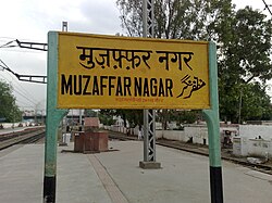
Muzaffarnagar connected by road and railway networks. The Ghaziabad - Saharanpur line passes through the city. Indian Railways provides connections to New Delhi, Western Uttar Pradesh, Jammu & Kashmir, Punjab, South India, and other parts of the country. Dehradun Shatabdi Express and Dehradun Jan Shatabdi Express trains pass through and halt at the Muzaffarnagar station. [citation needed]
.png)
The National Highway - 58 (NH-58) passes through Muzaffarnagar city. This highway provides connections towards Delhi on the southern direction and upper reaches of the Himalayas in the Uttarakhand state in the northern direction. The highway is the backbone of road transportation for the Muzaffarnagar city as well as the Garhwal region of Uttarakhand. Cities and areas of Hardwar, Rishikesh, Dehradun as well as Badrinath and Kedarnath are served by this highway.[citation needed]
City transportation mostly consists of tricycles and 3-wheeled vehicles, rickshaws. An international airport, Muzaffarnagar International Airport, was proposed in the city in order to reduce the traffic at the Indira Gandhi International Airport, however, the same was transferred to the Jewar Airport.[citation needed]
Environmental concerns[edit | edit source]
Muzaffarnagar lies approximately halfway on the road from Delhi to Uttarakhand Rishikesh (the NH-58). As a result, many roadside resorts and eateries have sprung up on the highway near the city. Especially, the town of Khatauli is famed for its canal side forest park named "Cheetal". Once visited for the sight of deer and rabbits and other wild animals, the Cheetal is now encroached by privately owned dhabas and resorts thus sidelining the animals.[citation needed]
Notable people[edit | edit source]
 | This list of "famous" or "notable" persons has no clear inclusion or exclusion criteria. Please help to define clear inclusion criteria and edit the list to contain only subjects that fit those criteria. (January 2017) |
- Kapil Dev Agarwal, politician, MLA from Muzaffarnagar City and state minister in Uttar Pradesh Government.
- Vijay Kumar Kashyap, politician, Ex-MLA Charthawal and former Minister of State for Revenue, Flood
- Gourav Baliyan, wrestler
- Rajpal Singh Baliyan, political figure, MLA from Budhana Assembly Seat.
- Sanjeev Balyan, politician, former Minister of State for Animal Husbandry, Dairying and Fisheries
- Kartar Singh Bhadana, political figure[20]
- Kamna Chandra, Haryana film writer
- Sumit Jain, entrepreneur, co-founder & CEO Opentalk.to | co-founder and ex-CEO of Commonfloor.com
- Divya Kakran, wrestler
- Swami Kalyandev (1876–2004), an ascetic in the fields of education and social reform, awarded the Padma Bhushan by the Indian government
- Amir Alam Khan, former M.P. and Uttar Pradesh minister, chairman of Bharat groups of colleges
- Liaquat Ali Khan, first Prime Minister of Pakistan (once lived in Muzaffarnagar)
- Nawazish Alam Khan, former MLA from Bhudana Vidhansabha
- Nishu Kumar, Indian professional football player, plays as full back at Kerala Blasters FC and India.
- Harendra Singh Malik, Lok Sabha MP from Muzaffarnagar constituency
- Pankaj Kumar Malik, political figure, MLA from Charthawal Assembly Seat.
- Alam Muzaffarnagari, Indian Urdu writer
- Mithlesh Pal, political figure, MLA from Meerapur(Muzaffarnagar) Assembly Seat falls in Bijnor constituency.
- Vishnu Prabhakar, novelist, writer, journalist[21]
- Sultan Rahi, Pakistani actor
- Kadir Rana, politician, former Lok Sabha MP from Muzaffarnagar constituency
- Shahnawaz Rana, politician, former M.L.A from Bijnor constituency, Uttar pradesh
- Sumit Rathi, Indian football player, plays for ATK and Indian U-17 Football Team
- Rajpal Singh Saini, political figure
- Nawazuddin Siddiqui, Bollywood actor
- Narain Singh, Gurjar leader and deputy chief minister of UP
- Brahma Singh, scientist and agriculturist; awarded the Padma Shri by the Indian government.
- Shaukat Thanvi, Pakistani author who wrote Qazi G
- Rakesh Tikait, Farmer leader
- A. M. Turaz, Indian poet, lyricist, and script writer
References[edit | edit source]
- ↑ "Who's Who". muzaffarnagar.nic.in. Retrieved 15 May 2019.
- ↑ 2.0 2.1 2.2 2.3 "Provisional Population Totals, Census of India 2011; Cities having population 1 lakh and above" (PDF). Office of the Registrar General & Census Commissioner, India. Archived from the original (PDF) on 7 May 2012. Retrieved 31 October 2023.
- ↑ 3.0 3.1 "Provisional Population Totals, Census of India 2011; Urban Agglomerations/Cities having population 1 lakh and above" (PDF). Office of the Registrar General & Census Commissioner, India. Archived from the original (PDF) on 22 November 2020. Retrieved 31 October 2023.
- ↑ 4.0 4.1 David Ross (1883). The Land of the Five Rivers and Sindh. p. 266.
- ↑ Cadell, Alan (1873). Settlement Report of the District of Muzaffarnagar: Including a Report on the Permanent Settlement of the Western Parganas of the District, and Also a Report on the Settlement of the Ganges Canal Tract. North-Western Provinces and Oudh Government Press. p. 31.
- ↑ William Wilson Hunter (1885). The Imperial Gazetteer of India: Volume 10. the University of California. p. 68. ISBN 978-81-7019-108-7.
- ↑ Marmaduke William Pickthall, Muhammad Asad (1933). Islamic Culture:Volume 7. p. 439.
- ↑ Abdul Aziz (1964). Discovery of Pakistan. the University of Michigan. p. 136.
- ↑ Muzaffarnagar District The Imperial Gazetteer of India, 1909, v. 18, p. 83.
- ↑ "Muzaffarnagar City". Imperial Gazetteer of India, Digital South Asia Library, Volume 18. 1909. p. 93. Retrieved 9 September 2013.
- ↑ Emergency excesses still haunt Khalapar, by Mohammad Ali, The Hindu (Chennai, Tamil Nadu), 1 July 2015
- ↑ "Government releases data of riot victims identifying religion". The Times of India. 24 September 2013. Retrieved 11 July 2014.
- ↑ "Western Uttar Pradesh tense after communal violence in Shamli". India Today. 4 May 2015. Retrieved 25 September 2016.
- ↑ "Maps, Weather, and Airports for Muzaffarnagar, India". www.fallingrain.com. Retrieved 1 February 2018.
- ↑ "With 13 of 20 most polluted cities, India ranks 5th globally". The Times of India. 12 March 2025. ISSN 0971-8257. Retrieved 18 March 2025.
- ↑ "Climatological Tables of Observatories in India 1991-2020" (PDF). India Meteorological Department. Retrieved 8 April 2024.
- ↑ "Station: Muzaffarnagar Climatological Table 1981–2010" (PDF). Climatological Normals 1981–2010. India Meteorological Department. January 2015. pp. 515–516. Archived from the original (PDF) on 5 February 2020. Retrieved 27 April 2020.
- ↑ 18.0 18.1 "Population by religion community - 2011". Census of India, 2011. The Registrar General & Census Commissioner, India. Archived from the original on 25 August 2015.
- ↑ "Muzaffarnagar clashes sour its famed jaggery business". indiatimes.com. India Times. 19 September 2013. Archived from the original on 21 July 2014. Retrieved 10 July 2014.
- ↑ "Elections: Uttar Pradesh Assembly". Retrieved 18 May 2018.
- ↑ "Vishnu Prabhakar".

