






WikiDwarfBOT (talk | contribs) robot: add new article |
imported>InesBaumgartner No edit summary |
||
| Line 1: | Line 1: | ||
{{About|the town in India|other uses}} | {{About|the town in India|other uses}} | ||
{{Use dmy dates|date=February 2017}} | |||
{{Use Indian English|date=February 2017}} | |||
{{multiple issues| | {{multiple issues| | ||
{{more citations needed|date=April 2014}} | {{more citations needed|date=April 2014}} | ||
{{ | {{promotional|date=April 2017}} | ||
}} | }} | ||
{{Infobox settlement | {{Infobox settlement | ||
| name | | name = Solan | ||
| other_name | | other_name = Mushroom City <br/> City of Red Gold | ||
| settlement_type | | settlement_type = City | ||
| image_skyline | | image_skyline = {{Photomontage |photo1a=Solan nightview.jpg | ||
| image_alt | |||
| image_caption | |photo2b=Mall road Solan.jpg |photo2a=Mohan Shaktipeeth National park.jpg |photo3a=Solan railway station 2019-10-18 11.11.19.jpg |photo3b=Maamandir.jpeg |photo4a=Thodo ground during Shoolini Mahotsav.jpg | ||
| nickname | |size=300 | ||
| map_alt | |position=center | ||
| map_caption | |spacing=2 | ||
| pushpin_map | |color=#FFFFFF | ||
| pushpin_label_position | |border=1 | ||
| pushpin_map_alt | |color_border = white | ||
| pushpin_map_caption | }} | ||
| coordinates | | image_alt = | ||
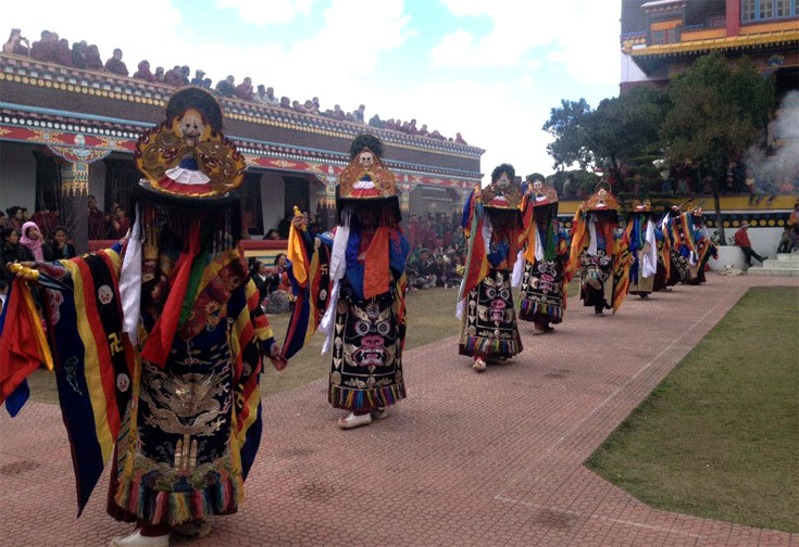
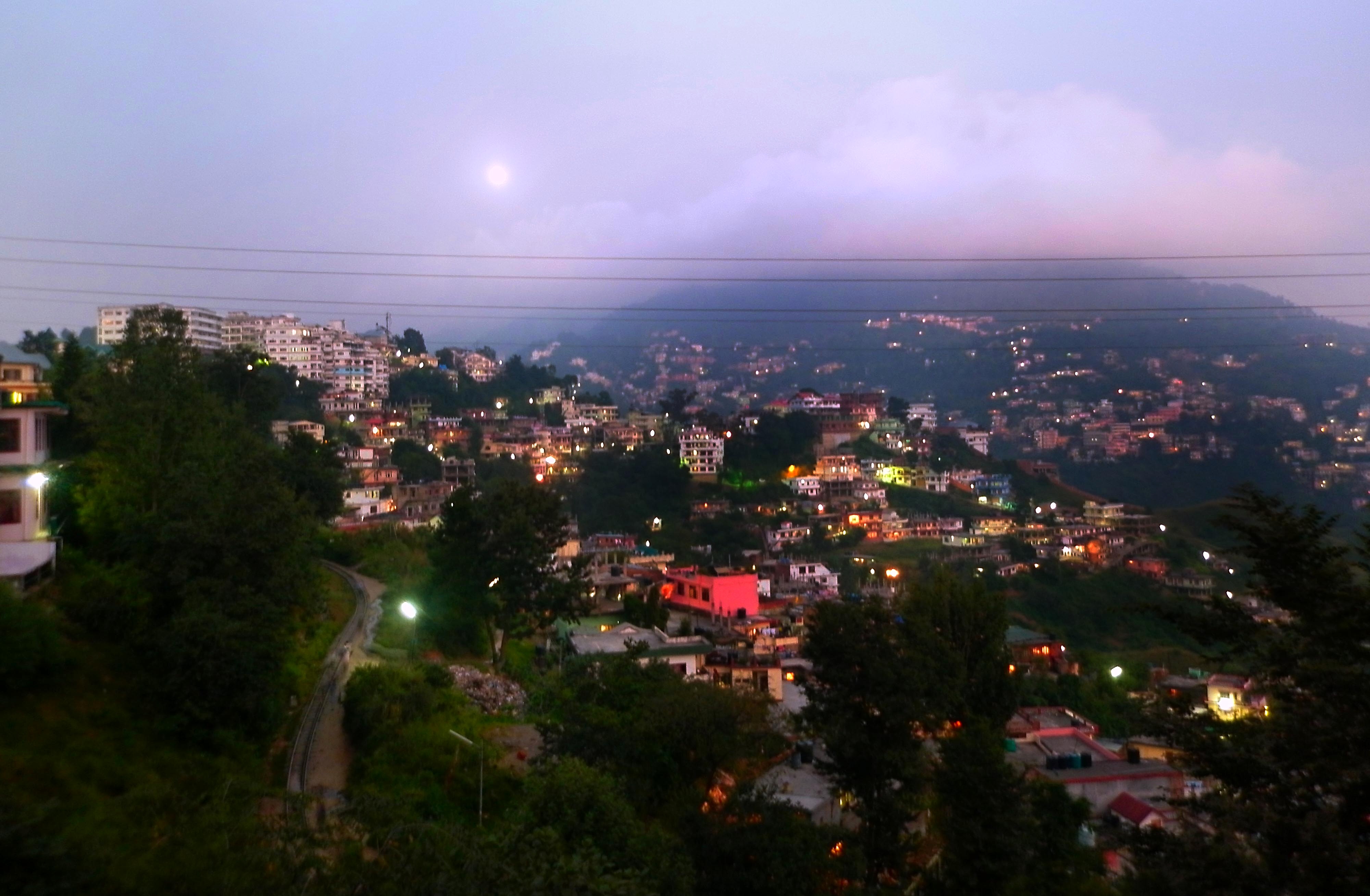
| subdivision_type | | image_caption = <div style="background:#CEE0F2;"> '''From top, left to right:<br />''' Panaromic night view of Solan city, [[Mohan Shakti National Heritage Park]], Mall Road Solan, [[Solan railway station]], [[Maa Shoolini|Shoolini Devi Mandir]], Shoolini Mahotsav in Thodo ground</div> | ||
| subdivision_name | | nickname = '''Mushroom City of India''', '''City of Red Gold''' | ||
| subdivision_type1 | | map_alt = | ||
| subdivision_name1 | | map_caption = Location in Himachal Pradesh | ||
| subdivision_type2 | | pushpin_map = India Himachal Pradesh#India | ||
| subdivision_name2 | | pushpin_label_position = right | ||
| established_title | | pushpin_map_alt = | ||
| established_date | | pushpin_map_caption = | ||
| founder | | coordinates = {{coord|30.907985|N|77.098403|E|display=inline,title}} | ||
| named_for | | subdivision_type = Country | ||
| government_type | | subdivision_name = {{flag|India}} | ||
| governing_body | | subdivision_type1 = [[States and territories of India|State]] | ||
| leader_title2 | | subdivision_name1 = {{flagicon image|}} [[Himachal Pradesh]] | ||
| leader_name2 | | subdivision_type2 = [[List of districts of India|District]] | ||
| unit_pref | | subdivision_name2 = [[Solan district|Solan]] | ||
| area_footnotes | | established_title = <!-- Established --> | ||
| area_rank | | established_date = | ||
| area_total_km2 | | founder = | ||
| elevation_footnotes | | named_for = | ||
| elevation_m | | government_type = | ||
| population_total | | governing_body = Municipal Corporation Solan | ||
| population_as_of | | leader_title2 = [[Member of the Legislative Assembly (India)|MLA]] | ||
| population_rank | | leader_name2 = [[Dhani Ram Shandil]] | ||
| population_density_km2 | | unit_pref = Metric | ||
| population_demonym | | area_footnotes = | ||
| population_footnotes | | area_rank = | ||
| demographics_type1 | | area_total_km2 = 33.43 | ||
| demographics1_title1 | | elevation_footnotes = | ||
| demographics1_info1 | | elevation_m = 1550 | ||
| demographics1_title2 | | population_total = 47,418 | ||
| demographics1_info2 | | population_as_of = 2020 | ||
| timezone1 | | population_rank = [[List of cities in Himachal Pradesh by population|3 in HP]] | ||
| utc_offset1 | | population_density_km2 = | ||
| postal_code_type | | population_demonym = | ||
| postal_code | | population_footnotes = | ||
| area_code_type | | demographics_type1 = Languages | ||
| area_code | | demographics1_title1 = Official | ||
| registration_plate | | demographics1_info1 = [[Hindi]] | ||
| blank1_name_sec2 | | demographics1_title2 = Native | ||
| blank1_info_sec2 | | demographics1_info2 = [[Mahasui]] (Baghati)<ref>{{cite web| website=Literary Herald |title=Language and dialect of Himachal Pradesh |url=https://tlhjournal.com/uploads/products/35.shradha-shandil-article.pdf?utm_}}</ref> | ||
| blank2_name_sec2 | | demographics2_title1 = | ||
| blank2_info_sec2 | | timezone1 = [[Indian Standard Time|IST]] | ||
| blank3_name_sec2 | | utc_offset1 = +5:30 | ||
| blank3_info_sec2 | | postal_code_type = [[Postal Index Number|PIN]] | ||
| blank4_name_sec2 | | postal_code = 173212 | ||
| blank4_info_sec2 | | area_code_type = Telephone code | ||
| website | | area_code = 01792 | ||
| footnotes | | registration_plate = '''HP-13, HP-14, HP-15, HP-59, HP-64''' | ||
| blank1_name_sec2 = Avg. annual temperature | |||
| blank1_info_sec2 = {{convert|15|°C|°F}} | |||
| blank2_name_sec2 = Avg. summer temperature | |||
| blank2_info_sec2 = {{convert|30|°C|°F}} | |||
| blank3_name_sec2 = Avg. winter temperature | |||
| blank3_info_sec2 = {{convert|0|°C|°F}} | |||
| blank4_name_sec2 = [[Köppen climate classification|Climate]] | |||
| blank4_info_sec2 = [[Humid subtropical climate|Cwa]] | |||
| website = {{URL|hpsolan.gov.in/}} | |||
| footnotes = | |||
}} | }} | ||
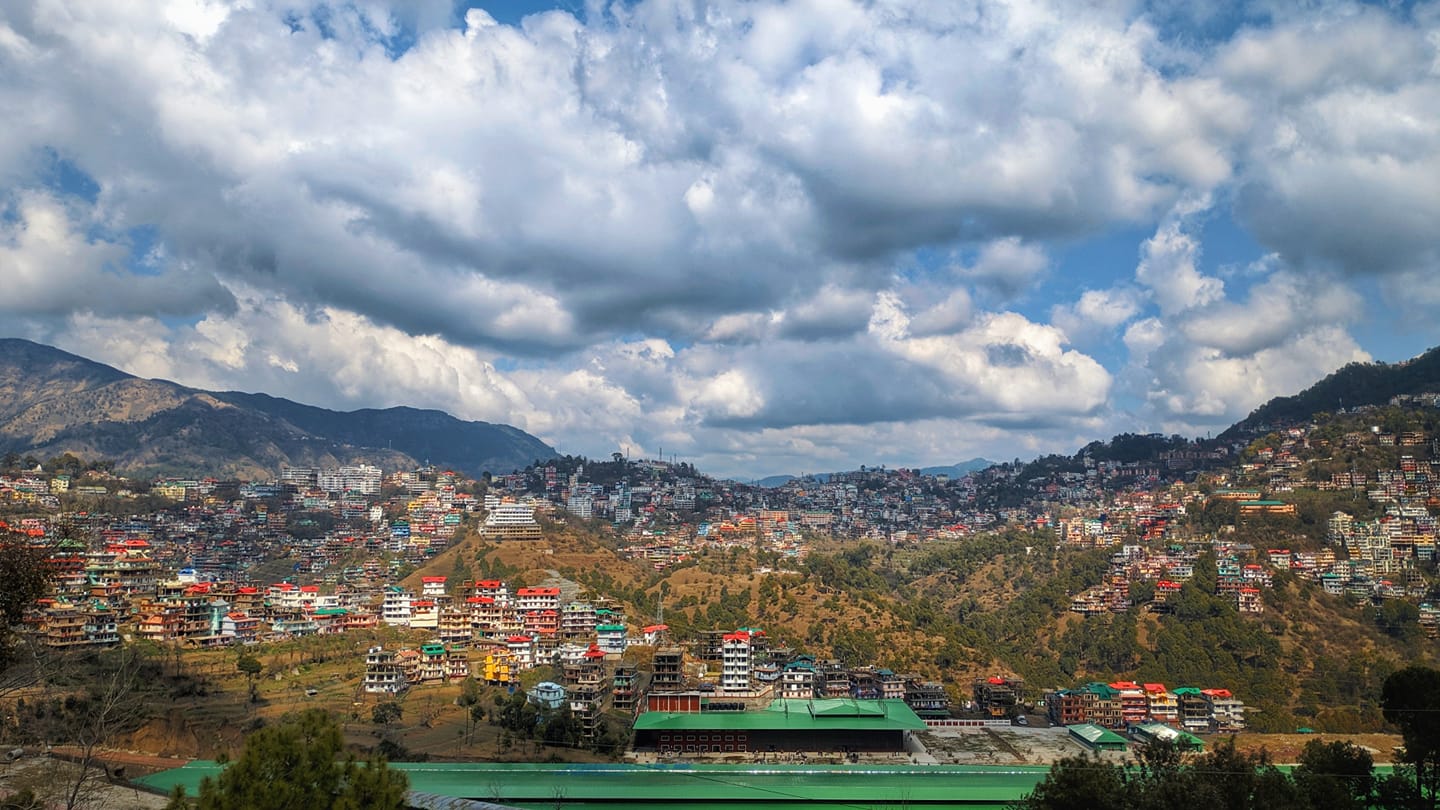
'''Solan''' is a city in the Indian state of [[Himachal Pradesh]] and the district headquarters of [[Solan district]]. It is located {{convert|45.5|km|mi|0|abbr=}} south of the state capital, [[Shimla]]. Solan has an average elevation of {{convert|1550|m|ft}}.<ref name="Solan travel and Tourism Guide">{{cite web |title=Solan Travel and Tourism Guide |url=https://en-gb.topographic-map.com/maps/2afb/Solan/}}</ref> The city is situated between [[Chandigarh]] | '''Solan''' is a city in the Indian state of [[Himachal Pradesh]] and the district headquarters of [[Solan district]].<ref>{{Cite web |title=District Solan, Government of Himachal Pradesh {{!}} Mushroom City Of India {{!}} India |url=https://hpsolan.nic.in/ |access-date=2024-08-26 |language=en-US}}</ref> It is located {{convert|45.5|km|mi|0|abbr=}} south of the state capital, [[Shimla]]. Solan has an average elevation of {{convert|1550|m|ft}}.<ref name="Solan travel and Tourism Guide">{{cite web |title=Solan Travel and Tourism Guide |url=https://en-gb.topographic-map.com/maps/2afb/Solan/}}</ref> The city is situated between [[Chandigarh]] and [[Shimla]] on the [[National Highway 5 (India)|Kalka-Shimla National Highway-5]]. The narrow-gauge [[Kalka-Shimla railway]] passes through Solan. Located on the Punjab-Himachal border, Solan is nestled in the [[Sivalik Hills|Shivalik Hills]] of the [[Himalayas]]. | ||
Solan was originally the capital of the [[princely state]], [[Baghat]].<ref name="Bhagat state">[http://www.hptdc.nic.in/cir0101.htm Capital of Bhagat state] {{webarchive|url=https://web.archive.org/web/20101125201025/http://hptdc.nic.in/cir0101.htm |date=25 November 2010 }}</ref> A defining feature of Solan | Solan was originally the capital of the [[princely state]], [[Baghat]].<ref name="Bhagat state">[http://www.hptdc.nic.in/cir0101.htm Capital of Bhagat state] {{webarchive|url=https://web.archive.org/web/20101125201025/http://hptdc.nic.in/cir0101.htm |date=25 November 2010 }}</ref> A defining feature of Solan are its ancient [[temple]]s<ref>{{Cite web|url=https://www.touristlink.com/india/solan/cat/temples.html|title=Religious Places of Worship, Temples in Solan, India|website=www.touristlink.com|language=en-US|access-date=2020-01-06}}</ref> and [[Monastery|monasteries]].<ref>{{Cite web|url=https://himachaltourism.gov.in/destination/monasteries/|title=Monasteries|last=him_admin|website=Himachal Tourism Official Website|language=en-US|access-date=2020-01-06}}</ref> The Shoolini Mata Temple and Jatoli Shiv Temple are popular tourist attractions. One of the most famous monasteries in this region is the [[Dolanji|Yundung Monastery]]. The hill-town is named after the Hindu goddess [[Maa Shoolini|Shoolini Devi, which is a manifestation of another goddess, Durga]], in her warrior aspect. Shoolini, when translated literally, means 'the goddess wielding the spear'. Every year in June, a fair venerating the Goddess is held, featuring a 3-day [[melā]] at the central [[Thodo]] ground. | ||
Solan is known for the production of quality mushrooms,<ref>{{Cite web|url=https://www.tribuneindia.com/news/archive/solan-has-mushroom-city-tag-yet-himachal-lags-behind-three-states-in-production-830666|title=Solan has Mushroom City tag, yet Himachal lags behind three states in production|last=Service|first=Tribune News|website=Tribuneindia News Service|language=en|access-date=2020-01-06}}</ref> as a result of the vast mushroom farming in the area, as well as the Directorate of Mushroom Research (DMR) situated at Chambaghat. Due to this fact, Solan is also known as the "Mushroom City of India". Solan is also called the "City of Red Gold", due to the bulk production of tomatoes in the area.<ref name="Solan travel and Tourism Guide" /> | Solan is known for the production of quality mushrooms,<ref>{{Cite web|url=https://www.tribuneindia.com/news/archive/solan-has-mushroom-city-tag-yet-himachal-lags-behind-three-states-in-production-830666|title=Solan has Mushroom City tag, yet Himachal lags behind three states in production|last=Service|first=Tribune News|website=Tribuneindia News Service|language=en|access-date=2020-01-06}}</ref> as a result of the vast mushroom farming in the area, as well as the Directorate of Mushroom Research (DMR) <ref>{{Cite web|url=https://www.indiascienceandtechnology.gov.in/organisations/ministry-and-departments/icar-directorate-mushroom-research|title=DMR}}</ref> situated at Chambaghat. Due to this fact, Solan is also known as the "Mushroom City of India". Solan is also called the "City of Red Gold", due to the bulk production of tomatoes in the area.<ref name="Solan travel and Tourism Guide" /> | ||
The city has one of the oldest [[Brewery|breweries]] in the country, and also has a 300-year-old fort located at the top of a hill. | The city has one of the oldest [[Brewery|breweries]] in the country, and also has a 300-year-old fort located at the top of a hill. | ||
Solan is fast becoming a top weekend getaway destination in [[Himachal Pradesh|Himachal]], due to location between two important cities Shimla and Chandigarh and improved road access and rising investment in resorts and wellness tourism.<ref>{{Cite web |title=Solan Rising in Tourist arrivals |url=https://www.moneycontrol.com/news/business/economy/himachal-s-traditional-destinations-less-popular-now-as-domestic-tourists-take-road-less-travelled-13405026.html}}</ref> | |||
==Historical evolution== | ==Historical evolution== | ||
The history of Solan goes back to the era of [[Pandava]]s. According to local folklore, Pandavas lived here during their exile.<ref>{{Cite web|url=http://travelisourpassion.blogspot.in/2014/07/trek-to-karol-tibba-pandava-cave.html|title=Travel Is Our Passion: Trek To Karol Tibba, Pandava Cave|website=travelisourpassion.blogspot.in|date=2 July 2014 |access-date=2016-06-02}}</ref> In 1815, British won Baghat state (now Solan) from the [[Gurkha]]s. Gurkha fort, or Arki Fort, is still standing tall on a mountain near to the city of Solan, and it is one of the historic tourist attractions of Solan.<ref>{{cite web|title=Gurkha Fort| url=http://www.holidayiq.com/Gurkha-Fort-Solan-Sightseeing-936-13165.html}}</ref> The | The history of Solan goes back to the era of [[Pandava]]s. According to local folklore, Pandavas lived here during their exile.<ref>{{Cite web|url=http://travelisourpassion.blogspot.in/2014/07/trek-to-karol-tibba-pandava-cave.html|title=Travel Is Our Passion: Trek To Karol Tibba, Pandava Cave|website=travelisourpassion.blogspot.in|date=2 July 2014 |access-date=2016-06-02}}</ref> In 1815, British won the Baghat state (now Solan) from the [[Gurkha]]s. Gurkha fort, or Arki Fort, is still standing tall on a mountain near to the city of Solan, and it is one of the historic tourist attractions of Solan.<ref>{{cite web|title=Gurkha Fort| url=http://www.holidayiq.com/Gurkha-Fort-Solan-Sightseeing-936-13165.html}}</ref> The city has been a capital of the princely Baghat State. The word ''Baghat'' is derived from ''Bau,'' or ''Bahu'', meaning "many", and ''Ghat,'' meaning "pass". Initially, the state headquarters of the Baghat State was located at Bhoch in the Bhuchali [[pargana]]. The headquarters of the state was shifted to Solan, after the construction of [[cantonment]] in the city; the railway was set up in 1902.<ref name="Historical Evolution Solan City">{{cite news|title=Historical Evolution Solan City|url=http://himachal.nic.in/tcp/DPSolan.pdf|url-status=dead|archive-url=https://web.archive.org/web/20110721172413/http://himachal.nic.in/tcp/DPSolan.pdf|archive-date=21 July 2011|df=dmy-all}}</ref> The evolution of Solan city can be understood in the following order or sequence: | ||
*Establishment of a cantonment area at Solan by Brits. | *Establishment of a cantonment area at Solan by Brits. | ||
*Establishing a brewery in Solan in 1855, due to availability of excellent quality mineral water. | *Establishing a brewery in Solan in 1855, due to availability of excellent quality mineral water. | ||
| Line 93: | Line 105: | ||
The list of heritage buildings in Solan town is as follows:- | The list of heritage buildings in Solan town is as follows:- | ||
*Shoolini Devi temple. | *[[Maa Shoolini|Shoolini Devi temple]]. | ||
*The Church in Solan cantonment. | *The Church in Solan cantonment. | ||
*The [[Solan railway station]].<ref name="Solan Railway Station">{{cite web| url=http://indiarailinfo.com/arrivals/solan-sol/2872| title=Solan Railway Station| work=indiarailinfo.com}}</ref> | *The [[Solan railway station]].<ref name="Solan Railway Station">{{cite web| url=http://indiarailinfo.com/arrivals/solan-sol/2872| title=Solan Railway Station| work=indiarailinfo.com}}</ref> | ||
| Line 100: | Line 112: | ||
*Hari Mandir, a famous [[Krishna|Lord Krishna]] temple. | *Hari Mandir, a famous [[Krishna|Lord Krishna]] temple. | ||
*The railway station and the railway rest house at Salogra. | *The railway station and the railway rest house at Salogra. | ||
*The DC residence on | *The DC residence on Shilli road. | ||
*Anees villa, ancestral home of [[Salman Rushdie]] | *Anees villa, ancestral home of [[Salman Rushdie]] Shilli road near DC residence.<ref>{{cite web|title=anees villa| date=25 December 2012| url=http://theoktravel.com/salman-rushdie-bungalow-himachal-solan/1136/}}</ref><ref name="Heritage">{{cite news|title=Heritage|url=http://himachal.nic.in/tcp/DPSolan.pdf|url-status=dead|archive-url=https://web.archive.org/web/20110721172413/http://himachal.nic.in/tcp/DPSolan.pdf|archive-date=21 July 2011|df=dmy-all}}</ref> | ||
*S.E., PWD office which used to be a [[Durbar (court)|durbar]] hall of Baghat State. | *S.E., PWD office which used to be a [[Durbar (court)|durbar]] hall of Baghat State. | ||
*Old guest house in the palace of Baghat state. | *Old guest house in the palace of Baghat state. | ||
*Khalifa lodge (now the JBT college running in it). | *Khalifa lodge (now the JBT college running in it). | ||
*Kishan Niwas and Hill View on circular road.<ref name="Heritage"/> | *Kishan Niwas and Hill View on circular road.<ref name="Heritage"/> | ||
*Jatoli Temple (5 km. far from Solan on Rajgarh Road). | *Jatoli Temple (5 km. far from Solan on Rajgarh Road). | ||
[[File:Jatoli.jpg|thumb|alt=Asia's tallest Temple devoted to Shiva in the Hills of Solan|Jatoli Temple, Solan]] | [[File:Jatoli.jpg|thumb|alt=Asia's tallest Temple devoted to Shiva in the Hills of Solan|Jatoli Temple, Solan]] | ||
| Line 115: | Line 126: | ||
*The Palace near Palace Road. | *The Palace near Palace Road. | ||
*Pandavas cave at Mount Karol, Chambaghat, Solan | *Pandavas cave at Mount Karol, Chambaghat, Solan | ||
*Dagshai Jail Museum | |||
{| | {| | ||
|[[File:Solan railway station.jpg|left|thumb|Solan railway station]] | |[[File:Solan railway station.jpg|left|thumb|Solan railway station]] | ||
|[[File:Bon Monastery Dholanji,Solan.jpg|center|thumb|Bon Monastery Dholanji, Solan]] | |[[File:Bon Monastery Dholanji,Solan.jpg|center|thumb|Bon Monastery Dholanji, Solan]] | ||
|[[File: | |[[File:Solan panorama.jpg|right|thumb|alt=Majestic Hills with houses built all across the Mountains as seen From Rabon|Panoramic View of Solan City]] | ||
|[[File:Solan nightview.jpg|thumb|alt=Thousands of Shining lights like stars studded on hills seen at Solan from Night |View of Solan at night]] | |[[File:Solan nightview.jpg|thumb|alt=Thousands of Shining lights like stars studded on hills seen at Solan from Night |View of Solan at night]] | ||
|} | |} | ||
| Line 124: | Line 136: | ||
==Geography== | ==Geography== | ||
Solan is located at {{Coord|30.92|N|77.12|E}}.<ref>[http://www.fallingrain.com/world/IN/11/Solan.html Falling Rain Genomics, Inc – Solan]</ref><ref>{{cite news|title=Geographical setting|url=http://himachal.nic.in/tcp/DPSolan.pdf|url-status=dead|archive-url=https://web.archive.org/web/20110721172413/http://himachal.nic.in/tcp/DPSolan.pdf|archive-date=21 July 2011|df=dmy-all}}</ref> It has an average elevation of 1502 [[metre]]s (5249.34 [[foot (length)|feet]]). The highest point is atop Mount Karol, at 2280 [[metre]]s. [[Pandava|Pandava's]] cave, where Pandavas believed to have [[Meditation|meditated]] during their 12-year [[exile]], is located at the mountain top. Solan gets occasional snowfall during winters.<ref name="Solan Town Planning Report">[http://himachal.nic.in/tcp/DPSolan.pdf Report page:8] {{webarchive|url=https://web.archive.org/web/20110721172413/http://himachal.nic.in/tcp/DPSolan.pdf |date=21 July 2011 }}</ref> | Solan is located at {{Coord|30.92|N|77.12|E}}.<ref>[http://www.fallingrain.com/world/IN/11/Solan.html Falling Rain Genomics, Inc – Solan]</ref><ref>{{cite news|title=Geographical setting|url=http://himachal.nic.in/tcp/DPSolan.pdf|url-status=dead|archive-url=https://web.archive.org/web/20110721172413/http://himachal.nic.in/tcp/DPSolan.pdf|archive-date=21 July 2011|df=dmy-all}}</ref> It has an average elevation of 1502 [[metre]]s (5249.34 [[foot (length)|feet]]). The highest point is atop Mount Karol, at 2280 [[metre]]s. [[Pandava|Pandava's]] cave, where Pandavas believed to have [[Meditation|meditated]] during their 12-year [[exile]], is located at the mountain top. Solan gets occasional snowfall during winters.<ref name="Solan Town Planning Report">[http://himachal.nic.in/tcp/DPSolan.pdf Report page:8] {{webarchive|url=https://web.archive.org/web/20110721172413/http://himachal.nic.in/tcp/DPSolan.pdf |date=21 July 2011 }}</ref> | ||
==Climate== | ==Climate== | ||
Situated at an altitude of 1600 metres on | Situated at an altitude of 1600 metres on average, Solan can be considered an average temperature hill station. Solan is neither as cold as Shimla, nor as hot as Kalka, as the temperatures hardly rise more than {{convert|35|C|F|abbr=}}. That is why it is considered as an ideal station, from a residential point of view. During winters, Solan experiences light snowfall. Temperatures typically range from {{convert|-4|C|F|abbr=}} to {{convert|34|C|F|abbr=}} over the course of a year, with record high temperature of 39 °C (102.2 °F). | ||
{| | {| | ||
|[[File:Snowfall solan city.jpg|right|thumb|Snowfall 2013, Solan]] | |[[File:Snowfall solan city.jpg|right|thumb|Snowfall 2013, Solan]] | ||
| Line 138: | Line 148: | ||
{{Weather box | {{Weather box | ||
| location = Solan ( | | location = Solan (1991–2020, extremes 1999–present) | ||
| metric first = Yes | | metric first = Yes | ||
| single line = Yes | | single line = Yes | ||
| Jan record high C = | | Jan record high C = 29.0 | ||
| Feb record high C = 29.2 | | Feb record high C = 29.2 | ||
| Mar record high C = 32.5 | | Mar record high C = 32.5 | ||
| Apr record high C = | | Apr record high C = 36.0 | ||
| May record high C = 38.0 | | May record high C = 38.0 | ||
| Jun record high C = 39.0 | | Jun record high C = 39.0 | ||
| Jul record high C = 35.1 | | Jul record high C = 35.1 | ||
| Aug record high C = 33.0 | | Aug record high C = 33.0 | ||
| Sep record high C = | | Sep record high C = 33.5 | ||
| Oct record high C = | | Oct record high C = 32.7 | ||
| Nov record high C = 30.2 | | Nov record high C = 30.2 | ||
| Dec record high C = 27.0 | | Dec record high C = 27.0 | ||
| year record high C = 39.0 | | year record high C = 39.0 | ||
| Jan high C = 18.4 | | Jan high C = 18.4 | ||
| Feb high C = 19. | | Feb high C = 19.8 | ||
| Mar high C = | | Mar high C = 24.0 | ||
| Apr high C = | | Apr high C = 28.8 | ||
| May high C = 31. | | May high C = 31.5 | ||
| Jun high C = 31. | | Jun high C = 31.0 | ||
| Jul high C = 28. | | Jul high C = 28.8 | ||
| Aug high C = 28.2 | | Aug high C = 28.2 | ||
| Sep high C = 28. | | Sep high C = 28.1 | ||
| Oct high C = 27.0 | | Oct high C = 27.0 | ||
| Nov high C = 23.8 | | Nov high C = 23.8 | ||
| Dec high C = | | Dec high C = 21.0 | ||
| year high C = 25. | | year high C = 25.8 | ||
| Jan low C = 2. | | Jan low C = 2.3 | ||
| Feb low C = 4.5 | | Feb low C = 4.5 | ||
| Mar low C = 8. | | Mar low C = 8.4 | ||
| Apr low C = 12. | | Apr low C = 12.5 | ||
| May low C = 16. | | May low C = 16.0 | ||
| Jun low C = 18. | | Jun low C = 18.6 | ||
| Jul low C = 20.2 | | Jul low C = 20.2 | ||
| Aug low C = 19.8 | | Aug low C = 19.8 | ||
| Sep low C = 16. | | Sep low C = 16.8 | ||
| Oct low C = 10.5 | | Oct low C = 10.5 | ||
| Nov low C = 5. | | Nov low C = 5.8 | ||
| Dec low C = | | Dec low C = 2.8 | ||
| year low C = 11.6 | | year low C = 11.6 | ||
| Jan record low C = -3.6 | | Jan record low C = -3.6 | ||
| Feb record low C = -2.8 | | Feb record low C = -2.8 | ||
| Mar record low C = | | Mar record low C = 0.5 | ||
| Apr record low C = 4.6 | | Apr record low C = 4.6 | ||
| May record low C = 8.5 | | May record low C = 8.5 | ||
| Line 194: | Line 204: | ||
| year record low C = -3.6 | | year record low C = -3.6 | ||
| rain colour = green | | rain colour = green | ||
| Jan rain mm = | | Jan rain mm = 49.5 | ||
| Feb rain mm = | | Feb rain mm = 67.1 | ||
| Mar rain mm = | | Mar rain mm = 55.9 | ||
| Apr rain mm = | | Apr rain mm = 35.7 | ||
| May rain mm = | | May rain mm = 51.1 | ||
| Jun rain mm = | | Jun rain mm = 123.0 | ||
| Jul rain mm = | | Jul rain mm = 221.6 | ||
| Aug rain mm = | | Aug rain mm = 206.1 | ||
| Sep rain mm = | | Sep rain mm = 148.2 | ||
| Oct rain mm = | | Oct rain mm = 14.3 | ||
| Nov rain mm = | | Nov rain mm = 4.5 | ||
| Dec rain mm = | | Dec rain mm = 26.4 | ||
| year rain mm = | | year rain mm = 1003.5 | ||
| Jan rain days = 3. | | Jan rain days = 3.1 | ||
| Feb rain days = 4. | | Feb rain days = 4.2 | ||
| Mar rain days = | | Mar rain days = 3.7 | ||
| Apr rain days = 3. | | Apr rain days = 3.2 | ||
| May rain days = 4. | | May rain days = 4.2 | ||
| Jun rain days = | | Jun rain days = 7.2 | ||
| Jul rain days = 11. | | Jul rain days = 11.3 | ||
| Aug rain days = 10. | | Aug rain days = 10.1 | ||
| Sep rain days = 5. | | Sep rain days = 5.6 | ||
| Oct rain days = 1. | | Oct rain days = 1.1 | ||
| Nov rain days = | | Nov rain days = 0.6 | ||
| Dec rain days = | | Dec rain days = 1.7 | ||
| year rain days = | | year rain days = 56.0 | ||
|time day = 17:30 [[Indian Standard Time|IST]] | |time day = 17:30 [[Indian Standard Time|IST]] | ||
| Jan humidity = 52 | | Jan humidity = 52 | ||
| Feb humidity = | | Feb humidity = 50 | ||
| Mar humidity = | | Mar humidity = 44 | ||
| Apr humidity = 38 | | Apr humidity = 38 | ||
| May humidity = | | May humidity = 38 | ||
| Jun humidity = | | Jun humidity = 53 | ||
| Jul humidity = | | Jul humidity = 74 | ||
| Aug humidity = 78 | | Aug humidity = 78 | ||
| Sep humidity = | | Sep humidity = 71 | ||
| Oct humidity = | | Oct humidity = 53 | ||
| Nov humidity = | | Nov humidity = 51 | ||
| Dec humidity = 51 | | Dec humidity = 51 | ||
|year humidity = 54 | |year humidity = 54 | ||
|source 1 = [[India Meteorological Department]]<ref name=IMDnormals> | |source 1 = [[India Meteorological Department]]<ref>{{cite web | ||
| url = https://imdpune.gov.in/library/public/Climatological%20Tables%201991-2020.pdf | |||
| title = Climatological Tables of Observatories in India 1991-2020 | |||
| publisher = [[India Meteorological Department]] | |||
| access-date = April 8, 2024 | |||
}}</ref><ref name=IMDnormals> | |||
{{cite web | {{cite web | ||
| archive-url = https://web.archive.org/web/20200205040301/http://imdpune.gov.in/library/public/1981-2010%20CLIM%20NORMALS%20%28STATWISE%29.pdf | | archive-url = https://web.archive.org/web/20200205040301/http://imdpune.gov.in/library/public/1981-2010%20CLIM%20NORMALS%20%28STATWISE%29.pdf | ||
| Line 256: | Line 271: | ||
}} | }} | ||
== | == Municipal Corporation and District administration == | ||
Municipal Corporation Solan is spread over an area of 33.43 km<sup>2</sup> with a residential population of 39,256.<ref name="censusindia.gov.in"/> It is the | [[Solan Municipal Corporation|Municipal Corporation Solan]] is spread over an area of 33.43 km<sup>2</sup> with a residential population of 39,256.<ref name="censusindia.gov.in"/> It is the third largest Municipal Corporation of [[Himachal Pradesh]]. | ||
==Demographics== | ==Demographics== | ||
| Line 294: | Line 285: | ||
'''Solan Work Profile''' | '''Solan Work Profile''' | ||
Out of total population, 15,640 were engaged in work or business activity. Of this 12,147 were males, while 3,493 were females. In census surveys, 'worker' is defined as a person who does business, jobs, services, [[Agriculture|cultivation]], and labour activity for profit. Of total 15,640 working population, 93.31% were engaged in main work, while 6.69% of total workers were engaged in [[Marginalism|marginal work]].<ref>{{Cite web|url=https://www.census2011.co.in/data/town/800128-solan-himachal-pradesh.html|title= Solan Town Population Census 2011|website=census2011.co.in|access-date=18 September 2018}}</ref><ref>{{Cite web|url=http://censusindia.gov.in/2011census/dchb/0209_PART_A_DCHB_SOLAN.pdf|title= DISTRICT CENSUS HANDBOOK SOLAN, VILLAGE AND TOWN DIRECTORY|website=censusindia.gov.in|access-date=18 September 2018}}</ref> | Out of total population, 15,640 were engaged in work or business activity. Of this 12,147 were males, while 3,493 were females. In census surveys, 'worker' is defined as a person who does business, jobs, services, [[Agriculture|cultivation]], and labour activity for profit. Of total 15,640 working population, 93.31% were engaged in main work, while 6.69% of total workers were engaged in [[Marginalism|marginal work]].<ref>{{Cite web|url=https://www.census2011.co.in/data/town/800128-solan-himachal-pradesh.html|title= Solan Town Population Census 2011|website=census2011.co.in|access-date=18 September 2018}}</ref><ref>{{Cite web|url=http://censusindia.gov.in/2011census/dchb/0209_PART_A_DCHB_SOLAN.pdf|title= DISTRICT CENSUS HANDBOOK SOLAN, VILLAGE AND TOWN DIRECTORY|website=censusindia.gov.in|access-date=18 September 2018}}</ref> | ||
'''City area''' | '''City area''' | ||
| Line 304: | Line 293: | ||
|[[File:Solan city at night.jpg|right|thumb|Twinkling hills of solan city at night]] | |[[File:Solan city at night.jpg|right|thumb|Twinkling hills of solan city at night]] | ||
|} | |} | ||
==Flora and fauna== | ==Flora and fauna== | ||
The Solan planning area contains Chil, Ban, and Kail, mainly [[Cedrus deodara|deodar cedar]] and [[pine]] trees in the city. [[Oak]] forests are also at higher elevations around moist locations. Places like [[Chail, Himachal Pradesh|Chail]] is the most predominant one for different species of vegetation. Besides the [[Native species|indigenous]] vegetation, there are [[Ornamental plant|ornamental]] and [[Introduced species|alien]] [[plantation]]s too. It consists of [[silver oak]], [[jhakranda]], [[List of plants known as bottlebrush|bottle brush]], [[Salix babylonica|weeping willows]], [[kachnar]], [[Poaceae|grasses]], etc.<ref name="Solan Town Planning Report"/> | The Solan planning area contains Chil, Ban, and Kail, mainly [[Cedrus deodara|deodar cedar]] and [[pine]] trees in the city. [[Oak]] forests are also at higher elevations around moist locations. Places like [[Chail, Himachal Pradesh|Chail]] is the most predominant one for different species of vegetation. Besides the [[Native species|indigenous]] vegetation, there are [[Ornamental plant|ornamental]] and [[Introduced species|alien]] [[plantation]]s too. It consists of [[silver oak]], [[Jacaranda mimosifolia|jhakranda]], [[List of plants known as bottlebrush|bottle brush]], [[Salix babylonica|weeping willows]], [[kachnar]], [[Poaceae|grasses]], etc.<ref name="Solan Town Planning Report"/> | ||
Due to variations in altitude, there is a variety of fauna in the region. The [[Himalayan black bear]] & [[Panthera pardus tulliana|panther]], [[Leopard]] are the [[carnivore]]s typically found in the area, whereas the Ghoral and the barking deer are the [[herbivore]]s, found in and around the Solan planning area. Other animals include the [[jackal]], [[mongoose]], the [[Wildcat| | Due to variations in altitude, there is a variety of fauna in the region. The [[Himalayan black bear]] & [[Panthera pardus tulliana|panther]], [[Leopard]] are the [[carnivore]]s typically found in the area, whereas the Ghoral and the barking deer are the [[herbivore]]s, found in and around the Solan planning area. Other animals include the [[jackal]], [[mongoose]], the [[Wildcat|Wildcats]], [[monkey]]s & [[Colobinae|langurs]], etc. [[Galliformes]] include [[Red junglefowl]], [[Columbidae|pigeon]], etc.<ref name=Fauna>[http://himachal.nic.in/tcp/DPSolan.pdf Report page:9] {{webarchive|url=https://web.archive.org/web/20110721172413/http://himachal.nic.in/tcp/DPSolan.pdf |date=21 July 2011 }}</ref> | ||
== | == Notable sites== | ||
[[File:Sharvilla.jpg|thumb|Sharvilla Health resorts Solan]] | [[File:Sharvilla.jpg|thumb|Sharvilla Health resorts Solan]] | ||
[[File:Gugaghat.JPG|thumb|210px|right|Hill Ranges of the Solan area looking south]] | [[File:Gugaghat.JPG|thumb|210px|right|Hill Ranges of the Solan area looking south]] | ||
*[[Badi ki dhar]] | |||
*[[Badi ki dhar]] | |||
*[[Dr. Yashwant Singh Parmar University of Horticulture and Forestry]] | *[[Dr. Yashwant Singh Parmar University of Horticulture and Forestry]] | ||
*[[Barog railway station]] | *[[Barog railway station]] | ||
*[[Chail, Himachal Pradesh|Chail]] Sanctuary | |||
*[[Chail, Himachal Pradesh|Chail]] Sanctuary | |||
*Water Park and Cafe at [[Sadhupul]]<ref>{{cite news|title=CM inaugurates Water Park at Sadhupul|url=https://www.tribuneindia.com/news/himachal/cm-inaugurates-water-park-at-sadhupul/429917.html |newspaper= The Tribune India, Himachal|date=1 July 2017}}</ref> | *Water Park and Cafe at [[Sadhupul]]<ref>{{cite news|title=CM inaugurates Water Park at Sadhupul|url=https://www.tribuneindia.com/news/himachal/cm-inaugurates-water-park-at-sadhupul/429917.html |newspaper= The Tribune India, Himachal|date=1 July 2017}}</ref> | ||
* [[Mohan Park]] – Built by Mohan Meakins breweries near Chambaghat on the Mall road, it has a terrace garden, rides, etc. | * [[Mohan Park]] – Built by Mohan Meakins breweries near Chambaghat on the Mall road, it has a terrace garden, rides, etc. | ||
* Subhash Chandra Bose Park – Hospital road Solan.<ref name="Tourist Attractions in Solan">{{cite news|title=Tourist Attractions in Solan| url=http://www.himachal-tourism.net}}</ref> | * Subhash Chandra Bose Park – Hospital road Solan.<ref name="Tourist Attractions in Solan">{{cite news|title=Tourist Attractions in Solan| url=http://www.himachal-tourism.net}}</ref> | ||
==Sports== | ==Sports== | ||
As of 2018 an indoor stadium was planned.<ref>{{cite news|title=HP allocates Rs 45.4 cr for sports|url=https://www.thestatesman.com/cities/hp-allocates-rs-45-4-cr-for-sports-1502679990.html |newspaper= The Statesman.|date=1 September 2018}}</ref> | |||
==Education== | ==Education== | ||
=== Private universities === | |||
*[[Baddi University of Emerging Sciences and Technologies]] | |||
*[[Chitkara University, Himachal Pradesh]] | |||
*[[Jaypee University of Information Technology]] | |||
*[[Maharaja Agrasen University]] | |||
Shoolini University and Jaypee University, were ranked '100-150' among Universities in India in the National Institutional Ranking Framework (NIRF) in 2019<ref>{{Cite journal|last=Ananthakrishnan|first=Nilakantan|date=2018|title=National Institutional Ranking Framework criteria are against the interests of health science institutions|journal=The National Medical Journal of India|volume=31|issue=6|pages=379–380|doi=10.4103/0970-258x.262902|pmid=31397379|s2cid=199033574|issn=0970-258X |doi-access=free }}</ref> | |||
==Media== | ==Media== | ||
*[[Divya Himachal]] – Mera Solan | *[[Divya Himachal]] – Mera Solan newspaper<ref>{{Cite news|url=http://epaper.divyahimachal.com/m5/1788485/Mera-Solan/Mera-Solan#page/1/1|title=Mera Solan|newspaper=Divya Himachal|access-date=16 September 2018}}</ref> | ||
* | *[[Himachal]] – National Mushroom Conference<ref>{{Cite news|url=https://hillspost.com/%e0%a4%ae%e0%a4%b6%e0%a4%b0%e0%a5%82%e0%a4%ae-%e0%a4%b8%e0%a4%bf%e0%a4%9f%e0%a5%80-%e0%a4%91%e0%a4%ab-%e0%a4%87%e0%a4%82%e0%a4%a1%e0%a4%bf%e0%a4%af%e0%a4%be-%e0%a4%b8%e0%a5%8b%e0%a4%b2%e0%a4%a8/54817/|title=National Mushroom Conference}}</ref> | ||
==Notable people== | ==Notable people== | ||
*[[Rajeev Bindal]] – Ex Speaker [[Himachal Pradesh]] Vidhan Sabha | *[[Rajeev Bindal]] – Ex Speaker [[Himachal Pradesh]] Vidhan Sabha | ||
*[[Dhani Ram Shandil]] – Ex [[Member of parliament|Member of Parliament]] | *[[Dhani Ram Shandil]] – Ex [[Member of parliament|Member of Parliament]] | ||
* [[Bikramjeet Kanwarpal|Major Bikramjeet Kanwarpal]] | * [[Bikramjeet Kanwarpal|Major Bikramjeet Kanwarpal]] - Indian film and television actor | ||
*[[Ruhani Sharma]] | *[[Ruhani Sharma]] - Indian film actress | ||
==Gallery== | ==Gallery== | ||
| Line 644: | Line 345: | ||
File:Platinum Mall Solan.jpg|Platinum Mall, Solan | File:Platinum Mall Solan.jpg|Platinum Mall, Solan | ||
File:Bank lane,the mall.JPG|Bank lane, The Mall, Solan | File:Bank lane,the mall.JPG|Bank lane, The Mall, Solan | ||
File:Solan_mall.jpg|Commercial mall, | File:Solan_mall.jpg|Commercial mall, Solan. | ||
File:Commercial_mall.jpg|SOLAN | File:Commercial_mall.jpg|SOLAN | ||
File:Foot path on mall road.jpg|Footpath on Mall road | File:Foot path on mall road.jpg|Footpath on Mall road | ||
| Line 667: | Line 368: | ||
==References== | ==References== | ||
{{Reflist|30em}} | {{Reflist|30em}} | ||
<ref>[https://tadkabytes.in/travel/asia-highest-shiva-temple-jatoli-shiv-mandir/ Jatoli Shiva Temple Tallest Shiva Temple Of Asia] Retrieved 03 July 2025. </ref> | |||
==External links== | ==External links== | ||
{{Commons category}} | |||
*[http://hpsolan.gov.in/ Official Site] | *[http://hpsolan.gov.in/ Official Site] | ||
* | *{{Wikivoyage inline}} | ||
{{Himachal Pradesh topics}} | {{Himachal Pradesh topics}} | ||
{{Authority control}} | {{Authority control}} | ||
[[Category:Solan| ]] | [[Category:Solan| ]] | ||
[[Category:Cities and towns in Solan district]] | [[Category:Cities and towns in Solan district]] | ||
Latest revision as of 07:03, 8 March 2026
 | This article has multiple issues. Please help improve it or discuss these issues on the talk page. (Learn how and when to remove these template messages)
|

Solan
Mushroom City City of Red Gold | |
|---|---|
City | |
From top, left to right: Panaromic night view of Solan city, Mohan Shakti National Heritage Park, Mall Road Solan, Solan railway station, Shoolini Devi Mandir, Shoolini Mahotsav in Thodo ground | |
| Nickname(s): Mushroom City of India, City of Red Gold | |
  Solan Location in Himachal Pradesh  Solan Solan (India) | |
| Coordinates: 30°54′29″N 77°05′54″E / 30.907985°N 77.098403°E | |
| Country |  India India |
| State |  Himachal Pradesh Himachal Pradesh |
| District | Solan |
| Government | |
| • Body | Municipal Corporation Solan |
| • MLA | Dhani Ram Shandil |
| Area | |
| • Total | 33.43 km2 (12.91 sq mi) |
| Elevation | 1,550 m (5,090 ft) |
| Population (2020) | |
| • Total | 47,418 |
| • Rank | 3 in HP |
| Languages | |
| • Official | Hindi |
| • Native | Mahasui (Baghati)[1] |
| Time zone | UTC+5:30 (IST) |
| PIN | 173212 |
| Telephone code | 01792 |
| Vehicle registration | HP-13, HP-14, HP-15, HP-59, HP-64 |
| Avg. annual temperature | 15 °C (59 °F) |
| Avg. summer temperature | 30 °C (86 °F) |
| Avg. winter temperature | 0 °C (32 °F) |
| Climate | Cwa |
| Website | hpsolan |


Solan is a city in the Indian state of Himachal Pradesh and the district headquarters of Solan district.[2] It is located 45.5 kilometres (28 mi) south of the state capital, Shimla. Solan has an average elevation of 1,550 metres (5,090 ft).[3] The city is situated between Chandigarh and Shimla on the Kalka-Shimla National Highway-5. The narrow-gauge Kalka-Shimla railway passes through Solan. Located on the Punjab-Himachal border, Solan is nestled in the Shivalik Hills of the Himalayas.
Solan was originally the capital of the princely state, Baghat.[4] A defining feature of Solan are its ancient temples[5] and monasteries.[6] The Shoolini Mata Temple and Jatoli Shiv Temple are popular tourist attractions. One of the most famous monasteries in this region is the Yundung Monastery. The hill-town is named after the Hindu goddess Shoolini Devi, which is a manifestation of another goddess, Durga, in her warrior aspect. Shoolini, when translated literally, means 'the goddess wielding the spear'. Every year in June, a fair venerating the Goddess is held, featuring a 3-day melā at the central Thodo ground.
Solan is known for the production of quality mushrooms,[7] as a result of the vast mushroom farming in the area, as well as the Directorate of Mushroom Research (DMR) [8] situated at Chambaghat. Due to this fact, Solan is also known as the "Mushroom City of India". Solan is also called the "City of Red Gold", due to the bulk production of tomatoes in the area.[3]
The city has one of the oldest breweries in the country, and also has a 300-year-old fort located at the top of a hill.
Solan is fast becoming a top weekend getaway destination in Himachal, due to location between two important cities Shimla and Chandigarh and improved road access and rising investment in resorts and wellness tourism.[9]
Historical evolution[edit | edit source]
The history of Solan goes back to the era of Pandavas. According to local folklore, Pandavas lived here during their exile.[10] In 1815, British won the Baghat state (now Solan) from the Gurkhas. Gurkha fort, or Arki Fort, is still standing tall on a mountain near to the city of Solan, and it is one of the historic tourist attractions of Solan.[11] The city has been a capital of the princely Baghat State. The word Baghat is derived from Bau, or Bahu, meaning "many", and Ghat, meaning "pass". Initially, the state headquarters of the Baghat State was located at Bhoch in the Bhuchali pargana. The headquarters of the state was shifted to Solan, after the construction of cantonment in the city; the railway was set up in 1902.[12] The evolution of Solan city can be understood in the following order or sequence:
- Establishment of a cantonment area at Solan by Brits.
- Establishing a brewery in Solan in 1855, due to availability of excellent quality mineral water.
- Shifting of the headquarters of Baghat State from Bhoch to Solan.
- Start of Kalka-Shimla rail line in 1902.
- Start of transportation activity on Kalka-Solan-Shimla road.
- The urban local body, i.e. Municipal Council Solan, came into existence in 1950.
- Solan became an independent district on 1 September 1972, and the town of Solan became the district headquarters.[12]
Heritage[edit | edit source]
Solan's history is intertwined with that of the erstwhile princely state of Baghat. The Solan cantonment is still the best, and the most well planned part of the area, hence buildings are made in a planned manner. The church in Solan cantonment is a heritage building, with wooden and stone carvings. It has sloping roofs and arches, reminiscent of British architecture.[citation needed]
The list of heritage buildings in Solan town is as follows:-
- The Church in Solan cantonment.
- The Solan railway station.[13]
- The Barog railway station.
- Hari Mandir, a famous Lord Krishna temple.
- The railway station and the railway rest house at Salogra.
- The DC residence on Shilli road.
- Anees villa, ancestral home of Salman Rushdie Shilli road near DC residence.[14][15]
- S.E., PWD office which used to be a durbar hall of Baghat State.
- Old guest house in the palace of Baghat state.
- Khalifa lodge (now the JBT college running in it).
- Kishan Niwas and Hill View on circular road.[15]
- Jatoli Temple (5 km. far from Solan on Rajgarh Road).

- Mohan Shakti National Heritage Park (in Hart, 12 km from Solan)
- Mohan Meakin Limited – Mohan Meakin is a large group of companies, which started with Asia's first brewery incorporated in 1855
- Dolanji Bon Monastery, Solan.
- Dr. Yashwant Singh Parmar University of Horticulture and Forestry
- The Palace near Palace Road.
- Pandavas cave at Mount Karol, Chambaghat, Solan
- Dagshai Jail Museum
 |
 |
 |
 |
Geography[edit | edit source]
Solan is located at 30°55′N 77°07′E / 30.92°N 77.12°E.[16][17] It has an average elevation of 1502 metres (5249.34 feet). The highest point is atop Mount Karol, at 2280 metres. Pandava's cave, where Pandavas believed to have meditated during their 12-year exile, is located at the mountain top. Solan gets occasional snowfall during winters.[18]
Climate[edit | edit source]
Situated at an altitude of 1600 metres on average, Solan can be considered an average temperature hill station. Solan is neither as cold as Shimla, nor as hot as Kalka, as the temperatures hardly rise more than 35 °C (95 °F). That is why it is considered as an ideal station, from a residential point of view. During winters, Solan experiences light snowfall. Temperatures typically range from −4 °C (25 °F) to 34 °C (93 °F) over the course of a year, with record high temperature of 39 °C (102.2 °F).
 |
 |
 |
| Climate data for Solan (1991–2020, extremes 1999–present) | |||||||||||||
|---|---|---|---|---|---|---|---|---|---|---|---|---|---|
| Month | Jan | Feb | Mar | Apr | May | Jun | Jul | Aug | Sep | Oct | Nov | Dec | Year |
| Record high °C (°F) | 29.0 (84.2) |
29.2 (84.6) |
32.5 (90.5) |
36.0 (96.8) |
38.0 (100.4) |
39.0 (102.2) |
35.1 (95.2) |
33.0 (91.4) |
33.5 (92.3) |
32.7 (90.9) |
30.2 (86.4) |
27.0 (80.6) |
39.0 (102.2) |
| Average high °C (°F) | 18.4 (65.1) |
19.8 (67.6) |
24.0 (75.2) |
28.8 (83.8) |
31.5 (88.7) |
31.0 (87.8) |
28.8 (83.8) |
28.2 (82.8) |
28.1 (82.6) |
27.0 (80.6) |
23.8 (74.8) |
21.0 (69.8) |
25.8 (78.4) |
| Average low °C (°F) | 2.3 (36.1) |
4.5 (40.1) |
8.4 (47.1) |
12.5 (54.5) |
16.0 (60.8) |
18.6 (65.5) |
20.2 (68.4) |
19.8 (67.6) |
16.8 (62.2) |
10.5 (50.9) |
5.8 (42.4) |
2.8 (37.0) |
11.6 (52.9) |
| Record low °C (°F) | −3.6 (25.5) |
−2.8 (27.0) |
0.5 (32.9) |
4.6 (40.3) |
8.5 (47.3) |
12.5 (54.5) |
16.0 (60.8) |
15.0 (59.0) |
10.5 (50.9) |
5.0 (41.0) |
1.0 (33.8) |
−2.5 (27.5) |
−3.6 (25.5) |
| Average rainfall mm (inches) | 49.5 (1.95) |
67.1 (2.64) |
55.9 (2.20) |
35.7 (1.41) |
51.1 (2.01) |
123.0 (4.84) |
221.6 (8.72) |
206.1 (8.11) |
148.2 (5.83) |
14.3 (0.56) |
4.5 (0.18) |
26.4 (1.04) |
1,003.5 (39.51) |
| Average rainy days | 3.1 | 4.2 | 3.7 | 3.2 | 4.2 | 7.2 | 11.3 | 10.1 | 5.6 | 1.1 | 0.6 | 1.7 | 56.0 |
| Average relative humidity (%) (at 17:30 IST) | 52 | 50 | 44 | 38 | 38 | 53 | 74 | 78 | 71 | 53 | 51 | 51 | 54 |
| Source: India Meteorological Department[21][22][23] | |||||||||||||
Municipal Corporation and District administration[edit | edit source]
Municipal Corporation Solan is spread over an area of 33.43 km2 with a residential population of 39,256.[24] It is the third largest Municipal Corporation of Himachal Pradesh.
Demographics[edit | edit source]
According to the 2011 Indian census, Solan has a population of 39,256,[24] making it the second largest city in Himachal, after Shimla. Solan had an average literacy rate of 85.02%.[25]
Solan is a Municipal Council city. It is divided into 17 wards for which elections are held every 5 years. The Solan Municipal Council has population of 39,256, of which 21,182 are males, while 18,074 are females, as per report released by Census India 2011.
Population of children with age of 0–6 is 3,524, which is 8.98% of the total population of Solan (M Cl). In Solan Municipal Council, the female sex ratio is of 8:53, against state average of 9:72. Moreover, child age ratio in Solan is around 886, compared to Himachal Pradesh state average of 909. Literacy rate of Solan city is 93.02% higher than the state average of 82.80%. In Solan, male literacy is around 94.01%, while female literacy rate is 91.86%.
Solan Municipal Council has total administration over 9,803 houses, to which it supplies basic amenities, like water and sewerage.
Solan Work Profile Out of total population, 15,640 were engaged in work or business activity. Of this 12,147 were males, while 3,493 were females. In census surveys, 'worker' is defined as a person who does business, jobs, services, cultivation, and labour activity for profit. Of total 15,640 working population, 93.31% were engaged in main work, while 6.69% of total workers were engaged in marginal work.[26][27]
City area Solan Planning Area covers 3,343 hectares = 33.43 km2 of land (2nd Largest city area in Himachal Pradesh).[28]
 |
 |
 |
Flora and fauna[edit | edit source]
The Solan planning area contains Chil, Ban, and Kail, mainly deodar cedar and pine trees in the city. Oak forests are also at higher elevations around moist locations. Places like Chail is the most predominant one for different species of vegetation. Besides the indigenous vegetation, there are ornamental and alien plantations too. It consists of silver oak, jhakranda, bottle brush, weeping willows, kachnar, grasses, etc.[18]
Due to variations in altitude, there is a variety of fauna in the region. The Himalayan black bear & panther, Leopard are the carnivores typically found in the area, whereas the Ghoral and the barking deer are the herbivores, found in and around the Solan planning area. Other animals include the jackal, mongoose, the Wildcats, monkeys & langurs, etc. Galliformes include Red junglefowl, pigeon, etc.[29]
Notable sites[edit | edit source]


- Badi ki dhar
- Dr. Yashwant Singh Parmar University of Horticulture and Forestry
- Barog railway station
- Chail Sanctuary
- Water Park and Cafe at Sadhupul[30]
- Mohan Park – Built by Mohan Meakins breweries near Chambaghat on the Mall road, it has a terrace garden, rides, etc.
- Subhash Chandra Bose Park – Hospital road Solan.[31]
Sports[edit | edit source]
As of 2018 an indoor stadium was planned.[32]
Education[edit | edit source]
Private universities[edit | edit source]
- Baddi University of Emerging Sciences and Technologies
- Chitkara University, Himachal Pradesh
- Jaypee University of Information Technology
- Maharaja Agrasen University
Shoolini University and Jaypee University, were ranked '100-150' among Universities in India in the National Institutional Ranking Framework (NIRF) in 2019[33]
Media[edit | edit source]
- Divya Himachal – Mera Solan newspaper[34]
- Himachal – National Mushroom Conference[35]
Notable people[edit | edit source]
- Rajeev Bindal – Ex Speaker Himachal Pradesh Vidhan Sabha
- Dhani Ram Shandil – Ex Member of Parliament
- Major Bikramjeet Kanwarpal - Indian film and television actor
- Ruhani Sharma - Indian film actress
Gallery[edit | edit source]
-
 Twilight view of Solan in monsoon from Mohan Park
 -
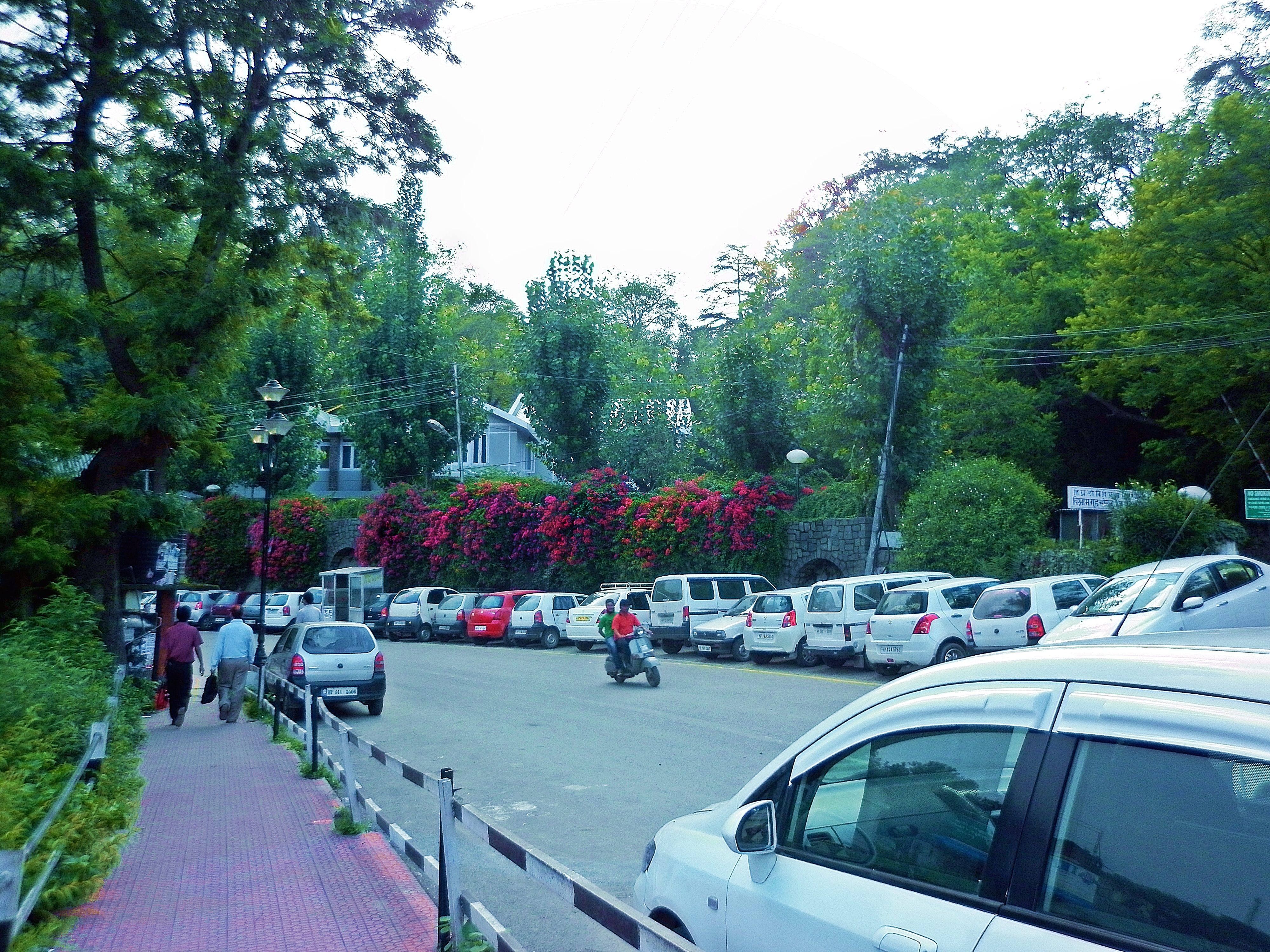
 Solan bypass
 -
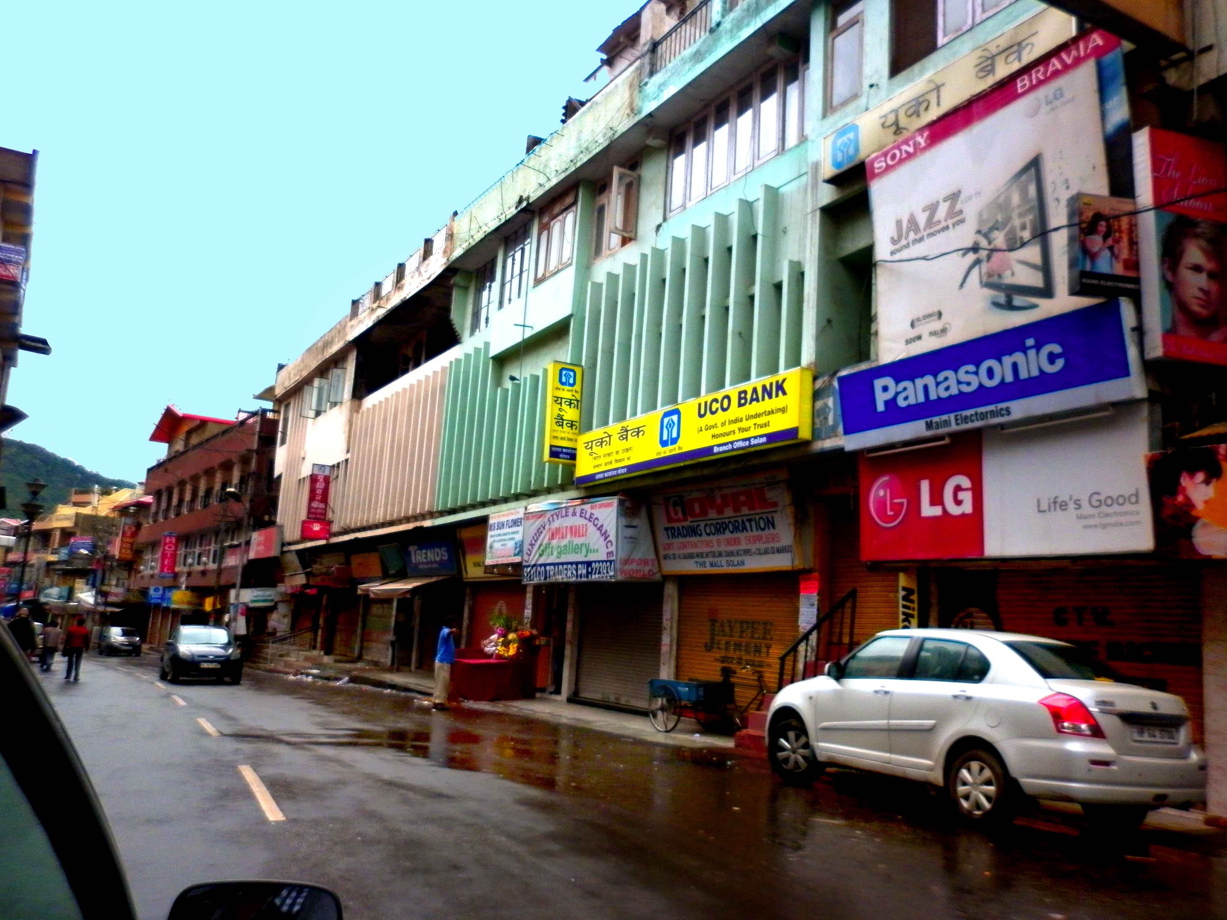 Mall road, Solan
 -
 Solan Bypass
 -
 Thoda dance wall painting, The Mall, Solan
 -
 Shilly sanctuary area Solan
 -
 Platinum Mall, Solan
 -
 Bank lane, The Mall, Solan
 -
 Commercial mall, Solan.
 -
 SOLAN
SOLAN -
 Footpath on Mall road
 -
 Amravati Hills, Solan
 -
 Solan railway station in 1911
 -
 Solan Bypass traffic lights
 -
 Old DC office during Shoolini Utsav 2012
 -
 Historical Thodo ground Solan
 -
 North-east part of Solan city at night
 -
 Sakpal of Shoolini Devi
 -
 Shoolini Mahotsav, Solan
 -
 Shoolini Mahotsav, Solan
 -
 Solan city from Mount Karol
 -
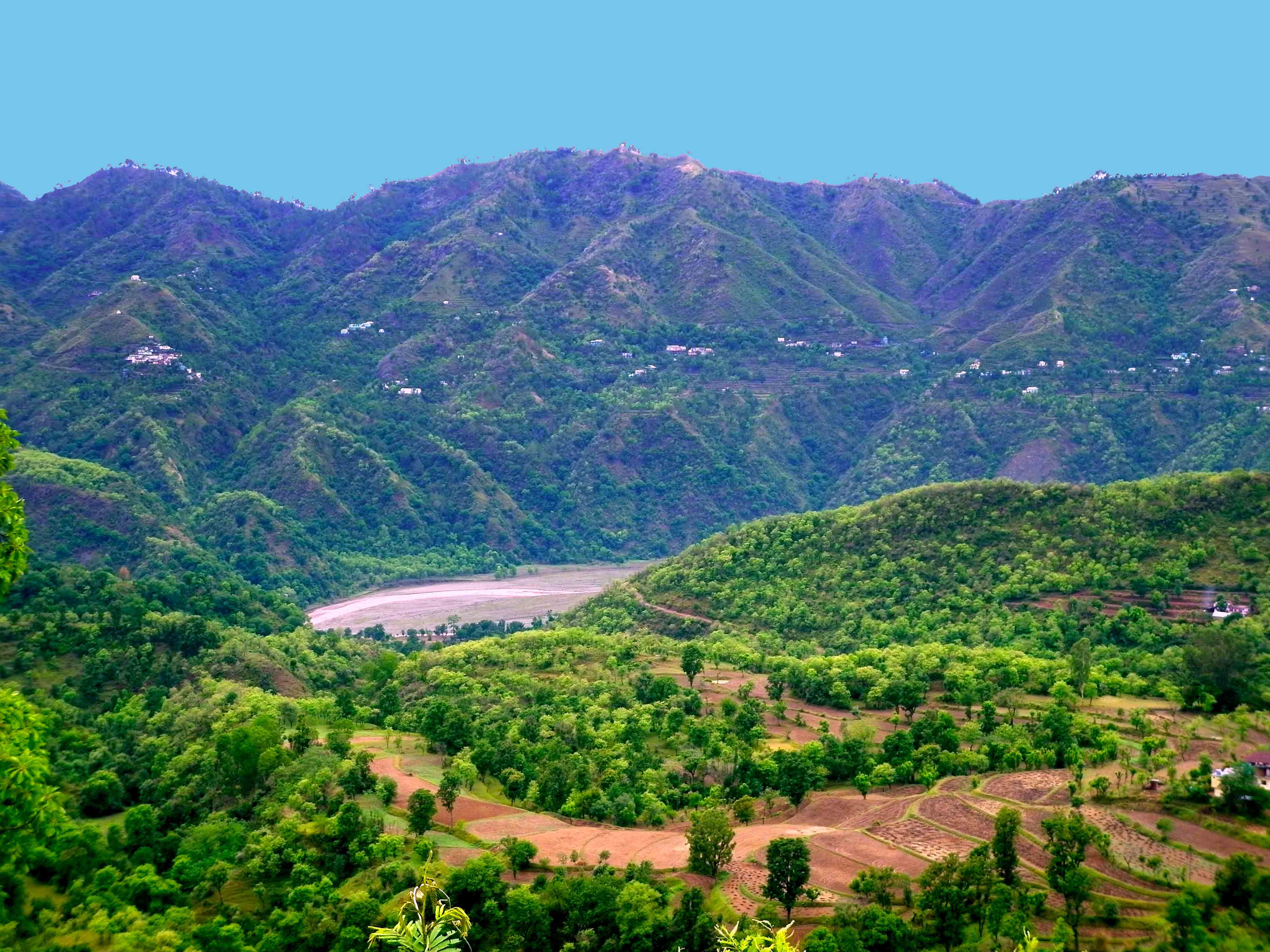 Kunihar valley, Solan
 -
 Himachal Belle, Mohan Park
 -
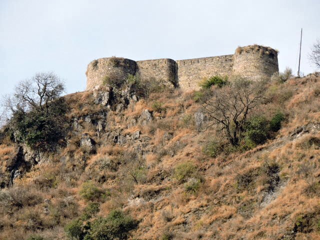 Nauni Fort in Solan district
 -
 Palace of Nalagarh Princely State
 -
 Palace of erstwhile Arki/Baghal State
 -
 Entrance of palace of Kuthar Princely State


References[edit | edit source]
- ↑ "Language and dialect of Himachal Pradesh" (PDF). Literary Herald.
- ↑ "District Solan, Government of Himachal Pradesh | Mushroom City Of India | India". Retrieved 26 August 2024.
- ↑ 3.0 3.1 "Solan Travel and Tourism Guide".
- ↑ Capital of Bhagat state Archived 25 November 2010 at the Wayback Machine
- ↑ "Religious Places of Worship, Temples in Solan, India". www.touristlink.com. Retrieved 6 January 2020.
- ↑ him_admin. "Monasteries". Himachal Tourism Official Website. Retrieved 6 January 2020.
- ↑ Service, Tribune News. "Solan has Mushroom City tag, yet Himachal lags behind three states in production". Tribuneindia News Service. Retrieved 6 January 2020.
- ↑ "DMR".
- ↑ "Solan Rising in Tourist arrivals".
- ↑ "Travel Is Our Passion: Trek To Karol Tibba, Pandava Cave". travelisourpassion.blogspot.in. 2 July 2014. Retrieved 2 June 2016.
- ↑ "Gurkha Fort".
- ↑ 12.0 12.1 "Historical Evolution Solan City" (PDF). Archived from the original (PDF) on 21 July 2011.
- ↑ "Solan Railway Station". indiarailinfo.com.
- ↑ "anees villa". 25 December 2012.
- ↑ 15.0 15.1 "Heritage" (PDF). Archived from the original (PDF) on 21 July 2011.
- ↑ Falling Rain Genomics, Inc – Solan
- ↑ "Geographical setting" (PDF). Archived from the original (PDF) on 21 July 2011.
- ↑ 18.0 18.1 Report page:8 Archived 21 July 2011 at the Wayback Machine
- ↑ "Climate Data for Solan".
- ↑ "Climate of Solan".
- ↑ "Climatological Tables of Observatories in India 1991-2020" (PDF). India Meteorological Department. Retrieved 8 April 2024.
- ↑ "Station: Solan Climatological Table 1981–2010" (PDF). Climatological Normals 1981–2010. India Meteorological Department. January 2015. pp. 547–548. Archived from the original (PDF) on 5 February 2020. Retrieved 14 February 2020.
- ↑ "Extremes of Temperature & Rainfall for Indian Stations (Up to 2012)" (PDF). India Meteorological Department. December 2016. p. M72. Archived from the original (PDF) on 5 February 2020. Retrieved 14 February 2020.
- ↑ 24.0 24.1 "Census of India 2011, Himachal Pradesh, Solan City census" (PDF).
- ↑ "Solan Literacy Rate 2011".
- ↑ "Solan Town Population Census 2011". census2011.co.in. Retrieved 18 September 2018.
- ↑ "DISTRICT CENSUS HANDBOOK SOLAN, VILLAGE AND TOWN DIRECTORY" (PDF). censusindia.gov.in. Retrieved 18 September 2018.
- ↑ "Proposed land use of Solan Planning Area" (PDF). Archived from the original (PDF) on 21 July 2011.
- ↑ Report page:9 Archived 21 July 2011 at the Wayback Machine
- ↑ "CM inaugurates Water Park at Sadhupul". The Tribune India, Himachal. 1 July 2017.
- ↑ "Tourist Attractions in Solan".
- ↑ "HP allocates Rs 45.4 cr for sports". The Statesman. 1 September 2018.
- ↑ Ananthakrishnan, Nilakantan (2018). "National Institutional Ranking Framework criteria are against the interests of health science institutions". The National Medical Journal of India. 31 (6): 379–380. doi:10.4103/0970-258x.262902. ISSN 0970-258X. PMID 31397379. S2CID 199033574.
- ↑ "Mera Solan". Divya Himachal. Retrieved 16 September 2018.
- ↑ "National Mushroom Conference".
External links[edit | edit source]
.png)
- ↑ Jatoli Shiva Temple Tallest Shiva Temple Of Asia Retrieved 03 July 2025.