
→History: By |
mNo edit summary |
||
| Line 5: | Line 5: | ||
<!-- See [[Wikipedia:WikiProject Indian cities]] for details --> | <!-- See [[Wikipedia:WikiProject Indian cities]] for details --> | ||
{{Infobox settlement | {{Infobox settlement | ||
| name | | name = Kalyan | ||
| settlement_type | | settlement_type = [[City]]<br />[[Mumbai Metropolitan Region]] | ||
| image_skyline | | image_skyline = | ||
| nickname | Kalyan Railway Yard, Kalyan, Maharashtra, India - panoramio (2).jpg | ||
| map_alt | | nickname = | ||
| map_caption | | map_alt = | ||
| pushpin_map | | map_caption = | ||
| pushpin_label_position | | pushpin_map = | ||
| pushpin_map_alt | | pushpin_label_position = | ||
| pushpin_map_caption | | pushpin_map_alt = | ||
| coordinates | | pushpin_map_caption = | ||
| subdivision_type | | coordinates = {{coord|19.24|N|73.13|E|display=inline,title}} | ||
| subdivision_name | | subdivision_type = Country | ||
| subdivision_type1 | | subdivision_name = {{flag|India}} | ||
| subdivision_type2 | | subdivision_type1 = [[States and Territories of India|State]] | ||
| subdivision_name1 | | subdivision_type2 = [[List of districts of India|District]] | ||
| subdivision_name2 | | subdivision_name1 = [[Maharashtra]] | ||
| established_title | | subdivision_name2 = [[Thane district|Thane]] | ||
| government_type | | established_title = <!-- Established --> | ||
| governing_body | | government_type = [[Municipal Corporation]] | ||
| leader_title | | governing_body = [[Kalyan-Dombivali Municipal Corporation]] | ||
| leader_name | | leader_title = [[Mayor]] | ||
| unit_pref | | leader_name = Vinita Rane ([[Shiv Sena]]) | ||
| area_footnotes | | unit_pref = Metric | ||
| area_total_km2 | | area_footnotes = | ||
| area_rank | | area_total_km2 = 137.15 | ||
| elevation_footnotes | | area_rank = | ||
| elevation_m | | elevation_footnotes = | ||
| population_total | | elevation_m = 8.84 | ||
| population_as_of | | population_total = 1,246,381 (with [[Dombivli]]) | ||
| population_footnotes | | population_as_of = 2011 | ||
| population_density_km2 | | population_footnotes = | ||
| population_rank | | population_density_km2 = auto | ||
| population_demonym | | population_rank = [[List of most populous cities in India|29th]] | ||
| demographics_type1 | | population_demonym = Kalyankar | ||
| demographics1_title1 | | demographics_type1 = [[Languages]] | ||
| timezone1 | | demographics1_title1 = [[Official]] | ||
| utc_offset1 | | timezone1 = [[Indian Standard Time|IST]] | ||
| postal_code_type | | utc_offset1 = +5:30 | ||
| postal_code | | postal_code_type = [[Postal Index Number|PIN CODE]] | ||
| registration_plate | | postal_code = 421301(Kalyan (West)) 421304 (Kalyan (S.O.)) 421306 (Kalyan (East)) | ||
| unemployment_rate | | registration_plate = [[List of RTO districts in India#MH.E2.80.94Maharashtra|MH]]-05 | ||
| blank1_name_sec1 | | unemployment_rate = | ||
| blank1_info_sec1 | | blank1_name_sec1 = [[Human sex ratio|Sex ratio]] | ||
| website | | blank1_info_sec1 = 917 females/1000 males [[male|♂]]/[[female|♀]] | ||
| footnotes | | website = | ||
| leader_title2 | | footnotes = | ||
| leader_name2 | | leader_title2 = [[Municipal Commissioner (India)|Municipal Commissioner]] | ||
| leader_title3 | | leader_name2 = Dr. Vijay Suryawanshi | ||
| leader_name3 | | leader_title3 = [[Deputy Mayor]] | ||
| demographics1_info1 | | leader_name3 = Moreshwar Bhoir ([[Bharatiya Janata Party]]) | ||
| blank2_name_sec1 | | demographics1_info1 = [[Marathi language|Marathi]] | ||
| blank2_info_sec1 | | blank2_name_sec1 = [[Literacy Rate]] | ||
| blank3_name_sec1 | | blank2_info_sec1 = 93.06% | ||
| blank3_info_sec1 | | blank3_name_sec1 = [[Lok Sabha]] constituency | ||
| blank4_name_sec1 | | blank3_info_sec1 = [[Kalyan (Lok Sabha constituency)|Kalyan]] | ||
| blank4_info_sec1 | | blank4_name_sec1 = [[Vidhan Sabha]] constituency | ||
| blank5_name_sec1 | | blank4_info_sec1 = Kalyan | ||
| blank5_info_sec1 | | blank5_name_sec1 = Civic agency | ||
| official_name = | | blank5_info_sec1 = [[Kalyan-Dombivli Municipal Corporation]] | ||
| official_name = | |||
| Region = West region | |||
| Zone = Zone 1 | |||
}} | }} | ||
'''Kalyan''' is a city in [[Thane district]] of [[Maharashtra]] state in [[Konkan division]] | '''Kalyan''' (Pronunciation: [[Help:IPA/Marathi|[kəljaːɳ]]]) is a city on the banks of [[Ulhas River]] in [[Thane district]] of [[Maharashtra]] state in [[Konkan division]]. It is governed by [[Kalyan-Dombivli Municipal Corporation]]. Kalyan is a subdivision ([[Taluka]]) of [[Thane district]]. Kalyan and its neighbouring township of [[Dombivli]] jointly form [[Kalyan-Dombivli Municipal Corporation]], abbreviated as KDMC. It is a founding city of the [[Mumbai Metropolitan Region]]. Kalyan is the 9th biggest city in Maharashtra and 29th in the India. | ||
==Etymology== | |||
[[File:Shivaji Maharaj visited Kalyan on 24th October 1657.jpg|thumb|Shivaji Maharaj visited Kalyan on 24th October 1657.]] | |||
The name 'Kalyan' is believed to be from Kalyan Swami, a great disciple of Sadguru Samartha Ramdas Swami who arrived at Durga Devi Temple on Fort Durgadi, which was won by Shri [[Chhatrapati Shivaji Maharaj]]. In Colonial India, the [[British Raj]] referred this city as ''Kallian'', ''Cullian'', or ''Calliannee''. | |||
The name 'Kalyan' is believed to be from Kalyan | |||
In | |||
<gallery> | <gallery> | ||
File:Kalyan 1857.jpg|A post 1857 map by John Tallis focused on the events of the Rebellion. The author spells Kalyan as "KALYAN LANJA"/"Calliannee". | File:Kalyan 1857.jpg|A post 1857 map by John Tallis focused on the events of the Rebellion. The author spells Kalyan as "KALYAN LANJA"/"Calliannee". | ||
File:Kalyan 1883.jpg|Letts's Popular Atlas, 1883 (Letts & Co., London), Spelled "Kalliannee". | File:Kalyan 1883.jpg|Letts's Popular Atlas, 1883 (Letts & Co., London), Spelled "Kalliannee". | ||
File:Kalyan 1885.jpg|Cram atlas map, 1885. Spelled as "Callian". | File:Kalyan 1885.jpg|Cram atlas map, 1885. Spelled as "Callian". | ||
File:Kalyan 1955.jpg|A documented map of Kalyan area 1955 from the US military. Spelled "Kalyan". | File:Kalyan 1955.jpg|A documented map of Kalyan area 1955 from the US military. Spelled "Kalyan". | ||
</gallery> | </gallery> | ||
==Around Kalyan== | ==Around Kalyan== | ||
| Line 98: | Line 86: | ||
===Durgadi Fort=== | ===Durgadi Fort=== | ||
[[File:Durgadi Fort Enterance.jpg|left|thumb|240px|Kalyan's Durgadi Fort entrance]] | [[File:Durgadi Fort Enterance.jpg|left|thumb|240px|Kalyan's Durgadi Fort entrance]] | ||
The city of Kalyan was surrounded by a fort wall, the construction of which began during Shah Jahan's reign and was completed during Aurangzeb's reign in 1694 A.D. This city wall, which ran in excess of 2000 yards, 2123 to be precise, was guarded by 4 gates and 11 towers. The fort wall enclosed an area of 70 acres and on a high mound near the Kalyan creek, where the current Ganesh ghat stands, was a fine fort since as early as 1570. | The city of Kalyan was surrounded by a fort wall, the construction of which began during [[Shah Jahan]]'s reign and was completed during [[Aurangzeb]]'s reign in 1694 A.D. This city wall, which ran in excess of 2000 yards, 2123 to be precise, was guarded by 4 gates and 11 towers. The fort wall enclosed an area of 70 acres and on a high mound near the Kalyan creek, where the current Ganesh ghat stands, was a fine fort since as early as 1570. | ||
The wall of the fort along the top of the inner bank of the ditch, and, near the north end, had a gateway known as the Delhi or Killyacha Darwaja. {{citation needed|date=May 2014}} | The wall of the fort along the top of the inner bank of the ditch, and, near the north end, had a gateway known as the Delhi or Killyacha Darwaja. {{citation needed|date=May 2014}} | ||
Under the Marathas (1760–72), a new gate about {{convert|150|ft|m}} to the south of the Ganesh gate was opened near the mansion of Ramji Mahadeo Biwalkar, the Peshwa's Governor. In the citadel of the fort Marathas built a small wooden temple of Durgadevi behind the mosque, and called the fort Durgadi Killain in honor of the goddess, a name which it still bears. The fort measures {{convert|220|ft|m}} in length and somewhat less in breadth. Under the English rule, the fort wall was dismantled and stones carried to build the Kalyan and Thane piers and a dwelling for the customs inspector in the west of the Kalyan fort. The gate to the north-west is almost the only trace of the fort wall, which is of rough stone masonry. During 1876 the original idol of the goddess Durga was stolen.<ref>Page no. 120, The Gazetteers of Bombay Presidency, Thane 3rd Edition</ref> | Under the [[Marathi people|Marathas]] (1760–72), a new gate about {{convert|150|ft|m}} to the south of the Ganesh gate was opened near the mansion of Ramji Mahadeo Biwalkar, the Peshwa's Governor. In the citadel of the fort Marathas built a small wooden temple of Durgadevi behind the mosque, and called the fort Durgadi Killain in honor of the goddess, a name which it still bears. The fort measures {{convert|220|ft|m}} in length and somewhat less in breadth. Under the English rule, the fort wall was dismantled and stones carried away to build the Kalyan and Thane piers and a dwelling for the customs inspector in the west of the Kalyan fort. The gate to the north-west is almost the only trace of the fort wall, which is of rough stone masonry. During 1876 the original idol of the goddess Durga was stolen.<ref>Page no. 120, The Gazetteers of Bombay Presidency, Thane 3rd Edition</ref> | ||
[[File:Kala Talao 1.jpg|thumb|Kala Talao, a historic lake]] | [[File:Kala Talao 1.jpg|thumb|Kala Talao, a historic lake]] | ||
==Demographics== | ==Demographics== | ||
The majority of Kalyan citizens are [[Hindu]]s with [[Muslim]]s being a | The majority of Kalyan citizens are [[Hindu]]s with [[Muslim]]s being a minority.{{citation needed|date=August 2017}}. | ||
==Climate== | ==Climate== | ||
| Line 149: | Line 137: | ||
|Oct precipitation mm = 87.1 | |Oct precipitation mm = 87.1 | ||
|Nov precipitation mm = 20.6 | |Nov precipitation mm = 20.6 | ||
|Dec precipitation mm = 2. | |Dec precipitation mm = 2.1 | ||
|source = [http://cultural.maharashtra.gov.in/english/gazetteer/Thane/Climate-%20table.html Government of Maharashtra] | |source = [http://cultural.maharashtra.gov.in/english/gazetteer/Thane/Climate-%20table.html Government of Maharashtra] | ||
|date = June 2012 | |date = June 2012 | ||
| Line 158: | Line 147: | ||
[[Kalyan Junction railway station]] is on the railway line between Mumbai and [[Karjat]]/[[Kasara]]. The city of Kalyan has access to four railway stations on the Central line - [[Thakurli]] Station, [[Vitthalwadi]], [[Shahad]] Station and '''Kalyan''' Junction. Kalyan Junction serves as an important railway station for the people in and around [[Mumbai]].<ref>{{cite web|url=http://zeenews.india.com/news/maharashtra/mumbai-cst-bound-local-train-derails-near-kalyan-1-feared-dead_919143.html|title=Mumbai CST-bound local train derails near Kalyan, 1 killed|date=20 March 2014|work=Zee Media|publisher=Essel|access-date=28 May 2014}}</ref> | [[Kalyan Junction railway station]] is on the railway line between Mumbai and [[Karjat]]/[[Kasara]]. The city of Kalyan has access to four railway stations on the Central line - [[Thakurli]] Station, [[Vitthalwadi]], [[Shahad]] Station and '''Kalyan''' Junction. Kalyan Junction serves as an important railway station for the people in and around [[Mumbai]].<ref>{{cite web|url=http://zeenews.india.com/news/maharashtra/mumbai-cst-bound-local-train-derails-near-kalyan-1-feared-dead_919143.html|title=Mumbai CST-bound local train derails near Kalyan, 1 killed|date=20 March 2014|work=Zee Media|publisher=Essel|access-date=28 May 2014}}</ref> | ||
One of the oldest and important railway project of Ahmednagar railway station was kalyan-Ahmednagar railway project which was in planning stage since british regime. It was referred as 3rd ghat project. The survey of this project was carried out in 1973,2000, 2006, 2014 etc. This project was in pink book in 2010. unfortunately this project could not be started. The alignment length of thus project was 184 km and it could have been shortest route for marathwada, andhra and telangana. The major challenge for this project was 18.96 km long tunnel in malshej ghat section. <ref>{{cite web | url = | |||
https://www.maharashtratimes.com/editorial/article/development-route-of-kalyan-ahmednagar-railway/amp_articleshow/59907427.cms }} </ref> | |||
Malshej Kriti samiti is following for kalyan ahmednagar railway project. Kalyan-murbad section which is first phase of this project is already under survey stage.<ref>{{cite news|url=https://www.loksatta.com/thane/article-on-malshej-ghat-railway-route-1210026/lite/}}</ref> | |||
==Civic amenities== | ==Civic amenities== | ||
| Line 167: | Line 161: | ||
Due to its highly educated population it is often called the second cultural capital of Maharashtra after Pune. Kalyan was once famous as a port in ancient times. Records of its existence as a premier port in the region have been found in ancient Greek manuscripts. | Due to its highly educated population it is often called the second cultural capital of Maharashtra after Pune. Kalyan was once famous as a port in ancient times. Records of its existence as a premier port in the region have been found in ancient Greek manuscripts. | ||
The corporation is governed by Bombay Provincial Municipal Corporation Act 1949. The following authorities are given charge to | The corporation is governed by Bombay Provincial Municipal Corporation Act 1949. The following authorities are given charge to implement the provisions of the act: | ||
* A corporation | * A corporation | ||
* A standing committee | * A standing committee | ||
| Line 177: | Line 171: | ||
As per the provisions of the Act, the total number of Councillors is 121. | As per the provisions of the Act, the total number of Councillors is 121. | ||
The Corporation elects one of its members as the Mayor and another to be the Deputy Mayor.<ref>{{cite web| url=http://www.kalyancity.com/Govt_Offices.php| title=Government in Kalyan| author=kalyancity.com| publisher=kalyancity.com}}</ref> | The Corporation elects one of its members as the Mayor and another to be the Deputy Mayor.<ref>{{cite web| url=http://www.kalyancity.com/Govt_Offices.php| title=Government in Kalyan| author=kalyancity.com| publisher=kalyancity.com}}</ref> | ||
== Education == <!--- comment, expand section with more schools ---> | |||
*[[Mar Thoma Special School for Children in Need of Special Care]] | |||
== Gallery == | == Gallery == | ||
| Line 189: | Line 186: | ||
<!---♦♦♦ Please keep the list in alphabetical order by LAST NAME ♦♦♦---> | <!---♦♦♦ Please keep the list in alphabetical order by LAST NAME ♦♦♦---> | ||
* [[Vishwanath Bhoir]]{{ndash}} MLA, (Kalyan West) | * [[Vishwanath Bhoir]]{{ndash}} MLA, (Kalyan West) | ||
* [[Tushar Deshpande]] {{ndash}} Indian | * [[Tushar Deshpande]] {{ndash}} Indian cricketer. (Fast bowler) | ||
* [[Pranav Dhanawade]] {{ndash}} Indian | * [[Pranav Dhanawade]] {{ndash}} Indian cricketer. (Record holder for most runs 1009*) | ||
* [[Ashish Dixit]] {{ndash}} Indian | * [[Ashish Dixit]] {{ndash}} Indian actor | ||
* [[Ganpat Gaikwad]]{{ndash}} MLA, BJP (Kalyan East) | * [[Ganpat Gaikwad]]{{ndash}} MLA, BJP (Kalyan East) | ||
* [[Anandi Gopal Joshi]] {{ndash}} first Indian female physician | * [[Anandi Gopal Joshi]] {{ndash}} first Indian female physician | ||
| Line 199: | Line 196: | ||
* [[Lalit Prabhakar]] {{ndash}} Indian actor | * [[Lalit Prabhakar]] {{ndash}} Indian actor | ||
* [[Shrikant Shinde]] {{ndash}} Member of Parliament (Kalyan) | * [[Shrikant Shinde]] {{ndash}} Member of Parliament (Kalyan) | ||
* [[Sneha Wagh]] {{ndash}} Indian | * [[Sneha Wagh]] {{ndash}} Indian television actress | ||
==Schools & Colleges== | |||
<!---♦♦♦ Only add a school or college to this list if it already has its own article on the English Wikipedia ♦♦♦---> | |||
<ref>{{Cite web|url=https://www.vibgyorrise.com/kalyan-khadakpada.php|title=ICSE {{!}} CBSE School in Kalyan , Mumbai - VIBGYOR High|website=www.vibgyorrise.com|access-date=2021-08-08}}</ref> | |||
* [[Central Railway Sec. School & Jr. College]] | |||
==References== | ==References== | ||
Revision as of 19:17, 30 June 2022
 | This article needs additional citations for verification. (April 2016) |
Kalyan | |
|---|---|
.jpg) | |
| Coordinates: 19°14′N 73°08′E / 19.24°N 73.13°E | |
| Country |  India India |
| State | Maharashtra |
| District | Thane |
| Government | |
| • Type | Municipal Corporation |
| • Body | Kalyan-Dombivali Municipal Corporation |
| • Mayor | Vinita Rane (Shiv Sena) |
| • Municipal Commissioner | Dr. Vijay Suryawanshi |
| • Deputy Mayor | Moreshwar Bhoir (Bharatiya Janata Party) |
| Area | |
| • Total | 137.15 km2 (52.95 sq mi) |
| Elevation | 8.84 m (29.00 ft) |
| Population (2011) | |
| • Total | 1,246,381 (with Dombivli) |
| • Rank | 29th |
| Demonym | Kalyankar |
| Languages | |
| • Official | Marathi |
| Time zone | UTC+5:30 (IST) |
| PIN CODE | 421301(Kalyan (West)) 421304 (Kalyan (S.O.)) 421306 (Kalyan (East)) |
| Vehicle registration | MH-05 |
| Sex ratio | 917 females/1000 males ♂/♀ |
| Literacy Rate | 93.06% |
| Lok Sabha constituency | Kalyan |
| Vidhan Sabha constituency | Kalyan |
| Civic agency | Kalyan-Dombivli Municipal Corporation |
Kalyan (Pronunciation: [kəljaːɳ]) is a city on the banks of Ulhas River in Thane district of Maharashtra state in Konkan division. It is governed by Kalyan-Dombivli Municipal Corporation. Kalyan is a subdivision (Taluka) of Thane district. Kalyan and its neighbouring township of Dombivli jointly form Kalyan-Dombivli Municipal Corporation, abbreviated as KDMC. It is a founding city of the Mumbai Metropolitan Region. Kalyan is the 9th biggest city in Maharashtra and 29th in the India.
Etymology

The name 'Kalyan' is believed to be from Kalyan Swami, a great disciple of Sadguru Samartha Ramdas Swami who arrived at Durga Devi Temple on Fort Durgadi, which was won by Shri Chhatrapati Shivaji Maharaj. In Colonial India, the British Raj referred this city as Kallian, Cullian, or Calliannee.
-
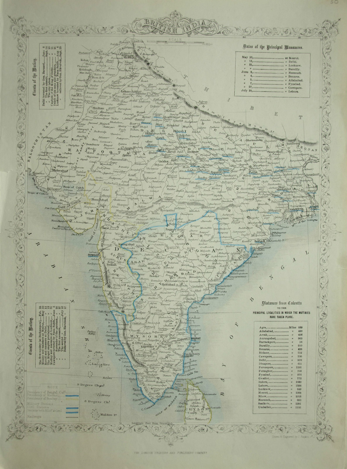 A post 1857 map by John Tallis focused on the events of the Rebellion. The author spells Kalyan as "KALYAN LANJA"/"Calliannee".
 -
 Letts's Popular Atlas, 1883 (Letts & Co., London), Spelled "Kalliannee".
 -
 Cram atlas map, 1885. Spelled as "Callian".
 -
 A documented map of Kalyan area 1955 from the US military. Spelled "Kalyan".


Around Kalyan
Durgadi Fort

The city of Kalyan was surrounded by a fort wall, the construction of which began during Shah Jahan's reign and was completed during Aurangzeb's reign in 1694 A.D. This city wall, which ran in excess of 2000 yards, 2123 to be precise, was guarded by 4 gates and 11 towers. The fort wall enclosed an area of 70 acres and on a high mound near the Kalyan creek, where the current Ganesh ghat stands, was a fine fort since as early as 1570.
The wall of the fort along the top of the inner bank of the ditch, and, near the north end, had a gateway known as the Delhi or Killyacha Darwaja. [citation needed]
Under the Marathas (1760–72), a new gate about 150 feet (46 m) to the south of the Ganesh gate was opened near the mansion of Ramji Mahadeo Biwalkar, the Peshwa's Governor. In the citadel of the fort Marathas built a small wooden temple of Durgadevi behind the mosque, and called the fort Durgadi Killain in honor of the goddess, a name which it still bears. The fort measures 220 feet (67 m) in length and somewhat less in breadth. Under the English rule, the fort wall was dismantled and stones carried away to build the Kalyan and Thane piers and a dwelling for the customs inspector in the west of the Kalyan fort. The gate to the north-west is almost the only trace of the fort wall, which is of rough stone masonry. During 1876 the original idol of the goddess Durga was stolen.[1]

Demographics
The majority of Kalyan citizens are Hindus with Muslims being a minority.[citation needed].
Climate
| Climate data for Kalyan | |||||||||||||
|---|---|---|---|---|---|---|---|---|---|---|---|---|---|
| Month | Jan | Feb | Mar | Apr | May | Jun | Jul | Aug | Sep | Oct | Nov | Dec | Year |
| Average high °C (°F) | 29.3 (84.7) |
34.7 (94.5) |
43.6 (110.5) |
48.7 (119.7) |
38.7 (101.7) |
31.9 (89.4) |
29.8 (85.6) |
29.3 (84.7) |
30.1 (86.2) |
32.9 (91.2) |
33.4 (92.1) |
32.0 (89.6) |
34.5 (94.2) |
| Average low °C (°F) | 14.6 (58.3) |
16.3 (61.3) |
19.6 (67.3) |
25.7 (78.3) |
26.1 (79.0) |
25.8 (78.4) |
24.8 (76.6) |
24.5 (76.1) |
24.0 (75.2) |
23.1 (73.6) |
20.5 (68.9) |
18.2 (64.8) |
21.9 (71.5) |
| Average precipitation mm (inches) | 2.3 (0.09) |
1.0 (0.04) |
0.8 (0.03) |
1.8 (0.07) |
13.5 (0.53) |
432.6 (17.03) |
946.1 (37.25) |
553.3 (21.78) |
294.1 (11.58) |
87.1 (3.43) |
20.6 (0.81) |
2.1 (0.08) |
2,355.3 (92.72) |
| Source: Government of Maharashtra | |||||||||||||
Transport
Trains, Buses and Auto-rickshaws are the important mode of transport in and around Kalyan. 200,000 Kalyan citizens travel daily by local trains.[2]
Kalyan Junction railway station is on the railway line between Mumbai and Karjat/Kasara. The city of Kalyan has access to four railway stations on the Central line - Thakurli Station, Vitthalwadi, Shahad Station and Kalyan Junction. Kalyan Junction serves as an important railway station for the people in and around Mumbai.[3]
One of the oldest and important railway project of Ahmednagar railway station was kalyan-Ahmednagar railway project which was in planning stage since british regime. It was referred as 3rd ghat project. The survey of this project was carried out in 1973,2000, 2006, 2014 etc. This project was in pink book in 2010. unfortunately this project could not be started. The alignment length of thus project was 184 km and it could have been shortest route for marathwada, andhra and telangana. The major challenge for this project was 18.96 km long tunnel in malshej ghat section. [4]
Malshej Kriti samiti is following for kalyan ahmednagar railway project. Kalyan-murbad section which is first phase of this project is already under survey stage.[5]
Civic amenities
With a population of more than 700,000, Kalyan is a part of the Kalyan-Dombivli Municipal Corporation established in 1983, with municipalities of Kalyan, Dombivli, Ambernath and 81 other villages. It was then one of the largest urban local bodies in Mumbai Metropolitan Region (MMR) and in the state, with an area around 209 km2 (81 sq mi). The government of Maharashtra has decided to delete major area of the corporation limits on different occasions.[clarification needed] Presently the total area of the corporation has remained, and measures about 67 km2 (26 sq mi).
Government
KDMC is a municipal corporation in Thane district of Maharashtra State, India. The municipal corporation was formed in 1983 to administer the twin townships of Kalyan and Dombivli. The municipal corporation has a population 15,18,762 citizens as per the 2011 census. Due to its highly educated population it is often called the second cultural capital of Maharashtra after Pune. Kalyan was once famous as a port in ancient times. Records of its existence as a premier port in the region have been found in ancient Greek manuscripts.
The corporation is governed by Bombay Provincial Municipal Corporation Act 1949. The following authorities are given charge to implement the provisions of the act:
- A corporation
- A standing committee
- Ward committees
- Municipal commissioner
Both the cities are divided into 122 wards. Municipal Corporation consists of Councillors elected directly at Ward Elections. The number and boundaries of the Wards into which the city is divided is specified by the State Election Commissioner. There are five Councillors nominated by the corporation. As per the provisions of the Act, the total number of Councillors is 121. The Corporation elects one of its members as the Mayor and another to be the Deputy Mayor.[6]
Education
Gallery
-
 KDMT Buses
 -
 Kalyan Junction during the 26 July floods
 -
 Kalyan Junction


Notable people
- Vishwanath Bhoir– MLA, (Kalyan West)
- Tushar Deshpande – Indian cricketer. (Fast bowler)
- Pranav Dhanawade – Indian cricketer. (Record holder for most runs 1009*)
- Ashish Dixit – Indian actor
- Ganpat Gaikwad– MLA, BJP (Kalyan East)
- Anandi Gopal Joshi – first Indian female physician
- Gavin Packard – Indian actor
- Pramod Ratan Patil– MLA, MNS (Kalyan Rural)
- Narendra Pawar – Ex-MLA, BJP (Kalyan West)
- Lalit Prabhakar – Indian actor
- Shrikant Shinde – Member of Parliament (Kalyan)
- Sneha Wagh – Indian television actress
Schools & Colleges
References
- ↑ Page no. 120, The Gazetteers of Bombay Presidency, Thane 3rd Edition
- ↑ "रिक्षाचालकांविरोधात प्रवासांचा एल्गार (Rikṣācālakāṃvirōdhāt Pravāsāṃcā Ēlgār)" (in मराठी). Kalyan, Thane: Sakal Publications. 24 February 2015. p. 6.
- ↑ "Mumbai CST-bound local train derails near Kalyan, 1 killed". Zee Media. Essel. 20 March 2014. Retrieved 28 May 2014.
- ↑ https://www.maharashtratimes.com/editorial/article/development-route-of-kalyan-ahmednagar-railway/amp_articleshow/59907427.cms.
{{cite web}}: Missing or empty|title=(help) - ↑ https://www.loksatta.com/thane/article-on-malshej-ghat-railway-route-1210026/lite/.
{{cite news}}: Missing or empty|title=(help) - ↑ kalyancity.com. "Government in Kalyan". kalyancity.com.
- ↑ "ICSE | CBSE School in Kalyan , Mumbai - VIBGYOR High". www.vibgyorrise.com. Retrieved 8 August 2021.
External links
- KDMC: Kalyan Dombivli Municipal Corporation