
->Mvqr |
No edit summary |
||
| Line 2: | Line 2: | ||
{{Infobox settlement | {{Infobox settlement | ||
| name = West Khasi Hills district | | name = West Khasi Hills district | ||
| settlement_type = [[ | | settlement_type = [[List of districts of Meghalaya|District]] of [[Meghalaya]] | ||
| | | image_map = {{maplink |frame=yes | ||
| | |frame-width=225 |frame-height=225 |frame-align=center | ||
| | |text= '''West Khasi Hills district''' | ||
| map_caption = Location | |type=shape |id=Q2064752 | ||
|stroke-colour=#C60C30 | |||
|stroke-width=2 | |||
|title= West Khasi Hills district of Meghalaya | |||
|type2=line|id2=Q1195|stroke-width2=1|stroke-colour2=#0000ff|title2=Meghalaya | |||
}} | |||
| map_alt = | |||
| map_caption = Location in Meghalaya | |||
| coordinates = | | coordinates = | ||
| coor_pinpoint = Nongstoin | | coor_pinpoint = Nongstoin | ||
| Line 83: | Line 90: | ||
According to the [[2011 census of India|2011 census]] West Khasi Hills district has a [[Demographics of India|population]] of 383,461,<ref name="districtcensus">{{cite web | url = http://www.census2011.co.in/district.php | title = District Census 2011 | access-date = 2011-09-30 | year = 2011 | publisher = Census2011.co.in}}</ref> roughly equal to the nation of [[Maldives]].<ref name="cia">{{cite web | author = US Directorate of Intelligence | title = Country Comparison:Population | url = https://www.cia.gov/library/publications/the-world-factbook/rankorder/2119rank.html | access-date = 2011-10-01 | quote = Maldives 394,999 July 2011 est.}}</ref> This gives it a ranking of 562th in India (out of a total of [[Districts of India|640]]).<ref name="districtcensus"/> The district has a population density of {{convert| 73 |PD/sqkm|PD/sqmi}}.<ref name="districtcensus"/> Its [[Family planning in India|population growth rate]] over the decade 2001-2011 was 30.25%.<ref name="districtcensus"/> West Khasi Hills has a [[sex ratio]] of 980 [[Women in India|females]] for every 1000 males,<ref name="districtcensus"/> and a [[Literacy in India|literacy rate]] of 77.87%.<ref name="districtcensus"/> | According to the [[2011 census of India|2011 census]] West Khasi Hills district has a [[Demographics of India|population]] of 383,461,<ref name="districtcensus">{{cite web | url = http://www.census2011.co.in/district.php | title = District Census 2011 | access-date = 2011-09-30 | year = 2011 | publisher = Census2011.co.in}}</ref> roughly equal to the nation of [[Maldives]].<ref name="cia">{{cite web | author = US Directorate of Intelligence | title = Country Comparison:Population | url = https://www.cia.gov/library/publications/the-world-factbook/rankorder/2119rank.html | access-date = 2011-10-01 | quote = Maldives 394,999 July 2011 est.}}</ref> This gives it a ranking of 562th in India (out of a total of [[Districts of India|640]]).<ref name="districtcensus"/> The district has a population density of {{convert| 73 |PD/sqkm|PD/sqmi}}.<ref name="districtcensus"/> Its [[Family planning in India|population growth rate]] over the decade 2001-2011 was 30.25%.<ref name="districtcensus"/> West Khasi Hills has a [[sex ratio]] of 980 [[Women in India|females]] for every 1000 males,<ref name="districtcensus"/> and a [[Literacy in India|literacy rate]] of 77.87%.<ref name="districtcensus"/> | ||
The district is predominantly inhabited by Khasi tribe. There is a significance presence of Garo Tribe in the Mawshynrut C n RD Block of West Khasi Hills District. | The district is predominantly inhabited by [[Khasi people|Khasi tribe]]. There is a significance presence of [[Garo (tribe)|Garo Tribe]] in the Mawshynrut C n RD Block of West Khasi Hills District. | ||
==Culture== | ==Culture== | ||
| Line 127: | Line 134: | ||
[[Category:1976 establishments in Meghalaya]] | [[Category:1976 establishments in Meghalaya]] | ||
[[Category:Autonomous regions of India]] | [[Category:Autonomous regions of India]] | ||
Latest revision as of 21:03, 18 June 2022
West Khasi Hills district | |
|---|---|
 | |
| Country | India |
| State | Meghalaya |
| Headquarters | Nongstoin |
| Government | |
| • Vidhan Sabha constituencies | 5 |
| Area | |
| • Total | 5,247 km2 (2,026 sq mi) |
| Population (2011) | |
| • Total | 383,461 |
| • Density | 73/km2 (190/sq mi) |
| Demographics | |
| • Literacy | 77.87% |
| • Sex ratio | 980 |
| Time zone | UTC+05:30 (IST) |
| Website | westkhasihills |
West Khasi Hills is an administrative district in the state of Meghalaya in India.
History[edit | edit source]
The West Khasi Hills district was carved out of the Khasi Hills district, which was divided into West and East Khasi Hills districts on 28 October 1976.
Geography[edit | edit source]
The district headquarters is located at Nongstoin. The district occupies an area of 5247 km2
Divisions[edit | edit source]
Administrative divisions[edit | edit source]
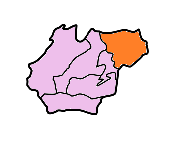
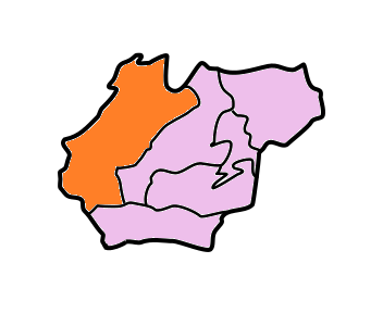
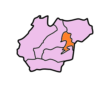
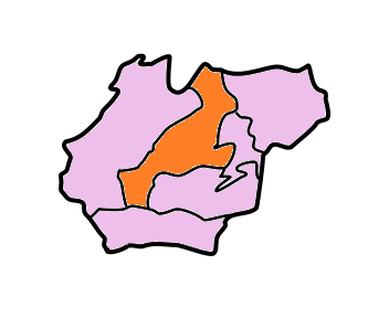
West Khasi Hills district is divided into four blocks:[1]
| Name | Headquarters | Population | Location |
| Mairang | Mairang |  | |
| Mawshynrut | Riangdo |  | |
| Mawthadraishan | Nongshillong |  | |
| Nongstoin | Nongstoin |  |
Demographics[edit | edit source]
According to the 2011 census West Khasi Hills district has a population of 383,461,[2] roughly equal to the nation of Maldives.[3] This gives it a ranking of 562th in India (out of a total of 640).[2] The district has a population density of 73 inhabitants per square kilometre (190/sq mi).[2] Its population growth rate over the decade 2001-2011 was 30.25%.[2] West Khasi Hills has a sex ratio of 980 females for every 1000 males,[2] and a literacy rate of 77.87%.[2]
The district is predominantly inhabited by Khasi tribe. There is a significance presence of Garo Tribe in the Mawshynrut C n RD Block of West Khasi Hills District.
Culture[edit | edit source]
Khasi society has greatly been transformed by many factors which have arisen in recent times. Adoption of the Western style of life, especially among the literate and educated, have been quite rapid although the matrilineal laws of inheritance and succession and the other cultural traits are still retained.
Places of interest[edit | edit source]
- Langshiang Falls, third-highest waterfalls in India
- Mawthadraishan Peak, second highest peak in Meghalaya
- Nongkhnum River Island, Langshiang Falls, Weinia Falls, Thums Falls
- Umyiap Paddy Field, longest paddy field in northeast India
- Ranikor
- Kyllang Rock
- Rambrai
- Langpih, a village which is the subject of a territorial dispute with neighbouring Kamrup District, Assam[4]
References[edit | edit source]
- ↑ Meghalaya Administrative Divisions (PDF) (Map). The Registrar General & Census Commissioner, India, New Delhi, Ministry of Home Affairs, Government of India. 2011. Retrieved 29 September 2011.
- ↑ 2.0 2.1 2.2 2.3 2.4 2.5 "District Census 2011". Census2011.co.in. 2011. Retrieved 30 September 2011.
- ↑ US Directorate of Intelligence. "Country Comparison:Population". Retrieved 1 October 2011.
Maldives 394,999 July 2011 est.
- ↑ Meghalaya flexes muscle on Assam boundary, 22 November 2008, retrieved 11 August 2012
External links[edit | edit source]
- West Khasi Hills website
- Khasi Hills Autonomous District Council website
- West Khasi Hills District website
Places adjacent to West Khasi Hills district | ||||||||||
|---|---|---|---|---|---|---|---|---|---|---|
| ||||||||||




| State symbols | |
|---|---|
| Topics | |
| Administration | |
| Divisions |
|
| Districts | |
| Municipalities | |
