




robot: Create/update articles. If there is a mistake please report on my talk page. |
No edit summary |
||
| Line 1: | Line 1: | ||
{{Short description|Fort in | {{Short description|Fort in Madhya Pradesh, India}} | ||
{{Multiple issues| | |||
{{Copy edit|date=August 2025}} | |||
{{Disputed|date=May 2024}} | |||
}} | |||
{{EngvarB|date=September 2013}} | {{EngvarB|date=September 2013}} | ||
{{Use dmy dates|date= | {{Use dmy dates|date=May 2024}} | ||
{{Infobox military installation | {{Infobox military installation | ||
| name = Gwalior | | name = Fort of Gwalior | ||
| | | location = | ||
| | | country = [[India]] | ||
[[India]] | | image = Gwalior_Fort_front.jpg | ||
| image = | |||
| image_size = 350 | | image_size = 350 | ||
| caption = Gwalior Fort | | caption = The "Man Mandir" at Gwalior Fort. | ||
| map_type = India Madhya Pradesh | | map_type = India#India Madhya Pradesh | ||
| coordinates = {{coord|26.2303|78.1689|type:landmark|display=inline,title}} | | coordinates = {{coord|26.2303|78.1689|type:landmark|display=inline,title}} | ||
| map_size = 300 | | map_size = 300 | ||
| map_caption = | | map_caption = | ||
| pushpin_relief = yes | |||
| type = [[Fort]] | | type = [[Fort]] | ||
| code = | | code = | ||
| built = 6th century, The modern-day fort, consisting a defensive structure and | | built = 6th century, The modern-day fort, consisting of a defensive structure and six palaces with several Temples. Later renovated by Scindias in 1916 | ||
| materials = [[Sandstone]] and lime mortar | | materials = [[Sandstone]] and lime mortar | ||
| height = | | height = | ||
| Line 23: | Line 26: | ||
| demolished = | | demolished = | ||
| open_to_public = Yes | | open_to_public = Yes | ||
| owner = *[[Hunas]] ( | | owner = *[[Hunas]] (5th century) | ||
*[[Gurjara-Pratihara|Pratihara dynasty]] ( | *[[Gurjara-Pratihara|Pratihara dynasty]] (8th–10th century) | ||
*[[Kachchhapaghata]] | *[[Kachchhapaghata |Kachchhapaghata Dynasty]] (10th–12th century) | ||
*[[Delhi Sultanate]] | *[[Delhi Sultanate]] (12th–13th century) | ||
*[[Tomaras of Gwalior|Tomar | *[[Tomaras of Gwalior|Tomar Dynasty]]{{sfn|Paul E. Schellinger|Robert M. Salkin|1994|p=312}} (14th–16th century) | ||
*[[Jats]] ( | *Captured by [[Babur]] (1526) | ||
*[[Scindia]] (mid 18th | *[[Sur Empire]] (1540–1542) | ||
*Briefly captured by [[British Empire]] | *[[Mughal Empire]] (1542–1725) | ||
*[[Government of India | *[[Jats]] of [[Gohad]] (1725–1735) | ||
*Briefly captured by [[East India Company]] (1735–1740) | |||
*[[Scindia Dynasty]] (mid 18th century; 1755–1948) | |||
*Briefly captured by [[British Empire]] (1858–86) | |||
*[[Government of India]] (1948–present) | |||
| garrison = | | garrison = | ||
| current_commander = | | current_commander = | ||
| Line 40: | Line 47: | ||
| image2_size = 200px | | image2_size = 200px | ||
}} | }} | ||
The | The '''Fort of Gwalior''' or '''Gwalior Fort''' is a 6th-century [[hill fort]] in [[Gwalior]], India. Mughal Emperor [[Babur]] described it as the "pearl amongst the fortresses of Hind and not even the winds could touch it's masts" due to its grandeur and magnificence. It was nicknamed as the "Gibraltar of India" for its impregnability and defensive structure. The fort dates back to the 5th century, perhaps earlier making it one of the oldest defense forts in India. Ancient Sanskrit inscriptions record the name of the fort as "Gopgiri".<ref name=":0">{{cite web |title=Gwalior Monument |url=https://asibhopal.nic.in/monument/gwalior.html |website=Archaeological Survey of India Bhopal}}</ref> | ||
The current structure has stood since at least the 8th century, and the inscriptions and monuments found within the fort complex indicate that it may have existed as early as the beginning of the 6th century. | |||
The modern-day fort comprises a defensive structure and six palaces, two of which were built by the [[Tomaras of Gwalior|Tomar]] ruler [[Man Singh Tomar]] (reigned 1486–1516 CE).{{sfn|Paul E. Schellinger|Robert M. Salkin|1994|p=312}}<ref>{{Cite book|author=Romila Thapar|author-link=Romila Thapar|url=https://books.google.com/books?id=HqmyEbLScZ4C&q=Rajput|title=The Penguin History of Early India: From the Origins to AD 1300|date=2003|publisher=Penguin Books Limited|isbn=978-0-14-193742-7|page=179|quote=Other claiming to be Rajput and descent from Solar and lunar lines established themselves as local kings in Western and Central India. Among these were the Chandelas present in 12th century in Bundelkhand, the Tomaras also subject to the earlier Pratiharas ruling in Haryana region near Dhilaka, now Delhi, around 736 AD and later established themselves in Gwalior region}}</ref> It has witnessed the changing fortunes of the [[Kushan Empire|Kushanas]], the [[Nagas of Padmavati|Nagas]], the [[Gupta Empire|Guptas]], the [[Huna people|Hunas]], the [[Pratihara dynasty|Pratiharas]], the [[Kachchhapaghata dynasty|Kachchhapaghatas]], the [[Tomaras of Gwalior|Tomaras]], the [[Pashtuns|Pathans]] ([[Sultanate]]), the [[Sur Empire|Surs]], the [[Mughal Empire|Mughals]], the [[British Raj|English]], the [[List of state leaders in 18th-century South Asia and its predecessor states|Jats]], and the [[House of Scindia|Scindias]]. | |||
The present-day fort includes several notable palaces, few of them are Man Mandir, Vikram Mandir, Karn Palace, Shah Jahan Palace, Jehangir Palace, and Gurjari Mahal. [[Gujari Mahal Archaeological Museum|Gurjari Mahal]] was commissioned by Man Singh Tomar, for his 9th wife Mrignayani, who belonged to the [[Gurjar]] community.{{sfn|Paul E. Schellinger|Robert M. Salkin|1994|p=312}} | |||
A stone inscription found engraved in the walls of Chaturbhuj Temple (famously known as [[Chaturbhuj Temple, Gwalior|Zero Temple]]) close to the top of the fort contains the second-oldest known record (after the [[Bakhshali manuscript]]) of the numeral ''"[[zero]]"'' with a place value, as used in decimal notation. The inscription is around 1,500 years old.<ref name="smithsonianmag.com">[http://www.smithsonianmag.com/smart-news/you-can-visit-the-worlds-oldest-zero-at-a-temple-in-india-2120286/?no-ist You Can Visit the World's Oldest Zero at a Temple in India] {{Webarchive|url=https://web.archive.org/web/20170916183250/http://www.smithsonianmag.com/smart-news/you-can-visit-the-worlds-oldest-zero-at-a-temple-in-india-2120286/?no-ist |date=16 September 2017 }}, Smithsonian magazine.</ref><ref>{{cite book |last1=Joseph |first1=George Gheverghese |title=Indian Mathematics: Engaging with the World from Ancient to Modern Times |publisher=World Scientific |date=2016 |isbn=978-1786340634 |quote=In a temple on the path up to Gwalior Fort [...] where we find a circular zero in the terminal position. }} {{page needed|date=July 2020}}</ref> | |||
==Etymology== | ==Etymology== | ||
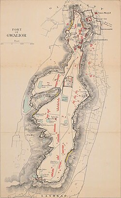
[[File:Gwaliorfort.png|right|200px|thumb|Map of the fortress.]] | [[File:Gwaliorfort.png|right|200px|thumb|Map of the fortress.]] | ||
The | The construction of the fort is associated with a local legend, and the exact date of its construction is therefore unknown. According to the legend, a local king named Suraj Sen ruled the region around the 3rd century CE. The king suffered from leprosy, a deadly disease that was incurable at the time.<ref>Fodor E. et al. [https://books.google.com/books?id=ifgtAAAAMAAJ&q=gwalipa "Fodor's India."] D. McKay 1971. p. 293. Accessed at Google Books 30 November 2013.]</ref> One day, while hunting at Gopgiri (Gop Mountain), he met with a sage named Gwalipa or Galav, who miraculously cured his disease by asking him to drink water from a sacred pond, believed to be the pond that is located inside the fort today. When the king was cured, he decided to build a wall around the pond, which later known as Suraj Kund, and constructed the fort on the hill and named it "Gwalior" meaning adobe of Rishi Gwalipa to honor the sage, subsequently a bustling city was developed from all corner of the Gwalior Fort which later came to be known as City of Gwalior.<ref>[https://books.google.com/books?id=ifgtAAAAMAAJ&q=gwalipa William Curtis, Fodor, Eugene, 1905 ''Fodor's India'' D. McKay., 1971]</ref> However, historical Sanskrit inscriptions and [[Gupta Empire|Gupta period]] records, refer to the site as Gop Parvat (Gop Mountain), Gopachala Durg, Gopgiri, and Gopadiri, all of which mean "cowherd's hill".<ref>{{Cite web |date=15 October 2024 |title=Cowherd's Hill |url=https://www.britannica.com/place/Gwalior-India |access-date=15 October 2024 |website=Britannica}}</ref> | ||
==Topography== | ==Topography== | ||
| Line 53: | Line 67: | ||
Gwalior Fort map 1911.jpg|Gwalior Fort map 1911 (click to see details) | Gwalior Fort map 1911.jpg|Gwalior Fort map 1911 (click to see details) | ||
</gallery> | </gallery> | ||
The fort is built on an outcrop of [[Vindhyan]] sandstone on a solitary rocky hill called Gopachal. | The fort is built on an outcrop of [[Vindhyan]] sandstone on a solitary rocky hill called Gopachal. The ridge is long, thin, and steep. The rock formations of the Gwalior range consist of [[ochre]]-coloured [[sandstone]] overlain by [[basalt]]. There is a horizontal stratum which rises to {{convert|342|ft|m}} at its highest point, extending roughly {{convert|1.5|mi|km}} in length, with an average width of about {{convert|1000|yard|m}}). It has a near-perpendicular precipice. A small river, the Swarnrekha, flows close by.<ref>Oldham R. D. [https://books.google.com/books?id=tjOSGsoaZ_4C&pg=PA65 "A manual of the geology of India."] {{ISBN|978-1108072540}} Cambridge University Press 2011. p. 65 Accessed at Google Books 30 November 2013.</ref> | ||
== History == | == History == | ||
[[File:Eastern face of Inner Court yard of Man Mandir, Gwalior Fort..jpg|200px|right|thumb|Courtyard of Maan Mandir]] | [[File:Fort with city.jpg|thumb|upright=1.5|Aerial view of Gwalior Fort]] | ||
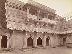
[[File:Eastern face of Inner Court yard of Man Mandir, Gwalior Fort..jpg|200px|right|thumb|Courtyard of Maan Mandir built by Raja Man Singh Tomar. ]] | |||
The inscriptions and monuments found within what is now the fort campus indicate that it may have existed as early as the beginning of the 6th century.{{sfn|Konstantin Nossov|Brain Delf|2006|p=11}} A [[Gwalior inscription of Mihirakula|Gwalior inscription]] describes a sun temple built during the reign of the [[Huna people|Huna]] emperor [[Mihirakula]] in 6th century. | |||
The | The fort definitely existed by the 8th century, when it is first mentioned in the historical records. From 11th century onwards, the Muslim dynasties attacked the fort. In 1022 CE, [[Mahmud of Ghazni]] besieged the fort for four days. According to ''Tabaqat-i-Akbari'', he lifted the siege in return for a tribute of 35 elephants.{{sfn|Sisirkumar Mitra|1977|pp=80–82}} Bahauddin Tourghil, a senior slave of the [[Ghurid]] ruler [[Muhammad of Ghor]] captured the fort in 1196 after a long siege.<ref>{{Cite book|author=Iqtidar Alam Khan|url=https://books.google.com/books?id=URluAAAAMAAJ |title=Historical Dictionary of Medieval India |date=2008|publisher=Scarecrow Press |isbn=978-0-8108-5503-8|page=33}}</ref> The [[Delhi Sultanate]] lost the fort for a short period before it was recaptured by [[Iltutmish]] in 1232 CE.{{sfn|Paul E. Schellinger|Robert M. Salkin|1994|p=312}} | ||
[[File:Tile Work on Mandir Mandir.jpg|thumb|Blue Tile Works on Man Mandir]] | |||
In 1398, the fort came under the control of the [[Tomaras of Gwalior|Tomars]]. The most distinguished of the Tomar rulers was [[Man Singh Tomar|Maan Singh]], who commissioned several monuments within the fort.{{sfn|Paul E. Schellinger|Robert M. Salkin|1994|p=312}} The [[Sikandar Khan Lodi|Delhi Sultan Sikander Lodi]] tried to capture the fort in 1505 but was unsuccessful. Another attack, by his son [[Ibrahim Lodi]] in 1516, resulted in Maan Singh's death. The Tomars ultimately surrendered the fort to the [[Delhi Sultanate]] after a year-long siege.{{sfn|Paul E. Schellinger|Robert M. Salkin|1994|p=314}} | |||
[[File:Maharaja Hemu Bhargava - Victor of Twenty Two Pitched Battles, 1910s.jpg|thumb|left|Gwalior Fort was the base for many of [[Hemu]]'s campaigns.]] | |||
Within a decade, the [[Mughal emperors|Mughal Emperor]] [[Babur]] captured the fort from the [[Delhi Sultanate]]. The [[Mughals]] lost the fort to [[Sher Shah Suri]] in 1542. Afterwards, the fort was captured and used by [[Hemu]], the [[Hindu]] general and, later, the last Hindu ruler of [[Delhi]], as his base for his many campaigns, but Babur's grandson [[Akbar]] recaptured it in 1558.{{sfn|Paul E. Schellinger|Robert M. Salkin|1994|p=314}} Akbar made the fort a prison for political prisoners. For example, Abu'l-Kasim,<ref name="Thorton" /> son of [[Kamran Mirza|Kamran]] and Akbar's first cousin was held and executed at the fort. The last Tomar king of Gwalior, [[Ramshah Tanwar|Maharaja Ramshah Tanwar]], who had then taken refuge in [[Mewar]] and had fought at the [[Battle of Haldighati]]. He was killed in the battle along with his three sons (which included [[Shalivahan Singh Tomar]], the heir-apparent). | |||
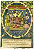
[[Guru Hargobind]], on 24 June 1606, at age 11, was crowned as the sixth Sikh Guru.<ref>Louis E. Fenech, Martyrdom in the Sikh Tradition, Oxford University Press, pages 118–121</ref><ref name=hssingha>HS Singha (2009), Sikh Studies, Book 7, Hemkunt Press, {{ISBN|978-8170102458}}, pages 18–19</ref> At his succession ceremony, he put on two swords: one indicated his spiritual authority (''piri'') and the other, his temporal authority (''miri'').<ref name=hssyan>HS Syan (2013), Sikh Militancy in the Seventeenth Century, IB Tauris, {{ISBN|978-1780762500}}, pages 48–55</ref> Because of the execution of [[Guru Arjan]] by Mughal Emperor Jahangir, Guru Hargobind from the very start was a dedicated enemy of the Mughal rule. He advised the [[Sikhs]] to arm themselves and fight.<ref name=mah>{{cite book |title=Muslim Rule in India |author=V. D. Mahajan |year=1970 |publisher=S. Chand, New Delhi, p.223}}</ref> The death of his father at the hands of [[Jahangir]] prompted him to emphasise the military dimension of the [[Sikh]] community.<ref name="Phyllis2004">{{cite book |title=Holy People of the World: A Cross-cultural Encyclopedia, Volume 1 |author=Phyllis G. Jestice |url=https://books.google.com/books?id=H5cQH17-HnMC&pg=PA345|publisher=[[ABC-CLIO]] |year=2004 |isbn=9781576073551 |pages=345, 346}}</ref> [[Jahangir]] responded by jailing the 14-year-old Guru Hargobind at Gwalior Fort in 1609, on the pretext that the fine imposed on [[Guru Arjan]] had not been paid by the [[Sikhs]] and [[Guru Hargobind]].<ref name=mandair48>{{cite book|title=Sikhism: A Guide for the Perplexed|author= Arvind-Pal Singh Mandair|url=https://books.google.com/books?id=BEP0Ty-GuVEC&pg=PA48 |publisher=[[A & C Black]] |year=2013|isbn=9781441117083|page=48}}</ref> It is not clear as to how much time he spent as a prisoner. The year of his release appears to have been either 1611 or 1612, when Guru Hargobind was about 16 years old.<ref name=mandair48/> Persian records, such as ''Dabistan i Mazahib'' suggest he was kept in jail for twelve years, including over 1617–1619 in Gwalior, after which he and his camp were kept under Muslim army's surveillance by Jahangir.<ref name=eos>{{cite book |author=Fauja Singh |editor=Harbans Singh |title=Encyclopaedia of Sikhism |volume=2, E–L |edition=3rd |chapter=Hargobind Guru (1595–1644) |year=2011 |publisher=Punjabi University |location=Patiala |pages=232–235 |chapter-url=https://archive.org/details/TheEncyclopediaOfSikhism-VolumeIiE-l/page/n245x |isbn=978-8173802041 |via=Internet Archive}}</ref><ref>{{cite book |title=The Sikh Review |volume=42–43 |issue=491–497 |url=https://books.google.com/books?id=1XPXAAAAMAAJ |year=1994 |publisher=Sikh Cultural Centre |pages=15–16}}</ref> According to Sikh tradition, Guru Hargobind was released from the bondage of prison on [[Diwali]]. This important event in Sikh history is now termed the ''[[Bandi Chhor Divas]]'' festival.<ref>{{cite book |author=Eleanor Nesbitt |title=Sikhism: A Very Short Introduction |url=https://books.google.com/books?id=XebnCwAAQBAJ |year=2016 |publisher=Oxford University Press |isbn=978-0-19-874557-0 |pages=28–29, 59, 120–131}}</ref> | |||
[[ | [[Aurangzeb]]'s brother, [[Murad Bakhsh]] and nephew [[Sulaiman Shikoh]] were also executed at the fort. The killings took place in the Man Mandir palace. [[Sipihr Shikoh]] was imprisoned at Gwalior Fort from 1659 to 1675. Aurangzeb's son, [[Muhammad Sultan (Mughal prince)|Muhammad Sultan]] was imprisoned at the fort from January 1661 to December 1672. After the death of Aurangzeb, the ruler of [[Gohad State|Gohad]], [[Bhim Singh Rana]] seized the Gwalior Fort in the Battle of Gwalior (1740). The [[Maratha Empire|Marathas]] had captured many territories held by the declining [[Mughal Empire]] in [[North India|Northern]] and [[Central India|Central]] India after the death of Aurangzeb. The Maratha incursions into North India were raids by the [[Bajirao I|Peshwa Bajirao]]. in 1755–1756, The [[Marathas]] took over Gwalior fort by defeating the ruler of Gohad.<ref name="Thorton">Torton E. [https://books.google.com/books?id=3DcoAAAAYAAJ&pg=RA1-PA68 "A gazetteer of the territories under the government of the East-India company, and of the native states on the continent of India, Volume 2"] W. H. Allen & Co. 1854.</ref>{{rp|page=68}} The [[Maratha Empire|Maratha]] general [[Mahadaji Shinde|Mahadaji]] [[Scindia]] captured the fort from the Gohad Rana Chhatar Singh, but later lost it to the British [[East India Company]].{{sfn|Tony McClenaghan|1996|p=131}} On 3 August 1780, a Company force under Captains Popham and Bruce captured the fort in a nighttime raid, scaling the walls with 12 [[grenadier]]s and 30 [[sepoy]]s. Both sides suffered fewer than 20 wounded total.<ref name="Thorton"/>{{rp|page=69}} In 1780, the [[Governor-General of India|British governor]] [[Warren Hastings]] restored the fort to the Ranas of Gohad. The Marathas recaptured the fort four years later, and this time the British did not intervene because the Ranas of Gohad had become hostile to them. [[Daulat Rao Sindhia]] lost the fort to the British during the [[Second Anglo-Maratha War]].{{sfn|Tony McClenaghan|1996|p=131}} | ||
[[ | [[File:A View of the Fortress of Gwalior, 1780.jpg|thumb|A View of the Fortress of Gwalior, 1780]] | ||
There were frequent changes in the control of the fort between the [[Scindias]] and the [[British Empire|British]] between 1808 and 1844. In January 1844, after the [[Battle of Maharajpore|Battle of Maharajpura]], the fort was occupied by the [[Gwalior State]] ruled by [[House of Scindia|Scindia Dynasty]], as a protectorate of the [[British government]].<ref name="Thorton"/> During the [[1857 uprising]], around 6500 sepoys stationed at Gwalior rebelled against the Company rule, although the company's vassal ruler [[Jayajirao Scindia]] remained loyal to the British.{{sfn|Paul E. Schellinger|Robert M. Salkin|1994|p=314}} The British took control of the fort in June 1858. They rewarded Jayajirao with some territory but retained control of the Gwalior Fort. By 1886, the British were in complete control of [[British Raj|India]], and the fort no longer had any strategic importance to them. Therefore, they handed over the fort to the [[Scindia|Scindia.]] The [[Scindias]] continued to rule Gwalior until the [[independence of India]] in 1947 and built several monuments including the [[Jai Vilas Mahal|Jai Vilas Palace]].{{sfn|Paul E. Schellinger|Robert M. Salkin|1994|p=316}}<ref>Archived at [https://ghostarchive.org/varchive/youtube/20211205/9UHaBw1EDrk Ghostarchive]{{cbignore}} and the [https://web.archive.org/web/20200423185256/https://www.youtube.com/watch?v=9UHaBw1EDrk&gl=US&hl=en Wayback Machine]{{cbignore}}: {{cite web |url=https://www.youtube.com/watch?v=9UHaBw1EDrk |title=History of Gwalior {{!}} ग्वालियर का इतिहास |date=27 January 2019 |via=[[YouTube]]}}{{cbignore}}</ref> | |||
In 2025, the Government of Madhya Pradesh participated in heritage and tourism investment initiatives that included proposals for conservation and development linked to Gwalior Fort and the wider cultural network of the region. At a state tourism conclave, investment proposals of around ₹3,500 crore were discussed, with plans including heritage works and infrastructure improvements benefitting historic sites such as Gwalior Fort and surrounding monuments.<ref>{{cite news|title=State gears up for major tourism boost with Rs 3,500 cr investment|url=https://timesofindia.indiatimes.com/city/bhopal/state-gears-up-with-rs-3500-cr-investment/articleshow/123607847.cms|work=The Times of India|date=Sep 2025|access-date=18 Dec 2025}}</ref> | |||
==Structures== | ==Structures== | ||
[[File:247 Gwalior.jpg|thumb|Rock | [[File:247 Gwalior.jpg|thumb|Siddhanchal Rock Cut Colossal of the Tirthankaras.]] | ||
The fort and its premises are well maintained and house many historic monuments including palaces, temples and water tanks. There are also a number of palaces (''mahal'') including the Man mandir, the Gujari, the [[Jahangir]], the Karan, and the [[Shah Jahan]].<ref>[http://www.kamat.com/kalranga/mp/gwalior.htm "Temples of Gwalior"] Kamat's Potpourri Webpage. Accessed 1 December 2013.</ref> | The fort and its premises are well maintained and house many historic monuments including palaces, temples and water tanks. There are also a number of palaces (''mahal'') including the Man mandir palace, the Gujari mahal, the [[Jahangir]] palace, the Karan palace, the Vikram mahal and the [[Shah Jahan]] palace.<ref>[http://www.kamat.com/kalranga/mp/gwalior.htm "Temples of Gwalior"] {{Webarchive|url=https://web.archive.org/web/20090420011046/http://www.kamat.com/kalranga/mp/gwalior.htm |date=20 April 2009 }} Kamat's Potpourri Webpage. Accessed 1 December 2013.</ref> | ||
The fort covers an area of {{convert|3|km2|mi2}} and rises {{convert|11|m|ft}}. Its rampart is built around the edge of the hill, connected by six [[bastions]] or towers. The profile of the fort has an irregular appearance due to the undulating ground beneath.{{citation needed|date=March 2017}} | The fort covers an area of {{convert|3|km2|mi2}} and rises {{convert|11|m|ft}}. Its rampart is built around the edge of the hill, connected by six [[bastions]] or towers. The profile of the fort has an irregular appearance due to the undulating ground beneath.{{citation needed|date=March 2017}} | ||
There are two gates | There are two gates: one on the northeast side with a long access ramp and the other on the southwest. The main entrance is the ornate Elephant gate (''Hathi Pol''). The other is the Badalgarh Gate. The Man Mandir palace or citadel is located at the northeast end of the fort. It was built in the 15th century and refurbished in 1648. The water tanks or reservoirs of the fort could provide water to a 15,000 strong garrison, the number required to secure the fort.{{citation needed|date=March 2017}} | ||
The second [[Bakhshali manuscript|oldest record]] of ''"[[zero]]"'' in the world was found in a small temple (the stone inscription has the second-oldest record of the numeric zero symbol having a place value as in the modern decimal notation), which is located on the way to the top. The inscription is around 1500 years old.<ref name="smithsonianmag.com"/><ref>{{cite book |last1=Joseph |first1=George Gheverghese |title=Indian Mathematics: Engaging with the World from Ancient to Modern Times |publisher=World Scientific |date=2016 |isbn=978-1786340634 |quote=In a temple on the path up to Gwalior Fort [...] where we find a circular zero in the terminal position. }} {{page needed|date=July 2020}}</ref> | |||
===Major | ===Major monuments=== | ||
==== Jain temples ==== | ==== Jain temples ==== | ||
{{Main|Siddhachal Caves|Gopachal rock cut Jain monuments}} | {{Main|Siddhachal Caves|Gopachal rock cut Jain monuments}} | ||
''' | '''Siddhanchal Jain Rock Cut Caves''' were built in 15th century. There are eleven Jain temples inside Gwalior fort dedicated to the Jain [[Tirthankara]]s. On the southern side are 21 temples cut into the rock with intricately carved of the tirthankaras. Tallest Idol is image of Rishabhanatha or Adinatha, the 1st Tirthankara, is {{convert|58|ft|4|in|m}} high.<ref>{{cite book |author1=Kurt Titze |author2=Klaus Bruhn |title=Jainism: A Pictorial Guide to the Religion of Non-violence |url=https://books.google.com/books?id=loQkEIf8z5wC |year=1998 |publisher=Motilal Banarsidass |isbn=978-81-208-1534-6|pages=106–110}}</ref><ref name=cunninghamgfortjain>{{cite book |last=Cunningham |first=Alexander |title=Archaeological Survey of India: Four Reports Made During the Year 1862–63–64-65 |volume=2 |chapter=XVI. Gwaliar, or Gwalior (Gwalior Fort: Rock Sculptures) |pages=364–370 |publisher=Government Central Press |location=Simla |date=1871 |chapter-url=https://archive.org/stream/archaeologicalsu02arch#page/n455/mode/2up |via=Internet Archive}}</ref><ref name=asifortjain>{{cite web |title=Gwalior Fort, Gwalior |website=Archaeological Survey of India, Bhopal Circle |url=http://asibhopal.nic.in/monument/gwalior_gwalior_gwaliorfort_more.html |publisher=Government of India, Ministry of Culture |date=2014 |archive-url=https://web.archive.org/web/20190515153007/http://www.asibhopal.nic.in/monument/gwalior_gwalior_gwaliorfort_more.html |archive-date=15 May 2019}}</ref> | ||
'''Main Temple''' | '''Main Temple''' | ||
'''Urvahi''' | '''Urvahi Valley''' | ||
[[File:Rock-cut_Jain_Statues_in_the_Gwalior_Fort.JPG|thumb|Jain | [[File:Rock-cut_Jain_Statues_in_the_Gwalior_Fort.JPG|thumb|Jain Colossi carved out of rock at Gopachal near Phoobagh, Gwalior]] | ||
The entire area of Gwalior fort is divided into five groups namely Urvahi, | The entire area of Gwalior fort is divided into five groups namely Urvahi, Northwest, Northeast, Southwest and the Southeast areas. In the Urvahi area 24 idols of Tirthankar in the [[Lotus position|padmasana]] posture, 40 in the [[kayotsarga]] posture and around 840 idols carved on the walls and pillars are present. The largest idol is a 58 feet 4 inches high idol of [[Rishabhanatha|Adinatha]] outside the Urvahi gate and a 35 feet high idol of [[Suparshvanatha]] in the Padmasana in ''Ek'' ''Paththar-ki Bawari'' (stone tank) area.<ref>{{Cite web |url=http://www.jainsamaj.org/rpg_site/literature2.php?id=2447&cat=40 |title=Jain Samaj |access-date=16 May 2016 |archive-date=4 June 2016 |archive-url=https://web.archive.org/web/20160604130802/http://www.jainsamaj.org/rpg_site/literature2.php?id=2447&cat=40 |url-status=live }}</ref> | ||
'''Gopachal''' | '''Gopachal''' | ||
[[File: | [[File:Siddhachal - Rishabhanatha.jpg|thumb|150px|{{convert|58.4|ft}} high idol of Bhagwan Adinatha.]] | ||
There are around 1500 idols on the [[Gopachal Hill]], which includes the size from 6 inch to 57 feet in height | There are around 1500 idols on the [[Gopachal Hill]], which includes the size from 6 inch to 57 feet in height.<ref name=cunninghamgfortjain/> | ||
Gopachal hosts a statue of Bhagwan Parsvanath in padmasan posture 42 feet in height & 30 feet in breadth. This is also the place where ''Shri 1008 Supratishtha Kevali'' was traditionally believed to have attained nirvana. There are 26 more Jain temples on this hill.<ref>{{Cite web |url=http://jain.org.in/tirth-Gopachal%20hill,%20M.P.html |title=jain.org.in |access-date=16 May 2016 |archive-date=21 April 2016 |archive-url=https://web.archive.org/web/20160421152014/http://jain.org.in/tirth-Gopachal%20hill,%20M.P.html |url-status=live }}</ref> | |||
'''Mughal Invasion:''' In 1527, [[Babur]] army attacked Gwalior Fort and de-faced these statues.<ref name=cunninghamgfortjain/> In spite of invasion the early Jaina sculptures of Gwalior have survived in fairly good condition so that their former splendour is not lost. | |||
====Teli Temple==== | |||
{{main|Teli ka Mandir}} | |||
[[Image:Teli ka mandir fort Gwalior - panoramio - Gyanendrasinghchauha… (1).jpg|150px|thumb|[[Teli ka Mandir|Teli Temple]] was built by the Pratihara emperor [[Mihira Bhoja]].<ref name="Bajpai2006">{{cite book|author=K. D. Bajpai|title=History of Gopāchala|url=https://books.google.com/books?id=Q3KcwLKuRnYC&pg=PA31|year=2006|publisher=Bharatiya Jnanpith|isbn=978-81-263-1155-2|page=31}}</ref>]] | |||
[[File:Sculptures near Teli Mandir, Gwalior Fort.jpg|thumb|right|Sculptures near Teli Temple, Gwalior Fort.]] | |||
[[Image:Teli ka mandir fort Gwalior - panoramio - Gyanendrasinghchauha… (1).jpg|150px|thumb|[[Teli ka Mandir]] was built by the Pratihara emperor [[Mihira Bhoja]].<ref name="Bajpai2006">{{cite book|author=K. D. Bajpai|title=History of Gopāchala|url=https://books.google.com/books?id=Q3KcwLKuRnYC&pg=PA31|year=2006|publisher=Bharatiya Jnanpith|isbn=978-81-263-1155-2|page=31}}</ref>]] | The [[Teli ka Mandir]] is a Hindu temple built by the Pratihara emperor [[Mihira Bhoja]].<ref name="Michell1977p117">{{cite book |author=George Michell |title=The Hindu Temple: An Introduction to Its Meaning and Forms |url=https://books.google.com/books?id=ajgImLs62gwC&pg=PA117 |year=1977 |publisher=University of Chicago Press |isbn=978-0-226-53230-1 |pages=117 with footnotes}}</ref><ref name="Allen1991">{{cite book |author=Margaret Prosser Allen |title=Ornament in Indian Architecture |url=https://books.google.com/books?id=vyXxEX5PQH8C&pg=RA1-PA203 |year=1991 |publisher=University of Delaware Press |isbn=978-0-87413-399-8 |page=1}}</ref> | ||
[[File:Sculptures near Teli Mandir, Gwalior Fort.jpg|thumb|right|Sculptures near Teli | |||
The [[Teli ka Mandir]] is a Hindu temple built by the Pratihara emperor [[Mihira Bhoja]].<ref name="Michell1977p117">{{cite book|author=George Michell|title=The Hindu Temple: An Introduction to Its Meaning and Forms |url=https://books.google.com/books?id=ajgImLs62gwC&pg=PA117 |year=1977 |publisher=University of Chicago Press|isbn=978-0-226-53230-1|pages=117 with footnotes}}</ref><ref name="Allen1991">{{cite book|author=Margaret Prosser Allen|title=Ornament in Indian Architecture|url=https://books.google.com/books?id=vyXxEX5PQH8C&pg=RA1-PA203|year= 1991|publisher=University of Delaware Press |isbn=978-0-87413-399-8|page=1}}</ref> | |||
It is the oldest part of the fort and has a blend of south and north [[Architecture of India|Indian architectural styles]]. Within the rectangular structure is a shrine with no pillared pavilions ([[mandapa]]) and a South Indian barrel-vaulted roof on top. It has a [[masonry]] tower in the North Indian [[Architecture of India#Nagara | It is the oldest part of the fort and has a blend of south and north [[Architecture of India|Indian architectural styles]]. Within the rectangular structure is a shrine with no pillared pavilions ([[mandapa]]) and a South Indian barrel-vaulted roof on top. It has a [[masonry]] tower in the North Indian [[Architecture of India#Nagara Style of Architecture|Nagara architectural style]] with a [[barrel vault]]ed roof {{convert|25|m|ft}} in height. The niches in the outer walls once housed statues but now have [[Chandrashala]]s (horseshoe arches) ventilator openings in the north Indian style. The Chandrashala has been compared to the [[trefoil]], a honeycomb design with a series of receding pointed arches within an arch. The entrance door has a torana or archway with sculpted images of river goddesses, romantic couples, foliation decoration and a [[Garuda]]. The vertical bands on either side of the door are decorated in a simple fashion with figures that are now badly damaged. Above the door are a small grouping of discs representing the {{lang|und|dama laka}} ([[finial]]) of a {{lang|sa|[[shikhara]]}}. The temple was originally dedicated to [[Shakti]]. It was extensively damaged during Muslim raids, then restored into a [[Shiva]] temple by installing a [[Lingam|liṅga]], while keeping the Vaishnava motifs such as the Garuda.<ref>Allen M. P. [https://books.google.com/books?id=vyXxEX5PQH8C&pg=RA1-PA203 "Ornament in Indian architecture."] University of Delaware Press 1991. {{ISBN|0-87413-399-8}}.</ref><ref>[https://archive.org/stream/archaeologicalsu02arch#page/n443/mode/2up ASI Report: Gwalior], A Cunningham, pp. 356–359</ref> It was refurbished between 1881 and 1883.<ref>{{cite book |editor1-last=Sengupta |editor1-first=Guatam |editor2-last=Lambah |editor2-first=Abha Narain |editor2-link=Abha Narain Lambah |title=Custodians of the past: 150 years of the Archaeological Survey of India |date=2012 |publisher=[[Archaeological Survey of India]], Ministry of Culture, Government of India |isbn=978-93-5086-199-8 |page=32 |url=https://archive.org/details/custodiansofpast00newd/page/32/mode/1up?q=keith&view=theater}}</ref><ref>{{cite report |author2=(Curator of Ancient Monuments, India) |author1=Henry Hardy Cole |title=Preservation of National Monuments: Report of the Curator of Ancient Monuments in India |url=https://books.google.com/books?id=gnEIAAAAQAAJ&pg=PR17 |year=1882 |publisher=Government Central Branch Press |location=Simla |page=17}}</ref> | ||
====Garuda monument==== | ====Garuda monument==== | ||
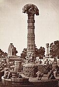
Close to the Teli ka Mandir temple is the [[Garuda]] monument, dedicated to [[Vishnu]], is the highest in the fort. It has a mixture of [[Muslim]] and [[Indian architecture]]. The word Teli comes from the Hindi word meaning oil.{{ | Close to the Teli ka Mandir temple is the [[Garuda]] monument, dedicated to [[Vishnu]], is the highest in the fort. It has a mixture of [[Muslim]] and [[Indian architecture]]. The word Teli comes from the Hindi word meaning oil.{{citation needed|date=April 2021}} | ||
==== | ====Saas Bahu temples==== | ||
The | The Saas Bahu Temples were built in 1092–93.<ref name="TitzeBruhn1998p101">{{cite book |author1=Kurt Titze|author2=Klaus Bruhn |title=Jainism: A Pictorial Guide to the Religion of Non-violence |url=https://books.google.com/books?id=loQkEIf8z5wC&pg=PA101 |year=1998 |publisher=Motilal Banarsidass |isbn=978-81-208-1534-6 |pages=101–102}}</ref><ref name="Allen1991p211">{{cite book |author=Margaret Prosser Allen |title=Ornament in Indian Architecture |url=https://books.google.com/books?id=vyXxEX5PQH8C |year=1991 |publisher=University of Delaware Press|isbn=978-0-87413-399-8 |pages=211–212}}</ref> Dedicated to Lord Annirudha and Lord Shiva, These are pyramidal in shape, built of red sandstone with several stories of beams and pillars but no arches. | ||
====Gurdwara Data Bandi Chhor==== | ====Gurdwara Data Bandi Chhor==== | ||
Gurdwara Data Bandi Chhor was built during 1970s and 1980s at the place where 6th [[Sikh]] [[Guru Hargobind]] | Gurdwara Data Bandi Chhor was built during 1970s and 1980s at the place where 6th [[Sikh]] [[Guru Hargobind]] was arrested and held captive by Mughal Emperor [[Jahangir]] in 1609 at the age of 14 years on the pretext that the fine imposed on his father, 5th Sikh [[Guru Arjan Dev Ji|Guru Arjan Dev]] had not been paid by the Sikhs and Guru Hargobind. According to Surjit Singh Gandhi, 52 [[Hindu]] Rajas who were imprisoned in the fort as hostages for "millions of rupees" and for opposing the [[Mughal Empire]] were dismayed as they were losing a spiritual mentor. On getting released Guru Hargobind requested the Rajas to be freed along with him as well. Jahangir allowed Guru Hargobind to free as many rajas he could as long as they are holding on to the guru while leaving the prison. Guru sahib got a special gown stitched which had 52 hems. As Guru Hargobind left the fort, all the captive kings caught the hems of the cloak and came out along with him.{{citation needed|date=April 2021}} | ||
===Palace=== | ===Palace=== | ||
====Man mandir | ====Man mandir==== | ||
The Man mandir palace was built by | [[File:Man Mandir and city skyline.jpg|thumb|Man Mandir view during winter morning dominating city's skyline]] | ||
The Man mandir palace was built by [[Man Singh Tomar]] in 15th century. Man Mandir is often referred as a Painted Palace due to the use of styled tiles of turquoise, green and yellow used extensively in a geometric pattern. | |||
====Hathi Pol==== | ====Hathi Pol==== | ||
The Hathi Pol | The Hathi Pol (or Hathiya Paur), is the principal entrance gate located on the southeast, leads to the Man mandir palace. It is the last of a series of seven gates. It is named for a life-sized statue of an elephant (hathi) that once adorned the gate. The gate was built in stone with cylindrical towers crowned with [[cupola]] domes. Carved parapets link the domes. | ||
====Karn Palace==== | |||
The Karan mahal is another significant monument at Gwalior Fort. The Karn mahal was built by the second king of the Tomar dynasty, Kirti Singh. He was also known as Karn Singh, hence the name of the palace.{{citation needed|date=March 2017}} | |||
==== | ====Vikram Mahal==== | ||
The | The Vikram mahal (also known as the Vikram mandir, as it once hosted a temple of [[Shiva]]) was built by Vikramaditya Singh, the elder son of [[Maharaja]] Mansingh tomar. He was a devotee of shiva.{{citation needed|date=March 2017}} The temple was destroyed during [[Mughal emperors|Mughal]] period but now has been re-established in the front open space of the Vikram mahal. | ||
====Chhatri of Bhim Singh Rana==== | ====Chhatri of Bhim Singh Rana==== | ||
This [[chhatri]] (cupola or domed shaped pavilion) was built as a memorial to [[Bhim Singh Rana]] (1707–1756), a ruler of [[Gohad]] state. It was built by his successor, Chhatra Singh. Bhim Singh | This [[chhatri]] (cupola or domed shaped pavilion) was built as a memorial to [[Bhim Singh Rana]] (1707–1756), a ruler of [[Gohad]] state. It was built by his successor, Chhatra Singh. Bhim Singh Rana were occupied the fort when the Mughal [[Satrap]], Ali Khan, surrendered. In 1754, Bhim Singh built a bhimtal (a lake) as a monument at the fort. Chhatra Singh built the memorial chhatri near the Johar Kund. | ||
====Assi Khambo ki Baoli==== | |||
Assi Khambo Ki Baoli, located near the Man Mandir Palace, is a step-well with 80 pillars and various chambers. It was built by [[Man Singh Tomar]] around 1500 CE. According to tradition, it was constructed in just five days by ancient Hindu engineers. The baoli served as a water storage during the siege of Gwalior in 1505 | |||
===Museum=== | ===Museum=== | ||
{{main|Gujari Mahal Archaeological Museum}} | {{main|Gujari Mahal Archaeological Museum}} | ||
The ''' | The '''Gurjari Mahal''' now a museum, was built by Raja [[Man Singh Tomar]] for his wife Mrignayani, a Gurjar princess. She demanded a separate palace for herself with a regular water supply through an aqueduct from the nearby Rai River.{{citation needed|date=March 2017}} The palace has been converted into an [[archaeological museum]]. Rare artefacts at the museum include Hindu and Jain sculptures dated to the 1st and 2nd centuries BCE; miniature statue of [[Salabhanjika]]; [[terracotta]] items and replicas of [[frescoes]] seen in the [[Bagh Caves]]. | ||
===Other monuments=== | ===Other monuments=== | ||
'''Gates (Pol)''': | |||
The Gwalior Fort has several gateways. These includes the Alamgiri Darwaza, Ganesha Pol, Chaturbhuj Pol, Urvai Pol, Laxman Pol, Badal Pol and Hathi Pol. The Hathi Pol is the principal entrance situated at the south east part and Urvai Pol used by the Britishers during British Raj. | |||
There are several other monuments built inside the fort area. These include the [[Scindia School]] (Originally an exclusive school for the sons of Indian princes and nobles) that was founded by [[Madho Rao Scindia]] in 1897. | There are several other monuments built inside the fort area. These include the [[Scindia School]] (Originally an exclusive school for the sons of Indian princes and nobles) that was founded by [[Madho Rao Scindia]] in 1897. | ||
==Gallery== | ==Gallery== | ||
<gallery widths="160px" heights="190px"> | <gallery widths="160px" heights="190px"> | ||
Interior_of_Jain_Temple,_Gwalior_Fort.jpg|Interior of | Interior_of_Jain_Temple,_Gwalior_Fort.jpg|Interior of Sas Temple, Gwalior Fort | ||
File:Pond of gwalior fort.jpg| | File:Pond of gwalior fort.jpg|Suraj Kund at Gwalior Fort. | ||
File:View of Gwalior Fort from the north-west.jpg|View of Gwalior Fort from the north-west. {{circa|1790}} | File:View of Gwalior Fort from the north-west.jpg|View of Gwalior Fort from the north-west. {{circa|1790}} | ||
File:246 Gwalior.jpg|The fort bastions. | File:246 Gwalior.jpg|The fort bastions. | ||
File:Interior of North Room, Man Mandir, Gwalior Fort..jpg|The north room, Man Mandir. | File:Interior of North Room, Man Mandir, Gwalior Fort..jpg|The north room, Man Mandir. | ||
File:Sas-Bahu temple, Gwalior Fort..jpg|[[Sasbahu Temple, Gwalior|Sas-Bahu | File:Sas-Bahu temple, Gwalior Fort..jpg|[[Sasbahu Temple, Gwalior|Sas-Bahu temples]] were built by the kacchapghata dynasty. | ||
File:Gate of Teki Mandir, Gwalior Fort.jpg|Gate of Teli | File:Gate of Teki Mandir, Gwalior Fort.jpg|Gate of Teli Temple. | ||
File:Gwalior Fort - Morning View.jpg|Gwalior Fort | File:Gwalior Fort - Morning View.jpg|Gwalior Fort – Morning View | ||
File:Gwalior fort6.jpg|Gwalior fort | File:Gwalior fort6.jpg|Gwalior fort | ||
File:Gurudwara Shri Data Bandi Chhor Shahib Gwalior 001 (2).jpg|Gurudwara Shri Data Bandi Chhor Shahib | File:Gurudwara Shri Data Bandi Chhor Shahib Gwalior 001 (2).jpg|Gurudwara Shri Data Bandi Chhor Shahib | ||
| Line 168: | Line 188: | ||
==References== | ==References== | ||
{{reflist | {{reflist}} | ||
=== Bibliography === | === Bibliography === | ||
| Line 179: | Line 199: | ||
==External links== | ==External links== | ||
{{commons category}} | {{commons category}} | ||
* [https://www.travelpraise.com/gwalior-fort/ Interesting Facts About Gwalior Fort] | * {{usurped|1=[https://web.archive.org/web/20200622185426/https://www.travelpraise.com/gwalior-fort/ Interesting Facts About Gwalior Fort]}} | ||
* {{Wikivoyage | * {{Wikivoyage inline}} | ||
{{Gwalior topics}} | {{Gwalior topics}} | ||
| Line 186: | Line 206: | ||
{{Forts in Madhya Pradesh}} | {{Forts in Madhya Pradesh}} | ||
[[Category:Rajput architecture]] | [[Category:Rajput architecture]] | ||
[[Category:Forts in Madhya Pradesh]] | [[Category:Forts in Madhya Pradesh]] | ||
| Line 193: | Line 212: | ||
[[Category:Jain rock-cut architecture]] | [[Category:Jain rock-cut architecture]] | ||
[[Category:Tourist attractions in Gwalior]] | [[Category:Tourist attractions in Gwalior]] | ||
[[Category: | [[Category:6th-century Jain temples]] | ||
[[Category:Colossal Jain statues in India]] | [[Category:Colossal Jain statues in India]] | ||
Latest revision as of 15:01, 26 February 2026
 | This article has multiple issues. Please help improve it or discuss these issues on the talk page. (Learn how and when to remove these template messages)
|


| Fort of Gwalior | |
|---|---|
| India | |
 The "Man Mandir" at Gwalior Fort. | |
  Fort of Gwalior  Fort of Gwalior | |
| Coordinates | 26°13′49″N 78°10′08″E / 26.2303°N 78.1689°E |
| Type | Fort |
| Site information | |
| Owner |
|
| Open to the public | Yes |
| Site history | |
| Built | 6th century, The modern-day fort, consisting of a defensive structure and six palaces with several Temples. Later renovated by Scindias in 1916 |
| In use | Yes |
| Materials | Sandstone and lime mortar |
| Battles/wars | Numerous |
| Events | Numerous |
The Fort of Gwalior or Gwalior Fort is a 6th-century hill fort in Gwalior, India. Mughal Emperor Babur described it as the "pearl amongst the fortresses of Hind and not even the winds could touch it's masts" due to its grandeur and magnificence. It was nicknamed as the "Gibraltar of India" for its impregnability and defensive structure. The fort dates back to the 5th century, perhaps earlier making it one of the oldest defense forts in India. Ancient Sanskrit inscriptions record the name of the fort as "Gopgiri".[2]
The current structure has stood since at least the 8th century, and the inscriptions and monuments found within the fort complex indicate that it may have existed as early as the beginning of the 6th century.
The modern-day fort comprises a defensive structure and six palaces, two of which were built by the Tomar ruler Man Singh Tomar (reigned 1486–1516 CE).[1][3] It has witnessed the changing fortunes of the Kushanas, the Nagas, the Guptas, the Hunas, the Pratiharas, the Kachchhapaghatas, the Tomaras, the Pathans (Sultanate), the Surs, the Mughals, the English, the Jats, and the Scindias.
The present-day fort includes several notable palaces, few of them are Man Mandir, Vikram Mandir, Karn Palace, Shah Jahan Palace, Jehangir Palace, and Gurjari Mahal. Gurjari Mahal was commissioned by Man Singh Tomar, for his 9th wife Mrignayani, who belonged to the Gurjar community.[1]
A stone inscription found engraved in the walls of Chaturbhuj Temple (famously known as Zero Temple) close to the top of the fort contains the second-oldest known record (after the Bakhshali manuscript) of the numeral "zero" with a place value, as used in decimal notation. The inscription is around 1,500 years old.[4][5]
Etymology[edit | edit source]

The construction of the fort is associated with a local legend, and the exact date of its construction is therefore unknown. According to the legend, a local king named Suraj Sen ruled the region around the 3rd century CE. The king suffered from leprosy, a deadly disease that was incurable at the time.[6] One day, while hunting at Gopgiri (Gop Mountain), he met with a sage named Gwalipa or Galav, who miraculously cured his disease by asking him to drink water from a sacred pond, believed to be the pond that is located inside the fort today. When the king was cured, he decided to build a wall around the pond, which later known as Suraj Kund, and constructed the fort on the hill and named it "Gwalior" meaning adobe of Rishi Gwalipa to honor the sage, subsequently a bustling city was developed from all corner of the Gwalior Fort which later came to be known as City of Gwalior.[7] However, historical Sanskrit inscriptions and Gupta period records, refer to the site as Gop Parvat (Gop Mountain), Gopachala Durg, Gopgiri, and Gopadiri, all of which mean "cowherd's hill".[8]
Topography[edit | edit source]
-
 Gwalior Fort seen from the Residency. 10 December 1868.
 -
 Gwalior Fort map 1911 (click to see details)


The fort is built on an outcrop of Vindhyan sandstone on a solitary rocky hill called Gopachal. The ridge is long, thin, and steep. The rock formations of the Gwalior range consist of ochre-coloured sandstone overlain by basalt. There is a horizontal stratum which rises to 342 feet (104 m) at its highest point, extending roughly 1.5 miles (2.4 km) in length, with an average width of about 1,000 yards (910 m)). It has a near-perpendicular precipice. A small river, the Swarnrekha, flows close by.[9]
History[edit | edit source]


The inscriptions and monuments found within what is now the fort campus indicate that it may have existed as early as the beginning of the 6th century.[10] A Gwalior inscription describes a sun temple built during the reign of the Huna emperor Mihirakula in 6th century.
The fort definitely existed by the 8th century, when it is first mentioned in the historical records. From 11th century onwards, the Muslim dynasties attacked the fort. In 1022 CE, Mahmud of Ghazni besieged the fort for four days. According to Tabaqat-i-Akbari, he lifted the siege in return for a tribute of 35 elephants.[11] Bahauddin Tourghil, a senior slave of the Ghurid ruler Muhammad of Ghor captured the fort in 1196 after a long siege.[12] The Delhi Sultanate lost the fort for a short period before it was recaptured by Iltutmish in 1232 CE.[1]
In 1398, the fort came under the control of the Tomars. The most distinguished of the Tomar rulers was Maan Singh, who commissioned several monuments within the fort.[1] The Delhi Sultan Sikander Lodi tried to capture the fort in 1505 but was unsuccessful. Another attack, by his son Ibrahim Lodi in 1516, resulted in Maan Singh's death. The Tomars ultimately surrendered the fort to the Delhi Sultanate after a year-long siege.[13]

Within a decade, the Mughal Emperor Babur captured the fort from the Delhi Sultanate. The Mughals lost the fort to Sher Shah Suri in 1542. Afterwards, the fort was captured and used by Hemu, the Hindu general and, later, the last Hindu ruler of Delhi, as his base for his many campaigns, but Babur's grandson Akbar recaptured it in 1558.[13] Akbar made the fort a prison for political prisoners. For example, Abu'l-Kasim,[14] son of Kamran and Akbar's first cousin was held and executed at the fort. The last Tomar king of Gwalior, Maharaja Ramshah Tanwar, who had then taken refuge in Mewar and had fought at the Battle of Haldighati. He was killed in the battle along with his three sons (which included Shalivahan Singh Tomar, the heir-apparent).
Guru Hargobind, on 24 June 1606, at age 11, was crowned as the sixth Sikh Guru.[15][16] At his succession ceremony, he put on two swords: one indicated his spiritual authority (piri) and the other, his temporal authority (miri).[17] Because of the execution of Guru Arjan by Mughal Emperor Jahangir, Guru Hargobind from the very start was a dedicated enemy of the Mughal rule. He advised the Sikhs to arm themselves and fight.[18] The death of his father at the hands of Jahangir prompted him to emphasise the military dimension of the Sikh community.[19] Jahangir responded by jailing the 14-year-old Guru Hargobind at Gwalior Fort in 1609, on the pretext that the fine imposed on Guru Arjan had not been paid by the Sikhs and Guru Hargobind.[20] It is not clear as to how much time he spent as a prisoner. The year of his release appears to have been either 1611 or 1612, when Guru Hargobind was about 16 years old.[20] Persian records, such as Dabistan i Mazahib suggest he was kept in jail for twelve years, including over 1617–1619 in Gwalior, after which he and his camp were kept under Muslim army's surveillance by Jahangir.[21][22] According to Sikh tradition, Guru Hargobind was released from the bondage of prison on Diwali. This important event in Sikh history is now termed the Bandi Chhor Divas festival.[23]
Aurangzeb's brother, Murad Bakhsh and nephew Sulaiman Shikoh were also executed at the fort. The killings took place in the Man Mandir palace. Sipihr Shikoh was imprisoned at Gwalior Fort from 1659 to 1675. Aurangzeb's son, Muhammad Sultan was imprisoned at the fort from January 1661 to December 1672. After the death of Aurangzeb, the ruler of Gohad, Bhim Singh Rana seized the Gwalior Fort in the Battle of Gwalior (1740). The Marathas had captured many territories held by the declining Mughal Empire in Northern and Central India after the death of Aurangzeb. The Maratha incursions into North India were raids by the Peshwa Bajirao. in 1755–1756, The Marathas took over Gwalior fort by defeating the ruler of Gohad.[14](p68) The Maratha general Mahadaji Scindia captured the fort from the Gohad Rana Chhatar Singh, but later lost it to the British East India Company.[24] On 3 August 1780, a Company force under Captains Popham and Bruce captured the fort in a nighttime raid, scaling the walls with 12 grenadiers and 30 sepoys. Both sides suffered fewer than 20 wounded total.[14](p69) In 1780, the British governor Warren Hastings restored the fort to the Ranas of Gohad. The Marathas recaptured the fort four years later, and this time the British did not intervene because the Ranas of Gohad had become hostile to them. Daulat Rao Sindhia lost the fort to the British during the Second Anglo-Maratha War.[24]

There were frequent changes in the control of the fort between the Scindias and the British between 1808 and 1844. In January 1844, after the Battle of Maharajpura, the fort was occupied by the Gwalior State ruled by Scindia Dynasty, as a protectorate of the British government.[14] During the 1857 uprising, around 6500 sepoys stationed at Gwalior rebelled against the Company rule, although the company's vassal ruler Jayajirao Scindia remained loyal to the British.[13] The British took control of the fort in June 1858. They rewarded Jayajirao with some territory but retained control of the Gwalior Fort. By 1886, the British were in complete control of India, and the fort no longer had any strategic importance to them. Therefore, they handed over the fort to the Scindia. The Scindias continued to rule Gwalior until the independence of India in 1947 and built several monuments including the Jai Vilas Palace.[25][26]
In 2025, the Government of Madhya Pradesh participated in heritage and tourism investment initiatives that included proposals for conservation and development linked to Gwalior Fort and the wider cultural network of the region. At a state tourism conclave, investment proposals of around ₹3,500 crore were discussed, with plans including heritage works and infrastructure improvements benefitting historic sites such as Gwalior Fort and surrounding monuments.[27]
Structures[edit | edit source]

The fort and its premises are well maintained and house many historic monuments including palaces, temples and water tanks. There are also a number of palaces (mahal) including the Man mandir palace, the Gujari mahal, the Jahangir palace, the Karan palace, the Vikram mahal and the Shah Jahan palace.[28] The fort covers an area of 3 square kilometres (1.2 sq mi) and rises 11 metres (36 ft). Its rampart is built around the edge of the hill, connected by six bastions or towers. The profile of the fort has an irregular appearance due to the undulating ground beneath.[citation needed]
There are two gates: one on the northeast side with a long access ramp and the other on the southwest. The main entrance is the ornate Elephant gate (Hathi Pol). The other is the Badalgarh Gate. The Man Mandir palace or citadel is located at the northeast end of the fort. It was built in the 15th century and refurbished in 1648. The water tanks or reservoirs of the fort could provide water to a 15,000 strong garrison, the number required to secure the fort.[citation needed]
The second oldest record of "zero" in the world was found in a small temple (the stone inscription has the second-oldest record of the numeric zero symbol having a place value as in the modern decimal notation), which is located on the way to the top. The inscription is around 1500 years old.[4][29]
Major monuments[edit | edit source]
Jain temples[edit | edit source]
Siddhanchal Jain Rock Cut Caves were built in 15th century. There are eleven Jain temples inside Gwalior fort dedicated to the Jain Tirthankaras. On the southern side are 21 temples cut into the rock with intricately carved of the tirthankaras. Tallest Idol is image of Rishabhanatha or Adinatha, the 1st Tirthankara, is 58 feet 4 inches (17.78 m) high.[30][31][32]
Main Temple
Urvahi Valley

The entire area of Gwalior fort is divided into five groups namely Urvahi, Northwest, Northeast, Southwest and the Southeast areas. In the Urvahi area 24 idols of Tirthankar in the padmasana posture, 40 in the kayotsarga posture and around 840 idols carved on the walls and pillars are present. The largest idol is a 58 feet 4 inches high idol of Adinatha outside the Urvahi gate and a 35 feet high idol of Suparshvanatha in the Padmasana in Ek Paththar-ki Bawari (stone tank) area.[33]
Gopachal

There are around 1500 idols on the Gopachal Hill, which includes the size from 6 inch to 57 feet in height.[31]
Gopachal hosts a statue of Bhagwan Parsvanath in padmasan posture 42 feet in height & 30 feet in breadth. This is also the place where Shri 1008 Supratishtha Kevali was traditionally believed to have attained nirvana. There are 26 more Jain temples on this hill.[34]
Mughal Invasion: In 1527, Babur army attacked Gwalior Fort and de-faced these statues.[31] In spite of invasion the early Jaina sculptures of Gwalior have survived in fairly good condition so that their former splendour is not lost.
Teli Temple[edit | edit source]
.jpg)

The Teli ka Mandir is a Hindu temple built by the Pratihara emperor Mihira Bhoja.[36][37]
It is the oldest part of the fort and has a blend of south and north Indian architectural styles. Within the rectangular structure is a shrine with no pillared pavilions (mandapa) and a South Indian barrel-vaulted roof on top. It has a masonry tower in the North Indian Nagara architectural style with a barrel vaulted roof 25 metres (82 ft) in height. The niches in the outer walls once housed statues but now have Chandrashalas (horseshoe arches) ventilator openings in the north Indian style. The Chandrashala has been compared to the trefoil, a honeycomb design with a series of receding pointed arches within an arch. The entrance door has a torana or archway with sculpted images of river goddesses, romantic couples, foliation decoration and a Garuda. The vertical bands on either side of the door are decorated in a simple fashion with figures that are now badly damaged. Above the door are a small grouping of discs representing the dama laka (finial) of a shikhara. The temple was originally dedicated to Shakti. It was extensively damaged during Muslim raids, then restored into a Shiva temple by installing a liṅga, while keeping the Vaishnava motifs such as the Garuda.[38][39] It was refurbished between 1881 and 1883.[40][41]
Garuda monument[edit | edit source]
Close to the Teli ka Mandir temple is the Garuda monument, dedicated to Vishnu, is the highest in the fort. It has a mixture of Muslim and Indian architecture. The word Teli comes from the Hindi word meaning oil.[citation needed]
Saas Bahu temples[edit | edit source]
The Saas Bahu Temples were built in 1092–93.[42][43] Dedicated to Lord Annirudha and Lord Shiva, These are pyramidal in shape, built of red sandstone with several stories of beams and pillars but no arches.
Gurdwara Data Bandi Chhor[edit | edit source]
Gurdwara Data Bandi Chhor was built during 1970s and 1980s at the place where 6th Sikh Guru Hargobind was arrested and held captive by Mughal Emperor Jahangir in 1609 at the age of 14 years on the pretext that the fine imposed on his father, 5th Sikh Guru Arjan Dev had not been paid by the Sikhs and Guru Hargobind. According to Surjit Singh Gandhi, 52 Hindu Rajas who were imprisoned in the fort as hostages for "millions of rupees" and for opposing the Mughal Empire were dismayed as they were losing a spiritual mentor. On getting released Guru Hargobind requested the Rajas to be freed along with him as well. Jahangir allowed Guru Hargobind to free as many rajas he could as long as they are holding on to the guru while leaving the prison. Guru sahib got a special gown stitched which had 52 hems. As Guru Hargobind left the fort, all the captive kings caught the hems of the cloak and came out along with him.[citation needed]
Palace[edit | edit source]
Man mandir[edit | edit source]
The Man mandir palace was built by Man Singh Tomar in 15th century. Man Mandir is often referred as a Painted Palace due to the use of styled tiles of turquoise, green and yellow used extensively in a geometric pattern.
Hathi Pol[edit | edit source]
The Hathi Pol (or Hathiya Paur), is the principal entrance gate located on the southeast, leads to the Man mandir palace. It is the last of a series of seven gates. It is named for a life-sized statue of an elephant (hathi) that once adorned the gate. The gate was built in stone with cylindrical towers crowned with cupola domes. Carved parapets link the domes.
Karn Palace[edit | edit source]
The Karan mahal is another significant monument at Gwalior Fort. The Karn mahal was built by the second king of the Tomar dynasty, Kirti Singh. He was also known as Karn Singh, hence the name of the palace.[citation needed]
Vikram Mahal[edit | edit source]
The Vikram mahal (also known as the Vikram mandir, as it once hosted a temple of Shiva) was built by Vikramaditya Singh, the elder son of Maharaja Mansingh tomar. He was a devotee of shiva.[citation needed] The temple was destroyed during Mughal period but now has been re-established in the front open space of the Vikram mahal.
Chhatri of Bhim Singh Rana[edit | edit source]
This chhatri (cupola or domed shaped pavilion) was built as a memorial to Bhim Singh Rana (1707–1756), a ruler of Gohad state. It was built by his successor, Chhatra Singh. Bhim Singh Rana were occupied the fort when the Mughal Satrap, Ali Khan, surrendered. In 1754, Bhim Singh built a bhimtal (a lake) as a monument at the fort. Chhatra Singh built the memorial chhatri near the Johar Kund.
Assi Khambo ki Baoli[edit | edit source]
Assi Khambo Ki Baoli, located near the Man Mandir Palace, is a step-well with 80 pillars and various chambers. It was built by Man Singh Tomar around 1500 CE. According to tradition, it was constructed in just five days by ancient Hindu engineers. The baoli served as a water storage during the siege of Gwalior in 1505
Museum[edit | edit source]
The Gurjari Mahal now a museum, was built by Raja Man Singh Tomar for his wife Mrignayani, a Gurjar princess. She demanded a separate palace for herself with a regular water supply through an aqueduct from the nearby Rai River.[citation needed] The palace has been converted into an archaeological museum. Rare artefacts at the museum include Hindu and Jain sculptures dated to the 1st and 2nd centuries BCE; miniature statue of Salabhanjika; terracotta items and replicas of frescoes seen in the Bagh Caves.
Other monuments[edit | edit source]
Gates (Pol):
The Gwalior Fort has several gateways. These includes the Alamgiri Darwaza, Ganesha Pol, Chaturbhuj Pol, Urvai Pol, Laxman Pol, Badal Pol and Hathi Pol. The Hathi Pol is the principal entrance situated at the south east part and Urvai Pol used by the Britishers during British Raj.
There are several other monuments built inside the fort area. These include the Scindia School (Originally an exclusive school for the sons of Indian princes and nobles) that was founded by Madho Rao Scindia in 1897.
Gallery[edit | edit source]
-
 Interior of Sas Temple, Gwalior Fort
 -
 Suraj Kund at Gwalior Fort.
 -
 View of Gwalior Fort from the north-west. c. 1790
 -
 The fort bastions.
 -
 The north room, Man Mandir.
 -
 Sas-Bahu temples were built by the kacchapghata dynasty.
 -
 Gate of Teli Temple.
 -
 Gwalior Fort – Morning View
 -
 Gwalior fort
 -
 Gurudwara Shri Data Bandi Chhor Shahib


.jpg)
References[edit | edit source]
- ↑ 1.0 1.1 1.2 1.3 1.4 Paul E. Schellinger & Robert M. Salkin 1994, p. 312.
- ↑ "Gwalior Monument". Archaeological Survey of India Bhopal.
- ↑ Romila Thapar (2003). The Penguin History of Early India: From the Origins to AD 1300. Penguin Books Limited. p. 179. ISBN 978-0-14-193742-7.
Other claiming to be Rajput and descent from Solar and lunar lines established themselves as local kings in Western and Central India. Among these were the Chandelas present in 12th century in Bundelkhand, the Tomaras also subject to the earlier Pratiharas ruling in Haryana region near Dhilaka, now Delhi, around 736 AD and later established themselves in Gwalior region
- ↑ 4.0 4.1 You Can Visit the World's Oldest Zero at a Temple in India Archived 16 September 2017 at the Wayback Machine, Smithsonian magazine.
- ↑ Joseph, George Gheverghese (2016). Indian Mathematics: Engaging with the World from Ancient to Modern Times. World Scientific. ISBN 978-1786340634.
In a temple on the path up to Gwalior Fort [...] where we find a circular zero in the terminal position.
[page needed] - ↑ Fodor E. et al. "Fodor's India." D. McKay 1971. p. 293. Accessed at Google Books 30 November 2013.]
- ↑ William Curtis, Fodor, Eugene, 1905 Fodor's India D. McKay., 1971
- ↑ "Cowherd's Hill". Britannica. 15 October 2024. Retrieved 15 October 2024.
- ↑ Oldham R. D. "A manual of the geology of India." ISBN 978-1108072540 Cambridge University Press 2011. p. 65 Accessed at Google Books 30 November 2013.
- ↑ Konstantin Nossov & Brain Delf 2006, p. 11.
- ↑ Sisirkumar Mitra 1977, pp. 80–82.
- ↑ Iqtidar Alam Khan (2008). Historical Dictionary of Medieval India. Scarecrow Press. p. 33. ISBN 978-0-8108-5503-8.
- ↑ 13.0 13.1 13.2 Paul E. Schellinger & Robert M. Salkin 1994, p. 314.
- ↑ 14.0 14.1 14.2 14.3 Torton E. "A gazetteer of the territories under the government of the East-India company, and of the native states on the continent of India, Volume 2" W. H. Allen & Co. 1854.
- ↑ Louis E. Fenech, Martyrdom in the Sikh Tradition, Oxford University Press, pages 118–121
- ↑ HS Singha (2009), Sikh Studies, Book 7, Hemkunt Press, ISBN 978-8170102458, pages 18–19
- ↑ HS Syan (2013), Sikh Militancy in the Seventeenth Century, IB Tauris, ISBN 978-1780762500, pages 48–55
- ↑ V. D. Mahajan (1970). Muslim Rule in India. S. Chand, New Delhi, p.223.
- ↑ Phyllis G. Jestice (2004). Holy People of the World: A Cross-cultural Encyclopedia, Volume 1. ABC-CLIO. pp. 345, 346. ISBN 9781576073551.
- ↑ 20.0 20.1 Arvind-Pal Singh Mandair (2013). Sikhism: A Guide for the Perplexed. A & C Black. p. 48. ISBN 9781441117083.
- ↑ Fauja Singh (2011). "Hargobind Guru (1595–1644)". In Harbans Singh (ed.). Encyclopaedia of Sikhism. Vol. 2, E–L (3rd ed.). Patiala: Punjabi University. pp. 232–235. ISBN 978-8173802041 – via Internet Archive.
- ↑ The Sikh Review. Vol. 42–43. Sikh Cultural Centre. 1994. pp. 15–16.
- ↑ Eleanor Nesbitt (2016). Sikhism: A Very Short Introduction. Oxford University Press. pp. 28–29, 59, 120–131. ISBN 978-0-19-874557-0.
- ↑ 24.0 24.1 Tony McClenaghan 1996, p. 131.
- ↑ Paul E. Schellinger & Robert M. Salkin 1994, p. 316.
- ↑ Archived at Ghostarchive and the Wayback Machine: "History of Gwalior | ग्वालियर का इतिहास". 27 January 2019 – via YouTube.
- ↑ "State gears up for major tourism boost with Rs 3,500 cr investment". The Times of India. September 2025. Retrieved 18 December 2025.
- ↑ "Temples of Gwalior" Archived 20 April 2009 at the Wayback Machine Kamat's Potpourri Webpage. Accessed 1 December 2013.
- ↑ Joseph, George Gheverghese (2016). Indian Mathematics: Engaging with the World from Ancient to Modern Times. World Scientific. ISBN 978-1786340634.
In a temple on the path up to Gwalior Fort [...] where we find a circular zero in the terminal position.
[page needed] - ↑ Kurt Titze; Klaus Bruhn (1998). Jainism: A Pictorial Guide to the Religion of Non-violence. Motilal Banarsidass. pp. 106–110. ISBN 978-81-208-1534-6.
- ↑ 31.0 31.1 31.2 Cunningham, Alexander (1871). "XVI. Gwaliar, or Gwalior (Gwalior Fort: Rock Sculptures)". Archaeological Survey of India: Four Reports Made During the Year 1862–63–64-65. Vol. 2. Simla: Government Central Press. pp. 364–370 – via Internet Archive.
- ↑ "Gwalior Fort, Gwalior". Archaeological Survey of India, Bhopal Circle. Government of India, Ministry of Culture. 2014. Archived from the original on 15 May 2019.
- ↑ "Jain Samaj". Archived from the original on 4 June 2016. Retrieved 16 May 2016.
- ↑ "jain.org.in". Archived from the original on 21 April 2016. Retrieved 16 May 2016.
- ↑ K. D. Bajpai (2006). History of Gopāchala. Bharatiya Jnanpith. p. 31. ISBN 978-81-263-1155-2.
- ↑ George Michell (1977). The Hindu Temple: An Introduction to Its Meaning and Forms. University of Chicago Press. pp. 117 with footnotes. ISBN 978-0-226-53230-1.
- ↑ Margaret Prosser Allen (1991). Ornament in Indian Architecture. University of Delaware Press. p. 1. ISBN 978-0-87413-399-8.
- ↑ Allen M. P. "Ornament in Indian architecture." University of Delaware Press 1991. ISBN 0-87413-399-8.
- ↑ ASI Report: Gwalior, A Cunningham, pp. 356–359
- ↑ Sengupta, Guatam; Lambah, Abha Narain, eds. (2012). Custodians of the past: 150 years of the Archaeological Survey of India. Archaeological Survey of India, Ministry of Culture, Government of India. p. 32. ISBN 978-93-5086-199-8.
- ↑ Henry Hardy Cole; (Curator of Ancient Monuments, India) (1882). Preservation of National Monuments: Report of the Curator of Ancient Monuments in India (Report). Simla: Government Central Branch Press. p. 17.
- ↑ Kurt Titze; Klaus Bruhn (1998). Jainism: A Pictorial Guide to the Religion of Non-violence. Motilal Banarsidass. pp. 101–102. ISBN 978-81-208-1534-6.
- ↑ Margaret Prosser Allen (1991). Ornament in Indian Architecture. University of Delaware Press. pp. 211–212. ISBN 978-0-87413-399-8.
Bibliography[edit | edit source]
- Konstantin Nossov; Brain Delf (2006). Indian Castles 1206–1526 (Illustrated ed.). Osprey. ISBN 1-84603-065-X.
- Paul E. Schellinger; Robert M. Salkin, eds. (1994). International Dictionary of Historic Places: Asia and Oceania. Vol. 5. Routledge/Taylor & Francis. ISBN 978-1884964046.
- Sisirkumar Mitra (1977). The Early Rulers of Khajurāho. Motilal Banarsidass. ISBN 978-8120819979.
- Tony McClenaghan (1996). Indian Princely Medals. Lancer. ISBN 978-1897829196.
- Tillotson G. H. R. "The Rajput Palaces – The Development of an Architectural Style" Yale University Press. New Haven and London 1987. First edition. Hardback. ISBN 0-300-03738-4


