
imported>Vatsmaxed m →top: replace, replaced: Indian road network → Roads in India |
No edit summary |
||
| (One intermediate revision by one other user not shown) | |||
| Line 2: | Line 2: | ||
{{Use Indian English|date=March 2020}} | {{Use Indian English|date=March 2020}} | ||
{{Infobox settlement | {{Infobox settlement | ||
| settlement_type = [[ | | settlement_type = [[List of districts of Meghalaya|District]] of [[Meghalaya]] | ||
| | | image_map = {{maplink |frame=yes | ||
| | |frame-width=225 |frame-height=225 |frame-align=center | ||
| map_caption = Location | |text= '''East Khasi Hills district''' | ||
|type=shape |id=Q1945304 | |||
|stroke-colour=#C60C30 | |||
|stroke-width=2 | |||
|title= East Khasi Hills district of Meghalaya | |||
|type2=line|id2=Q1195|stroke-width2=1|stroke-colour2=#0000ff|title2=Meghalaya | |||
}} | |||
| map_alt = | |||
| map_caption = Location in Meghalaya | |||
| coordinates = | | coordinates = | ||
| coor_pinpoint = Shillong | | coor_pinpoint = Shillong | ||
| Line 51: | Line 59: | ||
}} | }} | ||
'''East Khasi Hills''' is an administrative [[district]] in the state of [[Meghalaya]] in [[India]]. The district headquarters are located at [[Shillong]]. The district occupies an [[area]] of 2752 km² and has a [[population]] of 825,922 (as of 2011). As of 2011 it is the most populous district of Meghalaya's [[Districts of Meghalaya| | '''East Khasi Hills''' is an administrative [[district]] in the state of [[Meghalaya]] in [[India]]. The district headquarters are located at [[Shillong]]. The district occupies an [[area]] of 2752 km² and has a [[population]] of 825,922 (as of 2011). As of 2011 it is the most populous district of Meghalaya's [[Districts of Meghalaya| 12 districts]].<ref name="districtcensus">{{cite web | url = http://www.census2011.co.in/district.php | title = District Census 2011 | access-date = 2011-09-30 | year = 2011 | publisher = Census2011.co.in}}</ref> | ||
== History== | == History== | ||
| Line 70: | Line 78: | ||
The climate of the district ranges from temperate in the plateau region to the warmer tropical and sub-tropical pockets on the Northern and Southern regions. The whole of the district is influenced by the south-west monsoon which begins generally from May and continues till September. The weather is humid for the major portion of the year except for the relatively dry spell usually between December and March. | The climate of the district ranges from temperate in the plateau region to the warmer tropical and sub-tropical pockets on the Northern and Southern regions. The whole of the district is influenced by the south-west monsoon which begins generally from May and continues till September. The weather is humid for the major portion of the year except for the relatively dry spell usually between December and March. | ||
{{ | {{Weather box |single line = yes |width = 70% |location = Shillong | ||
|51|54|72|75|75|75|75|77|75|63|48|43 | |Jan high F = 51 | ||
|33|36|54|59|61|64|66|64|64|49|32|26 | |Feb high F = 54 | ||
|1|3|109|312|607|1111|1159|741|552|242|25|15 | |Mar high F = 72 | ||
|1|2|5|11|15|18|19|16|13|6|2|1 | |Apr high F = 75 | ||
|May high F = 75 | |||
|Jun high F = 75 | |||
|Jul high F = 75 | |||
|Aug high F = 77 | |||
|Sep high F = 75 | |||
|Oct high F = 63 | |||
|Nov high F = 48 | |||
|Dec high F = 43 | |||
|Jan low F = 33 | |||
|Feb low F = 36 | |||
|Mar low F = 54 | |||
|Apr low F = 59 | |||
|May low F = 61 | |||
|Jun low F = 64 | |||
|Jul low F = 66 | |||
|Aug low F = 64 | |||
|Sep low F = 64 | |||
|Oct low F = 49 | |||
|Nov low F = 32 | |||
|Dec low F = 26 | |||
|Jan rain mm = 1 | |||
|Feb rain mm = 3 | |||
|Mar rain mm = 109 | |||
|Apr rain mm = 312 | |||
|May rain mm = 607 | |||
|Jun rain mm = 1111 | |||
|Jul rain mm = 1159 | |||
|Aug rain mm = 741 | |||
|Sep rain mm = 552 | |||
|Oct rain mm = 242 | |||
|Nov rain mm = 25 | |||
|Dec rain mm = 15 | |||
|Jan rain days = 1 | |||
|Feb rain days = 2 | |||
|Mar rain days = 5 | |||
|Apr rain days = 11 | |||
|May rain days = 15 | |||
|Jun rain days = 18 | |||
|Jul rain days = 19 | |||
|Aug rain days = 16 | |||
|Sep rain days = 13 | |||
|Oct rain days = 6 | |||
|Nov rain days = 2 | |||
|Dec rain days = 1 | |||
|source 1 = http://worldclimateguide.co.uk/climateguides/india/shillong.php | |source 1 = http://worldclimateguide.co.uk/climateguides/india/shillong.php | ||
| | |source 2 = | ||
}} | }} | ||
| Line 109: | Line 165: | ||
==Demographics== | ==Demographics== | ||
According to the [[2011 census of India|2011 census]], East Khasi Hills district has a [[Demographics of India|population]] of 825,922,<ref name="districtcensus"/> roughly equal to the nation of [[Comoros]]<ref name="cia">{{cite web | author = US Directorate of Intelligence | title = Country Comparison:Population | url = https://www.cia.gov/library/publications/the-world-factbook/rankorder/2119rank.html | access-date = 2011-10-01 | quote = Comoros 794,683 July 2011 est. | {{Bar box|float=right|title=Religion in East Khasi Hills|titlebar=#Fcd116|left1='''Religions'''|right1='''%age'''|bars={{bar percent|[[Christians]]|blue|65.79}}{{bar percent|[[Hindus]]|orange|17.55}} | ||
}}</ref> or the US state of [[South Dakota]].<ref>{{cite web | {{bar percent|Others#|red|14.00}} | ||
{{bar percent|[[Muslims]]|green|1.72}}{{bar percent|[[Buddhists]]|yellow|0.38}} | |||
{{bar percent|[[Sikhs]]|magenta|0.30}} | |||
{{bar percent|[[Jains]]|pink|0.03}} | |||
|caption=#, includes [[animists]] and [[tribal religions in India|ethnic religions]].}} | |||
According to the [[2011 census of India|2011 census]], East Khasi Hills district has a [[Demographics of India|population]] of 825,922,<ref name="districtcensus"/> roughly equal to the nation of [[Comoros]]<ref name="cia">{{cite web | author = US Directorate of Intelligence | title = Country Comparison:Population | url = https://www.cia.gov/library/publications/the-world-factbook/rankorder/2119rank.html | access-date = 2011-10-01 | quote = Comoros 794,683 July 2011 est. | archive-date = 27 September 2011 | archive-url = https://web.archive.org/web/20110927165947/https://www.cia.gov/library/publications/the-world-factbook/rankorder/2119rank.html | url-status = dead }}</ref> or the US state of [[South Dakota]].<ref>{{cite web | |||
|url=http://2010.census.gov/2010census/data/apportionment-pop-text.php | |url=http://2010.census.gov/2010census/data/apportionment-pop-text.php | ||
|title=2010 Resident Population Data | |title=2010 Resident Population Data | ||
| Line 124: | Line 185: | ||
===Places of interest=== | ===Places of interest=== | ||
* [[Kongthong]]<!-- As per wikipedia guidelines, retain the redlink to encourage article creation. --> village is a popular tourist destination where people use the [[whistled language]]<ref name=m1>{{cite web|url=http://amazingindiablog.in/kongthong-a-village-in-meghalaya-where-people-whistle-to-communicate/|title=Kongthong – A Village in Meghalaya where People Whistle to Communicate|website=amazingindiablog.in|date=10 August 2017|access-date=14 August 2017}}</ref><ref name=m2>{{cite web|url=https://assamtribune.com/north-east/kongthong-among-3-indian-entries-for-unwto-best-village-contest-meghalaya-cm-1202328 | |||
| title= Kongthong among 3 Indian entries for UNWTO 'Best Village Contest': Meghalaya CM | website= Assama Tribune | date= 9 September 2021 |access-date=14 September 2021}}</ref> and build [[living root bridge]]s. | |||
* [[Kynrem Falls]] | |||
* [[Mawlynnong]] village, located in the Pynsursla block, is known for its cleanliness. The travel magazine ''Discover India'' declared the village as the cleanest in Asia in 2003, and the cleanest in India in 2005.<ref name="megtourism_eco">[http://megtourism.gov.in/ecodestination.html Eco Destination], Department of Tourism, Government of Meghalaya</ref> | |||
* [[Nohkalikai Falls]] one of the tallest falls in India is located near Sohra (Cherrapunjee). | |||
* [[Nohsngithiang Falls]] | |||
* [[Shillong]] the headquarters of this district is a hill station with a number of tourist attraction all around.{{citation needed|date=April 2019}} | * [[Shillong]] the headquarters of this district is a hill station with a number of tourist attraction all around.{{citation needed|date=April 2019}} | ||
* Sohra ([[Cherrapunji|Cherrapunjee]]) once the wettest place on the planet,{{citation needed|date=April 2019}} also known for its [[living root bridges]] and is a tourist attraction. | * Sohra ([[Cherrapunji|Cherrapunjee]]) once the wettest place on the planet,{{citation needed|date=April 2019}} also known for its [[living root bridges]] and is a tourist attraction. | ||
* [[Sweet Falls]] located in Mawshabuit | * [[Sweet Falls]] located in Mawshabuit | ||
* [[Umiam Lake]] an artificial lake on the way to Shillong. | * [[Umiam Lake]] an artificial lake on the way to Shillong. | ||
== Transport== | == Transport== | ||
Latest revision as of 14:57, 12 April 2022
East Khasi Hills district | |
|---|---|
| Error creating thumbnail: File missing | |
| Country | India |
| State | Meghalaya |
| Headquarters | Shillong |
| Government | |
| • Vidhan Sabha constituencies | 7 |
| Area | |
| • Total | 2,752 km2 (1,063 sq mi) |
| Population (2011[1]) | |
| • Total | 825,922 |
| • Density | 300/km2 (780/sq mi) |
| Demographics | |
| • Literacy | 85.7% |
| • Sex ratio | 1008 |
| Time zone | UTC+05:30 (IST) |
| Major highways | NH-44, NH-40 |
| Website | eastkhasihills |
East Khasi Hills is an administrative district in the state of Meghalaya in India. The district headquarters are located at Shillong. The district occupies an area of 2752 km² and has a population of 825,922 (as of 2011). As of 2011 it is the most populous district of Meghalaya's 12 districts.[2]
History[edit | edit source]
The former Khasi Hills district was divided into East and West Khasi Hills districts on 28 October 1976. On 4 June 1992, East Khasi Hills District was further divided into two administrative districts of East Khasi Hills District and Ri-Bhoi District.
Geography[edit | edit source]
Shillong is the district headquarters of East Khasi Hills District.
East Khasi Hills District forms a central part of Meghalaya and covers a total geographical area of 2,748 km2. It lies approximately between 25°07" & 25°41" N Lat. And 91°21" & 92°09" E Long.
The north of the district is bounded by the plain of Ri-Bhoi District gradually rising to the rolling grasslands of the Shillong Plateau interspersed with river valleys, then falls sharply in the Southern portion forming a deep gorges and ravines in Mawsynram and Shella-Bholaganj, community and rural development block, bordering Bangladesh. The district is bounded by the Jaintia Hills District to the east and the West Khasi Hills District to the west.
The East Khasi Hills District is mostly hilly with deep gorges and ravines on the southern portion. The most important physiographic features of the district is the Shillong Plateau interspersed with river valley, then fall sharply in the southern portion forming deep gorges and ravine in Mawsynram and Shella-Bholaganj bordering Bangladesh. Shillong peak, 10 km from the city, offers a panoramic view of the scenic country side and is also the highest point in the district as well as in the State.
Climate[edit | edit source]
The climate of the district ranges from temperate in the plateau region to the warmer tropical and sub-tropical pockets on the Northern and Southern regions. The whole of the district is influenced by the south-west monsoon which begins generally from May and continues till September. The weather is humid for the major portion of the year except for the relatively dry spell usually between December and March.
| Climate data for Shillong | |||||||||||||
|---|---|---|---|---|---|---|---|---|---|---|---|---|---|
| Month | Jan | Feb | Mar | Apr | May | Jun | Jul | Aug | Sep | Oct | Nov | Dec | Year |
| Average high °F (°C) | 51 (11) |
54 (12) |
72 (22) |
75 (24) |
75 (24) |
75 (24) |
75 (24) |
77 (25) |
75 (24) |
63 (17) |
48 (9) |
43 (6) |
65 (19) |
| Average low °F (°C) | 33 (1) |
36 (2) |
54 (12) |
59 (15) |
61 (16) |
64 (18) |
66 (19) |
64 (18) |
64 (18) |
49 (9) |
32 (0) |
26 (−3) |
51 (10) |
| Average rainfall inches (mm) | 0.0 (1) |
0.1 (3) |
4.3 (109) |
12.3 (312) |
23.9 (607) |
43.7 (1,111) |
45.6 (1,159) |
29.2 (741) |
21.7 (552) |
9.5 (242) |
1.0 (25) |
0.6 (15) |
191.9 (4,877) |
| Average rainy days | 1 | 2 | 5 | 11 | 15 | 18 | 19 | 16 | 13 | 6 | 2 | 1 | 109 |
| Source: http://worldclimateguide.co.uk/climateguides/india/shillong.php | |||||||||||||
Divisions[edit | edit source]
Administrative divisions[edit | edit source]
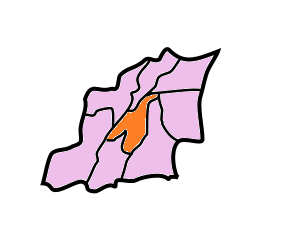
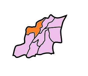
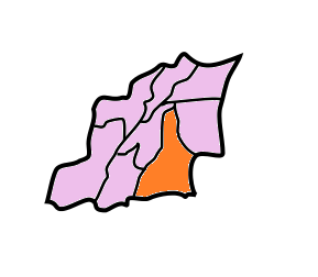
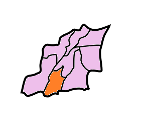
East Khasi Hills division is divided into eight blocks:[3]
| Name | Headquarters | Population | Location |
| Khatarshnong Laitkroh | Mawjrong |  | |
| Mawkynrew | Mawkynrew | ||
| Mawphlang | Mawphlang |  | |
| Mawryngkneng | Mawryngkneng | ||
| Mawsynram | Mawsynram | ||
| Mylliem | Mylliem | ||
| Pynsursla | Pynsursla |  | |
| Shella Bholaganj | Cherrapunjee |  |
Demographics[edit | edit source]
According to the 2011 census, East Khasi Hills district has a population of 825,922,[2] roughly equal to the nation of Comoros[4] or the US state of South Dakota.[5] This gives it a ranking of 478th in India (out of a total of 640).[2] The district has a population density of 292 inhabitants per square kilometre (760/sq mi) .[2] Its population growth rate over the decade 2001-2011 was 24.68%.[2] East Khasi Hills has a sex ratio of 1008 females for every 1000 males,[2] and a literacy rate of 84.7%.[2]
Culture[edit | edit source]
Places of interest[edit | edit source]
- Kongthong village is a popular tourist destination where people use the whistled language[6][7] and build living root bridges.
- Mawlynnong village, located in the Pynsursla block, is known for its cleanliness. The travel magazine Discover India declared the village as the cleanest in Asia in 2003, and the cleanest in India in 2005.[8]
- Nohkalikai Falls one of the tallest falls in India is located near Sohra (Cherrapunjee).
- Nohsngithiang Falls
- Shillong the headquarters of this district is a hill station with a number of tourist attraction all around.[citation needed]
- Sohra (Cherrapunjee) once the wettest place on the planet,[citation needed] also known for its living root bridges and is a tourist attraction.
- Sweet Falls located in Mawshabuit
- Umiam Lake an artificial lake on the way to Shillong.
Transport[edit | edit source]
The headquarters of the district, Shillong which is also the capital city of State, is connected to Guwahati and Silchar by NH 44 of 103 km and 240 km respectively. The nearest Rail head and airport are situated at Guwahati. There is an airstrip suitable for small aircraft at Umroi which is 35 km from Shillong. The agricultural and other products are transported by trucks, jeeps and tractors. Shillong is well connected with other parts of the State by motorable road. Similarly, all the block headquarters in the district are also connected by roads. However, the villages in the interior areas are poorly connected and transport services are inadequate.[citation needed]
Gallery[edit | edit source]
-
Noh Kalikai falls near cherrapunjee
-
 Highest Rainfall in the world in cherrapunjee
 -
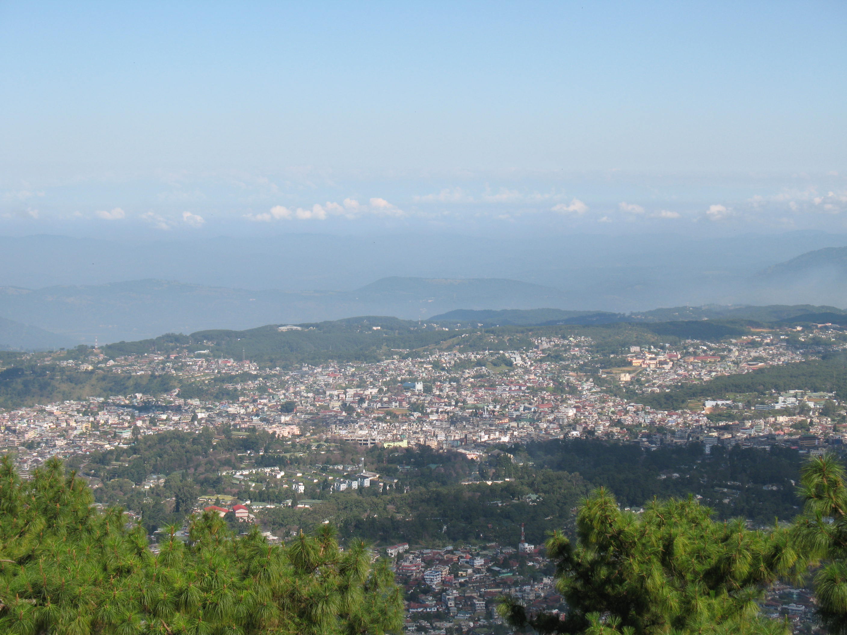 Shillong-The District Headquarters
 -
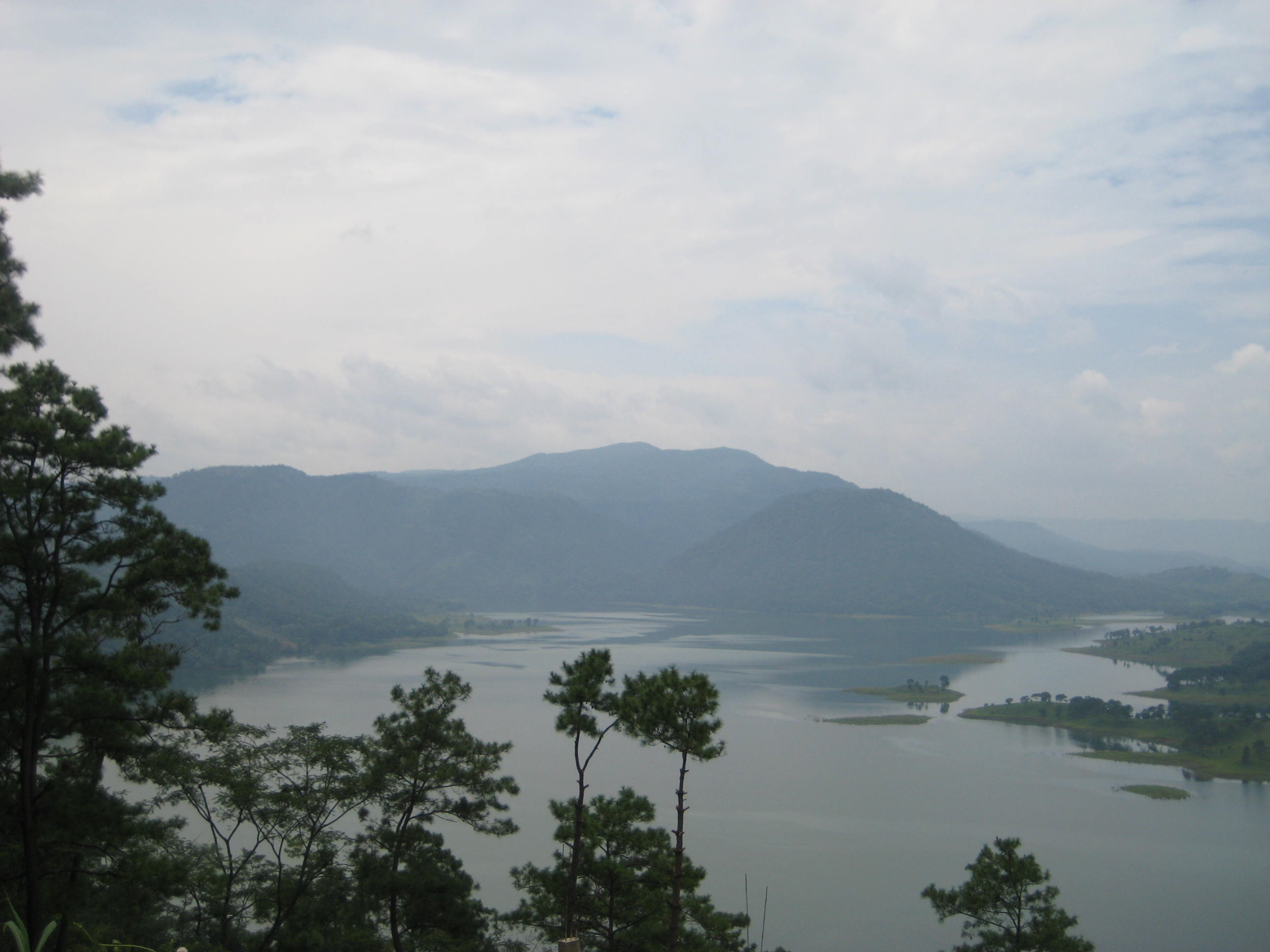 Umiam Lake


References[edit | edit source]
- ↑ "Archived copy". Retrieved 29 September 2012.
{{cite web}}: CS1 maint: deprecated archival service (link) - ↑ 2.0 2.1 2.2 2.3 2.4 2.5 2.6 "District Census 2011". Census2011.co.in. 2011. Retrieved 30 September 2011.
- ↑ Meghalaya Administrative Divisions (PDF) (Map). The Registrar General & Census Commissioner, India, New Delhi, Ministry of Home Affairs, Government of India. 2011. Retrieved 29 September 2011.
- ↑ US Directorate of Intelligence. "Country Comparison:Population". Archived from the original on 27 September 2011. Retrieved 1 October 2011.
Comoros 794,683 July 2011 est.
- ↑ "2010 Resident Population Data". U. S. Census Bureau. Archived from the original on 19 October 2013. Retrieved 30 September 2011.
South Dakota 814,180
- ↑ "Kongthong – A Village in Meghalaya where People Whistle to Communicate". amazingindiablog.in. 10 August 2017. Retrieved 14 August 2017.
- ↑ "Kongthong among 3 Indian entries for UNWTO 'Best Village Contest': Meghalaya CM". Assama Tribune. 9 September 2021. Retrieved 14 September 2021.
- ↑ Eco Destination, Department of Tourism, Government of Meghalaya
External links[edit | edit source]
- East Khasi Hills district
- Khasi Hills Autonomous District Council
- A BBC photographer's experiences in the East Khasi Hills
| State symbols | |
|---|---|
| Topics | |
| Administration | |
| Divisions |
|
| Districts | |
| Municipalities | |


