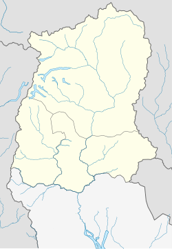
Soreng
This article needs additional citations for verification. (August 2015) |
Soreng | |
|---|---|
city | |
| Coordinates: 27°10′N 88°12′E / 27.17°N 88.20°ECoordinates: 27°10′N 88°12′E / 27.17°N 88.20°E | |
| Country | |
| State | Sikkim |
| District | Soreng |
| Population (2011)[1] | |
| • Total | 3,818 |
| Languages | |
| • Official | Nepali, Bhutia, Lepcha, Limbu, Newari, Rai, Gurung, Mangar, Sherpa, Tamang and Sunwar |
| Time zone | UTC+5:30 (IST) |
| Vehicle registration | SK 06 |
Soreng is a town forming the headquarters of the Soreng Subdivision in the West Sikkim district, in the Indian state of Sikkim. The subdivision is scheduled to become a district in 2022.[2]
Soreng is known for its largest production of vegetables, oranges and flowers. The inhabitants are mostly dependent on agriculture, floriculture and tourism for their livelihood and are mostly Nepali. The majority of the community follow Hinduism and Buddhism while the rest are Christians.
Soreng is about 45 kilometres (28 mi) by road from Darjeeling and 102 kilometres (63 mi) from the capital Gangtok. The region is an Ecotourism spot, and thousands of people visit every year. It is close to Daramdin.
The area's major attractions are its landscapes, fisheries, views of Mount Kangchenjunga, flora and fauna, and white river rafting on the Teesta river.
Currently the M.L.A of Soreng is Aditya Golay Tamang (Sikkim Krantikari Morcha).
References[edit]
- ↑ "Soreng Population". censusindia.gov.in. Retrieved 16 June 2019.
- ↑ SORENG DISTRICT STATUS WILL CATER TO GROWING POPULATION, ADMINISTRATIVE NEEDS OF FOUR CONSTITUENCIES: ADITYA, Sikkim Express, 22 June 2021.

