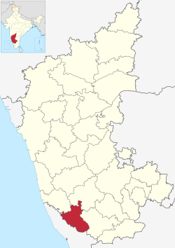
Somwarpet taluk
This article needs additional citations for verification. (January 2021) |
Somwarpet Taluk | |
|---|---|
 Location in Karnataka | |
| Coordinates: 12°35′51″N 075°50′54″E / 12.59750°N 75.84833°ECoordinates: 12°35′51″N 075°50′54″E / 12.59750°N 75.84833°E | |
| Country | |
| State | Karnataka |
| District | Kodagu district |
| Elected Representative(s) | MLA |
| Government | |
| • Type | Taluka Panchayat |
| • Body | Council |
| Area | |
| • Total | 1,003 km2 (387 sq mi) |
| Elevation | 609 m (1,998 ft) |
| Population (2011) | |
| • Total | 205,921 |
| • Density | 210/km2 (530/sq mi) |
| • Male Population | 102,739 |
| • Female Population | 103,182 |
| Sex Ratio | |
| Literacy Rate | |
| Area code | 08276 |
| Vehicle registration | KA-12 |
| No. of Villages | 135 |
Somawarpete taluk is one of the three talukas of Coorg district. Its administrative headquarters is in the town of Somwarpet.
Languages[edit]
Kannada, Are Bhashe, Kodava Takk, Beary bashe and English are spoken by the people.
Flora and fauna[edit]
Coffee is the major crop in the region. It is the major Arabica coffee growing region of India. Other crops like pepper, cardamom, orange, vanilla are grown. Rice, ginger is also grown.
Tourist attractions[edit]

Beelur Golf Club Beelur Golf Club is located 8 km from Somwarpet town. The lush green golf ground attracts movie makers.
Malemalleshwara Betta Malemalleshwara Betta is located 13 km from Somwarpet and 7 km from Shanivarsanthe. Pooja is conducted regularly and a Grand Celebration on Maha Shiva Rathri every year.
Kotebetta Kotebetta[2] is the third highest peak in Coorg after Tadiyandamol and Brahmagiri, Kotebetta means "Fort Hill" because of its fort-like appearance. Its height above sea level is 1620 metres (5313 ft). It lies near the border between the Dakshina Kannada and Coorg districts. The trek starting point is a junction near a bridge called Hattihole. The peak is 10 km from Hattihole. There is a Shiva temple at the base of Kotebetta.
Makkalagudi Betta is located in Kiraganduru 10 km between Somwarpet and Madikeri road. There is a view of paddy fields, forest, and the waters of the Harangi reservoir.
Mallalli Falls (Kannada:ಮಲ್ಲಳ್ಳಿ ಜಲಪಾತ) Mallalli Abbi or Kumaradhara Falls is one of the tallest waterfalls in the Coorg where the river Kumaradhara drops down 200 feet. Scattered along the stream are other misty waterfalls, situated on the foothills of the Pushpagiri hill-ranges, 25 km from Somwarpet.
"Beauty Spot" in mathanahaill, somwarpet, saniversante road. " Mountain Mist coffee valley"
Other attractions in the Taluk are[edit]
- Kushalanagar, a popular tourist destination[3] located southerly, along Mysore- Madikeri road. Bylakuppe Tibetan settlement is located close to this town
- Harangi Reservoir
- Kanive Hanging Bride and Kudige
- Kaveri Nisargadhama
- Dubare elephant camp,
- Chiklihole reservoir, and
- Nagarhole National Park is located in the close vicinity.
See also[edit]
References[edit]
- ↑ "Portico of the Coorg Rajah's Palace at Somwaspett". The Wesleyan Juvenile Offering: A Miscellany of Missionary Information for Young Persons. Wesleyan Missionary Society. X: 48. May 1853. Retrieved 29 February 2016.
- ↑ [1]
- ↑ http://www.kushalnagartown.mrc.gov.in/en/Tourism
