Sirhind railway station
Sirhind | |
|---|---|
| Indian Railways junction station | |
| Location | Main Market, Sirhind, Punjab India |
| Coordinates | 30°37′27″N 76°22′56″E / 30.6242°N 76.3822°ECoordinates: 30°37′27″N 76°22′56″E / 30.6242°N 76.3822°E |
| Elevation | 271 metres (889 ft) |
| Owned by | Indian Railways |
| Operated by | Northern Railway |
| Line(s) | Ambala–Attari line Sirhind–Nangal line |
| Platforms | 3 |
| Tracks | Broad gauge 1,676 mm (5 ft 6 in) |
| Construction | |
| Structure type | Standard on ground |
| Parking | Yes |
| Bicycle facilities | No |
| Other information | |
| Status | Functioning |
| Station code | SIR |
| Division(s) | Ambala |
| History | |
| Opened | 1870 |
| Location | |
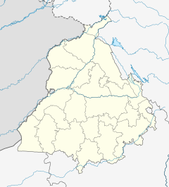
Location in Punjab | |
Sirhind railway station is located in Fatehgarh Sahib district in the Indian state of Punjab and serves Sirhind–Fategarh .
The railway station[edit]
Sirhind railway station is at an elevation of 271 metres (889 ft) and was assigned the code – SIR.[1]
History[edit]
The Sind, Punjab and Delhi railway completed the 483 km (300 mi)-long Amritsar–Ambala–Saharanpur–Ghaziabad line in 1870 connecting Multan (now in Pakistan) with Delhi.[2]
The Sirhind–Nangal line was opened in 1927.[3]
Electrification[edit]
The Shahbad Markanda-Mandi Gobindgarh sector was electrified in 1995–96.[4]
References[edit]
- ↑ "Arrivals at Sirhand Junction". indiarailinfo. Retrieved 20 February 2014.
- ↑ "IR History: Early Days II (1870-1899)". IRFCA. Retrieved 20 February 2014.
- ↑ "Chapter I – Brief Summary" (PDF). Table 1 – Details of development milestones of Roopnagar. Retrieved 21 February 2014.
- ↑ "History of Electrification". IRFCA. Retrieved 20 February 2014.
External links[edit]
| Preceding station | Indian Railways | Following station | ||
|---|---|---|---|---|
toward ? | Northern Railway zone | toward ? |
||
| Terminus | Northern Railway zone Sirhind–Nangal line | toward ? |
