Nanmanda
(Nanmanda)
നന്മണ്ട | |
|---|---|
village | |
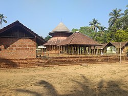
 Chembadicha ambalam (Nanjundeswara temple), Nanminda. | |
| Nickname: Good brain (നല്ല+മണ്ട) = നന്മണ്ട | |
| Coordinates: 11°25′20″N 75°49′55″E / 11.42222°N 75.83194°ECoordinates: 11°25′20″N 75°49′55″E / 11.42222°N 75.83194°E | |
| Country | |
| State | Kerala |
| District | Kozhikode |
| Named for | Kshetra stalam (ക്ഷേത്രസ്ഥലം) |
| Population (2001) | |
| • Total | 25,628 |
| • Rank | Normal |
| Languages | |
| • Official | Malayalam, English & Malayalam |
| Time zone | UTC+5:30 (IST) |
| PIN 673 613 Sub Post Office. | 6xxxxx |
| Vehicle registration | KL-76 |
Nanminda is a village in Kozhikode district in the state of Kerala, India.[1] Nanminda is also written as "Nanmanda".
Demographics[edit]
As of 2001[update] India census, Nanmanda had a population of 25,628 with 12,289 males and 13,339 females.[1] The Nanminda Panchayath is situated at Northern side of Chelannur Block in Kozhikode Taluk of Kozhikode District of Kerala in South India. The area of the panchayath is fully included in Nanminda village. It is located 19 km towards North from District headquarters Kozhikode. 9 km from Chelannur. 407 km from State capital Thiruvananthapuram. Quilandy, Kozhikode, Mavoor, Vadakara are the nearby Cities to Nanminda.
Nanminda is comprising with Nanminda 12th Mile, 13th Mile and 14th Mile. The closest city center to Nanminda is Ballusery also written as "Balluseri". Nanminda Higher Secondary School located at 12th Mile which was established in 1950 is one of the oldest schools across Nanminda.
Nanminda is known for its green paddy fields, coconut farms, areca nut farms, banana plantains, Jack fruit and Mango trees, water falls, lakes, hills and fishing.
In all sections of Agriculture, Animal husbandry, dairy, regional economic development, poverty eradication, health, women empowerment, social justice, SC/ST development are moving in good progress. In order to bring the SC/ST colonies into the mainstream many projects are being planned.
Suburbs and villages[edit]
- Karakkunnath, Koolippoyil and Ambalapoyil
- Nanmanda 12, Nanmanda 13 and Nanmanda 14
- Poyil thazham, Balabhodhini, Nanminda madu
Important landmarks[edit]
- Panyamvalli Varyam Madom Vishnu Kshethram, Nanminda
- Thali Maha Temple, Nanminda
- Kadambur Temple, Karakkunnath
- Nanjundeshwara Shiva Temple, Nanminda 13
- Narakassery temple, Nanminda
- Pallikkara Vishnu Sudharshana Temple, Balussery Mukku
- Kuniyil Narasimha Kshethram, Ambalapoyil, Nanminda
- Puthiyottumkandy Karinkaputhoyon kavu
- Nanmanda Central Juma Masjid
- Nanminda High School Nanminda
- Cheekilode AUP School
- Kolathur Govt. High School
- National ALP School
References[edit]
- ↑ 1.0 1.1 "Census of India : Villages with population 5000 & above". Registrar General & Census Commissioner, India. Retrieved 10 December 2008.
External links[edit]

