Murshidabad railway station
This article needs additional citations for verification. (January 2021) |
| Express train and Passenger train station | |||||||||||
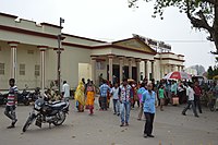
 Entrance | |||||||||||
| Location | Lalbagh, Murshidabad district, West Bengal India | ||||||||||
| Coordinates | 24°10′37″N 88°16′54″E / 24.176921°N 88.281628°E | ||||||||||
| Elevation | 24 m (79 ft) | ||||||||||
| Owned by | Indian Railways | ||||||||||
| Operated by | Eastern Railway zone | ||||||||||
| Line(s) | Sealdah–Lalgola main line | ||||||||||
| Platforms | 4 | ||||||||||
| Tracks | Doubled | ||||||||||
| Construction | |||||||||||
| Structure type | Standard (on-ground station) | ||||||||||
| Parking | Yes | ||||||||||
| Other information | |||||||||||
| Status | Functioning | ||||||||||
| Station code | MBB | ||||||||||
| Zone(s) | Eastern Railway zone | ||||||||||
| Division(s) | Sealdah | ||||||||||
| History | |||||||||||
| Electrified | Yes | ||||||||||
| Previous names | East Indian Railway Company | ||||||||||
| Services | |||||||||||
| |||||||||||
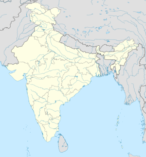
| Location | |||||||||||
Murshidabad is a railway station on the Sealdah–Ranaghat–Krishnanagar–Berhampore–Lalgola line and is located in Murshidabad district in the Indian state of West Bengal. Murshidabad railway station lies in Murshidabad.
Geography[edit | edit source]
| Murshidabad F: facility, H: historical site Owing to space constraints in the small map, the actual locations in a larger map may vary slightly |
Location[edit | edit source]
It is located in Murshidabad district, 199 km (124 mi) from Sealdah.
Hazarduari Palace and its associated sites in the Kila Nizamat area (forming the central area in the map alongside) is the centre of attraction in Murshidabad. Just a little away are Katra Masjid, Fauti Mosque, Jama Masjid and the Motijhil area. There is a group of attractions in the northern part of the town (as can be seen in the map alongside). Some attractions such as Khushbagh, Rosnaiganj, Baranagar, Kiriteswari Temple, Karnasuvarna and others are on the other side of the river and there are attractions in the neighbouring Berhampore area also (not shown in the map).[1]
Note: The map alongside presents some of the notable locations in Murshidabad city. Most of the places marked in the map are linked in the larger full screen map. A few, without pages yet, remain unmarked. The map has a scale. It will help viewers to find out the distances.
History[edit | edit source]
Ranaghat–Lalgola branch line was opened in 1905 during British reign.
Electrification[edit | edit source]
The 128 km long Krishnanagar–Lalgola stretch was electrified in 2004 for EMU services.[citation needed]
Infrastructure[edit | edit source]
The railway station has four platforms after the installation of a double railway track.
Expansion[edit | edit source]
Railway Ministry tried to connect the railway station to Azimganj Junction. But due to land acquisition problems, the work of connecting these two stations was stopped. However, with help of Mamata Banerjee, the expansion work has been started again in full swing. The bridge named as Nashipur Rail Bridge over the Bhagirathi River is complete. The Murshidabad-Azimgunj link is expected to be commissioned by the end of December 2017. Some North Bengal trains like Darjeeling Mail, Haldibari Express are likely to move through Sealdah–Ranaghat–Behrampore Court–Murshidabad–Azimganj instead of crossing Bali Bridge and move through Barddhaman–Baharwa–Malda Town. Rail Ministry reports say that this linkage will minimise the travel distance (25 km) as well as time.[2]
Mail/Express trains[edit | edit source]
- SDAH-LGL Bhagirathi Express
- KOAA-LGL Hazarduari Express
- KOAA-LGL Dhanodhanya Express
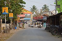
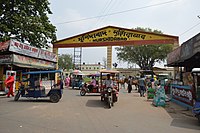
Around Murshidabad railway station[edit | edit source]
References[edit | edit source]
- ↑ "Offbeat Weekend in Murshidabad". Outskirts of Killa Nizamat (Northern part). Offbeat Weekend. Retrieved 20 July 2021.
- ↑ The Nashipur Syndrome, The Week, Retrieved 12 October 2020
External links[edit | edit source]
- Articles using Infobox station with markup inside name
- Articles using Infobox station with links or images inside name
- Articles with unsourced statements from March 2019
- Railway stations in Murshidabad district
- Sealdah railway division
- Kolkata Suburban Railway stations
- Murshidabad
- West Bengal railway station stubs
- Pages with maps


