


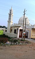


Mananthavady Road is an agricultural suburb of Mysore district in the Indian state of Karnataka.[1]
Terminology[edit | edit source]
The term Mananthavady Road is used for the 52 km stretch of road between Mysore and Heggadadevanakote (H.D.Kote) town in Karnataka. Some people use the term for the entire stretch up to Mananthavady town in Kerala province. The second stretch of the road passes through Nagarhole National Park. The second stretch is another 70 km long.[2]
Populated Places[edit | edit source]
Important Towns on the Mananthavady Route[edit | edit source]
Villages on the Mananthavady Route[edit | edit source]
- N.H.Palaya
- Kalavadi
- Kenchalagudu
- Kaliyugamane
- D.Salundi
- Doddundi
- D.B.Kuppe
- Machur
- Balle Elephant Camp
- Karapura
- Nisana Belathur
- Hemmankette
- Dommanakatete
- Anthare santhe
- Lakshmi pura
- Mahadeva Nagara
- Harohalli
Landmarks and Organizations[edit | edit source]
- Kaliyuva Mane School
- Railway workshop
- Prakruthi apartment
- Nirmala highschool
- Poorna chethana school
- Queen Mary hospital
- Good Shepherd School
- Mount Litera Zee School
- StJosephs Prasada Public School
- Mysore Public School
- Sericuluture Institute
- National Institute of Engineering
Image gallery[edit | edit source]
-
 Sericulture Institute
 -
 Balle Elephant Camp
 -
 Nagarhole National Park, Kodagu
 -
 Central Railway Workshop, Mysore
 -
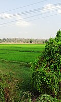 Machur village
 -
 Karappuram village
 -
 Ammari Amman Temple


See also[edit | edit source]
References[edit | edit source]
 | This article related to a location in Mysore district, Karnataka, India is a stub. You can help Bharatpedia by expanding it. |