.svg)
D.B.Kuppe
 Thank you for being part of the Bharatpedia family! 0% transparency: ₹0 raised out of ₹100,000 (0 supporter) |
Dodda Byrankuppe
D.B.Kuppe | |
|---|---|
| Coordinates: 12°28′04″N 76°15′55″E / 12.4676919°N 76.2652909°ECoordinates: 12°28′04″N 76°15′55″E / 12.4676919°N 76.2652909°E | |
| Country | |
| State | Karnataka |
| District | Mysore |
| Time zone | UTC+05:30 (IST) |
| PIN | 571114 |


D.B.Kuppe or DoddaByrankuppe is a small village on the bank of Kapila River in Mysore district, Karnataka province, India.[1] It comes under the jurisdiction of Heggadadevana kote taluk.[2]
Location[edit]
Technically, this village belongs to Karnataka state. In practice, the village has no effective road access to Karnataka state. Most of the villagers depend on Mananthavady town, 16 km away in Kerala state, for their day-to-day needs and employment. The Kerala Government has organized regular bus services to the village from Mananthavady.
Administration[edit]
The village is administered by a panchayath. It belongs to Mysore district.
Tourism[edit]
The village has good tourist potential as it is in the very middle of forest area.[3] A large number of devotees come to visit the Gundara Dargah at Machur. The Veda Gowda tribe of Bavali area celebrate the Moori Abba or Ori Abba festival on the new moon day after Deepavali. Centuries ago, this tribe fled from Chitradurga district because of the persecution of Tippu Sultan. The purpose of this celebration is the prosperity of their crops. The festival begins with nadi Pooja and a bullock race is also conducted. The bullocks are paraded before the Sree Basaveshwara Temple at Dodda Bairankuppa which is only 10 km away from the Kerala town of Pulpally. [4]
Paddy Farms[edit]
There is a lot of paddy cultivation in the village. There is also a post office in the village.[5]
Nearby villages[edit]
- Heggadadevana kote
- Manuganahalli 11.3 km
- Hampapura 14.6 km
- N.belthur 15.2 km
- Hyrige 22.8 km
Education[edit]
- Dr B R Ambedkar High School Kogiluru
- Primary School
Image Gallery[edit]

Machur village

Village temple

Village school
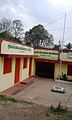
D.B.Kuppe

Machur Town
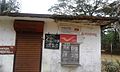
Post Office


Location[edit]
Location of D.B.Kuppe | ||||||||||
|---|---|---|---|---|---|---|---|---|---|---|
| ||||||||||
See also[edit]
References[edit]
- ↑ "Google Maps". Retrieved 1 May 2016.
- ↑ "Map Byrankuppa Road, Nagarhole National Park, Netkalhundi, Karnataka 571114, India". in.mapaworld.com. Archived from the original on 9 April 2016. Retrieved 1 May 2016.
- ↑ "KALLI VALLI : The killer of the wayanad : A walk back ,Man and Machine trip -day 2 Mananthavady-Mandya". kallivalli.blogspot.in. Retrieved 1 May 2016.
- ↑ http://www.indian24news.com/india/tribesmen-celebrate-moori-abba/64519-news
- ↑ "571114 PinCode of Heggadadevankote, Mysore, Karnataka". 1min.in. Retrieved 1 May 2016.