Khanahr
खनाहर Salgi | |
|---|---|
village | |
 | |
 Khanahr | |
| Coordinates: 31°47′03″N 76°59′55″E / 31.78425°N 76.99871°E | |
| Country | |
| State | Himachal Pradesh |
| Area | |
| • Total | 3.95 km2 (1.53 sq mi) |
| Population (2011) | |
| • Total | 523 |
| • Density | 130/km2 (340/sq mi) |
| Languages | |
| • Official | Mandeali, Hindi |
| Time zone | UTC+5:30 (IST) |
| Vehicle registration | HP- |
| Website | https://hpmandi.nic.in |
Khanahr (Hindi: खनाहर) is a small village in Himachal Pradesh, India. The village is situated on the mountain slopes on the right bank of Kataula-ka-khad, a tributary of the Uhl River. It is located on MDR23 Mandi-Bajaura Road, at a distance of 18 kilometres (11 mi) from Mandi town. The sub-village of Salgi is located on the main road. The North Campus of IIT Mandi borders Salgi and the entrance to the campus branches off from MDR23 at Salgi.
Description[edit | edit source]
Khanahr/Salgi is located on MDR23 Mandi-Bajaura Road, at a distance of 18 kilometres (11 mi) from Mandi town.[1] MDR23 continues on to Bajaura, connecting to Kullu, a distance of 48 kilometres (30 mi) from Salgi.[2] The village has an area of 395 hectares (980 acres).[3]
The population as of the 2011 Census was 523 with 104 households.[3] The languages are Mandyali and Hindi. Khanahr is a village in the Kamand Gram Panchayat. Khanahr village includes the following sub-villages: Chowkidhar, Kayali, Dwardu, Panjaut, Khada Gehar and Salgi.[citation needed]
EWOK, a registered society started by IIT Mandi to cater to the education, training and entrepreneurial needs of rural women, has its office in Salgi. A number of businesses incubated by EWOK are based in Salgi.[4]
Education[edit | edit source]
A government primary school below MDR23 caters to children from surrounding villages. The nearest government high school is in Kamand village 3 kilometres (1.9 mi) distance.[3] The IIT Mandi Mindtree School adjacent to Salgi caters to the IIT community and to children from villages of Kamand valley and Mandi town.[5] IIT Mandi is an institute of national importance offering bachelors, masters and PhD in engineering, and masters and PhD in sciences and humanities. Students come from all parts of India and from some foreign countries. The North Campus of IIT Mandi borders Khanahr/Salgi.[6]
Transport[edit | edit source]
Public and private buses and private vans ply regularly between Mandi and various villages in the Kamand valley, passing through Salgi. A few buses pass through en route from Mandi to Bajaura and Kullu.[7][8]
History[edit | edit source]

This section is empty. You can help by adding to it. (March 2021) |
Gallery[edit | edit source]
-
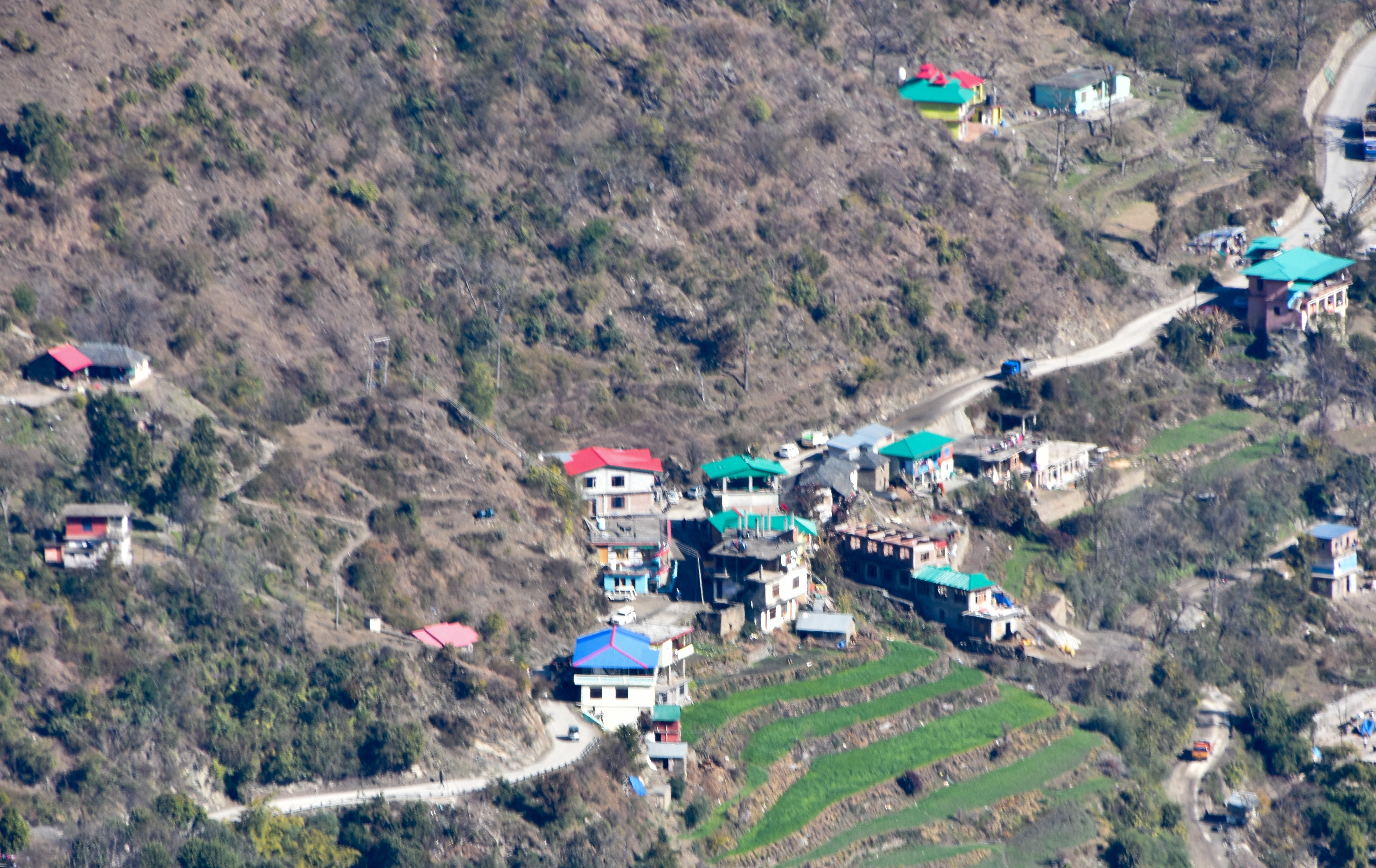
 Khanahr Top above Mindtree School and Salgi, Jan '18
 -
 IIT Mindtree School & Salgi village, Apr '20
 -
 Salgi village from Griffon Peak in the west, Jan '20
 -
 Rare snowfall, view from IIT campus, 8 Feb '19


See also[edit | edit source]
References[edit | edit source]
- ↑ "Mandi-Salgi route". OpenStreetMap.org. Retrieved 6 February 2021.
{{cite web}}: CS1 maint: url-status (link) - ↑ "Salgi-Kullu route". OpenStreetMap.org. Retrieved 6 February 2021.
{{cite web}}: CS1 maint: url-status (link) - ↑ 3.0 3.1 3.2 District Census Handbook: Mandi, Himachal -- Village and Town Directory. 3 Part XII A. Directorate of Census Operations, Himachal Pradesh, Ministry of Home Affairs, Govt of India. 2011. p. 1028.
- ↑ "EWOK". OpenStreetMap.org. Retrieved 6 February 2021.
{{cite web}}: CS1 maint: url-status (link) - ↑ IIT Mandi. "Visitor Information". IIT Mandi. Retrieved 25 March 2021.
{{cite web}}: CS1 maint: url-status (link) - ↑ Sarkar, Rinki (2017). Subramanian, B.; Sethi, Devika (eds.). Kamand Valley and Its Surroundings. Kamand Valley Monographs. Vol. III. Kamand, Himachal Pradesh: Indian Institute of Technology Mandi. p. 6. ISBN 978-93-5291-208-7.
- ↑ "Institute Vehicle Schedule: HRTC bus timing operate through Kamand" (PDF). IIT Mandi. 16 April 2021. p. 4. Retrieved 19 April 2021.
{{cite web}}: CS1 maint: url-status (link) - ↑ "Mandi Bus Stand Local Route Time Table". DisttMandi.com. Mandi - Kullu (Via Kataula), Mandi - Kataula Parashar, Mandi - Tepar Via Kataula, Mandi - Batheri – Aarang, Mandi–Kandhi, Mandi - Kadhalu (Kataula). Retrieved 25 March 2021.
{{cite web}}: CS1 maint: url-status (link)