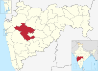
Kasare, Sangamner
Kasare | |
|---|---|
village | |
| Coordinates: 19°39′28″N 74°22′03″E / 19.65778°N 74.36750°ECoordinates: 19°39′28″N 74°22′03″E / 19.65778°N 74.36750°E | |
| Country | |
| State | Maharashtra |
| District | Ahmadnagar |
| Taluka | Sangamner |
| Government | |
| • Body | Village Panchayat |
| Languages | |
| • Official | Marathi |
| Time zone | UTC+5:30 (IST) |
| Lok Sabha constituency | Shirdi |
| Vidhan Sabha constituency | Sangamner |
Kasare, is a small village in Ahmednagar district of Maharashtra, India.[1] This village is located about equidistant between Talegaon to the northwest and Gogalgaon to the southeast on State Highway 45.
Demographics[edit]
In the 2001 census, the village of Kasare had 1,417 inhabitants, with 726 males (51.2%) and 691 females (48.8%), for a gender ratio of 952 females per thousand males.[2]
In the 2011 census, the village of Kasare had 1,776 inhabitants, for a net gain of 359 over the preceding decade.[3]
Religion[edit]
The majority of the population in Kasare is Hindu. There are several temples in the village, including the Kalika Mata Temple, the Hanumanji Temple, and the Gurdev Datta Temple.[citation needed]
References[edit]
- ↑ 2001 Census Village code for Kasare = 03218100, "2001 Census of India: List of Villages by Tehsil: Maharashtra" (PDF). Registrar General & Census Commissioner, India. p. 625. Archived (PDF) from the original on 13 November 2011.
- ↑ "Census 2001 Population Finder: Maharashtra: Ahmadnagar: Sangamner: Kasare". Office of The Registrar General & Census Commissioner, Ministry of Home Affairs, Government of India. Archived from the original on 15 May 2013.
- ↑ "NPR Report: Maharashtra: Ahmadnagar: Sangamner". National Population Register, Ministry of Home Affairs, Government of India. 2011.

