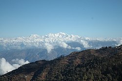
Kanatal
This article has multiple issues. Please help improve it or discuss these issues on the talk page. (Learn how and when to remove these template messages)
|
Kanatal | |
|---|---|
Hamlet | |
 | |
| Coordinates: 30°25′10″N 78°19′27″E / 30.419343°N 78.324286°ECoordinates: 30°25′10″N 78°19′27″E / 30.419343°N 78.324286°E | |
| Country | |
| State | Uttarakhand |
| District | Tehri |
| Elevation | 2,590 m (8,500 ft) |
| Languages | |
| • Official | Hindi |
| Time zone | UTC+5:30 (IST) |
| Vehicle registration | UK 07, UK 09 |
| Website | uk |
Kanatal is a small village and a hill station in the state of Uttarakhand, India. Kanatal is 78 km from Dehradun (capital of the State Uttarakhand), 38 km from Mussoorie and 12 km from Chamba. It is on the Chamba-Mussoorie road and nearly 300 km from Delhi.[1][2]
History[edit]
A few decades ago[when?] there was a small lake or taal (pond). When it dried up, people started calling it kaana taal. By that the name of nearby area is Kanatal. Indians usually use the word kaana for dry well or pond in Hindi language.
Surkanda Devi is a temple in Kaddukhal, dedicated to Sati. Surkanda is where the head of Sati had fallen after Shiva carried her on his trishool from Kankhal, Haridwar after she set herself on fire. You get a 360-degree view from the top of the temple. This temple is 8 km on the road to Mussoorie to Kaddukhal.
Climate[edit]
The temperature here ranges between 10-20 degrees Celsius during summer, and -5 to 10 degrees Celsius during winter. The location experiences heavy snowfall blocking roads in winters. Due to the high altitude, Kanatal faces unpredictable high winds.
Geography[edit]
Kanatal has an average elevation of about 8500 feet (2590 meters). The highest point is Surkanda Devi Temple.
Accessibility[edit]
Kanatal is connected by road to Delhi and major cities. You can reach here via Risikesh or via Dehradun. Both are major cities of uttrakhand. Both are connected by railways from Delhi. The nearest airport is at Dehradun.
Places of interest[edit]
- Tehri Dam at New Tehri is dam is built on the confluence of River Bhagirathi and Bhilangna.
- Kodia Jungle is 1 km away on the road towards Chamba.
- Mussoorie is 40 km from Kanatal and is a popular tourist destination.
- Chamba is 15 km from Kanatal.
- Dhanaulti is 15 km from Kanatal.
- Shivpuri is about 75 km from Kanatal and close to Rishikesh is Shivpuri, a rafting location.
- SunSet Point Sun Set is Best Visible from Himalyan Aleph Bunglow amongst the daisies in the summer in their Orchard all year around or bhandri farm eco park.
- Resting goddess hill view point ( Best view in moon light)
Adventure and activities are also available @ Bliss of Nature kanatal. Best Camping experience at @ Camp Chayan Kanatal
References[edit]
- ↑ Abhik Das (8 July 2015). "Road trip: In search of snow". India Today. Retrieved 10 May 2016.
- ↑ Tybros Holidays. "My Budget Weekend Holiday in Kanatal from New Delhi". Small Budget Big Trips.
