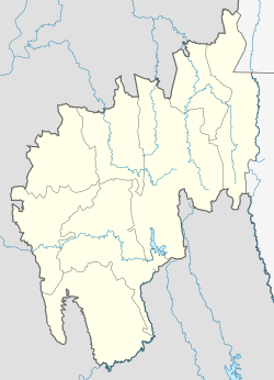
Jirania
Jirania | |
|---|---|
town | |
| Coordinates: 23°48′14″N 91°28′07″E / 23.80389°N 91.46861°ECoordinates: 23°48′14″N 91°28′07″E / 23.80389°N 91.46861°E | |
| Country | |
| State | Tripura |
| District | West Tripura |
| Elevation | 45 m (148 ft) |
| Languages | |
| • Official | Bengali, Kokborok, English |
| Time zone | UTC+5:30 (IST) |
| PIN | 799 035 |
| Vehicle registration | TR 01 |
| Nearest city | Agartala |
| Website | tripura |
This article does not cite any sources. (September 2008) |
Jirania is a small town in Tripura state of India on the banks of river Saidra. It is a nagar panchayat and also the headquarters of Jirania Rural Development Block. It is also the headquarters of Jirania Sub Division. It has 3 major high schools. Its market is of great importance for the local business and its sustainence. It lies on the National Highway 8 (Assam-Agartala Highway) of India.
It is the connecting link with the town of Khumulwng and Mandwi with the national highway. Other nearby towns include Ranirbazar and Champaknagar.
A petrol pump near the Jirania market serves for the town and its hinterland. The brick factories in and around Jirania are very famous. There are more than 100 brick factories in Jirania Block.
Educational Institutions[edit]
National Institute of Technology, Agartala is located in Jirania. It is located 4 km away from College Chowmahani, which lies on the National Highway connecting Tripura with neighbouring state Assam. It also has a Kendriya Vidyalaya primary school, Shishu Niketan Higher Secondary School (established in 1984), and Tripura Government High School, inside its campus.
Tripura State Rifles[edit]
Tripura State Rifles, 10th Battalion Camp is located near National Institute of Technology Campus.
Public Transportation[edit]
Jirania is connected to the rest of Tripura by Road and Rail transport.
Road transportation service in Jirania is provided by the local auto rickshaws and mini-vans, which ply from the campus of National Institute of Technology, till College Chowmahani. Other places such as Agartala can be reached using private mini buses and vans plying the route of Teliamura to Agartala. Buses to Assam can be boarded from College Chowmahani. Share auto rides are available for travel from National Institute of Technology Campus to College Chowmahani for Rs. 10 per head (as of May 2011).
Jirania has a railway station which lies in Agartala-Lumding train route. Two local trains ply between Agartala and Dharmanagar and two long distance train which ply between Agartala and Lumding daily. The average speed of these trains are 40 km/h. This stretch of railway comes under North-Frontier Railways and is one of the very few stretches which still have meter-gauge tracks. Except for Lumding in Assam, Jirania is not connected to the rest of the India through Rail Transport.
To reach Agartala airport which is located around 30 km away from Jirania, local auto rickshaws can be hired from the NIT campus for a fare of Rs. 300-350. To reach Jirania from Agartala Airport, pre-paid auto rickshaws and taxis are available inside the Airport. Journey by auto rickshaw costs Rs. 275 and by taxi costs Rs. 450 (as of May 2011).
See also[edit]
- List of cities and towns in Tripura
- Khumulwng, the headquarters of TTAADC.
- Howrah River

