Jetalsar Junction railway station
| Indian Railways station | |
 Jetalsar railway station | |
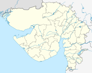
| Location | Rajkot, Gujarat India |
| Coordinates | 21°43′45″N 70°34′27″E / 21.729101°N 70.574214°ECoordinates: 21°43′45″N 70°34′27″E / 21.729101°N 70.574214°E |
| Elevation | 107 metres (351 ft) |
| Owned by | Indian Railways |
| Operated by | Western Railway |
| Line(s) | Rajkot–Somnath line Porbandar–Jetalsar section |
| Platforms | 5 |
| Tracks | 5 |
| Construction | |
| Structure type | Standard (on ground) |
| Parking | Yes |
| Other information | |
| Status | Functioning |
| Station code | JLR |
| Zone(s) | Western Railway |
| Division(s) | Bhavnagar |
| History | |
| Opened | 1890 |
| Electrified | Ongoing |
| Location | |
Jetalsar Junction railway station is an important junction railway station under Bhavnagar railway division of Western Railway Zone of Indian Railways.[1][2]
It connects Rajkot Junction on north direction, Wansjaliya, Porbandar on West direction, Junagadh Junction and Veraval Junction on south direction and Khijadiya Junction, Dhola Junction on East direction.[3][4][5][6]
Major trains[edit]
Following trains halt at Jetalsar Junction railway station:
- 22991/92 Bandra Terminus–Veraval Superfast Express
- 19569/70 Rajkot–Veraval Express
- 22957/58 Somnath Superfast Express
- 11465/66 Somnath–Jabalpur Express (via Bina)
- 11463/64 Somnath–Jabalpur Express (via Itarsi)
- 19119/20 Ahmedabad–Somnath Intercity Express
- 19251/52 Somnath–Okha Express
- 19571/52 Rajkot–Porbandar Express
- 12949/50 Kavi Guru Express
References[edit]
- ↑ "Departures from JLR/Jetalsar Junction (5 PFs)". India Rail Info.
- ↑ "Jetalsar Junction Train Station:Timetable". Cleartrip.
- ↑ western_rly Archived 16 May 2008 at the Wayback Machine
- ↑ "JLR:Passenger amenities details as on : 31/03/2018 Division : Bhavnagar". Raildrishti.
- ↑ "Railway Minister to lay foundation for Dhasa-Jetalsar Railway line Gauge Conversion project". Rail News.
- ↑ "SUMMARY OF PROJECTS AS ON 01-10-2017: Dhasa – Jetalsar (104.44 km)" (PDF). Western Railway.

