Hatkoti
Hatkoti | |
|---|---|
Village | |
 | |
| Coordinates: 31°07′52″N 77°44′38″E / 31.131°N 77.744°ECoordinates: 31°07′52″N 77°44′38″E / 31.131°N 77.744°E | |
| Country | |
| State | File:Himachal Pradesh Flag, India.png Himachal Pradesh |
| District | Shimla |
| Elevation | 1,442 m (4,731 ft) |
| Languages | |
| • Official | Hindi |
| Time zone | UTC+5:30 (IST) |
| PIN | 171206 |
| Vehicle registration | HP-10 |
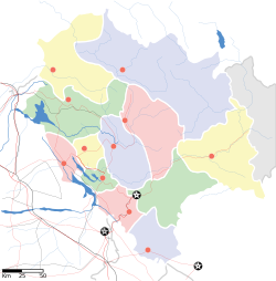
Hatkoti is a village in Shimla district of Himachal Pradesh, India. It is a village located at the banks of Pabbar River and it is about 102 kilometres away from Shimla city. Hatkoti is also famous for Hateshwari temple[1] and Sawra Kuddu Hydro Electric Project (111 MW).[2]
History[edit]
Hatkoti temples date back to the period between the sixth to the ninth century CE, the Gupta period in Indian history. The temples reflect the beautiful architecture of that era. The architecture and design of Hatkoti Temple was originally in the classical Shikhara or tower style. The Shikhara style represents ancient structures that are conical or narrow at the top and have a wide base at the bottom. The walls of the temples are carved with ornate sculptures and speak volumes of the architectural designs of the eras in which they were created.
Geography[edit]
Hatkoti is located at 31°07′52″N 77°44′38″E / 31.131°N 77.744°E. It has an average elevation of 1,442. Two mountain streams Bishkulti and Raanvati joins the Pabbar River in Hatkoti.
Transportation[edit]
Hatkoti is well connected to Himachal and rest of India through National Highway 707 and National Highway 705.[3]
See also[edit]
Nearby Towns
References[edit]
- ↑ Hateswari Temple "Hateswari Temple". Spirited Engineers. Retrieved 29 April 2013.
- ↑ Sawra Kuddu Hydroelectric Project "Introduction & Project Feature" (PDF). HPPCB. Archived from the original (PDF) on 20 June 2006. Retrieved 29 April 2013.
- ↑ "National Highways in Himachal Pradesh" (PDF). Himachal Pradesh Public Works Department. Retrieved 23 May 2018.
