.svg)
File:Location map India Sikkim.svg

Size of this PNG preview of this SVG file: 220 × 317 pixels. Other resolutions: 167 × 240 pixels | 260 × 375 pixels | 528 × 760 pixels.
Original file (SVG file, nominally 528 × 760 pixels, file size: 185 KB)
Summary
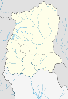
| Description | Location map of Sikkim, India |
| Date | |
| Source | Own work contains elements of India_Haryana_locator_map.svg |
| Author | Philg88; Attribution: Wikimedia Foundation (www.wikimedia.org) |
| Permission (Reusing this file) |
This file is licensed under the Creative Commons Attribution 4.0 International license.
|
| This work contains information from OpenStreetMap, which is made available under the Open Database License (ODbL).
The ODbL does not require any particular license for maps produced from ODbL data. Prior to 1 August 2020, map tiles produced by the OpenStreetMap Foundation were licensed under the CC-BY-SA-2.0 license. Maps produced by other people may be subject to other licences. |
W3C-validity not checked.
This W3C-unspecified vector image was created with Adobe Illustrator.
File history
Click on a date/time to view the file as it appeared at that time.
| Date/Time | Thumbnail | Dimensions | User | Comment | |
|---|---|---|---|---|---|
| current | 00:02, 15 April 2020 | | 528 × 760 (185 KB) | wikimediacommons>C1MM | Updated colors |
File usage
More than 100 pages use this file. The following list shows the first 100 pages that use this file only. A full list is available.
- 2009 Sikkim Legislative Assembly election
- Ambotey
- Aritar, Sikkim
- Banjhakri Falls and Energy Park
- Barfok
- Bering, East Sikkim
- Birdang
- Chawang
- Chidam
- Chomo Yummo
- Chujachen
- Chungthang
- Chungthang Forest Block
- Damthang, Sikkim
- Daramdin
- Dikchu
- Do-drul Chorten
- Dubdi Monastery
- Dzuluk
- Fambong Lho Wildlife Sanctuary
- Gnon-Samdong
- Gor, Sikkim
- Gurudongmar Lake
- Gyalshing
- Hanuman Tok
- Hee-Gyathang
- Hee Burmiok
- Jorethang
- Jorethang Loop Hydroelectric project
- Kabi, Sikkim
- Kabi Forest Block
- Kabi Longstok
- Kabi Lungchok
- Kazor
- Khangchendzonga National Park
- Khecheopalri Lake
- Kyongnosla Alpine Sanctuary
- Labi, Sikkim
- Labrang Monastery (Sikkim)
- Lachen, Sikkim
- Lachen Forest Block
- Lachung
- Lachung Monastery
- Lake Menmecho
- Lake Tsomgo
- Legship
- Lingdem
- Lingdum Monastery
- Lingthem
- Lingzah-Tolung
- Lower Mangshila
- Lum, Sikkim
- Maenam Wildlife Sanctuary
- Majitar
- Malbasey
- Mangan, India
- Mangan Forest Block
- Manjhitar
- Melli
- Men-Rongong
- Meyong, Sikkim
- Naga-Namgor
- Naga Forest Block
- Namchi
- Namok
- Nampatam
- Namthang
- Nayabazar
- Norbugang Chorten
- Pakshep
- Pakyong
- Paney-Phensong
- Parbing
- Pelling
- Pemayangtse Monastery
- Phamtam
- Phensang Monastery
- Phodong
- Rabdentse
- Ralang Monastery
- Rangeet River
- Rangit Dam
- Rinchenpong
- Rorathang
- Rumtek Monastery
- Sa-Ngor-Chotshog Centre
- Sanga Choeling Monastery
- Sherathang
- Shri Viswa Vinayaka Mandir Rhenock
- Singhik
- Singtam
- Soreng
- Tashiding
- Tashiding Monastery
- Tendong Gumpa
- Tso Lhamo Lake
- Tsuklakhang Palace
- Tumlong
- Upper Tadong
- Varsey Rhododendron Sanctuary
View more links to this file.