.svg)
Pannithittu
This article relies largely or entirely on a single source. (August 2017) |
Pannithittu | |
|---|---|
Village | |
| Lua error in Module:Location_map at line 526: Unable to find the specified location map definition: "Module:Location map/data/India Puducherry" does not exist. | |
| Coordinates: 11°49′43″N 79°48′08″E / 11.828668°N 79.802295°ECoordinates: 11°49′43″N 79°48′08″E / 11.828668°N 79.802295°E | |
| Country | |
| State | Puducherry |
| District | Pondicherry |
| Taluk | Bahour |
| Commune | Bahour |
| Languages | |
| • Official | French, Tamil, English |
| Time zone | UTC+5:30 (IST) |
| PIN | 607 402 |
| Telephone code | 0413 |
| ISO 3166 code | IN-WB |
| Vehicle registration | PY-01 |
| Sex ratio | 50% ♂/♀ |
Pannithittu is a village[1] in Bahour Commune of Bahour taluk in the Union Territory of Puducherry, India. It lies east of NH-45A at a distance of 2 km from it. River Malattar joins Bay of Bengal at Pannithittu.
Geography[edit]
Pannithittu is bordered by Kirumampakkam in the west, Malattar in the north, Bay of Bengal in east and Pillaiyarkuppam in the south.
Villages[edit]
Following are the villages under Pannithittu Village Panchayat.
- Pannithittu
- Aladimedu
- Etchangadu
- Vambapet
Road network[edit]
Pannithittu is connected to Puducherry by NH45A - Kirumampakkam road. Also Pannithittu is connected to Pudukuppam via. Pillaiyarkuppam, Bahour and Manappattu. There is also an access road from Reddichavadi via Pannithittu Regulator.
Gallery[edit]

Map of Pannithittu Village Panchayat

Government High School, Panniththittu, Bahour Commune
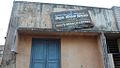
Government Branch Library, Panniththittu, Bahour Commune


Politics[edit]
Pannithittu is a part of Embalam (Union Territory Assembly constituency) which comes under Puducherry (Lok Sabha constituency)
References[edit]
- ↑ "Archived copy" (PDF). Archived from the original (PDF) on 27 September 2013. Retrieved 17 March 2013.
{{cite web}}: CS1 maint: archived copy as title (link)