


WikiDwarfBOT (talk | contribs) Cleanup: Source modification. Information added. |
basic adjusted lead after review additionally and cleaned formatting |
||
| Line 3: | Line 3: | ||
{{Use Indian English|date=February 2016}} | {{Use Indian English|date=February 2016}} | ||
{{Infobox settlement | {{Infobox settlement | ||
| native_name | | native_name = | ||
| image_skyline | | image_skyline = Kailash Parvat Rachna - 2.jpg | ||
| image_alt | | image_alt = Hastinapur City | ||
| image_caption | | image_caption = Kailash Parvat Rachna | ||
| pushpin_map | | pushpin_map = India Uttar Pradesh#India3 | ||
| pushpin_label_position = right | | pushpin_label_position = right | ||
| pushpin_map_alt | | pushpin_map_alt = Hastinapura | ||
| pushpin_relief | | pushpin_relief = 1 | ||
| pushpin_map_caption | | pushpin_map_caption = Location in Uttar Pradesh, India | ||
| coordinates | | coordinates = {{coord|29.17|N|78.02|E|display=inline,title}} | ||
| subdivision_type | | subdivision_type = Country | ||
| subdivision_name | | subdivision_name = {{flag|India}} | ||
| subdivision_type1 | | subdivision_type1 = [[States and territories of India|State]] | ||
| subdivision_type2 | | subdivision_type2 = [[List of districts of India|District]] | ||
| subdivision_name1 | | subdivision_name1 = [[Uttar Pradesh]] | ||
| subdivision_name2 | | subdivision_name2 = [[Meerut district|Meerut]] | ||
| unit_pref | | unit_pref = Metric | ||
| elevation_m | | elevation_m = 212 | ||
| population_total | | population_total = 58,452 | ||
| population_as_of | | population_as_of = 2011 | ||
| population_density_km2 = auto | | population_density_km2 = auto | ||
| demographics_type1 | | demographics_type1 = Languages | ||
| demographics1_title1 | | demographics1_title1 = Official | ||
| timezone1 | | timezone1 = [[Indian Standard Time|IST]] | ||
| utc_offset1 | | utc_offset1 = +5:30 | ||
| postal_code_type | | postal_code_type = [[Postal Index Number|PIN]] | ||
| postal_code | | postal_code = 250404 | ||
| pushpin_label | | pushpin_label = Hastinapur | ||
| demographics1_info1 | | demographics1_info1 = [[Hindi]] and [[Indian English|English]] | ||
| registration_plate | | registration_plate = UP-15 | ||
| settlement_type = City | |||
}} | }} | ||
'''Hastinapur''' is a city in the [[Meerut district]] in the Indian [[States and territories of India|state]] of [[Uttar Pradesh]]. ''Hastinapura'' | '''Hastinapur''' ({{IAST|Hastināpur}}) is a city in the [[Meerut district]] in the Indian [[States and territories of India|state]] of [[Uttar Pradesh]]. ''Hastinapura'' is described as the capital of the [[Kuru kingdom]] in [[Hindu texts]] such as the ''[[Mahabharata]]'' and the [[Puranas]]; it is also mentioned in ancient [[Jain literature|Jain texts]]. Hastinapur is located on the right bank of the [[Ganga]] river. | ||
==Etymology== | ==Etymology== | ||
In [[Sanskrit]], '' | In [[Sanskrit]], ''Hastinapura'' translates to 'the City of Elephants' from ''Hastina'' (elephant) and ''pura'' (city). Its history dates back to the period of ''[[Mahabharata]]''.<ref>{{Cite web|url=https://www.britannica.com/place/Uttar-Pradesh|title=Uttar Pradesh - History|website=Encyclopedia Britannica|language=en|access-date=2019-12-16}}</ref> It is said that the city was named after King Hasti.<ref name="Mittal2006">{{cite book|author=J.P. Mittal|title=History Of Ancient India (a New Version) : From 7300 Bb To 4250 Bc|url=https://books.google.com/books?id=b7gOBW8oDFgC&pg=PA308|access-date=21 March 2018|volume=1|year=2006|publisher=Atlantic Publishers & Distributors|location=New Delhi|isbn=978-81-269-0615-4|page=308}}</ref> | ||
It is also mentioned in the ''[[Ramayana]]'' , the 13th and 14th verses of which say (translated): | It is also mentioned in the ''[[Ramayana]]'', the 13th and 14th verses of which say (translated): | ||
{{blockquote| "Having crossed Ganga River at Hastinapura, they proceeded towards the west and, reaching | {{blockquote| "Having crossed Ganga River at Hastinapura, they proceeded towards the west and, reaching Panchala kingdom through Kuru Jangala and observing well-filled lakes and rivers with clear water, the messengers mentioned above went briskly, due to the pressing nature of their mission." |source=''[[Ramayana]]'' | ||
|sign=Valmiki}} | |sign=Valmiki}} | ||
==History== | ==History== | ||
Excavations at Hastinapur were carried out in the early 1950s by [[B. B. Lal (archaeologist)|B. B. Lal]], Director General of the [[Archaeological Survey of India]]. Although the main aim of this excavation, according to Lal himself, was to determine the stratigraphic position of [[Painted Grey Ware]] concerning other known ceramic industries of the early historical period, Lal found correlations between the text of the ''Mahabharata'' and the material remains that he unearthed at Hastinapur. This led him to historicize some of the traditions mentioned in the ''Mahabharata'' as well as link the appearance of the Painted Grey Ware with [[Aryan]]s in the upper [[Ganges]] basin areas.<ref>{{cite web|url=http://asi.nic.in/asi_exca_imp_uttarpradesh.asp|title=Excavation Sites in Uttar Pradesh - Archaeological Survey of India|work=asi.nic.in|access-date=25 August 2015}}</ref> | |||
===Earliest period: to {{circa}} 500 BCE=== | |||
The original excavations in the 1950s suggested that the site of Hastinapur appears to have been abandoned and reoccupied several times;<!-- Summarizing from Lal 1955, p. 12 --><ref name="Lal 1955"/>{{rp|12}} but subsequent excavation in 2021-22 suggested instead that the site had been continually occupied from antiquity until the late medieval period.<!-- Garnayak 2022, pp. 101, 105, 110-11 --><ref name="Garnayak 2022">{{cite journal |last1=Garnayak |first1=Dibishada Brajasundar |title=Excavation at Ulta-Kheda, Hastinapur: 2021 |journal=[[Puratattva]] |date=2022 |volume=52 |pages=100-111 |url=https://www.academia.edu/100807744/Excavation_at_Ulta_Kheda_Hastinapur_2021 |access-date=22 March 2026}}</ref>{{rp|101, 105, 110-11}} | |||
According to Lal's report for the 1950s excavation, the first phase appears to have been before about 1200 BCE.<!-- Lal 1955, p. 12 --> Settlement seems to have been rather sporadic during this period, and no structures from this time have been found.<!-- Lal 1955, p. 11 --> The main find from this layer is some scattered fragments of [[Ochre Coloured Pottery culture|Ochre Coloured Pottery]],<!-- Lal 1955, pp. 11-12 --> A distinct break between the first and second phases indicates that the site had been abandoned for some time before it was reoccupied.<!-- Lal 1955, p. 11 --><ref name="Lal 1955">{{cite journal |last1=Lal |first1=B. B. |author1-link=B. B. Lal |title=Excavations at Hastināpura and Other Explorations in the Upper Gangā and Sutlej Basins 1950-52: New Light on the Dark Age Between the End of the Harappā Culture and the Early Historical Period |journal=Bulletin of the Archaeological Survey of India |date=1954-55 |volume=10-11 |pages=5-151 |url=https://archive.org/download/excavation-at-hastinapura-and-other-explorations-in-the-upper-ganga-and-satlej-b/Excavation%20at%20Hastinapura%20and%20other%20explorations%20in%20the%20upper%20Ganga%20and%20Satlej%20basins%201950-52%20-%20New%20light%20on%20the%20dark%20age%20between%20the%20end%20of%20the%20Harappa%20Culture%20and%20the%20early%20historical%20period.pdf |access-date=21 March 2026}}</ref>{{rp|11-12}} | |||
In the ''Mahabharata'', Hastinapur is portrayed as the capital of the [[Kuru | The report for the 2020s excavation, on the other hand, described a bottom layer from approximately 1500-1000 BCE, with [[Painted Grey Ware]] pottery predominating, and structures with mud and mud brick walls.<!-- Garnayak 2022, p. 105 --><ref name="Garnayak 2022"/>{{rp|105}} | ||
According to Lal, the site of Hastinapura was reoccupied from about 1100 BCE to about 800 BCE.<!-- Lal 1955, p. 12 --> This second layer, Period II, is characterised by [[Painted Grey Ware]] pottery,<!-- Lal 1955, p. 11 --><ref name="Lal 1955"/>{{rp|11-12}} which is identified with the [[Vedic Period]].<ref name="Singh 2008">{{Cite book| last =Singh | first =Upinder | year =2008 | title =A History of Ancient and Early Medieval India From the Stone Age to the 12th Century | publisher =Pearson Education India | isbn =9788131711200 | url =https://books.google.com/books?id=H3lUIIYxWkEC&pg=PA216}}</ref> No complete houses have been found from this phase, but some traces of walls were found, and they were made variously of mud, mud bricks, or reeds (''[[Saccharum spontaneum]]'', arranged horizontally and vertically) with [[earthen plaster|mud plaster]].<!-- Lal 1955, pp. 12-3, 133-4 --> The mud plaster was mixed with rice husks for reinforcement; this building technique is still used in modern times.<!-- Lal 1955, pp. 133-4 --> Charred grains of rice have also been found in this layer, indicating that rice cultivation was practiced here during this period — one of the earliest archaeological attestations of rice cultivation in the Indian subcontinent.<!-- Lal 1955, pp. 14, 131-3 --> Copper appears to have been the main metal used during this period.<!-- Lal 1955, p. 13 --> No objects made of iron were found, although some lumps of iron ore and iron slag were found in the uppermost parts of this layer (that is, closer to the end of this period).<!-- Lal 1955, p. 13 --> Cattle bones, belonging to the [[zebu]] and the [[water buffalo]], were found "in very large numbers" from this period, indicating that cattle-rearing played a key role in this society.<!-- Lal 1955, p. 14 --> The presence of "definite cut-marks" on cattle, sheep, and pig bones indicates that they were slaughtered for food, indicating that eating beef and pork was not frowned upon during this period.<!-- Lal 1955, p. 14 --><ref name="Lal 1955"/>{{rp|12-14, 131-4}} | |||
The 2020s excavation report, on the other hand, reported a continuous occupation throughout this period, with a second phase lasting from about 1000 BCE to about 500 BCE and characterised by [[Northern Black Polished Ware]] along with other varieties.<!-- Garnayak 2022, p. 105 --><ref name="Garnayak 2022"/>{{rp|105}} | |||
====Portrayal in the ''Mahabharata''==== | |||
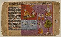
In the ''Mahabharata'', Hastinapur is portrayed as the capital of the [[Kuru kingdom]] of the [[Kaurava]]s. Many incidents in the ''Mahabharata'' were set in the city of Hastinapur. According to the ''Mahabharata'', the 100 Kaurava brothers were born in this city to their mother, Queen [[Gandhari (character)|Gandhari]], the wife of King [[Dhritarashtra]]. On the bank of the Budhi Ganga, two places near Hastinapur ([[Draupadi|Draupadi Ghat]]<ref>{{cite web|url=http://asi.nic.in/asi_exca_imp_uttarpradesh.asp|title=Excavation Sites in Uttar Pradesh - Archaeological Survey of India|work=asi.nic.in}}</ref> and [[Karna|Karna Ghat]]) reference ''Mahabharata'' personages. | |||
[[File: Brooklyn Museum - Balarama Pulling Hastinapur toward the Ganages Page from a Bhagavata Dasamskanda series.jpg|thumb|left|200px|[[Balarama]] pulling Hastinapur toward the Ganges, shown on a page from a "Bhagavata Dasamskanda" series]] | [[File: Brooklyn Museum - Balarama Pulling Hastinapur toward the Ganages Page from a Bhagavata Dasamskanda series.jpg|thumb|left|200px|[[Balarama]] pulling Hastinapur toward the Ganges, shown on a page from a "Bhagavata Dasamskanda" series]] | ||
The first reference to Hastinapur in the [[Puranas]] presents the city as the capital of [[Emperor Bharata|Emperor Bharata's]] kingdom. | The first reference to Hastinapur in the [[Puranas]] presents the city as the capital of [[Emperor Bharata|Emperor Bharata's]] kingdom. | ||
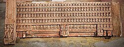
[[File:170 Jain Tirthankars.jpg|thumb|left|200px|A 2nd century stone relief of 170 Jain [[Tirthankars]] in lotus position excavated in Hastinapur]] | [[File:170 Jain Tirthankars.jpg|thumb|left|200px|A 2nd century stone relief of 170 Jain [[Tirthankars]] in lotus position excavated in Hastinapur]] | ||
====Major flood {{circa}} 800 BCE and abandonment?==== | |||
Perhaps around 800 BCE, according to Lal, there seems to have been a major flood in the Ganga, which is suggested by a major "erosional scar" in the mound.<!-- Lal 1955, pp. 12, 14 --> The site seems to have been abandoned for a couple centuries.<!-- Lal 1955, p. 12, 15 --> Notably, the ''Mahabharata'' mentions that, during the reign of the [[Kuru Kingdom|Kuru]] king [[Nichakshu]], "a great flood occurred in the Gangā which carried away a considerable portion of Hastināpura", after which the capital was moved to Kaushambi.<!-- Lal 1955, p. 149 --> Because of the similarity to the apparent flood at Hastinapur, Lal suggested that this bit about the flood ravaging Hastinapura and the capital being moved to Kaushambi may have a historical basis.<!-- Lal 1955, p. 151 --><ref name="Lal 1955"/>{{rp|12-15, 149-51}} | |||
The 2020s excavation report did not say anything about a flood either way.<!-- Garnayak 2022, summarizing --><ref name="Garnayak 2022"/> | |||
During British India, Hastinapur was ruled by [[Raja Nain Singh]] Nagar, who built many [[Hindu temple]]s in and around Hastinapura.<ref>{{cite journal|title=Unreason and Archaeology: The 'Painted Grey-Ware' and Beyond|journal= Social Scientist|volume=25|issue=1/2|pages=16–24|jstor = 3517758|last1 = Habib|first1 = Irfan|year=1997|doi= 10.2307/3517758}}</ref> | ==={{circa}} 500 BCE to {{circa}} 600s CE=== | ||
A third phase, according to the 1950s report, was from about the early 6th century BCE until about the early 3rd century BCE.<!-- Lal 1955, p. 12 --> During this phase, houses were made of mud bricks and baked bricks.<!-- Lal 1955, p. 12 --> [[Northern Black Polished Ware]] characterises this period, and there is no Painted Grey Ware.<!-- Lal 1955, p. 15 --> A couple of burnt-brick drains, evidently meant for wastewater to flow out through, have also been found in this layer.<!-- Lal 1955, p. 16 --> This is when the first iron objects start to appear, as well as various copper and silver coins.<!-- Lal 1955, p. 16 --> The end of this period appears to have been around the early 3rd century BCE, when there seems to have been a fire that destroyed much of the town, as evidenced by burnt walls and floors and charcoal remains of reed matting that had been used for roofs.<!-- Lal 1955, pp. 12, 17 --><ref name="Lal 1955"/>{{rp|12, 15-17}} | |||
The 2020s report instead listed a third phase lasting from about the 3rd to 2nd centuries BCE, corresponding roughly to the [[Maurya Empire|Maurya]] period.<!-- Garnayak 2022, p. 105 --> An inscription on a terracotta sling ball was found from this layer, which based on [[palaeography]] appears to be from roughly the 4th or 3rd centuries BCE.<!-- Garnayak 2022, p. 105 --> This report said nothing about a fire either way.<ref name="Garnayak 2022"/>{{rp|105}} | |||
According to Lal's report, after another apparent gap in occupation, the site was reoccupied in the early 2nd century BCE, remaining inhabited until the late 3rd century CE.<!-- Lal 1955, p. 12 --> Baked bricks were the predominant construction material used for houses during this period, for both walls and floors.<!-- Lal 1955, p. 12 --> There also seems to have been a fairly regular city planning along a grid during this phase.<!-- Lal 1955, p. 12 --> Among the sculptural highlights from this period is a terracotta figurine of [[Maitreya]], the prophesied future Buddha, seated in the [[abhayamudra|abhayamudrā]] pose with a [[kamandalu|kamaṇḍalu]] in his left hand.<!-- Lal 1955, p. 18 --> This sculpture, which was discovered among the upper (i.e. later) part of this layer, bears stylistic similarities to [[art of Mathura|sculptures from Mathura]] as well as [[Ahichchhatra]], and may have been influenced by those art styles.<!-- Lal 1955, p. 18 --> A rotary [[quern]] found in the middle part of this layer is significant because it represents a technological innovation that was more efficient than the [[quern#types|saddle quern]] that predominated in earlier protohistoric sites in the Indian subcontinent.<!-- Lal 1955, p. 19 --> [[Epigraphy|Epigraphic]] and [[numismatics|numismatic]] evidence from this layer helps determine its date.<!-- Lal 1955, p. 19 --> This includes two inscribed pots, identifying them as the property of individuals named Sadhujāta and Jayaśama respectively; a terracotta seal; and various coins, including some from the rulers of [[Mathura]] dated to the 2nd century BCE, some from the [[Yaudheya]]s right around the BCE/CE cutoff, and some "imitating those of" the [[Kushan Empire|Kushan]] king [[Vasudeva I|Vāsudeva I]] around the mid-3rd century CE.<!-- Lal 1955, pp. 12, 19 --><ref name="Lal 1955"/>{{rp|12, 18-19}} | |||
The 2020s report by Garnayak listed a fourth phase from approximately the 2nd century BCE to the 2nd century CE, roughly corresponding to the [[Shunga Empire|Shunga]] and Kushan periods.<!-- Garnayak 2022, p. 105 --> Among the findings from this phase were several terracotta seals, with one dated palaeographically to the 1st or 2nd century BCE and others dated to the Kushan period.<!-- Garnayak 2022, p. 105 --> Coins of the [[Indo-Greek]] king [[Menander I]] were also found from this period.<!-- Garnayak 2022, p. 105 --><ref name="Garnayak 2022"/>{{rp|105}} | |||
The original 1950s excavations suggested that, after about the 3rd century CE, the site appears to have been abandoned for a long time before being reoccupied in about the late 11th century CE.<!-- Lal 1955, p. 12, 19 --><ref name="Lal 1955"/>{{rp|12, 19}} However, the more recent investigations indicate that Hastinapur was definitely occupied during this period; in particular, a terracotta seal of the [[Gupta Empire|Gupta]] king [[Vishnugupta (Gupta Empire)|Vishnugupta]], along with various Gupta coins, provide evidence of occupation during the Gupta period.<!-- Garnayak 2022, p. 105, 110 --> The 2020s report suggested a fifth phase corresponding with the Gupta and [[Later Gupta]] periods, spanning roughly the 3rd through 7th centuries.<!-- Garnayak 2022, p. 105 --><ref name="Garnayak 2022"/>{{rp|105, 110}} | |||
The period from roughly the Shunga to Gupta dynasties ({{circa}} 2nd century BCE to {{circa}} 6th century CE) appears to have been Hastinapur's heyday.<!-- Garnayak 2022, pp. 101, 107-8, 110-11 --> Archaeological finds of ceramic roof tiles <!-- Garnayak 2022, p. 107 --> and textile-making tools<!-- Garnayak 2022, p. 108 --> peak during this period, for example, and the various coins and seals found here indicate that Hastinapur was a significant administrative and commercial centre that was connected to major trade routes (such as, perhaps, the [[Uttarapatha]] that traversed northern India).<!-- Garnayak 2022, p. 101, 110-11 --><ref name="Garnayak 2022"/>{{rp|101, 107-8, 110-11}} | |||
===Medieval period=== | |||
The 2020s excavation also reported a sixth layer, from roughly the 8th through 11th centuries.<!-- Garnayak 2022, p. 106 --> Structures from this period appear to be similar to those of the Gupta period.<!-- Garnayak 2022, p. 107 --><ref name="Garnayak 2022"/>{{rp|105-6, 110}} | |||
The 2020s report by Garnayak indicated a seventh and final phase lasting from roughly the 1100s to the 1500s, with structures reusing bricks from earlier periods.<!-- Garnayak 2022, p. 106 --> After this period, the site was abandoned, or perhaps simply shifted away from the area that was excavated.<!-- Garnayak 2022, p. 111 --> This may have been due to a flood or a shift in the Ganga's course.<!-- Garnayak 2022, p. 111 --><ref name="Garnayak 2022"/>{{rp|106, 111}} | |||
The pottery of Lal's Period V is completely different from Period IV, and the structures appear to have extensively reused bricks from Period III and IV structures as [[spolia]].<!-- Lal 1955, p. 20 --> A single coin from the reign of [[Balban]] ({{reign|1266|1287}}) helps fix the date of this layer.<!-- Lal 1955, p. 12, 20-1 --> A sandstone sculpture of [[Rishabhadeva]], the first Jain [[tirthankara|tīrthankara]], seated in the [[dhyānamudrā]] pose and perhaps dating from the 14th century, is significant as providing evidence of Hastinapur's earlier importance to Jains, since it is an important Jain pilgrimage destination today.<!-- Lal 1955, p. 21 -->{{rp|12, 20-21}} | |||
===Mughal period=== | |||
Hastinapur is listed in the [[Ain-i-Akbari]] as a [[pargana]] under Delhi [[sarkar (administrative division)|sarkar]], producing a revenue of 4,466,904 [[dam (Indian coin)|dam]]s for the imperial treasury and supplying a force of 300 infantry and 10 cavalry. The author [[Abu'l-Fazl ibn Mubarak]] describes it "an ancient Hindu settlement" lying on the Ganges.<ref name="Ain-i-Akbari">{{citation |url=https://archive.org/details/ainiakbarivolum00mubgoog |title=The Ain-i-Akbari |date=1891 |publisher=Asiatic Society of Bengal |location=Calcutta |page=288 |access-date=21 January 2021}}</ref> | |||
===British Raj=== | |||
In [[British Raj|British India]], Hastinapur was ruled by [[Raja Nain Singh]] Nagar, who built many [[Hindu temple]]s in and around Hastinapura.<ref>{{cite journal|title=Unreason and Archaeology: The 'Painted Grey-Ware' and Beyond|journal= Social Scientist|volume=25|issue=1/2|pages=16–24|jstor = 3517758|last1 = Habib|first1 = Irfan|year=1997|doi= 10.2307/3517758}}</ref> | |||
==Geography and climate== | ==Geography and climate== | ||
| Line 66: | Line 104: | ||
==Places of interest== | ==Places of interest== | ||
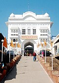
Located on the banks of an old ravine of the Ganges, Hastinapur is considered one of the holiest places for | Located on the banks of an old ravine of the Ganges, Hastinapur is considered one of the holiest places for [[Hinduism|Hindus]] and [[Jainism|Jains]]. It is believed to be the birthplace of three Jain [[Tirthankaras]]. There are many ancient Hindu temples including Pandeshwar Temple and Karna Temple, as well as Jain temples such as [[Digamber Jain Mandir Hastinapur|Shri Digamber]], [[Jain temple|Jain Mandir]], [[Jambudweep]], [[Mount Kailash|Kailash Parvat]], and Shwetambar Jain Temple.<ref>{{Cite web|url=https://www.amarujala.com/photo-gallery/uttar-pradesh/meerut/mahabharata-circuit-the-historical-glory-of-hastinapur-is-much-more-below-the-ground|title=महाभारत सर्किट: जितनी ऊपर, उससे कहीं ज्यादा जमीन के नीचे है हस्तिनापुर की वैभवशाली गौरवगाथा|website=Amar Ujala|language=hi}}</ref><ref>{{Cite web|url=http://uttarpradesh.gov.in/en/details/hastinapur/340030003800|title=Hastinapur | Meerut | UP Tourism|website=uttarpradesh.gov.in|access-date=15 April 2020|archive-date=2 March 2020|archive-url=https://web.archive.org/web/20200302060508/http://uttarpradesh.gov.in/en/details/hastinapur/340030003800|url-status=dead}}</ref>[[File:Vishal-singh-dwaar-big.jpg|thumb|[[Digamber Jain Mandir Hastinapur|Digamber Jain Bada Mandir Hastinapur]]|left]] | ||
===Temples and monuments=== | ===Temples and monuments=== | ||
==== | ====Digamber Jain Bada Mandir Hastinapur==== | ||
{{Main|Digamber Jain Bada Mandir Hastinapur}} | {{Main|Digamber Jain Bada Mandir Hastinapur}} | ||
[[Digamber Jain Mandir Hastinapur | [[Digamber Jain Bada Mandir Hastinapur]] is one of the oldest Jain temples in Hastinapur. The main temple is believed to have been built in 1801 under the aegis of [[Raja Harsukh Rai]], who was the imperial treasurer of Emperor [[Shah Alam II]].<ref>{{Cite web | url=http://mdameerut.in/major-attraction/ | title=Major Attractions | Meerut Development Authority | access-date=7 May 2016 | archive-date=5 October 2019 | archive-url=https://web.archive.org/web/20191005051647/http://mdameerut.in/major-attraction/ | url-status=dead }}</ref><ref>{{Cite web |url=http://www.digambarjainonline.com/pilgri/hastina.htm |title=Digambar Jain temple Shri Hastinapur |access-date=19 April 2016 |archive-url=https://web.archive.org/web/20151018060514/http://www.digambarjainonline.com/pilgri/hastina.htm |archive-date=18 October 2015 |url-status=dead }}</ref><ref>{{cite book |title=A Review of World Antiquarianism: Comparative Perspectives |journal= Bulletin of the History of Archaeology|volume= 24|publisher= Getty Publications |page=431 |isbn=978-1606061480|doi= 10.5334/bha.2418|year= 2014|last1= Evans|first1= Christopher|doi-access= free}}</ref> The temple has many other facilities, including, [[police station]], [[Gurukul|Digamber Jain Gurukul]], and a [[retirement home|Udaseen Ashram]]. Several tourist attractions including Jal Mandir, Jain Library, Acharya Vidyanand Museum, 24 Tonks, and the ancient Nishiyajis are situated few kilometres from the main temple.<ref>{{Cite web|url=http://www.uptourism.gov.in/article/hastinapur|title=Welcome to UP Tourism-Official Website of Department of Tourism, Government of Uttar Pradesh, India | Hastinapur|website=www.uptourism.gov.in|access-date=15 April 2020|archive-date=5 August 2020|archive-url=https://web.archive.org/web/20200805171313/http://uptourism.gov.in/article/hastinapur|url-status=dead}}</ref>[[File:Ashtapad Hastinapur.jpg|thumb|Ashtapad]] | ||
====Shri Shwetambar Jain Ashtapad Teerth==== | ====Shri Shwetambar Jain Ashtapad Teerth==== | ||
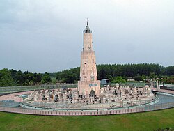
Shri Ashtapad Teerth was built under the aegis of ''Shri Hastinapur Jain Shwetambar Teerth Trust''. It is a {{convert|151|ft|m|adj=mid|-high|order=flip}} structure dedicated to first tirthankara [[Rishabhnath]].<ref>{{cite web|url=http://www.herenow4u.net/index.php?id=70744|title=HereNow4U.net :: Article Archive - The 151-Foot High Ashtapad Teerth in Hastinapur|work=HereNow4u: Portal on Jainism and next level consciousness|access-date=25 August 2015}}{{Dead link|date=August 2025 |bot=InternetArchiveBot |fix-attempted=yes }}</ref> | |||
Shri Ashtapad Teerth was built under the aegis of ''Shri Hastinapur Jain Shwetambar Teerth Trust''. It is a {{convert|151|ft|m|adj=mid|-high|order=flip}} structure dedicated to first tirthankara [[Rishabhnath]].<ref>{{cite web|url=http://www.herenow4u.net/index.php?id=70744|title=HereNow4U.net :: Article Archive - The 151-Foot High Ashtapad Teerth in Hastinapur|work=HereNow4u: Portal on Jainism and next level consciousness|access-date=25 August 2015}}</ref> | |||
====Kailash Parvat Rachna==== | ====Kailash Parvat Rachna==== | ||
Kailash Parvat is a {{convert|131|ft|m|adj=mid|-high|order=flip}} structure, constructed under the aegis of Shri Digamber Jain Mandir, Hastinapur. The Kailash Parvat premises are home to several Jain temples, including Yatri Niwas and Bhojanshala. Kailash Parvat also has an auditorium and a [[helipad]] on the premises.<ref>{{cite web|url=https://www.bhaktibharat.com/mandir/kailash-parvat-rachna|title=Home|work=bhaktibharat.com|access-date=25 August 2015}}</ref><ref>{{cite web|url=http://www.jainheritagecentres.com/jainism-in-india/uttar-pradesh/hastinapur/kailashparvat-mandir|title=WWW.JAINHERITAGECENTRES.COM > Jainism In India > Uttar Pradesh > Hastinapur > Kailash parvat Mandir|work=jainheritagecentres.com|access-date=25 August 2015|date=January 2012}}</ref> | Kailash Parvat is a {{convert|131|ft|m|adj=mid|-high|order=flip}} structure, constructed under the aegis of Shri Digamber Jain Mandir, Hastinapur. The Kailash Parvat premises are home to several Jain temples, including Yatri Niwas and Bhojanshala. Kailash Parvat also has an auditorium and a [[helipad]] on the premises.<ref>{{cite web|url=https://www.bhaktibharat.com/mandir/kailash-parvat-rachna|title=Home|work=bhaktibharat.com|access-date=25 August 2015}}</ref><ref>{{cite web|url=http://www.jainheritagecentres.com/jainism-in-india/uttar-pradesh/hastinapur/kailashparvat-mandir|title=WWW.JAINHERITAGECENTRES.COM > Jainism In India > Uttar Pradesh > Hastinapur > Kailash parvat Mandir|work=jainheritagecentres.com|access-date=25 August 2015|date=January 2012}}</ref>[[File:Jambudweep Rachna.jpg|thumb|[[Jambudweep]]]] | ||
====Jambudweep Jain Tirth==== | ====Jambudweep Jain Tirth==== | ||
{{main|Jambudweep}} | {{main|Jambudweep}} | ||
[[Jambudweep]], depicting a model of [[Jain cosmology]], was designed here under the supervision of Shri [[Gyanmati Mataji]] in 1985.<ref>{{cite web|url=http://www.jambudweep.org|title=Home|work=jambudweep.org|access-date=25 August 2015}}</ref> | [[Jambudweep]], depicting a model of [[Jain cosmology]], was designed here under the supervision of Shri [[Gyanmati Mataji]] in 1985.<ref>{{cite web|url=http://www.jambudweep.org|title=Home|work=jambudweep.org|access-date=25 August 2015}}</ref> | ||
| Line 94: | Line 126: | ||
====Bhai Dharam Singh Gurdwara==== | ====Bhai Dharam Singh Gurdwara==== | ||
This is a small [[Gurdwara]] located in the village of Saifpur, around {{convert|2.5|km|mi|abbr=on}} from Hastinapur.<ref>{{cite web|url=http://www.nativeplanet.com/hastinapur/attractions/bhai-dharam-sing-gurdwara/|title=Bhai Dharam Sing Gurdwara - Hastinapur - Bhai Dharam Sing Gurdwara Photos, Sightseeing - Native Planet|work=nativeplanet.com|access-date=25 August 2015}}</ref><ref>{{Cite web|url=https://upstdc.co.in/|title=Official Website Of Uttar Pradesh State Tourism Development Corporation Ltd|website=upstdc.co.in|access-date=2020-03-16}}</ref> | This is a small [[Gurdwara]] located in the village of Saifpur, around {{convert|2.5|km|mi|abbr=on}} from Hastinapur.<ref>{{cite web|url=http://www.nativeplanet.com/hastinapur/attractions/bhai-dharam-sing-gurdwara/|title=Bhai Dharam Sing Gurdwara - Hastinapur - Bhai Dharam Sing Gurdwara Photos, Sightseeing - Native Planet|work=nativeplanet.com|access-date=25 August 2015}}</ref><ref>{{Cite web|url=https://upstdc.co.in/|title=Official Website Of Uttar Pradesh State Tourism Development Corporation Ltd|website=upstdc.co.in|access-date=2020-03-16}}</ref>[[File:Migratory Birds At Hastinapur.jpg|thumb|200px|Migratory birds at [[Hastinapur Wildlife Sanctuary]]|left]] | ||
===Hastinapur Sanctuary=== | ===Hastinapur Sanctuary=== | ||
[[Hastinapur Sanctuary]], established in 1986, is one of the prominent wildlife projects in India. The sanctuary extends over a wide area, encompassing the districts of [[Meerut]], [[Ghaziabad district, Uttar Pradesh|Ghaziabad]], [[Gautam Budh Nagar]], [[Bijnor]], [[Hapur]], and [[Jyotiba Phule Nagar]] in [[Uttar Pradesh]]. It is a sprawling forest, occupying an area of nearly {{convert|2073|km2}}.<ref>{{cite web|url=http://www.hindu.com/mp/2006/12/09/stories/2006120900330200.htm|archive-url=https://web.archive.org/web/20121103070947/http://www.hindu.com/mp/2006/12/09/stories/2006120900330200.htm|url-status=dead|archive-date=3 November 2012|work=[[The Hindu]]|title=Hastinapur sanctuary|date=2006-12-09|access-date=25 August 2015}}</ref><ref>{{cite web|url=http://www.indiatravelfaq.com/india-sanctuaries/hastinapur-sanctuary.html|title=Hastinapur Sanctuary|work=indiatravelfaq.com|access-date=25 August 2015|archive-date=4 March 2016|archive-url=https://web.archive.org/web/20160304034840/http://www.indiatravelfaq.com/india-sanctuaries/hastinapur-sanctuary.html|url-status=dead}}</ref> | [[Hastinapur Sanctuary]], established in 1986, is one of the prominent wildlife projects in India. The sanctuary extends over a wide area, encompassing the districts of [[Meerut]], [[Ghaziabad district, Uttar Pradesh|Ghaziabad]], [[Gautam Budh Nagar]], [[Bijnor]], [[Hapur]], and [[Jyotiba Phule Nagar]] in [[Uttar Pradesh]]. It is a sprawling forest, occupying an area of nearly {{convert|2073|km2}}.<ref>{{cite web|url=http://www.hindu.com/mp/2006/12/09/stories/2006120900330200.htm|archive-url=https://web.archive.org/web/20121103070947/http://www.hindu.com/mp/2006/12/09/stories/2006120900330200.htm|url-status=dead|archive-date=3 November 2012|work=[[The Hindu]]|title=Hastinapur sanctuary|date=2006-12-09|access-date=25 August 2015}}</ref><ref>{{cite web|url=http://www.indiatravelfaq.com/india-sanctuaries/hastinapur-sanctuary.html|title=Hastinapur Sanctuary|work=indiatravelfaq.com|access-date=25 August 2015|archive-date=4 March 2016|archive-url=https://web.archive.org/web/20160304034840/http://www.indiatravelfaq.com/india-sanctuaries/hastinapur-sanctuary.html|url-status=dead}}</ref> | ||
| Line 118: | Line 148: | ||
==External links== | ==External links== | ||
* | * {{commons category-inline|Hastinapur}} | ||
{{Meerut district}} | {{Meerut district}} | ||
{{Mahabharata}} | {{Mahabharata}} | ||
[[Category: | [[Category:Places in Hindu mythology]] | ||
[[Category:Ancient Indian cities]] | [[Category:Ancient Indian cities]] | ||
[[Category:Jainism in Uttar Pradesh]] | [[Category:Jainism in Uttar Pradesh]] | ||
| Line 132: | Line 162: | ||
[[Category:Tourist attractions in Meerut district]] | [[Category:Tourist attractions in Meerut district]] | ||
[[Category:Bronze Age sites in Asia]] | [[Category:Bronze Age sites in Asia]] | ||
[[Category:Kuru]] | [[Category:Kuru kingdom]] | ||
[[Category:Indo-Aryan archaeological sites]] | |||
[[Category:Former capitals in India]] | |||
[[Category:Capitals of ancient kingdoms in Uttar Pradesh]] | |||
Latest revision as of 06:13, 23 March 2026
Hastinapur | |
|---|---|
City | |
 Kailash Parvat Rachna | |
Hastinapura  Hastinapur Location in Uttar Pradesh, India  Hastinapur Hastinapur (India) | |
| Coordinates: 29°10′N 78°01′E / 29.17°N 78.02°E | |
| Country |  India India |
| State | Uttar Pradesh |
| District | Meerut |
| Elevation | 212 m (696 ft) |
| Population (2011) | |
| • Total | 58,452 |
| Languages | |
| • Official | Hindi and English |
| Time zone | UTC+5:30 (IST) |
| PIN | 250404 |
| Vehicle registration | UP-15 |
Hastinapur (Hastināpur) is a city in the Meerut district in the Indian state of Uttar Pradesh. Hastinapura is described as the capital of the Kuru kingdom in Hindu texts such as the Mahabharata and the Puranas; it is also mentioned in ancient Jain texts. Hastinapur is located on the right bank of the Ganga river.
Etymology[edit | edit source]
In Sanskrit, Hastinapura translates to 'the City of Elephants' from Hastina (elephant) and pura (city). Its history dates back to the period of Mahabharata.[1] It is said that the city was named after King Hasti.[2]
It is also mentioned in the Ramayana, the 13th and 14th verses of which say (translated):
"Having crossed Ganga River at Hastinapura, they proceeded towards the west and, reaching Panchala kingdom through Kuru Jangala and observing well-filled lakes and rivers with clear water, the messengers mentioned above went briskly, due to the pressing nature of their mission."
— Valmiki, Ramayana
History[edit | edit source]
Excavations at Hastinapur were carried out in the early 1950s by B. B. Lal, Director General of the Archaeological Survey of India. Although the main aim of this excavation, according to Lal himself, was to determine the stratigraphic position of Painted Grey Ware concerning other known ceramic industries of the early historical period, Lal found correlations between the text of the Mahabharata and the material remains that he unearthed at Hastinapur. This led him to historicize some of the traditions mentioned in the Mahabharata as well as link the appearance of the Painted Grey Ware with Aryans in the upper Ganges basin areas.[3]
Earliest period: to c. 500 BCE[edit | edit source]
The original excavations in the 1950s suggested that the site of Hastinapur appears to have been abandoned and reoccupied several times;[4]:12 but subsequent excavation in 2021-22 suggested instead that the site had been continually occupied from antiquity until the late medieval period.[5]:101, 105, 110–11
According to Lal's report for the 1950s excavation, the first phase appears to have been before about 1200 BCE. Settlement seems to have been rather sporadic during this period, and no structures from this time have been found. The main find from this layer is some scattered fragments of Ochre Coloured Pottery, A distinct break between the first and second phases indicates that the site had been abandoned for some time before it was reoccupied.[4]:11–12
The report for the 2020s excavation, on the other hand, described a bottom layer from approximately 1500-1000 BCE, with Painted Grey Ware pottery predominating, and structures with mud and mud brick walls.[5]:105
According to Lal, the site of Hastinapura was reoccupied from about 1100 BCE to about 800 BCE. This second layer, Period II, is characterised by Painted Grey Ware pottery,[4]:11–12 which is identified with the Vedic Period.[6] No complete houses have been found from this phase, but some traces of walls were found, and they were made variously of mud, mud bricks, or reeds (Saccharum spontaneum, arranged horizontally and vertically) with mud plaster. The mud plaster was mixed with rice husks for reinforcement; this building technique is still used in modern times. Charred grains of rice have also been found in this layer, indicating that rice cultivation was practiced here during this period — one of the earliest archaeological attestations of rice cultivation in the Indian subcontinent. Copper appears to have been the main metal used during this period. No objects made of iron were found, although some lumps of iron ore and iron slag were found in the uppermost parts of this layer (that is, closer to the end of this period). Cattle bones, belonging to the zebu and the water buffalo, were found "in very large numbers" from this period, indicating that cattle-rearing played a key role in this society. The presence of "definite cut-marks" on cattle, sheep, and pig bones indicates that they were slaughtered for food, indicating that eating beef and pork was not frowned upon during this period.[4]:12–14, 131–4
The 2020s excavation report, on the other hand, reported a continuous occupation throughout this period, with a second phase lasting from about 1000 BCE to about 500 BCE and characterised by Northern Black Polished Ware along with other varieties.[5]:105
Portrayal in the Mahabharata[edit | edit source]
In the Mahabharata, Hastinapur is portrayed as the capital of the Kuru kingdom of the Kauravas. Many incidents in the Mahabharata were set in the city of Hastinapur. According to the Mahabharata, the 100 Kaurava brothers were born in this city to their mother, Queen Gandhari, the wife of King Dhritarashtra. On the bank of the Budhi Ganga, two places near Hastinapur (Draupadi Ghat[7] and Karna Ghat) reference Mahabharata personages.

The first reference to Hastinapur in the Puranas presents the city as the capital of Emperor Bharata's kingdom.

Major flood c. 800 BCE and abandonment?[edit | edit source]
Perhaps around 800 BCE, according to Lal, there seems to have been a major flood in the Ganga, which is suggested by a major "erosional scar" in the mound. The site seems to have been abandoned for a couple centuries. Notably, the Mahabharata mentions that, during the reign of the Kuru king Nichakshu, "a great flood occurred in the Gangā which carried away a considerable portion of Hastināpura", after which the capital was moved to Kaushambi. Because of the similarity to the apparent flood at Hastinapur, Lal suggested that this bit about the flood ravaging Hastinapura and the capital being moved to Kaushambi may have a historical basis.[4]:12–15, 149–51
The 2020s excavation report did not say anything about a flood either way.[5]
c. 500 BCE to c. 600s CE[edit | edit source]
A third phase, according to the 1950s report, was from about the early 6th century BCE until about the early 3rd century BCE. During this phase, houses were made of mud bricks and baked bricks. Northern Black Polished Ware characterises this period, and there is no Painted Grey Ware. A couple of burnt-brick drains, evidently meant for wastewater to flow out through, have also been found in this layer. This is when the first iron objects start to appear, as well as various copper and silver coins. The end of this period appears to have been around the early 3rd century BCE, when there seems to have been a fire that destroyed much of the town, as evidenced by burnt walls and floors and charcoal remains of reed matting that had been used for roofs.[4]:12, 15–17
The 2020s report instead listed a third phase lasting from about the 3rd to 2nd centuries BCE, corresponding roughly to the Maurya period. An inscription on a terracotta sling ball was found from this layer, which based on palaeography appears to be from roughly the 4th or 3rd centuries BCE. This report said nothing about a fire either way.[5]:105
According to Lal's report, after another apparent gap in occupation, the site was reoccupied in the early 2nd century BCE, remaining inhabited until the late 3rd century CE. Baked bricks were the predominant construction material used for houses during this period, for both walls and floors. There also seems to have been a fairly regular city planning along a grid during this phase. Among the sculptural highlights from this period is a terracotta figurine of Maitreya, the prophesied future Buddha, seated in the abhayamudrā pose with a kamaṇḍalu in his left hand. This sculpture, which was discovered among the upper (i.e. later) part of this layer, bears stylistic similarities to sculptures from Mathura as well as Ahichchhatra, and may have been influenced by those art styles. A rotary quern found in the middle part of this layer is significant because it represents a technological innovation that was more efficient than the saddle quern that predominated in earlier protohistoric sites in the Indian subcontinent. Epigraphic and numismatic evidence from this layer helps determine its date. This includes two inscribed pots, identifying them as the property of individuals named Sadhujāta and Jayaśama respectively; a terracotta seal; and various coins, including some from the rulers of Mathura dated to the 2nd century BCE, some from the Yaudheyas right around the BCE/CE cutoff, and some "imitating those of" the Kushan king Vāsudeva I around the mid-3rd century CE.[4]:12, 18–19
The 2020s report by Garnayak listed a fourth phase from approximately the 2nd century BCE to the 2nd century CE, roughly corresponding to the Shunga and Kushan periods. Among the findings from this phase were several terracotta seals, with one dated palaeographically to the 1st or 2nd century BCE and others dated to the Kushan period. Coins of the Indo-Greek king Menander I were also found from this period.[5]:105
The original 1950s excavations suggested that, after about the 3rd century CE, the site appears to have been abandoned for a long time before being reoccupied in about the late 11th century CE.[4]:12, 19 However, the more recent investigations indicate that Hastinapur was definitely occupied during this period; in particular, a terracotta seal of the Gupta king Vishnugupta, along with various Gupta coins, provide evidence of occupation during the Gupta period. The 2020s report suggested a fifth phase corresponding with the Gupta and Later Gupta periods, spanning roughly the 3rd through 7th centuries.[5]:105, 110
The period from roughly the Shunga to Gupta dynasties (c. 2nd century BCE to c. 6th century CE) appears to have been Hastinapur's heyday. Archaeological finds of ceramic roof tiles and textile-making tools peak during this period, for example, and the various coins and seals found here indicate that Hastinapur was a significant administrative and commercial centre that was connected to major trade routes (such as, perhaps, the Uttarapatha that traversed northern India).[5]:101, 107–8, 110–11
Medieval period[edit | edit source]
The 2020s excavation also reported a sixth layer, from roughly the 8th through 11th centuries. Structures from this period appear to be similar to those of the Gupta period.[5]:105–6, 110
The 2020s report by Garnayak indicated a seventh and final phase lasting from roughly the 1100s to the 1500s, with structures reusing bricks from earlier periods. After this period, the site was abandoned, or perhaps simply shifted away from the area that was excavated. This may have been due to a flood or a shift in the Ganga's course.[5]:106, 111
The pottery of Lal's Period V is completely different from Period IV, and the structures appear to have extensively reused bricks from Period III and IV structures as spolia. A single coin from the reign of Balban (r. 1266–1287) helps fix the date of this layer. A sandstone sculpture of Rishabhadeva, the first Jain tīrthankara, seated in the dhyānamudrā pose and perhaps dating from the 14th century, is significant as providing evidence of Hastinapur's earlier importance to Jains, since it is an important Jain pilgrimage destination today.:12, 20–21
Mughal period[edit | edit source]
Hastinapur is listed in the Ain-i-Akbari as a pargana under Delhi sarkar, producing a revenue of 4,466,904 dams for the imperial treasury and supplying a force of 300 infantry and 10 cavalry. The author Abu'l-Fazl ibn Mubarak describes it "an ancient Hindu settlement" lying on the Ganges.[8]
British Raj[edit | edit source]
In British India, Hastinapur was ruled by Raja Nain Singh Nagar, who built many Hindu temples in and around Hastinapura.[9]
Geography and climate[edit | edit source]
Present-day Hastinapur is a town in the Doab region of Uttar Pradesh in India, about 37 kilometres (23 mi) from Meerut and nearly 96 km (60 mi) north-east of Delhi on National Highway 34.[10] It is a small township re-established by Jawaharlal Nehru on February 6, 1949, located at 29°10′N 78°01′E / 29.17°N 78.02°E.[11] With an average elevation of 218 metres (715 ft), Hastinapur experiences temperatures ranging from 5 to 40 °C (41 to 104 °F). Summer season is from March to May, during which the temperatures range from 32 to 40 °C (90 to 104 °F). The monsoon season is from July to September, during which the temperature is relatively low. Winter lasts from December to February, with December usually being the coldest month of the year. During this time, temperatures can drop to around 5 °C (41 °F) and don't usually go above 14 °C (57 °F).[12]
Demographics[edit | edit source]
According to the 2011 Census of India, Hastinapur Nagar Panchayat had a population of 26,452, of which 14,010 are males while 12,442 are females. The literacy rate of the town was 74.5% slightly higher than the national average of 74%. Around 14% of the population was under 6 years of age.[13][14]
Places of interest[edit | edit source]
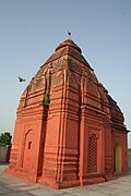
Located on the banks of an old ravine of the Ganges, Hastinapur is considered one of the holiest places for Hindus and Jains. It is believed to be the birthplace of three Jain Tirthankaras. There are many ancient Hindu temples including Pandeshwar Temple and Karna Temple, as well as Jain temples such as Shri Digamber, Jain Mandir, Jambudweep, Kailash Parvat, and Shwetambar Jain Temple.[15][16]

Temples and monuments[edit | edit source]
Digamber Jain Bada Mandir Hastinapur[edit | edit source]
Digamber Jain Bada Mandir Hastinapur is one of the oldest Jain temples in Hastinapur. The main temple is believed to have been built in 1801 under the aegis of Raja Harsukh Rai, who was the imperial treasurer of Emperor Shah Alam II.[17][18][19] The temple has many other facilities, including, police station, Digamber Jain Gurukul, and a Udaseen Ashram. Several tourist attractions including Jal Mandir, Jain Library, Acharya Vidyanand Museum, 24 Tonks, and the ancient Nishiyajis are situated few kilometres from the main temple.[20]

Shri Shwetambar Jain Ashtapad Teerth[edit | edit source]
Shri Ashtapad Teerth was built under the aegis of Shri Hastinapur Jain Shwetambar Teerth Trust. It is a 46-metre-high (151 ft) structure dedicated to first tirthankara Rishabhnath.[21]
Kailash Parvat Rachna[edit | edit source]
Kailash Parvat is a 40-metre-high (131 ft) structure, constructed under the aegis of Shri Digamber Jain Mandir, Hastinapur. The Kailash Parvat premises are home to several Jain temples, including Yatri Niwas and Bhojanshala. Kailash Parvat also has an auditorium and a helipad on the premises.[22][23]

Jambudweep Jain Tirth[edit | edit source]
Jambudweep, depicting a model of Jain cosmology, was designed here under the supervision of Shri Gyanmati Mataji in 1985.[24]
Pandeshwar Temple[edit | edit source]
Situated in the historic location of the ancient city of Hastinapur, the Pandeshwar temple is dedicated to Shiva. This temple is believed to be the place where Kauravas and Pandavas received their education in Vedas and Puranas.[citation needed] A temple of the Hindu goddess Kali and many Hindu ashramas are also present on a hillock between the ruins. Legend has it that in the Mahabharata period, Pandu's eldest son Yudhishthira had established the shivalinga at the Pandeshwar Mahadev temple before the war of Mahabharata and prayed to Shiva for a blessing of winning the war.[25]
Karna Temple[edit | edit source]

The Karna Temple is located near the Pandeshwar temple on an old ravine along the bank of the Ganges. The Shivling inside the Karna Temple is believed to be established by Karna, one of the prominent figures in the Mahabharata.[26]
Bhai Dharam Singh Gurdwara[edit | edit source]
This is a small Gurdwara located in the village of Saifpur, around 2.5 km (1.6 mi) from Hastinapur.[27][28]

Hastinapur Sanctuary[edit | edit source]
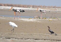
Hastinapur Sanctuary, established in 1986, is one of the prominent wildlife projects in India. The sanctuary extends over a wide area, encompassing the districts of Meerut, Ghaziabad, Gautam Budh Nagar, Bijnor, Hapur, and Jyotiba Phule Nagar in Uttar Pradesh. It is a sprawling forest, occupying an area of nearly 2,073 square kilometres (800 sq mi).[29][30]
Festivals and fairs[edit | edit source]
Various cultural events and religious celebrations are held in Hastinapur annually, including Akshaya Tritiya, Das Lakshana, Kartik Mela, Holi Mela, and Durga Puja. These festivals, among others, are organized by non-government organizations (NGOs) and the State Tourism Department.
See also[edit | edit source]
- Indraprastha
- Mahabharata
- Digamber Jain Bada Mandir Hastinapur
- Jambudweep
- Historicity of the Mahabharata
References[edit | edit source]
- ↑ "Uttar Pradesh - History". Encyclopedia Britannica. Retrieved 16 December 2019.
- ↑ J.P. Mittal (2006). History Of Ancient India (a New Version) : From 7300 Bb To 4250 Bc. Vol. 1. New Delhi: Atlantic Publishers & Distributors. p. 308. ISBN 978-81-269-0615-4. Retrieved 21 March 2018.
- ↑ "Excavation Sites in Uttar Pradesh - Archaeological Survey of India". asi.nic.in. Retrieved 25 August 2015.
- ↑ 4.0 4.1 4.2 4.3 4.4 4.5 4.6 4.7 Lal, B. B. (1954–55). "Excavations at Hastināpura and Other Explorations in the Upper Gangā and Sutlej Basins 1950-52: New Light on the Dark Age Between the End of the Harappā Culture and the Early Historical Period" (PDF). Bulletin of the Archaeological Survey of India. 10–11: 5–151. Retrieved 21 March 2026.
{{cite journal}}: CS1 maint: date format (link) - ↑ 5.00 5.01 5.02 5.03 5.04 5.05 5.06 5.07 5.08 5.09 Garnayak, Dibishada Brajasundar (2022). "Excavation at Ulta-Kheda, Hastinapur: 2021". Puratattva. 52: 100–111. Retrieved 22 March 2026.
- ↑ Singh, Upinder (2008). A History of Ancient and Early Medieval India From the Stone Age to the 12th Century. Pearson Education India. ISBN 9788131711200.
- ↑ "Excavation Sites in Uttar Pradesh - Archaeological Survey of India". asi.nic.in.
- ↑ The Ain-i-Akbari, Calcutta: Asiatic Society of Bengal, 1891, p. 288, retrieved 21 January 2021
- ↑ Habib, Irfan (1997). "Unreason and Archaeology: The 'Painted Grey-Ware' and Beyond". Social Scientist. 25 (1/2): 16–24. doi:10.2307/3517758. JSTOR 3517758.
- ↑ "Distance Hastināpur, Uttar-Pradesh, IND > New-Seema-Puri, New-Delhi, North-East, Delhi, IND - Air line, driving route, midpoint". www.distance.to.
- ↑ "Maps, Weather, and Airports for Hastinapur, India". fallingrain.com. Retrieved 25 August 2015.
- ↑ "Hastinapur Weather Forecast". WorldWeatherOnline.com.
- ↑ "Hastinapur Nagar Panchayat City Population Census 2011-2023 | Uttar Pradesh". www.census2011.co.in. Retrieved 1 April 2023.
- ↑ "Hastinapur (Meerut, Uttar Pradesh, India) - Population Statistics, Charts, Map, Location, Weather and Web Information". www.citypopulation.de. Retrieved 1 April 2023.
- ↑ "महाभारत सर्किट: जितनी ऊपर, उससे कहीं ज्यादा जमीन के नीचे है हस्तिनापुर की वैभवशाली गौरवगाथा". Amar Ujala (in हिन्दी).
- ↑ "Hastinapur | Meerut | UP Tourism". uttarpradesh.gov.in. Archived from the original on 2 March 2020. Retrieved 15 April 2020.
- ↑ "Major Attractions | Meerut Development Authority". Archived from the original on 5 October 2019. Retrieved 7 May 2016.
- ↑ "Digambar Jain temple Shri Hastinapur". Archived from the original on 18 October 2015. Retrieved 19 April 2016.
- ↑ Evans, Christopher (2014). A Review of World Antiquarianism: Comparative Perspectives. Vol. 24. Getty Publications. p. 431. doi:10.5334/bha.2418. ISBN 978-1606061480.
{{cite book}}:|journal=ignored (help) - ↑ "Welcome to UP Tourism-Official Website of Department of Tourism, Government of Uttar Pradesh, India | Hastinapur". www.uptourism.gov.in. Archived from the original on 5 August 2020. Retrieved 15 April 2020.
- ↑ "HereNow4U.net :: Article Archive - The 151-Foot High Ashtapad Teerth in Hastinapur". HereNow4u: Portal on Jainism and next level consciousness. Retrieved 25 August 2015.[permanent dead link]
- ↑ "Home". bhaktibharat.com. Retrieved 25 August 2015.
- ↑ "WWW.JAINHERITAGECENTRES.COM > Jainism In India > Uttar Pradesh > Hastinapur > Kailash parvat Mandir". jainheritagecentres.com. January 2012. Retrieved 25 August 2015.
- ↑ "Home". jambudweep.org. Retrieved 25 August 2015.
- ↑ "Yudhishthira had established the shivalinga". timesofindia.
- ↑ "Work on Mahabharat Circuit to start soon". The Hindu. 25 January 2006. Archived from the original on 23 March 2006. Retrieved 25 August 2015.
- ↑ "Bhai Dharam Sing Gurdwara - Hastinapur - Bhai Dharam Sing Gurdwara Photos, Sightseeing - Native Planet". nativeplanet.com. Retrieved 25 August 2015.
- ↑ "Official Website Of Uttar Pradesh State Tourism Development Corporation Ltd". upstdc.co.in. Retrieved 16 March 2020.
- ↑ "Hastinapur sanctuary". The Hindu. 9 December 2006. Archived from the original on 3 November 2012. Retrieved 25 August 2015.
- ↑ "Hastinapur Sanctuary". indiatravelfaq.com. Archived from the original on 4 March 2016. Retrieved 25 August 2015.
Further reading[edit | edit source]
- B.B. Lal (1952). New Light on the "dark Age" of Indian History: Recent Excavations at the Hastinapura Site, Near Delhi. Illustrated London news.
- Braj Basi Lal (1955). Excavations at Hastinapura and Other Explorations [in the Upper Gangā and Sutlej Basins], 1950-52.
External links[edit | edit source]


- Pages using the JsonConfig extension
- Places in Hindu mythology
- Ancient Indian cities
- Jainism in Uttar Pradesh
- Places in the Mahabharata
- Meerut district
- Cities and towns in Meerut district
- Jain pilgrimage sites
- Tourist attractions in Meerut district
- Bronze Age sites in Asia
- Kuru kingdom
- Indo-Aryan archaeological sites
- Former capitals in India
- Capitals of ancient kingdoms in Uttar Pradesh