

Ajay Kumar (talk | contribs) Created a new article |
refined lead after review for accuracy |
||
| Line 1: | Line 1: | ||
{{ | {{Short description|River in India and Bangladesh}} | ||
{{Use dmy dates|date=January 2019}} | {{Use dmy dates|date=January 2019}} | ||
{{Infobox river | {{Infobox river | ||
| Line 11: | Line 11: | ||
| map_size = | | map_size = | ||
| map_caption = Path of the Teesta | | map_caption = Path of the Teesta | ||
| | | mapframe = yes | ||
| | | mapframe-frame-height = 300 | ||
<!---------------------- LOCATION --> | <!---------------------- LOCATION --> | ||
| subdivision_type1 = Country | | subdivision_type1 = Country | ||
| Line 77: | Line 76: | ||
| source1_coordinates= | | source1_coordinates= | ||
| source1_elevation = {{cvt|7128|m}}<ref name=Mullick_al2011/> | | source1_elevation = {{cvt|7128|m}}<ref name=Mullick_al2011/> | ||
| mouth = [[ | | mouth = [[Jamuna River]] | ||
| mouth_location = [[Phulchhari Upazila]], [[Gaibandha]], Bangladesh | | mouth_location = [[Phulchhari Upazila]], [[Gaibandha]], Bangladesh | ||
| mouth_coordinates = | | mouth_coordinates = {{coord|25|30|20|N|89|39|57|E|type:river_region:BD|display=inline,title}} | ||
| mouth_elevation = | | mouth_elevation = | ||
| progression = | | progression = | ||
| Line 97: | Line 96: | ||
| custom_label = | | custom_label = | ||
| custom_data = | | custom_data = | ||
}} | |name_other=তিস্তা(Tistā)}} | ||
'''Teesta River''' is a {{cvt|414|km}} long river that rises in the [[Pauhunri|Pauhunri Mountain]] of eastern [[Himalayas]], flows through the [[Indian states]] of [[Sikkim]] and [[West Bengal]] and subsequently enters [[Bangladesh]] through [[Rangpur Division|Rangpur]] division. In Bangladesh, it | '''Teesta River''' ({{Langx|bn|তিস্তা|Tistā}}) ([[Limbu language|Limbu]]: {{Lang|lif| ᤋᤡᤘᤠ᤺}}, '''Teewaa'''; in Classical Limbu) is a {{cvt|414|km}} long river that rises in the [[Pauhunri|Pauhunri Mountain]] of eastern [[Himalayas]], flows through the [[Indian states]] of [[Sikkim]] and [[West Bengal]] and subsequently enters [[Bangladesh]] through [[Rangpur Division|Rangpur]] division. In Bangladesh, it merges with [[Jamuna River]] which after meeting some other major rivers of the [[Bengal delta]] finally falls into the [[Bay of Bengal]].<ref name=Mullick_al2011>{{cite journal |last1=Mullick |first1=M. R. A. |last2=Babel |first2=M. S. |last3=Perret |first3=S. R. |name-list-style=amp |year=2011 |title=Discharge-based economic valuation of irrigation water: Evidence from the Teesta River, Bangladesh |pages=481−492 |journal=Irrigation and Drainage |volume=60 |issue=4 |doi=10.1002/ird.597 |bibcode=2011IrrDr..60..481M }}</ref> It drains an area of {{cvt|12540|km2}}.<ref name=Rahaman_WP2020>{{cite journal |last1=Rahaman |first1=M. M. |last2=Mamun |first2=A. A. |name-list-style=amp |year=2020 |title=Hydropower development along Teesta river basin: opportunities for cooperation |pages=641–657 |journal=Water Policy |volume=22 |issue=4 |doi=10.2166/wp.2020.136 |doi-access=free |bibcode=2020WaPol..22..641R }}</ref> In [[India]], the Teesta River flows through [[North Sikkim district|Mangan District]], [[East Sikkim district|Gangtok District]], [[Pakyong District]], [[Kalimpong district]], [[Darjeeling District]], [[Jalpaiguri District]], and [[Cooch Behar District]] as well as the cities of [[Rangpo]], [[Jalpaiguri]], and [[Mekhliganj]]. In Bangladesh, it flows through [[Lalmonirhat District]], [[Rangpur District]], [[Kurigram District]] and [[Gaibandha District]]. It joins the [[Jamuna River]] at [[Phulchhari Upazila]] in Bangladesh. {{cvt|305|km}} of the river lies in India and {{cvt|109|km}} in Bangladesh. The Teesta is the largest river of Sikkim and second largest river of West Bengal after the [[Ganges]]. | ||
== Course == | == Course == | ||
[[File:Teesta river near Gangtok.jpg|thumb|alt=Teesta | [[File:Teesta river near Gangtok.jpg|thumb|alt=Teesta River near Gangtok|Teesta River near [[Gangtok]]]] | ||
[[File:Teestavalley.jpg|thumb|[[National Highway 10 (India)|National Highway 10]] winds along the banks of the Teesta River near [[Kalimpong]] | [[File:Teestavalley.jpg|thumb|[[National Highway 10 (India)|National Highway 10]] winds along the banks of the Teesta River near [[Kalimpong]]]] | ||
The Teesta River originates from [[Teesta Khangtse Glacier]], west of [[Pauhunri|Pahunri]] (or Teesta Kangse) glacier above {{Cvt|5400|m}}, and flows southward through gorges and rapids in the [[Sikkim]] Himalaya.<ref name=Meetei2007>{{cite journal |last1=Meetei |first1=L. I. |last2=Pattanayak |first2=S. K. |last3=Bhaskar |first3=A. |last4=Pandit |first4=M. K. |last5=Tandon |first5=S. K. |year=2007 |title=Climatic imprints in Quaternary valley fill deposits of the middle Teesta valley, Sikkim Himalaya |journal=Quaternary International |volume=159 |issue=1 |pages=32–46 |doi=10.1016/j.quaint.2006.08.018 |bibcode=2007QuInt.159...32M}}</ref> | The Teesta River originates from [[Teesta Khangtse Glacier]], west of [[Pauhunri|Pahunri]] (or Teesta Kangse) glacier above {{Cvt|5400|m}}, and flows southward through gorges and rapids in the [[Sikkim]] Himalaya.<ref name=Meetei2007>{{cite journal |last1=Meetei |first1=L. I. |last2=Pattanayak |first2=S. K. |last3=Bhaskar |first3=A. |last4=Pandit |first4=M. K. |last5=Tandon |first5=S. K. |year=2007 |title=Climatic imprints in Quaternary valley fill deposits of the middle Teesta valley, Sikkim Himalaya |journal=Quaternary International |volume=159 |issue=1 |pages=32–46 |doi=10.1016/j.quaint.2006.08.018 |bibcode=2007QuInt.159...32M |url=http://scholarbank.nus.edu.sg/handle/10635/114732 }}</ref> | ||
It is fed by streams from [[Tso Lhamo Lake]], [[Gurudongmar Lake]] and [[rivulet]]s arising in the [[Thangu Valley]], [[Yumthang Valley of Flowers]], [[Dikchu]] and Donkha mountain ranges. The river then flows past the towns of [[Chungthang]], [[Singhik]], [[Mangan, India|Mangan]], [[Dikchu]] | It is fed by streams from [[Tso Lhamo Lake]], [[Gurudongmar Lake]] and [[rivulet]]s arising in the [[Thangu Valley]], [[Yumthang Valley of Flowers]], [[Dikchu]] and Donkha mountain ranges. The river then flows past the towns of [[Chungthang]], [[Singhik]], [[Mangan, India|Mangan]], [[Dikchu]] and [[Makha, Sikkim|Makha]], where some major tributaries like Kanaka river join it, and reaches [[Singtam]], where it is spanned by the scenic Indreni Bridge. Also in Singtam, a large tributary of the Teesta called [[Ranikhola]] joins and then descends towards Bardang, [[Majitar]], Mining where it is spanned by Rangpo - Mining Teesta Bridge and reaches the city of [[Rangpo]] where [[Rangpo River]], the second largest tributary of the Teesta joins. From here river Teesta forms the border between Sikkim and [[West Bengal]] up to [[Teesta Bazaar]] via [[Melli]]. Just before the Teesta Bridge, where the roads from [[Kalimpong]] and [[Darjeeling]] join, the river is met by its largest [[tributary]], the [[Rangeet River]].<ref name=Chaudhuri2015>{{cite book |last1=Chaudhuri |first1=Samita |last2=Chaudhuri |first2=Utpal |year=2015 |title=And the Teesta Flows... |page=188 |publisher=Niyogi Books |isbn=978-93-83098-70-5}}</ref> | ||
After this point, Teesta | After this point, Teesta River changes its course southwards flowing into West Bengal and some more tributaries like [[Relli River]], Riyang River, Geil Khola etc joins. Than the river hits the plains at [[Sevoke]], {{cvt|22|km}} northeast of [[Siliguri]], where it is spanned by the [[Coronation Bridge]] and [[Sevoke Railway Bridge]] linking the northeast states to the rest of [[India]]. After crossing Sevoke, the river is fed by some small tributaries like Chel Khola, Neora Khola, Leesh Khola etc, and then reaches [[Gajoldoba]] where there is Teesta Barrage. The river then flows through [[Jalpaiguri]], where Jalpaiguri Teesta Bridge links Northeastern States. The river flows further down through [[Mekhliganj]] and [[Haldibari, India|Haldibari]] in [[Cooch Behar district]], where it is spanned by [[Joyee Setu]], the longest roadway bridge of West Bengal with length 3.8 kilometres. | ||
Here the | Here the Teesta completes its journey in India and enters [[Bangladesh]] in [[Dahagram]], [[Rangpur Division]]. The river descends towards Barakhata, where there is Teesta Barrage of Bangladesh. Further it reaches [[Rangpur District|Rangpur]] and [[Lalmonirhat]] town in [[Lalmonirhat District]] and [[Nilphamari District]]. After crossing Tepamadhupur Bazaar, Nagrakura Bazaar, Sundarganj and Bozra Bazaar, river Teesta joins [[Brahmaputra]] River at Haripur Port near [[Gaibandha]], [[Phulchhari Upazila]] in [[Kurigram District]] of Bangladesh.<ref name="Joshi2004">{{cite book |last=Joshi |first=H. G. |year=2004 |title=Sikkim: Past and Present |page=1 |publisher=Mittal Publications |isbn=978-81-7099-932-4 |url=https://books.google.com/books?id=L7gIVNzkN2YC&pg=PA1 |access-date=2009-09-08}}</ref> | ||
[[File:Gajoldoba Barrage on Teesta river in Gajoldoba 13.jpg|thumb|Gajoldoba Barrage on Teesta | [[File:Gajoldoba Barrage on Teesta river in Gajoldoba 13.jpg|thumb|Gajoldoba Barrage on Teesta River]] | ||
== Geography == | == Geography == | ||
{{More citations needed section|date=November 2022}} | {{More citations needed section|date=November 2022}} | ||
Through its course, the Teesta | Through its course, the Teesta River has carved out [[ravine]]s and [[gorge]]s in Sikkim meandering through the hills with the [[hill station]] of Kalimpong lying just off the river and the city of Siliguri at the foothills of Himalaya. Variegated vegetation can be seen along this route. At lower elevations, [[tropical]] [[deciduous]] trees and shrubs cover the surrounding hills; [[alpine climate|alpine vegetation]] is seen at the upper altitudes. The river is flanked by white sand which is used by the construction industry in the region. Large boulders in and around the waters make it ideal for [[rafting]]. | ||
During the [[monsoon]], Teesta River distends its banks, both in size and turbulence. [[Landslide]]s in this region often dam up parts of the river in this season. It has also caused severe flooding, multiple times during monsoon in Bangladesh.<ref>{{Cite news |author1=Hossain, E. |author2=Manik, R. K. |date=2021 |title=Fresh flood feared in Bangladesh as India opens Gajoldoba again |url=https://www.newagebd.net/article/148582/fresh-flood-feared-in-bangladesh-as-india-opens-gajoldoba-again |access-date=2 November 2021 |work=[[New Age (Bangladesh)]] |publication-place=[[Lalmonirhat]]}}</ref><ref>{{Cite news |author=Badal, L. A. |date=2021 |title=Nearly 2,000 families stranded as flood hits 15 Rangpur villages |url=https://www.dhakatribune.com/bangladesh/nation/2021/08/28/nearly-2-000-families-stranded-as-flood-hits-15-rangpur-villages |access-date=2 November 2021 |work=[[Dhaka Tribune]]}}</ref> | |||
During the [[monsoon]], Teesta | |||
== Changes in course of rivers == | == Changes in course of rivers == | ||
[[File:1776 Rennell - Dury Wall Map of Bihar and Bengal, India - Geographicus - BaharBengal-dury-1776.jpg|thumb|James Rennell's 1776 map shows an earlier flow of the Teesta meeting the [[Ganges]] in three channels before a devastating flood in 1787 changed its course]] | [[File:1776 Rennell - Dury Wall Map of Bihar and Bengal, India - Geographicus - BaharBengal-dury-1776.jpg|thumb|James Rennell's 1776 map shows an earlier flow of the Teesta meeting the [[Ganges]] in three channels before a devastating flood in 1787 changed its course.]] | ||
In the past, the Teesta flowed south from Jalpaiguri in three channels: the [[Punarbhaba River|Punarbhaba]], [[Atrai River|Atrai]] and [[Karatoya River]]s. The Teesta changed course as a result of the flooding of 1787, turning southeast to become part of the [[Brahmaputra River|Brahmaputra]].<ref name="Majumdar1971">{{cite book |last=Majumdar |first=R. C. |author-link=R. C. Majumdar |year=1971 |title=History of Ancient Bengal |location=Calcutta |publisher=G. Bhardwaj & Co. |pages=4–5 |oclc=961157849}}</ref> | In the past, the Teesta flowed south from Jalpaiguri in three channels: the [[Punarbhaba River|Punarbhaba]], [[Atrai River|Atrai]] and [[Karatoya River]]s. The Teesta changed course as a result of the flooding of 1787, turning southeast to become part of the [[Brahmaputra River|Brahmaputra]].<ref name="Majumdar1971">{{cite book |last=Majumdar |first=R. C. |author-link=R. C. Majumdar |year=1971 |title=History of Ancient Bengal |location=[[Calcutta]] |publisher=G. Bhardwaj & Co. |pages=4–5 |oclc=961157849}}</ref> | ||
== Hydroelectric projects and barrages == | == Hydroelectric projects and barrages == | ||
{{Multiple image |perrow=1 |image1=Hydel project on Dikchu, a tributary of Teesta AJTJ DSCN7049.jpg |caption1=Hydel project on the Dikchu, a tributary of Teesta |image2=Tista Barrage Bangladesh (2).jpg |caption2=The Teesta Barrage is a major irrigation project in Bangladesh, in [[Lalmonirhat District]]. Construction started 1979 and was completed in 1997–98.<ref name="Banglapedia">{{ | {{Multiple image |perrow=1 |image1=Hydel project on Dikchu, a tributary of Teesta AJTJ DSCN7049.jpg |caption1=Hydel project on the Dikchu, a tributary of Teesta |image2=Tista Barrage Bangladesh (2).jpg |caption2=The Teesta Barrage is a major irrigation project in Bangladesh, in [[Lalmonirhat District]]. Construction started 1979 and was completed in 1997–98.<ref name="Banglapedia">{{Cite Banglapedia|article=Barrage}}</ref>}} | ||
India has an estimated total hydroelectric power potential of 84 GW at 60% load factor. Of this, Sikkim's potential share is 2.9%, or about 4.29 GW.<ref name="moef.gov.in">{{cite web |url=http://www.moef.gov.in/sites/default/files/EIA%20Ting%20Ting.pdf |title=Environmental Impact Assessment of Ting Ting H.E. Project, Sikkim |website=Ministry of Environment, Forest, and Climate Change |archive-url=https://web.archive.org/web/20141020035343/http://www.moef.gov.in/sites/default/files/EIA%20Ting%20Ting.pdf |archive-date=2014 | India has an estimated total hydroelectric power potential of 84 GW at 60% load factor. Of this, Sikkim's potential share is 2.9%, or about 4.29 GW.<ref name="moef.gov.in">{{cite web |url=http://www.moef.gov.in/sites/default/files/EIA%20Ting%20Ting.pdf |title=Environmental Impact Assessment of Ting Ting H.E. Project, Sikkim |website=Ministry of Environment, Forest, and Climate Change |archive-url=https://web.archive.org/web/20141020035343/http://www.moef.gov.in/sites/default/files/EIA%20Ting%20Ting.pdf |archive-date=20 October 2014}}</ref> | ||
The successfully completed major projects and dams of Teesta River System are as follows: | The successfully completed major projects and dams of Teesta River System are as follows: | ||
*'''Teesta -V Dam''' : Output - | *'''Teesta -V Dam''': Output - 510 MW, Dam Location - [[Dikchu]], [[Gangtok district]], [[Sikkim]]. Powerhouse Location - Balutar, [[Singtam]], Gangtok district, Sikkim. Constructed by - [[NHPC Limited]]<ref>{{cite web |title=Teesta-V D01535 |url=http://india-wris.nrsc.gov.in/wrpinfo/index.php?title=Teesta-V_D01535 |url-status=dead |archive-url=https://web.archive.org/web/20141018132621/http://india-wris.nrsc.gov.in/wrpinfo/index.php?title=Teesta-V_D01535 |archive-date=18 October 2014 |access-date=15 June 2014 |website=India Water Resources Information System. National Remote Sensing Centre. Government of India}}</ref> | ||
*'''Teesta III Dam''' : Output - 1200 MW Dam Location - [[Chungthang]], [[Mangan district]], | *'''Teesta III Dam''': Output - 1200 MW Dam Location - [[Chungthang]], [[Mangan district]], Sikkim. Powerhouse Location - [[Singhik]], Mangan district, Sikkim. Constructed by - Teesta Urja Limited.<ref>{{Cite web|title=Teesta Dam Chungthang Mangan district Sikkim. |url=http://teestaurja.com/about-project/|website=}}</ref> On 4 October 2023, heavy rains caused a [[glacial lake outburst flood]].<ref name="reu4Oct2023">{{Cite news |last1=Choudhury |first1=Subrata Nag |last2=Hussain |first2=Zarir |date=4 October 2023 |title=Floods in India's Sikkim state leave 10 dead, 82 missing |language=en |work=Reuters |url=https://www.reuters.com/world/india/nearly-two-dozen-indian-troops-missing-after-flash-flood-ani-2023-10-04/ |access-date=4 October 2023 |archive-date=4 October 2023 |archive-url=https://web.archive.org/web/20231004201658/https://www.reuters.com/world/india/nearly-two-dozen-indian-troops-missing-after-flash-flood-ani-2023-10-04/ |url-status=live }}</ref> The flood reached the Teesta III Dam at midnight, before its gates could be opened, destroying the dam in minutes.<ref name=":1">{{Cite web |date=4 October 2023 |title=Sikkim dam washed away in 10 minutes after flash flood: Official |url=https://www.hindustantimes.com/cities/others/sikkims-biggest-hydro-project-suffers-massive-damage-in-flash-flood-101696420752235.html |access-date=4 October 2023 |website=Hindustan Times |language=en |archive-date=4 October 2023 |archive-url=https://web.archive.org/web/20231004161014/https://www.hindustantimes.com/cities/others/sikkims-biggest-hydro-project-suffers-massive-damage-in-flash-flood-101696420752235.html |url-status=live }}</ref> | ||
*'''[[Teesta Low Dam - III Hydropower Plant|Teesta Low Dam III]]''': Output - 132 MW, Dam & Powerhouse location - [[Rambi Bazar]], [[Kalimpong district]], [[West Bengal]] Constructed by - [[NHPC Limited]].<ref>{{Cite web|title=Teesta Low Dam III|url=http://nhpc.co.in/Default.aspx?id=186&lg=eng&CatId=1&ProjectId=31#:~:text=Teesta%20Low%20Dam%20III%20Power,Layout%20Plan|website=}}</ref> | |||
*'''[[Teesta Low Dam - IV Hydropower Plant|Teesta Low Dam IV]]''': Output- 160 MW, Dam & Powerhouse Location - [[Kalijhora]], [[Kalimpong district]], West Bengal Constructed by - NHPC Limited.<ref>{{Cite web|title=Teesta Low Dam IV|url=http://www.nhpcindia.com/projectdetail.htm?CatId=1&ProjectId=33|website=}}</ref> | |||
*'''Teesta | *'''Teesta Barrage''' - Location - [[Gajoldoba]], [[Jalpaiguri district]], West Bengal<ref>{{Cite web|title=Gajoldoba Teesta Barrage a bird watching destination|url=https://northbengaltourism.com/gajoldoba/|website=}}</ref> | ||
*'''Barakhata Teesta Barrage''' - Location: Goddimari, Barakhata, [[Nilphamari District]], [[Bangladesh]].<ref>{{Cite Banglapedia|article=Teesta Barrage}}</ref> | |||
*'''Teesta | *'''Teesta VI Dam''': Output: 500 MW, Dam Location: Sirwani, [[Singtam]], [[Gangtok district]], Sikkim. Powerhouse Location: Pamphok, [[Namchi district]], Sikkim. Constructed by - [[NHPC Limited]]& Lanco Infratech Limited.<ref>{{Cite web|title=Teesta VI Dam Singtam Sirwani|url=http://www.nhpcindia.com/Default.aspx?id=186&lg=eng&CatId=2&ProjectId=70|website=}}</ref> | ||
*'''Rangit III Dam''': On Greater [[Rangeet River]] which is a tributary of Teesta River. Output: 60 MW, Location: [[Legship]], [[Gyalshing district]], Sikkim. Constructed by [[NHPC Limited]]<ref>{{cite web |title=RANGIT-III HE PROJECT - NHPC(SIKKIM) - |url=http://india-wris.nrsc.gov.in/wrpinfo/index.php?title=RANGIT-III_HE_PROJECT_-_NHPC(SIKKIM) |access-date=22 March 2018 |website=India Water Resources Information System |publisher=National Remote Sensing Centre. Government of India}}</ref> | |||
*''' | *'''Gati [[Hydropower]] Project''': A 110 MW Gati Hydropower Project lies on [[Rangpo River|River Rangpo]], a tributary of River Teesta. Location - Between the town of [[Rorathang]] and [[Rongli]] of [[Pakyong District]] in Sikkim Constructed by - Gati Hydropower Limited.<ref>{{Cite web|url=http://www.gatiinfra.com/hydroelectric.html|title=Gati Infra | Chuzachen Hydro Electric Power Project|access-date=27 November 2022|archive-date=26 March 2023|archive-url=https://web.archive.org/web/20230326015844/http://gatiinfra.com/hydroelectric.html|url-status=dead}}</ref><ref name="indiatimes">{{cite news |title=Gati Infra builds 110 MW hydro power project in Sikkim |url=http://articles.economictimes.indiatimes.com/2013-07-30/news/40895552_1_hydro-electric-power-alstom-india-hydro-power-project |archive-url=https://web.archive.org/web/20130802123702/http://articles.economictimes.indiatimes.com/2013-07-30/news/40895552_1_hydro-electric-power-alstom-india-hydro-power-project |url-status=dead |archive-date=2 August 2013 |publisher=Economic Times |accessdate=21 April 2014}}</ref> | ||
*'''Dikchu River Hydroelectric Power Project''': Output: 96 MW on Dikchu River, tributary of River Teesta, Location - [[Dikchu]], [[Gangtok district]], Sikkim. Constructed by- Sneha Kinetic Power Projects Pvt. Ltd.<ref>{{Cite web|title= 96 MW Dikchu River Hydroelectric Power Project|url=http://environmentclearance.nic.in/Auth/openletter.aspx?EC=5766|website=}}</ref><ref>{{Cite web|title=Sneha Kinetic Power Project on Dikchu River |url=http://www.sserc.in/power-generators/sneha-kinetic-power-projects-private-limited-dikchu-hydropower-project |website=}}</ref> | |||
* '''Madhya Bharat Power Corporation Limited''': on [[Ranikhola]], a tributary of Teesta, Output: 96 MW Dam location- [[Ranipool]], Gangtok district, Sikkim. Powerhouse Location- [[Kumrek]], [[Pakyong district]], Sikkim.<ref>{{Cite web|title=Madhya Bharat Power Corporation Limited|url=http://www.sserc.in/power-generators/madhya-bharat-power-corporation-limited|website=|access-date=30 November 2022|archive-date=30 November 2022|archive-url=https://web.archive.org/web/20221130030856/http://www.sserc.in/power-generators/madhya-bharat-power-corporation-limited|url-status=dead}}</ref> | |||
The other three completed projects are significantly smaller and minor—Lower Lagyap, Upper Rongni Chhu and Mayang Chhu projects.<ref name="moef.gov.in"/> | The other three completed projects are significantly smaller and minor—Lower Lagyap, Upper Rongni Chhu and Mayang Chhu projects.<ref name="moef.gov.in"/> | ||
| Line 148: | Line 145: | ||
Disputes over the appropriate allocation and development of the water resources of the river have remained a subject of conflict between India and Bangladesh for almost 35 years, with several bilateral agreements and rounds of talks failing to produce results.<ref>{{cite news |last=Sarkar |first=SK |date=3 April 2017 |title=Sharing the Teesta |url=http://www.thestatesman.com/opinion/sharing-the-teesta-1491249152.html |access-date=7 April 2017 |work=The Statesman |type=Opinion}}</ref><ref>{{cite web |last=Ray |first=Aparna |date=8 June 2012 |title=India, Bangladesh: Water Disputes and Teesta River Diplomacy |url=https://globalvoices.org/2012/06/08/india-bangladesh-water-disputes-and-teesta-river-diplomacy/ |access-date=7 April 2017 |website=Global Voices}}</ref><ref>{{cite news |last=Bhattacharjee |first=Joyeeta |date=10 December 2016 |title=India and Bangladesh need to bring the Teesta out of muddled waters |url=http://www.hindustantimes.com/analysis/india-and-bangladesh-need-to-bring-the-teesta-out-of-muddled-waters/story-dVe7qCfsHlKervIjqKIRVK.html |access-date=7 April 2017 |work=Hindustan Times}}</ref> | Disputes over the appropriate allocation and development of the water resources of the river have remained a subject of conflict between India and Bangladesh for almost 35 years, with several bilateral agreements and rounds of talks failing to produce results.<ref>{{cite news |last=Sarkar |first=SK |date=3 April 2017 |title=Sharing the Teesta |url=http://www.thestatesman.com/opinion/sharing-the-teesta-1491249152.html |access-date=7 April 2017 |work=The Statesman |type=Opinion}}</ref><ref>{{cite web |last=Ray |first=Aparna |date=8 June 2012 |title=India, Bangladesh: Water Disputes and Teesta River Diplomacy |url=https://globalvoices.org/2012/06/08/india-bangladesh-water-disputes-and-teesta-river-diplomacy/ |access-date=7 April 2017 |website=Global Voices}}</ref><ref>{{cite news |last=Bhattacharjee |first=Joyeeta |date=10 December 2016 |title=India and Bangladesh need to bring the Teesta out of muddled waters |url=http://www.hindustantimes.com/analysis/india-and-bangladesh-need-to-bring-the-teesta-out-of-muddled-waters/story-dVe7qCfsHlKervIjqKIRVK.html |access-date=7 April 2017 |work=Hindustan Times}}</ref> | ||
Negotiations have been going on since 1983.<ref>{{Cite news |date=9 April 2017 |title=The Teesta river dispute explained in 10 points |url=https://timesofindia.indiatimes.com/india/the-teesta-river-dispute-explained-in-10-points/articleshow/58091320.cms |access-date=2021-11-02 |work=The Times of India}}</ref><ref name=":0">{{Cite book |last=Ranjan |first=Amit |url=https://books.google.com/books?id=EsHyDwAAQBAJ |title=Contested Waters: India's Transboundary River Water Disputes in South Asia |year=2020 |publisher=Taylor & Francis |isbn=978-1-000-17390-1 |at= |chapter=3: River water disputes between India and Bangladesh. The Teesta Rivers waters dispute.}}</ref><ref>{{Cite web |last=Gambhir |first=Mohak |date=31 May 2021 |title=Teesta Dispute and India-Bangladesh Relations |url=https://www.claws.in/teesta-dispute-and-india-bangladesh-relations/ |access-date=2021-11-02 |website=Center For Land Warfare Studies (CLAWS)}}</ref> In 1983, a temporary | Negotiations have been going on since 1983.<ref>{{Cite news |date=9 April 2017 |title=The Teesta river dispute explained in 10 points |url=https://timesofindia.indiatimes.com/india/the-teesta-river-dispute-explained-in-10-points/articleshow/58091320.cms |access-date=2021-11-02 |work=The Times of India}}</ref><ref name=":0">{{Cite book |last=Ranjan |first=Amit |url=https://books.google.com/books?id=EsHyDwAAQBAJ |title=Contested Waters: India's Transboundary River Water Disputes in South Asia |year=2020 |publisher=Taylor & Francis |isbn=978-1-000-17390-1 |at= |chapter=3: River water disputes between India and Bangladesh. The Teesta Rivers waters dispute.}}</ref><ref>{{Cite web |last=Gambhir |first=Mohak |date=31 May 2021 |title=Teesta Dispute and India-Bangladesh Relations |url=https://www.claws.in/teesta-dispute-and-india-bangladesh-relations/ |access-date=2021-11-02 |website=Center For Land Warfare Studies (CLAWS)}}</ref> In 1983, a temporary arrangement was reached: Bangladesh would receive 36%, India 39% while, and the remainder would remain unallocated.<ref name=":0" /> Both countries signed a water sharing treaty in 1996 which would look into water sharing between the two countries in general following the [[Ganges water dispute]].<ref name=":0" /> The water sharing remains a challenge.<ref name=":0" /> | ||
In recent developments, Bangladesh's interim government water advisor, [[Rizwana Hasan|Syeda Rizwana Hasan]], told news agency PTI (Press Trust of India) on September 1, 2024, that both upper and lower riparian countries must follow international water-sharing principles. If a treaty remains out of reach, it could mark a significant shift in India-Bangladesh relations if diplomacy fails.<ref>Express Web Desk, "Bangladesh’s interim govt ‘keen to restart talks’ on Teesta water treaty with India," The Indian Express, September 2, 2024, https://indianexpress.com/article/world/bangladesh-teesta-water-treaty-india-talks-sheikh-hasina-modi-9545804/.</ref> | |||
==Seismic concerns== | ==Seismic concerns== | ||
Teesta | Teesta River area is in the seismically active Zone-V and has experienced micro-seismic activity. According to India's Ministry of Environment & Forests, the Teesta River dam projects have been approved with the requirement that they adopt suitable seismic coefficient in the design for the dam, tunnel, surge shaft and power house. The projects are cascaded over the length of the river, do not store large amounts water, have small reservoirs, and therefore the projects are expected to have very low risk from the reservoir induced seismicity in the area.<ref name="moef.gov.in"/> | ||
== Climate and tectonics == | == Climate and tectonics == | ||
The Teesta | The Teesta River has preserved good imprints of climatic and tectonics along its valleys and catchments. The interrelationship between climate, erosion, deposition and tectonic activities is not properly understood to date. These are being studied.<ref name=Meetei2007 /><ref name="Mukul2000">{{cite journal |last1=Mukul |first1=Malay |date=2000 |title=The geometry and kinematics of the Main Boundary Thrust and related neotectonics in the Darjiling Himalayan fold-and-thrust belt, West Bengal, India |journal=Journal of Structural Geology |volume=22 |issue=9 |pages=1261–1283 |doi=10.1016/S0191-8141(00)00032-8 |bibcode=2000JSG....22.1261M}}</ref><ref>{{cite journal |last1=Mukul |first1=Malay |last2=Jaiswal |first2=M. |last3=Singhvi |first3=A. K. |date=November 2007 |title=Timing of recent out-of-sequence active deformation in the frontal Himalayan wedge: Insights from the Darjiling sub-Himalaya, India |journal=Geology |publisher=The Geological Society of America |volume=35 |issue=11 |pages=999–1002 |doi=10.1130/G23869A.1 |bibcode=2007Geo....35..999M}}</ref> | ||
==2023 Teesta Flash Floods== | |||
{{Main|2023 India flash floods}} | |||
== See also == | == See also == | ||
*[[Jaldhaka River]] | *[[Jaldhaka River]] | ||
* [[Teesta Water Dispute]] | |||
== References == | == References == | ||
| Line 169: | Line 172: | ||
{{Hydrography of Sikkim}} | {{Hydrography of Sikkim}} | ||
{{Rivers in and around Bengal}} | {{Rivers in and around Bengal}} | ||
[[Category:International rivers of Asia]] | [[Category:International rivers of Asia]] | ||
Revision as of 10:39, 26 January 2026
| Teesta River তিস্তা(Tistā) | |
|---|---|
 Teesta in Siliguri, West Bengal | |
 Path of the Teesta | |
| Location | |
| Country | |
| States | |
| Important Bridges |
|
| District's | |
| Towns & Cities | |
| Physical characteristics | |
| Source | Pauhunri, Zemu Glacier, Gurudongmar Lake, Tso Lhamo Lake |
| • location | Sikkim, India |
| • elevation | 7,128 m (23,386 ft)[1] |
| Mouth | Jamuna River |
• location | Phulchhari Upazila, Gaibandha, Bangladesh |
• coordinates | 25°30′20″N 89°39′57″E / 25.50556°N 89.66583°E |
| Length | 414 km (257 mi)[1] |
| Basin size | 12,540 km2 (4,840 sq mi)[2] |
| Basin features | |
| Tributaries | |
| • left |
|
| • right |
|
Teesta River (Bengali: তিস্তা, romanized: Tistā) (Limbu: ᤋᤡᤘᤠ᤺, Teewaa; in Classical Limbu) is a 414 km (257 mi) long river that rises in the Pauhunri Mountain of eastern Himalayas, flows through the Indian states of Sikkim and West Bengal and subsequently enters Bangladesh through Rangpur division. In Bangladesh, it merges with Jamuna River which after meeting some other major rivers of the Bengal delta finally falls into the Bay of Bengal.[1] It drains an area of 12,540 km2 (4,840 sq mi).[2] In India, the Teesta River flows through Mangan District, Gangtok District, Pakyong District, Kalimpong district, Darjeeling District, Jalpaiguri District, and Cooch Behar District as well as the cities of Rangpo, Jalpaiguri, and Mekhliganj. In Bangladesh, it flows through Lalmonirhat District, Rangpur District, Kurigram District and Gaibandha District. It joins the Jamuna River at Phulchhari Upazila in Bangladesh. 305 km (190 mi) of the river lies in India and 109 km (68 mi) in Bangladesh. The Teesta is the largest river of Sikkim and second largest river of West Bengal after the Ganges.
Course


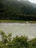
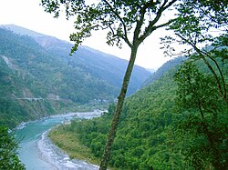
The Teesta River originates from Teesta Khangtse Glacier, west of Pahunri (or Teesta Kangse) glacier above 5,400 m (17,700 ft), and flows southward through gorges and rapids in the Sikkim Himalaya.[3]
It is fed by streams from Tso Lhamo Lake, Gurudongmar Lake and rivulets arising in the Thangu Valley, Yumthang Valley of Flowers, Dikchu and Donkha mountain ranges. The river then flows past the towns of Chungthang, Singhik, Mangan, Dikchu and Makha, where some major tributaries like Kanaka river join it, and reaches Singtam, where it is spanned by the scenic Indreni Bridge. Also in Singtam, a large tributary of the Teesta called Ranikhola joins and then descends towards Bardang, Majitar, Mining where it is spanned by Rangpo - Mining Teesta Bridge and reaches the city of Rangpo where Rangpo River, the second largest tributary of the Teesta joins. From here river Teesta forms the border between Sikkim and West Bengal up to Teesta Bazaar via Melli. Just before the Teesta Bridge, where the roads from Kalimpong and Darjeeling join, the river is met by its largest tributary, the Rangeet River.[4]
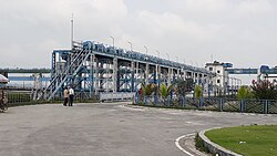
After this point, Teesta River changes its course southwards flowing into West Bengal and some more tributaries like Relli River, Riyang River, Geil Khola etc joins. Than the river hits the plains at Sevoke, 22 km (14 mi) northeast of Siliguri, where it is spanned by the Coronation Bridge and Sevoke Railway Bridge linking the northeast states to the rest of India. After crossing Sevoke, the river is fed by some small tributaries like Chel Khola, Neora Khola, Leesh Khola etc, and then reaches Gajoldoba where there is Teesta Barrage. The river then flows through Jalpaiguri, where Jalpaiguri Teesta Bridge links Northeastern States. The river flows further down through Mekhliganj and Haldibari in Cooch Behar district, where it is spanned by Joyee Setu, the longest roadway bridge of West Bengal with length 3.8 kilometres.
Here the Teesta completes its journey in India and enters Bangladesh in Dahagram, Rangpur Division. The river descends towards Barakhata, where there is Teesta Barrage of Bangladesh. Further it reaches Rangpur and Lalmonirhat town in Lalmonirhat District and Nilphamari District. After crossing Tepamadhupur Bazaar, Nagrakura Bazaar, Sundarganj and Bozra Bazaar, river Teesta joins Brahmaputra River at Haripur Port near Gaibandha, Phulchhari Upazila in Kurigram District of Bangladesh.[5]

Geography
 | This section needs more citations. (November 2022) |
Through its course, the Teesta River has carved out ravines and gorges in Sikkim meandering through the hills with the hill station of Kalimpong lying just off the river and the city of Siliguri at the foothills of Himalaya. Variegated vegetation can be seen along this route. At lower elevations, tropical deciduous trees and shrubs cover the surrounding hills; alpine vegetation is seen at the upper altitudes. The river is flanked by white sand which is used by the construction industry in the region. Large boulders in and around the waters make it ideal for rafting.
During the monsoon, Teesta River distends its banks, both in size and turbulence. Landslides in this region often dam up parts of the river in this season. It has also caused severe flooding, multiple times during monsoon in Bangladesh.[6][7]
Changes in course of rivers

In the past, the Teesta flowed south from Jalpaiguri in three channels: the Punarbhaba, Atrai and Karatoya Rivers. The Teesta changed course as a result of the flooding of 1787, turning southeast to become part of the Brahmaputra.[8]
Hydroelectric projects and barrages

.jpg)
India has an estimated total hydroelectric power potential of 84 GW at 60% load factor. Of this, Sikkim's potential share is 2.9%, or about 4.29 GW.[10]
The successfully completed major projects and dams of Teesta River System are as follows:
- Teesta -V Dam: Output - 510 MW, Dam Location - Dikchu, Gangtok district, Sikkim. Powerhouse Location - Balutar, Singtam, Gangtok district, Sikkim. Constructed by - NHPC Limited[11]
- Teesta III Dam: Output - 1200 MW Dam Location - Chungthang, Mangan district, Sikkim. Powerhouse Location - Singhik, Mangan district, Sikkim. Constructed by - Teesta Urja Limited.[12] On 4 October 2023, heavy rains caused a glacial lake outburst flood.[13] The flood reached the Teesta III Dam at midnight, before its gates could be opened, destroying the dam in minutes.[14]
- Teesta Low Dam III: Output - 132 MW, Dam & Powerhouse location - Rambi Bazar, Kalimpong district, West Bengal Constructed by - NHPC Limited.[15]
- Teesta Low Dam IV: Output- 160 MW, Dam & Powerhouse Location - Kalijhora, Kalimpong district, West Bengal Constructed by - NHPC Limited.[16]
- Teesta Barrage - Location - Gajoldoba, Jalpaiguri district, West Bengal[17]
- Barakhata Teesta Barrage - Location: Goddimari, Barakhata, Nilphamari District, Bangladesh.[18]
- Teesta VI Dam: Output: 500 MW, Dam Location: Sirwani, Singtam, Gangtok district, Sikkim. Powerhouse Location: Pamphok, Namchi district, Sikkim. Constructed by - NHPC Limited& Lanco Infratech Limited.[19]
- Rangit III Dam: On Greater Rangeet River which is a tributary of Teesta River. Output: 60 MW, Location: Legship, Gyalshing district, Sikkim. Constructed by NHPC Limited[20]
- Gati Hydropower Project: A 110 MW Gati Hydropower Project lies on River Rangpo, a tributary of River Teesta. Location - Between the town of Rorathang and Rongli of Pakyong District in Sikkim Constructed by - Gati Hydropower Limited.[21][22]
- Dikchu River Hydroelectric Power Project: Output: 96 MW on Dikchu River, tributary of River Teesta, Location - Dikchu, Gangtok district, Sikkim. Constructed by- Sneha Kinetic Power Projects Pvt. Ltd.[23][24]
- Madhya Bharat Power Corporation Limited: on Ranikhola, a tributary of Teesta, Output: 96 MW Dam location- Ranipool, Gangtok district, Sikkim. Powerhouse Location- Kumrek, Pakyong district, Sikkim.[25]
The other three completed projects are significantly smaller and minor—Lower Lagyap, Upper Rongni Chhu and Mayang Chhu projects.[10]
Water sharing challenge
Disputes over the appropriate allocation and development of the water resources of the river have remained a subject of conflict between India and Bangladesh for almost 35 years, with several bilateral agreements and rounds of talks failing to produce results.[26][27][28]
Negotiations have been going on since 1983.[29][30][31] In 1983, a temporary arrangement was reached: Bangladesh would receive 36%, India 39% while, and the remainder would remain unallocated.[30] Both countries signed a water sharing treaty in 1996 which would look into water sharing between the two countries in general following the Ganges water dispute.[30] The water sharing remains a challenge.[30]
In recent developments, Bangladesh's interim government water advisor, Syeda Rizwana Hasan, told news agency PTI (Press Trust of India) on September 1, 2024, that both upper and lower riparian countries must follow international water-sharing principles. If a treaty remains out of reach, it could mark a significant shift in India-Bangladesh relations if diplomacy fails.[32]
Seismic concerns
Teesta River area is in the seismically active Zone-V and has experienced micro-seismic activity. According to India's Ministry of Environment & Forests, the Teesta River dam projects have been approved with the requirement that they adopt suitable seismic coefficient in the design for the dam, tunnel, surge shaft and power house. The projects are cascaded over the length of the river, do not store large amounts water, have small reservoirs, and therefore the projects are expected to have very low risk from the reservoir induced seismicity in the area.[10]
Climate and tectonics
The Teesta River has preserved good imprints of climatic and tectonics along its valleys and catchments. The interrelationship between climate, erosion, deposition and tectonic activities is not properly understood to date. These are being studied.[3][33][34]
2023 Teesta Flash Floods
See also
References
- ↑ 1.0 1.1 1.2 Mullick, M. R. A.; Babel, M. S. & Perret, S. R. (2011). "Discharge-based economic valuation of irrigation water: Evidence from the Teesta River, Bangladesh". Irrigation and Drainage. 60 (4): 481−492. Bibcode:2011IrrDr..60..481M. doi:10.1002/ird.597.
- ↑ 2.0 2.1 Rahaman, M. M. & Mamun, A. A. (2020). "Hydropower development along Teesta river basin: opportunities for cooperation". Water Policy. 22 (4): 641–657. Bibcode:2020WaPol..22..641R. doi:10.2166/wp.2020.136.
- ↑ 3.0 3.1 Meetei, L. I.; Pattanayak, S. K.; Bhaskar, A.; Pandit, M. K.; Tandon, S. K. (2007). "Climatic imprints in Quaternary valley fill deposits of the middle Teesta valley, Sikkim Himalaya". Quaternary International. 159 (1): 32–46. Bibcode:2007QuInt.159...32M. doi:10.1016/j.quaint.2006.08.018.
- ↑ Chaudhuri, Samita; Chaudhuri, Utpal (2015). And the Teesta Flows... Niyogi Books. p. 188. ISBN 978-93-83098-70-5.
- ↑ Joshi, H. G. (2004). Sikkim: Past and Present. Mittal Publications. p. 1. ISBN 978-81-7099-932-4. Retrieved 8 September 2009.
- ↑ Hossain, E.; Manik, R. K. (2021). "Fresh flood feared in Bangladesh as India opens Gajoldoba again". New Age (Bangladesh). Lalmonirhat. Retrieved 2 November 2021.
- ↑ Badal, L. A. (2021). "Nearly 2,000 families stranded as flood hits 15 Rangpur villages". Dhaka Tribune. Retrieved 2 November 2021.
- ↑ Majumdar, R. C. (1971). History of Ancient Bengal. Calcutta: G. Bhardwaj & Co. pp. 4–5. OCLC 961157849.
- ↑ Islam, Sirajul; Miah, Sajahan; Khanam, Mahfuza; Ahmed, Sabbir, eds. (2012). "Barrage". Banglapedia: the National Encyclopedia of Bangladesh (Online ed.). Dhaka, Bangladesh: Banglapedia Trust, Asiatic Society of Bangladesh. ISBN 984-32-0576-6. OCLC 52727562. Retrieved 20 October 2026.
- ↑ 10.0 10.1 10.2 "Environmental Impact Assessment of Ting Ting H.E. Project, Sikkim" (PDF). Ministry of Environment, Forest, and Climate Change. Archived from the original (PDF) on 20 October 2014.
- ↑ "Teesta-V D01535". India Water Resources Information System. National Remote Sensing Centre. Government of India. Archived from the original on 18 October 2014. Retrieved 15 June 2014.
- ↑ "Teesta Dam Chungthang Mangan district Sikkim".
- ↑ Choudhury, Subrata Nag; Hussain, Zarir (4 October 2023). "Floods in India's Sikkim state leave 10 dead, 82 missing". Reuters. Archived from the original on 4 October 2023. Retrieved 4 October 2023.
- ↑ "Sikkim dam washed away in 10 minutes after flash flood: Official". Hindustan Times. 4 October 2023. Archived from the original on 4 October 2023. Retrieved 4 October 2023.
- ↑ "Teesta Low Dam III".
- ↑ "Teesta Low Dam IV".
- ↑ "Gajoldoba Teesta Barrage a bird watching destination".
- ↑ Islam, Sirajul; Miah, Sajahan; Khanam, Mahfuza; Ahmed, Sabbir, eds. (2012). "Teesta Barrage". Banglapedia: the National Encyclopedia of Bangladesh (Online ed.). Dhaka, Bangladesh: Banglapedia Trust, Asiatic Society of Bangladesh. ISBN 984-32-0576-6. OCLC 52727562. Retrieved 20 October 2026.
- ↑ "Teesta VI Dam Singtam Sirwani".
- ↑ "RANGIT-III HE PROJECT - NHPC(SIKKIM) -". India Water Resources Information System. National Remote Sensing Centre. Government of India. Retrieved 22 March 2018.
- ↑ "Gati Infra | Chuzachen Hydro Electric Power Project". Archived from the original on 26 March 2023. Retrieved 27 November 2022.
- ↑ "Gati Infra builds 110 MW hydro power project in Sikkim". Economic Times. Archived from the original on 2 August 2013. Retrieved 21 April 2014.
- ↑ "96 MW Dikchu River Hydroelectric Power Project".
- ↑ "Sneha Kinetic Power Project on Dikchu River".
- ↑ "Madhya Bharat Power Corporation Limited". Archived from the original on 30 November 2022. Retrieved 30 November 2022.
- ↑ Sarkar, SK (3 April 2017). "Sharing the Teesta". The Statesman (Opinion). Retrieved 7 April 2017.
- ↑ Ray, Aparna (8 June 2012). "India, Bangladesh: Water Disputes and Teesta River Diplomacy". Global Voices. Retrieved 7 April 2017.
- ↑ Bhattacharjee, Joyeeta (10 December 2016). "India and Bangladesh need to bring the Teesta out of muddled waters". Hindustan Times. Retrieved 7 April 2017.
- ↑ "The Teesta river dispute explained in 10 points". The Times of India. 9 April 2017. Retrieved 2 November 2021.
- ↑ 30.0 30.1 30.2 30.3 Ranjan, Amit (2020). "3: River water disputes between India and Bangladesh. The Teesta Rivers waters dispute.". Contested Waters: India's Transboundary River Water Disputes in South Asia. Taylor & Francis. ISBN 978-1-000-17390-1.
- ↑ Gambhir, Mohak (31 May 2021). "Teesta Dispute and India-Bangladesh Relations". Center For Land Warfare Studies (CLAWS). Retrieved 2 November 2021.
- ↑ Express Web Desk, "Bangladesh’s interim govt ‘keen to restart talks’ on Teesta water treaty with India," The Indian Express, September 2, 2024, https://indianexpress.com/article/world/bangladesh-teesta-water-treaty-india-talks-sheikh-hasina-modi-9545804/.
- ↑ Mukul, Malay (2000). "The geometry and kinematics of the Main Boundary Thrust and related neotectonics in the Darjiling Himalayan fold-and-thrust belt, West Bengal, India". Journal of Structural Geology. 22 (9): 1261–1283. Bibcode:2000JSG....22.1261M. doi:10.1016/S0191-8141(00)00032-8.
- ↑ Mukul, Malay; Jaiswal, M.; Singhvi, A. K. (November 2007). "Timing of recent out-of-sequence active deformation in the frontal Himalayan wedge: Insights from the Darjiling sub-Himalaya, India". Geology. 35 (11). The Geological Society of America: 999–1002. Bibcode:2007Geo....35..999M. doi:10.1130/G23869A.1.
External links
- Template:GEOnet2
- Mesbah-us-Saleheen (2012), "Tista River", in Sirajul Islam and Ahmed A. Jamal (ed.), Banglapedia: National Encyclopedia of Bangladesh (Second ed.), Asiatic Society of Bangladesh