

robot: Update article (please report if you notice any mistake or error in this edit) |
ShivaniSikri (talk | contribs) correct citations for clarity and improved wording |
||
| Line 2: | Line 2: | ||
{{Redirect|Gauriganj|the village in Nepal|Gauriganj, Nepal}} | {{Redirect|Gauriganj|the village in Nepal|Gauriganj, Nepal}} | ||
{{one source|date=June 2019}} | {{one source|date=June 2019}} | ||
{{Use dmy dates|date= | {{Use dmy dates|date=November 2023}} | ||
{{Use Indian English|date= | {{Use Indian English|date=November 2023}} | ||
{{Infobox settlement | {{Infobox settlement | ||
<!--See the table at Infobox settlement for all fields and descriptions of usage--> | <!--See the table at Infobox settlement for all fields and descriptions of usage--> | ||
<!-- Basic info -->| name = Gauriganj | <!-- Basic info --> | ||
| name = Gauriganj | |||
| other_name = | | other_name = | ||
| native_name = <!-- for cities whose native name is not in English --> | | native_name = <!-- for cities whose native name is not in English --> | ||
| nickname = | | nickname = | ||
| settlement_type = | | settlement_type = Municipal corporation | ||
| motto = <!-- images and maps --> | | motto = | ||
<!-- images and maps --> | |||
| image_skyline = Gngview.jpg | | image_skyline = Gngview.jpg | ||
| image_caption = Gauriganj skyline | | image_caption = Gauriganj skyline | ||
| Line 19: | Line 21: | ||
| image_seal = | | image_seal = | ||
| mapsize = | | mapsize = | ||
| pushpin_map = India Uttar Pradesh | | pushpin_map = India Uttar Pradesh#India | ||
| pushpin_label_position = bottom | | pushpin_label_position = bottom | ||
| pushpin_mapsize = | | pushpin_mapsize = | ||
| pushpin_map_caption = Location of Gauriganj in Uttar Pradesh | | pushpin_map_caption = Location of Gauriganj in Uttar Pradesh | ||
| subdivision_type = Country | |||
| subdivision_name = {{ | | subdivision_name = {{flag|India}} | ||
| subdivision_type1 = State | | subdivision_type1 = [[List of states and union territories of India|State]] | ||
| subdivision_name1 = [[Uttar Pradesh]] | | subdivision_name1 = [[Uttar Pradesh]] | ||
| subdivision_type2 = [[ | | subdivision_type2 = [[Administrative divisions of Uttar Pradesh|Division]] | ||
| | | subdivision_name2 = [[Ayodhya division|Ayodhya]] | ||
| subdivision_type3 = [[List of districts of Uttar Pradesh|District]] | |||
| subdivision_name3 = [[Amethi district|Amethi]] | |||
| government_type = [[Municipal council (India)|Municipal Council]] | |||
| governing_body = Gauriganj Municipal Council | |||
| leader_title = Municipal Chairperson | |||
| leader_name = Reshmi<ref>{{cite web|url=https://sec.up.nic.in/site/NewWinnerList2023.aspx|title=2023 UP Municipal Election results|work=ECI Uttar Pradesh|access-date=22 May 2023}}</ref><ref>{{cite web|url=https://sec.up.nic.in/site/IndividualULBResult2023.aspx|title=2023 UP Municipal Election detailed results|work=ECI Uttar Pradesh|accessdate=12 July 2023}}</ref> | |||
| leader_party = [[Bharatiya Janata Party|BJP]] | |||
| government_footnotes = | | government_footnotes = | ||
| | | leader_title1 = [[Member of the Legislative Assembly (India)|MLA]] | ||
| | | leader_name1 = [[Rakesh Pratap Singh (politician)|Rakesh Pratap Singh]] ([[Independent politician|IND]])<ref>{{cite web |title=Uttar Pradesh Legislative Assembly (UPLA): Member info |url=http://www.upvidhansabhaproceedings.gov.in/web/guest/member?memberId=20817 |website=www.upvidhansabhaproceedings.gov.in |access-date=14 October 2019}}</ref> | ||
| established_title = <!-- Settled --> | | established_title = <!-- Settled --> | ||
| established_date = <!-- Area --> | | established_date = | ||
<!-- Area --> | |||
| unit_pref = <!--Enter: Imperial, if Imperial (metric) is desired--> | | unit_pref = <!--Enter: Imperial, if Imperial (metric) is desired--> | ||
| area_footnotes = | | area_footnotes = | ||
| Line 59: | Line 67: | ||
| elevation_footnotes = <!--for references: use <ref> </ref> tags--> | | elevation_footnotes = <!--for references: use <ref> </ref> tags--> | ||
| elevation_m = 104 | | elevation_m = 104 | ||
<!-- Area/postal codes & others -->| postal_code_type = Postal code | <!-- Area/postal codes & others --> | ||
| postal_code_type = Postal code | |||
| postal_code = 227409 | | postal_code = 227409 | ||
| blank3_name = [[Vehicle registration plate|Vehicle Registration]] | | blank3_name = [[Vehicle registration plate|Vehicle Registration]] | ||
| Line 68: | Line 77: | ||
}} | }} | ||
'''Gauriganj''' is a city, tehsil and administrative headquarters of [[Amethi district]] in | '''Gauriganj''' is a city, municipal corporation, tehsil and administrative headquarters of [[Amethi district]] in [[Ayodhya division]], [[Uttar Pradesh]], India.<ref name="Census2011Gov"/> It is situated about 126 km from the state capital [[Lucknow]]. Before July 2010, it was part of [[Sultanpur district]]. After that Gauriganj, Amethi, Jais, Jagdispur and Salon formed a new district Chhatrapati Sahuji Maharaj Nagar, later named Gauriganj and now Amethi. Gauriganj is connected with State Highway 34 and National Highway 128. | ||
==Etymology== | ==Etymology== | ||
Gauriganj is named after | Gauriganj is named after [[Parvati|Gauri]], a deity in Hinduism.{{citation needed|date=March 2022}} | ||
==History== | ==History== | ||
At the turn of the 20th century, Gauriganj was described as "a rising town, with a station on the [[Oudh and Rohilkhand Railway]]."<ref name="Gazetteer 1903">{{cite book |last1=Nevill |first1=H.R. |title=Sultanpur: A Gazetteer, Being Volume XLVI Of The District Gazetteers Of The United Provinces Of Agra And Oudh |date=1903 |publisher=Government Press |location=Allahabad |pages= | At the turn of the 20th century, Gauriganj was described as "a rising town, with a station on the [[Oudh and Rohilkhand Railway]]."<ref name="Gazetteer 1903">{{cite book |last1=Nevill |first1=H.R. |title=Sultanpur: A Gazetteer, Being Volume XLVI Of The District Gazetteers Of The United Provinces Of Agra And Oudh |date=1903 |publisher=Government Press |location=Allahabad |pages=178–9 |url=https://archive.org/details/in.ernet.dli.2015.113213 |access-date=13 December 2021}}</ref> It then technically consisted of two villages, [[Katra-Lalganj]] and [[Madhopur, Gauriganj|Madhopur]].<ref name="Gazetteer 1903"/> The bazar was founded by Madho Singh, the [[Raja]] of [[Amethi Estate |Amethi]](d.1891).<ref name="Gazetteer 1903"/> Gauriganj then hosted a rising [[grain trade|grain market]] and had a pound, police station, and post office, as well as an upper primary school, which had many students from both Gauriganj itself and the surrounding countryside; it had a small building, though, which was not big enough to accommodate the student body adequately.<ref name="Gazetteer 1903"/> The town was then surrounded by several deep hollows.<ref name="Gazetteer 1903"/> West of Katra-Lalganj were low-lying fields where only ''[[jarhan]]'' rice was grown.<ref name="Gazetteer 1903"/> The population of Gauriganj as of 1901 was 2,543, including a large [[Bania (caste)|Bania]] community which was larger than any other town in the district except Sultanpur.<ref name="Gazetteer 1903"/> There was a Muslim minority of 194, and the rest of the town's population was a mix of [[Ahir]]s, [[Kurmi]]s, and [[Gadariya]]s, as well as some [[Pasi (caste)|Pasi]]s.<ref name="Gazetteer 1903"/> | ||
==Geography== | ==Geography== | ||
| Line 80: | Line 89: | ||
Gauriganj has a warm subtropical climate with very cold and dry winters from December to mid-February, and dry, hot summers from April to mid-June. During extreme winters, the maximum temperature is around 12 degrees Celsius and the minimum is around 3 to 4 degrees Celsius. Fog is quite common from late December to late January. Summers can be quite hot with temperatures rising to 40 to 45 degrees Celsius. | Gauriganj has a warm subtropical climate with very cold and dry winters from December to mid-February, and dry, hot summers from April to mid-June. During extreme winters, the maximum temperature is around 12 degrees Celsius and the minimum is around 3 to 4 degrees Celsius. Fog is quite common from late December to late January. Summers can be quite hot with temperatures rising to 40 to 45 degrees Celsius. | ||
Gauriganj has a tropical wet and dry climate with average temperatures ranging between 20 and 28 | Gauriganj has a tropical wet and dry climate with average temperatures ranging between {{convert|20|and|28|C|F}}. Gauriganj experiences three distinct seasons: summer, monsoon and a mild autumn. Typical summer months are from March to May, with maximum temperatures ranging from {{convert|30|to|45|C|F}}. Although summer doesn't end until May, the city often receives heavy thundershowers in May, and humidity remains high. The rainy season is from mid-June to mid-September, when it gets an average rainfall of 722 mm, mostly from the south-west monsoon winds. Even during the hottest months, the nights are usually cool due to Gauriganj's altitude. The highest temperature ever recorded was {{convert|48.3|°C|°F|abbr=on}}. The monsoon lasts from June to October, with moderate rainfall and temperatures ranging from {{convert|10|to|28|C|F}}. Autumn begins in November. The daytime temperature hovers around {{convert|28|°C|°F|abbr=on}} while the night temperature is below {{convert|10|°C|°F|abbr=on}} for most of December and January, often dropping to {{convert|3|to|4|C|F}}. | ||
==Demographics== | ==Demographics== | ||
As of [[2011 Indian Census]], Gauriganj tehsil had a total population of 390,935, of which 196,844 were males and 194,091 were females. Population within the age group of 0 to 6 years was 59,192. The total number of literates in Gauriganj was 214,282, which constituted 54.8% of the population with male literacy of 60.1% and female literacy of 45.4%. The effective literacy rate of 7+ population of Gauriganj was 64.6%, of which male literacy rate was 75.9% and female literacy rate was 53.3%. The [[Scheduled Castes and Scheduled Tribes]] population was 108,841 and 86 respectively. Gauriganj had 67,832 households in 2011.<ref name="Census2011Gov">{{cite web |title=Census of India: Gauriganj |url=https://censusindia.gov.in/pca/SearchDetails.aspx?Id=194745 |website=censusindia.gov.in |access-date=27 March 2022}}</ref> | As of [[2011 Indian Census]], Gauriganj tehsil had a total population of 390,935, of which 196,844 were males and 194,091 were females. Population within the age group of 0 to 6 years was 59,192. The total number of literates in Gauriganj was 214,282, which constituted 54.8% of the population with male literacy of 60.1% and female literacy of 45.4%. The effective literacy rate of 7+ population of Gauriganj was 64.6%, of which male literacy rate was 75.9% and female literacy rate was 53.3%. The [[Scheduled Castes and Scheduled Tribes]] population was 108,841 and 86 respectively. Gauriganj had 67,832 households in 2011.<ref name="Census2011Gov">{{cite web |title=Census of India: Gauriganj |url=https://censusindia.gov.in/pca/SearchDetails.aspx?Id=194745 |website=censusindia.gov.in |access-date=27 March 2022}}</ref> | ||
The [[1961 Census of India|1961 census]] recorded Gauriganj as having a population of 1,883 people (1,038 male and 845 female), in 468 households and 456 physical houses | The [[1961 Census of India|1961 census]] recorded Gauriganj as having a population of 1,883 people (1,038 male and 845 female), in 468 households and 456 physical houses.<ref name="Census 1961">{{cite book |title=Census 1961: District Census Handbook, Uttar Pradesh (44 - Sultanpur District) |date=1965 |location=Lucknow |pages=118, 121–2, 147, xxxviii-xxxix |url=http://lsi.gov.in:8081/jspui/bitstream/123456789/1035/1/22847_1961_SUL.pdf |access-date=13 December 2021}}</ref> | ||
=== Languages and religion === | === Languages and religion === | ||
[[File:Queen Nagamati talks to her parrot, Padmavat, c1750.jpg|thumb|An illustrated manuscript of the epic poem ''[[Padmavat]]'', by [[Malik Muhammad Jayasi]] (c. 1750)]] | [[File:Queen Nagamati talks to her parrot, Padmavat, c1750.jpg|thumb|An illustrated manuscript of the epic poem ''[[Padmavat]]'', by [[Malik Muhammad Jayasi]] (c. 1750)]] | ||
[[Hindi]] and [[Urdu]] are the official languages. [[Awadhi]] is also widely spoken along with English. | [[Hindi]] and [[Urdu]] are the official languages. [[Awadhi language|Awadhi]] is also widely spoken along with English. | ||
[[Hinduism]] is followed by large numbers of the population. A significant part of the population of the city consists of followers of [[Islam]] and [[Sikh]]ism. [[Christians]] and [[Jain]]s constitute a minority of the population. | [[Hinduism]] is followed by large numbers of the population. A significant part of the population of the city consists of followers of [[Islam]] and [[Sikh]]ism. [[Christians]] and [[Jain]]s constitute a minority of the population. | ||
== | ==Government and politics== | ||
===Civic administration=== | ===Civic administration=== | ||
Gauriganj had a police force of 2 sub-inspectors, 1 head constable, and 13 constables.<ref name="Census 1961"/> | Gauriganj had a police force of 2 sub-inspectors, 1 head constable, and 13 constables.<ref name="Census 1961"/> | ||
===Amenities=== | ===Amenities=== | ||
Gauriganj has a post office, a railway station, a library, and a government-run dispensary with 4 male and 2 female beds, as well as a maternity and child welfare centre and a family planning centre.<ref name="Census 1961"/> | Gauriganj has a post office, a railway station, a library, and a government-run dispensary with 4 male and 2 female beds, as well as a maternity and child welfare centre and a family planning centre.<ref name="Census 1961"/> | ||
==Economy== | ==Economy== | ||
| Line 114: | Line 123: | ||
* [[Mata Mawai Dham]] | * [[Mata Mawai Dham]] | ||
* [[Ulta Gadha Dham]] | * [[Ulta Gadha Dham]] | ||
* [[LBA music Guariganj]] | |||
==Education== | ==Education== | ||
| Line 119: | Line 129: | ||
==Villages== | ==Villages== | ||
Gauriganj CD block has the following 102 villages:<ref name="Census 2011">{{cite web |title=Census of India 2011: Uttar Pradesh District Census Handbook - Sultanpur, Part A (Village and Town Directory) |pages= | Gauriganj CD block has the following 102 villages:<ref name="Census 2011">{{cite web |title=Census of India 2011: Uttar Pradesh District Census Handbook - Sultanpur, Part A (Village and Town Directory) |pages=181–98 |url=https://censusindia.gov.in/2011census/dchb/DCHB_A/09/0948_PART_A_DCHB_SULTANPUR.pdf |website=Census 2011 India|access-date=13 December 2021}}</ref> | ||
{| class="wikitable sortable" | {| class="wikitable sortable" | ||
| Line 321: | Line 331: | ||
| [[Chhitepur]] || 153.1 || 1,093 | | [[Chhitepur]] || 153.1 || 1,093 | ||
|- | |- | ||
| [[Pandri]] || 412 || 2,513 | | [[Pandri, Amethi District|Pandri]] || 412 || 2,513 | ||
|- | |- | ||
| [[Gudun Pur]] || 106 || 874 | | [[Gudun Pur]] || 106 || 874 | ||
| Line 339: | Line 349: | ||
<!--Add names only if the person has an article in English Wikipedia. Arrange alphabetically by LAST NAME--> | <!--Add names only if the person has an article in English Wikipedia. Arrange alphabetically by LAST NAME--> | ||
* [[Manoj Muntashir]] is an Indian lyricist, poet and screenwriter was born in this town. | * [[Manoj Muntashir]] is an Indian lyricist, poet and screenwriter was born in this town. | ||
* [[Rakesh Pandey (author)|Rakesh Pandey]] | * [[Rakesh Pandey (author)|Rakesh Pandey]] (writer and author) | ||
* [[Jagdish Piyush]] | * [[Jagdish Piyush]] (journalist, writer and author) | ||
* [[Deepak Singh (politician)|Deepak Singh]] | * [[Akshay Pratap Singh]] (MLC and former MP) | ||
* [[Deepak Singh (politician)|Deepak Singh]] (former MLC) | |||
* [[Rakesh Pratap Singh]] (MLA) | |||
* [[Rudra Pratap Singh (politician)|Rudra Pratap Singh]] (former MP, former MLA, former MLC) | |||
== Gallery == | == Gallery == | ||
| Line 349: | Line 362: | ||
File:Hanuman Mandir(2).jpg|Hanuman Mandir, Madhopur | File:Hanuman Mandir(2).jpg|Hanuman Mandir, Madhopur | ||
</gallery> | </gallery> | ||
==References== | ==References== | ||
{{reflist}} | {{reflist}} | ||
== External links == | |||
* {{Commons-inline}} | |||
{{Authority control}} | |||
[[Category:Cities and towns in Amethi district]] | [[Category:Cities and towns in Amethi district]] | ||
[[pl:Gauriganj]] | [[pl:Gauriganj]] | ||
Latest revision as of 21:45, 21 March 2026
 | This article relies on a single source. (June 2019) |
Gauriganj | |
|---|---|
Municipal corporation | |
 Gauriganj skyline | |
 Map of Gauriganj CD block | |
  Gauriganj Location of Gauriganj in Uttar Pradesh  Gauriganj Gauriganj (India) | |
| Coordinates: 26°12′22″N 81°41′24″E / 26.206°N 81.690°E | |
| Country |  India India |
| State | Uttar Pradesh |
| Division | Ayodhya |
| District | Amethi |
| Government | |
| • Type | Municipal Council |
| • Body | Gauriganj Municipal Council |
| • Municipal Chairperson | Reshmi[1][2] (BJP) |
| • MLA | Rakesh Pratap Singh (IND)[3] |
| Elevation | 104 m (341 ft) |
| Population (2011)[4] | |
| • Total | 390,935 |
| • Density | 855/km2 (2,210/sq mi) |
| Language | |
| • Official | Hindi[5] |
| • Additional official | Urdu[5] |
| Time zone | UTC+5:30 (Indian Standard Time) |
| Postal code | 227409 |
| Telephone code | 05-368 |
| Sex ratio | 904:1000 ♂/♀ |
| Vehicle Registration | UP-36 |
Gauriganj is a city, municipal corporation, tehsil and administrative headquarters of Amethi district in Ayodhya division, Uttar Pradesh, India.[4] It is situated about 126 km from the state capital Lucknow. Before July 2010, it was part of Sultanpur district. After that Gauriganj, Amethi, Jais, Jagdispur and Salon formed a new district Chhatrapati Sahuji Maharaj Nagar, later named Gauriganj and now Amethi. Gauriganj is connected with State Highway 34 and National Highway 128.
Etymology[edit | edit source]
Gauriganj is named after Gauri, a deity in Hinduism.[citation needed]
History[edit | edit source]
At the turn of the 20th century, Gauriganj was described as "a rising town, with a station on the Oudh and Rohilkhand Railway."[6] It then technically consisted of two villages, Katra-Lalganj and Madhopur.[6] The bazar was founded by Madho Singh, the Raja of Amethi(d.1891).[6] Gauriganj then hosted a rising grain market and had a pound, police station, and post office, as well as an upper primary school, which had many students from both Gauriganj itself and the surrounding countryside; it had a small building, though, which was not big enough to accommodate the student body adequately.[6] The town was then surrounded by several deep hollows.[6] West of Katra-Lalganj were low-lying fields where only jarhan rice was grown.[6] The population of Gauriganj as of 1901 was 2,543, including a large Bania community which was larger than any other town in the district except Sultanpur.[6] There was a Muslim minority of 194, and the rest of the town's population was a mix of Ahirs, Kurmis, and Gadariyas, as well as some Pasis.[6]
Geography[edit | edit source]
Climate[edit | edit source]
Gauriganj has a warm subtropical climate with very cold and dry winters from December to mid-February, and dry, hot summers from April to mid-June. During extreme winters, the maximum temperature is around 12 degrees Celsius and the minimum is around 3 to 4 degrees Celsius. Fog is quite common from late December to late January. Summers can be quite hot with temperatures rising to 40 to 45 degrees Celsius.
Gauriganj has a tropical wet and dry climate with average temperatures ranging between 20 and 28 °C (68 and 82 °F). Gauriganj experiences three distinct seasons: summer, monsoon and a mild autumn. Typical summer months are from March to May, with maximum temperatures ranging from 30 to 45 °C (86 to 113 °F). Although summer doesn't end until May, the city often receives heavy thundershowers in May, and humidity remains high. The rainy season is from mid-June to mid-September, when it gets an average rainfall of 722 mm, mostly from the south-west monsoon winds. Even during the hottest months, the nights are usually cool due to Gauriganj's altitude. The highest temperature ever recorded was 48.3 °C (118.9 °F). The monsoon lasts from June to October, with moderate rainfall and temperatures ranging from 10 to 28 °C (50 to 82 °F). Autumn begins in November. The daytime temperature hovers around 28 °C (82 °F) while the night temperature is below 10 °C (50 °F) for most of December and January, often dropping to 3 to 4 °C (37 to 39 °F).
Demographics[edit | edit source]
As of 2011 Indian Census, Gauriganj tehsil had a total population of 390,935, of which 196,844 were males and 194,091 were females. Population within the age group of 0 to 6 years was 59,192. The total number of literates in Gauriganj was 214,282, which constituted 54.8% of the population with male literacy of 60.1% and female literacy of 45.4%. The effective literacy rate of 7+ population of Gauriganj was 64.6%, of which male literacy rate was 75.9% and female literacy rate was 53.3%. The Scheduled Castes and Scheduled Tribes population was 108,841 and 86 respectively. Gauriganj had 67,832 households in 2011.[4]
The 1961 census recorded Gauriganj as having a population of 1,883 people (1,038 male and 845 female), in 468 households and 456 physical houses.[7]
Languages and religion[edit | edit source]

Hindi and Urdu are the official languages. Awadhi is also widely spoken along with English.
Hinduism is followed by large numbers of the population. A significant part of the population of the city consists of followers of Islam and Sikhism. Christians and Jains constitute a minority of the population.
Government and politics[edit | edit source]
Civic administration[edit | edit source]
Gauriganj had a police force of 2 sub-inspectors, 1 head constable, and 13 constables.[7]
Amenities[edit | edit source]
Gauriganj has a post office, a railway station, a library, and a government-run dispensary with 4 male and 2 female beds, as well as a maternity and child welfare centre and a family planning centre.[7]
Economy[edit | edit source]
Gauriganj hosts a grain market on Mondays and Fridays, with an average attendance of about 2,000 at the time of the 1961 census.[7]
Cityscape / Culture[edit | edit source]
Durga Puja is celebrated in Gauriganj with cultural activities from the 8th day of Navratri for 14 days. Moorty Visarjan is also a big event as it takes approximately 90 hours to complete with thousands of indulged people. Krishna Janmashtami is also celebrated with great joy. In Some Aashram (likes: Baba Balak Das etc.) and some temples (e.g. Doodh Nath Mandir, Ram Janki Mandir, Hanuman Mandir) Feast (i.e. Vishal Bhog Bhandara) took places annually.[clarification needed]
Eid-ul-Fitr, Eid-ul-Adha, Eid Milad-un-Nabi and Shab-e-Barat are also celebrated in Gauriganj.
Places of interest[edit | edit source]
- Nandmahar Dham
- Lodi Baba Mandir
- Durgan Dham Temple
- Mata Mawai Dham
- Ulta Gadha Dham
- LBA music Guariganj
Education[edit | edit source]
The 1951 census recorded Gauriganj as having a district board-run primary school, with 201 students in attendance as of 1 January of the year.[8]
Villages[edit | edit source]
Gauriganj CD block has the following 102 villages:[9]
| Village name | Total land area (hectares) | Population (in 2011) |
|---|---|---|
| Manmatipur | 194 | 795 |
| Bhatgawan | 389.7 | 3,654 |
| Bastidai | 464.1 | 2,086 |
| Manjhwara | 428.9 | 3,074 |
| Gulalpur | 273.4 | 1,208 |
| Benipur Baldeo | 256.7 | 1,398 |
| Rauja | 190.1 | 1,538 |
| Tulsi Pur | 246.1 | 1,341 |
| Mau | 504.1 | 3,865 |
| Sarauli | 127 | 687 |
| Oripur | 191 | 1,883 |
| Basupur | 194 | 1,402 |
| Itaujapachhim | 290.2 | 2,303 |
| Mohanpur | 45.4 | 107 |
| Gopalipur | 178.4 | 603 |
| Sujanpur | 379.8 | 1,872 |
| Narauli | 345.7 | 2,153 |
| Guwawan | 665.2 | 4,716 |
| Rohshi Khurd | 432.8 | 2,078 |
| Sarai Hirday Shah | 361.6 | 2,564 |
| Jagdishpur | 187.7 | 1,384 |
| Bishundas Pur | 393.2 | 2,255 |
| Gauri Pur | 266.3 | 2,690 |
| Gopiya Pur | 29 | 294 |
| Hasram Pur | 44.4 | 118 |
| Ana Pur | 156.3 | 1,072 |
| Dost Pur | 101 | 586 |
| Jethauna | 176.8 | 1,018 |
| Harakh Pur | 236.1 | 1,892 |
| Jethumawai | 95 | 1,037 |
| Medan Mawi | 88.9 | 418 |
| Belkhaur | 83.7 | 1,950 |
| Lila Tikara | 78.6 | 417 |
| Suja Pur | 38.2 | 333 |
| Dhani Jalalpur | 55.6 | 685 |
| Basthan | 51.1 | 233 |
| Shahbaj Pur | 152.2 | 1,222 |
| Garha Mafi | 220.6 | 1,563 |
| Darpipur | 158.8 | 1,012 |
| Baburi Tola | 48.6 | 402 |
| Sarai Barwand Singh | 125.5 | 984 |
| Behta | 231.1 | 1,557 |
| Barna Tikar | 447.5 | 2,927 |
| Madho Pur | 179.2 | 4,717 |
| Raj Garh | 107.3 | 2,028 |
| Misrauli | 231.8 | 1,738 |
| Sarai Bhag Mani | 235.8 | 2,185 |
| Mahima Pur | 218.5 | 737 |
| Asaida Pur | 158.9 | 1,387 |
| Katra Lal Ganj | 230.1 | 5,834 |
| Bali Pur Khurdwan | 112.6 | 1,449 |
| Amiya | 123.6 | 799 |
| Chauhan Pur | 61.8 | 360 |
| Palia | 68.1 | 549 |
| Argwan | 174.3 | 1,195 |
| Sembhue | 135.8 | 966 |
| Kaji Patti | 44.3 | 503 |
| Rampur Kurwa | 183.5 | 1,298 |
| Senipur | 73.7 | 653 |
| Madhupur | 51 | 214 |
| Sultanpur | 63.4 | 493 |
| Jagmalpur | 113.9 | 520 |
| Paiga | 293.1 | 1,053 |
| Gvjar Tol | 141.4 | 1,102 |
| Pure Fajil | 312.2 | 1,685 |
| Dharu Pur | 117 | 1,112 |
| Sogara | 376.2 | 1,693 |
| Biswan | 59.2 | 353 |
| Asura | 123.1 | 803 |
| Dhanapur | 110 | 953 |
| Bhawan Shah Pur | 129 | 821 |
| Lugri | 314 | 1,148 |
| Pachehri | 234.1 | 1,403 |
| Paharpur | 84.3 | 494 |
| Raghipur | 60 | 1,207 |
| Banwari Pur | 94.1 | 337 |
| Ronhsi Buzurg | 210.3 | 1,072 |
| Chandai Pur | 199.7 | 1,329 |
| Atta Nagar | 244.4 | 1,417 |
| Bahan Pur | 194 | 1,828 |
| Sakrawan | 225.4 | 1,322 |
| Ramai Pur | 126.2 | 381 |
| Saripur | 162.2 | 895 |
| Kharanwan | 112.2 | 1,056 |
| Saintha | 639.6 | 4,076 |
| Tikariya | 360.8 | 2,031 |
| Khajuri | 147 | 1,066 |
| Basaikpur | 193.4 | 1,787 |
| Gundur | 168.9 | 1,020 |
| Raja Patti | 63.1 | 278 |
| Babupur | 122.4 | 1,226 |
| Anni Baijal | 460 | 3,063 |
| Aintha | 116.9 | 1,369 |
| Pathanpur | 221.4 | 1,449 |
| Pahar Ganj | 404.9 | 2,682 |
| Ismailpur | 52 | 427 |
| Chhitepur | 153.1 | 1,093 |
| Pandri | 412 | 2,513 |
| Gudun Pur | 106 | 874 |
| Samhanwa | 495 | 2,561 |
| Pure Udhao | 17.1 | 267 |
| Lal Shah Pur | 125.1 | 422 |
| Block total | 144,669 | 20,372.8 |
| Village name | Total land area (hectares) | Population (in 2011) |
Notable people[edit | edit source]
- Manoj Muntashir is an Indian lyricist, poet and screenwriter was born in this town.
- Rakesh Pandey (writer and author)
- Jagdish Piyush (journalist, writer and author)
- Akshay Pratap Singh (MLC and former MP)
- Deepak Singh (former MLC)
- Rakesh Pratap Singh (MLA)
- Rudra Pratap Singh (former MP, former MLA, former MLC)
Gallery[edit | edit source]
-
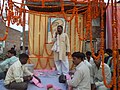 Bhandara at Baba Balak Das Ashram, Stage (2011)
 -
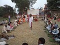 Bhandara at Baba Balak Das Ashram (2011)
 -
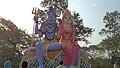 Hanuman Mandir, Madhopur


.jpg)
References[edit | edit source]
- ↑ "2023 UP Municipal Election results". ECI Uttar Pradesh. Retrieved 22 May 2023.
- ↑ "2023 UP Municipal Election detailed results". ECI Uttar Pradesh. Retrieved 12 July 2023.
- ↑ "Uttar Pradesh Legislative Assembly (UPLA): Member info". www.upvidhansabhaproceedings.gov.in. Retrieved 14 October 2019.
- ↑ 4.0 4.1 4.2 "Census of India: Gauriganj". censusindia.gov.in. Retrieved 27 March 2022.
- ↑ 5.0 5.1 "52nd Report of the Commissioner for Linguistic Minorities in India" (PDF). nclm.nic.in. Ministry of Minority Affairs. Archived from the original (PDF) on 25 May 2017. Retrieved 11 January 2018.
- ↑ 6.0 6.1 6.2 6.3 6.4 6.5 6.6 6.7 Nevill, H.R. (1903). Sultanpur: A Gazetteer, Being Volume XLVI Of The District Gazetteers Of The United Provinces Of Agra And Oudh. Allahabad: Government Press. pp. 178–9. Retrieved 13 December 2021.
- ↑ 7.0 7.1 7.2 7.3 Census 1961: District Census Handbook, Uttar Pradesh (44 - Sultanpur District) (PDF). Lucknow. 1965. pp. 118, 121–2, 147, xxxviii–xxxix. Retrieved 13 December 2021.
{{cite book}}: CS1 maint: location missing publisher (link) - ↑ Census of India, 1951: District Census Handbook Uttar Pradesh (49 - Rae Bareli District) (PDF). Allahabad. 1955. p. 198. Retrieved 13 December 2021.
{{cite book}}: CS1 maint: location missing publisher (link) - ↑ "Census of India 2011: Uttar Pradesh District Census Handbook - Sultanpur, Part A (Village and Town Directory)" (PDF). Census 2011 India. pp. 181–98. Retrieved 13 December 2021.