

No edit summary Tags: Mobile edit Mobile web edit |
m added references |
||
| Line 1: | Line 1: | ||
{{Short description|Municipality in Tamil Nadu, India}} | |||
{{more citations needed|date=April 2020}} | |||
{{Use dmy dates|date=May 2019}} | {{Use dmy dates|date=May 2019}} | ||
{{Use Indian English|date=May 2018}} | {{Use Indian English|date=May 2018}} | ||
{{Infobox settlement | {{Infobox settlement | ||
| name = Kilakarai | | name = Kilakarai | ||
| settlement_type = Municipality | |||
| settlement_type = | |||
| nickname = | | nickname = | ||
| pushpin_map = India Tamil Nadu | | pushpin_map = India Tamil Nadu | ||
| Line 28: | Line 23: | ||
| government_type = Second Grade Municipality | | government_type = Second Grade Municipality | ||
| governing_body = Municipality of kilakarai | | governing_body = Municipality of kilakarai | ||
| leader_title1 = Vice Chairman | |||
| leader_name1 = V. S. Hameed Sultan<ref>{{cite web | |||
|title=Vice‑Chairman – Keelakarai Municipality | |||
|url=https://www.tnurbantree.tn.gov.in/keelakarai/vice‑chairman/ | |||
|publisher=Directorate of Municipal Administration, Tamil Nadu | |||
|accessdate=2025-08-16 | |||
}}</ref>{{Dead link|date=March 2026|fix-attempted=yes |url=}} | |||
| unit_pref = Metric | | unit_pref = Metric | ||
| area_footnotes = | | area_footnotes = | ||
| area_total_km2 = | | area_total_km2 = 7.5 | ||
| area_rank = 5 | | area_rank = 5 | ||
| elevation_footnotes = | | elevation_footnotes = | ||
| elevation_m = 17 | | elevation_m = 17 | ||
| population_total = | | population_total = ~60,000 | ||
| population_as_of = | | population_as_of = 2021 | ||
| population_footnotes = | | population_footnotes = | ||
| population_density_km2 = auto | | population_density_km2 = auto | ||
| Line 70: | Line 73: | ||
| blank2_info_sec2 = {{convert|909|mm|in}} | | blank2_info_sec2 = {{convert|909|mm|in}} | ||
| blank3_name_sec2 = Avg. summer temperature | | blank3_name_sec2 = Avg. summer temperature | ||
| blank3_info_sec2 = {{convert| | | blank3_info_sec2 = {{convert|31|°C|°F}} | ||
| blank4_name_sec2 = Avg. winter temperature | | blank4_name_sec2 = Avg. winter temperature | ||
| blank4_info_sec2 = {{convert| | | blank4_info_sec2 = {{convert|24|°C|°F}} | ||
| official_name = | | official_name = | ||
}} | }} | ||
'''Kilakarai''' (alternatively spelled '''Kilakkarai''' or '''Keelakarai''') is a [[municipality]] in [[Ramanathapuram district]] in the [[India]]n [[States and territories of India|state]] of [[Tamil Nadu]]. As of | '''Kilakarai''' (alternatively spelled '''Kilakkarai''' or '''Keelakarai''') is a [[municipality]] in [[Ramanathapuram district]] in the [[India]]n [[States and territories of India|state]] of [[Tamil Nadu]]. As of 2021, the town has a population of approximately 60,000. Known for its rapid development, Kilakarai is one of the fastest-growing talukas in the Ramanathapuram district. The town is also home to a number of prestigious businessmen and entrepreneurs who have made their mark globally. | ||
== History == | == History == | ||
Kilakarai is an eastern coastal town and a port, located in southern Tamil Nadu. It was a flourishing seaport and a gateway to places as far as [[Madurai]] until the early 20th century. The famous pearl belt known as the [[Gulf of Mannar]] in the Bay of Bengal is dotted with small islands Appa Tivu, [[Nalla Tanni Tivu|Nallathanni Theevu]], Shuli Tivu, Uppu Tanni Tivu, Talari Tivu and Musal Tivu. The coastal line of Kilakarai is formed by a series of small bays and coral reefs sheltering the town from the ocean. It was also called as "Quilicare",<ref>{{Cite book | url=https://books.google.com/books?id=edzW9fuOF-cC&q=quilicare&pg=PA120 |title = The Book of Duarte Barbosa: An Account of the Countries Bordering on the Indian Ocean and Their Inhabitants|isbn = 9788120604513|last1 = Barbosa|first1 = Duarte|last2 = Dames|first2 = Mansel Longworth|year = 1989}}</ref> kirkari, Sembi Nadu, Korkai, Powthira Manicka Pattinam,<ref>http://puthu.thinnai.com/?p=20958</ref> "Kelikkarai", "Ninathaan mudithaan pattinam", "Seppi Nadu", "lebbat pattan" (pattan mentioned in voyages of [[Ibn Battuta]] & map displayed in [[Ibn Battuta Mall]]). A strong cultural connection exists between Kayalpatnam, Adirampattinam and Kilakarai. | Kilakarai is an eastern coastal town and a port, located in southern Tamil Nadu. It was a flourishing seaport and a gateway to places as far as [[Madurai]] until the early 20th century. The famous pearl belt known as the [[Gulf of Mannar]] in the Bay of Bengal is dotted with small islands Appa Tivu, [[Nalla Tanni Tivu|Nallathanni Theevu]], Shuli Tivu, Uppu Tanni Tivu, Talari Tivu and Musal Tivu. The coastal line of Kilakarai is formed by a series of small bays and coral reefs sheltering the town from the ocean. It was also called as "Quilicare",<ref>{{Cite book | url=https://books.google.com/books?id=edzW9fuOF-cC&q=quilicare&pg=PA120 |title = The Book of Duarte Barbosa: An Account of the Countries Bordering on the Indian Ocean and Their Inhabitants|isbn = 9788120604513|last1 = Barbosa|first1 = Duarte|last2 = Dames|first2 = Mansel Longworth|year = 1989}}</ref> kirkari, Sembi Nadu, Korkai, Powthira Manicka Pattinam,<ref>{{cite web |url=http://puthu.thinnai.com/?p=20958 |title = செம்பி நாட்டுக்கதைகள்…… {{!}} திண்ணை}}</ref> "Kelikkarai", "Ninathaan mudithaan pattinam", "Seppi Nadu", "lebbat pattan" (pattan mentioned in voyages of [[Ibn Battuta]] & map displayed in [[Ibn Battuta Mall]]). A strong cultural connection exists between Kayalpatnam, Adirampattinam and Kilakarai. | ||
The prime occupations of the people were pearl, conch, sea trade and transport.<ref name="Kunz Stevenson 2013 p. 113">{{cite book | last1=Kunz | first1=G.F. | last2=Stevenson | first2=C.H. | title=The Book of the Pearl: Its History, Art, Science and Industry | publisher=Dover Publications | series=Dover Jewelry and Metalwork | year=2013 | isbn=978-0-486-14274-6 | url=https://books.google.com/books?id=OfG7AQAAQBAJ&pg=PA113 | access-date=14 May 2019 | page=113}}</ref> The mid-20th century saw a decline in the occupations of the people of Kilakarai, with the advent of surface transport the merchant shipping fleets declined and Kilakarai aka Killikare<ref>{{cite web |author=mohammad suhaib, on 17 August 2012, said |url=https://www.panoramio.com/photo/57491312 |title=Photo of Kilakarai in an ancient map |publisher=Panoramio |date=17 August 2012 |access-date=6 June 2013 |archive-url=https://web.archive.org/web/20180118182215/https://www.panoramio.com/photo/57491312 |archive-date=18 January 2018 |url-status=live}}</ref> ceased to be a harbour and port. The cultured pearl industry and dragnet fishing that destroyed the coral reefs choked the once robust pearl trade, or Muthu Salabam | The prime occupations of the people were pearl, conch, sea trade and transport.<ref name="Kunz Stevenson 2013 p. 113">{{cite book | last1=Kunz | first1=G.F. | last2=Stevenson | first2=C.H. | title=The Book of the Pearl: Its History, Art, Science and Industry | publisher=Dover Publications | series=Dover Jewelry and Metalwork | year=2013 | isbn=978-0-486-14274-6 | url=https://books.google.com/books?id=OfG7AQAAQBAJ&pg=PA113 | access-date=14 May 2019 | page=113}}</ref> The mid-20th century saw a decline in the occupations of the people of Kilakarai, with the advent of surface transport the merchant shipping fleets declined and Kilakarai aka Killikare<ref>{{cite web |author=mohammad suhaib, on 17 August 2012, said |url=https://www.panoramio.com/photo/57491312 |title=Photo of Kilakarai in an ancient map |publisher=Panoramio |date=17 August 2012 |access-date=6 June 2013 |archive-url=https://web.archive.org/web/20180118182215/https://www.panoramio.com/photo/57491312 |archive-date=18 January 2018 |url-status=live}}</ref> ceased to be a harbour and port. The cultured pearl industry and dragnet fishing that destroyed the coral reefs choked the once robust pearl trade, or Muthu Salabam. | ||
Kilakarai | Kilakarai's pearls, conch (sangu) and coral (pavazham) industries played a vital role in the local economy. However, these industries declined due to environmental regulations and conservation laws. The Indian [[Wild Life (Protection) Act, 1972]] classified corals and certain conch species under protected categories, prohibiting their extraction and trade. Additionally, the establishment of the Gulf of Mannar Marine National Park and stringent Coastal Regulation Zone (CRZ) rules further restricted traditional harvesting practices, impacting the livelihoods of pearl divers, fishermen and traders in the region. | ||
It has the oldest mosque in India known as the [[Meen Kada Palli| | Kilakarai is renowned for its communal harmony. The majority of the population here is Muslim with people of other faith Hindu, Christians living together. The communal harmony that always existed is best exemplified by the famous Rameswaram [[Ramanathaswamy Temple]] and [https://www.youtube.com/watch?v=SdHwx35tUnU Kilakarai Jumma Pallivasal] ([[Vallal Seethakathi]] is interred here) at Kilakarai, while the architecture is the same the workforce was provided by the erstwhile ruler [[Sethupathi]] of [[Ramnad estate|Ramnad]] and most of the materials for both the edifice were supplied by the Kilakarai merchant navies. The town is reminiscent of Spanish Moorish architecture and is located about 60 km south west of the temple town of Rameswaram. | ||
It has the oldest mosque in India known as the [[Meen Kada Palli|Palaiya Kuthba Palli]]. It has a unique pre-Islamic heritage of more than 1300 years. | |||
The migration of the people after the decline of the marine trade and industry resulted in people exploring the other parts of the globe. Kilakarai has a large expatriate population and a high literacy rate. This has enabled the people of Kilakarai to span the globe and become active merchants in the Middle and Far East, US and European markets. | The migration of the people after the decline of the marine trade and industry resulted in people exploring the other parts of the globe. Kilakarai has a large expatriate population and a high literacy rate. This has enabled the people of Kilakarai to span the globe and become active merchants in the Middle and Far East, US and European markets. | ||
The 1970s decline of marine trade resulted in people migrating to other countries for business and jobs. Now as per the law of nature the reverse migration is all set to happen. Post-Covid, pandemic and Lockdowns job losses have become the order of the day and disruptions are all set to happen. The Gulf mission to minimise the Indian immigrants, improved and fast-developing job and business opportunities in Tamil Nadu, the native bonding, self-content nature etc. have made many people come back home for good. | The 1970s decline of marine trade resulted in people migrating to other countries for business and jobs. Now as per the law of nature the reverse migration is all set to happen. Post-Covid, pandemic and Lockdowns job losses have become the order of the day and disruptions are all set to happen. The Gulf mission to minimise the Indian immigrants, improved and fast-developing job and business opportunities in Tamil Nadu, the native bonding, self-content nature etc. have made many people come back home for good. | ||
Kilakarai has long been a destination of cultural, historical, and spiritual significance. It was constituted as a panchayat in the year 1885. As per G.O. No. 1157LN, date: 3 December 1885. It has since been upgraded as a Special Town Panchayat as per Director of Town Panchayat, Madras as per G.O. No. 1481/82/J5, Dated on 25 January 1982 and then upgraded as per G.O. No. 300 and 301 Dated on 24 August 2004 as a Third Grade Municipality.{{citation needed|date=February 2023}} | |||
Kilakarai | The Muslim community of Kilakarai is philanthropic in nature, providing continuous assistance to the downtrodden sections of society. There are more than 20 schools and colleges in this town, where education was provided irrespective of Caste, creed or religion by the community. Literacy rates in Kilakarai is much higher than the national and even State averages. | ||
Hameedia High School founded in 1940s beside the old Arabic Madrasa Aroosiya Thaika, was a catalyst to more graduates from Kilakarai. With the arrival of [[Mohamed Sathak Engineering College]]<ref>{{Cite web |title=:: Mohamed Sathak Engineering College :: |url=http://www.sathaktrust.com/kilakariengineering/home.htm |url-status=live |archive-url=https://web.archive.org/web/20110811112551/http://www.sathaktrust.com/kilakariengineering/home.htm |archive-date=11 August 2011 |access-date=17 August 2011}}</ref> and then the Thassim Beevi Abdul Kader College for Women<ref>{{cite web |date=3 April 2013 |title=Thassim Beevi Abdul Kader College For Women |url=http://www.thassim.in/ |url-status=live |archive-url=https://web.archive.org/web/20110924193041/http://www.thassim.in/ |archive-date=24 September 2011 |access-date=6 June 2013 |publisher=Thassim.in}}</ref> the number of graduates from this traditional town has seen a steady rise. | |||
<ref>https:// | |||
== Demographics == | == Demographics == | ||
{{bar box|title=Religious census|titlebar=#ddd|left1=Religion|right1=Percent(%)|float=left|bars={{bar percent|[[ | {{bar box|title=Religious census|titlebar=#ddd|left1=Religion|right1=Percent(%)|float=left|bars={{bar percent|[[Islam|Muslims]] | green|79.92}}{{bar percent|[[Hinduism|Hindus]]|Orange|17.60}}{{bar percent|[[Christianity|Christian]] | purple|1.16}}{{bar percent|[[Sikhism|Sikh]] | yellow|0.01}}{{bar percent|[[Jainism|Jain]] | Blue|0.00}}{{bar percent|Not stated|grey|1.31}}}} | ||
According to [[2011 census of India|2011 census]], Keelakarai had a population of 38,355 with a sex-ratio of 948 females for every 1,000 males, much above the national average of 929.<ref name="dashboard">{{cite web |title=Census Info 2011 Final population totals |url=http://www.censusindia.gov.in/2011census/censusinfodashboard/index.html |publisher=Office of The Registrar General and Census Commissioner, Ministry of Home Affairs, Government of India |year=2013 |access-date=26 January 2014 |archive-url=https://web.archive.org/web/20131113144743/http://www.censusindia.gov.in/2011census/censusinfodashboard/index.html |archive-date=13 November 2013 |url-status=live}}</ref> A total of 4,391 were under the age of six, constituting 2,204 males and 2,187 females. [[Scheduled Castes and Scheduled Tribes]] accounted for 2.83% and .% of the population respectively. The average literacy of the town was 82.63%, compared to the national average of 72.99%.<ref name="dashboard" /> The town had a total of : 7448 households. There were a total of 12,033 workers, comprising 29 cultivators, 47 main agricultural labourers, 165 in house hold industries, 10,765 other workers, 1,027 marginal workers, 15 marginal cultivators, 18 marginal agricultural labourers, 38 marginal workers in household industries and 956 other marginal workers.<ref name="2011census">{{cite web |title=Census Info 2011 Final population totals – Keelakarai |url=http://www.censusindia.gov.in/pca/SearchDetails.aspx?Id=700521 |publisher=Office of The Registrar General and Census Commissioner, Ministry of Home Affairs, Government of India |year=2013 |access-date=26 January 2014 |archive-url=https://web.archive.org/web/20150924150257/http://www.censusindia.gov.in/pca/SearchDetails.aspx?Id=700521 |archive-date=24 September 2015 |url-status=live}}</ref> | According to [[2011 census of India|2011 census]], Keelakarai had a population of 38,355 with a sex-ratio of 948 females for every 1,000 males, much above the national average of 929.<ref name="dashboard">{{cite web |title=Census Info 2011 Final population totals |url=http://www.censusindia.gov.in/2011census/censusinfodashboard/index.html |publisher=Office of The Registrar General and Census Commissioner, Ministry of Home Affairs, Government of India |year=2013 |access-date=26 January 2014 |archive-url=https://web.archive.org/web/20131113144743/http://www.censusindia.gov.in/2011census/censusinfodashboard/index.html |archive-date=13 November 2013 |url-status=live}}</ref> A total of 4,391 were under the age of six, constituting 2,204 males and 2,187 females. [[Scheduled Castes and Scheduled Tribes]] accounted for 2.83% and .% of the population respectively. The average literacy of the town was 82.63%, compared to the national average of 72.99%.<ref name="dashboard" /> The town had a total of : 7448 households. There were a total of 12,033 workers, comprising 29 cultivators, 47 main agricultural labourers, 165 in house hold industries, 10,765 other workers, 1,027 marginal workers, 15 marginal cultivators, 18 marginal agricultural labourers, 38 marginal workers in household industries and 956 other marginal workers.<ref name="2011census">{{cite web |title=Census Info 2011 Final population totals – Keelakarai |url=http://www.censusindia.gov.in/pca/SearchDetails.aspx?Id=700521 |publisher=Office of The Registrar General and Census Commissioner, Ministry of Home Affairs, Government of India |year=2013 |access-date=26 January 2014 |archive-url=https://web.archive.org/web/20150924150257/http://www.censusindia.gov.in/pca/SearchDetails.aspx?Id=700521 |archive-date=24 September 2015 |url-status=live}}</ref> | ||
As per the religious census of 2011, Keelakarai had | As per the religious census of 2011, Keelakarai had 79.92% [[Muslims]], 17.6% [[Hindus]], 1.16% [[Christians]], 0.01% [[Sikhs]], 0.01% [[Jainism|Jains]], and 1.31% following other religions.<ref name="religion2011">{{cite web |title=Population By Religious Community – Tamil Nadu |year=2011 |url=http://www.censusindia.gov.in/2011census/C-01.html |format=XLS |publisher=Office of The Registrar General and Census Commissioner, Ministry of Home Affairs, Government of India |access-date=13 September 2015 |archive-url=https://web.archive.org/web/20150913045700/http://www.censusindia.gov.in/2011census/C-01.html |archive-date=13 September 2015 |url-status=live}}</ref> | ||
{{Adjacent communities | |||
= | | Centre = Kilakarai | ||
| North = | |||
| Northeast = | |||
| East = | |||
| Southeast = | |||
| South = | |||
| Southwest = | |||
| West = | |||
| Northwest = | |||
}} | |||
== Educational institutions == | == Educational institutions == | ||
| Line 145: | Line 141: | ||
=== Colleges === | === Colleges === | ||
* [[Mohamed Sathak Engineering College]] | * [[Mohamed Sathak Engineering College]] | ||
* | * Thassim Beevi Abdul Kader College for Women<ref>{{cite web |title=Thassim Beevi Abdul Kader College for Women |url=https://thassim.ac.in/ |access-date=14 March 2026}}</ref> | ||
* | * Syed Hameedha Arts and Science College | ||
* [[Mohamed Sathak Polytechnic College]] | * [[Mohamed Sathak Polytechnic College]] | ||
* [[Mohamed Sathak I.T.I (Industrial Training Institute)]] | * [[Mohamed Sathak I.T.I (Industrial Training Institute)]] | ||
| Line 155: | Line 151: | ||
== Photo gallery == | == Photo gallery == | ||
<gallery> | <gallery> | ||
File:KILAKARAI BEACH.jpg|alt=KILAKARAI KADAL|KILAKARAI STONE BEACH | |||
File:I LOVE KILAKARAI.jpg|alt=KILAKARAI TEA SPOT|I LOVE KILAKARAI | |||
File:KILAKARAI STREET VIEW.jpg|alt=MOTTA MADI|KILAKARAI STREET VIEW | |||
File:KILAKARAI PALLIVASAL.jpg|alt=KILAKARAI PALLIVASAL|KILAKARAI MOSQUE | |||
File:KILAKARAI L PAALAM.jpg|alt=KILAKARAI PERNAL MANALMEDU|EID CELEBRATION AT KILAKARAI | |||
KILAKARAI OLD BRIDGE.jpg|alt=KILAKARAI OLD PALAM|KILAKARAI OLD BRIDGE | |||
KILAKARAI LIGHTHOUSE.jpg|KILAKARAI LIGHTHOUSE | |||
Interior of Odakarai palli.jpg|Interior of Odakarai Palli (masjid) | Interior of Odakarai palli.jpg|Interior of Odakarai Palli (masjid) | ||
ConservationOttakaraMasjid.jpg|Odakarai Palli (masjid) under conservation | ConservationOttakaraMasjid.jpg|Odakarai Palli (masjid) under conservation | ||
Latest revision as of 07:22, 22 March 2026
 | This article needs more citations. (April 2020) |
Kilakarai | |
|---|---|
Municipality | |
  Kilakarai Location in Tamil Nadu, India | |
| Coordinates: 9°13′53″N 78°47′04″E / 9.23135°N 78.7844°E | |
| Country |  India India |
| State | Tamil Nadu |
| District | Ramanathapuram |
| Taluka | Kilakarai |
| Government | |
| • Type | Second Grade Municipality |
| • Body | Municipality of kilakarai |
| • Vice Chairman | V. S. Hameed Sultan[1][permanent dead link] |
| Area | |
| • Total | 7.5 km2 (2.9 sq mi) |
| • Rank | 5 |
| Elevation | 17 m (56 ft) |
| Population (2021) | |
| • Total | ~60,000 |
| • Rank | 2 |
| Demonym | Kilakaraian |
| Languages | |
| • Official | Tamil |
| Time zone | UTC+5:30 (IST) |
| PIN | 623 517 |
| Telephone code | 91 4567 |
| Vehicle registration | TN 65 |
| Distance from Chennai | 558 kilometres (347 mi) S |
| Distance from Bengaluru | 539 kilometres (335 mi) S |
| Distance from Madurai | 132 kilometres (82 mi) E |
| Distance from Ramanathapuram | 18 kilometres (11 mi) S |
| Distance from Coimbatore | 365 kilometres (227 mi) W |
| Distance from Tuticorin | 121 kilometres (75 mi) N |
| Distance from Tiruchirappalli | 229 kilometres (142 mi) S |
| Climate | BSh (Köppen) |
| Precipitation | 909 millimetres (35.8 in) |
| Avg. summer temperature | 31 °C (88 °F) |
| Avg. winter temperature | 24 °C (75 °F) |
Kilakarai (alternatively spelled Kilakkarai or Keelakarai) is a municipality in Ramanathapuram district in the Indian state of Tamil Nadu. As of 2021, the town has a population of approximately 60,000. Known for its rapid development, Kilakarai is one of the fastest-growing talukas in the Ramanathapuram district. The town is also home to a number of prestigious businessmen and entrepreneurs who have made their mark globally.
History[edit | edit source]
Kilakarai is an eastern coastal town and a port, located in southern Tamil Nadu. It was a flourishing seaport and a gateway to places as far as Madurai until the early 20th century. The famous pearl belt known as the Gulf of Mannar in the Bay of Bengal is dotted with small islands Appa Tivu, Nallathanni Theevu, Shuli Tivu, Uppu Tanni Tivu, Talari Tivu and Musal Tivu. The coastal line of Kilakarai is formed by a series of small bays and coral reefs sheltering the town from the ocean. It was also called as "Quilicare",[2] kirkari, Sembi Nadu, Korkai, Powthira Manicka Pattinam,[3] "Kelikkarai", "Ninathaan mudithaan pattinam", "Seppi Nadu", "lebbat pattan" (pattan mentioned in voyages of Ibn Battuta & map displayed in Ibn Battuta Mall). A strong cultural connection exists between Kayalpatnam, Adirampattinam and Kilakarai.
The prime occupations of the people were pearl, conch, sea trade and transport.[4] The mid-20th century saw a decline in the occupations of the people of Kilakarai, with the advent of surface transport the merchant shipping fleets declined and Kilakarai aka Killikare[5] ceased to be a harbour and port. The cultured pearl industry and dragnet fishing that destroyed the coral reefs choked the once robust pearl trade, or Muthu Salabam.
Kilakarai's pearls, conch (sangu) and coral (pavazham) industries played a vital role in the local economy. However, these industries declined due to environmental regulations and conservation laws. The Indian Wild Life (Protection) Act, 1972 classified corals and certain conch species under protected categories, prohibiting their extraction and trade. Additionally, the establishment of the Gulf of Mannar Marine National Park and stringent Coastal Regulation Zone (CRZ) rules further restricted traditional harvesting practices, impacting the livelihoods of pearl divers, fishermen and traders in the region.
Kilakarai is renowned for its communal harmony. The majority of the population here is Muslim with people of other faith Hindu, Christians living together. The communal harmony that always existed is best exemplified by the famous Rameswaram Ramanathaswamy Temple and Kilakarai Jumma Pallivasal (Vallal Seethakathi is interred here) at Kilakarai, while the architecture is the same the workforce was provided by the erstwhile ruler Sethupathi of Ramnad and most of the materials for both the edifice were supplied by the Kilakarai merchant navies. The town is reminiscent of Spanish Moorish architecture and is located about 60 km south west of the temple town of Rameswaram.
It has the oldest mosque in India known as the Palaiya Kuthba Palli. It has a unique pre-Islamic heritage of more than 1300 years.
The migration of the people after the decline of the marine trade and industry resulted in people exploring the other parts of the globe. Kilakarai has a large expatriate population and a high literacy rate. This has enabled the people of Kilakarai to span the globe and become active merchants in the Middle and Far East, US and European markets.
The 1970s decline of marine trade resulted in people migrating to other countries for business and jobs. Now as per the law of nature the reverse migration is all set to happen. Post-Covid, pandemic and Lockdowns job losses have become the order of the day and disruptions are all set to happen. The Gulf mission to minimise the Indian immigrants, improved and fast-developing job and business opportunities in Tamil Nadu, the native bonding, self-content nature etc. have made many people come back home for good.
Kilakarai has long been a destination of cultural, historical, and spiritual significance. It was constituted as a panchayat in the year 1885. As per G.O. No. 1157LN, date: 3 December 1885. It has since been upgraded as a Special Town Panchayat as per Director of Town Panchayat, Madras as per G.O. No. 1481/82/J5, Dated on 25 January 1982 and then upgraded as per G.O. No. 300 and 301 Dated on 24 August 2004 as a Third Grade Municipality.[citation needed]
The Muslim community of Kilakarai is philanthropic in nature, providing continuous assistance to the downtrodden sections of society. There are more than 20 schools and colleges in this town, where education was provided irrespective of Caste, creed or religion by the community. Literacy rates in Kilakarai is much higher than the national and even State averages.
Hameedia High School founded in 1940s beside the old Arabic Madrasa Aroosiya Thaika, was a catalyst to more graduates from Kilakarai. With the arrival of Mohamed Sathak Engineering College[6] and then the Thassim Beevi Abdul Kader College for Women[7] the number of graduates from this traditional town has seen a steady rise.
Demographics[edit | edit source]
According to 2011 census, Keelakarai had a population of 38,355 with a sex-ratio of 948 females for every 1,000 males, much above the national average of 929.[8] A total of 4,391 were under the age of six, constituting 2,204 males and 2,187 females. Scheduled Castes and Scheduled Tribes accounted for 2.83% and .% of the population respectively. The average literacy of the town was 82.63%, compared to the national average of 72.99%.[8] The town had a total of : 7448 households. There were a total of 12,033 workers, comprising 29 cultivators, 47 main agricultural labourers, 165 in house hold industries, 10,765 other workers, 1,027 marginal workers, 15 marginal cultivators, 18 marginal agricultural labourers, 38 marginal workers in household industries and 956 other marginal workers.[9] As per the religious census of 2011, Keelakarai had 79.92% Muslims, 17.6% Hindus, 1.16% Christians, 0.01% Sikhs, 0.01% Jains, and 1.31% following other religions.[10]
Places adjacent to Kilakarai | ||||||||||
|---|---|---|---|---|---|---|---|---|---|---|
| ||||||||||


Educational institutions[edit | edit source]
Schools[edit | edit source]
- Hairathul Jalaliah Higher Secondary School – East street
- Magdoomiah High School – OJM Street
- Kannadi Vappa International School – Kanjirangudi
- Hameediah Matriculation Higher Secondary School – West Street
- Islamiah Matriculation Higher secondary school – South Street
- Islamiah High School – South Street
- Mohaideeniah Matriculation Higher secondary school – North street
- Sathakathun Jariyah Middle School – Middle Street
- Hameediyah Boys Higher Secondary School – Mulluvadi
- Hameediyah Girls Higher Secondary School – West Street
- Hameediah Primary School – West Street . founded in 1870
- Nooraniah Matriculation School – New Street
- Dheeniyah Matriculation Higher Secondary School – East Street
- Pearl Matriculation School – Kilakarai
- Al Bayyinah Matriculation School – East Street
- P.s.Subramanian Jayalakshmi Nadar Matriculation School - Kilakarai
Colleges[edit | edit source]
- Mohamed Sathak Engineering College
- Thassim Beevi Abdul Kader College for Women[11]
- Syed Hameedha Arts and Science College
- Mohamed Sathak Polytechnic College
- Mohamed Sathak I.T.I (Industrial Training Institute)
- Arusiyyah Arabic College
- Syed Hameedha Arabic College
- Bukhari Aalim Arabic College
Photo gallery[edit | edit source]
-
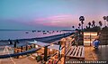 KILAKARAI STONE BEACH
 -
 I LOVE KILAKARAI
 -
 KILAKARAI STREET VIEW
 -
 KILAKARAI MOSQUE
 -
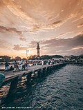 EID CELEBRATION AT KILAKARAI
 -
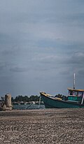 KILAKARAI OLD BRIDGE
 -
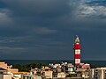 KILAKARAI LIGHTHOUSE
 -
 Interior of Odakarai Palli (masjid)
 -
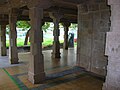 Odakarai Palli (masjid) under conservation
 -
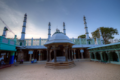 Masjid ul Jamiah
 -
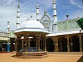 Masjid ul Jamiah (3rd oldest masjid of Kilakarai)
 -
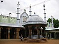 Masjid ul Jamiah
 -
 Corridor in Masjid ul Jamiah
 -
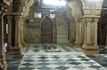 Interior of Masjid ul Jamiah
 -
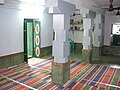 Interior of Palaiya Jumma Palli or The Old Jumma Masjid of Kilakarai, the oldest masjid of India
 -
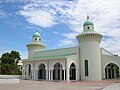 Amir ul Muminin Abu Baker Siddiq Palli (masjid)
 -
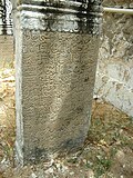 Tombstone with Arabic & Tamil (Arwi) inscription (at The Old Jumma Masjid of Kilakarai)
 -
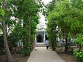 Kulangarai Appa Palli (masjid), East Street, Kilakkarai
 -
 Interior of Kulangarai Appa Palli (masjid), East Street, Kilakarai
 -
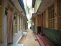 Typical street


Notes[edit | edit source]
- ↑ "Vice‑Chairman – Keelakarai Municipality". Directorate of Municipal Administration, Tamil Nadu. Retrieved 16 August 2025.
- ↑ Barbosa, Duarte; Dames, Mansel Longworth (1989). The Book of Duarte Barbosa: An Account of the Countries Bordering on the Indian Ocean and Their Inhabitants. ISBN 9788120604513.
- ↑ "செம்பி நாட்டுக்கதைகள்…… | திண்ணை".
- ↑ Kunz, G.F.; Stevenson, C.H. (2013). The Book of the Pearl: Its History, Art, Science and Industry. Dover Jewelry and Metalwork. Dover Publications. p. 113. ISBN 978-0-486-14274-6. Retrieved 14 May 2019.
- ↑ mohammad suhaib, on 17 August 2012, said (17 August 2012). "Photo of Kilakarai in an ancient map". Panoramio. Archived from the original on 18 January 2018. Retrieved 6 June 2013.
{{cite web}}: CS1 maint: multiple names: authors list (link) CS1 maint: numeric names: authors list (link) - ↑ ":: Mohamed Sathak Engineering College ::". Archived from the original on 11 August 2011. Retrieved 17 August 2011.
- ↑ "Thassim Beevi Abdul Kader College For Women". Thassim.in. 3 April 2013. Archived from the original on 24 September 2011. Retrieved 6 June 2013.
- ↑ 8.0 8.1 "Census Info 2011 Final population totals". Office of The Registrar General and Census Commissioner, Ministry of Home Affairs, Government of India. 2013. Archived from the original on 13 November 2013. Retrieved 26 January 2014.
- ↑ "Census Info 2011 Final population totals – Keelakarai". Office of The Registrar General and Census Commissioner, Ministry of Home Affairs, Government of India. 2013. Archived from the original on 24 September 2015. Retrieved 26 January 2014.
- ↑ "Population By Religious Community – Tamil Nadu" (XLS). Office of The Registrar General and Census Commissioner, Ministry of Home Affairs, Government of India. 2011. Archived from the original on 13 September 2015. Retrieved 13 September 2015.
- ↑ "Thassim Beevi Abdul Kader College for Women". Retrieved 14 March 2026.
References[edit | edit source]
- "Tamil Nadu's Kilakarai – the birth place of world famous Indian conches". onlypunjab.com. Archived from the original on 23 May 2007.
- "An oasis in a desert A district bridging the gulf". The Hindu. 7 August 2005. Archived from the original on 9 August 2005.