

>Gouri222 m Nothing |
No edit summary |
||
| Line 2: | Line 2: | ||
{{Use Indian English|date=September 2018}} | {{Use Indian English|date=September 2018}} | ||
{{Infobox settlement | {{Infobox settlement | ||
| name | | name = Irulam | ||
| other_name | | other_name = | ||
| nickname | | nickname = | ||
| settlement_type | | settlement_type = village | ||
| image_skyline | | image_skyline = File:Seetha Lava Kusha - waynad.jpg | ||
| image_alt | | image_alt = | ||
| image_caption | | image_caption = Seetha Lava Kusha Temple, Irulam | ||
| pushpin_map | | pushpin_map = | ||
| pushpin_label_position | | pushpin_label_position = right | ||
| pushpin_map_alt | | pushpin_map_alt = | ||
| pushpin_map_caption | | pushpin_map_caption = Location in Kerala, India | ||
| coordinates | | coordinates = {{coord|11|45|0|N|76|11|0|E|display=inline,title}} | ||
| subdivision_type | | subdivision_type = Country | ||
| subdivision_name | | subdivision_name = {{flag|India}} | ||
| subdivision_type1 | | subdivision_type1 = [[States and territories of India|State]] | ||
| subdivision_name1 | | subdivision_name1 = [[Kerala]] | ||
| subdivision_type2 | | subdivision_type2 = [[List of districts of India|District]] | ||
| subdivision_name2 | | subdivision_name2 = [[Wayanad district|Wayanad]] | ||
| established_title | | established_title = <!-- Established --> | ||
| established_date | | established_date = | ||
| founder | | founder = | ||
| named_for | | named_for = | ||
| government_type | | government_type = | ||
| governing_body | | governing_body = | ||
| unit_pref | | unit_pref = Metric | ||
| area_footnotes | | area_footnotes = | ||
| area_rank | | area_rank = | ||
| area_total_km2 | | area_total_km2 = | ||
| elevation_footnotes | | elevation_footnotes = | ||
| elevation_m | | elevation_m = | ||
| population_total | | population_total = 21052 | ||
| population_as_of | | population_as_of = 2011 | ||
| population_rank | | population_rank = | ||
| population_density_km2 | | population_density_km2 = auto | ||
| population_demonym | | population_demonym = | ||
| population_footnotes | | population_footnotes = | ||
| demographics_type1 | | demographics_type1 = Languages | ||
| demographics1_title1 | | demographics1_title1 = Official | ||
| demographics1_info1 | | demographics1_info1 = [[Malayalam language|Malayalam]] | ||
| timezone1 | | timezone1 = [[Indian Standard Time|IST]] | ||
| utc_offset1 | | utc_offset1 = +05:30 | ||
| postal_code_type | | postal_code_type = [[Postal Index Number|PIN]] | ||
| postal_code | | postal_code = 673579 | ||
| registration_plate | | registration_plate = [[List of RTO districts in Kerala#Sub Regional Transport Offices|KL-73]] | ||
| blank1_name_sec1 | | blank1_name_sec1 = Nearest city | ||
| blank1_info_sec1 | | blank1_info_sec1 = Pulpally | ||
| blank2_name_sec1 | | blank2_name_sec1 = Literacy | ||
| blank2_info_sec1 | | blank2_info_sec1 = 95% | ||
| blank3_name_sec1 | | blank3_name_sec1 = [[Lok Sabha]] constituency | ||
| blank3_info_sec1 | | blank3_info_sec1 = [[Wayanad District|Wayanad]] | ||
| blank4_name_sec1 | | blank4_name_sec1 = [[Vidhan Sabha]] constituency | ||
| blank4_info_sec1 | | blank4_info_sec1 = [[Sultan Bathery]] | ||
| blank1_name_sec2 | | blank1_name_sec2 = [[Climate of India|Climate]] | ||
| blank1_info_sec2 | | blank1_info_sec2 = | ||
| website | | website = | ||
| iso_code | | iso_code = [[ISO 3166-2:IN|IN-KL]] | ||
| footnotes | | footnotes = | ||
}} | }} | ||
'''Irulam''' is a small village located in [[Sultan Bathery]] Municipality, [[Wayanad District]] of [[Kerala]] in India. | |||
==Demographics== | ==Demographics== | ||
{{As of| | {{As of|2011}} India [[census]], Irulam had a population of 21052 with 10465 males and 10587 females.<ref>{{Cite web |title=Irulam Village Population - Sulthanbathery - Wayanad, Kerala |url=https://www.census2011.co.in/data/village/627314-irulam-kerala.html |access-date=2026-01-13 |website=www.census2011.co.in}}</ref><ref name="censusindia">{{cite web|title=Census of India : Villages with population 5000 & above|url=http://www.censusindia.gov.in/Census_Data_2001/Village_Directory/Population_data/Population_5000_and_Above.aspx|url-status=dead|archive-url=https://web.archive.org/web/20080211182048/http://www.censusindia.gov.in/Census_Data_2001/Village_Directory/Population_data/Population_5000_and_Above.aspx|archive-date=2008-02-11|access-date=2008-12-10|publisher=Registrar General & Census Commissioner, India}}</ref> | ||
== Economy == | == Economy == | ||
Latest revision as of 10:45, 13 January 2026
Irulam | |
|---|---|
village | |
 Seetha Lava Kusha Temple, Irulam | |
| Coordinates: 11°45′0″N 76°11′0″E / 11.75000°N 76.18333°E | |
| Country |  India India |
| State | Kerala |
| District | Wayanad |
| Population (2011) | |
| • Total | 21,052 |
| Languages | |
| • Official | Malayalam |
| Time zone | UTC+05:30 (IST) |
| PIN | 673579 |
| ISO 3166 code | IN-KL |
| Vehicle registration | KL-73 |
| Nearest city | Pulpally |
| Literacy | 95% |
| Lok Sabha constituency | Wayanad |
| Vidhan Sabha constituency | Sultan Bathery |
Irulam is a small village located in Sultan Bathery Municipality, Wayanad District of Kerala in India.
Demographics[edit | edit source]
As of 2011[update] India census, Irulam had a population of 21052 with 10465 males and 10587 females.[1][2]
Economy[edit | edit source]
The main crops in the village are pepper, coffee, cardamom, paddy and ginger.
Transportation[edit | edit source]
Irulam village can be accessed from Sultan Bathery or Pulpally. The Periya ghat road connects Mananthavady to Kannur and Thalassery. The Thamarassery mountain road connects Calicut with Kalpetta. The Kuttiady mountain road connects Vatakara with Kalpetta and Mananthavady. The Palchuram mountain road connects Kannur and Iritty with Mananthavady. The road from Nilambur to Ooty is also connected to Wayanad through the village of Meppadi.
The nearest railway station is at Mysore and the nearest airports are Kozhikode International Airport-120 km, Bengaluru International Airport-290 km, and Kannur International Airport, 58 km.
Image Gallery[edit | edit source]
-
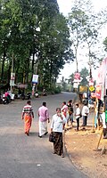 Irulam junction
 -
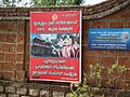 Temple Wall
 -
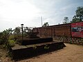 Mandapam
 -
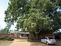 Sacred Tree


References[edit | edit source]
- ↑ "Irulam Village Population - Sulthanbathery - Wayanad, Kerala". www.census2011.co.in. Retrieved 13 January 2026.
- ↑ "Census of India : Villages with population 5000 & above". Registrar General & Census Commissioner, India. Archived from the original on 11 February 2008. Retrieved 10 December 2008.
 | This article related to a location in Wayanad district, Kerala, India is a stub. You can help Bharatpedia by expanding it. |