

m Removed empty portal template using script |
No edit summary |
||
| Line 1: | Line 1: | ||
{{Short description|Atoll in the Union Territory of Lakshadweep, India}} | {{Short description|Atoll in the Union Territory of Lakshadweep, India}} | ||
{{Redirect|Bangaram|the 2006 film|Bangaram (film)}} | {{Redirect|Bangaram|the 2006 film|Bangaram (film)}} | ||
| Line 11: | Line 10: | ||
| image_caption = | | image_caption = | ||
| image_alt = | | image_alt = | ||
| map = | | map = India3 | ||
| map_caption = Location of Bangaram Atoll in [[Lakshadweep]] | | map_caption = Location of Bangaram Atoll in [[Lakshadweep]] | ||
| coordinates = {{coord|10.95|N|72.29|E|region:IN-LD_type:isle_dim:50000_source:GNS-enwiki|display=inline,title}} | | coordinates = {{coord|10.95|N|72.29|E|region:IN-LD_type:isle_dim:50000_source:GNS-enwiki|display=inline,title}} | ||
| Line 66: | Line 65: | ||
==Geography== | ==Geography== | ||
The | The roughly rectangular atoll is 8.1 km in length with a maximum width of 4.2 km and with a [[lagoon]] area of {{convert|36|km2|abbr=on}}. It is located over {{convert|352|km|mi|abbr=on}} off [[Kannur]], {{convert|382|km|mi|abbr=on}} off [[Kozhikode]], {{convert|400|km|mi|abbr=on}} off [[Kochi]], and {{convert|525|km|mi|abbr=on}} from [[Kollam]] [[Kollam Port|Port]] in the [[Indian Ocean]]. | ||
Bangaram atoll is about {{convert|7|km|mi|abbr=on}} northeast of the island of [[Agatti]] and {{convert|25|km|mi|abbr=on}} to the southeast of [[Perumal Par]], in the western Lakshadweep [[archipelago]] at {{coord|10|56|N|72|17|E}}. Bangaram atoll is connected to the reef of Agatti through a shallow [[submarine ridge]].<ref>{{cite web|url=http://www.oceandots.com/indian/lakshadweep/bangaram.php |title=Bangaram - Oceandots |accessdate=2011-11-08 |url-status= | Bangaram atoll is about {{convert|7|km|mi|abbr=on}} northeast of the island of [[Agatti]] and {{convert|25|km|mi|abbr=on}} to the southeast of [[Perumal Par]], in the western Lakshadweep [[archipelago]] at {{coord|10|56|N|72|17|E}}. Bangaram atoll is connected to the reef of Agatti through a shallow [[submarine ridge]].<ref>{{cite web|url=http://www.oceandots.com/indian/lakshadweep/bangaram.php |title=Bangaram - Oceandots |accessdate=2011-11-08 |url-status=usurped |archiveurl=https://web.archive.org/web/20101223043232/http://www.oceandots.com/indian/lakshadweep/bangaram.php |archivedate=2010-12-23 }}</ref> | ||
===Islands=== | ===Islands=== | ||
*'''Bangaram Island''', the largest island in the atoll, with a land surface of {{convert|0.623|km2|abbr=on}} is located at {{coord|10.94|N|72.286|E}}. There is a long brackish pond in the center of the island fringed by [[screwpine]] and [[coconut palm]]s. | *'''Bangaram Island''', the largest island in the atoll, with a land surface of {{convert|0.623|km2|abbr=on}}, is located at {{coord|10.94|N|72.286|E}}. There is a long brackish pond in the center of the island fringed by [[screwpine]] and [[coconut palm]]s. | ||
*'''South Bangaram Cay''', the smallest island in the atoll, with a land surface of {{convert|0.001|km2|abbr=on}} is located at {{coord|10.933|N|72.278|E}}. It is a small sand cay. | *'''South Bangaram Cay''', the smallest island in the atoll, with a land surface of {{convert|0.001|km2|abbr=on}} is located at {{coord|10.933|N|72.278|E}}. It is a small sand cay. | ||
*'''Thinnakara''', another large island in the atoll, has a land surface of {{convert|0.522|km2|abbr=on}} . It is located {{convert|1.5|mi|km}} East-Northeast of Bangaram island, at the edge of the [[lagoon]] basin {{coord|10.945|N|72.315|E}}. | *'''Thinnakara''', another large island in the atoll, has a land surface of {{convert|0.522|km2|abbr=on}} . It is located {{convert|1.5|mi|km}} East-Northeast of Bangaram island, at the edge of the [[lagoon]] basin {{coord|10.945|N|72.315|E}}. | ||
*'''Parali 1''', '''Parali 2''' and '''Parali 3''' are three small islets at the eastern fringe of the reef {{coord|10.955|N|72.33|E}}.<ref name="gpo-">{{cite web|url=http://permanent.access.gpo.gov/websites/pollux/pollux.nss.nima.mil/NAV_PUBS/SD/pub173/173sec05.pdf|title=Pub 173. Sailing Directions (Enroute): India & The Bay of Bengal|publisher=National Imagery and Mapping Agency|year=2002|accessdate=2012-05-07}}</ref><ref> | *'''Parali 1''', '''Parali 2''' and '''Parali 3''' are three small islets at the eastern fringe of the reef {{coord|10.955|N|72.33|E}}.<ref name="gpo-">{{cite web|url=http://permanent.access.gpo.gov/websites/pollux/pollux.nss.nima.mil/NAV_PUBS/SD/pub173/173sec05.pdf|title=Pub 173. Sailing Directions (Enroute): India & The Bay of Bengal|publisher=National Imagery and Mapping Agency|year=2002|accessdate=2012-05-07}}</ref><ref>{{Cite web |url=http://www.orientalbirdclub.org/publications/forktail/10pdfs/Kurup-Lakshadweep.pdf |title=Birds of Lakshadweep Islands |access-date=8 November 2011 |archive-date=12 January 2012 |archive-url=https://web.archive.org/web/20120112215302/http://www.orientalbirdclub.org/publications/forktail/10pdfs/Kurup-Lakshadweep.pdf |url-status=dead }}</ref> The Islets have a total land surface of {{convert|0.089|km2|abbr=on}} '''Parali 1''' was washed away in 2017.<ref>{{Cite web|url=https://www.livemint.com/Science/QFLIaXhV8NswaWkdcdyisL/Uninhabited-Lakshadweep-island-Parali-I-vanishes-4-others-s.html|title=Uninhabited Lakshadweep island Parali I vanishes, 4 others shrinking fast: study|last=PTI|date=2017-09-06|website=Mint|language=en|access-date=2019-06-25}}</ref> | ||
==Demographics== | ==Demographics== | ||
| Line 97: | Line 96: | ||
File:LakshadweepIsland.jpg|One of the islands of Bangaram Atoll | File:LakshadweepIsland.jpg|One of the islands of Bangaram Atoll | ||
File:Sea off Bangaram island, Lakshadweep.jpg|View of the lagoon off Bangaram Island | File:Sea off Bangaram island, Lakshadweep.jpg|View of the lagoon off Bangaram Island | ||
File:Bangaram-mother with child.jpg|Bangaram resident mother with child | |||
</gallery> | </gallery> | ||
== References == | == References == | ||
{{Portal|Islands|India}} | |||
{{reflist}} | {{reflist}} | ||
{{commons category|Bangaram}} | {{commons category|Bangaram}} | ||
*{{wikivoyage-inline|Lakshadweep}} | *{{wikivoyage-inline|Lakshadweep}} | ||
{{Lakshadweep}} | {{Lakshadweep}} | ||
| Line 109: | Line 109: | ||
[[Category:Atolls of India]] | [[Category:Atolls of India]] | ||
[[Category:Underwater diving sites in India]] | [[Category:Underwater diving sites in India]] | ||
[[Category:Cities and towns in Lakshadweep]] | [[Category:Cities and towns in Lakshadweep district]] | ||
[[Category: | [[Category:Populated places in India]] | ||
[[Category:Islands of India]] | |||
Latest revision as of 09:36, 22 December 2025
  Bangaram Atoll Location of Bangaram Atoll in Lakshadweep | |
| Geography | |
|---|---|
| Location | Arabian Sea |
| Coordinates | 10°57′N 72°17′E / 10.95°N 72.29°E |
| Type | Atoll |
| Archipelago | Lakshadweep |
| Adjacent bodies of water | Indian Ocean |
| Total islands | 6 |
| Major islands |
|
| Area | 1.234 km2 (0.476 sq mi)[1] |
| Length | 1.22 km (0.758 mi) |
| Width | 0.7 km (0.43 mi) |
| Coastline | 3.9 km (2.42 mi) |
| Highest elevation | 1 m (3 ft) |
| Administration | |
| Territory | Union territory of Lakshadweep |
| District | Lakshadweep |
| Island group | Laccadive Islands |
| Tehsils of India | Kavaratti |
| Subdivisions of India | Agatti Island |
| Largest settlement | Thinnakara (pop. 30) |
| Demographics | |
| Population | 40 (2014) |
| Pop. density | 32/km2 (83/sq mi) |
| Ethnic groups | Malayali, Mahls |
| Additional information | |
| Time zone | |
| PIN | 68255x |
| Telephone code | 04896 |
| ISO code | IN-LD-06[2] |
| Official website | www |

Bangaram is an atoll in the Union Territory of Lakshadweep, India.
Geography[edit | edit source]
The roughly rectangular atoll is 8.1 km in length with a maximum width of 4.2 km and with a lagoon area of 36 km2 (14 sq mi). It is located over 352 km (219 mi) off Kannur, 382 km (237 mi) off Kozhikode, 400 km (250 mi) off Kochi, and 525 km (326 mi) from Kollam Port in the Indian Ocean.
Bangaram atoll is about 7 km (4.3 mi) northeast of the island of Agatti and 25 km (16 mi) to the southeast of Perumal Par, in the western Lakshadweep archipelago at 10°56′N 72°17′E / 10.933°N 72.283°E. Bangaram atoll is connected to the reef of Agatti through a shallow submarine ridge.[3]
Islands[edit | edit source]
- Bangaram Island, the largest island in the atoll, with a land surface of 0.623 km2 (0.241 sq mi), is located at 10°56′24″N 72°17′10″E / 10.94°N 72.286°E. There is a long brackish pond in the center of the island fringed by screwpine and coconut palms.
- South Bangaram Cay, the smallest island in the atoll, with a land surface of 0.001 km2 (0.00039 sq mi) is located at 10°55′59″N 72°16′41″E / 10.933°N 72.278°E. It is a small sand cay.
- Thinnakara, another large island in the atoll, has a land surface of 0.522 km2 (0.202 sq mi) . It is located 1.5 miles (2.4 km) East-Northeast of Bangaram island, at the edge of the lagoon basin 10°56′42″N 72°18′54″E / 10.945°N 72.315°E.
- Parali 1, Parali 2 and Parali 3 are three small islets at the eastern fringe of the reef 10°57′18″N 72°19′48″E / 10.955°N 72.33°E.[4][5] The Islets have a total land surface of 0.089 km2 (0.034 sq mi) Parali 1 was washed away in 2017.[6]
Demographics[edit | edit source]
Bangaram Island, the main island in the atoll, has a small population of 10. Bangaram Island Resort was located on the east coast of this island.[7] Thinnakara, has a construction camp (~30) for the new resort being built on its west coast.[8]
Administration[edit | edit source]
The island belongs to the township of Agatti Island of Kavaratti Tehsil.[9]
Tourism[edit | edit source]
The Bangaram Island Beach Resort opened to tourism in 1974, but the lack of commercial flights made access difficult. Tourism took off after the Agatti Aerodrome on the nearby Agatti island was commissioned and regular commercial flights from Kochi were established.[10] The resort had 60 cottages. Current alcohol regulations in Lakshadweep allow consumption of alcoholic drinks only on Bangaram Atoll.
The new Thinnakara is owned by locals from Agatti. It will offer numerous adventure activities, including scuba diving, snorkelling, deep sea fishing beside white sand beaches, a calm lagoon and a sparkling, clear coral reef.[11]
Flora and fauna[edit | edit source]
The Atoll is popular for its serene setting. Numerous species of tropical birds are found on the island.[12]
Image gallery[edit | edit source]
-
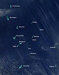 Satellite picture showing the atolls of the Lakshadweep except for Minicoy
 -
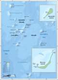 Map
Map -
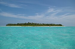 One of the islands of Bangaram Atoll
 -
 View of the lagoon off Bangaram Island
 -
 Bangaram resident mother with child


References[edit | edit source]

- ↑ "Islandwise Area and Population - 2011 Census" (PDF). Government of Lakshadweep. Archived from the original (PDF) on 22 July 2016.
- ↑ Registration Plate Numbers added to ISO Code
- ↑ "Bangaram - Oceandots". Archived from the original on 23 December 2010. Retrieved 8 November 2011.
- ↑ "Pub 173. Sailing Directions (Enroute): India & The Bay of Bengal" (PDF). National Imagery and Mapping Agency. 2002. Retrieved 7 May 2012.
- ↑ "Birds of Lakshadweep Islands" (PDF). Archived from the original (PDF) on 12 January 2012. Retrieved 8 November 2011.
- ↑ PTI (6 September 2017). "Uninhabited Lakshadweep island Parali I vanishes, 4 others shrinking fast: study". Mint. Retrieved 25 June 2019.
- ↑ Bangaram Islands Archived 2011-05-10 at the Wayback Machine
- ↑ [1] resort]
- ↑ "Tehsils info" (PDF). Archived from the original (PDF) on 21 July 2011. Retrieved 29 April 2016.
- ↑ "Tourism in Lakshadweep". Archived from the original on 19 February 2015. Retrieved 8 November 2011.
- ↑ "Bangaram Island". Union Territory of Lakshadweep. Archived from the original on 2 February 2013. Retrieved 7 May 2012.
- ↑ Satish Pande; et al. (January–February 2007). "An ornithological expedition to the Lakshadweep archipelago: Assessment of threats to pelagic and other birds and recommendations" (PDF). Indian Birds. 3 (1). Archived from the original (PDF) on 17 June 2013. Retrieved 7 May 2012.