

robot: Create/update articles. If there is a mistake please report on my talk page. |
Naveed Aslam (talk | contribs) added intro per sources and added references for accuracy |
||
| Line 1: | Line 1: | ||
{{Short description| | {{Short description|Hill fort in Mumbai, India}} | ||
{{Use dmy dates|date=September 2018}} | {{Use dmy dates|date=September 2018}} | ||
{{Use Indian English|date=September 2018}} | {{Use Indian English|date=September 2018}} | ||
{{ | {{Infobox military installation | ||
| name = Sion Fort | |||
| partof = | |||
| location = [[Sion, Mumbai|Sion]], [[Mumbai]], India | |||
| image = Sion Fort, Mumbai.png | |||
| caption = View of Sion Fort from the base of the hillock | |||
| map_type = | |||
| pushpin_map = | |||
| pushpin_mapsize = | |||
| pushpin_map_caption = | |||
| coordinates = {{coord|19|02|48|N|72|52|03|E|type:landmark_region:IN_scale:100|display=inline}} | |||
| type = [[Hillfort|Hill Fort]] | |||
| code = | |||
| height = | |||
| architect = | |||
| ownership = *[[East India Company]] (1677–1947) | |||
*[[Government of India]] (1947–Present) | |||
| open_to_public = Yes | |||
| condition = Dilapidated | |||
| built = 1669–1677 | |||
| builder = [[Gerald Aungier]] | |||
| used = | |||
| materials = [[Basalt]] and [[Lime mortar]] | |||
| demolished = | |||
| battles = | |||
| current_commander = | |||
| past_commanders = | |||
| occupants = | |||
| events = | |||
| embedded = {{designation list | embed = yes | |||
| designation1 = MANI | |||
| designation1_offname = {{ubl|Whole hill fort of Sion together with all ancient Portuguese remains of buildings situated to the north, east and south-east sides of the hill at its toe}} | |||
| designation1_date = | |||
| designation1_number = N-MH-M6<!-- for embedding other infobox templates --> }} | |||
| footnotes = | |||
}} | |||
[[File:Bombay map 18c.jpg|thumb|Old map of the region (post 1805).]] | [[File:Bombay map 18c.jpg|thumb|Old map of the region (post 1805).]] | ||
[[File:External Wall of Sion Fort.jpg|upright|thumb|The outer wall of the fort]] | [[File:External Wall of Sion Fort.jpg|upright|thumb|The outer wall of the fort]] | ||
| Line 8: | Line 43: | ||
The '''Sion Hillock Fort''' is a [[fort]] in [[Mumbai]] (Bombay), [[India]]. It was built under the regime of the English [[East India Company]], between 1669 and 1677, atop a conical hillock when [[Gerard Aungier]] was the Governor of Bombay. It was notified in 1925 as a Grade I Heritage structure.<ref>{{cite book|title=Documentation Update: April 2005 to March 2006|publisher=Equitable Tourism Options (Equations)|year=2006|pages=136 |url=https://books.google.com/books?id=a-hav3ybwDsC&dq=Sion+fort&pg=PT136}}</ref> When it was built, the fort marked the boundary between British-held Parel island and the [[Portuguese India|Portuguese]] held [[Salsette Island]] that lay to the north across the creek.<ref name="HT">{{cite web|url=http://www.hindustantimes.com/india-news/mumbai/plan-to-beautify-sion-fort-hits-roadblock/article1-726412.aspx |archive-url=https://web.archive.org/web/20130930161449/http://www.hindustantimes.com/India-news/Mumbai/Plan-to-beautify-Sion-Fort-hits-roadblock/Article1-726412.aspx |url-status=dead |archive-date=30 September 2013 |title=Plan to beautify Sion Fort hits roadblock |work= [[Hindustan Times]]|date=28 July 2011|access-date=10 September 2014}}</ref> | The '''Sion Hillock Fort''' is a [[fort]] in [[Mumbai]] (Bombay), [[India]]. It was built under the regime of the English [[East India Company]], between 1669 and 1677, atop a conical hillock when [[Gerard Aungier]] was the Governor of Bombay. It was notified in 1925 as a Grade I Heritage structure.<ref>{{cite book|title=Documentation Update: April 2005 to March 2006|publisher=Equitable Tourism Options (Equations)|year=2006|pages=136 |url=https://books.google.com/books?id=a-hav3ybwDsC&dq=Sion+fort&pg=PT136}}</ref> When it was built, the fort marked the boundary between British-held Parel island and the [[Portuguese India|Portuguese]] held [[Salsette Island]] that lay to the north across the creek.<ref name="HT">{{cite web|url=http://www.hindustantimes.com/india-news/mumbai/plan-to-beautify-sion-fort-hits-roadblock/article1-726412.aspx |archive-url=https://web.archive.org/web/20130930161449/http://www.hindustantimes.com/India-news/Mumbai/Plan-to-beautify-Sion-Fort-hits-roadblock/Article1-726412.aspx |url-status=dead |archive-date=30 September 2013 |title=Plan to beautify Sion Fort hits roadblock |work= [[Hindustan Times]]|date=28 July 2011|access-date=10 September 2014}}</ref> | ||
The hillock is situated 500 metres from the [[Sion railway station (India)|Sion railway station]].<ref>{{cite web|url=http://epaper.timesofindia.com/Repository/ml.asp?Ref=VE9JTS8yMDA4LzAyLzI3I0FyMDA3MDE |title= Sion fort to get back old glory |work= [[The Times of India]]|date=27 February 2008 |access-date=10 September 2014}}</ref> At the base of the hill is the Mumbai Circle office of the [[Archaeological Survey of India]],<ref>{{cite web|url=http://asi.nic.in/asi_aboutus_organization_circle_mumbai.asp |title=Mumbai Circle |work= [[Archeological Survey of India]]|access-date=10 September 2014}}</ref> and a garden – the [[Pandit Jawaharlal Nehru]] Udyan. Nearby forts include the [[Riwa Fort]] and [[Sewri Fort]]. | The hillock is situated 500 metres from the [[Sion railway station (India)|Sion railway station]].<ref>{{cite web|url=http://epaper.timesofindia.com/Repository/ml.asp?Ref=VE9JTS8yMDA4LzAyLzI3I0FyMDA3MDE |archive-url=https://web.archive.org/web/20140911003342/http://epaper.timesofindia.com/Repository/ml.asp?Ref=VE9JTS8yMDA4LzAyLzI3I0FyMDA3MDE |url-status=dead |archive-date=11 September 2014 |title= Sion fort to get back old glory |work= [[The Times of India]]|date=27 February 2008 |access-date=10 September 2014}}</ref> At the base of the hill is the Mumbai Circle office of the [[Archaeological Survey of India]],<ref>{{cite web|url=http://asi.nic.in/asi_aboutus_organization_circle_mumbai.asp |title=Mumbai Circle |work= [[Archeological Survey of India]]|access-date=10 September 2014}}</ref> and a garden – the [[Pandit Jawaharlal Nehru]] Udyan. Nearby forts include the [[Riwa Fort]] and [[Sewri Fort]]. | ||
The fort is dilapidated and a collection of broken stone steps, scattered walls and ruins, overrun by trees and ground cover. The fort wall has a small room on top. A series of pathways lead to it. The fort offers a panoramic view, overlooking the salt pans in the [[Thane Creek]]. However vandalism and apathy have taken their toll on the structure. Restoration of the fort had begun in 2009 but was stopped mid-way due to paucity of funds.<ref name="HT"/> | The fort is dilapidated and a collection of broken stone steps, scattered walls and ruins, overrun by trees and ground cover. The fort wall has a small room on top. A series of pathways lead to it. The fort offers a panoramic view, overlooking the salt pans in the [[Thane Creek]]. However vandalism and apathy have taken their toll on the structure. Restoration of the fort had begun in 2009 but was stopped mid-way due to paucity of funds.<ref name="HT"/> | ||
| Line 41: | Line 76: | ||
[[Category:History of Mumbai]] | [[Category:History of Mumbai]] | ||
[[Category:1670s establishments in the British Empire]] | [[Category:1670s establishments in the British Empire]] | ||
[[Category:Monuments of National Importance in Maharashtra]] | |||
{{maharashtra-stub}} | {{maharashtra-stub}} | ||
{{fort-stub}} | {{fort-stub}} | ||
Latest revision as of 18:15, 18 September 2025
| Sion Fort | |
|---|---|
| Sion, Mumbai, India | |
 View of Sion Fort from the base of the hillock | |
| Coordinates | 19°02′48″N 72°52′03″E / 19.04667°N 72.86750°E |
| Type | Hill Fort |
| Site information | |
| Owner |
|
| Open to the public | Yes |
| Condition | Dilapidated |
| Site history | |
| Built | 1669–1677 |
| Built by | Gerald Aungier |
| Materials | Basalt and Lime mortar |
| Lua error: bad argument #1 to 'mw.loadJsonData' ('Module:Designation/list' is not a valid JSON page). | |
Official name |
|
| Reference no. | N-MH-M6 |


The Sion Hillock Fort is a fort in Mumbai (Bombay), India. It was built under the regime of the English East India Company, between 1669 and 1677, atop a conical hillock when Gerard Aungier was the Governor of Bombay. It was notified in 1925 as a Grade I Heritage structure.[1] When it was built, the fort marked the boundary between British-held Parel island and the Portuguese held Salsette Island that lay to the north across the creek.[2]
The hillock is situated 500 metres from the Sion railway station.[3] At the base of the hill is the Mumbai Circle office of the Archaeological Survey of India,[4] and a garden – the Pandit Jawaharlal Nehru Udyan. Nearby forts include the Riwa Fort and Sewri Fort.
The fort is dilapidated and a collection of broken stone steps, scattered walls and ruins, overrun by trees and ground cover. The fort wall has a small room on top. A series of pathways lead to it. The fort offers a panoramic view, overlooking the salt pans in the Thane Creek. However vandalism and apathy have taken their toll on the structure. Restoration of the fort had begun in 2009 but was stopped mid-way due to paucity of funds.[2]
Gallery[edit | edit source]
-
 The fort together with all ancient Portuguese remains of buildings situated to the north, east and south-east sides of the hill
 -

-
 Fort walls
 -
 Fort walls
 -
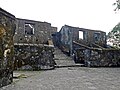 fort of Sion ancient Portuguese remains at Sion Fort
 -
 The fort
 -
 A Canon at the Fort
 -
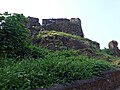 The fort on the hill


See also[edit | edit source]
References[edit | edit source]
- ↑ Documentation Update: April 2005 to March 2006. Equitable Tourism Options (Equations). 2006. p. 136.
- ↑ 2.0 2.1 "Plan to beautify Sion Fort hits roadblock". Hindustan Times. 28 July 2011. Archived from the original on 30 September 2013. Retrieved 10 September 2014.
- ↑ "Sion fort to get back old glory". The Times of India. 27 February 2008. Archived from the original on 11 September 2014. Retrieved 10 September 2014.
- ↑ "Mumbai Circle". Archeological Survey of India. Retrieved 10 September 2014.

19°02′48″N 72°52′04″E / 19.0467°N 72.8677°E
 | This Maharashtra-related article is a stub. You can help Bharatpedia by expanding it. |
 | This military base or fortification article is a stub. You can help Bharatpedia by expanding it. |