







ImportMaster (talk | contribs) No edit summary |
Enhanced and reorganized content |
||
| Line 1: | Line 1: | ||
{{Short description|Mountain range along the eastern coast of India}} | |||
{{Use dmy dates|date=October 2019}} | |||
{{Use Indian English|date=August 2019}} | |||
{{Infobox mountain | |||
| name = Eastern Ghats | |||
| photo = Andhra Pradesh - Landscapes from Andhra Pradesh, views from Indias South Central Railway (83).JPG | |||
| photo_caption = Eastern Ghats at the [[Sri Venkateswara National Park]] near [[Talakona]] in [[Andhra Pradesh]] | |||
| country = India | |||
| subdivision1_type = Regions | |||
| subdivision1 = [[Eastern India|Eastern]] and [[Southern India]] | |||
| subdivision2_type = States | |||
| subdivision2 = {{hlist|[[Odisha]]|[[Andhra Pradesh]]|[[Tamil Nadu]]|[[Karnataka]]|[[Telangana]]}} | |||
<!-- *** Orthography *** --> | |||
| geology = {{hlist|[[Charnockite]]|[[Granite]]|[[Khondalite]]|[[Metamorphic ]]|[[Quartzite]]}} | |||
| orogeny = | |||
| biome = [[Tropical forests]] and [[Wetlands]] | |||
<!-- *** Geography *** --> | |||
| area_km2 = 75000 | |||
| length_km = 1750 | |||
| length_orientation = N–S | |||
| width_km = 100-200 | |||
| width_orientation = E–W | |||
| highest = [[Arma Konda]] | |||
| coordinates = {{coord|18|13|41|N|82|43|23|E|type:mountain|display=inline,title}} | |||
| highest_location = Andhra Pradesh | |||
| elevation_m = 1680 | |||
| elevation_ref = <ref>{{cite web|title=SOI Sheet Number 65J/12|url=https://onlinemaps.surveyofindia.gov.in|work=Survery of India|access-date=1 June 2024}}</ref><ref name="Arma">{{cite web|url=http://peakbagger.com/peak.aspx?pid=52152|title=Arma Konda, India|work=Peak Bagger|access-date=1 June 2017|archive-date=15 July 2023|archive-url=https://web.archive.org/web/20230715233023/https://www.peakbagger.com/peak.aspx?pid=52152|url-status=live}}</ref> | |||
}} | |||
The '''Eastern Ghats''' is a mountain range that stretches {{cvt|1,750|km}} along the [[East Coast of India|eastern coast]] of the [[Indian peninsula]]. Covering an area of {{cvt|75,000|km2}}, it traverses the [[states and union territories of India|states]] of [[Odisha]], [[Telangana]], [[Andhra Pradesh]], [[Karnataka]], and [[Tamil Nadu]]. The range forms a discontinuous chain of mountains along the eastern edge of the [[Deccan Plateau]], stretching from north of the [[Mahanadi River]] in Odisha to [[Vaigai River]] in Tamil Nadu at the southern end of the peninsula. The Eastern Ghats meet the [[Western Ghats]] at the [[Nilgiris]]. The average elevation is around {{cvt|600|m}} and [[Arma Konda]] is the highest peak in the mountains at {{cvt|1680|m}}. | |||
Geological evidence indicates that the mountains were formed during the [[archeozoic]] era and became part of the [[Indian subcontinent]] post the break-up of the supercontinent of [[Rodinia]] and the formation of [[Gondwana]]. The mountains were formed through further [[metamorphism]] during the mid-[[Proterozoic]] era. The northern section of the range has an elevation ranging from {{cvt|900-1400|m}} and lies mostly in Odisha. The middle section stretches up to the [[Penna River]] and consists of two parallel ranges with an average elevation of {{cvt|520|m}}. At the southern end, the range is made up of several smaller hills. | |||
The Eastern Ghats form a part of one of the major [[Drainage basin|watersheds]] of India, consisting of many perennial river systems such as the [[Godavari]], [[Krishna River|Krishna]], Mahanadi and [[Kaveri]]. Because of the higher elevation of the Deccan Plateau on the west, most rivers originate from the Western Ghats and flow eastwards to cut across the range to the [[Bay of Bengal]]. As the mountains are discontinuous and have a lower elevation, they have a considerably lesser influence than the Western Ghats on the weather patterns in India. However, [[orography]] studies indicate that the range does play a role in bringing rainfall to the eastern coastal areas. | |||
The weather is normally dry and humid with seasonal rainfall. There are nine different forest types found in the region including [[evergreen forests|evergreen]], [[deciduous]] and [[Thorns, spines, and prickles|thorn]] forests. The Eastern Ghats region contains a large number of different species of flora and fauna, some of which are endemic to this region. | |||
== Etymology == | |||
The name Eastern Ghats derives from the word [[ghat]] and the cardinal direction in which it is located with respect to the Indian mainland. ''Ghat'', a term used in the Indian subcontinent, depending on the context, could either refer to a [[Geography of India#Coastal plains and ghats|range of stepped hills]] such as the Western Ghats and Eastern Ghats, or a series of steps leading down to a body of water or [[wharf]].<ref>{{cite book|author1=Sunithi L. Narayan|author2=Revathy Nagaswami|title=Discover Sublime India|publisher=[[University of Michigan]]|year=1992|page=5}}</ref><ref>{{cite web|url=https://dictionary.cambridge.org/dictionary/english/ghat|title=Ghat definition|access-date=30 January 2019|work=[[Cambridge dictionary]]|archive-date=30 January 2019|archive-url=https://web.archive.org/web/20190130053346/https://dictionary.cambridge.org/dictionary/english/ghat|url-status=live}}</ref> As per linguist [[Thomas Burrow]], the word ''Ghat'' was derived from similar words used in various [[Dravidian languages|Dravidian]] languages such as ''kattu'' (mountain side, ridge, or dam) in [[Tamil language|Tamil]], ''katte'' (dam), ''gatta'' (mountain), and ''gatte'' (bank or shore) in [[Kannada]], and ''katta'' (dam), and ''gattu'' (shore or embankment) in [[Telugu language|Telugu]].<ref>{{cite book|last=Jaini|first=Padmanabh S.|title=Jainism and Early Buddhism|year=2003|publisher=Jain Publishing Company|pages=528|isbn=978-0-8958-1956-7}}</ref> | |||
== Geology == | |||
[[File:Khondalite suite of rocks (Eastern Ghats) at Tenneti park beach.JPG|thumb|[[Khondalite]] is one of the major rock types found in the Eastern Ghats.]] | |||
The Eastern Ghats are an ancient [[orogenic]] belt which started forming during the collision of crustal rocks during the [[archeozoic]] era. Geologic evidence indicates that these became part of the Indian subcontinent following the break-up of the super-continent of Rodinia and the creation of Gondwana. The mountains were formed over millions of years through [[metamorphism]], and [[erosion]] and are significantly older than the Western Ghats.<ref>{{cite web|url=https://lakesofindia.com/2022/08/27/the-eastern-ghats-of-india-in-depth/#:~:text=Eastern%20Ghats%2C%20an%20ancient%20orogenic,older%20than%20the%20Western%20Ghats|title=Eastern Ghats: an ancient orogenic, older than the Western Ghats|work=Lakes of India|access-date=27 August 2022}}</ref><ref name="PA">{{cite web|url=https://peakvisor.com/range/eastern-ghats.html|title=Eastern Ghats|work=Peakvisor|access-date=1 June 2024}}</ref> The rock layers were largely formed during the mid-proterozoic era by the accumulation of [[silt]], [[carbonates]] and [[basalt]] which later became [[khondalite]] and [[calcium silicate]] rocks. The major rock types found are [[charnockite]], [[granite]], khondalite, [[metamorphic]], and [[quartzite]].<ref name="PA"/><ref>{{cite journal|url=https://virtualexplorer.com.au/system/files/papers/00254/assets/proterozoic-eastern-ghats-belt.pdf|title=Proterozoic Eastern Ghats Belt, India – a witness of multiple orogenies and its lineage with ancient supercontinents|author1=Subrata Karmakar|author2=Sankar Bose|author3=Kaushik Das|author4=Somnath Dasgupta|journal=Journal of the Virtual Explorer|issn=1441-8142|volume=32|year=2009|access-date=7 November 2024|archive-date=14 April 2024|archive-url=https://web.archive.org/web/20240414202540/https://virtualexplorer.com.au/system/files/papers/00254/assets/proterozoic-eastern-ghats-belt.pdf|url-status=live}}</ref> | |||
In the [[mesoproterozoic]] era, the range was compacted and re-aligned north-east. The structure includes multiple [[Thrust fault|thrusts]] and [[strike-slip fault]]s along its range.<ref>{{cite journal |last1=Sriramadas |first1=A. |date=November 1967 |title=Geology of Eastern Ghats in Andhra Pradesh |url=https://link.springer.com/content/pdf/10.1007%2FBF03052185.pdf#page-1 |journal=Proceedings of the Indian Academy of Sciences, Section B |volume=66 |issue=5 |pages=200–205 |doi=10.1007/BF03052185 |s2cid=126925893}}</ref> The [[Eparchaean Unconformity]] of the [[Tirumala Hills]] is a major [[unconformity|discontinuity]] of [[stratigraphy|stratigraphic]] significance that represents an extensive period of erosion and [[Deposition (geology)|non-deposition]], which is evident from the steep natural slopes, and ravines.<ref>{{cite web|url=http://www.portal.gsi.gov.in/pls/portal/url/page/GSI_STATIC/GSI_STAT_GEO_TOURISM_MONUMENTS|title=Eparchaean Unconformity, Tirumala Ghat section|access-date=20 September 2009| publisher=[[Geological Survey of India]]|archive-url=https://archive.today/20130419091251/http://www.portal.gsi.gov.in/pls/portal/url/page/GSI_STATIC/GSI_STAT_GEO_TOURISM_MONUMENTS|archive-date=19 April 2013| url-status=dead}}</ref><ref>{{cite book|title=Geological Monuments of India: Eparchaean Unconformity (Tirupati Tirupati Road)|pages=5–8|publisher=[[Geological Survey of India]]| year=2001}}</ref> Along the western edge, [[sedimentary rocks]] were deposited due to [[volcanic]] activity, which and later formed [[schist]] belts. The region consists of [[bauxite]], [[iron ore]] and [[limestone]] reserves. The major soil types found are [[red soil|red]], [[chernozem|black]], [[laterite soil|laterite]], and [[alluvial soil|alluvial]].<ref name="PA"/> | |||
== Geography == | |||
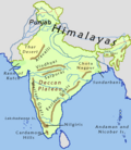
[[File:Indiahills.png|thumb|Mountain ranges of India, showing the Eastern Ghats]] | |||
The Eastern Ghats extend from north of the [[Mahanadi River]] and run approximately {{cvt|1750|km}} to the [[Vaigai River|Vaigai basin]] in the south of Indian peninsula.<ref name="BSI">{{cite report|url=https://bsi.gov.in/uploads/userfiles/file/ENVIS/PAMPLETS/Pamplet_Endemic%20Flowering%20Plants%20of%20Eastern%20Ghats,%20India.pdf|title=Endemic Flowering Plants of Eastern Ghats|page=2|publisher=[[Botanical Survey of India]]|access-date=1 June 2024}}</ref> It covers an area of {{cvt|160,000|km2}}, traversing across the [[States and union territories of India|Indian states]] of [[Odisha]] (25%), [[Telangana]] (5%), [[Andhra Pradesh]] (40%), [[Karnataka]] (5%), and [[Tamil Nadu]] (25%).<ref name="Eco">{{cite web|url=https://india.mongabay.com/2020/02/climate-change-land-use-change-may-enhance-plant-species-loss-in-the-eastern-ghats/|title=Climate change, land-use change may enhance plant species loss in the Eastern Ghats|date=26 February 2020|access-date=1 June 2024|work=[[Mongabay]]|archive-date=26 May 2024|archive-url=https://web.archive.org/web/20240526142755/https://india.mongabay.com/2020/02/climate-change-land-use-change-may-enhance-plant-species-loss-in-the-eastern-ghats/|url-status=live}}</ref><ref name="EG">{{cite report|url=http://cgrindia.org/wp-content/uploads/2024/03/Eastern-Ghats-Environment-Outlook-compressed.pdf|title=Eastern Ghats environmental outlook|publisher=Greens Alliance for Conservation of Eastern Ghats|date=March 2024|access-date=1 June 2024|archive-date=12 August 2024|archive-url=https://web.archive.org/web/20240812064012/http://cgrindia.org/wp-content/uploads/2024/03/Eastern-Ghats-Environment-Outlook-compressed.pdf|url-status=live}}</ref>{{rp|page=24}} | |||
=== Topography === | |||
The Eastern Ghats form a discontinuous chain of mountains with an average elevation of {{cvt|600|m}} and run parallel to the [[East Coast of India|eastern coast of India]] along the Bay of Bengal.<ref name="PA"/><ref name="Brit">{{cite encyclopedia|url=https://www.britannica.com/place/Ghats#ref233982|title=Ghats|encyclopedia=[[Britannica]]|access-date=1 December 2023}}</ref> The [[Eastern coastal plains]] are the {{cvt|100-130|km}} wide region between the Eastern Ghats and the Bay of Bengal.<ref>{{cite press release|url=https://pib.gov.in/newsite/erelcontent.aspx?relid=42501|title=Physiography of Water|date=9 September 2008|access-date=1 June 2024|work=[[Press Information Bureau]]}}</ref><ref>{{cite book|title=Population of India|publisher=Economic and Social Commission for Asia and the Pacific, United Nations|year=1982|page=2}}</ref> The average width of the mountains range from {{cvt|100-200|km}} with the mountains wider in the north and narrower in the south.<ref name="BSI"/><ref name="EG"/>{{rp|page=24}} [[Arma Konda]] is the highest peak in the mountains at {{cvt|1680|m}}.<ref name="Brit"/><ref name="Herb">{{cite web|url=https://indiaflora-ces.iisc.ac.in/EasternGhats/easternghats.php|title=Eastern Ghats|work=[[Indian Institute of Science]]|access-date=1 June 2024|archive-date=15 September 2024|archive-url=https://web.archive.org/web/20240915200014/https://indiaflora-ces.iisc.ac.in/EasternGhats/easternghats.php|url-status=live}}</ref> | |||
The range can be roughly divided into three separate sections. The northern section of the range lies majorly in Odisha and stretches from the Similipal hills in the north to the Andhra Pradesh border. It has an elevation ranging from {{cvt|900-1400|m}} with the highest peak at [[Deomali (mountain)|Deomali]] (1672 m).<ref name="Herb"/><ref name="EG"/>{{rp|page=24}} The central section lies in Telangana and Andhra Pradesh and stretches up to the [[Penna River]]. It consists of two parallel ranges with an average elevation of {{cvt|520|m}} and is separated by a {{cvt|160|km}} wide gorge through which the rivers [[Godavari]] and [[Krishna River|Krishna]] flow. The hills continue as [[Javadi Hills|Javadi]] and [[Shevaroy Hills]], south of [[Chennai]] and meet with the Western Ghats at [[Nilgiris]]. The [[Biligiriranga Hills|Biligiriranga]] and [[Malai Mahadeshwara Hills]] in Karnataka extend to Talamalai in Tamil Nadu, and is separated from the Western Ghats meet by the [[Moyar River]] valley.<ref>{{cite report|url=https://cgrindia.org/wp-content/uploads/2024/03/Eastern-Ghats-Environment-Outlook-compressed.pdf|title=Eastern Ghats Environment Outlook|date=March 2024|access-date=1 June 2025|work=CGRI|page=24}}</ref> At the southern end, the Eastern Ghats is made up of several smaller hills such as the [[Sirumalai]].<ref name="Brit"/><ref name="Herb"/><ref name="EG"/>{{rp|page=24}} | |||
{{Table alignment}} | |||
{| class="wikitable sortable defaultleft collapsible" style="font-size: 85%" | |||
|+Hill ranges of Eastern Ghats<ref name="EG"/>{{rp|page=25}} | |||
|- | |||
!Section | |||
!State | |||
!Range | |||
!District | |||
|- | |||
|rowspan="7"|North | |||
|rowspan="7"|[[Odisha]] | |||
|[[Similipal]] | |||
|[[Mayurbhanj district|Mayurbhanj]] | |||
|- | |||
|[[Garhjat Hills|Garhjat]] | |||
|[[Bargarh district|Bargarh]], [[Jharsuguda district|Jharsuguda]], [[Kendujhar district|Kendujhar]], [[Sambalpur district|Sambalpur]], [[Subarnapur district|Subarnapur]], [[Sundergarh district|Sundergarh]] | |||
|- | |||
|[[Gandhamardan Hills|Gandhamardan]] | |||
|[[Balangir district|Balangir]], [[Bargarh district|Bargarh]], [[Sambalpur district|Sambalpur]] | |||
|- | |||
|[[Kandhamal]] | |||
|[[Kalahandi district|Kalahandi]], [[Phulbani district|Phulbani]] | |||
|- | |||
|[[Niyamgiri]] | |||
|[[Kalahandi district|Kalahandi]], [[Rayagada district|Rayagada]] | |||
|- | |||
|[[Deomali (mountain)|Deomali]] | |||
|[[Koraput district|Koraput]] | |||
|- | |||
|[[Mahendragiri (Odisha)|Mahendragiri]] | |||
|[[Gajapati district|Gajapati]] | |||
|- | |||
|rowspan="11"|Central | |||
|rowspan="11"|{{nowrap|[[Andhra Pradesh]]}} <br/> [[Telangana]] | |||
|- | |||
|[[Palakonda]], Antikonda, Burrakonda, [[Pathapatnam]], [[Mandasa]], [[Sompeta]] | |||
|[[Parvathipuram Manyam district|Parvathipuram]], [[Srikakulam district|Srikakulam]] | |||
|- | |||
|[[Salur]], Peddakonda, Duggeru, Gurupam, Kalikonda, Sunkarimetta, Madgole&ndash;[[Ananthagiri Hills|Anantagiri]], [[Chintapalli, Alluri Sitharama Raju district|Chintapalli]]&ndash;Sapparla&ndash;[[Gudem kotha veedhi|Gudem]]&ndash;Marripakala | |||
|[[Alluri Sitharama Raju district|Alluri]], [[Parvathipuram Manyam district|Parvathipuram]], [[Visakhapatnam district|Visakhapatnam]], [[Vizianagaram district|Vizianagaram]] | |||
|- | |||
|Gurthedu, [[Addateegala]], [[Rampachodavaram]], Maredumili, Bison Hills | |||
|[[Alluri Sitharama Raju district|Alluri]], [[East Godavari district|East Godavari]] | |||
|- | |||
|[[Polavaram, Eluru district|Polavaram]], [[Papikonda National Park|Papikonda]] | |||
|[[Alluri Sitharama Raju district|Alluri]], [[Eluru district|Eluru]], [[West Godavari district|West Godavari]] | |||
|- | |||
|[[Kondapalli]] | |||
|[[Krishna district|Krishna]] | |||
|- | |||
|[[Kondaveedu Fort|Kondaveedu]] | |||
|[[Palnadu district|Palnadu]] | |||
|- | |||
|[[Nallamala Hills|Nallamala]] | |||
|[[Guntur district|Guntur]], [[Kurnool district|Kurnool]], [[Nagarkurnool district|Nagarkurnool]], [[Nalgonda district|Nalgonda]], [[Prakasam district|Prakasam]], [[Wanaparthy district|Wanaparthy]] | |||
|- | |||
|Yerramala, [[Palakonda]] | |||
|[[Kadapa district|Kadapa]] | |||
|- | |||
|Veligonda | |||
|[[Nellore district|Nellore]] | |||
|- | |||
|[[Seshachalam Hills|Seshachalam]], [[Sri Lankamalleswara Wildlife Sanctuary|Lankamala]], [[Nagari, Andhra Pradesh|Nagari]], Kambakkam | |||
|[[Chittoor district|Chittoor]], [[Kadapa district|Kadapa]], [[Tirupati district|Tirupati]] | |||
|- | |||
|rowspan="9"|South | |||
|rowspan="9"|{{nowrap|[[Karnataka]]}} <br/> [[Tamil Nadu]] | |||
|[[Biligiriranga Hills|Biligiriranga]] | |||
|[[Chamarajanagar district|Chamarajanagar]] | |||
|- | |||
|Kambakkam | |||
|[[Vellore district|Vellore]] | |||
|- | |||
|[[Javadi Hills|Javadi]] | |||
|[[Tirupathur district|Tirupathur]], [[Tiruvannamalai district|Tiruvannamalai]], [[Vellore district|Vellore]] | |||
|- | |||
|[[Gingee]] | |||
|[[Viluppuram district|Viluppuram]] | |||
|- | |||
|[[Servarayan Hills|Servarayan]], [[Kalrayan Hills|Kalrayan]] | |||
|[[Salem district|Salem]] | |||
|- | |||
|[[Kolli Hills|Kollimalai]], [[Bodhamalai]], Nainamalai | |||
|[[Namakkal district|Namakkal]] | |||
|- | |||
|[[Chitteri Hills|Chitteri]] | |||
|[[Dharmapuri district|Dharmapuri]] | |||
|- | |||
|[[Melagiri]] | |||
|[[Dharmapuri district|Dharmapuri]], [[Krishnagiri district|Krishnagiri]] | |||
|- | |||
|[[Pachaimalai Hills|Pachaimalai]] | |||
|[[Tiruchirappalli district|Tiruchirappalli]] | |||
|} | |||
=== Hydrology === | |||
[[File:Early_morning_in_Godavari_02.jpg|thumb|[[Godavari]] is the largest river in the region and cuts through the range.]] | |||
The Eastern Ghats form one of the major [[Drainage basin|watersheds]] of India with major river systems such as [[Godavari]], [[Kaveri]], [[Krishna River|Krishna]] and [[Mahanadi]] cutting across the range.<ref name="PA"/><ref name="Herb"/><ref>{{cite book|title=The Indian Rivers: Scientific and Socio-economic Aspects|author= Dhruv Sen Singh|year=2017|isbn=978-9-8110-2984-4|publisher=[[Springer Science]]|page=309}}</ref> Most rivers flow eastwards towards the Bay of Bengal owing to the steeper gradient moving from east to west.<ref>{{cite book|title=Western Ghats - From Ecology To Economics|author1=Shanavas P H|author2=Sumesh A K|author3=Haris P M|year=2016|isbn=978-9-3852-4758-3|publisher=Educreation Publishing|pages=27–29}}</ref> The Eastern Ghats are the source for many small and medium rivers of the east coastal plains.<ref>{{cite book |author1=T. Pullaiah |url=https://books.google.com/books?id=pSXidQZupHYC&pg=PR3 |title=Flora of Eastern Ghats : hill range of South East India. |author2=D. Muralidhara Rao |publisher=Regency Publications |year=2002 |isbn=978-81-87498-49-0 |page=3}}</ref> | |||
{{Table alignment}} | |||
{| class="wikitable sortable defaultleft collapsible" style="font-size: 85%" | |||
|+ Minor rivers of the Eastern Ghats<ref name="EG"/>{{rp|page=36}} | |||
|- | |||
![[Riparian zone|Riparian state]] | |||
!Rivers | |||
|- | |||
|[[Odisha]] | |||
|[[Baitarani]], [[Brahmani River|Brahmani]], [[Budhabalanga]], [[Nagavali River|Nagavali]], [[Rushikulya]], [[Sabari River|Sabari]], [[Subarnarekha River|Subarnarekha]], [[Vamsadhara River|Vamsadhara]] | |||
|- | |||
|[[Andhra Pradesh]] | |||
|[[Champavathi River|Champavathi]], [[Chitravathi River|Chitravathi]], [[Gosthani River|Gosthani]], [[Gundlakamma River|Gundlakamma]], [[Kundu River|Kundu]], [[Penna River|Penna]], [[Sarada River|Sarada]], [[Sileru River|Sileru]], [[Swarnamukhi]], [[Tammileru]] | |||
|- | |||
|[[Tamil Nadu]] | |||
|[[Amaravathi River|Amaravathi]], [[Palar]], [[Ponnaiyar River|Ponnaiyar]], [[Swetha River|Swetha]], [[Thamirabarani River|Thamirabharani]], [[Varaha River|Varaha]], [[Vaigai]], [[Vellar River|Vellar]] | |||
|} | |||
The streams and rivers give rise to numerous waterfalls in the region. The region also consists of many [[wetlands]] and large coastal [[lagoons]] such as the [[Chilika Lake|Chilika]], [[Kolleru lake|Kolleru]] and [[Pulicat Lake|Pulicat]] lakes.<ref name="EG"/>{{rp|page=36}} The rivers have been dammed for [[hydroelectric]] and [[irrigation]] purposes, with major reservoirs spread across the region.<ref>{{cite web|url=http://www.rainwaterharvesting.org/resources/statistics/stat233.htm|title=Indian Dams by River and State|work=Rain water harvesting|access-date=19 March 2007|archive-date=19 March 2007|archive-url=https://web.archive.org/web/20070319061137/http://www.rainwaterharvesting.org/resources/statistics/stat233.htm|url-status=live }}</ref><ref>{{cite book|first1=R.L.|last1=Samani|first2=A.P.|last2=Ayhad|title=Silting Problems in Hydropower Plants|editor=S. P. Kaushish|editor2=B. S. K. Naidu|publisher=Central Board of Irrigation and Power|location=Bangkok|year=2002|chapter=Siltation of Reservoirs-Koyna Hydroelectric Project-A Case Study|isbn=978-90-5809-238-0}}</ref> | |||
== Climate == | |||
[[File:Koppen-Geiger_Map_IND_present.svg|thumb|Climatic zones in India]] | |||
As the mountains are discontinuous and have a lower elevation, they have a considerably lesser influence than the Western Ghats on the [[weather in India|weather patterns in India]]. However, [[orography]] studies indicate that the range does play a role in rainfall patterns along the coast. The range blocks winds at the low level which brings rainfall to the eastern coastal plains.<ref>{{cite journal|url=https://journals.ametsoc.org/view/journals/mwre/146/4/mwr-d-16-0473.1.xml|title=Role of Eastern Ghats Orography and Cold Pool in an Extreme Rainfall Event over Chennai on 1 December 2015|author=Jayesh Phadtare|date=1 April 2018|pages=943–965|journal=Monthly Weather Report|publisher=[[American Meteorological Society]]|access-date=7 November 2024|archive-date=18 April 2024|archive-url=https://web.archive.org/web/20240418203905/https://journals.ametsoc.org/view/journals/mwre/146/4/mwr-d-16-0473.1.xml|url-status=live}}</ref> The Eastern Ghats region has a [[tropical climate]] and receives rainfall from the [[monsoon]]. It is hot in the summers with temperatures reaching {{cvt|44|°C}} during summer with [[humidity]] levels of 65–75%. The northern region receives {{cvt|120-150|cm}} of rainfall and the lower regions receive {{cvt|60-110|cm}} of rain. The temperature is lowest in the winter month of January with an average of {{cvt|20-25|°C}}. The higher hill ranges are generally wetter and cooler with the lower parts remaining semi-arid and dry. The coastal regions experience [[tropical cyclones]] during the monsoon season.<ref name="Herb"/><ref name="EG"/>{{rp|page=28}} | |||
== Bio-diversity == | |||
=== Flora === | |||
[[File:Cauvery_Wildlife_Sanctuary_9.JPG|thumb|[[South Deccan Plateau dry deciduous forests|Dry deciduous]] forests are common across the region.]] | |||
There are nine forest types in the Eastern Ghats region, namely [[evergreen forests|tropical evergreen]], [[Odisha semi-evergreen forests|semi-evergreen]], [[Eastern Highlands moist deciduous forests|moist deciduous]], [[riverine forest|riverine]], [[South Deccan Plateau dry deciduous forests|southern dry deciduous]], [[Northern dry deciduous forests|northern dry deciduous]], [[grasslands|dry savannah]], [[Deccan thorn scrub forests|thorn scrub]], and [[East Deccan dry evergreen forests|dry evergreen forests]].<ref name="BSI"/> The vegetation varies considerably with altitude with scrubs and dry forests at lower altitudes and deciduous, semi-evergreen forests, and evergreen forests at higher altitudes.<ref name="Herb"/> Tropical evergreen forests occur in small patches in [[Shevroy]] in Tamil Nadu and in north Andhra Pradesh. Semi-evergreen forests are found in the northern section and southern fringes. Moist deciduous forests occur in Odisha and [[Nallamala]] in Andhra Pradesh&ndash;Telangana. Dry deciduous, dry savannah and scrub forests occur across the range. Dry evergreen forests are limited to south Andhra Pradesh, and north Tamil Nadu.<ref name="EG"/>{{rp|page=44}} | |||
The region is home to more than 4500 species of [[angiosperms]], which account for 13% of the flowering plant species in India.<ref name="Herb"/><ref name="PA"/> About 166 species of flowering plants are [[endemic]] to the Eastern Ghats and more than ten new species have been discovered in the region since the early 2010s.<ref name="BSI"/> About 184 species of [[ferns]], and 190 species of [[orchids]] have been recorded in the region.<ref name="EG"/>{{rp|page=43}} Commercially viable tree species include [[Indian rosewood]], [[teak]], [[mahogany]], and [[red sandalwood]].<ref name="EG"/>{{rp|page=44}}<ref name="PA"/> | |||
=== Fauna === | |||
[[File:Slender_Loris.jpg|thumb|The [[grey slender loris]] is limited to [[South India]] and parts of [[Sri Lanka]].]] | |||
{{Table alignment}} | |||
{| class="wikitable sortable defaultcenter col1left collapsible" style="font-size: 85%" | |||
|+Bio-diversity of Eastern Ghats<ref name="EG"/>{{rp|page=42}} | |||
|- | |||
!Group | |||
!Species in Eastern Ghats | |||
!Species in India | |||
|- | |||
|[[Mammals]] | |||
|100 | |||
|250 | |||
|- | |||
|[[Birds]] | |||
|425 | |||
|1224 | |||
|- | |||
|[[Reptiles]] | |||
|99 | |||
|197 | |||
|- | |||
|[[Amphibians]] | |||
|100 | |||
|408 | |||
|- | |||
|[[Fishes]] | |||
|155 | |||
|2546 | |||
|} | |||
Mammals found in the region include the [[Bengal tiger]], [[leopard]], [[sloth bear]], [[Indian wild dog]], [[golden jackal]], [[Indian fox]], and other cat species such as [[jungle cat]], [[fishing cat]], and [[leopard cat]]. Large herbivores include [[Indian elephant]], [[blackbuck]], [[sambar deer]], [[spotted deer]], [[barking deer]], [[Indian gazelle]], [[four-horned antelope]], [[Indian bison]], [[wild boar]], [[Indian crested porcupine]], [[mouse deer]], and [[nilgai]]. Other smaller mammals include [[grey slender loris]], [[Indian hare]], [[Indian hedgehog]], [[Indian mongoose]], [[mole rat]], [[smooth coated otter]], [[Indian pangolin]], [[palm civet]], [[Indian giant flying squirrel]], and [[Madras treeshrew]].<ref name="EG"/>{{rp|page=43}} [[Bonnet macaque]], [[rhesus macaque]], and [[Hanuman langur]] are the major [[primates]]. The region is also home to more than 15 species of [[bats]].<ref name="EG"/>{{rp|page=44}} | |||
[[File:JC_PJ.jpg|thumb|The [[Jerdon's courser]] was thought to be [[extinct in the wild]] before it was re-discovered in the range in 1986.]] | |||
Bird surveys have found about 425 species belonging to 57 families in the region. Four species of [[hornbills]] are found in the region and are considered [[keystone species]].<ref name="EG"/>{{rp|page=50}}<ref>{{cite news|url=https://www.thehindu.com/features/metroplus/for-joy-of-birdwatching/article7433993.ece|title=For joy of birdwatching|last=Ganguly|first=Nivedita|date=17 July 2015|newspaper=[[The Hindu]]|access-date=1 June 2020|archive-date=14 April 2021|archive-url=https://web.archive.org/web/20210414042628/https://www.thehindu.com/features/metroplus/for-joy-of-birdwatching/article7433993.ece|url-status=live}}</ref> The [[Jerdon's courser]] was thought to be [[extinct in the wild]] before it was re-discovered in the range in 1986. More than 50% of the wild population of the [[critically endangered]] [[Indian bustard]] is found in the region.<ref name="EG"/>{{rp|page=53}} Common and widespread species include the [[red-vented bulbul]], [[white-browed bulbul]], [[red-whiskered bulbul]], [[common iora]], and [[purple-rumped sunbird]]. Five species of birds that are endemic to the Western Ghats region have been sighted in the fringes of the Eastern Ghats. These include [[grey-headed bulbul]], [[Nilgiri wood pigeon]], [[Malabar parakeet]], [[crimson-backed sunbird]], and [[rufous babbler]]. Other species of avifauna include [[laughing dove]], [[Indian nightjar]], [[jungle owlet]], [[red avadavat]], [[Malayan night heron]], [[striated heron]], [[white-naped woodpecker]], [[savanna nightjar]], [[brown hawk-owl]], [[Nilgiri flowerpecker]], [[spot-bellied eagle-owl]], [[blue-eared kingfisher]], [[green imperial pigeon]], [[oriental dwarf kingfisher]], [[Indian swiftlet]], and [[white-browed fantail]]. [[Raptor (bird)|Raptors]] included [[white-eyed buzzard]], [[grey-headed fish eagle]], [[lesser fish eagle]].<ref>{{cite journal|url=https://threatenedtaxa.org/index.php/JoTT/article/view/2763/4132|title=A reassessment of the avian species diversity in the Eastern Ghats of Tamil Nadu, after the Vernay Survey|author1=J. Patrick David|author2=R.J. Ranjit Daniels|author3=Vinoth Balasubramanian|journal=Journal of Threatened Taxa|date=6 August 2017|volume=9|issue=8|access-date=7 November 2024|archive-date=6 September 2024|archive-url=https://web.archive.org/web/20240906123109/https://threatenedtaxa.org/index.php/JoTT/article/view/2763/4132|url-status=live}}</ref><ref>{{cite journal|title=Nocturnal birds in the Eastern Ghats of Tamil Nadu|url=https://indianbirds.in/pdfs/IB_11_2_DavidVinoth_EasternGhats.pdf|author1=J. Patrick David|author2=B. Vinoth|year=2016|journal=Indian Birds|volume=11|issue=2|pages=39–41}}</ref> Two species of [[critically endangered]] [[vultures]] &ndash; [[Indian vulture]] and [[red-headed vulture]] have been reported in the region.<ref>{{cite news|url=http://www.thehindu.com/sci-tech/energy-and-environment/endangered-vultures-sighted-in-raichur/article3832861.ece|title=Endangered vultures sighted in Raichur|newspaper=[[The Hindu]]|date=29 August 2012|access-date=28 July 2013}}</ref><ref>{{cite news|url=http://www.thehindu.com/sci-tech/energy-and-environment/critically-endangered-vulture-found-in-adilabad-district/article4784430.ece|title=Critically endangered vulture found in Adilabad district|newspaper=[[The Hindu]]|date=5 June 2013|access-date=28 July 2013|archive-date=13 July 2013|archive-url=https://web.archive.org/web/20130713024126/http://www.thehindu.com/sci-tech/energy-and-environment/critically-endangered-vulture-found-in-adilabad-district/article4784430.ece|url-status=live}}</ref> | |||
There are about 99 [[reptile]] species found in the region. These include [[Bengal monitor|Indian monitor lizard]], and endemic species such as [[Hemiphyllodactylus aurantiacus|Yercaud slender gecko]], [[Barkudia melanosticta|burrowing limbless skink]], [[Sepsophis punctatus|spotted Eastern Ghats skink]], and [[Barkudia insularis|Madras spotted skink]]. The [[Indian golden gecko]], and [[Jeypore ground gecko]] were rediscovered in 1986 and 2010 respectively.<ref name="EG"/>{{rp|page=49}}<ref>{{cite journal |journal=Journal of Threatened Taxa|pages=1109–1103|volume=2|issue=8|date=26 July 2010|title=Three little known reptile species from the Araku Valley, Eastern Ghats with notes on their distribution|author1=Basundhara Chettri|author2=S. Bhupathy|doi=10.11609/JoTT.o2329.1109-13|url=http://threatenedtaxa.org/ZooPrintJournal/2010/July/o236026vii101109-1113.pdf|access-date=19 June 2013|url-status=dead|archive-url=https://web.archive.org/web/20121101102130/http://threatenedtaxa.org/ZooPrintJournal/2010/July/o236026vii101109-1113.pdf|archive-date=1 November 2012}}</ref> Other reptiles include [[Gekkonidae|geckos]], [[Scincidae|skinks]], [[Lacertidae|lacertas]], [[Agamidae|iguanas]], [[Chameleonidae|chameleons]], and [[Varanidae|monitors]]. [[Snakes]] include [[Typhlopidae|blind snakes]], [[Uropeltidae|shield-tailed snakes]], [[Erycidae|sand boas]], [[Elapidae|cobras]], [[vipers]], [[kraits]], [[coral snakes]], and [[Pythonidae|python]]. There are about 100 species of [[amphibians]] found in the region including [[toads]], [[pond frogs]], [[cricket frogs]], [[bull frogs]], [[Indian burrowing frog|burrowing frogs]], [[balloon frogs]], [[Microhyla|small-mouthed frogs]], [[tree frogs]], and [[golden-backed frogs]].<ref>{{cite journal|url=https://www.ajcb.in/journals/full_papers_july_2018/AJCB-Vol7-No1-Ganesh%20et%20al.pdf|title=Herpetofauna of Southern Eastern Ghats, India – II From Western Ghats to Coromandel Coast|author=S.R.Ganesh|date=30 June 2018|journal=Asian Journal of Conservation Biology|volume=7|issue=1|pages=28–45|issn=2278-7666|access-date=7 November 2024|archive-date=29 June 2024|archive-url=https://web.archive.org/web/20240629072538/http://ajcb.in/journals/full_papers_july_2018/AJCB-Vol7-No1-Ganesh%20et%20al.pdf|url-status=live}}</ref> There are also about 155 species of [[freshwater fish]] from 28 families found across the waters in the region. [[Insects]] include nearly 150 species of [[butterflies]] and nine species of [[tarantulas]] amongst others.<ref name="EG"/>{{rp|page=51}} | |||
=== Threats and conservation === | |||
A 2017 study indicated that the Eastern Ghats region has lost about {{cvt|32200|km2}} forest cover between 1920 and 2015. Forests which occupied 43.5% of the land area reduced by nearly 16 percent.<ref name="EG"/>{{rp|page=119}} An estimated 7.92 percent of the forest area converted for agriculture and 3.80 percent to grasslands from 1920 to 2015. As of 2018, only 3.53 percent of the total area was declared as [[List of Protected areas in India|protected areas]].<ref name="Eco"/> The major threats included [[illegal logging]], [[mining]], [[grazing]], [[agriculture]], [[forest fires]] and [[tourism]], [[poaching]], and illegal tapping of forest resources which have resulted in [[deforestation]] and fragmentation of forests.<ref name="BSI"/><ref name="Eco"/> Various [[natural disasters]] such as heavy rainfalls, extreme temperature, environmental changes, competition due to [[invasive species]] have been threats to the biodiversity in the region. The absence of [[pollinators]] have also had an effect on the natural regeneration of vegetation.<ref name="BSI"/> | |||
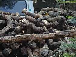
[[File:Red_sandalwood_logs_at_kapiltirtham0.jpg|thumb|left|Seized illegally felled [[red sandalwood|red sanders]] logs in Andhra Pradesh.]] | |||
Till 1980, logging was a major contributor for the loss of forest cover with decrease in tree species such as [[teak]], [[Sal (tree)|sal]], [[red sandalwood|red sanders]], and sandalwood. Though laws in 1988 curtailed illegal logging, wood is still quarried by people for making [[charcoal]], [[firewood]], and construction.<ref name="EG"/>{{rp|page=91}} Forest produce is a source of income for people living in the fringes of the ranges. Over harvesting of forest produce for [[fodder]], [[traditional medicine]], and domestic uses along with unscientific extraction methods and burning of forests have been threats.<ref name="EG"/>{{rp|page=92}} The introduction of alien species either by deliberate or non deliberate means have resulted in competition to native species.<ref name="EG"/>{{rp|page=93}} The construction of large [[dams]] across rivers in the region have submerged more than {{cvt|2300|km2}} of forest cover.<ref name="EG"/>{{rp|page=94}} | |||
[[File:Banki, Odisha, India - panoramio (1).jpg|thumb|An abandoned mine in Odisha.]] | |||
The Eastern Ghats region is rich in [[minerals]] and [[semi-precious stones]]. Illegal mining, poor mining processes, over exploitation, and unsafe disposal of debris have resulted in issues bio-degeneration of the areas.<ref name="EG"/>{{rp|page=98–99}} Eight of the 29 forest fire prone districts are located in the region and, Odisha and Andhra Pradesh recorded the most forest fires in 2014. With more than 90% of these fires caused by humans, this has resulted in loss of forest cover.<ref name="EG"/>{{rp|page=101}} Practices such as [[shifting cultivation]], [[plantations]], and illegal encroachments are the major agricultural contributors to deforestation.<ref name="EG"/>{{rp|page=103, 107}} Increased [[urbanisation]], and expansion of cities, construction of roads and railways, and tourism have led to encroachments into forest lands, and threats to bio-diversity in the region.<ref name="EG"/>{{rp|page=112, 114}} | |||
The [[Government of India]] had enacted various policies over the years to address the environmental concerns, access to forest resources, and protection of wildlife.<ref name="EG"/>{{rp|page=140}} Three [[List of national parks in India|national parks]], two [[biosphere reserves]], and 22 [[List of wildlife sanctuaries in India|wildlife sanctuaries]] are present in the Eastern Ghats region. The protected areas include five [[List of tiger reserves in India|tiger reserves]] under the [[Project Tiger]], and an elephant reserve under the [[Project Elephant]] protection plans. About 13 eco-sensitive zones have been declared, which are jointly managed with the local communities.<ref name="EG"/>{{rp|page=144–146}} | |||
[[File:Coringa_Wildlife_Sanctuary_1.jpg|thumb|Birds at the [[Godavari River]] estuary at the [[Coringa Wildlife Sanctuary]]]] | |||
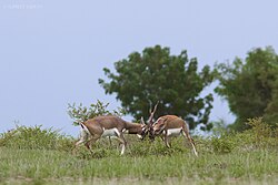
[[File:Blackbucks_Sparring.jpg|thumb|[[Blackbuck]]s at the [[Rollapadu Wildlife Sanctuary]]]] | |||
[[File:Steep_cliffs_are_a_common_sight_in_Sunabeda_wildlife_Sanctuary.jpg|thumb|[[Sunabeda Wildlife Sanctuary]]]] | |||
{|class="wikitable sortable collapsible defaultleft" style="font-size: 85%" | |||
|+ Protected areas<ref name="EG"/>{{rp|page=143}}<ref>{{cite report|url=https://tourism.gov.in/sites/default/files/2023-04/9%20Compendium%20Book_2021_Low%20%281%29%20%282%29.pdf|title=National Parks and Wildlife Sanctuaries in India|work=[[Ministry of Environment, Forest and Climate Change]], [[Government of India]]|date=November 2021|access-date=1 June 2024}}</ref> | |||
|- | |||
!State | |||
!Protected area | |||
!Declared | |||
!Area (km<sup>2</sup>) | |||
!District | |||
|- | |||
| rowspan="8"|[[Odisha]] | |||
| [[Ushakothi Wildlife Sanctuary|Badrama Wildlife Sanctuary]] | |||
| 1962 | |||
| 304.03 | |||
| [[Sambalpur district|Sambalpur]] | |||
|- | |||
| [[Hadgarh Wildlife Sanctuary]] | |||
| 1978 | |||
| 191.06 | |||
| [[Keonjhar district|Keonjhar]], [[Mayurbhanj district|Mayurbhanj]] | |||
|- | |||
| [[Karlapat Wildlife Sanctuary]] | |||
| 1992 | |||
| 147.66 | |||
| [[Kalahandi district|Kalahandi]] | |||
|- | |||
| [[Khalasuni Wildlife Sanctuary]] | |||
| 1982 | |||
| 116 | |||
| [[Sambalpur district|Sambalpur]] | |||
|- | |||
| [[Lakhari Valley Wildlife Sanctuary]] | |||
| 1985 | |||
| 185.87 | |||
| [[Gajapati district|Gajapati]] | |||
|- | |||
| [[Nalbana Bird Sanctuary]] | |||
| 1987 | |||
| 15.53 | |||
| [[Ganjam district|Ganjam]], [[Khurda district|Khurda]], [[Puri district|Puri]] | |||
|- | |||
| [[Simlipal National Park]] | |||
| 1979 | |||
| 1354.3 | |||
| [[Mayurbhanj district|Mayurbhanj]] | |||
|- | |||
| [[Sunabeda Wildlife Sanctuary]] | |||
| 1988 | |||
| 500 | |||
| [[Nuapada district|Nuapada]] | |||
|- | |||
| rowspan="11"|[[Andhra Pradesh]] | |||
| [[Coringa Wildlife Sanctuary]] | |||
| 1978 | |||
| 235.7 | |||
| [[East Godavari district|East Godavari]] | |||
|- | |||
| [[Gundla Brahmeswaram Wildlife Sanctuary]] | |||
| 1990 | |||
| 1194 | |||
| [[Kurnool district|Kurnool]], [[Prakasam district|Prakasam]] | |||
|- | |||
| [[Kambalakonda Wildlife Sanctuary]] | |||
| 2002 | |||
| 70 | |||
| [[Visakhapatnam district|Visakhapatnam]] | |||
|- | |||
| [[Koundinya Wildlife Sanctuary]] | |||
| 1990 | |||
| 356.7 | |||
| [[Chittoor district|Chittoor]] | |||
|- | |||
| [[Krishna Wildlife Sanctuary]] | |||
| 1989 | |||
| 194.81 | |||
| [[Guntur district|Guntur]], [[Krishna district|Krishna]] | |||
|- | |||
| [[Nagarjunsagar-Srisailam Tiger Reserve]] | |||
| 1978 | |||
| 3568.09 | |||
| [[Alluri Sitarama Raju district|Alluri]], [[Eluru district|Eluru]] | |||
|- | |||
| [[Papikonda National Park]] | |||
| 1974 | |||
| 1012.86 | |||
| [[Nandyal district|Nandyal]], [[Palnadu district|Palnadu]], [[Prakasam district|Prakasam]] | |||
|- | |||
| [[Rollapadu Wildlife Sanctuary]] | |||
| 1988 | |||
| 6.14 | |||
| [[Nandyal district|Nandyal]] | |||
|- | |||
| [[Sri Lankamalleswara Wildlife Sanctuary]] | |||
| 1988 | |||
| 464.42 | |||
| [[Kadapa district|Kadapa]] | |||
|- | |||
| [[Sri Penusila Narasimha Wildlife Sanctuary]] | |||
| 1997 | |||
| 1030.85 | |||
| [[Nellore district|Nellore]] | |||
|- | |||
| [[Sri Venkateswara National Park]] | |||
| 1985 | |||
| 153.32 | |||
| [[Tirupati district|Tirupati]] | |||
|- | |||
| rowspan="2"|[[Telangana]] | |||
| [[Kinnerasani Wildlife Sanctuary]] | |||
| 1977 | |||
| 656 | |||
| [[Khammam district|Khammam]] | |||
|- | |||
| [[Amrabad|Amrabad Tiger Reserve]] | |||
| 1983 | |||
| 2611.4 | |||
| [[Nagarkurnool district|Nagarkurnool]], [[Nalgonda district|Nalgonda]] | |||
|- | |||
| [[Karnataka]] | |||
| [[Biligiriranga Hills|Biligiri Rangaswamy Temple Wildlife Sanctuary]] | |||
| 1987 | |||
| 539.52 | |||
| [[Chamarajanagar district|Chamarajanagar]] | |||
|- | |||
| rowspan="3"|[[Tamil Nadu]] | |||
| [[Vedanthangal Bird Sanctuary]] | |||
| 1936 | |||
| 0.3 | |||
| [[Chengalpattu district|Chengalpattu]] | |||
|- | |||
| [[Cauvery North Wildlife Sanctuary]] | |||
| 2014 | |||
| 504.34 | |||
| [[Dharmapuri district|Dharmapuri]], [[Krishnagiri district|Krishnagiri]] | |||
|- | |||
| [[Cauvery South Wildlife Sanctuary]] | |||
| 2022<ref>{{cite news|url=https://indianexpress.com/article/cities/chennai/tamil-nadu-notifies-cauvery-south-wildlife-sanctuary-as-states-17th-wildlife-sanctuary-8257478/|title=Tamil Nadu notifies Cauvery South Wildlife Sanctuary as state's 17th wildlife sanctuary|date=10 November 2022|access-date=24 August 2023|newspaper=[[The New Indian Express]]|archive-date=25 August 2023|archive-url=https://web.archive.org/web/20230825114511/https://indianexpress.com/article/cities/chennai/tamil-nadu-notifies-cauvery-south-wildlife-sanctuary-as-states-17th-wildlife-sanctuary-8257478/|url-status=live}}</ref> | |||
| 686.4 | |||
| [[Dharmapuri district|Dharmapuri]], [[Krishnagiri district|Krishnagiri]] | |||
|} | |||
== See also == | |||
{{commons category|Eastern Ghats}} | |||
* [[Ghat Roads]] | |||
* [[Western Ghats]] | |||
== References == | |||
{{Reflist}} | |||
{{Eastern Ghats}} | |||
{{GeoSouthAsia}} | |||
[[Category:Eastern Ghats| ]] | |||
[[Category:Mountain ranges of India]] | [[Category:Mountain ranges of India]] | ||
[[Category:Landforms of | [[Category:Landforms of Andhra Pradesh]] | ||
[[Category:Landforms of Odisha]] | |||
[[Category:Landforms of Karnataka]] | |||
[[Category:Landforms of Tamil Nadu]] | |||
[[Category:Landforms of Telangana]] | |||
[[Category:Physiographic provinces]] | |||
Revision as of 20:25, 14 February 2026
| Eastern Ghats | |
|---|---|
.JPG) | |
| Highest point | |
| Peak | Arma Konda, Andhra Pradesh |
| Elevation | 1,680 m (5,510 ft) <ref>"SOI Sheet Number 65J/12". Survery of India. Retrieved 1 June 2024.</ref><ref name="Arma">"Arma Konda, India". Peak Bagger. Archived from the original on 15 July 2023. Retrieved 1 June 2017.</ref> |
| Coordinates | 18°13′41″N 82°43′23″E / 18.22806°N 82.72306°E |
| Dimensions | |
| Length | 1,750 km (1,090 mi) N–S |
| Width | 100–200 km (62–124 mi) E–W |
| Area | 75,000 km2 (29,000 sq mi) |
| Geography | |
| Country | India |
| Regions | Eastern and Southern India |
| States | <!-- *** Orthography *** --> |
| Biome | Tropical forests and Wetlands <!-- *** Geography *** --> |
| Geology | |
| Type of rock | |
The Eastern Ghats is a mountain range that stretches 1,750 km (1,090 mi) along the eastern coast of the Indian peninsula. Covering an area of 75,000 km2 (29,000 sq mi), it traverses the states of Odisha, Telangana, Andhra Pradesh, Karnataka, and Tamil Nadu. The range forms a discontinuous chain of mountains along the eastern edge of the Deccan Plateau, stretching from north of the Mahanadi River in Odisha to Vaigai River in Tamil Nadu at the southern end of the peninsula. The Eastern Ghats meet the Western Ghats at the Nilgiris. The average elevation is around 600 m (2,000 ft) and Arma Konda is the highest peak in the mountains at 1,680 m (5,510 ft).
Geological evidence indicates that the mountains were formed during the archeozoic era and became part of the Indian subcontinent post the break-up of the supercontinent of Rodinia and the formation of Gondwana. The mountains were formed through further metamorphism during the mid-Proterozoic era. The northern section of the range has an elevation ranging from 900–1,400 m (3,000–4,600 ft) and lies mostly in Odisha. The middle section stretches up to the Penna River and consists of two parallel ranges with an average elevation of 520 m (1,710 ft). At the southern end, the range is made up of several smaller hills.
The Eastern Ghats form a part of one of the major watersheds of India, consisting of many perennial river systems such as the Godavari, Krishna, Mahanadi and Kaveri. Because of the higher elevation of the Deccan Plateau on the west, most rivers originate from the Western Ghats and flow eastwards to cut across the range to the Bay of Bengal. As the mountains are discontinuous and have a lower elevation, they have a considerably lesser influence than the Western Ghats on the weather patterns in India. However, orography studies indicate that the range does play a role in bringing rainfall to the eastern coastal areas.
The weather is normally dry and humid with seasonal rainfall. There are nine different forest types found in the region including evergreen, deciduous and thorn forests. The Eastern Ghats region contains a large number of different species of flora and fauna, some of which are endemic to this region.
Etymology
The name Eastern Ghats derives from the word ghat and the cardinal direction in which it is located with respect to the Indian mainland. Ghat, a term used in the Indian subcontinent, depending on the context, could either refer to a range of stepped hills such as the Western Ghats and Eastern Ghats, or a series of steps leading down to a body of water or wharf.<ref>Sunithi L. Narayan; Revathy Nagaswami (1992). Discover Sublime India. University of Michigan. p. 5.</ref><ref>"Ghat definition". Cambridge dictionary. Archived from the original on 30 January 2019. Retrieved 30 January 2019.</ref> As per linguist Thomas Burrow, the word Ghat was derived from similar words used in various Dravidian languages such as kattu (mountain side, ridge, or dam) in Tamil, katte (dam), gatta (mountain), and gatte (bank or shore) in Kannada, and katta (dam), and gattu (shore or embankment) in Telugu.<ref>Jaini, Padmanabh S. (2003). Jainism and Early Buddhism. Jain Publishing Company. p. 528. ISBN 978-0-8958-1956-7.</ref>
Geology
_at_Tenneti_park_beach.JPG)
The Eastern Ghats are an ancient orogenic belt which started forming during the collision of crustal rocks during the archeozoic era. Geologic evidence indicates that these became part of the Indian subcontinent following the break-up of the super-continent of Rodinia and the creation of Gondwana. The mountains were formed over millions of years through metamorphism, and erosion and are significantly older than the Western Ghats.<ref>"Eastern Ghats: an ancient orogenic, older than the Western Ghats". Lakes of India. Retrieved 27 August 2022.</ref><ref name="PA">"Eastern Ghats". Peakvisor. Retrieved 1 June 2024.</ref> The rock layers were largely formed during the mid-proterozoic era by the accumulation of silt, carbonates and basalt which later became khondalite and calcium silicate rocks. The major rock types found are charnockite, granite, khondalite, metamorphic, and quartzite.<ref name="PA"/><ref>Subrata Karmakar; Sankar Bose; Kaushik Das; Somnath Dasgupta (2009). "Proterozoic Eastern Ghats Belt, India – a witness of multiple orogenies and its lineage with ancient supercontinents" (PDF). Journal of the Virtual Explorer. 32. ISSN 1441-8142. Archived (PDF) from the original on 14 April 2024. Retrieved 7 November 2024.</ref>
In the mesoproterozoic era, the range was compacted and re-aligned north-east. The structure includes multiple thrusts and strike-slip faults along its range.<ref>Sriramadas, A. (November 1967). "Geology of Eastern Ghats in Andhra Pradesh" (PDF). Proceedings of the Indian Academy of Sciences, Section B. 66 (5): 200–205. doi:10.1007/BF03052185. S2CID 126925893.</ref> The Eparchaean Unconformity of the Tirumala Hills is a major discontinuity of stratigraphic significance that represents an extensive period of erosion and non-deposition, which is evident from the steep natural slopes, and ravines.<ref>"Eparchaean Unconformity, Tirumala Ghat section". Geological Survey of India. Retrieved 20 September 2009.{{cite web}}: CS1 maint: deprecated archival service (link)</ref><ref>Geological Monuments of India: Eparchaean Unconformity (Tirupati Tirupati Road). Geological Survey of India. 2001. pp. 5–8.</ref> Along the western edge, sedimentary rocks were deposited due to volcanic activity, which and later formed schist belts. The region consists of bauxite, iron ore and limestone reserves. The major soil types found are red, black, laterite, and alluvial.<ref name="PA"/>
Geography

The Eastern Ghats extend from north of the Mahanadi River and run approximately 1,750 km (1,090 mi) to the Vaigai basin in the south of Indian peninsula.<ref name="BSI">Endemic Flowering Plants of Eastern Ghats (PDF) (Report). Botanical Survey of India. p. 2. Retrieved 1 June 2024.</ref> It covers an area of 160,000 km2 (62,000 sq mi), traversing across the Indian states of Odisha (25%), Telangana (5%), Andhra Pradesh (40%), Karnataka (5%), and Tamil Nadu (25%).<ref name="Eco">"Climate change, land-use change may enhance plant species loss in the Eastern Ghats". Mongabay. 26 February 2020. Archived from the original on 26 May 2024. Retrieved 1 June 2024.</ref><ref name="EG">Eastern Ghats environmental outlook (PDF) (Report). Greens Alliance for Conservation of Eastern Ghats. March 2024. Archived (PDF) from the original on 12 August 2024. Retrieved 1 June 2024.</ref>(p24)
Topography
The Eastern Ghats form a discontinuous chain of mountains with an average elevation of 600 m (2,000 ft) and run parallel to the eastern coast of India along the Bay of Bengal.<ref name="PA"/><ref name="Brit">"Ghats". Britannica. Retrieved 1 December 2023.</ref> The Eastern coastal plains are the 100–130 km (62–81 mi) wide region between the Eastern Ghats and the Bay of Bengal.<ref>"Physiography of Water". Press Information Bureau (Press release). 9 September 2008. Retrieved 1 June 2024.</ref><ref>Population of India. Economic and Social Commission for Asia and the Pacific, United Nations. 1982. p. 2.</ref> The average width of the mountains range from 100–200 km (62–124 mi) with the mountains wider in the north and narrower in the south.<ref name="BSI"/><ref name="EG"/>(p24) Arma Konda is the highest peak in the mountains at 1,680 m (5,510 ft).<ref name="Brit"/><ref name="Herb">"Eastern Ghats". Indian Institute of Science. Archived from the original on 15 September 2024. Retrieved 1 June 2024.</ref>
The range can be roughly divided into three separate sections. The northern section of the range lies majorly in Odisha and stretches from the Similipal hills in the north to the Andhra Pradesh border. It has an elevation ranging from 900–1,400 m (3,000–4,600 ft) with the highest peak at Deomali (1672 m).<ref name="Herb"/><ref name="EG"/>(p24) The central section lies in Telangana and Andhra Pradesh and stretches up to the Penna River. It consists of two parallel ranges with an average elevation of 520 m (1,710 ft) and is separated by a 160 km (99 mi) wide gorge through which the rivers Godavari and Krishna flow. The hills continue as Javadi and Shevaroy Hills, south of Chennai and meet with the Western Ghats at Nilgiris. The Biligiriranga and Malai Mahadeshwara Hills in Karnataka extend to Talamalai in Tamil Nadu, and is separated from the Western Ghats meet by the Moyar River valley.<ref>Eastern Ghats Environment Outlook (PDF). CGRI (Report). March 2024. p. 24. Retrieved 1 June 2025.</ref> At the southern end, the Eastern Ghats is made up of several smaller hills such as the Sirumalai.<ref name="Brit"/><ref name="Herb"/><ref name="EG"/>(p24)
Hydrology

The Eastern Ghats form one of the major watersheds of India with major river systems such as Godavari, Kaveri, Krishna and Mahanadi cutting across the range.<ref name="PA"/><ref name="Herb"/><ref>Dhruv Sen Singh (2017). The Indian Rivers: Scientific and Socio-economic Aspects. Springer Science. p. 309. ISBN 978-9-8110-2984-4.</ref> Most rivers flow eastwards towards the Bay of Bengal owing to the steeper gradient moving from east to west.<ref>Shanavas P H; Sumesh A K; Haris P M (2016). Western Ghats - From Ecology To Economics. Educreation Publishing. pp. 27–29. ISBN 978-9-3852-4758-3.</ref> The Eastern Ghats are the source for many small and medium rivers of the east coastal plains.<ref>T. Pullaiah; D. Muralidhara Rao (2002). Flora of Eastern Ghats : hill range of South East India. Regency Publications. p. 3. ISBN 978-81-87498-49-0.</ref>
| Riparian state | Rivers |
|---|---|
| Odisha | Baitarani, Brahmani, Budhabalanga, Nagavali, Rushikulya, Sabari, Subarnarekha, Vamsadhara |
| Andhra Pradesh | Champavathi, Chitravathi, Gosthani, Gundlakamma, Kundu, Penna, Sarada, Sileru, Swarnamukhi, Tammileru |
| Tamil Nadu | Amaravathi, Palar, Ponnaiyar, Swetha, Thamirabharani, Varaha, Vaigai, Vellar |
The streams and rivers give rise to numerous waterfalls in the region. The region also consists of many wetlands and large coastal lagoons such as the Chilika, Kolleru and Pulicat lakes.<ref name="EG"/>(p36) The rivers have been dammed for hydroelectric and irrigation purposes, with major reservoirs spread across the region.<ref>"Indian Dams by River and State". Rain water harvesting. Archived from the original on 19 March 2007. Retrieved 19 March 2007.</ref><ref>Samani, R.L.; Ayhad, A.P. (2002). "Siltation of Reservoirs-Koyna Hydroelectric Project-A Case Study". In S. P. Kaushish; B. S. K. Naidu (eds.). Silting Problems in Hydropower Plants. Bangkok: Central Board of Irrigation and Power. ISBN 978-90-5809-238-0.</ref>
Climate

As the mountains are discontinuous and have a lower elevation, they have a considerably lesser influence than the Western Ghats on the weather patterns in India. However, orography studies indicate that the range does play a role in rainfall patterns along the coast. The range blocks winds at the low level which brings rainfall to the eastern coastal plains.<ref>Jayesh Phadtare (1 April 2018). "Role of Eastern Ghats Orography and Cold Pool in an Extreme Rainfall Event over Chennai on 1 December 2015". Monthly Weather Report. American Meteorological Society: 943–965. Archived from the original on 18 April 2024. Retrieved 7 November 2024.</ref> The Eastern Ghats region has a tropical climate and receives rainfall from the monsoon. It is hot in the summers with temperatures reaching 44 °C (111 °F) during summer with humidity levels of 65–75%. The northern region receives 120–150 cm (47–59 in) of rainfall and the lower regions receive 60–110 cm (24–43 in) of rain. The temperature is lowest in the winter month of January with an average of 20–25 °C (68–77 °F). The higher hill ranges are generally wetter and cooler with the lower parts remaining semi-arid and dry. The coastal regions experience tropical cyclones during the monsoon season.<ref name="Herb"/><ref name="EG"/>(p28)
Bio-diversity
Flora

There are nine forest types in the Eastern Ghats region, namely tropical evergreen, semi-evergreen, moist deciduous, riverine, southern dry deciduous, northern dry deciduous, dry savannah, thorn scrub, and dry evergreen forests.<ref name="BSI"/> The vegetation varies considerably with altitude with scrubs and dry forests at lower altitudes and deciduous, semi-evergreen forests, and evergreen forests at higher altitudes.<ref name="Herb"/> Tropical evergreen forests occur in small patches in Shevroy in Tamil Nadu and in north Andhra Pradesh. Semi-evergreen forests are found in the northern section and southern fringes. Moist deciduous forests occur in Odisha and Nallamala in Andhra Pradesh–Telangana. Dry deciduous, dry savannah and scrub forests occur across the range. Dry evergreen forests are limited to south Andhra Pradesh, and north Tamil Nadu.<ref name="EG"/>(p44)
The region is home to more than 4500 species of angiosperms, which account for 13% of the flowering plant species in India.<ref name="Herb"/><ref name="PA"/> About 166 species of flowering plants are endemic to the Eastern Ghats and more than ten new species have been discovered in the region since the early 2010s.<ref name="BSI"/> About 184 species of ferns, and 190 species of orchids have been recorded in the region.<ref name="EG"/>(p43) Commercially viable tree species include Indian rosewood, teak, mahogany, and red sandalwood.<ref name="EG"/>(p44)<ref name="PA"/>
Fauna

| Group | Species in Eastern Ghats | Species in India |
|---|---|---|
| Mammals | 100 | 250 |
| Birds | 425 | 1224 |
| Reptiles | 99 | 197 |
| Amphibians | 100 | 408 |
| Fishes | 155 | 2546 |
Mammals found in the region include the Bengal tiger, leopard, sloth bear, Indian wild dog, golden jackal, Indian fox, and other cat species such as jungle cat, fishing cat, and leopard cat. Large herbivores include Indian elephant, blackbuck, sambar deer, spotted deer, barking deer, Indian gazelle, four-horned antelope, Indian bison, wild boar, Indian crested porcupine, mouse deer, and nilgai. Other smaller mammals include grey slender loris, Indian hare, Indian hedgehog, Indian mongoose, mole rat, smooth coated otter, Indian pangolin, palm civet, Indian giant flying squirrel, and Madras treeshrew.<ref name="EG"/>(p43) Bonnet macaque, rhesus macaque, and Hanuman langur are the major primates. The region is also home to more than 15 species of bats.<ref name="EG"/>(p44)

Bird surveys have found about 425 species belonging to 57 families in the region. Four species of hornbills are found in the region and are considered keystone species.<ref name="EG"/>(p50)<ref>Ganguly, Nivedita (17 July 2015). "For joy of birdwatching". The Hindu. Archived from the original on 14 April 2021. Retrieved 1 June 2020.</ref> The Jerdon's courser was thought to be extinct in the wild before it was re-discovered in the range in 1986. More than 50% of the wild population of the critically endangered Indian bustard is found in the region.<ref name="EG"/>(p53) Common and widespread species include the red-vented bulbul, white-browed bulbul, red-whiskered bulbul, common iora, and purple-rumped sunbird. Five species of birds that are endemic to the Western Ghats region have been sighted in the fringes of the Eastern Ghats. These include grey-headed bulbul, Nilgiri wood pigeon, Malabar parakeet, crimson-backed sunbird, and rufous babbler. Other species of avifauna include laughing dove, Indian nightjar, jungle owlet, red avadavat, Malayan night heron, striated heron, white-naped woodpecker, savanna nightjar, brown hawk-owl, Nilgiri flowerpecker, spot-bellied eagle-owl, blue-eared kingfisher, green imperial pigeon, oriental dwarf kingfisher, Indian swiftlet, and white-browed fantail. Raptors included white-eyed buzzard, grey-headed fish eagle, lesser fish eagle.<ref>J. Patrick David; R.J. Ranjit Daniels; Vinoth Balasubramanian (6 August 2017). "A reassessment of the avian species diversity in the Eastern Ghats of Tamil Nadu, after the Vernay Survey". Journal of Threatened Taxa. 9 (8). Archived from the original on 6 September 2024. Retrieved 7 November 2024.</ref><ref>J. Patrick David; B. Vinoth (2016). "Nocturnal birds in the Eastern Ghats of Tamil Nadu" (PDF). Indian Birds. 11 (2): 39–41.</ref> Two species of critically endangered vultures – Indian vulture and red-headed vulture have been reported in the region.<ref>"Endangered vultures sighted in Raichur". The Hindu. 29 August 2012. Retrieved 28 July 2013.</ref><ref>"Critically endangered vulture found in Adilabad district". The Hindu. 5 June 2013. Archived from the original on 13 July 2013. Retrieved 28 July 2013.</ref>
There are about 99 reptile species found in the region. These include Indian monitor lizard, and endemic species such as Yercaud slender gecko, burrowing limbless skink, spotted Eastern Ghats skink, and Madras spotted skink. The Indian golden gecko, and Jeypore ground gecko were rediscovered in 1986 and 2010 respectively.<ref name="EG"/>(p49)<ref>Basundhara Chettri; S. Bhupathy (26 July 2010). "Three little known reptile species from the Araku Valley, Eastern Ghats with notes on their distribution" (PDF). Journal of Threatened Taxa. 2 (8): 1109–1103. doi:10.11609/JoTT.o2329.1109-13. Archived from the original (PDF) on 1 November 2012. Retrieved 19 June 2013.</ref> Other reptiles include geckos, skinks, lacertas, iguanas, chameleons, and monitors. Snakes include blind snakes, shield-tailed snakes, sand boas, cobras, vipers, kraits, coral snakes, and python. There are about 100 species of amphibians found in the region including toads, pond frogs, cricket frogs, bull frogs, burrowing frogs, balloon frogs, small-mouthed frogs, tree frogs, and golden-backed frogs.<ref>S.R.Ganesh (30 June 2018). "Herpetofauna of Southern Eastern Ghats, India – II From Western Ghats to Coromandel Coast" (PDF). Asian Journal of Conservation Biology. 7 (1): 28–45. ISSN 2278-7666. Archived (PDF) from the original on 29 June 2024. Retrieved 7 November 2024.</ref> There are also about 155 species of freshwater fish from 28 families found across the waters in the region. Insects include nearly 150 species of butterflies and nine species of tarantulas amongst others.<ref name="EG"/>(p51)
Threats and conservation
A 2017 study indicated that the Eastern Ghats region has lost about 32,200 km2 (12,400 sq mi) forest cover between 1920 and 2015. Forests which occupied 43.5% of the land area reduced by nearly 16 percent.<ref name="EG"/>(p119) An estimated 7.92 percent of the forest area converted for agriculture and 3.80 percent to grasslands from 1920 to 2015. As of 2018, only 3.53 percent of the total area was declared as protected areas.<ref name="Eco"/> The major threats included illegal logging, mining, grazing, agriculture, forest fires and tourism, poaching, and illegal tapping of forest resources which have resulted in deforestation and fragmentation of forests.<ref name="BSI"/><ref name="Eco"/> Various natural disasters such as heavy rainfalls, extreme temperature, environmental changes, competition due to invasive species have been threats to the biodiversity in the region. The absence of pollinators have also had an effect on the natural regeneration of vegetation.<ref name="BSI"/>

Till 1980, logging was a major contributor for the loss of forest cover with decrease in tree species such as teak, sal, red sanders, and sandalwood. Though laws in 1988 curtailed illegal logging, wood is still quarried by people for making charcoal, firewood, and construction.<ref name="EG"/>(p91) Forest produce is a source of income for people living in the fringes of the ranges. Over harvesting of forest produce for fodder, traditional medicine, and domestic uses along with unscientific extraction methods and burning of forests have been threats.<ref name="EG"/>(p92) The introduction of alien species either by deliberate or non deliberate means have resulted in competition to native species.<ref name="EG"/>(p93) The construction of large dams across rivers in the region have submerged more than 2,300 km2 (890 sq mi) of forest cover.<ref name="EG"/>(p94)
.jpg)
The Eastern Ghats region is rich in minerals and semi-precious stones. Illegal mining, poor mining processes, over exploitation, and unsafe disposal of debris have resulted in issues bio-degeneration of the areas.<ref name="EG"/>(p98–99) Eight of the 29 forest fire prone districts are located in the region and, Odisha and Andhra Pradesh recorded the most forest fires in 2014. With more than 90% of these fires caused by humans, this has resulted in loss of forest cover.<ref name="EG"/>(p101) Practices such as shifting cultivation, plantations, and illegal encroachments are the major agricultural contributors to deforestation.<ref name="EG"/>(p103, 107) Increased urbanisation, and expansion of cities, construction of roads and railways, and tourism have led to encroachments into forest lands, and threats to bio-diversity in the region.<ref name="EG"/>(p112, 114)
The Government of India had enacted various policies over the years to address the environmental concerns, access to forest resources, and protection of wildlife.<ref name="EG"/>(p140) Three national parks, two biosphere reserves, and 22 wildlife sanctuaries are present in the Eastern Ghats region. The protected areas include five tiger reserves under the Project Tiger, and an elephant reserve under the Project Elephant protection plans. About 13 eco-sensitive zones have been declared, which are jointly managed with the local communities.<ref name="EG"/>(p144–146)


