

>Msclrfl22 No edit summary |
TessaLovins0 (talk | contribs) m quick fix |
||
| Line 5: | Line 5: | ||
{{Infobox river | {{Infobox river | ||
| name = Kali River | | name = Kali River | ||
| | | native_name = | ||
| | | native_name_lang = | ||
| name_other = | | name_other = | ||
| name_etymology = | | name_etymology = | ||
<!---------------------- IMAGE & MAP --> | <!---------------------- IMAGE & MAP --> | ||
| image = | | image = | ||
| Line 18: | Line 18: | ||
| pushpin_map = | | pushpin_map = | ||
| pushpin_map_size = | | pushpin_map_size = | ||
| pushpin_map_caption= | | pushpin_map_caption= | ||
<!---------------------- LOCATION --> | <!---------------------- LOCATION --> | ||
| subdivision_type1 = Country | | subdivision_type1 = Country | ||
| subdivision_name1 = | | subdivision_name1 = {{flag|India}} | ||
| subdivision_type2 = | | subdivision_type2 = State | ||
| subdivision_name2 = | | subdivision_name2 = Karnataka | ||
| subdivision_type3 = | | subdivision_type3 = District | ||
| subdivision_name3 = | | subdivision_name3 = [[Uttara Kannada]] | ||
| subdivision_type4 = | | subdivision_type4 = | ||
| subdivision_name4 = | | subdivision_name4 = | ||
| subdivision_type5 = | | subdivision_type5 = | ||
| subdivision_name5 = | | subdivision_name5 = | ||
<!---------------------- PHYSICAL CHARACTERISTICS --> | <!---------------------- PHYSICAL CHARACTERISTICS --> | ||
| | | length_km = 265 | ||
| width_min = | | width_min = | ||
| width_avg = | | width_avg = | ||
| Line 41: | Line 41: | ||
| discharge1_min = | | discharge1_min = | ||
| discharge1_avg = {{convert|152|m3/s|cuft/s|abbr=on}} | | discharge1_avg = {{convert|152|m3/s|cuft/s|abbr=on}} | ||
<!---------------------- BASIN FEATURES --> | <!---------------------- BASIN FEATURES --> | ||
| source1 = Diggi village, Karnataka | | source1 = Diggi village, Karnataka | ||
| Line 51: | Line 47: | ||
| source1_coordinates= | | source1_coordinates= | ||
| source1_elevation = | | source1_elevation = | ||
| mouth = | | mouth = Arabian Sea | ||
| mouth_location = | | mouth_location = [[Karwar]] | ||
| mouth_coordinates = | | mouth_coordinates = | ||
| mouth_elevation = | | mouth_elevation = | ||
| Line 66: | Line 62: | ||
[[File:Sadashivgad Fort & Kali Bridge as seen from Nandangadda Village.jpg|thumb|Kali River & [[Sadashivgad]] Fort as seen from [[Nandangadda]] Village]] | [[File:Sadashivgad Fort & Kali Bridge as seen from Nandangadda Village.jpg|thumb|Kali River & [[Sadashivgad]] Fort as seen from [[Nandangadda]] Village]] | ||
The '''Kali River''' or '''Kaali Nadi''' is a [[river]] flowing through [[Uttara Kannada]] district of [[Karnataka]] state in [[India]].<ref>{{GEOnet2|32FA8822EC573774E0440003BA962ED3|Kālī Nadī (Approved)}}, [[National Geospatial-Intelligence Agency|United States National Geospatial-Intelligence Agency]]</ref> The river rises near Kushavali, a small village in Uttar Kannada district. The river is the lifeline to some 400,000 people in the Uttara Kannada district and supports the livelihoods of tens of thousands of people including fishermen on the coast of Karwar. | The '''Kali River''' or '''Kaali Nadi''' is a [[river]] flowing through [[Uttara Kannada]] district of [[Karnataka]] state in [[India]].<ref>{{GEOnet2|32FA8822EC573774E0440003BA962ED3|Kālī Nadī (Approved)}}, [[National Geospatial-Intelligence Agency|United States National Geospatial-Intelligence Agency]]</ref> The river rises near Kushavali, a small village in Uttar Kannada district. The river is the lifeline to some 400,000 people in the Uttara Kannada district and supports the livelihoods of tens of thousands of people including fishermen on the coast of [[Karwar]]. Many dams have been built across this river for [[electricity]] generation. One of the important dams build across Kali river is the [[Supa Dam]] at Ganeshgudi. The river runs 184 kilometers before joining the [[Arabian Sea]].<ref name=IHO>{{cite web|url=https://iho.int/uploads/user/pubs/standards/s-23/S-23_Ed3_1953_EN.pdf|title=Limits of Oceans and Seas, 3rd edition|year=1953|publisher=International Hydrographic Organization|page=21|access-date=28 December 2020|archive-url=https://web.archive.org/web/20111008191433/http://www.iho.int/iho_pubs/standard/S-23/S-23_Ed3_1953_EN.pdf|archive-date=8 October 2011}}</ref> | ||
Significant and picturesque, the [[Sadashivgad]] fort is now a popular tourist destination located by the coastal highway Kali river bridge, which has been built above the confluence of the river and the [[Arabian Sea]]. | Significant and picturesque, the [[Sadashivgad]] fort is now a popular tourist destination located by the coastal highway Kali river bridge, which has been built above the confluence of the river and the [[Arabian Sea]].<ref name=IHO /> | ||
The National Highway [[NH-17]] continues on the Kali [[Bridge]] built over Kali River and the road continues to split the Sadashivgad granite rock hill to connect Karnataka to [[Goa]]. | The National Highway [[NH-17]] continues on the Kali [[Bridge]] built over Kali River and the road continues to split the Sadashivgad granite rock hill to connect Karnataka to [[Goa]]. | ||
[[File:Kali River Karwar Karnataka India.jpg|thumb | [[File:Kali River Karwar Karnataka India.jpg|thumb|A view of Kali River]] | ||
In August 2019 due to excessive rains in the region it caused flooding and loss of property and animal life due to the floods which took place when a huge amount of water was discharged on the downstream area. Many people lost their houses and moved to rehabilitation services provided by the government. | In August 2019 due to excessive rains in the region it caused flooding and loss of property and animal life due to the floods which took place when a huge amount of water was discharged on the downstream area. Many people lost their houses and moved to rehabilitation services provided by the government. | ||
==Origin and course== | == Origin and course == | ||
[[File:Leisure boats on Kali River.jpg|thumb | The Kali River has its origin near the village of Kushavali of Joida Taluka, {{Coord|15|14|56|N|074|17|58|E|display=inline}}, 2011 Census Village code is 602664,<ref>{{Cite web|title=Reports of National Panchayat Directory: List of Census Villages mapped for: Bazaar Kulang Gram Panchayat, Supa, Uttar Kannad, Karnataka|publisher=Registrar General & Census Commissioner, India|url=http://panchayatdirectory.gov.in/adminreps/viewGPmapcvills.asp?gpcode=223801&rlbtype=V|archive-url=https://archive.today/20130702103730/http://panchayatdirectory.gov.in/adminreps/viewGPmapcvills.asp?gpcode=223801&rlbtype=V|url-status=dead|archive-date=2 July 2013}}</ref> in the [[Western Ghats]] and flows eastwards into the Supa Dam Reservoir,<ref>The former village of Supa, which gave its name to the dam and the taluka, was drowned when the reservoir was created. For its location see {{Citation|title=Belgaum|series=series U502, sheet ND 43-02|format=topographic map, 1:250,000|publisher=United States Army Map Service|date=May 1960|url=http://www.lib.utexas.edu/maps/ams/india/nd-43-02.jpg}}</ref> where it is joined by the Pandri River from the left (north). The Kali exits at [[Supa Dam]] near Kurandi then flows east towards [[Dandeli]]. Passing south of Dandeli, the Kali River flows southeast into the Bommanalli Reservoir, exiting at the dam and flowing east between the villages of Kegdal on the right (south) and Bommanalli<ref>Bommanalli, Haliyal Taluka, {{Coord|15|10|04|N|074|42|39|E|display=inline}}, 2011 Census Village code = 602800, {{Cite web|title=Reports of National Panchayat Directory: List of Census Villages mapped for: Bhagvati Gram Panchayat, Haliyal, Uttar Kannad, Karnataka|publisher=Registrar General & Census Commissioner, India|url=http://panchayatdirectory.gov.in/adminreps/viewGPmapcvills.asp?gpcode=223658&rlbtype=V|access-date=16 April 2013|archive-url=https://web.archive.org/web/20130416205855/http://panchayatdirectory.gov.in/adminreps/viewGPmapcvills.asp?gpcode=223658&rlbtype=V|archive-date=16 April 2013|url-status=dead}}</ref> on the left (north). After the village of Bommanalli the Kali turns south and at {{Coord|15|05|21|N|074|43|57|E|display=inline}} is joined by the Tattihalla River from the left (west). controller and Tunnel is there in Bhagavathi. At that point the Kali turns west and flows through a gorge which ends at Sathodi Falls below Sykes Point. The Kali is then joined by the Kaneri River from the right (north) at {{Coord|15|03|52|N|074|36|17|E|display=inline}}, and flows south-southwest into [[Kodasalli Dam|Kodasalli Reservoir]]. Leaving that reservoir, the Kali River flows west and is joined by the Vuki Halla from the right (north). Whence it flows southwest into the [[Kadra Dam|Kadra Reservoir]], and is joined by the Thana Halla just below the dam at Kadra.<ref>{{Citation|title=Karwar|series=series U502, sheet ND 43-02|format=topographic map, 1:250,000|publisher=United States Army Map Service|date=March 1960|url=http://www.lib.utexas.edu/maps/ams/india/nd-43-06.jpg}}</ref> From Kadra, the Kali flows west through marshland to join the [[Arabian Sea]] near the town of [[Karwar]]. The river flows entirely through the district of [[Uttara Kannada]].{{citation needed|date=October 2025}} | ||
<!-- This is unlikely to be the right river. THere are others across the country. Where is Khudaganj anyway? See comments on talk page. | |||
[[File:Leisure boats on Kali River.jpg|thumb|Leisure boats on Kali River]] | |||
<!-- This is unlikely to be the right river. THere are others across the country. Where is Khudaganj anyway? See comments on talk page. | |||
== Battle of Kallee Nuddee == | == Battle of Kallee Nuddee == | ||
On 2 January 1858 the battle of Kallee Nuddee was fought near [[Khudaganj]] between Sir Colin Campbell of the [[East India Company]] and Nawab of Farrukhabad of the Rebel Sepoys.<ref>Fibis: [http://wiki.fibis.org/index.php/Battle_of_Kallah_Nuddee Battle of Kallah Nuddee.]</ref><ref>{{cite book|title=Bulletins and Other State Intelligence|url=https://books.google.com/books?id=09M1AAAAMAAJ&pg=PA1179|year=1860|publisher=Compiled and arranged from the official documents published in the London gazette.|page=1179}}</ref><ref name="Verney1862">{{cite book|author=Edmund Hope Verney|title=The Shannon's brigade in India: being some account of Sir William Peel's naval brigade in the Indian campaign of 1857-1858|url=https://books.google.com/books?id=A7XMfkemThoC&pg=PA59|year=1862|publisher=Saunders, Otley|page=59}}</ref> | On 2 January 1858 the battle of Kallee Nuddee was fought near [[Khudaganj]] between Sir Colin Campbell of the [[East India Company]] and Nawab of Farrukhabad of the Rebel Sepoys.<ref>Fibis: [http://wiki.fibis.org/index.php/Battle_of_Kallah_Nuddee Battle of Kallah Nuddee.]</ref><ref>{{cite book|title=Bulletins and Other State Intelligence|url=https://books.google.com/books?id=09M1AAAAMAAJ&pg=PA1179|year=1860|publisher=Compiled and arranged from the official documents published in the London gazette.|page=1179}}</ref><ref name="Verney1862">{{cite book|author=Edmund Hope Verney|title=The Shannon's brigade in India: being some account of Sir William Peel's naval brigade in the Indian campaign of 1857-1858|url=https://books.google.com/books?id=A7XMfkemThoC&pg=PA59|year=1862|publisher=Saunders, Otley|page=59}}</ref> | ||
--> | --> | ||
==Pollution and ecology== | == Pollution and ecology == | ||
Treated effluents released directly into the river by industrial units and [[illegal sand mining]] in the Supa Dam area resulted in serious disturbances to the river's ecology. The government strategy for controlling the pollution from illegal sand mining has produced a cleaner river.<ref>{{Cite news|author=ಸುದ್ದಿಲೋಕ, ವಿಕ (Suddiloka, Vika)|title=ಕಾಳಿ ನದಿ: ರಕ್ಷಣೆಗೆ ಹೊಸ ಕಾರ್ಯತಂತ್ರ (Kali River: the protection of a new strategy) | |||
Treated effluents released directly into the river by industrial units and [[illegal sand mining]] in the Supa Dam area resulted in serious disturbances to the river's ecology. The government strategy for controlling the pollution from illegal sand mining has produced a cleaner river.<ref>{{Cite news |author=ಸುದ್ದಿಲೋಕ, ವಿಕ (Suddiloka, Vika) |date=11 April 2013 |title=ಕಾಳಿ ನದಿ: ರಕ್ಷಣೆಗೆ ಹೊಸ ಕಾರ್ಯತಂತ್ರ (Kali River: the protection of a new strategy) |url=http://vijaykarnataka.indiatimes.com/articleshow/19479439.cms |url-status=live |archive-url=https://web.archive.org/web/20130417035931/http://vijaykarnataka.indiatimes.com/articleshow/19479439.cms |archive-date=17 April 2013 |newspaper=The Times of India |language=kn}}</ref> The releases from a papermill have drawn crocodiles to the [[Anshi Dandeli Tiger Reserve]].<ref>{{Cite news |date=13 December 2011 |title=Industrial pollution brings crocodile tears |url=http://newstoday.com.bd/index.php?option=details&news_id=46897&date=2011-12-13 |url-status=live |archive-url=https://web.archive.org/web/20130417044317/http://newstoday.com.bd/index.php?option=details&news_id=46897&date=2011-12-13 |archive-date=17 April 2013 |newspaper=The News Today |location=Dhaka, Bangladesh}}</ref> Although there is no credible evidence, some tend to believe that chemical and petroleum companies near its estuary have been leaking toxic wastes including mercury, as alleged by some, into the Kali River for decades, impacts of which have not yet been seen or confirmed.{{cn|date=June 2025}} | |||
The releases from a papermill have drawn crocodiles to the [[Anshi Dandeli Tiger Reserve]].<ref>{{Cite news|date=13 December 2011|title=Industrial pollution brings crocodile tears|newspaper=The News Today|location=Dhaka, Bangladesh|url=http://newstoday.com.bd/index.php?option=details&news_id=46897&date=2011-12-13|archive-url=https://web.archive.org/web/20130417044317/http://newstoday.com.bd/index.php?option=details&news_id=46897&date=2011-12-13|archive-date=17 April 2013|url-status=live}}</ref> | |||
[[File:Kali river bridge.jpg|thumb|View of Kali river and the bridge from [[Sadashivgad]] Fort.]] | |||
== Television entertainment == | == Television entertainment == | ||
* [[Real TV (Indian Channel)|Real TV's]] India's biggest reality show, [[Sarkaar Ki Duniya]] was shot at Mango Island Near Ambe Joog, which is an island surrounded by the Kali river in Siddar near [[Karwar]].<ref>"Island" in [[Konkani language]] translates to "Joog".</ref> | * [[Real TV (Indian Channel)|Real TV's]] India's biggest reality show, [[Sarkaar Ki Duniya]] was shot at Mango Island Near Ambe Joog, which is an island surrounded by the Kali river in Siddar near [[Karwar]].<ref>"Island" in [[Konkani language]] translates to "Joog".</ref> | ||
== See also== | == See also== | ||
| Line 98: | Line 98: | ||
* [[Sadashivgad]] | * [[Sadashivgad]] | ||
== | ==References== | ||
{{Reflist}} | {{Reflist}} | ||
| Line 105: | Line 105: | ||
* [https://www.youtube.com/watch?v=RuVnAwkuTVw A documentary on the river] by [[Amoghavarsha JS]] | * [https://www.youtube.com/watch?v=RuVnAwkuTVw A documentary on the river] by [[Amoghavarsha JS]] | ||
*[http://www.karnatakapower.com/bommanahallidam.htm Kali Nadi] | *[http://www.karnatakapower.com/bommanahallidam.htm Kali Nadi] | ||
*[https://archive.today/20130103114000/http://www.hinduonnet.com/thehindu/thscrip/print.pl?file=20060519003009900.htm&date=fl2309/&prd=fline& Kali river ] | *{{usurped|1=[https://archive.today/20130103114000/http://www.hinduonnet.com/thehindu/thscrip/print.pl?file=20060519003009900.htm&date=fl2309/&prd=fline& Kali river]}} | ||
{{coord|14|50|32|N|74|07|23|E|display=title}} | {{coord|14|50|32|N|74|07|23|E|display=title}} | ||
| Line 115: | Line 115: | ||
[[Category:Rivers of the Western Ghats]] | [[Category:Rivers of the Western Ghats]] | ||
[[Category:Geography of Uttara Kannada district]] | [[Category:Geography of Uttara Kannada district]] | ||
[[ca:Kali Nadi Occidental]] | [[ca:Kali Nadi Occidental]] | ||
Latest revision as of 13:25, 29 October 2025
| Kali River | |
|---|---|
| Location | |
| Country |  India India |
| State | Karnataka |
| District | Uttara Kannada |
| Physical characteristics | |
| Source | Diggi village, Karnataka |
| • location | Joida taluk |
| Mouth | Arabian Sea |
• location | Karwar |
| Discharge | |
| • location | Karwar, India |
| • average | 152 m3/s (5,400 cu ft/s) |

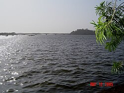
The Kali River or Kaali Nadi is a river flowing through Uttara Kannada district of Karnataka state in India.[1] The river rises near Kushavali, a small village in Uttar Kannada district. The river is the lifeline to some 400,000 people in the Uttara Kannada district and supports the livelihoods of tens of thousands of people including fishermen on the coast of Karwar. Many dams have been built across this river for electricity generation. One of the important dams build across Kali river is the Supa Dam at Ganeshgudi. The river runs 184 kilometers before joining the Arabian Sea.[2]
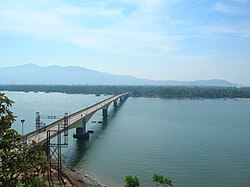
Significant and picturesque, the Sadashivgad fort is now a popular tourist destination located by the coastal highway Kali river bridge, which has been built above the confluence of the river and the Arabian Sea.[2]
The National Highway NH-17 continues on the Kali Bridge built over Kali River and the road continues to split the Sadashivgad granite rock hill to connect Karnataka to Goa.

In August 2019 due to excessive rains in the region it caused flooding and loss of property and animal life due to the floods which took place when a huge amount of water was discharged on the downstream area. Many people lost their houses and moved to rehabilitation services provided by the government.
Origin and course[edit | edit source]
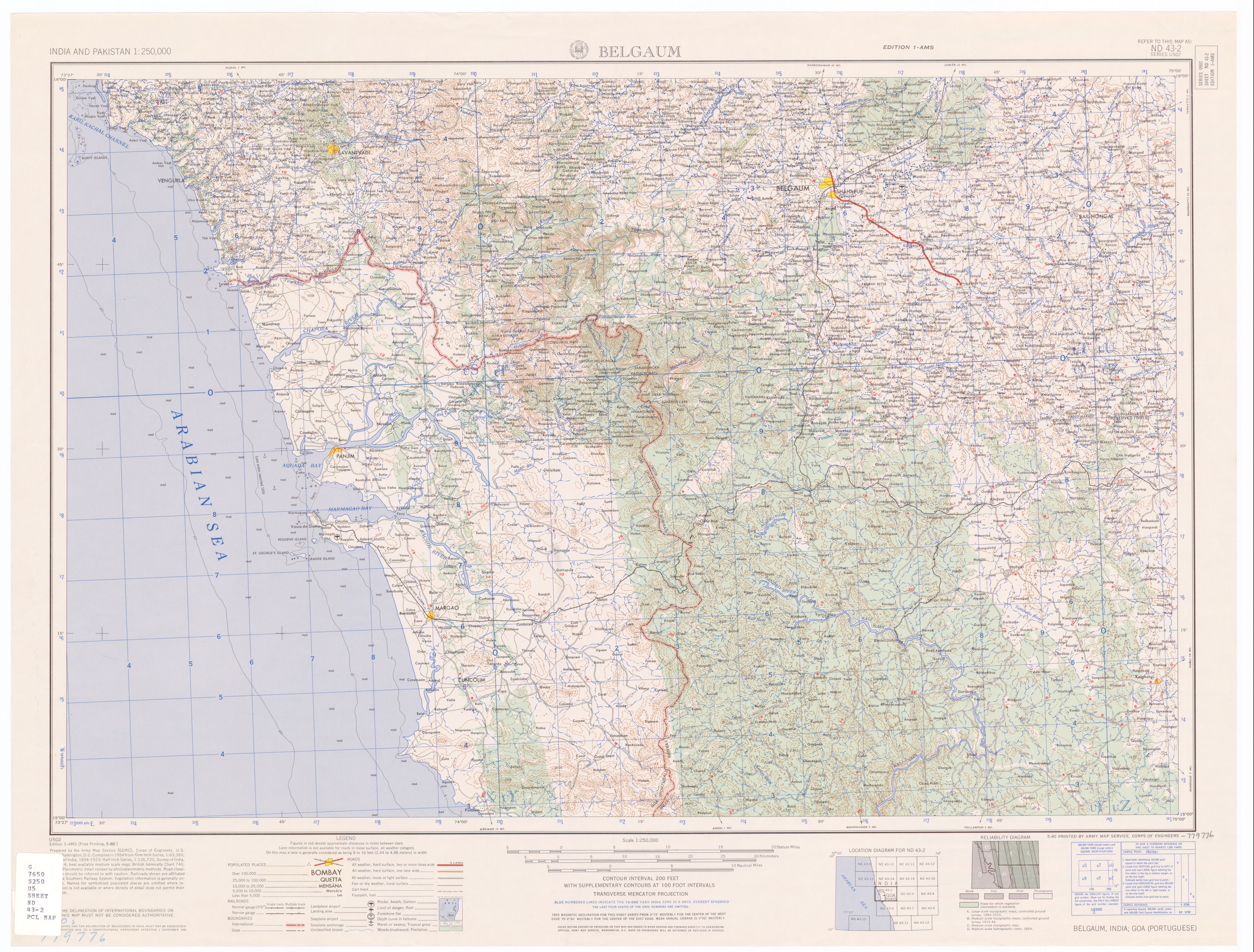
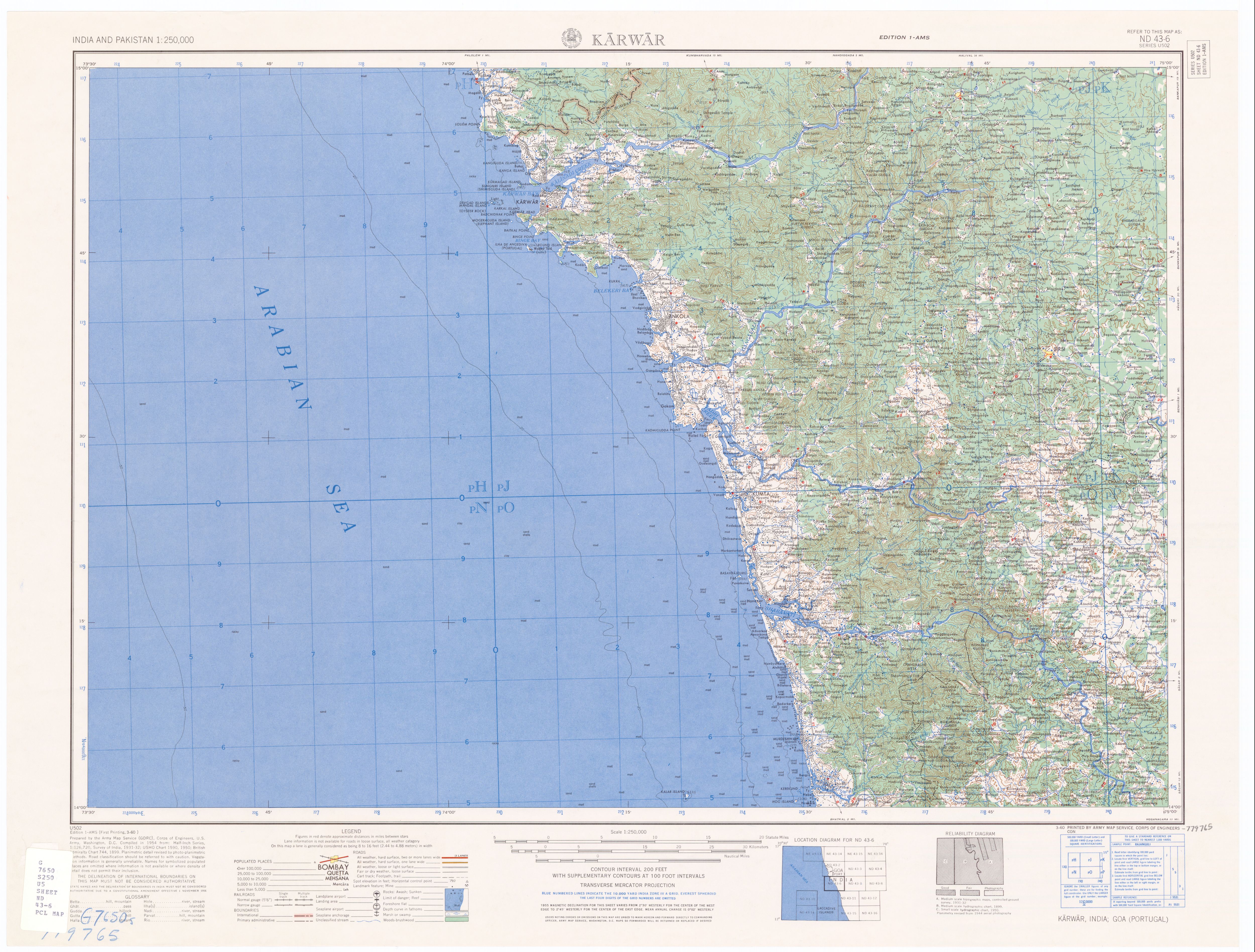
The Kali River has its origin near the village of Kushavali of Joida Taluka, 15°14′56″N 074°17′58″E / 15.24889°N 74.29944°E, 2011 Census Village code is 602664,[3] in the Western Ghats and flows eastwards into the Supa Dam Reservoir,[4] where it is joined by the Pandri River from the left (north). The Kali exits at Supa Dam near Kurandi then flows east towards Dandeli. Passing south of Dandeli, the Kali River flows southeast into the Bommanalli Reservoir, exiting at the dam and flowing east between the villages of Kegdal on the right (south) and Bommanalli[5] on the left (north). After the village of Bommanalli the Kali turns south and at 15°05′21″N 074°43′57″E / 15.08917°N 74.73250°E is joined by the Tattihalla River from the left (west). controller and Tunnel is there in Bhagavathi. At that point the Kali turns west and flows through a gorge which ends at Sathodi Falls below Sykes Point. The Kali is then joined by the Kaneri River from the right (north) at 15°03′52″N 074°36′17″E / 15.06444°N 74.60472°E, and flows south-southwest into Kodasalli Reservoir. Leaving that reservoir, the Kali River flows west and is joined by the Vuki Halla from the right (north). Whence it flows southwest into the Kadra Reservoir, and is joined by the Thana Halla just below the dam at Kadra.[6] From Kadra, the Kali flows west through marshland to join the Arabian Sea near the town of Karwar. The river flows entirely through the district of Uttara Kannada.[citation needed]

Pollution and ecology[edit | edit source]
Treated effluents released directly into the river by industrial units and illegal sand mining in the Supa Dam area resulted in serious disturbances to the river's ecology. The government strategy for controlling the pollution from illegal sand mining has produced a cleaner river.[7] The releases from a papermill have drawn crocodiles to the Anshi Dandeli Tiger Reserve.[8] Although there is no credible evidence, some tend to believe that chemical and petroleum companies near its estuary have been leaking toxic wastes including mercury, as alleged by some, into the Kali River for decades, impacts of which have not yet been seen or confirmed.[citation needed]
The releases from a papermill have drawn crocodiles to the Anshi Dandeli Tiger Reserve.[9]

Television entertainment[edit | edit source]
- Real TV's India's biggest reality show, Sarkaar Ki Duniya was shot at Mango Island Near Ambe Joog, which is an island surrounded by the Kali river in Siddar near Karwar.[10]
See also[edit | edit source]
References[edit | edit source]
- ↑ Template:GEOnet2, United States National Geospatial-Intelligence Agency
- ↑ 2.0 2.1 "Limits of Oceans and Seas, 3rd edition" (PDF). International Hydrographic Organization. 1953. p. 21. Archived from the original (PDF) on 8 October 2011. Retrieved 28 December 2020.
- ↑ "Reports of National Panchayat Directory: List of Census Villages mapped for: Bazaar Kulang Gram Panchayat, Supa, Uttar Kannad, Karnataka". Registrar General & Census Commissioner, India.
{{cite web}}: CS1 maint: deprecated archival service (link) - ↑ The former village of Supa, which gave its name to the dam and the taluka, was drowned when the reservoir was created. For its location see Belgaum (topographic map, 1:250,000), series U502, sheet ND 43-02, United States Army Map Service, May 1960
- ↑ Bommanalli, Haliyal Taluka, 15°10′04″N 074°42′39″E / 15.16778°N 74.71083°E, 2011 Census Village code = 602800, "Reports of National Panchayat Directory: List of Census Villages mapped for: Bhagvati Gram Panchayat, Haliyal, Uttar Kannad, Karnataka". Registrar General & Census Commissioner, India. Archived from the original on 16 April 2013. Retrieved 16 April 2013.
- ↑ Karwar (topographic map, 1:250,000), series U502, sheet ND 43-02, United States Army Map Service, March 1960
- ↑ ಸುದ್ದಿಲೋಕ, ವಿಕ (Suddiloka, Vika) (11 April 2013). "ಕಾಳಿ ನದಿ: ರಕ್ಷಣೆಗೆ ಹೊಸ ಕಾರ್ಯತಂತ್ರ (Kali River: the protection of a new strategy)". The Times of India (in ಕನ್ನಡ). Archived from the original on 17 April 2013.
{{cite news}}: CS1 maint: multiple names: authors list (link) - ↑ "Industrial pollution brings crocodile tears". The News Today. Dhaka, Bangladesh. 13 December 2011. Archived from the original on 17 April 2013.
- ↑ "Industrial pollution brings crocodile tears". The News Today. Dhaka, Bangladesh. 13 December 2011. Archived from the original on 17 April 2013.
- ↑ "Island" in Konkani language translates to "Joog".