

>BrownHairedGirl remove navbox {{Uttar Pradesh}}, which doesn't link here, removed: {{Uttar Pradesh}} |
WikiDwarfBOT (talk | contribs) Cleanup: Source modification. Information added. |
||
| Line 1: | Line 1: | ||
{{Short description|City in Uttar Pradesh, India}} | |||
{{About|the municipality in Uttar Pradesh, India|other uses|Etawah (disambiguation)}} | {{About|the municipality in Uttar Pradesh, India|other uses|Etawah (disambiguation)}} | ||
{{Use Indian English|date=March 2015}} | {{Use Indian English|date=March 2015}} | ||
| Line 5: | Line 6: | ||
| name = Etawah | | name = Etawah | ||
| native_name = | | native_name = | ||
| native_name_lang = | | native_name_lang = | ||
| other_name = Ishtikapuri | | other_name = Ishtikapuri | ||
| settlement_type = | | settlement_type = City | ||
| image_skyline = VVIP Guest House (Sumer SIngh Fort).jpg | | image_skyline = VVIP Guest House (Sumer SIngh Fort).jpg | ||
| image_alt = | | image_alt = | ||
| image_caption = Sumer Singh Fort | | image_caption = Sumer Singh Fort | ||
| nickname = | | nickname = City Of Chief Ministers | ||
| image_map = | | image_map = | ||
| map_alt = | | map_alt = | ||
| Line 21: | Line 21: | ||
| pushpin_map_caption = | | pushpin_map_caption = | ||
| coordinates = {{coord|26.77|N|79.03|E|display=inline,title}} | | coordinates = {{coord|26.77|N|79.03|E|display=inline,title}} | ||
| subdivision_type = | | subdivision_type = Country | ||
| subdivision_name = {{ | | subdivision_name = {{flag|India}} | ||
| subdivision_type1 = [[States and territories of India|State]] | | subdivision_type1 = [[States and territories of India|State]] | ||
| subdivision_name1 = [[Uttar Pradesh]] | | subdivision_name1 = [[Uttar Pradesh]] | ||
| Line 30: | Line 30: | ||
| leader_name = | | leader_name = | ||
| leader_title1 = MLA (Etawah constituency) | | leader_title1 = MLA (Etawah constituency) | ||
| leader_name1 = [[Sarita Bhadauria]] ([[Bharatiya Janata Party]]) | | leader_name1 = [[Sarita Bhadauria]] | ||
([[Bharatiya Janata Party]]) | |||
| established_title = <!-- Established --> | | established_title = <!-- Established --> | ||
| established_date = | | established_date = | ||
| Line 36: | Line 37: | ||
| named_for = | | named_for = | ||
| government_type = Municipal Council | | government_type = Municipal Council | ||
| governing_body = Etawah Nagar Palika Parishad<ref> | | governing_body = Etawah Nagar Palika Parishad<ref>{{cite web |url=http://www.nppetawah.in/ |title=Home |website=nppetawah.in}}</ref> | ||
| unit_pref = Metric | | unit_pref = Metric | ||
| area_footnotes = | | area_footnotes = | ||
| Line 43: | Line 44: | ||
| elevation_footnotes = | | elevation_footnotes = | ||
| elevation_m = 197 | | elevation_m = 197 | ||
| population_total = 256,838<ref name=2011census>{{Cite web |url=http://www.census2011.co.in/census/city/130-etawah.html |title= | | population_total = 256,838<ref name=2011census>{{Cite web |url=http://www.census2011.co.in/census/city/130-etawah.html |title=Census 2011|access-date=19 December 2016 |archive-url=https://web.archive.org/web/20170210025054/http://www.census2011.co.in/census/city/130-etawah.html |archive-date=10 February 2017 |url-status=live |df=dmy-all }}</ref> | ||
| population_as_of = 2011 | | population_as_of = 2011 | ||
| population_rank = [[List of cities in India by population| | | population_rank = [[List of cities in India by population|174th]] | ||
| population_density_km2 = 684 | | population_density_km2 = 684 | ||
| population_demonym = Etawian | | population_demonym = Etawian | ||
| Line 51: | Line 52: | ||
| demographics_type1 = Languages | | demographics_type1 = Languages | ||
| demographics1_title1 = Official | | demographics1_title1 = Official | ||
| demographics1_info1 = [[ | | demographics1_info1 = [[Hindi]], [[Urdu]] | ||
| demographics1_title2 = Regional | |||
| demographics1_info2 = [[Awadhi language|Awadhi]] | |||
| blank1_name_sec1 = Coastline | | blank1_name_sec1 = Coastline | ||
| blank1_info_sec1 = {{Convert|0|km|mi}} | | blank1_info_sec1 = {{Convert|0|km|mi}} | ||
| Line 58: | Line 61: | ||
| blank3_name_sec1 = Literacy | | blank3_name_sec1 = Literacy | ||
| blank3_info_sec1 = 81.75% | | blank3_info_sec1 = 81.75% | ||
| timezone1 = [[Indian Standard Time|IST]] | | timezone1 = [[Indian Standard Time|IST]] | ||
| utc_offset1 = +5:30 | | utc_offset1 = +5:30 | ||
| Line 70: | Line 71: | ||
| footnotes = | | footnotes = | ||
}} | }} | ||
'''Etawah''' also known as '''Ishtikapuri''' is a city on the banks of [[Yamuna]] River in the state of Western [[Uttar Pradesh]] in India. It is the administrative headquarters of [[Etawah District]]. Etawah's population of 256,838 (as per 2011 population census) makes it the [[List of most populous cities in India|one hundred and eightieth-most populous city]] in India.<ref name=2011census/> The city lies {{convert|300|km|mi|abbr=on}} southeast of the national capital [[New Delhi]], and {{convert|230|km|mi|abbr=on}} northwest of the state capital [[Lucknow]]. | |||
Etawah is about 120 km east of [[Agra]] and is about 140 km west of [[Kanpur]]. The city was an important centre for the [[Indian Rebellion of 1857]]. It is also the sangam or [[Confluence (geography)|confluence]] of the Yamuna and [[Chambal River|Chambal]] rivers. It is the [[List of cities in Uttar Pradesh by population|26th most populous city in Uttar Pradesh]]. | |||
Etawah is about 120 km east of [[Agra]] and is about | |||
==Demographics== | ==Demographics== | ||
{{See also|List of cities in Uttar Pradesh by population}} | {{See also|List of cities in Uttar Pradesh by population}} | ||
{{bar box | |||
|title=Religions in Etawah city (2011)<ref name="religion">{{Cite web|date=2011|title=Table C-01 Population by Religion: Uttar Pradesh|url=https://censusindia.gov.in/nada/index.php/catalog/11394/download/14507/DDW09C-01%20MDDS.XLS|website=censusindia.gov.in|publisher=[[Registrar General and Census Commissioner of India]]}}</ref> | |||
|titlebar=#Fcd116 | |||
|left1=Religion | |||
|right1=Percent | |||
|float=left | |||
|bars= | |||
{{bar percent|[[Hindus]]|darkorange|74.64}} | |||
{{bar percent|[[Islam in Uttar Pradesh|Muslims]]|green|23.61}} | |||
{{bar percent|[[Jains]]|pink|1.05}} | |||
|caption=Distribution of religions | |||
}} | |||
As per the 2011 census, Etawah city had a population of 256,790, of which males were 135,829, and females were 120,961 - an increase of 22% from 211,460 in 2001 census. (The entire Etawah district had a population of 1,581,810 in 2011.) The literacy rate was 82.89 per cent.<ref name=2011census /><ref>{{cite web | url = http://www.censusindia.gov.in/2011-prov-results/paper2/data_files/India2/Table_3_PR_UA_Citiees_1Lakh_and_Above.pdf | title = Urban Agglomerations/Cities having population 1 lakh and above | work = Provisional Population Totals, Census of India 2011 | access-date = 2012-07-07 | archive-url = https://web.archive.org/web/20111113152754/http://www.censusindia.gov.in/2011-prov-results/paper2/data_files/India2/Table_3_PR_UA_Citiees_1Lakh_and_Above.pdf | archive-date = 13 November 2011 | url-status = live | df = dmy-all }}</ref> | As per the 2011 census, Etawah city had a population of 256,790, of which males were 135,829, and females were 120,961 - an increase of 22% from 211,460 in 2001 census. (The entire Etawah district had a population of 1,581,810 in 2011.) The literacy rate was 82.89 per cent.<ref name=2011census /><ref>{{cite web | url = http://www.censusindia.gov.in/2011-prov-results/paper2/data_files/India2/Table_3_PR_UA_Citiees_1Lakh_and_Above.pdf | title = Urban Agglomerations/Cities having population 1 lakh and above | work = Provisional Population Totals, Census of India 2011 | access-date = 2012-07-07 | archive-url = https://web.archive.org/web/20111113152754/http://www.censusindia.gov.in/2011-prov-results/paper2/data_files/India2/Table_3_PR_UA_Citiees_1Lakh_and_Above.pdf | archive-date = 13 November 2011 | url-status = live | df = dmy-all }}</ref> | ||
Hinduism is majority religion in Etawah city with 74.64% followers. Islam is second most popular religion in city of Etawah with approximately 23.61% following it. In Etawah city, Christianity is followed by 0.19%, Jainism by 1.05%, Sikhism by 0.24% and Buddhism by 0.24%. Around 0.01% stated 'Other Religion', approximately 0.19% stated 'No Particular Religion'. | |||
Main spoken languages are Hindi (98.20%), Urdu (1.75%), Sindhi (0.01%)<ref>{{Cite web|title=Uttar Pradesh District Factbook : Etawah District|url=https://www.indiastatpublications.com/District_Factbook/Uttar_Pradesh/Etawah|access-date=2022-04-09|website=www.indiastatpublications.com}}</ref> | |||
Total no. of Slums in Etawah city numbers 5,528 in which population of 33,188 resides. This is around 12.92% of total population of Etawah city.<ref>Census 2011</ref> | |||
==Name== | |||
During Rajput era the king of Chauhan dynasty Sumershah had gone to the bank of the Yamuna river in Etawah, where he saw an incredible act of nature. He saw a goat and a wolf drinking water together on the bank of the Yamuna. After seeing this incident, the king went to astrologers and consulted about the incident, who advised him to build a fort at the place where the wolf and the goat were drinking water together. According to astrological calculation, building a fort would benefit the king.When construction work of the fort started at the decided location, then, while digging foundation the laborers working there found a brick of gold and silver, which made them excited and they started shouting "Eeet Mili, Eeet Mili" after hearing which the place was named as "Eeet Aaya" which later turned into ‘Etawah’. | |||
Etawah is still sometimes referred to as the city of bricks and both tradition and the appearance of the ground suggest that the modern city was founded on an ancient Khera or town site, so that it is not improbable that the existence of old bricks or old brick kilns may have led to its present name. According to some scholars the region from Bateshwar in district Agra to Bhareh was known as ‘Ishtapath’ and there are a large number of temples of Lord Siva who was ‘Isht Dev’ of the people of that region. From the word ‘Isht’ the town was given the name of Ishtkapuri a reference to which is found in Bhareshya Puran.<ref name="cdn.s3waas.gov.in">[https://cdn.s3waas.gov.in/s374db120f0a8e5646ef5a30154e9f6deb/uploads/2018/08/2018083193.pdf District Census handbook]</ref> | |||
==History== | ==History== | ||
| Line 83: | Line 105: | ||
===Ancient era=== | ===Ancient era=== | ||
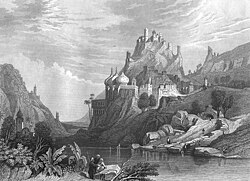
[[File:Ettaia-ettawa.ruins.1830s-1850s.jpg|thumb|An engraving of ruins at Etawah, in the first half of the 19th century AD]] | [[File:Ettaia-ettawa.ruins.1830s-1850s.jpg|thumb|An engraving of ruins at Etawah, in the first half of the 19th century AD]] | ||
This region is | It is believed that the land existed right from the Bronze Age in the medieval times.<ref name="etawah.nic.in">{{Cite web|url=https://etawah.nic.in/history/|title=History | District Etawah | India}}</ref> It once formed part of the ancient country of Panchala which is said to have extended from the foot of the Himalayas in the north to the river Chambal in the south. This region rose into great prominence during the period of Mahabharata. Many local traditions are attached to the modern Chakar Nagar which is a tehsil nearby which most probably seems to be Ekchakra mentioned in Mahabharata. It was Ekchakra where Pandavas along with their mother Kunti spent their secret abode of one year during the period of their exile. There is a belief that the city was founded by King Bharat. During the fourth century A.D., Guptas once again established imperial unity in India. The Chinees traveler Fa-Hien also visited a city named ‘A-lo i.e. Alvi, which has been identified with modern Airwa nearly town, and spent his treat at the Dragon Shrine. Fa-Hien described it as "a city near a large forest" (atavi). There are the remains of Buddhist and Jain temples evidently of every ancient date in large number. In the ninth and tenth centuries, this region was under the rule of Gurjara Pratihara rulers. The conquest of Kannauj by Nagabhata II handed Pratiharas control over this region. But the place was said to be evolved as an affluent region under Mihir Bhoj, the Pratihara King.<ref>[https://www.indiastatpublications.com/pdf_Samples/district_factbook/Uttar_Pradesh/DistrictFactbook_Uttar-Pradesh_Etawah.pdf Uttar Pradesh District Factbook] {{dead link|date=January 2023}}</ref> | ||
With the coronation of Harsha as a king (in 606 AD) the city came under the Thaneshwar dynasty. Hiuen Tsang in his works has also dwelt upon the prosperity of this region. | |||
===Medieval Era=== | |||
The defeat of [[Jaichandra|Jaichandra of Kannauj]] in the [[Battle of Chandawar]] in 1193 A.D at the hands of [[Muhammad of Ghor|Shahab-ud-din Ghori]], the city passed under influence of Muslim power, which by end of the century held in different degrees of subjection the whole of North India except Malwa and some contiguous districts. Muslim rule in Etawah faced Maratha invasion for short period within their rule in Etawah. However, the local history of the city during the early years of the thirteenth century is more or less the account of the settlement and emergence of certain Rajput clans. The Gaurs occupied part of Phaphund and Bidhuna near the Kanpur boundary, both falling in turn to [[Chandelas of Jejakabhukti|Chandelas of Mahoba]]. The [[Chahamanas of Shakambari|Chauhans]] occupied the western portion of the district, with extensive tracts now in Mainpuri. During this period; however, some disturbance related to tax arouse in [[Nasir ud din Muhammad Shah III|Nasir-ud-din Muhammad Shah]]'s rule, yet these issues were put to end by [[Tomaras of Gwalior|Tomar ruler of Gwalior]] in 1390. In 1400–1401 Mallu Iqbal Khan marched towards this region and was opposed by Rai Sumar Singh or Sabir of Etawah and other Zamindars of the vicinity on the banks of the Ab-i-Siyah (Kali Nadi) near Patiali.<ref>{{cite book |last1=Manzar |first1=Nishat |title=Proceedings of the Indian History Congress Vol. 56 |date=1995 |publisher=Indian History Congress |page=301-311 |url=https://www.jstor.org/stable/44158633 |chapter=Zamindars of Etawah Region: c. 1390-1450}}</ref> The opposing army of Rai was defeated and chased down to the confines of Etawah where they took shelter. | |||
Etawah was associated with various important historical events like Jaunpur Campaign, reigns of rulers like [[Bahlul Lodi]], [[Ibrahim Lodi]], [[Babur]], [[Humayun]] and [[Akbar]]. In the fourth year of [[Akbar]]'s reign, Bahadur Khan a younger brother of Ali Quli Khan was granted the jagir of Etawah at the instance of [[Maham Anga|Maham Anka]], the foster mother of the Emperor. After this, Etawah district underwent major changes during reign of [[Kingdom of Rohilkhand|Rohillas]] and the [[Oudh State|Oudh Government]].<ref name="cdn.s3waas.gov.in"/> | |||
The | ===Colonial Era=== | ||
The cession on November 10, 1801, the city was made over to the British Government by the Nawab Saadat Ali Khan together with the rest of the lower Doab and other tracts. This action was taken in return for a guarantee of protection, and by way of payment for the maintenance of the Oadh local forces which were ultimately stationed at Kanpur. Still for some years Etawah was threatened with Maratha inroads, while scenes occurred with the zamindars in the earlier years of the British administration which recall the experiences of the imperial officers in the 16th century, and it was not until the zamindars of Saudaus, Sahson and Kamait had been finally settled with in 1816 A.D.<ref name="cdn.s3waas.gov.in"/> | |||
===Mutiny of 1857=== | |||
On December 25, 1857, a British Column arrived in the city. Kunwar Johar Singh now surrounded and blew up the Etawah tahsil building from where Taj Khan, was resisting the British advance. On 6 January 1858 the British reoccupied Etawah, but struggle was hardly crushed.<ref name="cdn.s3waas.gov.in"/> | |||
===Freedom Struggle=== | |||
In 1907 rumours were afloated in Etawah that Zorawar Singh Nigam, had organized a conspiracy to throw out the British. But on enquiry it was found baseless and a person Khalil who was responsible for rumour was arrested and sentenced. In 1914–15, the city came into prominence as a centre of revolutionary activity when Gendalal Dixit, a teacher at Auraiya nearby town, formed the Shivaji Samitti with object of liberating the country. Gendalal Dixit had also organized a group of young men called ‘Matri-Vedi’. | |||
In 1920 Mahatma Gandhi launched his non-cooperation movement all over the country. In Etawah, the response of the people to this movement was enthusiastic and wide spread. In 1920–21, the district congress committee was formed with Maulana Rahamat Ullah as its president. In 1925, Jyoti Shankar Dixit of Etawah was arrested in connection with the Kakori conspiracy case but later released. In 1928, boycott of the Simon Commission; followed by; the civil disobedience movement in 1930 and Quit India Movement 1942 were started in Etawah, as in other parts of the country.<ref name="cdn.s3waas.gov.in"/> | |||
=== | After Independence of India till January, 1974, 548 freedom fighters were awarded Tamra Patras, i.e. copper plates containing a record of the services rendered by them or their forebears.<ref>{{Cite web |date=2021-03-06 |title=Official Website of Nagar Palika Parishad Etawah, Uttar Pradesh, India. / Etawah City / History of Etawah City |url=http://nppetawah.in/en/page/history-of-etawah-city |access-date=2022-04-09 |website= |archive-url=https://web.archive.org/web/20210306073007/http://nppetawah.in/en/page/history-of-etawah-city |archive-date=6 March 2021 |url-status=dead}}</ref> | ||
The | ==Municipal Council, Etawah== | ||
Municipal Council, Etawah was founded through Notificatin-332 date 11 July 1884 on 16 August 1884. At that time district was divided into 10 wards.Now it has 36 wards . The chairman is Noshaba Khanam Furqan with Executive Officer Shri Anil Kumar . | |||
{| class="wikitable" | |||
|+ Director | |||
|- | |||
! Sr.No !! Name | |||
|- | |||
| 1 || Mr. Kushagra Singh (Aadi) | |||
|} | |||
{| class="wikitable" | |||
|+ Ex-officio members | |||
|- | |||
! Sr.No !! Name of Ex-officio members !! Position !! Name of | |||
|- | |||
| 1 || Mr. Ansar Ahmad || Member of Parliament || Kalikabre, Etawah | |||
|- | |||
| 2 || Mr. Rajendra Sngh Kushwaha || MLA, Sadar || Tulsi Adda, Etawah | |||
|} | |||
{| class="wikitable" | |||
|+ Elected Ward Members | |||
|- | |||
! Ward no. !! Name of elected candidate !! Director/ Member !! Name of ward | |||
|- | |||
| 1 || Mr. Gambhir Singh || Member || K.F.M Khan II | |||
|- | |||
| 2 || Mr. Ravi Kumar || Member || Friends Colony II | |||
|- | |||
| 3 || Mr. Abhay Singh || Member || Katra Balsingh I | |||
|- | |||
| 4 || Mr. Arvind || Member || Sundarpur | |||
|- | |||
| 5 || Mr. Dilip Kumar Dubey || Member || Katra Sahab Khan | |||
|- | |||
| 6 || Mr. Jayveer Singh || Member || Friends Colony III | |||
|- | |||
| 7 || Mrs. Shanti Devi || Member || Gaadipura | |||
|- | |||
| 8 || Mr. Mahendra Kumar || Member || Vijay Nagar III | |||
|- | |||
| 9 || Mrs. Madhu || Member || Civil Line I | |||
|- | |||
| 10 || Mrs. Usha Devi || Member || Mewati Tola | |||
|- | |||
| 11 || Mr. Mohammad Anees || Member || Sabitganj | |||
|- | |||
| 12 || Ms. Mithilesh || Member || Vijay Nagar I | |||
|- | |||
| 13 || Mrs. Rajanshri || Member || Purabia Tola Nalapar | |||
|- | |||
| 14 || Mrs. Neelam Dubey || Member || Karanpura | |||
|- | |||
| 15 || Mrs. Uma || Member || Friends Colony I | |||
|- | |||
| 16|| Mrs. Santosh Kumari || Member || Lalpura | |||
|- | |||
| 17 || Mr. Shabir || Member || Shahgraan | |||
|- | |||
| 18 || Mrs. Roopkiran Verma || Member || Ghatiya Ajmat Ali II | |||
|- | |||
| 19 || Mr. Deepak || Member || Chaugurji | |||
|- | |||
| 20 || Mrs. Manju Devi || Member || Vijay Nagar II | |||
|- | |||
| 21 || Mr. ratnesh || Member || Ashok Nagar I | |||
|- | |||
| 22 || Mr. Srikrishna Yadav || Member || Ghatiya Ajmat Ali II | |||
|- | |||
| 23 || Mr. Imran Hashmi || Member || Katra Shamsher Khan | |||
|- | |||
| 24 || Mrs. Lilavati || Member || K.F.M Khan I | |||
|- | |||
| 25 || Mr. Vimal || Member || Maksoodpura | |||
|- | |||
| 26 || Mrs. Nazma || Member || Chhipaiti | |||
|- | |||
| 27 || Mrs. Ruby Begum || Member || Bairuntola | |||
|- | |||
| 28 || Mr. Iqbal || Member || Pathvaria | |||
|- | |||
| 29 || Mr. Sharad Bajpayee || Member || Akalganj | |||
|- | |||
| 30 || Mr. Sunil || Member || Ashok Nagar II | |||
|- | |||
| 31 || Mrs. Pushpa || Member || Civil Line II | |||
|- | |||
| 32 || Mr. Shafeek Mast Khan || Member || Urdu Mohalla | |||
|- | |||
| 33 || Mr. Udayraj Singh || Member || Ashok Nagar III | |||
|- | |||
| 34 || Mr. Mohd Iliyaas || Member || Naurangabad | |||
|- | |||
| 35 || Mr. Anil || Member || Katra Balsingh II | |||
|- | |||
| 36 || Dr. Omkumari || Member || Purabia Tola Pajava | |||
|} | |||
{| class="wikitable" | |||
|+ Elected by Government | |||
|- | |||
! Header text !! Name of elected candidate | |||
|- | |||
| 1 || Mr. Mohd Nazir Ansari | |||
|- | |||
| 2 || Mr. rakesh Yadav | |||
|- | |||
| 3 || Mr. Amit Soni | |||
|- | |||
| 4 || Mr. Ramesh Prajapati | |||
|} | |||
==Climate== | ==Climate== | ||
{{Weather box | {{Weather box | ||
| location = Etawah ( | | location = Etawah (1991–2020 normals, extremes 1982–present) | ||
| metric first = yes | | metric first = yes | ||
| single line = yes | | single line = yes | ||
| Line 123: | Line 256: | ||
| Oct record high C = 38.4 | | Oct record high C = 38.4 | ||
| Nov record high C = 38.2 | | Nov record high C = 38.2 | ||
| Dec record high C = | | Dec record high C = 31.2 | ||
|year record high C = 48.6 | |year record high C = 48.6 | ||
| Jan high C = | | Jan high C = 20.0 | ||
| Feb high C = | | Feb high C = 24.8 | ||
| Mar high C = | | Mar high C = 30.9 | ||
| Apr high C = | | Apr high C = 38.8 | ||
| May high C = | | May high C = 42.0 | ||
| Jun high C = 40. | | Jun high C = 40.6 | ||
| Jul high C = 35. | | Jul high C = 35.2 | ||
| Aug high C = 33. | | Aug high C = 33.0 | ||
| Sep high C = 32. | | Sep high C = 32.7 | ||
| Oct high C = 31. | | Oct high C = 31.6 | ||
| Nov high C = 27. | | Nov high C = 27.8 | ||
| Dec high C = 22. | | Dec high C = 22.7 | ||
|year high C = 31. | |year high C = 31.8 | ||
| Jan low C = 6. | | Jan low C = 6.4 | ||
| Feb low C = | | Feb low C = 9.6 | ||
| Mar low C = | | Mar low C = 13.9 | ||
| Apr low C = 19. | | Apr low C = 19.4 | ||
| May low C = 24. | | May low C = 24.1 | ||
| Jun low C = | | Jun low C = 25.6 | ||
| Jul low C = | | Jul low C = 24.7 | ||
| Aug low C = | | Aug low C = 23.9 | ||
| Sep low C = | | Sep low C = 22.9 | ||
| Oct low C = 18. | | Oct low C = 18.9 | ||
| Nov low C = | | Nov low C = 13.4 | ||
| Dec low C = 8. | | Dec low C = 8.1 | ||
|year low C = | |year low C = 17.6 | ||
| Jan record low C = 0.4 | | Jan record low C = 0.4 | ||
| Feb record low C = | | Feb record low C = 1.4 | ||
| Mar record low C = 6.8 | | Mar record low C = 6.8 | ||
| Apr record low C = 7.5 | | Apr record low C = 7.5 | ||
| Line 161: | Line 294: | ||
| Sep record low C = 13.0 | | Sep record low C = 13.0 | ||
| Oct record low C = 2.0 | | Oct record low C = 2.0 | ||
| Nov record low C = | | Nov record low C = 5.7 | ||
| Dec record low C = 1.3 | | Dec record low C = 1.3 | ||
|year record low C = 0.4 | |year record low C = 0.4 | ||
| rain colour = green | | rain colour = green | ||
| Jan rain mm = | | Jan rain mm = 7.4 | ||
| Feb rain mm = | | Feb rain mm = 11.8 | ||
| Mar rain mm = | | Mar rain mm = 4.8 | ||
| Apr rain mm = | | Apr rain mm = 3.3 | ||
| May rain mm = | | May rain mm = 14.4 | ||
| Jun rain mm = | | Jun rain mm = 43.1 | ||
| Jul rain mm = | | Jul rain mm = 213.2 | ||
| Aug rain mm = | | Aug rain mm = 199.1 | ||
| Sep rain mm = | | Sep rain mm = 121.8 | ||
| Oct rain mm = | | Oct rain mm = 12.8 | ||
| Nov rain mm = | | Nov rain mm = 3.8 | ||
| Dec rain mm = | | Dec rain mm = 7.6 | ||
|year rain mm = | |year rain mm = 643.0 | ||
| Jan rain days = 0. | | Jan rain days = 0.6 | ||
| Feb rain days = | | Feb rain days = 0.8 | ||
| Mar rain days = 0. | | Mar rain days = 0.6 | ||
| Apr rain days = 0. | | Apr rain days = 0.5 | ||
| May rain days = 1. | | May rain days = 1.0 | ||
| Jun rain days = 2. | | Jun rain days = 2.7 | ||
| Jul rain days = 7. | | Jul rain days = 7.4 | ||
| Aug rain days = | | Aug rain days = 8.7 | ||
| Sep rain days = 5. | | Sep rain days = 5.0 | ||
| Oct rain days = 1.1 | | Oct rain days = 1.1 | ||
| Nov rain days = 0. | | Nov rain days = 0.3 | ||
| Dec rain days = 0. | | Dec rain days = 0.5 | ||
|year rain days = | |year rain days = 29.2 | ||
|time day = 17:30 [[Indian Standard Time|IST]] | |time day = 17:30 [[Indian Standard Time|IST]] | ||
| Jan humidity = | | Jan humidity = 70 | ||
| Feb humidity = | | Feb humidity = 60 | ||
| Mar humidity = | | Mar humidity = 49 | ||
| Apr humidity = | | Apr humidity = 40 | ||
| May humidity = | | May humidity = 38 | ||
| Jun humidity = | | Jun humidity = 50 | ||
| Jul humidity = 69 | | Jul humidity = 69 | ||
| Aug humidity = | | Aug humidity = 77 | ||
| Sep humidity = | | Sep humidity = 74 | ||
| Oct humidity = | | Oct humidity = 66 | ||
| Nov humidity = 66 | | Nov humidity = 66 | ||
| Dec humidity = | | Dec humidity = 72 | ||
|year humidity = | |year humidity = 61 | ||
|source 1 = [[India Meteorological Department]]<ref name=IMDnormals> | |source 1 = [[India Meteorological Department]]<ref name=IMDnormals> | ||
{{cite web | {{cite web | ||
| Line 217: | Line 350: | ||
| access-date = 6 May 2020}}</ref> | | access-date = 6 May 2020}}</ref> | ||
}} | }} | ||
==Communal Clashes== | |||
In 1885 when Dussehra and Muharram coincided, communal disturbances broke out between the Hindus and the Muslims.<ref name="cdn.s3waas.gov.in"/> | |||
== Politics == | == Politics == | ||
Until the 1980s, the regional politics was largely dominated by the Congress. The region saw several changes in the succeeding decades which led to a reconfiguration of political power. Until the 80s the upper castes often used coercion to get votes from the lower caste majority in the region. The lower castes began to assert themselves much more forcefully. Two leaders, Chaudhary Charan Singh, a Jat leader who briefly became prime minister in 1979, and Mulayam Singh Yadav became faces for opposition to the Congress. Moreover, dacoits from backward castes strengthened, asserting control over land and political power.<ref>{{Cite web|url=https://caravanmagazine.in/reportage/everybodys-brother-akhilesh-yadav|title=Akhilesh Yadav in the family business|last=Dixit|first=Neha|website=The Caravan|language=en|access-date=2019-05-22}}</ref> | Until the 1980s, the regional politics was largely dominated by the Congress. The region saw several changes in the succeeding decades which led to a reconfiguration of political power. Until the 80s the upper castes often used coercion to get votes from the lower caste majority in the region. The lower castes began to assert themselves much more forcefully. Two leaders, Chaudhary Charan Singh, a Jat leader who briefly became prime minister in 1979, and Mulayam Singh Yadav became faces for opposition to the Congress. Moreover, dacoits from backward castes strengthened, asserting control over land and political power.<ref>{{Cite web|url=https://caravanmagazine.in/reportage/everybodys-brother-akhilesh-yadav|title=Akhilesh Yadav in the family business|last=Dixit|first=Neha|website=The Caravan|language=en|access-date=2019-05-22}}</ref> | ||
==Economy== | |||
{| class="wikitable" | |||
| Gross District Domestic Product (At Current Price) || 9,24,258 Lakhs (2015–16) | |||
|- | |||
| Gross District Domestic Product (At Constant) || 6,96,774 Lakhs (2011–12) | |||
|- | |||
| Net District Domestic Product (At Current Price) || 8,20,371 Lakhs (2015–16) | |||
|- | |||
| Net District Domestic Product || 6,10,494 Lakhs (2011–12) | |||
|- | |||
| Per Capita Income (NDDP, At Factor Cost)(At Current Price) || 48,850 (2015–16) | |||
|- | |||
| Per Capita Income (NDDP, At Factor Cost)(At Constant) || 36,353 (2011–12) | |||
|} | |||
Manufacturing (Industries) Share in GDP | |||
Manufacturing accounted for 22142 lakhs at Current Prices (2015–16), 19646 Lakhs at Constant Price (2011–12 | |||
==Transport== | ==Transport== | ||
| Line 252: | Line 406: | ||
===Colleges=== | ===Colleges=== | ||
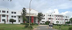
[[File:CAET Main Building.jpg|Baba Saheb Dr. B.R.A. College of Agriculture Engineering & Technology|thumb]] | [[File:CAET Main Building.jpg|Baba Saheb Dr. B.R.A. College of Agriculture Engineering & Technology|thumb]] | ||
*[[Chandra Shekhar Azad University of Agriculture and Technology]], based in [[Kanpur]] has a campus in Etawah, established in 1994–95. | |||
*[[Chaudhary Charan Singh Post Graduate College]] is offers undergraduate and post-graduate courses in Science, Arts, Commerce faculties. The college is affiliated to [[Chhatrapati Shahu Ji Maharaj University]]. | |||
*[[ | * [[College of Dairy Technology, Etawah]], established in 2015 is a constituent college and faculty of Kanpur's Chandra Shekhar Azad University of Agriculture and Technology. | ||
* [[College of Fisheries Science and Research Centre, Etawah]], established in 2015, is a constituent college and faculty of Kanpur's Chandra Shekhar Azad University of Agriculture and Technology. | |||
*[[ | *[[Government Girls Post Graduate College, Etawah]] is government women's college offering BA, BCom and MA (Hindi, Sociology & Economics) courses in Etawah. The college is affiliated to [[Chhatrapati Shahu Ji Maharaj University]]. | ||
*[[Karm Kshetra Post Graduate College]] is a college offering undergraduate and post-graduate courses in Science, Arts, Commerce faculties. The college is affiliated to [[Chhatrapati Shahu Ji Maharaj University]] | |||
*[[ | * [[Uttar Pradesh University of Medical Sciences]] (UPUMS), established in 2016, (Formerly Uttar Pradesh Rural Institute of Medical Sciences and Research (U.P. RIMS&R) which established in 2005 and was affiliated to Chhatrapati Shahu Ji Maharaj University Kanpur). | ||
*[[ | |||
*[[ | |||
*[[ | |||
*[[ | |||
==Places of interest== | ==Places of interest== | ||
Bhareh ka Qila, Boddh Sculptures, Bais Khwaja, National Chambal Sanctuary, Tixi Temple, Jains Temple, Nilkanth Temple, Kaaliwahan Temple, St. Mary Church, Company Bagh Garden, St. Mary Garden | |||
===Etawah Safari Park=== | ===Etawah Safari Park=== | ||
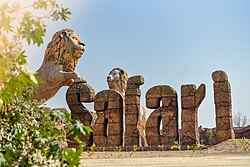
[[File:Etawah Safari Park.jpg|alt=Etawah Safari Park|right|thumb|Etawah Safari Park]] | [[File:Etawah Safari Park.jpg|alt=Etawah Safari Park|right|thumb|Etawah Safari Park]] | ||
The uniqueness of [[Etawah Safari Park]] lies in the fact that while at other such places the animals remain caged and the tourists move freely in the area. While in Etawah Lion Safari, people will move in caged paths while the lions and other animals are seen moving freely in the jungle. The Lion Safari, which is mainly being developed to provide an alternate home to Asiatic lions, that are now limited only to Gir Forests in [[Gujarat]] will also feature a Lion Breeding Centre.<ref>https://www.m.timesofindia.com/city/kanpur/etawah-safari-opens-for-public-lion-segment-to-wait/amp_articleshow/72214891.cms</ref> | The uniqueness of [[Etawah Safari Park]] lies in the fact that while at other such places the animals remain caged and the tourists move freely in the area. While in Etawah Lion Safari, people will move in caged paths while the lions and other animals are seen moving freely in the jungle. The Lion Safari, which is mainly being developed to provide an alternate home to Asiatic lions, that are now limited only to Gir Forests in [[Gujarat]] will also feature a Lion Breeding Centre.<ref>{{Cite web |url=https://www.m.timesofindia.com/city/kanpur/etawah-safari-opens-for-public-lion-segment-to-wait/amp_articleshow/72214891.cms |title=Etawah Safari opens for public, lion segment to wait {{!}} Kanpur News - Times of India<!-- Bot generated title --> |access-date=25 April 2020 |archive-date=11 June 2021 |archive-url=https://web.archive.org/web/20210611085619/https://www.m.timesofindia.com/city/kanpur/etawah-safari-opens-for-public-lion-segment-to-wait/amp_articleshow/72214891.cms |url-status=dead }}</ref> | ||
===National Chambal Sanctuary=== | ===National Chambal Sanctuary=== | ||
[[National Chambal Sanctuary]] is spread over the Agra and Etawah districts, and a total of 290 different species of migratory and resident birds have been identified in the region so far. Winter is the best time to visit the sanctuary.<ref>https://www.zeenews.india.com/news/india/crocodiles-on-the-prowl-in-ups-etawah-villagers-fear-for-life_1935852.html/amp</ref> A boat ride in its tranquil waters during this time is an exhilarating experience with spectacular sightings of the big reptiles basking along the 180 km sparkling sand stretches in the morning sun. But the main draw of the sanctuary are the flamingoes that arrive here in November and stay | [[National Chambal Sanctuary]] is spread over the Agra and Etawah districts, and a total of 290 different species of migratory and resident birds have been identified in the region so far. Winter is the best time to visit the sanctuary.<ref>{{cite web| url = https://www.zeenews.india.com/news/india/crocodiles-on-the-prowl-in-ups-etawah-villagers-fear-for-life_1935852.html/amp| url-status = dead| archive-url = https://web.archive.org/web/20210611084118/https://www.zeenews.india.com/news/india/crocodiles-on-the-prowl-in-ups-etawah-villagers-fear-for-life_1935852.html/amp| archive-date = 2021-06-11| title = Crocodiles on the prowl in UP's Etawah, villagers fear for life {{!}} India News {{!}} Zee News}}</ref> A boat ride in its tranquil waters during this time is an exhilarating experience with spectacular sightings of the big reptiles basking along the 180 km sparkling sand stretches in the morning sun. But the main draw of the sanctuary are the flamingoes that arrive here in November and stay until May. The Rudy Shelduck also arrives a little earlier in September and stays here until May. The Indian Skimmers have huge colonies in the sanctuary and breed prolifically here. | ||
===Sarsai Nawar Wetland=== | ===Sarsai Nawar Wetland=== | ||
[[Sarsai Nawar Wetland]] is a Ramsar enlisted site wetland, en route to Saman Wildlife Sanctuary, in Etawah District of Uttar Pradesh. It comprises two small lakes that attract [[Sarus Crane]]s, White Ibis and other water birds in large numbers. It has a large population of the threatened species of Sarus Cranes, the world's tallest flying birds. Ten Sarus Crane pairs breed here regularly, which is more than twice the number of breeding pairs in the bird sanctuary of Bharatpur in Rajasthan. In winters, almost more than 40,000 migratory birds from northern arc visit Sarsai Nawar wetland.<ref>https://www.m.timesofindia.com/city/lucknow/6-up-wetlands-declared-ramsar-sites-this-year/amp_articleshow/74431796.cms</ref> | [[Sarsai Nawar Wetland]] is a Ramsar enlisted site wetland, en route to Saman Wildlife Sanctuary, in Etawah District of Uttar Pradesh. It comprises two small lakes that attract [[Sarus Crane]]s, White Ibis and other water birds in large numbers. It has a large population of the threatened species of Sarus Cranes, the world's tallest flying birds. Ten Sarus Crane pairs breed here regularly, which is more than twice the number of breeding pairs in the bird sanctuary of Bharatpur in Rajasthan. In winters, almost more than 40,000 migratory birds from northern arc visit Sarsai Nawar wetland.<ref>{{Cite web |url=https://www.m.timesofindia.com/city/lucknow/6-up-wetlands-declared-ramsar-sites-this-year/amp_articleshow/74431796.cms |title=Six UP wetlands declared Ramsar sites this year {{!}} Lucknow News - Times of India<!-- Bot generated title --> |access-date=25 April 2020 |archive-date=11 June 2021 |archive-url=https://web.archive.org/web/20210611085619/https://www.m.timesofindia.com/city/lucknow/6-up-wetlands-declared-ramsar-sites-this-year/amp_articleshow/74431796.cms |url-status=dead }}</ref> | ||
===Agra-Etawah Cycle Highway=== | ===Agra-Etawah Cycle Highway=== | ||
[[Image:Sarsai City Cycle Highway.jpg|thumb|Cycle Highway]] | [[Image:Sarsai City Cycle Highway.jpg|thumb|Cycle Highway]] | ||
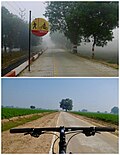
[[Agra-Etawah Cycle Highway]] in Uttar Pradesh now has Asia's first cycle highway. A first-of-its-kind project, the 207-km-long cycle highway runs between Etawah and Agra and was declared open on Saturday, 27 November 2016. The track begins from the lion safari in Etawah. On its way to Agra are tourist destinations like Naugava ka Quila, Raja Bhoj ki Haveli, and Bateshwarnath Temple. It ends at the eastern gate of the Taj Mahal in Agra.<ref>https://www.m.timesofindia.com/city/agra/akhileshs-cycle-highway-inaugurated-four-months-ago-develops-cracks/amp_articleshow/57385825.cms</ref> | [[Agra-Etawah Cycle Highway]] in Uttar Pradesh now has Asia's first cycle highway. A first-of-its-kind project, the 207-km-long cycle highway runs between Etawah and Agra and was declared open on Saturday, 27 November 2016. The track begins from the lion safari in Etawah. On its way to Agra are tourist destinations like Naugava ka Quila, Raja Bhoj ki Haveli, and Bateshwarnath Temple. It ends at the eastern gate of the Taj Mahal in Agra.<ref>{{Cite web |url=https://www.m.timesofindia.com/city/agra/akhileshs-cycle-highway-inaugurated-four-months-ago-develops-cracks/amp_articleshow/57385825.cms |title=Agra-Etawah cycle highway: Akhilesh's cycle highway, inaugurated four months ago, develops cracks {{!}} Agra News - Times of India<!-- Bot generated title --> |access-date=25 April 2020 |archive-date=11 June 2021 |archive-url=https://web.archive.org/web/20210611091123/https://www.m.timesofindia.com/city/agra/akhileshs-cycle-highway-inaugurated-four-months-ago-develops-cracks/amp_articleshow/57385825.cms |url-status=dead }}</ref> | ||
==Notable Buildings== | ==Notable Buildings== | ||
| Line 301: | Line 438: | ||
[[Image:Tixcy Temple.jpg|thumb|Tixi Shiva Mandir]] | [[Image:Tixcy Temple.jpg|thumb|Tixi Shiva Mandir]] | ||
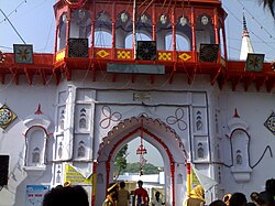
* [[Hajari Mahadev Temple]] Sarsai Nawar | * [[Hajari Mahadev Temple]] Sarsai Nawar | ||
*Kundeshwar Mahadev Temple | * Kundeshwar Mahadev Temple, Agra-Bah road, Udi Mod, Etawah | ||
*[[Shakti Peetha|Kali Vahan Mandir, Gwalior Road Etawah]] | *[[Shakti Peetha|Kali Vahan Mandir, Gwalior Road Etawah]] | ||
* Neel Kanth Mahadev Mandir (Lord Shiva Temple) | * Neel Kanth Mahadev Mandir (Lord Shiva Temple) | ||
| Line 313: | Line 450: | ||
* Pili Kothi | * Pili Kothi | ||
* Nasia Ji Digambar Jain Temple | * Nasia Ji Digambar Jain Temple | ||
* Bharehshwar Mahadev Mandir, Bhareh | |||
==Notable people== | ==Notable people== | ||
{{alumni|residents|date=July 2021}} | |||
{{col div|colwidth=30em}} | {{col div|colwidth=30em}} | ||
<!---♦♦♦ Only add a person to this list if they already have their own article on the English Wikipedia ♦♦♦---> | <!---♦♦♦ Only add a person to this list if they already have their own article on the English Wikipedia ♦♦♦---> | ||
<!---♦♦♦ Please keep the list in alphabetical order by LAST NAME ♦♦♦---> | <!---♦♦♦ Please keep the list in alphabetical order by LAST NAME ♦♦♦---> | ||
*[[K. Asif]], film director was born in Etawah | |||
*[[K. Asif]] | *[[Pia Bajpiee]], actress born in Etawah | ||
*[[Pia Bajpiee]] | *[[Sarita Bhadauria]], MLA from Etawah | ||
*[[Sarita Bhadauria]] | *[[Ghulam Mustafa Burdwani]], former Mufti of Etawah | ||
*[[ | *[[Babu Gulabrai]], a significant figure in modern Hindi literature was born in Etawah | ||
*[[ | *[[Allan Octavian Hume]], the founder of Indian National Congress was district collector in 1857<ref name="etawah.nic.in"/> *[[Zakir Husain (politician)|Dr. Zakir Hussain]], President of India completed his high school in Etawah | ||
*[[ | *[[C. K. Jain]], former Secretary-General was born in Etawah | ||
*[[Zakir Husain (politician)|Dr. Zakir Hussain]] | *[[Premdas Katheria]], former MP from Etawah | ||
*[[ | *[[Ram Shankar Katheria]], MP from Etawah | ||
*[[ | *[[Mohsin-ul-Mulk]], prominent in Aligarh Movement | ||
*[[ | *[[Raghuraj Singh Shakya]], former MLA of Etawah | ||
*[[ | *[[Ram Singh Shakya]], former MP of Etawah | ||
*[[ | *[[Akshay Yadav]], former MP born In Etawah | ||
*[[ | |||
<!---♦♦♦ Only add a person to this list if they already have their own article on the English Wikipedia ♦♦♦---> | <!---♦♦♦ Only add a person to this list if they already have their own article on the English Wikipedia ♦♦♦---> | ||
<!---♦♦♦ Please keep the list in alphabetical order by LAST NAME ♦♦♦---> | <!---♦♦♦ Please keep the list in alphabetical order by LAST NAME ♦♦♦---> | ||
| Line 341: | Line 479: | ||
==External links== | ==External links== | ||
* [http://etawah.nic.in Website of Etawah District] | * [http://etawah.nic.in Website of Etawah District] | ||
* [https://web.archive.org/web/20121201033126/http://www.etawahcity.com/ Local Directory of Etawah District] | * [https://web.archive.org/web/20121201033126/http://www.etawahcity.com/ Local Directory of Etawah District] | ||
| Line 356: | Line 494: | ||
[[Category:Etawah| ]] | [[Category:Etawah| ]] | ||
[[Category:Cities in Uttar Pradesh]] | [[Category:Cities in Uttar Pradesh]] | ||
[[Category:Tourism in Uttar Pradesh]] | |||
Latest revision as of 06:04, 22 July 2023
Etawah
Ishtikapuri | |
|---|---|
City | |
.jpg) Sumer Singh Fort | |
| Nickname: City Of Chief Ministers | |
  Etawah  Etawah | |
| Coordinates: 26°46′N 79°02′E / 26.77°N 79.03°E | |
| Country |  India India |
| State | Uttar Pradesh |
| District | Etawah |
| Government | |
| • Type | Municipal Council |
| • Body | Etawah Nagar Palika Parishad[2] |
| • MLA (Etawah constituency) | Sarita Bhadauria (Bharatiya Janata Party) |
| Elevation | 197 m (646 ft) |
| Population (2011) | |
| • Total | 256,838[1] |
| • Rank | 174th |
| • Density | 684/km2 (1,770/sq mi) |
| Demonym | Etawian |
| Languages | |
| • Official | Hindi, Urdu |
| • Regional | Awadhi |
| Time zone | UTC+5:30 (IST) |
| 206001 | 2060xx |
| Telephone code | 05688 |
| Vehicle registration | UP-75 |
| Coastline | 0 kilometres (0 mi) |
| Sex ratio | 896/1000 ♂/♀ |
| Literacy | 81.75% |
| Website | www |
Etawah also known as Ishtikapuri is a city on the banks of Yamuna River in the state of Western Uttar Pradesh in India. It is the administrative headquarters of Etawah District. Etawah's population of 256,838 (as per 2011 population census) makes it the one hundred and eightieth-most populous city in India.[1] The city lies 300 km (190 mi) southeast of the national capital New Delhi, and 230 km (140 mi) northwest of the state capital Lucknow.
Etawah is about 120 km east of Agra and is about 140 km west of Kanpur. The city was an important centre for the Indian Rebellion of 1857. It is also the sangam or confluence of the Yamuna and Chambal rivers. It is the 26th most populous city in Uttar Pradesh.
Demographics[edit | edit source]
As per the 2011 census, Etawah city had a population of 256,790, of which males were 135,829, and females were 120,961 - an increase of 22% from 211,460 in 2001 census. (The entire Etawah district had a population of 1,581,810 in 2011.) The literacy rate was 82.89 per cent.[1][4] Hinduism is majority religion in Etawah city with 74.64% followers. Islam is second most popular religion in city of Etawah with approximately 23.61% following it. In Etawah city, Christianity is followed by 0.19%, Jainism by 1.05%, Sikhism by 0.24% and Buddhism by 0.24%. Around 0.01% stated 'Other Religion', approximately 0.19% stated 'No Particular Religion'.
Main spoken languages are Hindi (98.20%), Urdu (1.75%), Sindhi (0.01%)[5]
Total no. of Slums in Etawah city numbers 5,528 in which population of 33,188 resides. This is around 12.92% of total population of Etawah city.[6]
Name[edit | edit source]
During Rajput era the king of Chauhan dynasty Sumershah had gone to the bank of the Yamuna river in Etawah, where he saw an incredible act of nature. He saw a goat and a wolf drinking water together on the bank of the Yamuna. After seeing this incident, the king went to astrologers and consulted about the incident, who advised him to build a fort at the place where the wolf and the goat were drinking water together. According to astrological calculation, building a fort would benefit the king.When construction work of the fort started at the decided location, then, while digging foundation the laborers working there found a brick of gold and silver, which made them excited and they started shouting "Eeet Mili, Eeet Mili" after hearing which the place was named as "Eeet Aaya" which later turned into ‘Etawah’.
Etawah is still sometimes referred to as the city of bricks and both tradition and the appearance of the ground suggest that the modern city was founded on an ancient Khera or town site, so that it is not improbable that the existence of old bricks or old brick kilns may have led to its present name. According to some scholars the region from Bateshwar in district Agra to Bhareh was known as ‘Ishtapath’ and there are a large number of temples of Lord Siva who was ‘Isht Dev’ of the people of that region. From the word ‘Isht’ the town was given the name of Ishtkapuri a reference to which is found in Bhareshya Puran.[7]
History[edit | edit source]
Ancient era[edit | edit source]

It is believed that the land existed right from the Bronze Age in the medieval times.[8] It once formed part of the ancient country of Panchala which is said to have extended from the foot of the Himalayas in the north to the river Chambal in the south. This region rose into great prominence during the period of Mahabharata. Many local traditions are attached to the modern Chakar Nagar which is a tehsil nearby which most probably seems to be Ekchakra mentioned in Mahabharata. It was Ekchakra where Pandavas along with their mother Kunti spent their secret abode of one year during the period of their exile. There is a belief that the city was founded by King Bharat. During the fourth century A.D., Guptas once again established imperial unity in India. The Chinees traveler Fa-Hien also visited a city named ‘A-lo i.e. Alvi, which has been identified with modern Airwa nearly town, and spent his treat at the Dragon Shrine. Fa-Hien described it as "a city near a large forest" (atavi). There are the remains of Buddhist and Jain temples evidently of every ancient date in large number. In the ninth and tenth centuries, this region was under the rule of Gurjara Pratihara rulers. The conquest of Kannauj by Nagabhata II handed Pratiharas control over this region. But the place was said to be evolved as an affluent region under Mihir Bhoj, the Pratihara King.[9]
With the coronation of Harsha as a king (in 606 AD) the city came under the Thaneshwar dynasty. Hiuen Tsang in his works has also dwelt upon the prosperity of this region.
Medieval Era[edit | edit source]
The defeat of Jaichandra of Kannauj in the Battle of Chandawar in 1193 A.D at the hands of Shahab-ud-din Ghori, the city passed under influence of Muslim power, which by end of the century held in different degrees of subjection the whole of North India except Malwa and some contiguous districts. Muslim rule in Etawah faced Maratha invasion for short period within their rule in Etawah. However, the local history of the city during the early years of the thirteenth century is more or less the account of the settlement and emergence of certain Rajput clans. The Gaurs occupied part of Phaphund and Bidhuna near the Kanpur boundary, both falling in turn to Chandelas of Mahoba. The Chauhans occupied the western portion of the district, with extensive tracts now in Mainpuri. During this period; however, some disturbance related to tax arouse in Nasir-ud-din Muhammad Shah's rule, yet these issues were put to end by Tomar ruler of Gwalior in 1390. In 1400–1401 Mallu Iqbal Khan marched towards this region and was opposed by Rai Sumar Singh or Sabir of Etawah and other Zamindars of the vicinity on the banks of the Ab-i-Siyah (Kali Nadi) near Patiali.[10] The opposing army of Rai was defeated and chased down to the confines of Etawah where they took shelter.
Etawah was associated with various important historical events like Jaunpur Campaign, reigns of rulers like Bahlul Lodi, Ibrahim Lodi, Babur, Humayun and Akbar. In the fourth year of Akbar's reign, Bahadur Khan a younger brother of Ali Quli Khan was granted the jagir of Etawah at the instance of Maham Anka, the foster mother of the Emperor. After this, Etawah district underwent major changes during reign of Rohillas and the Oudh Government.[7]
Colonial Era[edit | edit source]
The cession on November 10, 1801, the city was made over to the British Government by the Nawab Saadat Ali Khan together with the rest of the lower Doab and other tracts. This action was taken in return for a guarantee of protection, and by way of payment for the maintenance of the Oadh local forces which were ultimately stationed at Kanpur. Still for some years Etawah was threatened with Maratha inroads, while scenes occurred with the zamindars in the earlier years of the British administration which recall the experiences of the imperial officers in the 16th century, and it was not until the zamindars of Saudaus, Sahson and Kamait had been finally settled with in 1816 A.D.[7]
Mutiny of 1857[edit | edit source]
On December 25, 1857, a British Column arrived in the city. Kunwar Johar Singh now surrounded and blew up the Etawah tahsil building from where Taj Khan, was resisting the British advance. On 6 January 1858 the British reoccupied Etawah, but struggle was hardly crushed.[7]
Freedom Struggle[edit | edit source]
In 1907 rumours were afloated in Etawah that Zorawar Singh Nigam, had organized a conspiracy to throw out the British. But on enquiry it was found baseless and a person Khalil who was responsible for rumour was arrested and sentenced. In 1914–15, the city came into prominence as a centre of revolutionary activity when Gendalal Dixit, a teacher at Auraiya nearby town, formed the Shivaji Samitti with object of liberating the country. Gendalal Dixit had also organized a group of young men called ‘Matri-Vedi’.
In 1920 Mahatma Gandhi launched his non-cooperation movement all over the country. In Etawah, the response of the people to this movement was enthusiastic and wide spread. In 1920–21, the district congress committee was formed with Maulana Rahamat Ullah as its president. In 1925, Jyoti Shankar Dixit of Etawah was arrested in connection with the Kakori conspiracy case but later released. In 1928, boycott of the Simon Commission; followed by; the civil disobedience movement in 1930 and Quit India Movement 1942 were started in Etawah, as in other parts of the country.[7]
After Independence of India till January, 1974, 548 freedom fighters were awarded Tamra Patras, i.e. copper plates containing a record of the services rendered by them or their forebears.[11]
Municipal Council, Etawah[edit | edit source]
Municipal Council, Etawah was founded through Notificatin-332 date 11 July 1884 on 16 August 1884. At that time district was divided into 10 wards.Now it has 36 wards . The chairman is Noshaba Khanam Furqan with Executive Officer Shri Anil Kumar .
| Sr.No | Name |
|---|---|
| 1 | Mr. Kushagra Singh (Aadi) |
| Sr.No | Name of Ex-officio members | Position | Name of |
|---|---|---|---|
| 1 | Mr. Ansar Ahmad | Member of Parliament | Kalikabre, Etawah |
| 2 | Mr. Rajendra Sngh Kushwaha | MLA, Sadar | Tulsi Adda, Etawah |
| Ward no. | Name of elected candidate | Director/ Member | Name of ward |
|---|---|---|---|
| 1 | Mr. Gambhir Singh | Member | K.F.M Khan II |
| 2 | Mr. Ravi Kumar | Member | Friends Colony II |
| 3 | Mr. Abhay Singh | Member | Katra Balsingh I |
| 4 | Mr. Arvind | Member | Sundarpur |
| 5 | Mr. Dilip Kumar Dubey | Member | Katra Sahab Khan |
| 6 | Mr. Jayveer Singh | Member | Friends Colony III |
| 7 | Mrs. Shanti Devi | Member | Gaadipura |
| 8 | Mr. Mahendra Kumar | Member | Vijay Nagar III |
| 9 | Mrs. Madhu | Member | Civil Line I |
| 10 | Mrs. Usha Devi | Member | Mewati Tola |
| 11 | Mr. Mohammad Anees | Member | Sabitganj |
| 12 | Ms. Mithilesh | Member | Vijay Nagar I |
| 13 | Mrs. Rajanshri | Member | Purabia Tola Nalapar |
| 14 | Mrs. Neelam Dubey | Member | Karanpura |
| 15 | Mrs. Uma | Member | Friends Colony I |
| 16 | Mrs. Santosh Kumari | Member | Lalpura |
| 17 | Mr. Shabir | Member | Shahgraan |
| 18 | Mrs. Roopkiran Verma | Member | Ghatiya Ajmat Ali II |
| 19 | Mr. Deepak | Member | Chaugurji |
| 20 | Mrs. Manju Devi | Member | Vijay Nagar II |
| 21 | Mr. ratnesh | Member | Ashok Nagar I |
| 22 | Mr. Srikrishna Yadav | Member | Ghatiya Ajmat Ali II |
| 23 | Mr. Imran Hashmi | Member | Katra Shamsher Khan |
| 24 | Mrs. Lilavati | Member | K.F.M Khan I |
| 25 | Mr. Vimal | Member | Maksoodpura |
| 26 | Mrs. Nazma | Member | Chhipaiti |
| 27 | Mrs. Ruby Begum | Member | Bairuntola |
| 28 | Mr. Iqbal | Member | Pathvaria |
| 29 | Mr. Sharad Bajpayee | Member | Akalganj |
| 30 | Mr. Sunil | Member | Ashok Nagar II |
| 31 | Mrs. Pushpa | Member | Civil Line II |
| 32 | Mr. Shafeek Mast Khan | Member | Urdu Mohalla |
| 33 | Mr. Udayraj Singh | Member | Ashok Nagar III |
| 34 | Mr. Mohd Iliyaas | Member | Naurangabad |
| 35 | Mr. Anil | Member | Katra Balsingh II |
| 36 | Dr. Omkumari | Member | Purabia Tola Pajava |
| Header text | Name of elected candidate |
|---|---|
| 1 | Mr. Mohd Nazir Ansari |
| 2 | Mr. rakesh Yadav |
| 3 | Mr. Amit Soni |
| 4 | Mr. Ramesh Prajapati |
Climate[edit | edit source]
| Climate data for Etawah (1991–2020 normals, extremes 1982–present) | |||||||||||||
|---|---|---|---|---|---|---|---|---|---|---|---|---|---|
| Month | Jan | Feb | Mar | Apr | May | Jun | Jul | Aug | Sep | Oct | Nov | Dec | Year |
| Record high °C (°F) | 29.0 (84.2) |
36.1 (97.0) |
42.0 (107.6) |
46.4 (115.5) |
48.6 (119.5) |
47.6 (117.7) |
44.2 (111.6) |
42.0 (107.6) |
39.2 (102.6) |
38.4 (101.1) |
38.2 (100.8) |
31.2 (88.2) |
48.6 (119.5) |
| Average high °C (°F) | 20.0 (68.0) |
24.8 (76.6) |
30.9 (87.6) |
38.8 (101.8) |
42.0 (107.6) |
40.6 (105.1) |
35.2 (95.4) |
33.0 (91.4) |
32.7 (90.9) |
31.6 (88.9) |
27.8 (82.0) |
22.7 (72.9) |
31.8 (89.2) |
| Average low °C (°F) | 6.4 (43.5) |
9.6 (49.3) |
13.9 (57.0) |
19.4 (66.9) |
24.1 (75.4) |
25.6 (78.1) |
24.7 (76.5) |
23.9 (75.0) |
22.9 (73.2) |
18.9 (66.0) |
13.4 (56.1) |
8.1 (46.6) |
17.6 (63.7) |
| Record low °C (°F) | 0.4 (32.7) |
1.4 (34.5) |
6.8 (44.2) |
7.5 (45.5) |
11.4 (52.5) |
14.2 (57.6) |
17.0 (62.6) |
14.2 (57.6) |
13.0 (55.4) |
2.0 (35.6) |
5.7 (42.3) |
1.3 (34.3) |
0.4 (32.7) |
| Average rainfall mm (inches) | 7.4 (0.29) |
11.8 (0.46) |
4.8 (0.19) |
3.3 (0.13) |
14.4 (0.57) |
43.1 (1.70) |
213.2 (8.39) |
199.1 (7.84) |
121.8 (4.80) |
12.8 (0.50) |
3.8 (0.15) |
7.6 (0.30) |
643.0 (25.31) |
| Average rainy days | 0.6 | 0.8 | 0.6 | 0.5 | 1.0 | 2.7 | 7.4 | 8.7 | 5.0 | 1.1 | 0.3 | 0.5 | 29.2 |
| Average relative humidity (%) (at 17:30 IST) | 70 | 60 | 49 | 40 | 38 | 50 | 69 | 77 | 74 | 66 | 66 | 72 | 61 |
| Source: India Meteorological Department[12] | |||||||||||||
Communal Clashes[edit | edit source]
In 1885 when Dussehra and Muharram coincided, communal disturbances broke out between the Hindus and the Muslims.[7]
Politics[edit | edit source]
Until the 1980s, the regional politics was largely dominated by the Congress. The region saw several changes in the succeeding decades which led to a reconfiguration of political power. Until the 80s the upper castes often used coercion to get votes from the lower caste majority in the region. The lower castes began to assert themselves much more forcefully. Two leaders, Chaudhary Charan Singh, a Jat leader who briefly became prime minister in 1979, and Mulayam Singh Yadav became faces for opposition to the Congress. Moreover, dacoits from backward castes strengthened, asserting control over land and political power.[13]
Economy[edit | edit source]
| Gross District Domestic Product (At Current Price) | 9,24,258 Lakhs (2015–16) |
| Gross District Domestic Product (At Constant) | 6,96,774 Lakhs (2011–12) |
| Net District Domestic Product (At Current Price) | 8,20,371 Lakhs (2015–16) |
| Net District Domestic Product | 6,10,494 Lakhs (2011–12) |
| Per Capita Income (NDDP, At Factor Cost)(At Current Price) | 48,850 (2015–16) |
| Per Capita Income (NDDP, At Factor Cost)(At Constant) | 36,353 (2011–12) |
Manufacturing (Industries) Share in GDP Manufacturing accounted for 22142 lakhs at Current Prices (2015–16), 19646 Lakhs at Constant Price (2011–12
Transport[edit | edit source]
Air[edit | edit source]
City is served by Saifai Domestic Airport, which is around 15 km from city center. The airport has only unscheduled chartered flights. The nearest domestic airport is at Ganesh Shankar Vidyarthi Airport which is 175 km. The nearest International Airport is Chaudhary Charan Singh International Airport located at a distance of around 220 km.
Rail[edit | edit source]
Mainpuri-Etawah Branch Railway Line | ||||||||||||||||||||||||||||||||||||||||||||||||||||||||
|---|---|---|---|---|---|---|---|---|---|---|---|---|---|---|---|---|---|---|---|---|---|---|---|---|---|---|---|---|---|---|---|---|---|---|---|---|---|---|---|---|---|---|---|---|---|---|---|---|---|---|---|---|---|---|---|---|
| ||||||||||||||||||||||||||||||||||||||||||||||||||||||||


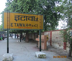
Etawah Junction railway station is the main station of the city as well as of the Howrah-Delhi main line and Guna - Etawah Rail Line . It is a class A station of Allahabad division of North Central Railways. It has a secondary railway line to Agra via reserved sanctuary area. Etawah - Mainpuri line is also constructed and train is running between Etawah and Mainpuri. One another railway line from Etawah to Bindki is to be constructed. It has halt for fastest trains like Kanpur New Delhi Shatabdi Express, Lucknow Swarna Shatabdi Express and many more. Etawah Junction is one of the cleanest railway station of Indian Railways. Necessary basic amenities like water taps, pay and use toilets, foot over bridges, platform shed, waiting hall, railway enquiry window, computerized reservation hall, ATMs, food stalls, integrated train information system, train announcement system, train display boards, platform - coach indicators, infotainment screens, wheelchair accessible ramp can be found at station. Sooner, we will find escalators to the bridge at the station. The city is also served by four other railway stations viz. Udi Junction, Sarai Bhopat, Ekdil and Vaidhpura.
Road[edit | edit source]
Etawah is well-connected by roads with the rest of Uttar Pradesh state. Etawah is the regional office of Etawah Region of UP Roadways. It has buses for all cities of Uttar Pradesh as well as for all neighbouring states. It has buses to Delhi for every 15 minutes. National Highway 19 passes through Etawah, connecting it to important cities like Delhi, Mathura, Agra, Kanpur, Allahabad, Varanasi, Gurugram, Dhanbad and Kolkata. There are three big cities namely Gwalior, Agra and Kanpur, near Etawah with well connected roads.
Agra Lucknow Expressway have various cuts, from where roads connect it to city like with Farrukhabad Road near Baralokpur, with Etawah - Mainpuri State Highway near Karhal, with NH 19 near Bhadan.
Within the city, auto-rickshaw and cycle rickshaw are the major forms of transport. Bus services run at high frequencies. Etawah city is waiting for city bus services as it was announced by UPA government to run 85 city buses to connect the city and to develop a ring road around the city. City buses will be available from Sai City Udaypur in North to Udi More in South, from Sarai Bhopat in the west to Pilkhar in the east. It will cover 50 km (approx.) distance if starts.
Education[edit | edit source]
Colleges[edit | edit source]

- Chandra Shekhar Azad University of Agriculture and Technology, based in Kanpur has a campus in Etawah, established in 1994–95.
- Chaudhary Charan Singh Post Graduate College is offers undergraduate and post-graduate courses in Science, Arts, Commerce faculties. The college is affiliated to Chhatrapati Shahu Ji Maharaj University.
- College of Dairy Technology, Etawah, established in 2015 is a constituent college and faculty of Kanpur's Chandra Shekhar Azad University of Agriculture and Technology.
- College of Fisheries Science and Research Centre, Etawah, established in 2015, is a constituent college and faculty of Kanpur's Chandra Shekhar Azad University of Agriculture and Technology.
- Government Girls Post Graduate College, Etawah is government women's college offering BA, BCom and MA (Hindi, Sociology & Economics) courses in Etawah. The college is affiliated to Chhatrapati Shahu Ji Maharaj University.
- Karm Kshetra Post Graduate College is a college offering undergraduate and post-graduate courses in Science, Arts, Commerce faculties. The college is affiliated to Chhatrapati Shahu Ji Maharaj University
- Uttar Pradesh University of Medical Sciences (UPUMS), established in 2016, (Formerly Uttar Pradesh Rural Institute of Medical Sciences and Research (U.P. RIMS&R) which established in 2005 and was affiliated to Chhatrapati Shahu Ji Maharaj University Kanpur).
Places of interest[edit | edit source]
Bhareh ka Qila, Boddh Sculptures, Bais Khwaja, National Chambal Sanctuary, Tixi Temple, Jains Temple, Nilkanth Temple, Kaaliwahan Temple, St. Mary Church, Company Bagh Garden, St. Mary Garden
Etawah Safari Park[edit | edit source]

The uniqueness of Etawah Safari Park lies in the fact that while at other such places the animals remain caged and the tourists move freely in the area. While in Etawah Lion Safari, people will move in caged paths while the lions and other animals are seen moving freely in the jungle. The Lion Safari, which is mainly being developed to provide an alternate home to Asiatic lions, that are now limited only to Gir Forests in Gujarat will also feature a Lion Breeding Centre.[14]
National Chambal Sanctuary[edit | edit source]
National Chambal Sanctuary is spread over the Agra and Etawah districts, and a total of 290 different species of migratory and resident birds have been identified in the region so far. Winter is the best time to visit the sanctuary.[15] A boat ride in its tranquil waters during this time is an exhilarating experience with spectacular sightings of the big reptiles basking along the 180 km sparkling sand stretches in the morning sun. But the main draw of the sanctuary are the flamingoes that arrive here in November and stay until May. The Rudy Shelduck also arrives a little earlier in September and stays here until May. The Indian Skimmers have huge colonies in the sanctuary and breed prolifically here.
Sarsai Nawar Wetland[edit | edit source]
Sarsai Nawar Wetland is a Ramsar enlisted site wetland, en route to Saman Wildlife Sanctuary, in Etawah District of Uttar Pradesh. It comprises two small lakes that attract Sarus Cranes, White Ibis and other water birds in large numbers. It has a large population of the threatened species of Sarus Cranes, the world's tallest flying birds. Ten Sarus Crane pairs breed here regularly, which is more than twice the number of breeding pairs in the bird sanctuary of Bharatpur in Rajasthan. In winters, almost more than 40,000 migratory birds from northern arc visit Sarsai Nawar wetland.[16]
Agra-Etawah Cycle Highway[edit | edit source]

Agra-Etawah Cycle Highway in Uttar Pradesh now has Asia's first cycle highway. A first-of-its-kind project, the 207-km-long cycle highway runs between Etawah and Agra and was declared open on Saturday, 27 November 2016. The track begins from the lion safari in Etawah. On its way to Agra are tourist destinations like Naugava ka Quila, Raja Bhoj ki Haveli, and Bateshwarnath Temple. It ends at the eastern gate of the Taj Mahal in Agra.[17]
Notable Buildings[edit | edit source]
Religious[edit | edit source]


- Hajari Mahadev Temple Sarsai Nawar
- Kundeshwar Mahadev Temple, Agra-Bah road, Udi Mod, Etawah
- Kali Vahan Mandir, Gwalior Road Etawah
- Neel Kanth Mahadev Mandir (Lord Shiva Temple)
- Maa Kalika Devi Mandir, Lakhna, Etawah
- Pachnada, Etawah
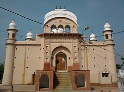
- Shahi Jama Masjid
- Sai Mandir
- Tixi Temple Etawah
- Pilua Mahavir
- Brahmani Devi
- Pili Kothi
- Nasia Ji Digambar Jain Temple
- Bharehshwar Mahadev Mandir, Bhareh
Notable people[edit | edit source]
 | This article's list of residents may not follow Bharatpedia's verifiability policy. (July 2021) |
- K. Asif, film director was born in Etawah
- Pia Bajpiee, actress born in Etawah
- Sarita Bhadauria, MLA from Etawah
- Ghulam Mustafa Burdwani, former Mufti of Etawah
- Babu Gulabrai, a significant figure in modern Hindi literature was born in Etawah
- Allan Octavian Hume, the founder of Indian National Congress was district collector in 1857[8] *Dr. Zakir Hussain, President of India completed his high school in Etawah
- C. K. Jain, former Secretary-General was born in Etawah
- Premdas Katheria, former MP from Etawah
- Ram Shankar Katheria, MP from Etawah
- Mohsin-ul-Mulk, prominent in Aligarh Movement
- Raghuraj Singh Shakya, former MLA of Etawah
- Ram Singh Shakya, former MP of Etawah
- Akshay Yadav, former MP born In Etawah
References[edit | edit source]
- ↑ 1.0 1.1 1.2 "Census 2011". Archived from the original on 10 February 2017. Retrieved 19 December 2016.
- ↑ "Home". nppetawah.in.
- ↑ "Table C-01 Population by Religion: Uttar Pradesh". censusindia.gov.in. Registrar General and Census Commissioner of India. 2011.
- ↑ "Urban Agglomerations/Cities having population 1 lakh and above" (PDF). Provisional Population Totals, Census of India 2011. Archived (PDF) from the original on 13 November 2011. Retrieved 7 July 2012.
- ↑ "Uttar Pradesh District Factbook : Etawah District". www.indiastatpublications.com. Retrieved 9 April 2022.
- ↑ Census 2011
- ↑ 7.0 7.1 7.2 7.3 7.4 7.5 District Census handbook
- ↑ 8.0 8.1 "History | District Etawah | India".
- ↑ Uttar Pradesh District Factbook [dead link]
- ↑ Manzar, Nishat (1995). "Zamindars of Etawah Region: c. 1390-1450". Proceedings of the Indian History Congress Vol. 56. Indian History Congress. p. 301-311.
- ↑ "Official Website of Nagar Palika Parishad Etawah, Uttar Pradesh, India. / Etawah City / History of Etawah City". 6 March 2021. Archived from the original on 6 March 2021. Retrieved 9 April 2022.
- ↑ "Station: Etawah Climatological Table 1981–2010" (PDF). Climatological Normals 1981–2010. India Meteorological Department. January 2015. pp. 267–268. Archived from the original (PDF) on 5 February 2020. Retrieved 6 May 2020.
- ↑ Dixit, Neha. "Akhilesh Yadav in the family business". The Caravan. Retrieved 22 May 2019.
- ↑ "Etawah Safari opens for public, lion segment to wait | Kanpur News - Times of India". Archived from the original on 11 June 2021. Retrieved 25 April 2020.
- ↑ "Crocodiles on the prowl in UP's Etawah, villagers fear for life | India News | Zee News". Archived from the original on 11 June 2021.
- ↑ "Six UP wetlands declared Ramsar sites this year | Lucknow News - Times of India". Archived from the original on 11 June 2021. Retrieved 25 April 2020.
- ↑ "Agra-Etawah cycle highway: Akhilesh's cycle highway, inaugurated four months ago, develops cracks | Agra News - Times of India". Archived from the original on 11 June 2021. Retrieved 25 April 2020.