



m Removing protection template from an unprotected page |
WikiDwarfBOT (talk | contribs) Cleanup: Source modification. |
||
| Line 1: | Line 1: | ||
{{short description|Religious mountain in Tibet Autonomous Region}} | {{short description|Religious mountain in Tibet Autonomous Region}} | ||
{{Redirect2|Kailash|Kailasa|other uses|Kailash (disambiguation)|and|Kailasa (band)|Kailasa island | {{Redirect2|Kailash|Kailasa|other uses|Kailash (disambiguation)|and|Kailasa (band)|Kailasa island|Kailaasa}} | ||
{{EngvarB|date=July 2015}} | {{EngvarB|date=July 2015}} | ||
| Line 15: | Line 15: | ||
| coordinates = {{coord|31|4|0|N|81|18|45|E|region:CN-54|display=it}} | | coordinates = {{coord|31|4|0|N|81|18|45|E|region:CN-54|display=it}} | ||
| easiest_route = | | easiest_route = | ||
| native_name = {{native name|bo|{{bo-textonly|གངས་རིན་པོ་ཆེ}}}} | | native_name = {{ubl| | ||
|{{native name|bo|{{bo-textonly|གངས་རིན་པོ་ཆེ}}}} | |||
|{{native name|sa|कैलास}}}} | |||
| language = [[Tibetic languages|Tibetan]] | | language = [[Tibetic languages|Tibetan]] | ||
| map_size = 300 | | map_size = 300 | ||
| Line 22: | Line 24: | ||
}} | }} | ||
'''Mount Kailash''' (also '''Kailasa'''; '''''Kangrinboqê''''' or ''Gang [[Rinpoche]]''; [[Standard Tibetan|Tibetan]]: གངས་རིན་པོ་ཆེ; {{zh|s=冈仁波齐峰|t=岡仁波齊峰|p=Gāngrénbōqí Fēng}}; {{lang-sa|कैलास}}, {{IAST3|Kailāsa}}), is a mountain in the [[Ngari Prefecture]], [[Tibet Autonomous Region]] of China. It has an altitude of {{convert|6638|m|abbr=on}}.<ref>Chinese topographic map</ref> It lies in the [[Gangdise Shan|Kailash Range]] (Gangdisê Mountains) of the [[Transhimalaya]], in the western part of the Tibetan Plateau. Mount Kailash is less than 100 km | '''Mount Kailash''' (also '''Kailasa'''; '''''Kangrinboqê''''' or ''Gang [[Rinpoche]]''; [[Standard Tibetan|Tibetan]]: གངས་རིན་པོ་ཆེ; {{zh|s=冈仁波齐峰|t=岡仁波齊峰|p=Gāngrénbōqí Fēng}}; {{lang-sa|कैलास}}, {{IAST3|Kailāsa}}), is a mountain in the [[Ngari Prefecture]], [[Tibet Autonomous Region]] of China. It has an altitude of {{convert|6638|m|abbr=on}}.<ref>Chinese topographic map</ref> It lies in the [[Gangdise Shan|Kailash Range]] (Gangdisê Mountains) of the [[Transhimalaya]], in the western part of the Tibetan Plateau. Mount Kailash is less than {{convert|100|km|abbr=in}} north of the western [[Tripoint|trijunction]] of the borders of China, India, and Nepal.<ref>{{Cite web |last=Nanda |date=2020-05-10 |title=Kailash Mansarovar Yatra 2022 Guide - Kailash Mansaroavar via Uttarakahnd KMVN |url=https://www.euttaranchal.com/tourism/kailash-mansarovar-yatra.php |access-date=2022-08-06 |website=www.euttaranchal.com}}</ref> | ||
Mount Kailash is located close to [[Lake Manasarovar]] and [[Lake Rakshastal]]. The sources of four major Asian rivers lie close to this mountain and the two lakes. These rivers are the [[Indus River|Indus]], the [[Sutlej]], the [[Brahmaputra River|Brahmaputra]], and the [[Karnali River|Karnali]] (a tributary of the [[Ganges]], fed by [[Mabja Zangbo]]). Mount Kailash is considered sacred in four religions: [[Hinduism]], [[Buddhism]], [[Jainism]]<ref name="kmy">{{cite web |title=Kailash Manasarovar Yatra |url=https://kmy.gov.in/kmy/?lang=en |publisher=Ministry of External Affairs, Government of India |access-date=30 July 2022}}</ref> and [[Bon]].<ref name="NYT">{{cite news |author1=Karen Swenson |title=A Sacred Circuit in Tibet |url=https://www.nytimes.com/2003/03/16/travel/a-sacred-circuit-in-tibet.html |access-date=30 July 2022 |work=The New York Times |date=16 March 2003}}</ref> | Mount Kailash is located close to [[Lake Manasarovar]] and [[Lake Rakshastal]]. The sources of four major Asian rivers lie close to this mountain and the two lakes. These rivers are the [[Indus River|Indus]], the [[Sutlej]], the [[Brahmaputra River|Brahmaputra]], and the [[Karnali River|Karnali]] (a tributary of the [[Ganges]], fed by [[Mabja Zangbo]]). Mount Kailash is considered sacred in four religions: [[Hinduism]], [[Buddhism]], [[Jainism]]<ref name="kmy">{{cite web |title=Kailash Manasarovar Yatra |url=https://kmy.gov.in/kmy/?lang=en |publisher=Ministry of External Affairs, Government of India |access-date=30 July 2022}}</ref> and [[Bon]].<ref name="NYT">{{cite news |author1=Karen Swenson |title=A Sacred Circuit in Tibet |url=https://www.nytimes.com/2003/03/16/travel/a-sacred-circuit-in-tibet.html |access-date=30 July 2022 |work=The New York Times |date=16 March 2003}}</ref> | ||
| Line 40: | Line 42: | ||
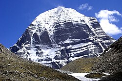
[[File:Kailash north.JPG|thumb|The north face of Mount Kailash.]] | [[File:Kailash north.JPG|thumb|The north face of Mount Kailash.]] | ||
The region around Mount Kailash and the Indus headwaters area is typified by wide-scale [[faulting]] of [[metamorphosed]] late [[Cretaceous]] to mid [[Cenozoic]] [[sedimentary rocks]] which have been [[intruded]] by [[Igneous rock|igneous]] Cenozoic [[granitic]] rocks. Mount Kailash appears to be a [[metasedimentary]] [[roof pendant]] supported by a massive [[granite]] base. The [[Cenozoic]] rocks represent offshore marine [[limestone]]s deposited before [[subduction]] of the [[Tethys Ocean|Tethys oceanic]] [[Crust (geology)|crust]]. These sediments were deposited on the southern margin of the Asia block during subduction of the Tethys oceanic crust before the [[Indian Plate|collision between the Indian and Asian continents]].<ref>[http://www.shangri-la-river-expeditions.com/wchinageo/indushwgeo/kailash&indushwgeo.html Geology and Geography of the Mt. Kailash area and Indus River headwaters in southwestern Tibet] Pete Winn, Science Director, Earth Science Expeditions. Retrieved January 2014.</ref><ref>[http://plate-tectonic.narod.ru/chinageo1photoalbum.html Plate Tectonic & northern Pacific] Accessed January 2014.</ref> | The region around Mount Kailash and the Indus headwaters area is typified by wide-scale [[faulting]] of [[metamorphosed]] late-[[Cretaceous]] to mid-[[Cenozoic]] [[sedimentary rocks]] which have been [[intruded]] by [[Igneous rock|igneous]] Cenozoic [[granitic]] rocks. Mount Kailash appears to be a [[metasedimentary]] [[roof pendant]] supported by a massive [[granite]] base. The [[Cenozoic]] rocks represent offshore marine [[limestone]]s deposited before [[subduction]] of the [[Tethys Ocean|Tethys oceanic]] [[Crust (geology)|crust]]. These sediments were deposited on the southern margin of the Asia block during subduction of the Tethys oceanic crust before the [[Indian Plate|collision between the Indian and Asian continents]].<ref>[http://www.shangri-la-river-expeditions.com/wchinageo/indushwgeo/kailash&indushwgeo.html Geology and Geography of the Mt. Kailash area and Indus River headwaters in southwestern Tibet] Pete Winn, Science Director, Earth Science Expeditions. Retrieved January 2014.</ref><ref>[http://plate-tectonic.narod.ru/chinageo1photoalbum.html Plate Tectonic & northern Pacific] Accessed January 2014.</ref> | ||
==Religious significance== | ==Religious significance== | ||
| Line 81: | Line 83: | ||
Numerous sites in the region are associated with [[Padmasambhava]], whose [[tantra|tantric practices]] in holy sites around Tibet are credited with finally establishing Buddhism as the main religion of the country in the 7th–8th century CE.<ref>''The Sacred Mountain'', pp. 39, 33, 35, 225, 280, 353, 362–363, 377–378</ref> | Numerous sites in the region are associated with [[Padmasambhava]], whose [[tantra|tantric practices]] in holy sites around Tibet are credited with finally establishing Buddhism as the main religion of the country in the 7th–8th century CE.<ref>''The Sacred Mountain'', pp. 39, 33, 35, 225, 280, 353, 362–363, 377–378</ref> | ||
It is said that [[Milarepa]] ( | It is said that [[Milarepa]] ({{Circa|1052|1135}}), champion of Vajrayana, arrived in Tibet to challenge Naro Bönchung, champion of the [[Bön]] religion of Tibet. The two magicians engaged in a terrifying sorcerers' battle, but neither was able to gain a decisive advantage. Finally, it was agreed that whoever could reach the summit of Kailash most rapidly would be the victor. While Naro Bönchung sat on magic [[drum]] and soared up the slope, Milarepa's followers were dumbfounded to see him sitting still and meditating. Yet when Naro Bönchung was nearly at the top, Milarepa suddenly moved into action and overtook him by riding on [[sunlight]], thus winning the contest. He did, however, fling a handful of snow on to the top of a nearby mountain, since known as Bönri, bequeathing it to the Bönpo and thereby ensuring continued Bönpo connections with the region.<ref>''The Sacred Mountain'', pp. 31, 33, 35</ref><ref>The World's Most Mysterious Places Published by Reader's Digest {{ISBN|0-276-42217-1}} pg.85</ref><ref>''The Sacred Mountain'', pp. 25–26</ref> | ||
==Pilgrimage== | ==Pilgrimage== | ||
| Line 90: | Line 89: | ||
=== The history of the Kailash-Manasarovar pilgrimage === | === The history of the Kailash-Manasarovar pilgrimage === | ||
The history of the | The history of the Mount Kailash pilgrimage is closely tied with the history of the pilgrimage to Lake Manasarovar. For this history, see the section 'History and texts' on the [[Lake Manasarovar]] page. | ||
=== The Kailash parikrama, or kora === | === The Kailash parikrama, or kora === | ||
The Sanskrit word for circumambulation of a holy site is '[[Parikrama]]', and the Tibetan word for the same act is '[https://www.tibettravel.org/blog/complete-guide-to-tibetan-kailash-kora/#:~:text=Sep%2004%2C2017%20%2F%20by%20Kunga,to%20be%20holy%20and%20sacred. kora']. Both words are widely used to describe the act of circumambulating | The Sanskrit word for circumambulation of a holy site is '[[Parikrama]]', and the Tibetan word for the same act is '[https://www.tibettravel.org/blog/complete-guide-to-tibetan-kailash-kora/#:~:text=Sep%2004%2C2017%20%2F%20by%20Kunga,to%20be%20holy%20and%20sacred. kora']. Both words are widely used to describe the act of circumambulating Mount Kailash. [[Pilgrim]]s of several religions believe that doing the parikrama/kora of Mount Kailash on foot is a spiritually beneficial practice that can bring various positive effects, such as the collection of meritorious karma, the cleansing of sins from one's consciousness, and good fortune. The circumambulation is made in a clockwise direction by Hindus, Buddhists, and Jains, while Bönpos circumambulate the mountain in a counterclockwise direction.<ref>{{Cite book |last1=Bubriski |first1=Kevin |title=Kailash Yatra: a Long Walk to Mount Kailash through Humla |last2=Pandey |first2=Abhimanyu |publisher=Penguin Random House |year=2018 |location=New Delhi |pages=151}}</ref> | ||
In Tibet, the Kailash parikrama/kora begins and ends at [[Darchen]], at an elevation of {{convert|4670|m|abbr=on}}, a small outpost that swells with pilgrims at certain times of the year.<ref name=":1">{{Cite book |last1=Bubriski |first1=Kevin |title=Kailash Yatra: a Long Walk to | In Tibet, the Kailash parikrama/kora begins and ends at [[Darchen]], at an elevation of {{convert|4670|m|abbr=on}}, a small outpost that swells with pilgrims at certain times of the year.<ref name=":1">{{Cite book |last1=Bubriski |first1=Kevin |title=Kailash Yatra: a Long Walk to Mount Kailash through Humla |last2=Pandey |first2=Abhimanyu |publisher=Penguin Random House |year=2018 |isbn=978-0670091119 |location=New Delhi |pages=151}}</ref> The path around Mount Kailash is {{convert|52|km|mi|abbr=on}} long. Walking around the mountain has to be done on foot, [[pony]] or [[domestic yak]], and takes some three days of trekking. The highest point on the pilgrimage is the Drölma pass at 5,650m (18,540 feet). One camps on two nights en route: firstlly, near the meadow of Dirapuk [[gompa]], some {{convert|2|to|3|km|abbr=on}} before the pass, and secondly, after crossing the pass and going as far downhill as possible (while passing by Gauri Kund lake less than a hundred meters below the Drolma La pass). The second night halt is often at Zutulphuk. | ||
Most pilgrims take three days to complete the pilgrimage. Some pilgrims, usually Tibetans or Nepali people from high altitude regions, do it in a single day. Some other pilgrims venture a very demanding regimen, performing body-length [[prostration]]s over the entire length of the circumambulation.<ref>{{Cite book |last1=Bubriski |first1=Kevin |title=Kailash Yatra: a Long Walk to | Most pilgrims take three days to complete the pilgrimage. Some pilgrims, usually Tibetans or Nepali people from high altitude regions, do it in a single day. Some other pilgrims venture a very demanding regimen, performing body-length [[prostration]]s over the entire length of the circumambulation. The pilgrim bends down, kneels, prostrates full-length, makes a mark with her fingers, rises to her knees, prays, and then crawls forward on hands and knees to the mark made by her fingers before repeating the process. With this method, the pilgrimage takes at least three weeks to complete.<ref>{{Cite book |last1=Bubriski |first1=Kevin |title=Kailash Yatra: a Long Walk to Mount Kailash through Humla |last2=Pandey |first2=Abhimanyu |publisher=Penguin Random House |year=2018 |isbn=978-0670091119 |location=New Delhi |pages=163–165}}</ref> Tibetan and Himalayan Buddhist pilgrims often sing 'nyelu' songs while crossing the Dolma La pass. These Tibetan songs proclaim the timeless fraternity of all pilgrims who cross paths on a Kailash pilgrimage.<ref>{{Cite web |last=Pandey |first=Abhimanyu |date=2023-04-20 |title=Ancient bonds: Joining the Kailash-Mansarovar yatra |url=https://frontline.thehindu.com/other/travel/white-space-ancient-bonds-lives-of-people-in-the-remote-places-along-the-kailash-mansarovar-pilgrimage-route-by-abhimanyu-pandey/article66706198.ece |access-date=2023-04-21 |website=frontline.thehindu.com |language=en}}</ref> | ||
The mountain is located in a particularly remote and inhospitable area of the Tibetan Himalayas. A few modern amenities, such as benches, resting places, and refreshment kiosks, exist to aid the pilgrims in their devotion. For varied reasons for the different faiths that revere the mountain, setting foot on | The mountain is located in a particularly remote and inhospitable area of the Tibetan Himalayas. A few modern amenities, such as benches, resting places, and refreshment kiosks, exist to aid the pilgrims in their devotion. For varied reasons for the different faiths that revere the mountain, setting foot on Mount Kailash's slopes and attempting to climb it is forbidden.<ref name=":0">{{Cite book |last=Snelling |first=John |title=The Sacred Mountain: a Complete Guide to Tibet's Sacred Mountain |publisher=Motilal Banarsidas Publishers |year=1990}}</ref> | ||
== Mountaineering == | == Mountaineering == | ||
| Line 109: | Line 108: | ||
[[Reinhold Messner]] was given the opportunity by the Chinese government to climb in the mid-1980s. But he declined, saying “If we conquer this mountain, then we conquer something in people's souls.”<ref>{{Cite web |title=Kailash: the mountain that calls |url=https://www.suunto.com/sports/News-Articles-container-page/Kailash-the-mountain-that-calls/ |access-date=2022-08-06 |website=Suunto |language=en}}</ref> | [[Reinhold Messner]] was given the opportunity by the Chinese government to climb in the mid-1980s. But he declined, saying “If we conquer this mountain, then we conquer something in people's souls.”<ref>{{Cite web |title=Kailash: the mountain that calls |url=https://www.suunto.com/sports/News-Articles-container-page/Kailash-the-mountain-that-calls/ |access-date=2022-08-06 |website=Suunto |language=en}}</ref> | ||
In 2001, reports emerged that the Chinese government had given permission for a Spanish team to climb the peak, which caused an international backlash. Chinese authorities disputed the reports, and stated that any climbing activities on | In 2001, reports emerged that the Chinese government had given permission for a Spanish team to climb the peak, which caused an international backlash. Chinese authorities disputed the reports, and stated that any climbing activities on Mount Kailash were strictly prohibited.<ref name="tew.org">{{cite web |title=China to Ban Expeditions on Mount Kailash |url=http://www.tew.org/archived/kailash.ban.html |url-status=dead |archive-url=https://web.archive.org/web/20110718190919/http://www.tew.org/archived/kailash.ban.html |archive-date=18 July 2011 |access-date=16 September 2016 |publisher=tew.org}}</ref> | ||
==Access== | ==Access== | ||
[[File:KailashMani.jpg|thumb|[[Mani stone]]s on the Kailash path.]] | [[File:KailashMani.jpg|thumb|[[Mani stone]]s on the Kailash path.]] | ||
Since the 1980s, the numbers of pilgrims going on a Kailash pilgrimage annually has grown considerably.<ref name=":0" /> In 2007, over 70,000 people visited the area around Mount Kailash and the two holy lakes nearby. Most of them were pilgrims, and these included about 18,000 foreign visitors (foreign here implying non-Tibetan/non-Chinese).<ref>{{Cite book |last1=Zomer |first1=Robert |title=Kailash Sacred Landscape Conservation Initiative: Feasibility Assessment Report |last2=Oli |first2=Krishna Prasad |publisher=ICIMOD |year=2011 |location=Kathmandu |pages=10}}</ref> In the years just before the [[COVID-19 pandemic]], several thousand pilgrims from India were going to this pilgrimage every year, mostly through Nepal.<ref>{{Cite web |title=Kailash Manasarovar Yatra likely to see record numbers |url=https://kathmandupost.com/money/2018/05/16/kailash-manasarovar-yatra-likely-to-see-record-numbers |access-date=2022-08-04 |website=kathmandupost.com |language=English}}</ref><ref>{{Cite news |title=Mansarovar Yatra: First-time pilgrims get preference in computerised draw of lots |work=The Economic Times |url=https://economictimes.indiatimes.com/news/politics-and-nation/mansarovar-yatra-first-time-pilgrims-get-preference-in-computerised-draw-of-lots/articleshow/69344332.cms?from=mdr |access-date=2022-08-04}}</ref> While many more aspire to undertake this pilgrimage, it remains out of reach for most due to high expenses; the risks and difficulties posed by the remoteness of | Since the 1980s, the numbers of pilgrims going on a Kailash pilgrimage annually has grown considerably.<ref name=":0" /> In 2007, over 70,000 people visited the area around Mount Kailash and the two holy lakes nearby. Most of them were pilgrims, and these included about 18,000 foreign visitors (foreign here implying non-Tibetan/non-Chinese).<ref>{{Cite book |last1=Zomer |first1=Robert |title=Kailash Sacred Landscape Conservation Initiative: Feasibility Assessment Report |last2=Oli |first2=Krishna Prasad |publisher=ICIMOD |year=2011 |location=Kathmandu |pages=10}}</ref> In the years just before the [[COVID-19 pandemic]], several thousand pilgrims from India were going to this pilgrimage every year, mostly through Nepal.<ref>{{Cite web |title=Kailash Manasarovar Yatra likely to see record numbers |url=https://kathmandupost.com/money/2018/05/16/kailash-manasarovar-yatra-likely-to-see-record-numbers |access-date=2022-08-04 |website=kathmandupost.com |language=English}}</ref><ref>{{Cite news |title=Mansarovar Yatra: First-time pilgrims get preference in computerised draw of lots |work=The Economic Times |url=https://economictimes.indiatimes.com/news/politics-and-nation/mansarovar-yatra-first-time-pilgrims-get-preference-in-computerised-draw-of-lots/articleshow/69344332.cms?from=mdr |access-date=2022-08-04}}</ref> While many more aspire to undertake this pilgrimage, it remains out of reach for most due to high expenses; the risks and difficulties posed by the remoteness of Mount Kailash and the high-altitude of the pilgrimage route, and the unpredictable closures of this pilgrimage due to adverse developments in the regional geopolitics. | ||
Every year, Kailash pilgrimage is possible only between April and mid-October. April-June and September-October are recommended periods for the pilgrimage; in July and August, monsoonal rains can make the circumambulation somewhat challenging. Between late October and early April, the winter conditions can be extremely severe in this high, windswept corner of Tibet, and generally make the pilgrimage impossible.<ref>{{Cite web |title=Best Time to Visit Kailash Manasarovar: New Updates for 2022 |url=https://www.tibettravel.org/tibet-travel-advice/best-time-to-visit-kailash.html |access-date=2022-08-06 |website=Tibet Travel and Tours - Tibet Vista |language=en}}</ref> | Every year, Kailash pilgrimage is possible only between April and mid-October. April-June and September-October are recommended periods for the pilgrimage; in July and August, monsoonal rains can make the circumambulation somewhat challenging. Between late October and early April, the winter conditions can be extremely severe in this high, windswept corner of Tibet, and generally make the pilgrimage impossible.<ref>{{Cite web |title=Best Time to Visit Kailash Manasarovar: New Updates for 2022 |url=https://www.tibettravel.org/tibet-travel-advice/best-time-to-visit-kailash.html |access-date=2022-08-06 |website=Tibet Travel and Tours - Tibet Vista |language=en}}</ref> | ||
| Line 121: | Line 120: | ||
=== Routes through India === | === Routes through India === | ||
Indian pilgrims have the option of going either through the annual Kailash pilgrimages organised by the [[Government of India]]'s [[Ministry of External Affairs (India)|Ministry of External Affairs]] (MEA),<ref>{{Cite web |title=Kailash Manasarovar Yatra |url=https://kmy.gov.in/kmy/?lang=en |access-date=2022-08-04 |website=kmy.gov.in}}</ref> or through private groups organised by various travel companies. For the pilgrimages organised by the Government of India, a person has to be an Indian citizen with a passport valid for at least six months as on September 1 of the current year, besides certain other conditions. | Indian pilgrims have the option of going either through the annual Kailash pilgrimages organised by the [[Government of India]]'s [[Ministry of External Affairs (India)|Ministry of External Affairs]] (MEA),<ref>{{Cite web |title=Kailash Manasarovar Yatra |url=https://kmy.gov.in/kmy/?lang=en |access-date=2022-08-04 |website=kmy.gov.in}}</ref> or through private groups organised by various travel companies. For the pilgrimages organised by the Government of India, a person has to be an Indian citizen with a passport valid for at least six months as on September 1 of the current year, besides certain other conditions.<ref>{{Cite web |title=Kailash Manasarovar Yatra |url=https://kmy.gov.in/kmy/faq.do?lang=en |access-date=2022-08-09 |website=kmy.gov.in}}</ref> The selection of candidates by the government is done through a "fair computer-generated, random, gender-balanced selection process", through which the selected candidates are also assigned either of the two routes to Kailash currently open through India: the [[Lipulekh Pass|Lipu Lekh pass]] in [[Uttarakhand]] and the [[Nathu La|Nathu La pass]] in [[Sikkim]].<ref>{{Cite web |title=Kailash Manasarovar Yatra |url=https://kmy.gov.in/kmy/selectionProcessPage.do?lang=en |access-date=2022-08-09 |website=kmy.gov.in}}</ref> No private travel companies are allowed to conduct the Kailash-Manasarovar pilgrimage via these two routes. In each batch of Kailash Manasarovar Yatra organised by the Government of India, an Indian government official accompanies the group as a Liaison Officer.<ref>{{Cite web |title=Kailash Manasarovar Yatra |url=https://kmy.gov.in/kmy/faq.do?lang=en |access-date=2022-08-09 |website=kmy.gov.in}}</ref> | ||
* The Lipu Lekh route involves briefing and medical checks in [[Delhi]], from there travel to the Lipu Lekh pass, and beyond that travel in Tibet for the Kailash-Manasarovar pilgrimage. Till recently, the Lipu Lekh route required 5-7 days of trekking along the Indian side of the Mahakali valley, from Narayan Ashram till the Lipu Lekh pass. Thereon, the travel to Taklakot and Darchen in Tibet would happen by bus or other vehicles. In 2020, a new motorable road was inaugurated to the Lipu Lekh pass through the Indian side of the Mahakali valley, removing the need to walk the Indian part of the Lipu Lekh route to | * The Lipu Lekh route involves briefing and medical checks in [[Delhi]], from there travel to the Lipu Lekh pass, and beyond that travel in Tibet for the Kailash-Manasarovar pilgrimage. Till recently, the Lipu Lekh route required 5-7 days of trekking along the Indian side of the Mahakali valley, from Narayan Ashram till the Lipu Lekh pass. Thereon, the travel to Taklakot and Darchen in Tibet would happen by bus or other vehicles. In 2020, a new motorable road was inaugurated to the Lipu Lekh pass through the Indian side of the Mahakali valley, removing the need to walk the Indian part of the Lipu Lekh route to Mount Kailash.<ref>{{Cite web |last=Team |first=ThePrint |date=2020-05-11 |title=New road to Kailash Mansarovar via Lipulekh Pass and why Nepal is objecting to it |url=https://theprint.in/opinion/new-road-to-kailash-mansarovar-via-lipulekh-pass-and-why-nepal-is-objecting-to-it/418638/ |access-date=2022-08-06 |website=ThePrint |language=en-US}}</ref> | ||
* The Nathu La route involves briefing and medical checks in Delhi; then a flight from Delhi to [[Bagdogra Airport|Bagdogra]]; Bagdogra to Nathu La pass via [[Gangtok]], and three days of road journeys in Tibet till arrival in Darchen on the third day.<ref>{{Cite web |last=Holidays |first=Max |title=Kailash Mansarovar Yatra via Nathula Pass Sikkim |url=https://www.kailash-yatra.org/kailash-mansarovar-yatra-via-nathula-pass-sikkim.html |access-date=2022-08-06 |website=kailash-yatra.org |language=English}}</ref> | * The Nathu La route involves briefing and medical checks in Delhi; then a flight from Delhi to [[Bagdogra Airport|Bagdogra]]; Bagdogra to Nathu La pass via [[Gangtok]], and three days of road journeys in Tibet till arrival in Darchen on the third day.<ref>{{Cite web |last=Holidays |first=Max |title=Kailash Mansarovar Yatra via Nathula Pass Sikkim |url=https://www.kailash-yatra.org/kailash-mansarovar-yatra-via-nathula-pass-sikkim.html |access-date=2022-08-06 |website=kailash-yatra.org |language=English}}</ref> | ||
| Line 129: | Line 128: | ||
The groups organised by travel companies usually go through Nepal. People from all nationalities can go in these groups. Anyone who has the valid documents and can pay, can go with such groups. Generally, there are fewer medical requirements involved in going to Kailash-Manasarovar with private travel companies. | The groups organised by travel companies usually go through Nepal. People from all nationalities can go in these groups. Anyone who has the valid documents and can pay, can go with such groups. Generally, there are fewer medical requirements involved in going to Kailash-Manasarovar with private travel companies. | ||
* In | * In recent years, the general route via Nepal has been the route through the [[Humla District|Humla district]] in northwestern Nepal.<ref>{{Cite book |last1=Bubriski |first1=Kevin |title=Kailash Yatra: a Long Walk to Mount Kailash through Humla |last2=Pandey |first2=Abhimanyu |publisher=Penguin Random House |year=2018 |isbn=978-0670091119 |location=New Delhi |pages=20}}</ref> This route involves three flights ahead of [[Kathmandu]]: Kathmandu-[[Nepalgunj]], Nepalgunj-[[Simikot]], and Simikot-[[Hilsa, Nepal|Hilsa]] (Simikot-Hilsa by helicopter). From Hilsa, the group crosses into Tibet (China). Hilsa to Darchen can be done within a single day. But generally, groups acclimatize at [[Taklakot]] for a night, and also tend to stay at Chiu Gumba by the shores of [[Lake Manasarovar]] for a night, before arriving at Darchen. | ||
* There is also a possibility of viewing | * There is also a possibility of viewing Mount Kailash from within Nepal. This is possible from the Lapcha La pass above the [[Limi|Limi valley]], in district Humla.<ref>{{Cite book |last1=Bubriski |first1=Kevin |title=Kailash Yatra: a Long Walk to Mount Kailash through Humla |last2=Pandey |first2=Abhimanyu |publisher=Penguin Random House |year=2018 |location=New Delhi |pages=1}}</ref><ref>{{Cite web |title=Limi-Lapcha could be an alternative route to Kailash Manasarovar |url=https://thehimalayantimes.com/nepal/limi-lapcha-could-be-an-alternative-route-to-kailash-manasarovar |access-date=2022-08-09 |website=thehimalayantimes.com|date=13 March 2021 }}</ref> This route involves trekking from Simikot to Lapcha La, a journey that usually takes 4-5 days. This option has been becoming known as a means to get the '[[Darshan (Indian religions)|darshan]]' of Kailash especially in times when entry into Tibet has become forbidden for any reason. | ||
* A second major route through Nepal, which actually used to be the main route to Kailash through Nepal till the [[April 2015 Nepal earthquake|April 2015 Nepal Earthquake]], is the [[Tatopani, Sindhupalchok|Tatopani]]-[[Zhangmu|Zangmu]] route.<ref>{{Cite book |last1=Bubriski |first1=Kevin |title=Kailash Yatra: a Long Walk to Mt Kailash through Humla |last2=Pandey |first2=Abhimanyu |publisher=Penguin Random House |year=2018 |location=New Delhi |pages=20}}</ref> It was closed for four years following extensive damage due to the 7.8 Richter-scale-intensity earthquake, till 2019.<ref name=":2">{{Cite web |title=A Personal Account of Border Crossing Reveals the Deep Ties Between Nepal, China |url=https://thewire.in/world/all-roads-lead-north-nepal-china |access-date=2022-08-09 |website=The Wire}}</ref> Zangmu to Darchen is a 3-4 day drive.<ref>{{Cite web |last=http://www.himalayajourneys.com |first=Himalaya Journey Treks & Expedition- |title=Zhangmu Kailash Mansarovar tour - Himalaya Journey |url=https://www.himalayajourneys.com/tibet-zhangmu-kailash-mansarovar-tour.php |access-date=2022-08-09 |website=Himalaya Journey Treks |language=en}}</ref> | * A second major route through Nepal, which actually used to be the main route to Kailash through Nepal till the [[April 2015 Nepal earthquake|April 2015 Nepal Earthquake]], is the [[Tatopani, Sindhupalchok|Tatopani]]-[[Zhangmu|Zangmu]] route.<ref>{{Cite book |last1=Bubriski |first1=Kevin |title=Kailash Yatra: a Long Walk to Mt Kailash through Humla |last2=Pandey |first2=Abhimanyu |publisher=Penguin Random House |year=2018 |location=New Delhi |pages=20}}</ref> It was closed for four years following extensive damage due to the 7.8 Richter-scale-intensity earthquake, till 2019.<ref name=":2">{{Cite web |title=A Personal Account of Border Crossing Reveals the Deep Ties Between Nepal, China |url=https://thewire.in/world/all-roads-lead-north-nepal-china |access-date=2022-08-09 |website=The Wire}}</ref> Zangmu to Darchen is a 3-4 day drive.<ref>{{Cite web |last=http://www.himalayajourneys.com |first=Himalaya Journey Treks & Expedition- |title=Zhangmu Kailash Mansarovar tour - Himalaya Journey |url=https://www.himalayajourneys.com/tibet-zhangmu-kailash-mansarovar-tour.php |access-date=2022-08-09 |website=Himalaya Journey Treks |language=en}}</ref> | ||
* A third major route through Nepal is the [[Rasuwa District|Rasuwa]]-[[Gyirong County|Gyirong]] route.<ref>{{Cite web |title=13 Days Kailash Pilgrimage Tour via Gyirong Port |url=https://www.tibettravel.org/kailash-tour/kailash-and-manasarova-tour.html |access-date=2022-08-09 |website=Tibet Travel and Tours - Tibet Vista |language=en}}</ref> Gyirong to Darchen is a three-day drive. This route is close to the Tatopani-Zangmu route, and became important especially in the period when the Tatopani-Zangmu route was closed for four years.<ref name=":2" /> | * A third major route through Nepal is the [[Rasuwa District|Rasuwa]]-[[Gyirong County|Gyirong]] route.<ref>{{Cite web |title=13 Days Kailash Pilgrimage Tour via Gyirong Port |url=https://www.tibettravel.org/kailash-tour/kailash-and-manasarova-tour.html |access-date=2022-08-09 |website=Tibet Travel and Tours - Tibet Vista |language=en}}</ref> Gyirong to Darchen is a three-day drive. This route is close to the Tatopani-Zangmu route, and became important especially in the period when the Tatopani-Zangmu route was closed for four years.<ref name=":2" /> | ||
| Line 138: | Line 137: | ||
== Climate change == | == Climate change == | ||
Climate change due to [[Climate change|global warming]] is happening three times faster on the [[Tibetan Plateau]] than anywhere else in the world.<ref>{{Cite journal |last=Qiu |first=Jane |date=2008-07-01 |title=China: The third pole |journal=Nature |language=en |volume=454 |issue=7203 |pages=393–396 |doi=10.1038/454393a |pmid=18650887 |issn=1476-4687|doi-access=free }}</ref> Mount Kailash is located in a mountain range upon the Tibetan Plateau, near the plateau's western edges. According to local observers, the land around Mount Kailash has been growing warmer in recent years; the pilgrimage season isn't as cold as it used to be.<ref>{{Cite web |date=2019-01-09 |title=Ignoring climate change in the Himalayas |url=https://www.thethirdpole.net/en/climate/ignoring-climate-change-in-the-himalayas/ |access-date=2022-08-06 |website=The Third Pole |language=en-US}}</ref> According to available data from the region, [[Glacier|glaciers]] are retreating, lakes are shrinking, the amount of barren land is increasing, and the eventual thawing of the [[permafrost]] in this region may lead to uncertain effects on water resources and [[Carbon cycle|carbon cycles]].<ref>{{Cite book |last1=Zomer |first1=Robert |title=Kailash Sacred Landscape Conservation Initiative: Feasibility Assessment Report |last2=Oli |first2=Krishna Prasad |publisher=ICIMOD |year=2011 |location=Kathmandu |pages=39–40}}</ref> The intergovernmental organisation [[ICIMOD]] is involved in ongoing efforts to generate knowledge on the ecological, social, and economic effects of climate change, and sustainable ways to cope with them, in the Chinese region around | Climate change due to [[Climate change|global warming]] is happening three times faster on the [[Tibetan Plateau]] than anywhere else in the world.<ref>{{Cite journal |last=Qiu |first=Jane |date=2008-07-01 |title=China: The third pole |journal=Nature |language=en |volume=454 |issue=7203 |pages=393–396 |doi=10.1038/454393a |pmid=18650887 |issn=1476-4687|doi-access=free }}</ref> Mount Kailash is located in a mountain range upon the Tibetan Plateau, near the plateau's western edges. According to local observers, the land around Mount Kailash has been growing warmer in recent years; the pilgrimage season isn't as cold as it used to be.<ref>{{Cite web |date=2019-01-09 |title=Ignoring climate change in the Himalayas |url=https://www.thethirdpole.net/en/climate/ignoring-climate-change-in-the-himalayas/ |access-date=2022-08-06 |website=The Third Pole |language=en-US}}</ref> According to available data from the region, [[Glacier|glaciers]] are retreating, lakes are shrinking, the amount of barren land is increasing, and the eventual thawing of the [[permafrost]] in this region may lead to uncertain effects on water resources and [[Carbon cycle|carbon cycles]].<ref>{{Cite book |last1=Zomer |first1=Robert |title=Kailash Sacred Landscape Conservation Initiative: Feasibility Assessment Report |last2=Oli |first2=Krishna Prasad |publisher=ICIMOD |year=2011 |location=Kathmandu |pages=39–40}}</ref> The intergovernmental organisation [[ICIMOD]] is involved in ongoing efforts to generate knowledge on the ecological, social, and economic effects of climate change, and sustainable ways to cope with them, in the Chinese region around Mount Kailash and the bordering areas of [[Uttarakhand]] (India) and western [[Nepal]], in a transboundary project called the Kailash Sacred Landscape Conservation and Development Initiative.<ref>{{Cite web |title=About KSL |url=https://www.icimod.org/initiative/about-ksl/ |access-date=2022-08-07 |website=ICIMOD |language=en-US}}</ref><ref>{{Cite web |title=KSL Components |url=https://www.icimod.org/initiative/ksl-components/ |access-date=2022-08-07 |website=ICIMOD |language=en-US}}</ref> | ||
== See also == | == See also == | ||
| Line 152: | Line 151: | ||
==References== | ==References== | ||
{{Reflist| | {{Reflist|2}} | ||
==Bibliography== | ==Bibliography== | ||
| Line 171: | Line 170: | ||
{{Refend}} | {{Refend}} | ||
{{Sacred Mountains of China}} | {{Sacred Mountains of China}} | ||
| Line 191: | Line 189: | ||
[[Category:Six-thousanders of the Transhimalayas]] | [[Category:Six-thousanders of the Transhimalayas]] | ||
[[Category:Mountains in Buddhism]] | [[Category:Mountains in Buddhism]] | ||
[[Category:Mountains in Hinduism]] | |||
Revision as of 03:24, 22 July 2023
| Mount Kailash | |
|---|---|
Lua error in Module:Location_map at line 851: Unable to find the specified location map definition: "Module:Location map/data/China Tibet Ngari" does not exist.
| |
| Highest point | |
| Elevation | 6,638 m (21,778 ft) |
| Coordinates | 31°4′0″N 81°18′45″E / 31.06667°N 81.31250°E |
| Naming | |
| Native name | [
|
| Geography | |
| Location | Burang County, Tibet Autonomous Region |
| Country |  China China |
| Parent range | Gangdisê Range |
| Climbing | |
| First ascent | Unclimbed (mountaineering prohibited currently) |
Mount Kailash (also Kailasa; Kangrinboqê or Gang Rinpoche; Tibetan: གངས་རིན་པོ་ཆེ; simplified Chinese: 冈仁波齐峰; traditional Chinese: 岡仁波齊峰; pinyin: Gāngrénbōqí Fēng; Sanskrit: कैलास, IAST: Kailāsa), is a mountain in the Ngari Prefecture, Tibet Autonomous Region of China. It has an altitude of 6,638 m (21,778 ft).[1] It lies in the Kailash Range (Gangdisê Mountains) of the Transhimalaya, in the western part of the Tibetan Plateau. Mount Kailash is less than 100 km (62 miles) north of the western trijunction of the borders of China, India, and Nepal.[2]
Mount Kailash is located close to Lake Manasarovar and Lake Rakshastal. The sources of four major Asian rivers lie close to this mountain and the two lakes. These rivers are the Indus, the Sutlej, the Brahmaputra, and the Karnali (a tributary of the Ganges, fed by Mabja Zangbo). Mount Kailash is considered sacred in four religions: Hinduism, Buddhism, Jainism[3] and Bon.[4]
Etymology
The mountain is known as “Kailāsa” (कैलास; var. Kailāśa कैलाश) in Sanskrit.[5][6] The name also could have been derived from the word “kelāsa” (केलास), which means "crystal".[7]
In his Tibetan-English dictionary, Chandra (1902: p. 32) identifies the entry for 'kai la sha' (Wylie: kai la sha) which is a loan word from Sanskrit.[8]
The Tibetan name for the mountain is Gang Rinpoche (Tibetan: གངས་རིན་པོ་ཆེ་; simplified Chinese: 冈仁波齐峰; traditional Chinese: 岡仁波齊峰). Gang or Kang is the Tibetan word for snow peak analogous to alp or hima; rinpoche is an honorific meaning "precious one" so the combined term can be translated "precious jewel of snows". Alice Albinia lists some of the names for the mountain, and its religious significance to various faiths:
"Tibetan Buddhists call it Kangri Rinpoche; 'Precious Snow Mountain'. Bon texts have many names: Water's Flower, Mountain of Sea Water, Nine Stacked Swastika Mountain. For Hindus, it is the home of the Hindu god Shiva and it is believed that Shiva resides there; for Jains it is where their first leader was enlightened; for Buddhists, the navel of the universe; and for adherents of Bon, the abode of the sky goddess Sipaimen."[9]
Another local name for the mountain is Tisé mountain, which derives from ti tse in the Zhang-Zhung language, meaning "water peak" or "river peak", connoting the mountain's status as the source of the mythical Lion, Horse, Peacock and Elephant Rivers, and in fact the Indus, Yarlung Tsangpo/Dihang/Brahmaputra, Karnali and Sutlej all begin in the Kailash-Lake Manasarovara region.[10]
Geology

The region around Mount Kailash and the Indus headwaters area is typified by wide-scale faulting of metamorphosed late-Cretaceous to mid-Cenozoic sedimentary rocks which have been intruded by igneous Cenozoic granitic rocks. Mount Kailash appears to be a metasedimentary roof pendant supported by a massive granite base. The Cenozoic rocks represent offshore marine limestones deposited before subduction of the Tethys oceanic crust. These sediments were deposited on the southern margin of the Asia block during subduction of the Tethys oceanic crust before the collision between the Indian and Asian continents.[11][12]
Religious significance

In Hinduism
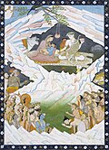
In Hinduism, it is traditionally recognized as the abode of Shiva, who resided there along with his consort goddess Parvati and their children, Ganesha and Kartikeya.[citation needed]
In the Uttara Kanda section of the epic Ramayana, it is said that Ravana attempted to uproot the Mount Kailash as retaliation to lord Shiva, who in turn, pressed his right big toe upon the mountain, trapping Ravana in between.[13] This version of lord Shiva is also referred to as Ravananugraha, or favour form to Ravana while seated in mount Kailash.[14]
According to the epic Mahabharata, it is said that the Pandava brothers, along with their wife Draupadi, trekked to the summit of mount Kailash on their path to liberation, as it is considered to be a gateway to Heaven, also known as Swarga Loka.[citation needed]
According to Charles Allen, one description in the Vishnu Purana of the mountain states that its four faces are made of crystal, ruby, gold, and lapis lazuli.[15] It is a pillar of the world and is located at the heart of six mountain ranges symbolizing a lotus.[15]
In Jainism

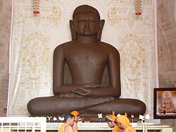
According to Jain scriptures, Ashtapada is the site where the first Jain Tirthankara, Rishabhadeva attained moksha (liberation).[16] In Jain tradition, it is believed that after Rishabhdeva attained nirvana, his son emperor Bharata Chakravartin had constructed three stupas and twenty four shrines of the 24 tirthankaras over there with their idols studded with precious stones and named it Sinhnishdha.[17]
Nirvan Kand Bhasha also mentions of Ashtapada.[18]
(दोहा)
वीतराग वन्दौं सदा, भाव सहित सिर नाय |
कहूं काण्ड निर्वाण की, भाषा सुगम बनाये ||
(चौपाई)
अष्टापद आदीश्वर स्वामि, वासुपूज्य चम्पापुरि नामि |
नेमिनाथ स्वामी गिरनार, वन्दौं भाव भगति उर धार ||1||
चरम तीर्थकर चरम शरीर, पावापुरि स्वामि महावीर |
शिखर समेद जिनेसुर बीस, भावसहित वन्दौं निश दीस ||2||
In Jain tradition, the 24th and last Tirthankara, Vardhamana Mahavira, was taken to the summit of Meru by Indra shortly after his birth, after putting his mother Queen Trishala into deep slumber. There he was bathed and anointed with precious unctions.[19][20]
In Buddhism
Mount Kailash (Kailasa) is known as Mount Meru in Buddhist texts. It is central to its cosmology, and a major pilgrimage site for some Buddhist traditions.[21]

Vajrayana Buddhists believe that Mount Kailash is the home of the buddha Cakrasaṃvara (also known as Demchok), who represents supreme bliss.[citation needed]
Numerous sites in the region are associated with Padmasambhava, whose tantric practices in holy sites around Tibet are credited with finally establishing Buddhism as the main religion of the country in the 7th–8th century CE.[22]
It is said that Milarepa (c. 1052 – c. 1135), champion of Vajrayana, arrived in Tibet to challenge Naro Bönchung, champion of the Bön religion of Tibet. The two magicians engaged in a terrifying sorcerers' battle, but neither was able to gain a decisive advantage. Finally, it was agreed that whoever could reach the summit of Kailash most rapidly would be the victor. While Naro Bönchung sat on magic drum and soared up the slope, Milarepa's followers were dumbfounded to see him sitting still and meditating. Yet when Naro Bönchung was nearly at the top, Milarepa suddenly moved into action and overtook him by riding on sunlight, thus winning the contest. He did, however, fling a handful of snow on to the top of a nearby mountain, since known as Bönri, bequeathing it to the Bönpo and thereby ensuring continued Bönpo connections with the region.[23][24][25]
Pilgrimage

The history of the Kailash-Manasarovar pilgrimage
The history of the Mount Kailash pilgrimage is closely tied with the history of the pilgrimage to Lake Manasarovar. For this history, see the section 'History and texts' on the Lake Manasarovar page.
The Kailash parikrama, or kora
The Sanskrit word for circumambulation of a holy site is 'Parikrama', and the Tibetan word for the same act is 'kora'. Both words are widely used to describe the act of circumambulating Mount Kailash. Pilgrims of several religions believe that doing the parikrama/kora of Mount Kailash on foot is a spiritually beneficial practice that can bring various positive effects, such as the collection of meritorious karma, the cleansing of sins from one's consciousness, and good fortune. The circumambulation is made in a clockwise direction by Hindus, Buddhists, and Jains, while Bönpos circumambulate the mountain in a counterclockwise direction.[26]
In Tibet, the Kailash parikrama/kora begins and ends at Darchen, at an elevation of 4,670 m (15,320 ft), a small outpost that swells with pilgrims at certain times of the year.[27] The path around Mount Kailash is 52 km (32 mi) long. Walking around the mountain has to be done on foot, pony or domestic yak, and takes some three days of trekking. The highest point on the pilgrimage is the Drölma pass at 5,650m (18,540 feet). One camps on two nights en route: firstlly, near the meadow of Dirapuk gompa, some 2 to 3 km (1.2 to 1.9 mi) before the pass, and secondly, after crossing the pass and going as far downhill as possible (while passing by Gauri Kund lake less than a hundred meters below the Drolma La pass). The second night halt is often at Zutulphuk.
Most pilgrims take three days to complete the pilgrimage. Some pilgrims, usually Tibetans or Nepali people from high altitude regions, do it in a single day. Some other pilgrims venture a very demanding regimen, performing body-length prostrations over the entire length of the circumambulation. The pilgrim bends down, kneels, prostrates full-length, makes a mark with her fingers, rises to her knees, prays, and then crawls forward on hands and knees to the mark made by her fingers before repeating the process. With this method, the pilgrimage takes at least three weeks to complete.[28] Tibetan and Himalayan Buddhist pilgrims often sing 'nyelu' songs while crossing the Dolma La pass. These Tibetan songs proclaim the timeless fraternity of all pilgrims who cross paths on a Kailash pilgrimage.[29]
The mountain is located in a particularly remote and inhospitable area of the Tibetan Himalayas. A few modern amenities, such as benches, resting places, and refreshment kiosks, exist to aid the pilgrims in their devotion. For varied reasons for the different faiths that revere the mountain, setting foot on Mount Kailash's slopes and attempting to climb it is forbidden.[30]
Mountaineering

In 1926, Hugh Ruttledge studied the north face, which he estimated was 6,000 feet (1,800 m) high and "utterly unclimbable"[31] and thought about an ascent of the northeast ridge, but he ran out of time. Ruttledge had been exploring the area with Colonel R. C. Wilson, who was on the other side of the mountain with his Sherpa named Tseten. Wilson said that Tseten told him: "'Sahib, we can climb that!' ... as he too saw that this [the SE ridge] represented a feasible route to the summit."[32] Wilson went on to explain that although he was serious about climbing Kailash, he ran into unexpected difficulties: "Just when I discovered an easy walk to the summit of the mountain, heavy snow began to fall, making the ascent impossible."[33]
Herbert Tichy was in the area in 1936, attempting to climb Gurla Mandhata. When he asked one of the Garpons of Ngari whether Kailash was climbable, the Garpon replied: "Only a man entirely free of sin could climb Kailash. And he wouldn't have to actually scale the sheer walls of ice to do it – he'd just turn himself into a bird and fly to the summit."[34]
Reinhold Messner was given the opportunity by the Chinese government to climb in the mid-1980s. But he declined, saying “If we conquer this mountain, then we conquer something in people's souls.”[35]
In 2001, reports emerged that the Chinese government had given permission for a Spanish team to climb the peak, which caused an international backlash. Chinese authorities disputed the reports, and stated that any climbing activities on Mount Kailash were strictly prohibited.[36]
Access

Since the 1980s, the numbers of pilgrims going on a Kailash pilgrimage annually has grown considerably.[30] In 2007, over 70,000 people visited the area around Mount Kailash and the two holy lakes nearby. Most of them were pilgrims, and these included about 18,000 foreign visitors (foreign here implying non-Tibetan/non-Chinese).[37] In the years just before the COVID-19 pandemic, several thousand pilgrims from India were going to this pilgrimage every year, mostly through Nepal.[38][39] While many more aspire to undertake this pilgrimage, it remains out of reach for most due to high expenses; the risks and difficulties posed by the remoteness of Mount Kailash and the high-altitude of the pilgrimage route, and the unpredictable closures of this pilgrimage due to adverse developments in the regional geopolitics.
Every year, Kailash pilgrimage is possible only between April and mid-October. April-June and September-October are recommended periods for the pilgrimage; in July and August, monsoonal rains can make the circumambulation somewhat challenging. Between late October and early April, the winter conditions can be extremely severe in this high, windswept corner of Tibet, and generally make the pilgrimage impossible.[40]
For all foreigners, including pilgrims from India and Nepal, passports and specific Chinese visas valid for the Kailash pilgrimage are necessary.
Routes through India
Indian pilgrims have the option of going either through the annual Kailash pilgrimages organised by the Government of India's Ministry of External Affairs (MEA),[41] or through private groups organised by various travel companies. For the pilgrimages organised by the Government of India, a person has to be an Indian citizen with a passport valid for at least six months as on September 1 of the current year, besides certain other conditions.[42] The selection of candidates by the government is done through a "fair computer-generated, random, gender-balanced selection process", through which the selected candidates are also assigned either of the two routes to Kailash currently open through India: the Lipu Lekh pass in Uttarakhand and the Nathu La pass in Sikkim.[43] No private travel companies are allowed to conduct the Kailash-Manasarovar pilgrimage via these two routes. In each batch of Kailash Manasarovar Yatra organised by the Government of India, an Indian government official accompanies the group as a Liaison Officer.[44]
- The Lipu Lekh route involves briefing and medical checks in Delhi, from there travel to the Lipu Lekh pass, and beyond that travel in Tibet for the Kailash-Manasarovar pilgrimage. Till recently, the Lipu Lekh route required 5-7 days of trekking along the Indian side of the Mahakali valley, from Narayan Ashram till the Lipu Lekh pass. Thereon, the travel to Taklakot and Darchen in Tibet would happen by bus or other vehicles. In 2020, a new motorable road was inaugurated to the Lipu Lekh pass through the Indian side of the Mahakali valley, removing the need to walk the Indian part of the Lipu Lekh route to Mount Kailash.[45]
- The Nathu La route involves briefing and medical checks in Delhi; then a flight from Delhi to Bagdogra; Bagdogra to Nathu La pass via Gangtok, and three days of road journeys in Tibet till arrival in Darchen on the third day.[46]
Routes through Nepal
The groups organised by travel companies usually go through Nepal. People from all nationalities can go in these groups. Anyone who has the valid documents and can pay, can go with such groups. Generally, there are fewer medical requirements involved in going to Kailash-Manasarovar with private travel companies.
- In recent years, the general route via Nepal has been the route through the Humla district in northwestern Nepal.[47] This route involves three flights ahead of Kathmandu: Kathmandu-Nepalgunj, Nepalgunj-Simikot, and Simikot-Hilsa (Simikot-Hilsa by helicopter). From Hilsa, the group crosses into Tibet (China). Hilsa to Darchen can be done within a single day. But generally, groups acclimatize at Taklakot for a night, and also tend to stay at Chiu Gumba by the shores of Lake Manasarovar for a night, before arriving at Darchen.
- There is also a possibility of viewing Mount Kailash from within Nepal. This is possible from the Lapcha La pass above the Limi valley, in district Humla.[48][49] This route involves trekking from Simikot to Lapcha La, a journey that usually takes 4-5 days. This option has been becoming known as a means to get the 'darshan' of Kailash especially in times when entry into Tibet has become forbidden for any reason.
- A second major route through Nepal, which actually used to be the main route to Kailash through Nepal till the April 2015 Nepal Earthquake, is the Tatopani-Zangmu route.[50] It was closed for four years following extensive damage due to the 7.8 Richter-scale-intensity earthquake, till 2019.[51] Zangmu to Darchen is a 3-4 day drive.[52]
- A third major route through Nepal is the Rasuwa-Gyirong route.[53] Gyirong to Darchen is a three-day drive. This route is close to the Tatopani-Zangmu route, and became important especially in the period when the Tatopani-Zangmu route was closed for four years.[51]
Routes through Tibet
For private travel companies, both in Nepal and in Tibet (China), another important route to Kailash is the one via Lhasa. In this one, pilgrims first arrive at Lhasa by road, flight or other means, and from there they make a four-day road journey to Lake Manasarovar or Darchen.[54] Other than the Lipu Lekh route through India and the Humla route through Nepal, all the major routes to Kailash through Tibet - from Lhasa, Zangmu, Gyirong, and Nathu La - involve 3-4 days of long drives through the high-altitude Tibetan plateau and some mountain ranges on it, to reach to Darchen.
Climate change
Climate change due to global warming is happening three times faster on the Tibetan Plateau than anywhere else in the world.[55] Mount Kailash is located in a mountain range upon the Tibetan Plateau, near the plateau's western edges. According to local observers, the land around Mount Kailash has been growing warmer in recent years; the pilgrimage season isn't as cold as it used to be.[56] According to available data from the region, glaciers are retreating, lakes are shrinking, the amount of barren land is increasing, and the eventual thawing of the permafrost in this region may lead to uncertain effects on water resources and carbon cycles.[57] The intergovernmental organisation ICIMOD is involved in ongoing efforts to generate knowledge on the ecological, social, and economic effects of climate change, and sustainable ways to cope with them, in the Chinese region around Mount Kailash and the bordering areas of Uttarakhand (India) and western Nepal, in a transboundary project called the Kailash Sacred Landscape Conservation and Development Initiative.[58][59]
See also
- Gurla Mandhata
- Kawagarbo
- Om Parvat
- Adi Kailash
- Kinnaur Kailash
- Mani Mahesh Kailash
- Shrikhand Kailash
- Sacred mountains
- Kailash: A Journal of Himalayan Studies
References
- ↑ Chinese topographic map
- ↑ Nanda (10 May 2020). "Kailash Mansarovar Yatra 2022 Guide - Kailash Mansaroavar via Uttarakahnd KMVN". www.euttaranchal.com. Retrieved 6 August 2022.
- ↑ "Kailash Manasarovar Yatra". Ministry of External Affairs, Government of India. Retrieved 30 July 2022.
- ↑ Karen Swenson (16 March 2003). "A Sacred Circuit in Tibet". The New York Times. Retrieved 30 July 2022.
- ↑ Monier-Williams Sanskrit Dictionary, page 311 column 3
- ↑ Entry for कैलासः in Apte Sanskrit-English Dictionary
- ↑ Williams, Monier. "Monier-Williams Sanskrit-English Dictionary".
kelāsa m. crystal W
- ↑ Sarat Chandra Das (1902). Tibetan-English Dictionary with Sanskrit Synonyms. Calcutta, India: Bengal Secretariat Book Depot, page 32.
- ↑ Alice Albinia (2008). Empires of the Indus: The Story of a River. John Murray. p. 288. ISBN 9780719560033.
- ↑ Camaria, Pradeep (1996), Kailash Manasarovara on the Rugged Road to Revelation, New Delhi: Abhinav, ISBN 9788170173366, retrieved 11 June 2010
- ↑ Geology and Geography of the Mt. Kailash area and Indus River headwaters in southwestern Tibet Pete Winn, Science Director, Earth Science Expeditions. Retrieved January 2014.
- ↑ Plate Tectonic & northern Pacific Accessed January 2014.
- ↑ "National Museum, New Delhi". www.nationalmuseumindia.gov.in. Archived from the original on 17 May 2013.
- ↑ Dallapiccola, Anna L. (2003). "Ravananugrahamurti". Dictionary of Hindu Lore and Legend. Thames & Hudson. ISBN 978-0-500-51088-9. (subscription required)
- ↑ 15.0 15.1 Allen, Charles. (1982). A Mountain in Tibet, pp. 21–22. André Deutsch. Reprint: 1991. Futura Publications, London. ISBN 0-7088-2411-0.
- ↑ "To heaven and back". The Times of India. 11 January 2012. Retrieved 2 March 2012.
{{cite web}}: CS1 maint: deprecated archival service (link) - ↑ Jain, Arun Kumar (2009). Faith & Philosophy of Jainism. ISBN 9788178357232.
- ↑ admin. "निर्वाणकांड (हिंदी) Nirvankand (Hindi) Archives". Jinvani Sangrah. Retrieved 13 July 2022.
- ↑ Welch, Stuart Cary; Metropolitan Museum of Art (New York, N.Y.) (1985). India: Art and Culture, 1300-1900. ISBN 9780030061141.
- ↑ "Jainism Literature Center - Rituals".
- ↑ Robert E. Buswell (2004). Encyclopedia of Buddhism: A-L. Macmillan Reference. pp. 407–408. ISBN 978-0-02-865719-6.
- ↑ The Sacred Mountain, pp. 39, 33, 35, 225, 280, 353, 362–363, 377–378
- ↑ The Sacred Mountain, pp. 31, 33, 35
- ↑ The World's Most Mysterious Places Published by Reader's Digest ISBN 0-276-42217-1 pg.85
- ↑ The Sacred Mountain, pp. 25–26
- ↑ Bubriski, Kevin; Pandey, Abhimanyu (2018). Kailash Yatra: a Long Walk to Mount Kailash through Humla. New Delhi: Penguin Random House. p. 151.
- ↑ Bubriski, Kevin; Pandey, Abhimanyu (2018). Kailash Yatra: a Long Walk to Mount Kailash through Humla. New Delhi: Penguin Random House. p. 151. ISBN 978-0670091119.
- ↑ Bubriski, Kevin; Pandey, Abhimanyu (2018). Kailash Yatra: a Long Walk to Mount Kailash through Humla. New Delhi: Penguin Random House. pp. 163–165. ISBN 978-0670091119.
- ↑ Pandey, Abhimanyu (20 April 2023). "Ancient bonds: Joining the Kailash-Mansarovar yatra". frontline.thehindu.com. Retrieved 21 April 2023.
- ↑ 30.0 30.1 Snelling, John (1990). The Sacred Mountain: a Complete Guide to Tibet's Sacred Mountain. Motilal Banarsidas Publishers.
- ↑ The Sacred Mountain, p. 120
- ↑ The Sacred Mountain, p. 116
- ↑ Further excerpts from Wilson's article in the Alpine Journal (vol. 40, 1928)
- ↑ The Sacred Mountain, p. 129
- ↑ "Kailash: the mountain that calls". Suunto. Retrieved 6 August 2022.
- ↑ "China to Ban Expeditions on Mount Kailash". tew.org. Archived from the original on 18 July 2011. Retrieved 16 September 2016.
- ↑ Zomer, Robert; Oli, Krishna Prasad (2011). Kailash Sacred Landscape Conservation Initiative: Feasibility Assessment Report. Kathmandu: ICIMOD. p. 10.
- ↑ "Kailash Manasarovar Yatra likely to see record numbers". kathmandupost.com. Retrieved 4 August 2022.
- ↑ "Mansarovar Yatra: First-time pilgrims get preference in computerised draw of lots". The Economic Times. Retrieved 4 August 2022.
- ↑ "Best Time to Visit Kailash Manasarovar: New Updates for 2022". Tibet Travel and Tours - Tibet Vista. Retrieved 6 August 2022.
- ↑ "Kailash Manasarovar Yatra". kmy.gov.in. Retrieved 4 August 2022.
- ↑ "Kailash Manasarovar Yatra". kmy.gov.in. Retrieved 9 August 2022.
- ↑ "Kailash Manasarovar Yatra". kmy.gov.in. Retrieved 9 August 2022.
- ↑ "Kailash Manasarovar Yatra". kmy.gov.in. Retrieved 9 August 2022.
- ↑ Team, ThePrint (11 May 2020). "New road to Kailash Mansarovar via Lipulekh Pass and why Nepal is objecting to it". ThePrint. Retrieved 6 August 2022.
- ↑ Holidays, Max. "Kailash Mansarovar Yatra via Nathula Pass Sikkim". kailash-yatra.org. Retrieved 6 August 2022.
- ↑ Bubriski, Kevin; Pandey, Abhimanyu (2018). Kailash Yatra: a Long Walk to Mount Kailash through Humla. New Delhi: Penguin Random House. p. 20. ISBN 978-0670091119.
- ↑ Bubriski, Kevin; Pandey, Abhimanyu (2018). Kailash Yatra: a Long Walk to Mount Kailash through Humla. New Delhi: Penguin Random House. p. 1.
- ↑ "Limi-Lapcha could be an alternative route to Kailash Manasarovar". thehimalayantimes.com. 13 March 2021. Retrieved 9 August 2022.
- ↑ Bubriski, Kevin; Pandey, Abhimanyu (2018). Kailash Yatra: a Long Walk to Mt Kailash through Humla. New Delhi: Penguin Random House. p. 20.
- ↑ 51.0 51.1 "A Personal Account of Border Crossing Reveals the Deep Ties Between Nepal, China". The Wire. Retrieved 9 August 2022.
- ↑ http://www.himalayajourneys.com, Himalaya Journey Treks & Expedition-. "Zhangmu Kailash Mansarovar tour - Himalaya Journey". Himalaya Journey Treks. Retrieved 9 August 2022.
{{cite web}}: External link in|last= - ↑ "13 Days Kailash Pilgrimage Tour via Gyirong Port". Tibet Travel and Tours - Tibet Vista. Retrieved 9 August 2022.
- ↑ "Kathmandu Lhasa Kailash Tour | Lhasa Kailash Tour | Tibet Kailash Travel". www.tibetkailash.com. Retrieved 9 August 2022.
- ↑ Qiu, Jane (1 July 2008). "China: The third pole". Nature. 454 (7203): 393–396. doi:10.1038/454393a. ISSN 1476-4687. PMID 18650887.
- ↑ "Ignoring climate change in the Himalayas". The Third Pole. 9 January 2019. Retrieved 6 August 2022.
- ↑ Zomer, Robert; Oli, Krishna Prasad (2011). Kailash Sacred Landscape Conservation Initiative: Feasibility Assessment Report. Kathmandu: ICIMOD. pp. 39–40.
- ↑ "About KSL". ICIMOD. Retrieved 7 August 2022.
- ↑ "KSL Components". ICIMOD. Retrieved 7 August 2022.
Bibliography
- Albinia, Alice. (2008) Empires of the Indus: The Story of a River. First American Edition (2010) W. W. Norton & Company, New York. ISBN 978-0-393-33860-7
- Bubriski, Kevin and Abhimanyu Pandey. Kailash Yatra: a Long Walk to Mt Kailash through Humla. New Delhi: Penguin Random House, 2018
- Nomachi, Kazuyoshi. Tibet. Boston: Shambhala, 1997.
- Thurman, Robert and Tad Wise, Circling the Sacred Mountain: A Spiritual Adventure Through the Himalayas. New York: Bantam, 1999. ISBN 0-553-37850-3 — Tells the story of a Western Buddhist making the trek around Mount Kailash.
- Snelling, John. (1990). The Sacred Mountain: The Complete Guide to Tibet's Mount Kailas. 1st edition 1983. Revised and enlarged edition, including: Kailas-Manasarovar Travellers' Guide. Forwards by H.H. the Dalai Lama of Tibet and Christmas Humphreys. East-West Publications, London and The Hague. ISBN 0-85692-173-4.
- (Elevation) Chinese Snow Map "Kangrinboqe", published by the Lanzhou Institute of Glaciology, Chinese Academy of Sciences.
- Allen, Charles (1982) A Mountain in Tibet: The Search for Mount Kailas and the Sources of the Great Rivers of Asia. (London, André Deutsch).
- Allen, Charles. (1999). The Search for Shangri-La: A Journey into Tibetan History. Little, Brown and Company. Reprint: Abacus, London. 2000. ISBN 0-349-11142-1.
- "A Tibetan Guide for Pilgrimage to Ti-se (Mount Kailas) and mTsho Ma-pham (Lake Manasarovar)." Toni Huber and Tsepak Rigzin. In: Sacred Spaces and Powerful Places in Tibetan Culture: A Collection of Essays. (1999) Edited by Toni Huber, pp. 125–153. The Library of Tibetan Works and Archives, Dharamsala, H.P., India. ISBN 81-86470-22-0.
- Stein, R. A. (1961). Les tribus anciennes des marches Sino-Tibétaines: légendes, classifications et histoire. Presses Universitaires de France, Paris. (In French)
- Johnson, Russell, and Moran, Kerry. (1989). The Sacred Mountain of Tibet: On Pilgrimage to Kailas. Park Street Press, Rochester, Vermont. ISBN 0-89281-325-3.
- Govinda, Lama Anagarika. (1966). The Way of the White Clouds: A Buddhist Pilgrim in Tibet. Shambhala Publications, Inc. Boulder, Colorado. Reprint with foreword by Peter Matthiessen: Shambhala Publications, Inc. Boston, Massachusetts. 1988. ISBN 0-87773-007-5
- Thubron, Colin. (2011). "To a Mountain in Tibet." Chatto & Windus, London. ISBN 978-0-7011-8380-6
Template:Sacred Mountains of China


| Deities |  | ||||||
|---|---|---|---|---|---|---|---|
| Texts | |||||||
| Mantra/Stotra | |||||||
| Philosophical traditions | |||||||
| Jyotirlingas | |||||||
| Temples |
| ||||||
| Traditional observances | |||||||
| Gods | |||||
|---|---|---|---|---|---|
| Philosophy | |||||
| Branches |
| ||||
| Practices | |||||
| Literature | |||||
| Symbols |
| ||||
| Ascetics | |||||
| Scholars | |||||
| Community | |||||
| Jainism in |
| ||||
| Jainism and | |||||
| Dynasties and empires | |||||
| Related | |||||
| Lists | |||||
| Navboxes | |||||


- Pages using the JsonConfig extension
- Lang and lang-xx template errors
- Pages using Lang-xx templates
- Mountains of Tibet
- Hindu pilgrimage sites in China
- Sacred mountains
- Buddhist pilgrimage sites in China
- Hindu tantra
- Tibetan Buddhist places
- Padal Petra Stalam
- Six-thousanders of the Transhimalayas
- Mountains in Buddhism
- Mountains in Hinduism